Have you ever noticed that the beach that used to stretch out every summer has quietly shrunk, until the concrete of a seawall now looms just behind the waterline? According to Ministry of Land, Infrastructure, Transport and Tourism (MLIT) estimates, Japan has lost about 13% of its sandy beaches over the past 15 years — roughly 2,400 hectares. That is an area of "land" comparable to a large swath of central Tokyo that has quietly returned to the sea.
Coastal erosion is never caused by a single factor. Upstream dams trap sediment that rivers would otherwise carry from the mountains to the sea; seawalls and groins built to protect the coast ironically end up eating away at the beach next door; and sea-level rise piles on top of it all. Because the causes overlap in layers, there is no single, simple fix.
This article organizes, based on primary sources, the mechanisms driving coastal erosion across Japan, explains "sand bypassing" technology put into practice at places like Asaba Coast in Shizuoka Prefecture and Amanohashidate in Kyoto Prefecture, and covers the often-overlooked disaster-prevention functions of beaches and the ecosystems—like sea turtles—that depend on them.
What you'll learn in this article
- The current state of Japan's sandy beaches, which have shrunk by about 13% over 15 years, and the scale of the area involved
- The three main causes of coastal erosion—dams, coastal structures, and sea-level rise—and how each works
- How groins and seawalls cause "downdrift erosion," and the types of coastal protection structures
- Real-world examples of restoration technologies such as sand bypassing and beach nourishment
- The disaster-prevention functions of beaches (buffering storm surges and waves) and their impact on ecosystems like sea turtles
What's Happening on Japan's Beaches Right Now: The State of Erosion
Japan's coastline stretches roughly 35,000 km in total (MLIT coastal statistics). Within that, the sandy beaches that have long served as spaces for leisure, fishing, and disaster prevention are visibly thinning across the country. According to MLIT data, Japan's beaches cover roughly 19,000 hectares in total, but over a 15-year survey period, about 13%—roughly 2,400 hectares—was reportedly lost to erosion.
What the Statistics Show About the Pace of Erosion
According to a summary by MLIT's River Bureau, from around 1978 to around 1992, Japan lost an average of about 160 hectares of beach per year to erosion nationwide. Estimates suggest that if this pace continued for 30 years, the lost beach area would be comparable to Miyakejima Island in Tokyo (about 6,000 hectares). The numbers can be hard to grasp intuitively, but in essence, a scale of change equivalent to "an island's worth of beach vanishing into the sea every year" has continued, on and off, from the postwar period to today.

The Speed of Erosion at Nakatajima Dunes, Hamamatsu
A well-known example that puts concrete numbers to the speed of erosion is the Nakatajima Dunes in Hamamatsu City, Shizuoka Prefecture. Spreading west of the mouth of the Tenryu River, this dune system has reportedly seen its shoreline retreat about 180 meters over the past 30 years—an average of about 5.6 meters per year. Comparing old photographs to today, the pine forests and observation facilities that once stood atop the dunes are now pressed right up against the waterline. Behind this lies a sharp decline in sediment supply from the dams upstream on the river, explained in the next section.
Erosion has been particularly noted around the mouths of major rivers like this one, and in narrow stretches of beach hemmed in by coastal protection structures. Past MLIT technical reports and research have repeatedly cited coasts along the Sea of Japan in Niigata and Tottori prefectures, the Enshu-nada coast of Shizuoka Prefecture, and Kujukuri Beach in Chiba Prefecture as representative examples prone to erosion. What they have in common is that they are all beaches heavily dependent on both "sediment supply from rivers" and "longshore sediment transport" along the coast.
What Is Longshore Sediment Transport?
This refers to the zigzag movement of sand and gravel along the coastline, driven by wave action. The volume of longshore sediment transport is determined by wave height, period, and direction, and together with sediment supplied by rivers, it forms the "budget" of a beach. When this budget tips into deficit, the beach gradually thins.
Erosion Looks Different from Region to Region
The term "coastal erosion" covers a range of different situations depending on the region. As explained later, the Nakatajima Dunes in Shizuoka were directly triggered by a sharp drop in sediment supply from dams upstream on the Tenryu River, while Kujukuri Beach in Chiba is primarily attributed to reduced sediment supply from eroding sea cliffs and changes in longshore sediment transport. Amanohashidate in Kyoto, meanwhile, saw localized deposition and erosion imbalances caused by breakwater construction within Miyazu Bay. Even though the phenomenon of "a beach thinning out" looks the same on the surface, the underlying structure of sediment inflow and outflow differs from coast to coast. That is why countermeasures, too, are chosen not as a one-size-fits-all method but based on the characteristics of each coast's sediment system.
| Coast | Erosion characteristics | Main cause |
|---|---|---|
| Nakatajima Dunes, Shizuoka | Shoreline retreated ~180 m over 30 years (avg. 5.6 m/yr) | Sharp decline in sediment supply from 15 dams upstream on the Tenryu River |
| Kujukuri Beach, Chiba | 22 headlands built across 21 km of the 60 km coastline | Reduced sediment supply from sea cliffs; changes in longshore transport |
| Amanohashidate, Kyoto | Erosion at the tip; deposition concentrated around breakwaters | Shifts in sediment balance from breakwater construction at Miyazu Port |
Cause 1: Dams Cutting Off the "Path of Sediment"
Much of the sand and gravel that makes up a beach originally came from mountain rock, weathered over time and carried by rivers from upstream to the river mouth and then along the coast. But the many dams built across Japan, while playing important roles in flood control and water use, also trap the sediment that rivers would otherwise carry, at the bottom of their reservoirs. Once sediment stops reaching the river mouth, the amount supplied to nearby beaches via longshore transport declines as well.
The Tenryu River Case: From 38,000,000 m³ to 160,000 m³
A striking illustration of just how severe this can be comes from the Tenryu River, which has fed sediment to the Nakatajima Dunes. The river's flow is blocked by 15 dams across its main stream and tributaries combined. Before the dams were built, an estimated 38 million cubic meters of sediment reportedly reached the river mouth each year; today, that figure is said to be only about 160,000 cubic meters. In simple terms, the sediment supply has dropped to less than one-hundredth of its former volume. The rapid erosion of the Nakatajima Dunes cannot be considered separately from this upstream change.
The effects of severing this "path of sediment from river to sea" are not limited to the area right below a dam—they can reach coastlines dozens of kilometers away. Once the sediment source itself thins out, combined with the sediment-blocking effects of seawalls and groins discussed below, a beach can easily end up in a state where more sand leaves than arrives. MLIT itself, in its guidelines on sediment management at dam reservoirs, references the need for management that takes into account sediment supply to downstream river channels and coasts.
What makes this difficult is that dams themselves are not simply unnecessary. Their roles in flood control, and in securing drinking water, irrigation water, and water for power generation, are directly tied to the safety and livelihoods of people living in the watershed. Removing dams as a coastal erosion countermeasure is, in most cases, not realistic. That is precisely why technologies that restore sediment flow while keeping dams functional—such as "sediment return," which excavates sediment accumulated in dams and returns it downstream, or bypass tunnels that route sediment around a reservoir—are being explored in various locations.
Related article: The detailed mechanics of dams and coastal erosion
- For more on how dams cut off sediment supply and efforts at "sediment return" to restore it downstream, see our related article "How Are Dams Linked to Coastal Erosion? The Trapped Sediment Behind Vanishing Beaches and the Push to Return It."
Cause 2: Seawalls and Groins Trigger "Downdrift Erosion"
Levees, seawalls, groins, detached breakwaters, wave-dissipating structures, and artificial reefs—structures built to protect the coast from waves—are collectively known as "coastal protection facilities." Under the definitions used by Japan's Ministry of Agriculture, Forestry and Fisheries and MLIT, coastal protection facilities include levees, groins, seawalls, parapets, detached breakwaters, beaches, and other structures designed to prevent seawater intrusion or erosion by seawater. While these play important roles in disaster prevention, they also tend to block or redirect the flow of longshore sediment, which can trigger new erosion in unexpected places.
Main Types of Coastal Protection Structures
| Structure | Location | Main role |
|---|---|---|
| Levee/seawall | Near the shoreline | Directly protects land behind it from storm surges and waves |
| Groin | Projecting offshore from the shoreline | Controls longshore sediment transport to maintain or advance the shoreline |
| Detached breakwater | Offshore, set back from the shoreline | Dampens waves to help maintain or build up the beach |
| Wave-dissipating structure | Landward of detached breakwaters | Dampens wave energy to prevent erosion |
| Artificial reef | Submerged, offshore | Calms waves like a natural coral reef, forming a stable beach |
| Beach nourishment | Across the coast | Brings in sand from outside or nearby to restore the beach |
Longshore Sediment Transport and the "Updrift" and "Downdrift" Sides of Groins
Groins are structures built on coasts with dominant longshore sediment transport, aimed at controlling the flow of sand to maintain or advance the shoreline. According to MLIT technical standards, in the stretch bounded by a groin, sand tends to accumulate and the shoreline advances on the side sediment flows from (the "updrift" side), while on the side it flows toward (the "downdrift" side), the sediment supply is cut off and the shoreline tends to retreat. The magnitude of this retreat and advance grows larger as the spacing between groins increases.
In other words, a structure built to protect one stretch of beach can end up "stealing" sand from the adjacent downdrift coast. According to a summary by Fukui Prefecture, offshore structures such as detached breakwaters and artificial reefs can have a similar effect: while they weaken waves and protect the beach, depending on their location and scale they may also alter the surrounding longshore sediment balance. The fact that protection and erosion are two sides of the same coin symbolizes the difficulty of coastal conservation.

Wave-Dissipating Blocks and the Effects of Reflected Waves
Wave-dissipating blocks such as tetrapods, a common sight along Japan's coasts, also play an important role in weakening incoming wave energy. However, depending on their shape and placement angle, they can strongly reflect waves back offshore, which in some cases has been found to wash away the sand at their base instead. Coastal protection structures are not simply a matter of "the more you install, the safer it gets"—they must be planned with the entire surrounding pattern of sediment transport in mind. This has long been a guiding principle in the field of coastal engineering.
The Difficulty of Coordinating Sediment Systems That Cross Administrative Boundaries
What makes this tricky is that a sediment system—the connected area within which sediment moves—does not necessarily align with municipal or prefectural boundaries. A local government may build a groin to protect the coast within its own jurisdiction, only to find that erosion progresses on the coast of a neighboring municipality. For this reason, recent coastal conservation plans increasingly treat the entire sediment system, from a river mouth along the coast, as a single planning unit, with a framework being developed for the relevant municipalities, river administrators, and port authorities to share information and consider countermeasures together.
Cause 3: Sea-Level Rise and Climate Change Pile On
In addition to changes in sediment supply caused by dams and coastal structures, another growing concern in recent years is sea-level rise driven by climate change. As sea level rises, the same amount of wave energy reaches farther inland, accelerating the pace at which beaches erode. In addition, changes in the frequency and intensity of storm surges and high waves associated with typhoons and low-pressure systems raise the risk of sudden, "event-driven erosion" that strips away large amounts of sand in a short period. As sea-level rise adds a new variable on top of the chronic sediment shortage caused by dams and coastal structures, the very premises of past coastal conservation efforts are being called into question.
On Reclaimed Land, Land Subsidence Adds to the Problem
When land subsidence compounds sea-level rise driven by climate change, the impact grows even larger. Land subsidence is caused by human factors such as groundwater extraction, as well as by consolidation specific to reclaimed land (the process by which land settles and sinks under its own weight). Domestic research has found that on reclaimed land in Tokyo Bay, the "relative sea-level rise rate" from 1980 to 2020—the effective rate of rise combining land subsidence and sea-level rise—reached roughly 20 times the rate of sea-level rise alone, and that on the first-phase island of Kansai International Airport, the relative rate of rise from 2000 to 2020 was about 120 times that of sea-level rise alone. Reclaimed land and low-lying areas near river mouths, due to these compounding factors, tend to face a higher risk of erosion and flooding than other coasts.
Related article: Projections for sea-level rise and beach loss
For a detailed look at the projected impact of sea-level rise on Japan's beaches, and its relationship to ports, groundwater, and storm-surge risk, see our related article "Could Sea-Level Rise Wipe Out 90% of Japan's Beaches? Ports, Groundwater, Storm-Surge Risk, and Coastal Defense."
What Happens When Beaches Disappear (1): Loss of Disaster-Prevention Function
Beaches are not just spaces for tourism and recreation—they also serve as natural "cushions" that protect coastal towns, functioning as disaster-prevention infrastructure. A wide beach gradually dissipates the energy of waves coming in from offshore, preventing storm surges and high waves from striking levees and residential areas behind them directly.
What Happens as Beaches Thin Out
- Waves begin striking seawalls and levees directly, raising the risk of overtopping (waves surging inland over a levee)
- The beach's role in suppressing sand drift (sand blown up by strong winds) weakens, making it more likely to affect nearby roads and farmland
- As the base of a seawall continues to take the direct impact of waves, scouring (erosion of the ground beneath the foundation) progresses, accelerating deterioration and damage to the structure itself
- The local living and tourism infrastructure that depends on beaches, such as swimming beaches and fishing port use, shrinks
A Problem That Comes Back as Rising Countermeasure Costs
As a beach—a "natural protective structure"—thins out, the protective function it once provided must increasingly be shouldered by artificial structures instead. Raising or reinforcing seawalls and adding more wave-dissipating blocks both require substantial budgets, and restoring a beach that has already been lost requires yet another project, such as the sand bypassing or beach nourishment discussed later. In fact, just the countermeasures Chiba Prefecture is planning for the entirety of Kujukuri Beach come with a total project cost of about 34 billion yen over roughly 30 years. In other words, coastal erosion is not simply a matter of "the scenery changing"—it increases the burden on protective infrastructure and, as a result, pushes up the social cost of coastal conservation over the long term.
The "Invisible Breakwater" That Also Affects Hazard Maps
The storm-surge and tsunami hazard maps published by local governments calculate expected flooding based on the current terrain and the layout of existing coastal protection facilities. If a beach thins and its shoreline retreats, the expected flood extent and arrival time can change as well. Unlike a levee, a beach does not give an obvious visual sense of "protecting" anything, but it plays the role of an "invisible breakwater," dissipating wave energy before it reaches land. As this role shrinks, it represents a change that touches the very premises of disaster-prevention planning.
What Happens When Beaches Disappear (2): Impact on Ecosystems
Beyond their disaster-prevention functions, beaches are also irreplaceable habitats and breeding grounds for many creatures. A prime example is sea turtles, including the loggerhead turtle. Japan's Ministry of the Environment has long monitored sea turtle landings and nesting across the country's beaches through its survey programs.
Beaches as Sea Turtle Nesting Grounds
Sea turtles have a habit of digging nests to lay their eggs in dry sand set back a bit from the waterline. If a beach does not have enough depth, it becomes difficult to secure a place to land and sand of sufficient depth for nesting, making egg-laying itself harder. Research suggests that in addition to beach shrinkage from sea-level rise, rising sand temperatures (which are thought to affect the sex ratio of hatchlings) and artificial structures such as seawalls, as well as nighttime lighting, may also affect the ability of females to come ashore and the survival of hatchlings. A beach thinning out and being replaced by a seawall directly reduces the very places available for nesting.

Beach Vegetation and Small Creatures
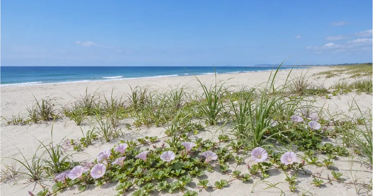
In the dunes behind a beach, coastal plants such as Carex kobomugi, beach morning glory, and Vitex rotundifolia take root, playing a role in holding down sand that would otherwise be blown about by the wind. These vegetated zones serve as nesting sites for shorebirds such as little terns, and as habitats for small creatures like ghost crabs and sand hoppers. These, in turn, form the base of a food web that indirectly connects to larger bird and fish ecosystems.
A beach thinning out and being replaced by a seawall means these ecological connections are physically lost. Once the vegetated zone disappears, the plant communities themselves vanish, and creatures that have lost their nesting and living spaces disappear from the beach as well. As with disaster-prevention function, once ecological function is lost, it does not easily return—this is part of the hard-to-see gravity of coastal erosion.
The Waterline Is Also a "Nursery" for Juvenile Fish
According to explanations from Japan's Fisheries Agency, alongside seaweed beds and tidal flats, the waterline of a sandy beach (the surf zone) is also positioned as an important nursery ground for juvenile fish. A nursery ground refers to a habitat where juveniles that have hatched from eggs can survive and grow into adults while sheltering from predators and finding food. A gently sloping, calm sandy beach offers an environment where large predatory fish have difficulty entering, allowing juveniles to hide and grow. When a beach thins out and gives way to a deeper-water terrain along a seawall, these shallow areas are lost, and fishery resources in the immediate area may be indirectly affected as well.
Looking at all of this together, it becomes clear that a beach's ecological function is not just about being "a special place where sea turtles nest"—it forms a foundation supporting the life histories of a wide range of creatures, from coastal plants and birds to crustaceans and the juvenile fish that sustain coastal fisheries. Both disaster-prevention and ecological functions rest on the same landform resource—the beach—so protecting a beach ends up protecting both at once.
Countermeasure 1: "Sand Bypassing" to Artificially Replenish Sand
One technology that has spread in recent years as a response to coastal erosion is known as "sand bypassing" (a sand bypass system). This mechanism artificially moves sand that has accumulated excessively at fishing ports or river mouths on the updrift side of a sediment system back to eroding beaches on the downdrift side—essentially "bridging" the natural flow of sediment by hand.
Amanohashidate: Japan's First Sand Bypass System
The first place in Japan to put this idea into practice was Amanohashidate in Kyoto Prefecture, one of Japan's "three scenic views." This 3.6 km sandbar stretching across Miyazu Bay was experiencing erosion at its tip even as sand accumulated at nearby breakwaters. Studies began around 1981, and the sand bypass project moved into full operation in 1986, dredging sand that had accumulated in the Hioki and Ejiri districts of Miyazu Port and depositing it near the base of Amanohashidate, letting the natural force of the waves distribute it across the sandbar. This effort halted erosion at Amanohashidate and is credited with achieving a "dynamically stable beach"—one where the deposited sand keeps being exchanged by wave action, yet the overall shape remains stable.
The Jet-Pump Sand Bypass System at Asaba Coast
A leading example of a permanent system that goes a step further than Amanohashidate's dredging-based approach is the "Jet-pump Sand Bypass" (J-SB) method operating at Fukude Fishing Port and Asaba Coast in Shizuoka Prefecture. At this coast, sediment supplied by the Tenryu River was accumulating on the updrift side of the fishing port, burying its navigation channel, while the downdrift Asaba Coast was eroding due to a lack of sediment supply—two opposite problems occurring simultaneously on a single stretch of coast. Completed in 2014, this system uses jet pumps installed on a sand-collection pier to draw up accumulated sand and send it as a slurry (a sand-and-water mixture) through a roughly 2.2 km pipeline to the eroding coast. Unlike dredging and transport by ship, it is less affected by weather and sea conditions and produces fewer emissions, drawing attention for its long-term maintenance profile as well. The plan targets transporting about 80,000 cubic meters of sand annually—equivalent to roughly half of the total annual sediment volume (about 160,000 cubic meters) the Tenryu River currently discharges at its mouth, being artificially made up for by this system.

| Method | Characteristics | Representative example |
|---|---|---|
| Dredging-and-transport sand bypass | Sand collected and transported by barge or dredging vessel for placement | Amanohashidate Coast, Kyoto Prefecture (since 1986) |
| Jet-pump sand bypass | Sand transported via pipeline; operates permanently and is less affected by weather | Fukude Fishing Port/Asaba Coast, Shizuoka Prefecture (since 2014) |
| Sand recycling | A smaller-scale method moving sand accumulated within the same coast to eroding areas | Various coastal conservation projects nationwide |
Countermeasure 2: Beach Nourishment and the Basic Coastal Conservation Policy
Alongside sand bypassing, another widely used countermeasure is "beach nourishment." According to materials from Kanagawa Prefecture, beach nourishment is a method of artificially supplying sediment to a coast to maintain or restore an eroded beach, either by bringing in sediment from outside or by using sediment generated nearby. While sand bypassing focuses on "bridging the flow of sediment," nourishment centers on "bringing in sand from outside or nearby"—but both share the goal of restoring a beach's sediment budget to a positive balance.
A Case Study in Comprehensive Protection: Kujukuri Beach, Chiba Prefecture
A case that illustrates the scale of these countermeasures well is Kujukuri Beach in Chiba Prefecture. This roughly 60 km stretch of sandy coast facing the Pacific Ocean remained relatively stable until around 1965, but erosion progressed from the 1970s onward, triggered by a decline in sediment supply linked partly to measures against cliff erosion. Chiba Prefecture has to date built 12 headlands along the 14 km stretch of severely eroding northern Kujukuri and 10 headlands along the 7 km stretch of southern Kujukuri (headlands are a type of groin projecting far out to sea, forming an artificial promontory), and has also carried out nourishment in southern Kujukuri based on the "Minami-Kujukuri Beach Nourishment Plan" formulated in 2009.
Chiba Prefecture's current comprehensive erosion-control plan aims to secure a 40-meter-wide beach across the entirety of Kujukuri Beach, with a total project cost of about 34 billion yen over a roughly 30-year period through 2049. The plan calls for using sediment accumulated around nearby fishing ports for nourishment, adopting a "comprehensive protection" approach that combines facility construction with nourishment. Rather than a one-off repair to a single seawall, this is a project managing an entire coast over a span of decades.
The Framework of the Coast Act and Basic Coastal Conservation Policy
Coastal conservation in Japan proceeds within a framework based on the Coast Act, comprising a "Basic Coastal Conservation Policy" and "Basic Coastal Conservation Plans." When the Coast Act was first enacted in 1956, its primary purpose was "protection" from disasters, but a sweeping revision in 1999 added two new objectives—"improvement and conservation of the coastal environment" and "proper public use of the coast"—transforming it into a system built around three pillars: protection, environment, and use. MLIT materials note the need to address multiple challenges—tsunamis, storm surges, aging infrastructure, erosion, environment, and use—in an integrated manner, and increasing emphasis has been placed on comprehensive plans that look at an entire sediment system, rather than isolated "point" measures like individual groins or seawalls.
Nourished Beaches Are Now Recognized as "Coastal Protection Facilities"
A case in Niigata Prefecture illustrates how the status of beach nourishment is changing. At Niigata Port Coast (West Coast district), a beach formed through artificial nourishment was officially designated in 2022 as a coastal protection facility under the Coast Act—only the second such case nationwide, and the first within Niigata Prefecture. This means a nourished beach is no longer treated as a stopgap measure, but is legally positioned as permanent disaster-prevention infrastructure on par with levees and seawalls—a notable development for thinking about the future of coastal conservation.
A Shift in Thinking on Coastal Conservation
- Past approach: focused on individually installing seawalls and groins as "point" measures where erosion occurred
- Current approach: considering the sediment budget across the entire sediment system, combining "area-wide" measures such as sand bypassing and nourishment
- Background: reflection on how the growth of artificial coastline (30.4% of the total as of 1998) has ended up triggering erosion elsewhere
- Purpose: to reconcile the three pillars the Coast Act sets out—"protection," "environment," and "use"
Conclusion: Coastal Erosion Is an "Invisible Environmental Problem"
Coastal erosion is rarely discussed on the global scale that climate change is, but it has, in fact, quietly and steadily progressed on beaches across Japan. The Tenryu River basin—where an annual sediment supply that once totaled 38 million cubic meters has fallen to 160,000 cubic meters, and where dunes at the river mouth have retreated 180 meters in 30 years—illustrates just how large this change has been. Because the causes overlap in layers—reduced sediment supply from dams, blocked longshore transport from seawalls and groins, and sea-level rise—both technical countermeasures like sand bypassing and nourishment, and a coastal conservation approach that looks at the entire sediment system, are needed.
A beach is a place where we connect with the sea, but it is also disaster-prevention infrastructure that protects our lives from storm surges, and a breeding ground for creatures like sea turtles. The next time you visit a beach on a trip or a walk, taking a moment to wonder where the sand beneath your feet came from, and how it is being protected, can be a first step toward understanding coastal erosion as an "invisible environmental problem."
1986 at Amanohashidate, 2014 at Asaba Coast, and 2022 at Niigata Port Coast—the technology and institutions surrounding sand bypassing and nourishment have been steadily built up over roughly the past 40 years. The next time you come across news of seawall construction or a nourishment project on a local coast, seeing it not merely as civil engineering work, but as an extension of this long process of trial and error, might change how it looks to you.

References & Sources
- MLIT, "The Current State and Challenges of Coastal Erosion" – Technical report on coastal erosion statistics and causes
- MLIT, "The Current State and Challenges of Coasts" – Comprehensive report on coastal administration covering tsunamis, storm surges, aging infrastructure, erosion, and the environment
- MLIT, "The Shape of Japan's Coasts" – Basic data including the total length of Japan's coastline
- MLIT, "Guidelines for Sediment Management at Dam Reservoirs (Draft)" – Technical report on dam sedimentation and downstream sediment supply
- Penta-Ocean Construction, "Fukude Fishing Port/Asaba Coast Sand Bypass System" – Case study of Japan's first jet-pump sand bypass system
- Penta-Ocean Construction, "Jet-Pump Sand Bypass Method (J-SB Method)" – Explanation of the technical mechanism
- Kyoto Prefecture, "Sand Bypass Project" – Background on the sand bypass project at Amanohashidate Coast
- Ministry of the Environment, "Sea Turtle Conservation Handbook" – Ministry of the Environment guidance on sea turtle ecology and conservation
- Ministry of the Environment, Biodiversity Center, "Coastal Survey" – Data on the proportion of artificial coastline from the Natural Environmental Conservation Basic Survey
- Fukui Prefecture, "The Roles and Effects of Coastal Protection Facilities Such as Detached Breakwaters and Artificial Reefs" – Explanation of the function of coastal protection facilities and their impact on sediment transport
- Chiba Prefecture, "Kujukuri Beach Erosion Countermeasure Plan" – Details of the comprehensive protection plan combining headland construction and nourishment
- Niigata Prefecture, "On Coastal Conservation in Niigata Prefecture" – Explanation of the causes of coastal erosion and countermeasures such as detached breakwaters and nourishment
- Fisheries Agency, "Environmental Beautification and Conservation of Coastal Areas" – The role of beaches, seaweed beds, and tidal flats as nursery grounds for juvenile fish
- Japanese Geotechnical Society Journal, "Flood Hazard Assessment of Coastal Areas Using Relative Sea-Level Rise Rates" – Analysis of relative sea-level rise rates in Tokyo Bay and Osaka Bay
※ Listed in order of reliability: government and academic institutions > peer-reviewed papers > specialized organizations > reputable media