⚡ In short
After the 2011 Great East Japan Earthquake, roughly 400 km of seawalls costing about 1 trillion yen were built along the coasts of Iwate, Miyagi and Fukushima. This article examines the debate from every angle: disaster-reduction benefits, the loss of seascapes and coastal ecosystems, Kesennuma's three-year consensus process, Onagawa's seawall-free relocation to higher ground, and hybrid approaches with green infrastructure.
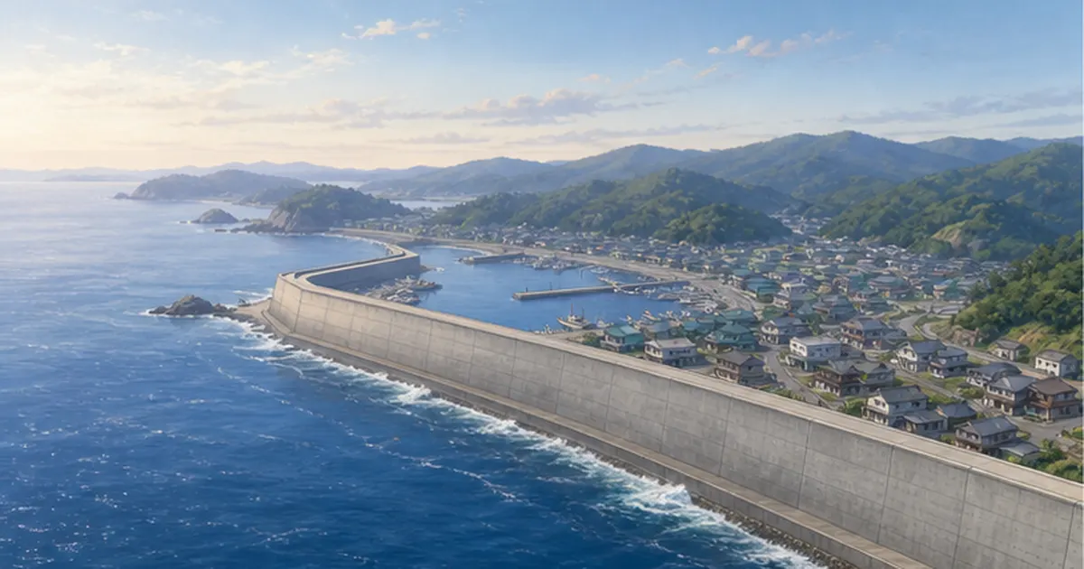
After the Great East Japan Earthquake, seawalls totaling roughly 400 km in length and about 1 trillion yen in cost were built along the Tohoku coastline. Concrete walls exceeding 10 m in height are at once a "symbol of safety" protecting lives and livelihoods from the next tsunami, and a "wall of separation" that hides the sea from daily life and erases beaches — and opinion remains divided to this day.
"If it saves lives, a high wall is a price worth paying." "If we can no longer see the sea, a town that has lived with the sea loses its meaning." — The seawall debate has never been merely about the pros and cons of a civil-engineering project. It asks how coastal communities face disaster risk and what kind of relationship they want to rebuild with the sea. Indeed, some communities, like Kesennuma, spent three years renegotiating the height, while others, like Onagawa Town, chose a path without a giant seawall at all.
This article draws on primary sources to lay out the issues: the "L1/L2 tsunami" framework that determined wall heights, real examples of disaster reduction, the lost scenery and ecosystems, the consensus-building process among residents, and combinations with ecosystem-based green infrastructure. Precisely because there is no single right answer, we want to examine the material for judgment carefully.
What you will learn in this article
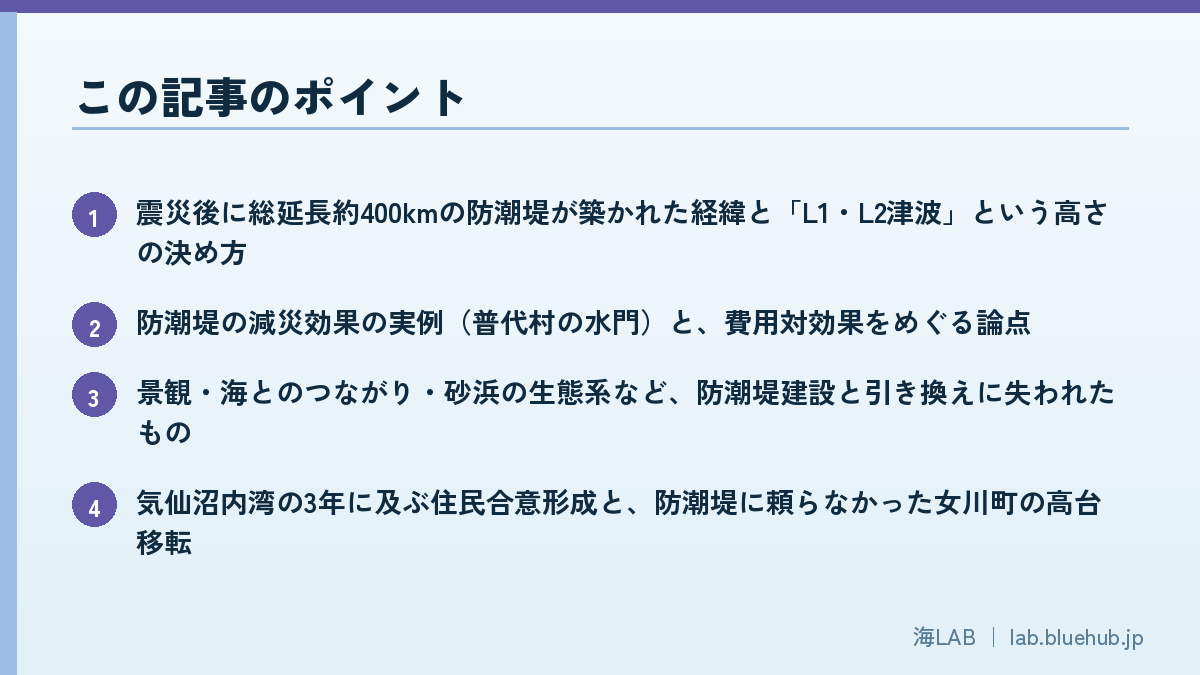
- How roughly 400 km of seawalls came to be built after the disaster, and how heights were set under the "L1/L2 tsunami" framework
- Real cases of seawalls reducing damage (the Fudai floodgate) and the cost-benefit questions that remain
- What was lost in exchange — scenery, connection with the sea, and beach ecosystems
- Kesennuma inner bay's three-year consensus process, and Onagawa's relocation to higher ground without a seawall
- Green seawalls, Eco-DRR and other hybrid approaches combining concrete and nature for future coastal defense
What Are the Giant Seawalls — What Happened on the Coast After the Disaster
The Tohoku-Pacific Ocean Earthquake of March 11, 2011 was, at magnitude 9.0, the largest ever recorded in Japan. The tsunami that struck the Pacific coast overtopped or destroyed seawalls in place after place, causing unprecedented damage with roughly 22,000 dead or missing (including disaster-related deaths). Even the seawall at Taro District in Miyako City, Iwate — 10 m high, about 2.4 km long and nicknamed the "Great Wall of China" — partially collapsed, and the town behind it was devastated. Post-disaster seawall construction began from the point where trust in existing coastal defenses had been shaken to its foundations.
The Scale: ~400 km in Length, ~1 Trillion Yen in Cost
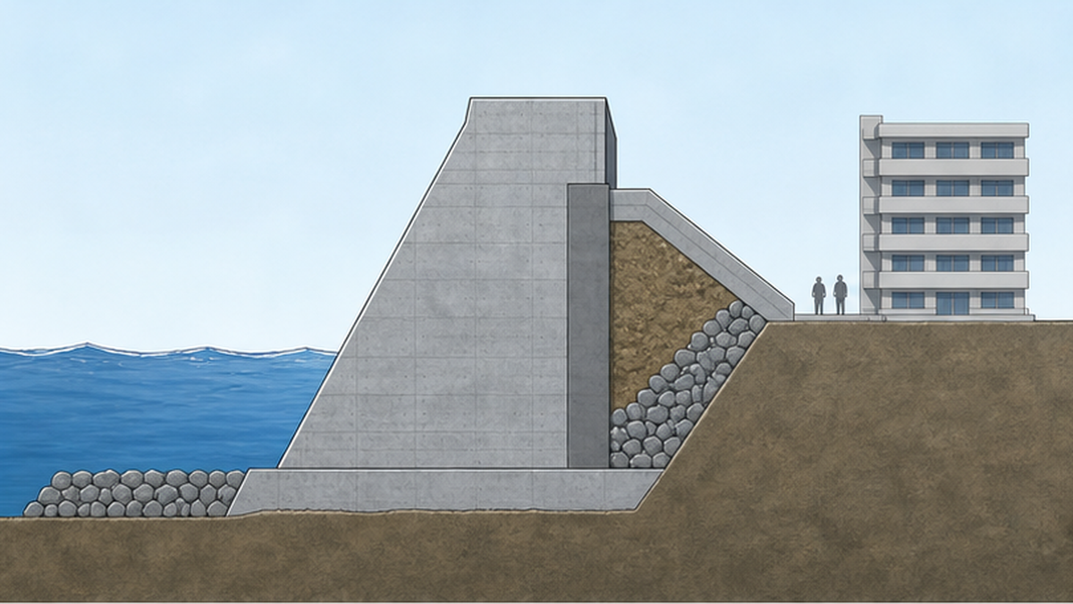
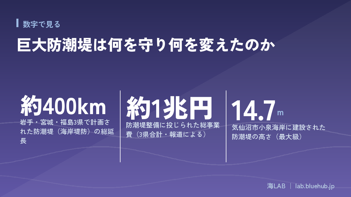
After the disaster, the three prefectures of Iwate, Miyagi and Fukushima launched a sweeping national reconstruction program to restore and raise the damaged coastal levees. The total length is reported at about 400 km, with total project costs of about 1 trillion yen. A line of concrete structures comparable to the straight-line distance from Tokyo to Osaka rose along the coast in little more than a decade. Heights also far exceeded prewar norms: at Koizumi Beach in Kesennuma City, Miyagi, a seawall 14.7 m high with a base roughly 90 m wide — the height of a five-story building — was constructed.
A New Design Philosophy: the "Resilient Structure"
Post-disaster seawalls incorporate a design philosophy different from before: the "resilient (nebari-zuyoi) structure." In 2011, the moment tsunami water overtopped a levee, it scoured the ground behind it and entire embankments collapsed at once. New levees therefore armor the crown and landward slope with concrete and reinforce the toe so that even when overtopped, they do not fail immediately but buy time before breaking. The goal is not to stop the tsunami completely but to secure evacuation time and reduce inflow — a shift in thinking that goes hand in hand with the "disaster mitigation" approach to L2 tsunamis described below.
Lessons from Taro's "Great Wall"
The seawall of Taro District in Miyako City, Iwate was a symbol of Japanese tsunami defense long before 2011. Devastated twice by the Meiji and Showa Sanriku tsunamis, Taro spent decades from 1934 building an X-shaped seawall about 2.4 km long and 10 m high. It largely blocked the 1960 Chilean tsunami, earning the name "the miracle of Taro," and inspection tours came from all over the country. Yet in 2011 the seaward front line of this "Great Wall" collapsed and the town was destroyed again. Ironically, the very record of success had rooted a belief that "inside the wall is safe," and some residents reportedly hesitated to evacuate. A structure's track record itself breeds overconfidence — Taro embodied the dilemma at the heart of the seawall question.
Another thing that must not be forgotten is the sacrifice of those who went to close floodgates and land gates. In the Great East Japan Earthquake, 254 volunteer firefighters died or went missing, many of them heading toward the sea to close gates or guide evacuations. Learning from this, remote operation and automation are now the rule for floodgates and land gates built since the disaster — systems designed so that "no one has to go and close them." The seawall debate was thus redesigned to include not only the height of walls but the safety of the people who operate them.
Seawall, coastal levee, floodgate — what's the difference?
- Seawall (coastal levee): an embankment along the shoreline protecting land from storm surge and tsunamis. In post-disaster reconstruction the two terms are used almost interchangeably
- Floodgate / land gate (rikko): openable gates where rivers or roads cross a levee. Failure to close them, or mechanical failure, is their weak point
- Breakwater: a structure built in the sea to calm waves inside a harbor. Bay-mouth breakwaters such as Kamaishi's were also confirmed to blunt tsunami force
How Were the Heights Decided — The L1/L2 Tsunami Framework
"Why this height?" Most residents' questions about the seawalls concerned the basis for their height. The standard was the "two levels of tsunami" framework presented in autumn 2011 by an expert panel of the Central Disaster Management Council. Japan's tsunami policy pivoted decisively on this report.
L1: Block with Structures; L2: Save Lives by Evacuation
A Level 1 (L1) tsunami is a "relatively frequent tsunami" occurring once every few decades to roughly 150 years. In many regions the Meiji Sanriku tsunami or the Chilean tsunami falls in this class. Against L1, the goal is to prevent flooding itself with structures such as seawalls, to protect residents' property and the local economy. A Level 2 (L2) tsunami, by contrast, is a "maximum-class tsunami that is extremely rare but catastrophic," like that of the Great East Japan Earthquake. Against L2, the policy gives up on stopping the water with structures alone and minimizes damage through 'multi-layered defense' combining hardware and software, with evacuation as the pillar. In other words, post-disaster seawalls are designed from the outset on the premise that the largest tsunamis will come over the top.
| Item | L1 tsunami (Level 1) | L2 tsunami (Level 2) |
|---|---|---|
| Frequency | Once every few decades to ~150 years | Extremely rare (once in centuries to a millennium) |
| Examples | Meiji Sanriku tsunami, Chilean tsunami | Maximum-class events like the 2011 tsunami |
| Main countermeasure | Prevent flooding with seawalls and other structures | Mitigate damage via multi-layered defense centered on evacuation |
| Seawall's role | Prevent inundation | Delay arrival and reduce inflow (overtopping assumed) |
How Design Water Levels Are Set, and Residents' Unease
Actual heights are set by prefectural governments, which divide the coastline into segments and calculate an L1-class design tsunami water level from historical tsunami traces and simulations. But the calculation is highly technical, and to many residents it felt as though "one day, out of nowhere, the prefecture showed us a drawing with a wall X meters high." The mismatch between an administration racing to reconstruct and residents wanting time to weigh a decision that would define their daily scenery generated friction across the region.
Tension with the Lesson "Don't Trust the Assumptions"
The most widely shared lesson of the disaster was to "ignore the assumptions and just run to high ground." Ironically, an imposing seawall stands in tension with that lesson. Might the reassurance of "the wall will hold" delay evacuation? In fact, in some districts in 2011, overconfidence in seawalls is said to have slowed people's flight. A seawall is ultimately a device for buying time; the final line of defense for human life is evacuation behavior — a principle that does not change however high the walls become.
The Dilemma of Reconstruction Speed vs. Dialogue
What made the height controversy so hard was the constraint of time. Seawall construction ran on time-limited budget frameworks such as reconstruction grants, giving the government a strong incentive to "fix the plan fast and break ground fast." Residents, meanwhile, had to weigh the pros and cons of a seawall while living in temporary housing, having lost family members and homes, and while trying to picture their future livelihoods and town. People struggling to rebuild their lives have little capacity to join debates that will determine the coastline decades from now. "Spend time on dialogue and reconstruction is delayed; rush and you sow lasting regret" — this dilemma was taken up by national media and in the Diet, and the seawall question became one of the emblematic issues of the reconstruction. Communities that chose dialogue, like Kesennuma below, can be described as those that accepted the cost of delay in exchange for consent.
The reassessment of assumptions also drove a re-reading of the historical record. Sediment studies had suggested that the tsunami of the 869 Jogan earthquake, in the Heian period, may have rivaled the 2011 event in scale, but this was not adequately reflected in pre-disaster planning. Learning from that failure, today's L2 estimates routinely reach back through geological evidence spanning centuries to a millennium to estimate the "largest possible" event. The debate over seawall heights is, at bottom, also a debate over how far back into the past we are willing to learn.
What Seawalls Can Protect — Numbers and Real Cases
For all the criticism, few experts deny the disaster-reduction benefits of seawalls themselves. The benefits fall into three categories. First, against L1-class tsunamis and storm surges, they prevent flooding outright. Second, even against L2-class events they delay arrival and buy evacuation time. Third, by reducing the volume of water that enters, they shrink the flooded area and depth, reducing building damage and debris. Documents from Japan's Ministry of Land, Infrastructure, Transport and Tourism state explicitly that resilient-structure levees are built with these mitigation effects in mind.
The Fudai Floodgate — How 15.5 Meters Saved a Village
The example most often cited of a structure saving lives is the Fudai floodgate (15.5 m high) in Fudai Village, Iwate. Badly hit by the 1933 Showa Sanriku tsunami, the village's postwar mayor Kotoku Wamura pushed through a floodgate and seawall of an extraordinary 15.5 m for the time, insisting that "what happened twice must not happen a third time." That much-criticized height largely stopped the 2011 tsunami from flooding the village center, and Fudai recorded no deaths in its residential district (one person working at the fishing port went missing). It stands as a symbolic case showing that a structure of the right height, functioning as designed, can dramatically reduce damage.
The Stubborn Question of Cost-Effectiveness
At the same time, the question of whether the benefits justify a project cost of about 1 trillion yen has never gone away. The main points of contention:
- Population decline: where the population behind the wall keeps shrinking, how much will remain to protect in a few decades?
- Maintenance costs: concrete structures have finite lifespans, and repair and renewal costs fall on future generations
- Opportunity cost: critics note the lack of rigorous comparison with spending the same budget on relocation, evacuation routes or disaster education
- The side effect of reassurance: if overconfidence in structures lowers evacuation rates, human losses could actually increase
What matters is that these are not arguments that "seawalls are pointless," but arguments that where, how high, and in combination with what should be examined region by region. There is no uniform national answer; the optimum varies with topography, population, industry and evacuation conditions.
Kamaishi's Bay-Mouth Breakwater — Cutting the Tsunami Offshore
Alongside seawalls, the offshore bay-mouth breakwater deserves mention. The breakwater at the mouth of Kamaishi Bay in Iwate, rising from a seabed 63 m deep, held a Guinness World Record as the world's deepest breakwater — and was largely toppled by the 2011 tsunami. Even so, analyses by the Ministry of Land, Infrastructure, Transport and Tourism and others estimate that it reduced tsunami height by roughly 40% and delayed the start of flooding in the city by about six minutes. This example — a structure that bought evacuation time even as it failed — vindicated the resilient-structure philosophy of asking how much mitigation is possible on the assumption of failure, and the breakwater was subsequently rebuilt. How many lines of defense to layer — shoreline seawalls, offshore breakwaters, evacuation systems — is the real design question; debating the seawall in isolation yields no answer.
What Was Lost — Scenery, Connection with the Sea, Ecosystems
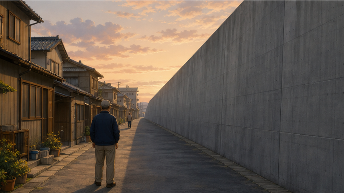
The price of the seawalls most often spoken of is "life without sight of the sea." In Sanriku's fishing towns, people read the weather and the fishing from the color of the water and the look of the waves, seen from home or workplace. From inside the levee the sea is invisible; from the sea, the town is invisible. A daily life in which people no longer meet the sea's gaze has even been flagged as counterproductive for disaster readiness: changes in the sea go unnoticed longer. For tourism, too, the losses from walls cutting off beaches and port townscapes are not small.
Impacts on Beaches and Wildlife
The ecological impacts are serious as well. Seawall and revetment construction locks down the land behind beaches and blocks the supply and movement of sand, starving the beaches themselves. The Nature Conservation Society of Japan and others report that shoreline armoring has reduced the beaches where loggerhead turtles can nest, with more turtles coming ashore only to give up and return to the sea. Severing the beach's backshore plant communities and the ecological links between beach and shallow sea also affects the juvenile fish and small animals that grow there. The concreting of the shoreline, together with the reclamation of tidal flats, lies on the continuum of structural problems Japan's coastal ecosystems have long carried.
Some also point to effects on residents' minds: the oppressive presence of a massive wall before one's eyes, and the grief of knowing a familiar shore will never return, complicated any sense of recovery. Conversely, there are certainly voices saying "the wall is why we felt safe reopening our business on the low ground." The same structure becomes reassurance for some and pain for others. The verdict on the seawalls remains split precisely because they touch both a measurable disaster-prevention function and an unmeasurable quality of life.
Impacts on the Culture of "Living with the Sea"
The slogan Kesennuma City adopted for its reconstruction was "Living with the Sea." Shore festivals, harbor memories, seaside play — coastal culture rests on daily contact with the water. Only some years after the disaster, as the debate matured, did more communities come to see the seawall not as an evil in itself but as a design question: how to preserve those points of contact while securing safety. The Kesennuma inner-bay case in the next chapter symbolizes that turning point.
Beaches, Groundwater, Windblown Sand — Indirect Effects on Daily Life
The impacts go beyond scenery and rare species. Seawall construction changed access to the shore, and some bathing beaches gave up reopening or saw visitor numbers plummet. Where a levee's foundations alter groundwater and brackish flows, the water environment of wetlands and farmland behind them is affected too. When walls cut off windblown sand moving inland, dunes and coastal plant communities stop renewing — an ecological change in slow motion. If fishing, surfing and beach play recede from daily life, the next generation grows up less familiar with the sea, which in the long run echoes into marine education and the future workforce of the fisheries. These "slow losses" rarely register in cost-benefit calculations, which is exactly why it matters that residents put them into words in the debate.
Main impacts attributed to seawall construction
- Delayed awareness of changes at sea and weakened evacuation-mindedness when the sea cannot be seen
- Shrinking and vanishing beaches, and blows to beach ecosystems including sea turtles
- Loss of port-town scenery and tourism resources, and thinning of seaside culture
- Water-quality and biodiversity impacts from severing wetlands and brackish zones
Three Years of Dialogue — Consensus in Kesennuma's Inner Bay
The inner bay (Naiwan) district of Kesennuma City, Miyagi is a landmark case of resident consensus-building over a seawall, documented in detail in a Japan Society of Civil Engineers paper. What happened there was a process, rare anywhere in Japan, in which confrontation between government and residents led through dialogue all the way to a design change.
A Plan for a Place That "Had No Seawall Before the Disaster"
The inner bay is the heart of Kesennuma's port-town culture, and before the disaster it had no seawall at all. After the disaster, however, Miyagi Prefecture presented a plan for a seawall at T.P. (Tokyo Peil) +6.2 m to handle an L1 tsunami. Against a plan that would veil the harbor scenery behind a wall roughly 4.4 m above ground, many residents pushed back — "the face of the port town will disappear," "tourism and commerce cannot recover" — and town-planning groups and shopkeepers began drafting alternatives.
The turning point came from a residents' study movement. The year after the disaster, local business people and volunteers launched a "Seawall Study Group," inviting experts to learn tsunami simulation and coastal engineering, and building a foundation for engaging the prefecture's plan with data rather than emotion. Not shouting "no" but putting forward alternatives — this shift in posture turned the talks with the administration constructive.
Landing on "a Height Where Walkers Can See the Sea"
Talks among the prefecture, the city and residents ran about three years. In the end, by moving the levee's position and combining it with raising the land behind it, the crest was set at T.P. +4.1 m, with the wall's apparent height from the land side compressed to about 1.3 m. At 1.3 m, a person walking by can see the sea at eye level. Some sections adopted flap-gate movable barriers that rise by buoyancy only when a tsunami comes, reconciling everyday views with emergency protection. By writing "being able to see the sea" into the design conditions alongside engineering performance, this agreement influenced seawall debates across the country.
A Construction Error That Tested Trust
In 2018, however, it emerged that a seawall in the Sakanamachi district near the inner bay had been built 22 cm higher than designed due to a construction error, and Miyagi Prefecture issued an apology. The cause was a failure to reflect post-quake ground uplift in the construction. For residents who had debated the height down to the centimeter, the mistake was not a mere construction issue but a matter of trust. It became a lesson that consensus-building does not end when the drawings are fixed — it continues through construction and maintenance.
Oya Beach, Where the Sand Was Saved — Setting the Wall Back
Kesennuma produced one more nationally known form of agreement: Oya Beach, once one of Japan's most popular bathing beaches. The prefecture's original plan would have put the seawall on the beach itself, but residents objected that "the beach is the region's treasure" and assembled a counterproposal to set the wall back inland and integrate it with the raising of National Route 45. After long negotiations the plan was realized: the beach was preserved, and in 2021 — ten years after the disaster — the swimming beach reopened. By showing a third solution beyond "higher or lower" — build it further back — the Oya case widened the possibilities of design fitted to terrain and daily life.
Lessons from the Kesennuma inner-bay consensus
- Disclosure of the plan's rationale in terms residents can understand is the starting point
- Whether opposition can be converted into alternative-drafting determines the quality of the debate
- Combining options — land raising, repositioning, movable gates — dissolves the safety-vs-scenery dichotomy
- It takes time. But a wall built in haste stands for decades and cannot be redone
Choosing Not to Build — Onagawa's Relocation to Higher Ground
Onagawa Town in Miyagi Prefecture, despite losing about 8% of its population — one of the highest casualty rates of the disaster — is known for choosing a reconstruction without a giant seawall in its center. Not "protect with a wall" but "live where the tsunami cannot reach" — an answer different again from Kesennuma's.
Multi-Layered Defense with Relocation and an Elevated Road
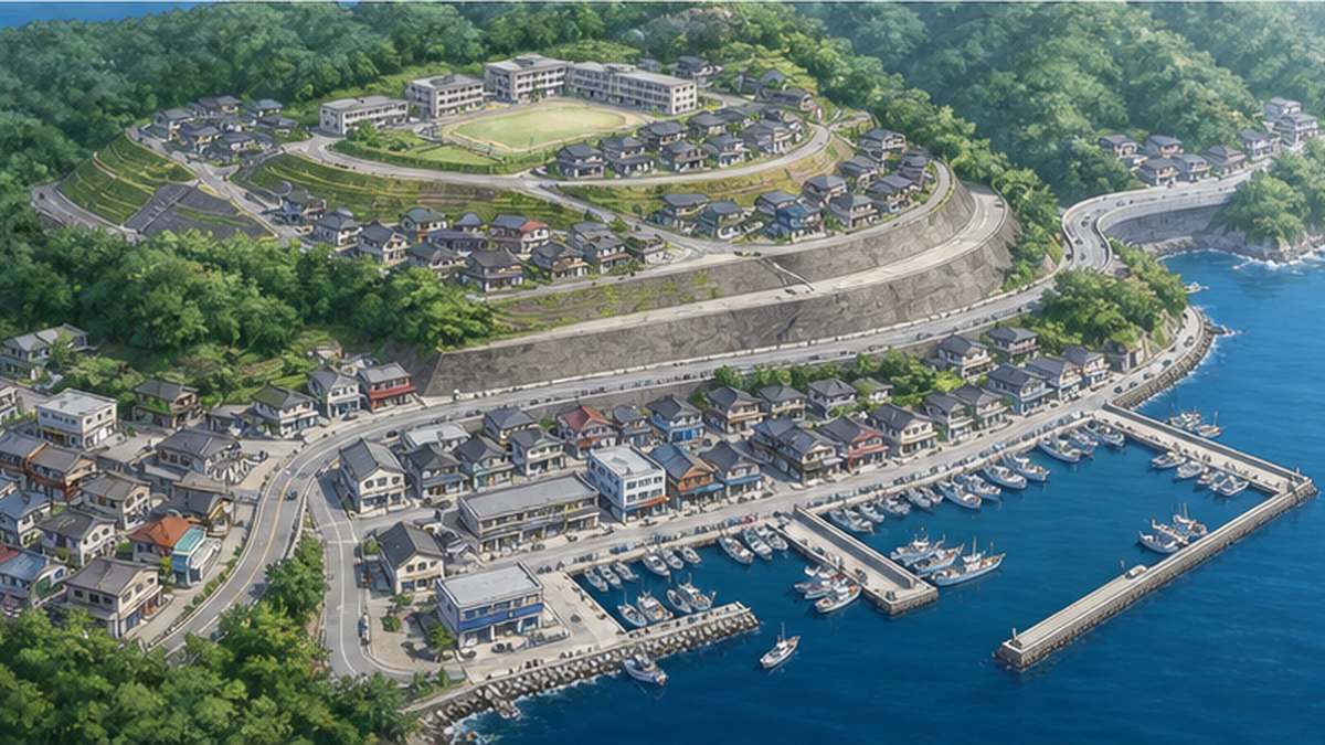
Onagawa's reconstruction plan moved the functions of daily life — housing, schools, the hospital, the town hall — to high ground beyond tsunami reach, and regenerated the low-lying seafront as a zone for commerce and fisheries. National Route 398 along the shore was raised on embankments to serve as a second levee when a tsunami comes. Instead of building a dedicated wall, in other words, the town assembled its multi-layered defense from reorganized land use and a dual-purpose road. On the premise that those working on the low ground will flee uphill, evacuation routes and guidance equipment were also put in place.
A Town Where "Every Home Can See the Sea"
The face of the recovery became JR Onagawa Station, opened in 2015, and the tenant-style shopping street "Seapal-Pier Onagawa" before it. The station building, designed by architect Shigeru Ban, houses a public hot-spring bath, and stepping off the train the view runs straight down to the sea. The raised commercial area is built low-rise around the idea of a port town that is a pleasure to walk, and it has functioned as a magnet for visitors — at times drawing more than before the disaster.
Commercial buildings line the promenade running straight from Onagawa Station to the water, with the horizon visible from the station front. The hillside neighborhoods, too, look out over the bay, and "a recovery with the sea in view" became the town's identity. A decade on, Onagawa hosts study visits from Japan and abroad as an example of town-making that embraces a seafront without a seawall.
Still, Onagawa's choice did not solve everything. The town's population continues the decline that began before the disaster, and the hilltop development and downtown reorganization took many years and great expense. "Reconstruction without a seawall" tends to be introduced glowingly, but in substance it rests on a heavy decision: accepting land-use restrictions and giving up the freedom to live on the low ground.
The Conditions That Made Onagawa's Choice Possible
- The ria-coast terrain allowed high ground to be developed immediately behind the town center
- The damage was so devastating that staying on the low ground was effectively not an option
- Consensus-building that handed decisions to the young — "those past sixty keep out of it" — worked from early on
- Roles could be shared with offshore mitigation infrastructure such as the rebuilt bay-mouth breakwater
Conversely, regions with broad plains and distant high ground, like the southern Sendai Plain, cannot easily copy the method. Onagawa's case should be read not as grounds for "seawalls are unnecessary," but as showing that the solution changes with the terrain and the will of the community. The wider story of sea-based recovery is covered in our article on disaster recovery and coastal tourism.
Beyond Concrete Alone — Green Infrastructure and Eco-DRR
Another legacy of the seawall controversy is that thinking which combines the two sides — beyond the binary of "concrete or nature" — has moved into the policy mainstream. The keywords are "green infrastructure" and "Eco-DRR" (ecosystem-based disaster risk reduction).
What Is Eco-DRR?
Eco-DRR (Ecosystem-based Disaster Risk Reduction) is the idea of reducing disaster risk through conserving and restoring ecosystems while simultaneously raising multiple values such as biodiversity and local attractiveness. Japan's Ministry of the Environment is compiling foundational data and potential maps, and the UN's Sendai Framework for Disaster Risk Reduction, adopted in Sendai in 2015, likewise enshrines the importance of ecosystem-based mitigation, which is becoming mainstream internationally. Wetlands soften floods, forests hold back landslides, dunes and coastal forests blunt storm surge and tsunami — the idea is to use nature's defensive functions not as a substitute for concrete but as its complement.
Green Seawalls and Coastal Protection Forests
One concrete example is the "green seawall" advanced along the Sendai Bay coast: earth is banked on the landward side of a concrete levee and planted with trees, integrating embankment and forest so that overtopping water loses energy and the levee's failure is delayed — enhancing resilience while creating scenery and habitat. Restoration of the coastal protection forests (black pine) annihilated by the tsunami has also advanced across the region. A coastal forest cannot stop a tsunami outright, but it is confirmed to catch drifting debris, slow the flow and buy evacuation time. How coastal forests work is explained in detail in our article why coastal forests are strong.
Coral Reefs, Seagrass Beds and Tidal Flats — Natural Breakwaters
Looking globally, research finds that coral reefs attenuate on average 97% of wave energy, and the storm-surge protection of mangrove forests is being quantified. In Japan, too, the restoration of seagrass beds and tidal flats is now discussed in the context of coastal protection alongside water purification and blue carbon. As detailed in our article coral reefs as natural breakwaters, a healthy ecosystem is also infrastructure that is cheap to maintain, repairs itself, and compounds in value.
The Global Trend — The Netherlands' "Building with Nature"
The idea of enlisting nature in disaster defense is accelerating worldwide. The Netherlands, a pioneer in flood control, champions "Building with Nature": in 2011 it deposited about 21.5 million cubic meters of sand at a single point on the coast and left tides and waves to redistribute it along the shore over decades — the experimental nourishment project known as the "Sand Motor." Rather than endlessly raising dikes, it puts natural processes to work — a reversal of thinking. In the United States, "living shorelines" that restore oyster reefs and salt marshes to damp waves, instead of hardening banks with concrete, are spreading. Such nature-based solutions (NbS) are promoted by the UN Environment Programme among others, and Japan's Eco-DRR and green seawalls belong to the same current.
| Approach | Typical examples | Strengths | Weaknesses |
|---|---|---|---|
| Gray infrastructure | Concrete seawalls, floodgates | Delivers a calculated level of protection | Impacts on scenery and ecosystems; upkeep and renewal costs |
| Green infrastructure | Coastal forests, dunes, seagrass beds, coral reefs | Self-repairing, generates multiple values | Cannot stop maximum-class tsunamis alone |
| Hybrid | Green seawalls, dual-purpose road levees | The two offset each other's weaknesses | Design and consensus take time and ingenuity |
Main hybrid combinations for coastal protection
- Concrete levee + earth banking and planting = green seawall (resilience plus scenery)
- Seawall + coastal protection forest = catching debris and slowing the flow
- Relocation to high ground + elevated road = multi-layered defense through land use (the Onagawa model)
- Conserving coral reefs, seagrass beds and dunes = natural infrastructure that cuts wave energy offshore
Coasts and Communities from Here On — Lessons of the Seawall Debate
Fifteen years on from the disaster, the argument over the seawalls has not been settled. But the experience of these years has made at least this much clear: the seawall is not a build-or-don't-build binary, but a question of design and consent — where, how high, combined with what, and decided by whom.
Beyond Binary Opposition — Toward Local Optimal Solutions
There is Fudai, where a structure saved the village; Onagawa, which regenerated without relying on one; Kesennuma, where dialogue changed the height. What they share is this: communities that faced their own conditions — terrain, industry, population, culture — and involved residents in the decision show greater conviction in the answer they chose. Conversely, on coasts where construction advanced uniformly on schedule-first terms, the question "whose wall is this?" lingers even after completion. As population decline advances, a "second round" of debate is unavoidable: how to fund the upkeep of existing seawalls, and to what standard to rebuild them when renewal comes due.
Lessons for the Nankai Trough Era
This is not only a Tohoku story. Along the Pacific coast where a Nankai Trough megaquake is anticipated, from Shizuoka to Kyushu, seawall raising and evacuation-tower construction are under way. What Tohoku's fifteen years teach is that whatever the standard of the hardware, in an L2-class tsunami evacuation takes priority over everything — and that once a wall severs a seaside region's landscape and culture, winning them back takes time measured in generations.
The other task is the handing down of memory. Decades from now, the seawalls will pass to generations who do not know why they were built. Unless it is told why this height, and what was protected and what given up in the choosing, the walls become mere scenery, breeding overconfidence or indifference. The preserved disaster ruins, the storyteller (kataribe) programs, the tsunami memorial stones are "soft infrastructure" linking structures to evacuation-mindedness — and they should be maintained as a set with the seawalls.
What We Can Do
- Check the hazard map where you live or visit for both L1 and L2 inundation zones and evacuation sites
- When traveling the coast, look at the seawalls and hilltop districts as records of reconstruction choices, and listen to local people's stories
- Attend briefings and submit public comments on local coastal works and evacuation plans — Kesennuma's lesson is that raised voices can change a design
- Support activities that grow nature's defenses, such as coastal-forest planting and beach cleanups
The "Next Seawalls" Rising Along the Nankai Trough Coast
Tohoku's experience is already being carried to the next front line. In Hamamatsu City, Shizuoka, where a great tsunami from a Nankai Trough megaquake is anticipated, a seawall running about 17.5 km along the coast was completed in 2020, funded by a donation of roughly 30 billion yen from the local Ichijo Komuten construction group. It stands 13–15 m high. Here the CSG method — cementing local soil and gravel — was used, and the cross-section is shaped like an embankment integrated with the existing dunes and coastal protection forest, creating a landscape unlike the looming concrete of the Sanriku type. It can be called a case where the concern for scenery and ecosystems crystallized in Tohoku's debate was reflected in later design. In Kochi, Wakayama and elsewhere, tsunami evacuation towers and routes are being built alongside seawall raising, with the combination of hardware and software assumed from the start.
Summary of this article
- After the 2011 disaster, roughly 400 km of seawalls costing about 1 trillion yen were built across Iwate, Miyagi and Fukushima
- Heights follow a two-tier standard: L1 tsunamis blocked by structures, L2 tsunamis mitigated by evacuation — the largest events are assumed to overtop the walls
- There are proven mitigation cases such as the Fudai floodgate, but the price — lost scenery, ecosystems and cultural ties to the sea — is also large
- Kesennuma's inner bay changed the design to "a height where the sea stays visible" through three years of dialogue; Onagawa relocated to high ground without a seawall
- Hybrid protection combining concrete and ecosystems — green seawalls, Eco-DRR — is becoming the mainstream ahead
References and Sources
- Ministry of Land, Infrastructure, Transport and Tourism (MLIT), Water and Disaster Management Bureau – Restoration and reconstruction of coasts after the Great East Japan Earthquake
- MLIT, Water and Disaster Management Bureau – Coastal development for tsunami disaster prevention (the L1/L2 framework)
- MLIT – On resilient-structure coastal levees (coastal project evaluation material)
- Reconstruction Agency – 10 Years since the Great East Japan Earthquake portal: reconstruction from the air
- Ministry of the Environment, Biodiversity Center of Japan – Basic information on ecosystem-based disaster risk reduction (Eco-DRR)
- Journal of the Japan Society of Civil Engineers (J-STAGE) – The consensus-building process for seawall planning and design in the inner-bay district of Kesennuma
- Miyagi Prefecture – On the construction error in the Sakanamachi district seawall, Kesennuma fishing port
- Sasakawa Peace Foundation, Ocean Policy Research Institute – International trends in ecosystem-based disaster risk reduction (Eco-DRR)
- Nature Conservation Society of Japan – Restoring beaches where sea turtles can nest
- nippon.com – Ten years after 3.11: Kesennuma's recovery and its choice to live with the sea (Part 1)
* Ordered by reliability: government agencies and academic institutions > peer-reviewed papers > specialist institutions > trusted media