⚡ In short
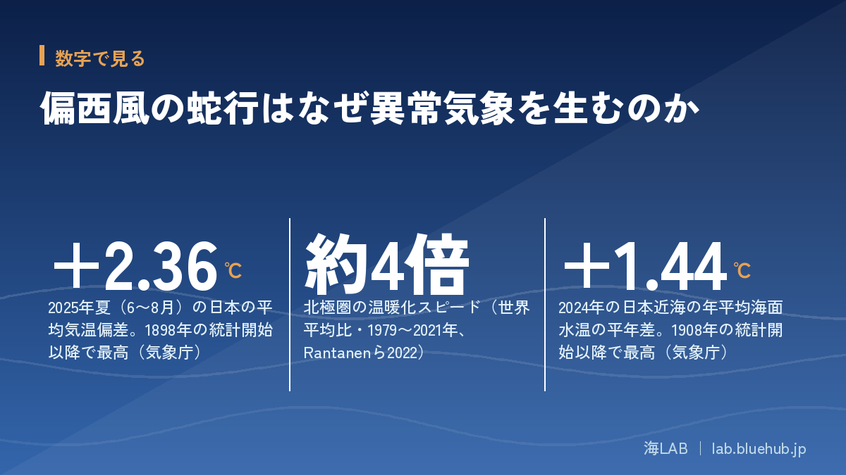
The summer of 2025 was Japan's hottest on record, at +2.36°C above the baseline. Behind it, one culprit keeps being named: the meandering of the westerlies. Why does a wavy jet stream bring heatwaves, torrential rain and heavy snow alike? We explain the mechanism—and its links to Arctic warming and rising sea temperatures around Japan—based on primary sources from the JMA and JAMSTEC.
"This summer's heatwave was caused by a meandering jet stream." We hear this on the news almost every year. Indeed, the Japan Meteorological Agency's Advisory Panel on Extreme Climatic Events cited the northward meander of the westerlies as a major factor behind 2025—the hottest summer on record, at +2.36°C above the baseline. But what exactly is happening when the westerlies "meander"?
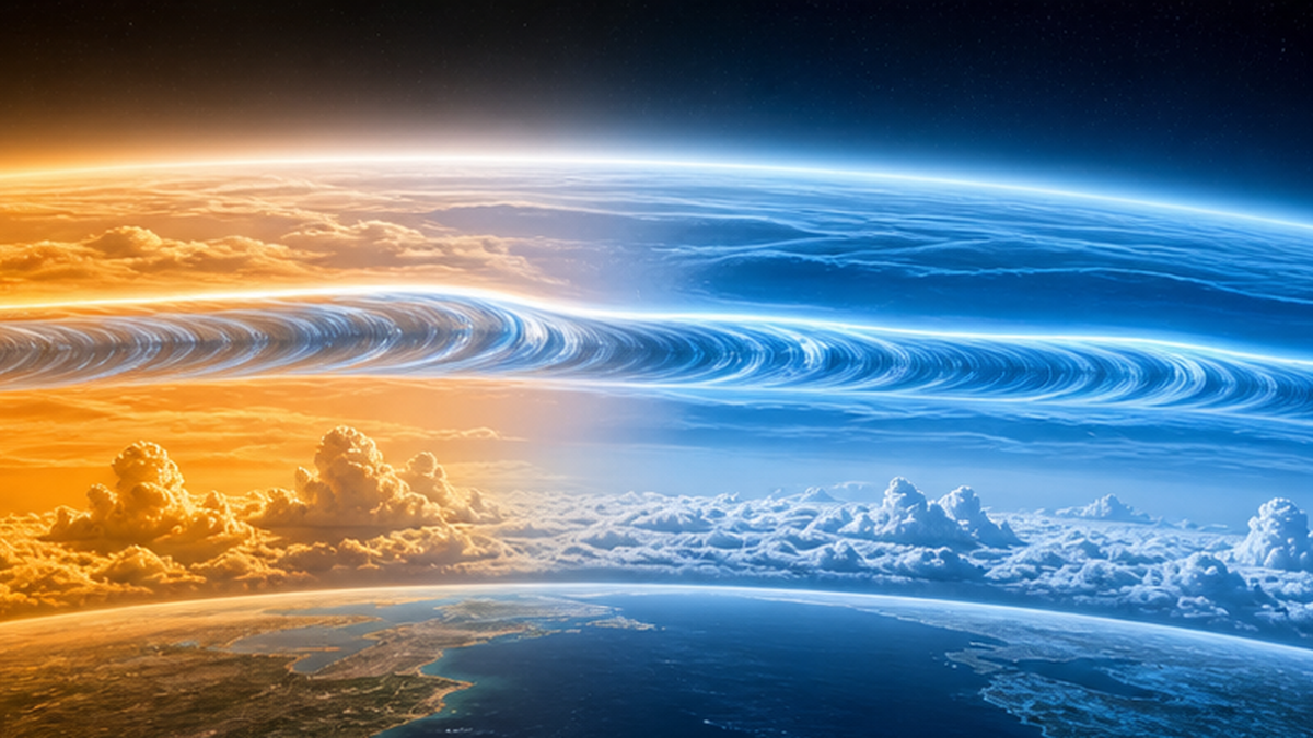
The westerlies are strong winds flowing from west to east roughly 8–13 km above Japan, and their fastest ribbons are called jet streams. When this flow runs straight, weather changes in an orderly rhythm; when it undulates deeply north and south, warm or cold air masses camp over the same regions, and extremes—heatwaves, downpours, heavy snow—drag on. The westerlies are thus both the "delivery system" of Japan's weather and a potential "amplifier" of extreme events.
This article walks through the basics of the westerlies and jet streams, how meanders generate extreme weather, real cases in Japan, and the connections to Arctic warming and rising sea temperatures—drawing on primary sources from the JMA, JAMSTEC and peer-reviewed research. We also take an honest look at a question scientists are still debating: does global warming make the jet stream meander more?
What you will learn in this article
- How the westerlies (jet streams) blow, and the difference between the subtropical jet and the polar front jet
- How meanders and blocking highs simultaneously produce opposite extremes—heatwaves, downpours and heavy snow
- Japan's real-world cases and JMA analyses: the record heat and western Japan floods of 2018, the Hokuriku snow disaster of 2021, and more
- How rapid Arctic warming (about 4x the global average) and rising sea temperatures around Japan affect the westerlies
- The scientific frontier of the "warming makes meanders worse" hypothesis—and what remains unsettled
- Practical ways to prepare for extreme weather, from seasonal forecasts to early warning information
The Westerlies and Jet Streams: The Basics
The westerlies are large-scale winds that blow from west to east year-round in the upper air of the mid-latitudes (roughly 30–60°N). Earth is strongly heated near the equator and cold near the poles. As the atmosphere works to even out this north–south temperature difference, the effect of Earth's rotation (the Coriolis force) bends the motion into a powerful eastward flow. The westerlies are, in essence, a river of air flowing along the boundary between the warm south and the cold north.
The Japanese saying "weather changes from the west" captures this wind from everyday experience. Lows, highs and rain-bearing fronts ride the westerlies from west to east. That is why forecasts say the weather "worsens from western Japan first," and why yellow dust from the continent arrives ahead of the cherry-blossom front in spring. Understanding Japan's weather begins with understanding the westerlies.
The jet stream is the "express lane" of the westerlies
Within the westerlies, the ribbon-shaped flows where wind speeds peak at altitudes of about 8–13 km are called jet streams. In winter, the skies over Japan host some of the strongest jet streams in the world: winds average around 30 m/s and can approach 100 m/s (about 360 km/h) at their strongest. Aircraft flying from Tokyo to Honolulu or the U.S. West Coast arrive faster because they ride this tailwind. In summer, as the north–south temperature contrast weakens, wind speeds drop to about half their winter values.
The two jet streams that shape Japan's weather
Two jet streams with distinct characters flow in the upper air near Japan. One is the subtropical jet stream, around 30°N at an altitude of about 12 km (near the 200 hPa level); the other is the polar front jet stream, around 40°N at about 10 km (near the 300 hPa level). The position of the baiu rain front, the tracks of typhoons, the southward surges of winter cold—nearly every turning point in Japan's weather involves the behavior of these two jets.
A Japanese scientist was the first to pin down the jet stream
It is little known that the first person to demonstrate, through systematic observation, the existence of extremely strong winds aloft was the Japanese meteorologist Wasaburo Oishi. As the first director of the Aerological Observatory in present-day Tsukuba, Ibaraki, Oishi conducted repeated pilot-balloon observations in the 1920s and reported in a 1926 paper that winter winds over Japan reached speeds of up to 70 m/s. His work drew little international attention at the time, but during World War II, high-flying aircraft encountered these winds, and the phenomenon became known as the "jet stream." The skies above Japan—one of the world's great jet stream corridors—were the very stage of its discovery.
| Item | Subtropical jet stream | Polar front jet stream |
|---|---|---|
| Typical position | Around 30°N | Around 40°N (highly variable) |
| Altitude of maximum wind | About 12 km (near 200 hPa) | About 10 km (near 300 hPa) |
| Associated phenomena | Baiu front, extension of the Pacific High | Cold surges, bomb cyclones, heavy snow |
| Seasonal behavior | Shifts north and weakens in summer | Prone to large north–south undulations |
Key points so far
- The westerlies are a "river of air" created by the north–south temperature difference and Earth's rotation
- The fastest ribbons are jet streams, and winter skies over Japan are among the world's windiest
- The subtropical jet and the polar front jet together steer Japan's weather
Why Do Meanders Happen? Rossby Waves and Blocking Highs
The westerlies rarely flow in a straight line. Their normal state is to undulate north and south on scales of thousands of kilometers. These great undulations are called Rossby waves (planetary waves), after the meteorologist who discovered them. Mountain ranges, temperature contrasts between continents and oceans, and tropical thunderstorm activity provide the initial "ripples," which Earth's rotation then organizes into large waves.
Shallow meanders versus deep meanders
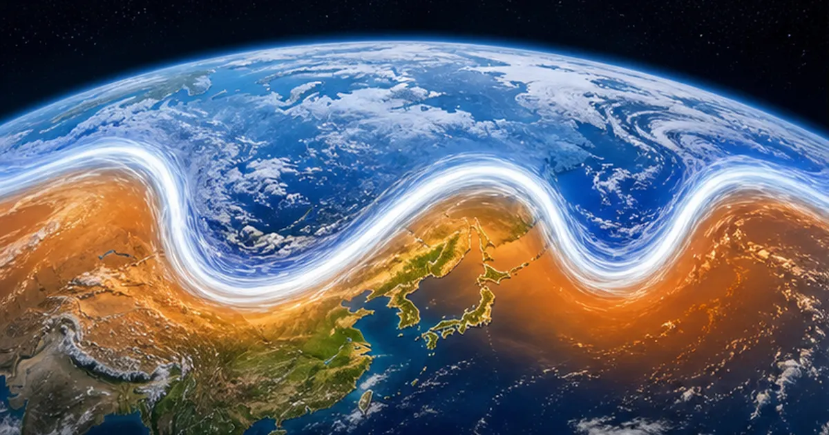
When the meanders are shallow, highs and lows pass from west to east on a cycle of a few days and weather changes periodically. When the meanders deepen, warm air is carried far poleward in the ridges (northward bulges) and cold air far equatorward in the troughs (southward dips). Regions under a ridge bake beneath a persistent warm high, while regions near a trough see lows and fronts stall, bringing prolonged rain or unseasonable cold. Heatwaves in one part of the world and floods or cold spells in another, at the same time, can often be traced to a single connected wave.
The immovable "blocking high" prolongs the extremes
When a meander deepens further and the wave pinches off, a tall high-pressure system can be left stranded in the mid-latitude flow, barely moving for a week to several weeks. This is a blocking high. True to its name, it blocks the path of the lows and highs arriving from the west, so the march of weather stops and the same conditions—heat upon heat, rain upon rain—persist abnormally long. In most extreme weather disasters, it is this persistence, as much as raw intensity, that multiplies the damage.
The event that showed the world what blocking can do was the Russian heatwave of summer 2010. A blocking high sat over western Russia for about a month and a half; Moscow recorded its all-time high of 38.2°C, and record drought combined with vast forest fires caused many deaths and a halt to grain exports with global repercussions. Meanwhile, within the same stalled wave pattern, Pakistan suffered historic flooding. One enormous meander produced opposite disasters at once—heat and drought on one side, floods on the other.
One wave can trigger simultaneous extremes around the world
Because the westerly wave wraps all the way around the globe, a deepening meander in one region telegraphs its influence to distant places along the wave. In the summer of 2018, for example, Japan's record heat coincided with heatwaves and wildfires in Scandinavia, major fires in Greece, and high temperatures in North America. Analyses found that the westerly wave circling the Northern Hemisphere mid-latitudes had stalled in a particular pattern, igniting heatwaves under multiple ridges at once. The westerlies embody planetary-scale connections invisible on Japan's weather map alone.
- Triggers of meandering: mountain ranges, land–sea temperature contrasts, tropical thunderstorm activity (El Niño and others)
- Conditions that deepen meanders: changes in the north–south temperature difference, weakening of the jet stream
- What prolongs the extremes: blocking highs (stalling for one to several weeks)
Defining "extreme weather"
The JMA defines extreme weather, in principle, as "a phenomenon occurring once in 30 years or less at a given place and time of year." Deep westerly meanders and blocking highs are textbook mechanisms for producing exactly this kind of rare, persistent weather.
Meanders and Heatwaves: Japan in 2018, 2023 and 2025
When the westerlies meander north of their usual track near Japan, the archipelago is engulfed by warm high pressure. The signature setup is a "double-decker" of highs: the Pacific High extends over Japan in the lower atmosphere while the Tibetan High overlays it aloft. Inside the resulting deep dome of high pressure, air sinks and warms (subsidence heating), locking in clear skies and high temperatures day after day.
July 2018: Kumagaya's 41.1°C and "disaster-level heat"
On July 23, 2018, Kumagaya City in Saitama Prefecture recorded 41.1°C, then the highest temperature ever observed in Japan (tied by Hamamatsu, Shizuoka in 2020; it remains the national record). The JMA's advisory panel attributed the record heat to a strong northward meander of the westerlies near Japan, with the Pacific High and the Tibetan High stacked over the archipelago. This was the year the JMA described the heat as a "disaster-level" event at a press conference, and heatstroke emergency transports reached record levels.
The human toll that year was extraordinary. According to the Fire and Disaster Management Agency, emergency transports for heatstroke from May to September 2018 exceeded 90,000 people—the most since the survey began, at that time. It marked a turning point in public awareness: from "heat is something to endure" to "heat is a disaster that can kill."
June 2022: the first 40°C June day on record
In 2022 the heat came unusually early. On June 25, Isesaki City in Gunma Prefecture hit 40.2°C—the first time Japan had ever recorded 40°C or higher in June. That year, too, the JMA's advisory panel concluded that meandering westerlies had influenced the persistence of troughs and highs, contributing to both the summer heat and heavy rain. The extraordinarily early end of the rainy season (preliminarily among the earliest on record) and the record June heat were driven by a northward meander of the westerlies and an early extension of the Pacific High.
2023: a "double event" of El Niño and the Indian Ocean Dipole
The summer of 2023 was also one of record heat. According to JAMSTEC (Japan Agency for Marine-Earth Science and Technology), the westerlies again flowed north of their usual track, pushing warm air over Japan—and on top of that came the simultaneous occurrence of El Niño and a positive Indian Ocean Dipole, the first such combination in eight years, since 2015. Moreover, after three consecutive years of La Niña (summer 2020 to winter 2022), sea temperatures in the western Pacific entered summer still elevated, leaving the entire tropical ocean warmer than normal and raising the baseline heat of the atmosphere. Using the coupled ocean–atmosphere model SINTEX-F, Senior Researcher Takeshi Doi and colleagues at JAMSTEC had predicted the pronounced warmth around Japan as early as May.
2025: the hottest summer ever observed
Then came summer 2025 (June–August): Japan's mean temperature finished +2.36°C above the baseline, the hottest summer since statistics began in 1898. A record 132 observation stations nationwide set new summer temperature records. In September, the JMA's advisory panel pointed to the northward meander of the westerlies aiding the expansion of high pressure, active thunderstorm clouds near the Philippines, and the backdrop of global warming and remarkably high sea surface temperatures around Japan. The panel's chair remarked that this was "clearly abnormal weather" and that "with global warming, things we have never experienced are now happening." Annual mean temperatures tell the same story: 2024 (+1.48°C), 2023 (+1.29°C) and 2025 (+1.23°C) rank first through third on record. The heat is no longer a fluke—it is an accumulating trend.
Heatwaves are ocean events, too
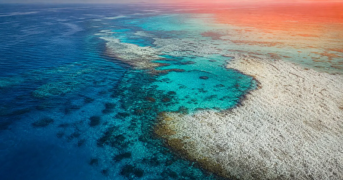
- Alongside heat on land, marine heatwaves (abnormally high water temperatures) are becoming frequent in the seas around Japan
- Warm seas heat the atmosphere from below, acting as an "amplifier" that sustains high-pressure systems
- Abnormal sea temperatures directly affect fish distributions and fisheries (see our article on marine heatwaves)
Meanders and Downpours: Stalled Troughs and Ocean Moisture
Westerly meanders bring not only heat but also its apparent opposite: torrential rain. The key is the stalling of the trough—the southward dip of the meander. Air rises readily east of a trough, invigorating frontal activity. The deeper and slower the meander, the longer the rain keeps falling over the same places.
July 2018: the western Japan floods (Heavy Rain Event of July 2018)
The "Heavy Rain Event of July 2018," which struck western Japan from late June into early July, claimed more than 200 lives through record-breaking rainfall. The JMA's analysis found that the baiu front had stalled in nearly the same position for an extended period while record volumes of water vapor streamed in along two routes—with the persistence of the large-scale flow, tied to westerly meandering, in the background. Strikingly, the record heatwave described earlier arrived immediately after these floods. Torrential rain and extreme heat in the same summer, back to back—this is the classic signature of a meandering jet stream.
The July 2020 floods and "senjo-kousuitai" rainbands
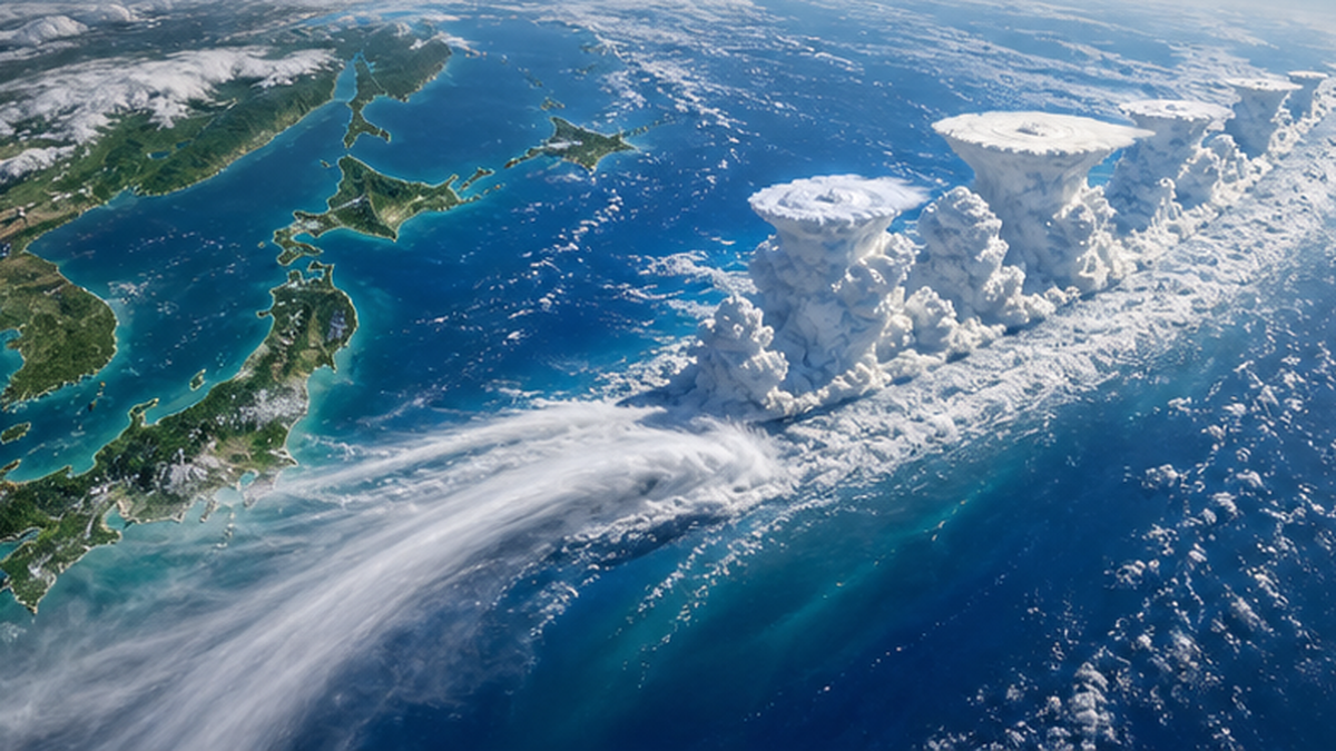
In July 2020, the "Heavy Rain Event of July 2020" hit Kyushu and other regions—the Kuma River in Kumamoto Prefecture burst its banks—claiming more than 80 lives. Once again, the baiu front stalled for a long period as warm, humid air streamed in relentlessly. A recurring actor in recent flood disasters is the senjo-kousuitai, or linear precipitation band: a train of well-developed cumulonimbus clouds, 50–300 km long, that passes over or stalls above the same area, unleashing ferocious rain for hours. The rainband itself is a local phenomenon, but where it forms and how long it persists are set by the larger stage—the position of fronts and the moisture corridors—in other words, by the meander pattern of the westerlies. The planetary flow and the local downpour are nested parts of one system.
The warmer the sea, the harder it rains
The other lead actor in torrential rain is the ocean. For every 1°C rise in temperature, the atmosphere can hold about 7% more water vapor (the Clausius–Clapeyron relation). Sea surface temperatures around Japan are rising at +1.33°C per century—about twice the global average (+0.62°C per century). Because a warmer sea supplies more vapor, the rain that falls when meandering westerlies stall a front or a low is heavier than it once was. The recent prominence of linear rainband disasters is not unrelated to this "refueling from the ocean."
Downpours and the westerlies: a summary
- In the meander's trough, rising air and frontal activity intensify, favoring rain-cloud growth
- The deeper and slower the meander, the less the rain area moves and the greater the total rainfall
- Rising sea temperatures boost the supply of water vapor, making each rain event heavier
Meanders and Heavy Snow: Why Blizzards Persist in a Warming World
"If the planet is warming, why do we still get record snowfalls?"—a common and fair question. Part of the answer, again, lies in the meandering westerlies. When the westerlies dip deeply southward near Japan in winter, powerful Arctic air floods in. Even as average temperatures climb, once this "cold-air delivery route" opens, short-lived but intense snow dumps remain entirely possible.
Winter 2020–21: a blocking high met La Niña
From December 2020 into January 2021, record snow buried the Sea of Japan side of the country, centered on the Hokuriku region, and long lines of vehicles were repeatedly stranded on expressways and national highways. The JMA's analysis found that a blocking high near western Siberia combined with the La Niña event underway since summer 2020, causing both the high-latitude and mid-latitude westerlies to meander south near Japan. Air colder than −51°C at an altitude of about 5,500 m was primed to pour in.
Rewinding to February 2018, the Hokuriku region suffered the record snowfall known as the "Heavy Snow of 2018": Fukui City's snow depth reached 147 cm, its deepest in 37 years, and about 1,500 vehicles were stranded on National Route 8, taking days to clear. Then, too, a strong southward surge of cold air was behind it. The modern pattern of snow damage is not "wide and shallow" but "narrow, concentrated and fierce."
The JPCZ: where cold air converges into snow machines over the Sea of Japan
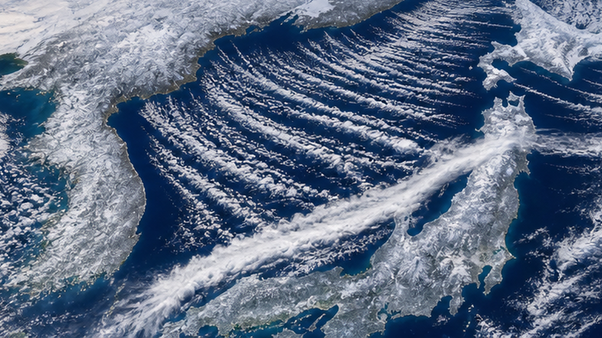
When cold continental air blasts out over the Sea of Japan, the flow splits around the mountains of the northern Korean Peninsula and reconverges over the sea, sometimes forming a cloud band up to 1,000 km long. This is the JPCZ (Japan sea Polar air mass Convergence Zone). Fed heat and moisture by the relatively warm Sea of Japan, cumulonimbus clouds build along the band and dump concentrated snowfall wherever it makes landfall. Recent research suggests that warming of the Sea of Japan may be increasing the vapor supplied to snow clouds—so heavy snow, too, is inseparable from the changing ocean.
The future of snow: fewer days, heavier dumps
The JMA's climate change assessment reports project that Japan's overall snowfall will decline as warming progresses. At the same time, the concentrated heavy snows that strike the Sea of Japan side when strong cold air surges south are expected to remain a risk, partly because a warmer Sea of Japan supplies more water vapor. In short: "fewer snow days, but heavier dumps when it snows." The average and the extreme moving in opposite directions—few phenomena capture the counterintuitive nature of climate change better. Ski resorts and agriculture that depends on meltwater face snow scarcity, while transport infrastructure faces concentrated blizzards: the same change wears different faces.
Warming and heavy snow do not contradict each other
- A deep southward meander of the westerlies opens a "road" carrying Arctic cold all the way to Japan
- Blocking highs and La Niña deepen the meander and prolong cold waves
- A warmer Sea of Japan feeds snow clouds with vapor, intensifying sudden dumps
How the Arctic and the Ocean Reshape the Westerlies
Why, then, has the meandering of the westerlies drawn so much attention in recent years? Because the very fuel of the westerlies—the north–south temperature difference itself—is changing.
The Arctic is warming about four times faster than the global average
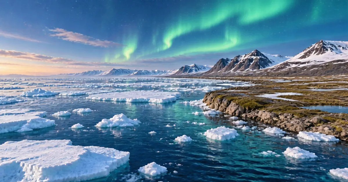
According to a 2022 study in the journal Communications Earth & Environment by Dr. Mika Rantanen of the Finnish Meteorological Institute and colleagues, the Arctic warmed at about 0.75°C per decade from 1979 to 2021—at least about four times the global average. In parts of the Eurasian Arctic Ocean near Svalbard and Novaya Zemlya, the rate reached 1.25°C per decade, seven times the global average. The phenomenon is called Arctic amplification, and shrinking sea ice is considered its main driver: as reflective white ice disappears, the exposed dark ocean absorbs solar heat, melting yet more ice in a vicious cycle.
The loss of Arctic sea ice has been dramatic. The IPCC Sixth Assessment Report finds that, comparing 1979–1988 with 2010–2019, Arctic sea ice area declined by about 40% in September (the annual minimum) and about 10% in March (the annual maximum), and assesses it very likely that human activity was the main contributor. Over just a few decades, the late-summer Arctic has been transforming from a white, frozen sea into dark, open water.
What happens to the westerlies as the temperature gap narrows?
The strength of the westerlies rests on the north–south temperature difference. If the Arctic alone warms rapidly and that gap shrinks, the westerlies may weaken, lose their zonal discipline and meander more readily north and south. Since the American researcher Dr. Jennifer Francis and colleagues proposed this idea in 2012, it has been studied worldwide as a possible contributor to Japan's extreme heatwaves and cold spells.
Warming seas around Japan and remote effects from the tropics
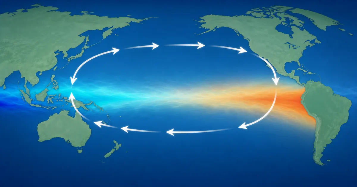
The ocean's changes are not confined to the Arctic. As noted, sea surface temperatures around Japan are rising at +1.33°C per century—about double the global pace—and the 2024 annual mean set a record anomaly of +1.44°C, the highest since statistics began in 1908. A warmer sea heats the atmosphere from below, amplifying extremes by strengthening highs and boosting water vapor. Meanwhile, shifts in tropical sea temperature patterns such as El Niño and La Niña relocate thunderstorm activity, remotely steering the westerlies' meander patterns thousands of kilometers away (teleconnection). We explain the El Niño mechanism in How El Niño and La Niña Change Fisheries and Weather, and abnormal ocean heat around Japan in What Is a Marine Heatwave?.
Nor is the influence one-way between air and sea. When a meander parks a high over the ocean, sunshine and weak winds heat the surface abnormally, spawning a marine heatwave—whose warm waters then heat the atmosphere further, a mutual amplification loop. Indeed, south of Japan, sea surface temperatures can hold above 30°C beneath the summer high, influencing the growth of passing typhoons and the vapor supplied to the autumn rain front. Anomalies of sky and sea always advance as a pair.
Three "ocean factors" that alter the westerlies
- Arctic sea ice loss → Arctic amplification → a narrower north–south temperature gap
- Rising sea surface temperatures around Japan → stronger highs and more water vapor
- Tropical sea temperature swings (El Niño / La Niña) → remote control of meander patterns
The Scientific Frontier: "Warming Increases Meandering" Is Not Settled
By this point, the chain "warming → Arctic amplification → westerly meandering → extreme weather" may sound like established fact. In reality, parts of this chain remain the subject of lively scientific controversy. Let us take honest stock of where things stand.
What we know for sure
- The Arctic is warming far faster than the global average (an observed fact)
- Human influence has increased the frequency and intensity of extreme heat such as heatwaves (IPCC Sixth Assessment Report)
- In individual cases of Japanese heatwaves and downpours, westerly meanders have been the direct trigger (JMA analyses)
- In the Southern Hemisphere, the summer mid-latitude jet has shifted poleward, and human influence very likely contributed (IPCC AR6)
What is still debated
By contrast, the hypothesis that Arctic amplification is driving a long-term increase in Northern Hemisphere mid-latitude meandering has produced conflicting results across observational analyses and model experiments, and no high-confidence conclusion has been reached. Professor Emeritus Hiroshi Tanaka of the University of Tsukuba, a specialist in atmospheric dynamics, for example, has raised pointed questions from a position skeptical that meandering is increasing at all. The IPCC's Sixth Assessment Report likewise affirms with high confidence the contribution of warming to individual heatwaves and downpours, while remaining deliberately cautious on linking Arctic amplification to mid-latitude extremes—reflecting a scientific consensus still in formation.
Event attribution: answering "was this heatwave climate change?"
A research method called event attribution now quantifies the relationship between individual extreme events and global warming. It runs large ensembles of simulations of the real, warmed Earth alongside a hypothetical Earth without warming, and compares how likely the event is in each. Applying this method to Japan's July 2018 heatwave, a team including the Meteorological Research Institute concluded that such a heatwave could essentially not have occurred without industrial-era warming. The division of roles between the two factors—the meander as the direct trigger, warming as the rising floor—is something science can increasingly express in numbers.
Science that advances by admitting what it doesn't know
The crucial point: "scientists are still debating" does not mean "climate action is unnecessary." That warming raises the floor beneath individual extremes—through higher temperatures, warmer seas and more water vapor—is established with high confidence; only the more intricate question of long-term meander trends remains open. Seasonal forecasts from coupled ocean–atmosphere models such as JAMSTEC's SINTEX-F grow more accurate each year—predicting the hot summer of 2023 months in advance—as research advances on the twin tracks of understanding the mechanism and delivering practical prediction.
This is clearly abnormal weather. With global warming, things we have never experienced are now happening.
― Chair of the JMA Advisory Panel on Extreme Climatic Events, September 2025 (as reported in the press)
How We Can Prepare: Use the Information, Adapt Our Lives
We cannot stop the westerlies from meandering. But the extreme weather that meanders bring now shows warning signs days to weeks in advance. Here is how individuals and households can prepare.
Make forecast information your ally
- Early Warning Information on extreme weather (JMA): flags the possibility of significant heat, cold or heavy snow up to 10 days ahead—useful for planning farm work and health care
- Heatstroke Alerts: warnings based on the WBGT heat index; reconsider outings and exercise on alert days
- Kikikuru (real-time risk maps): shows landslide, inundation and flood risk from heavy rain on a live map
- Three-month and warm/cold season outlooks: seasonal-scale forecasts that factor in conditions such as El Niño
Preparing for "persistent" extremes
The hallmark of meander-driven extremes is that they last. For heatwaves, manage electricity, water and health over multi-week spans; for downpours, stock supplies with sheltering at home in mind (at least 3 days of water and food, ideally a week); for heavy snow, carry fuel, blankets and a shovel in the car in case of stranding. Prepare for a campaign, not a single event. Checking hazard maps for your neighborhood remains the foundation.
Growing use in farming, fisheries and business
Seasonal forecast information is being put to work beyond personal disaster readiness. Farmers use early warning information and two-week temperature forecasts to counter heat damage to rice (adjusting water management, harvesting earlier) and to time vegetable sowing. In fisheries, sea temperature forecasts inform fishing-ground decisions and high-temperature countermeasures in aquaculture, such as early shipment or relocating pens. As extreme weather becomes an unavoidable premise, the ability to fold forecasts into decision-making is gaining value in every field.
Don't forget the root cause
In the long run, the only fundamental remedy is to cut the greenhouse gas emissions that keep raising the floor beneath extreme weather. Everyday actions—saving energy, choosing renewables, reducing food waste—may look small, but each is a vote toward changing society's emissions structure. Rising sea temperatures also feed the intensification of typhoons; the atmosphere and the ocean are one connected problem.
Actions you can take today
- Bookmark the JMA's Early Warning Information and Kikikuru risk maps
- Check the risks around your home and workplace on the hazard map portal
- Inspect your week's worth of supplies: drinking water, food, mobile batteries
- In winter, watch for JPCZ heavy-snow information and keep winter gear and a shovel in the car
Conclusion: The Waving River of Air, and Us Below It
The westerlies—the jet stream—are a river of air coursing through the mid-latitude sky, powered by the north–south temperature difference, delivering Japan's weather. When the flow meanders deeply and stalls behind blocking highs, seemingly opposite extremes—heatwaves, downpours, heavy snow—all arrive in the same persistent form. The western Japan floods and Kumagaya's 41.1°C in 2018, the Hokuriku snow disaster of 2021, and the hottest summer on record in 2025: much of Japan's recent extreme weather has unfolded beneath this waving flow.
And no account of the changing westerlies can leave out the ocean: an Arctic warming about four times faster than the global average; the seas around Japan warming at +1.33°C per century, twice the global pace; El Niño and La Niña steering weather thousands of kilometers away. The river of air flows in constant dialogue with the ocean beneath it. Whether warming will make the meanders worse is still an open question—but the fact that science moves forward while stating frankly what it does not know is itself the foundation of our trust in it. Next time you look up and watch the clouds drift, spare a thought for the river of air ten kilometers overhead—and for the changing ocean that sets it swaying.
Summary of this article
- The westerlies are a mid-latitude "river of air" born of the north–south temperature difference; its fastest ribbons are jet streams
- Deep meanders and blocking highs turn heatwaves, downpours and heavy snow into "persistent disasters"
- Summer 2025 was the hottest on record at +2.36°C; the JMA cited westerly meandering and high sea temperatures
- The Arctic is warming about 4x the global average; whether the shrinking temperature gap increases meandering is still under study
- Seas around Japan have warmed +1.33°C per century, adding "fuel" for downpours, snow dumps and typhoons
- Practical defenses: use early warning information and Kikikuru, and prepare for prolonged, not one-off, extremes
References and Sources
- Japan Meteorological Agency – Long-term trend of Japan's annual mean temperature
- Japan Meteorological Agency – Climate of summer 2025 (Jun–Aug; +2.36°C anomaly, highest since records began)
- Japan Meteorological Agency – Special report: 2024 annual sea surface temperature around Japan sets a record high (+1.44°C)
- Japan Meteorological Agency – FY2020 Advisory Panel on Extreme Climatic Events (analysis of heavy snow, blocking high and La Niña)
- Japan Meteorological Agency – Causes of the Heavy Rain Event of July 2018 and the record heat from mid-July (advisory panel materials)
- JAMSTEC BASE – What caused this summer's extraordinary heat? The meandering westerlies and a phenomenon seen for the first time in eight years (2023)
- Nature Portfolio (Communications Earth & Environment) – The Arctic has warmed nearly four times faster than the rest of the world (Rantanen et al., 2022)
- IPCC Sixth Assessment Report, WGI Summary for Policymakers (JMA provisional translation) – Assessment of extreme events and human influence
- Sasakawa Peace Foundation, Ocean Policy Research Institute, Ocean Newsletter – Arctic environmental change brings extreme weather to Japan
※ Ordered by reliability: government and academic institutions > peer-reviewed papers > specialist organizations > trusted media