⚡ In short
Rows of black pine trees line Japan's coastlines, forming multi-purpose protective forests that shield communities from blown sand, salty winds, and tsunamis. This article explains how these forests work and traces the decade-long effort to rebuild roughly 3,700 hectares destroyed by the 2011 tsunami, centered on the story of Takata Matsubara.
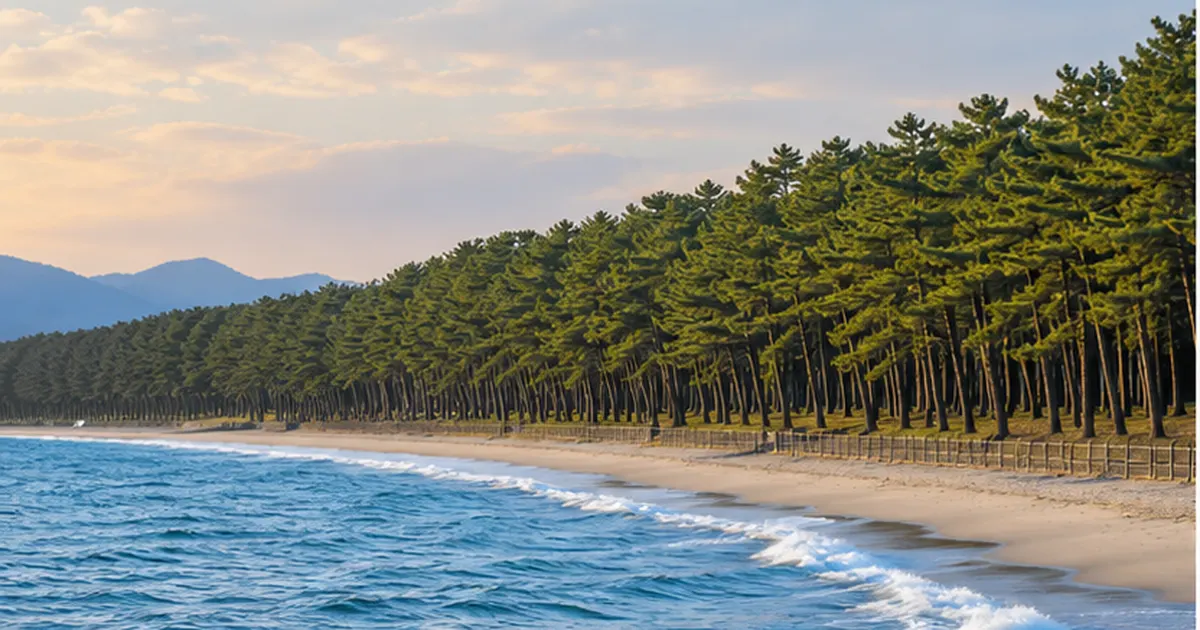
Along much of Japan's coastline, groves of black pine trees run just inland of the beach. Known as coastal forests (coastal disaster-prevention forests), these woodlands are protective forests that combine several roles at once — windbreak, sand-control, and fish-attracting forest — shielding inland villages and farmland from salty wind, blowing sand, and tsunamis. The 2011 Great East Japan Earthquake exposed both the limits and the resilience of these forests, and more than a decade of rebuilding since has reshaped how coastal disaster-prevention forests are designed.
Black pine, the leading species in these forests, is one of the few trees able to grow in sandy, salt-laden soil with little fresh water — an environment most trees cannot tolerate. Through symbiosis with mycorrhizal fungi it draws nutrients even from poor sandy soil, and it withstands the salt and spray carried by sea winds. Since the Edo period, coastal communities across Japan have densely planted this tree to build artificial forests that protected fields and homes from blowing sand and salt damage. The "white sand, green pines" scenery still seen around the country is not merely scenic — it is the accumulated legacy of disaster-prevention infrastructure built up over many generations.
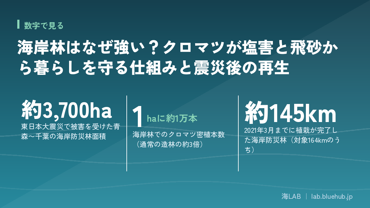
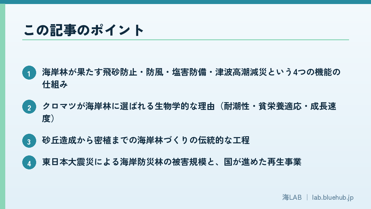
This article explains the four functions of coastal forests, why black pine was chosen, the roughly 3,700 hectares of coastal disaster-prevention forest lost in the 2011 disaster and the road to recovery, and the story of Takata Matsubara in Rikuzentakata — all based on primary information from the Forestry Agency and other public bodies. It is a forest often overlooked in daily life, but one built and maintained under a surprisingly precise design philosophy.
What you'll learn in this article
- How coastal forests perform four functions: sand control, wind-blocking, salt-damage prevention, and tsunami/storm-surge mitigation
- The biological reasons black pine was chosen for coastal forests (salt tolerance, adaptation to poor soil, growth speed)
- The traditional process of building a coastal forest, from dune construction to dense planting
- The scale of damage to coastal disaster-prevention forests in the 2011 earthquake and the national rebuilding effort
- The history and lessons of Takata Matsubara and its "Miracle Lone Pine"
- How coastal disaster-prevention forest design has evolved: earthworks, forest-belt width, and broadleaf mixing
What Is a Coastal Forest? A Multi-Purpose Forest That Guards Against Sand, Salt Wind and Tsunamis
A coastal forest is the common name for a forest designated under Japan's Forest Act as a "salt-damage protective forest," "windbreak protective forest," "sand-control protective forest," and similar categories — all managed as targets of erosion-control and forestry projects overseen by the Forestry Agency. Much of Japan's coastline consists of sandy beaches and dune terrain, where strong salty winds and blowing sand push inland. To protect homes and farmland in this environment, generations of people built and raised forests along the coast. Unlike seawalls or concrete structures that can be completed in a short time, a coastal forest is a "grown disaster-prevention infrastructure" that takes decades from planting until it fully performs its function.
Its Place in the Protective Forest System
According to the Forestry Agency, protective forests are classified into 17 categories by designation purpose, and several of these relate to coastal forests: salt-damage prevention, windbreak, sand control, and tidal protection (against storm surge and tsunami), among others. Many coastal forests satisfy several designation purposes within a single forest at once — from the beach side it may be described as "tsunami/storm-surge protection," while from the inland side it is "windbreak" or "sand control," with location and role overlapping. Forests designated as protective forests face restrictions, such as requiring permission to fell trees or alter land form, but in exchange they become the target of public erosion-control projects for maintenance. Many are privately owned even while under protective-forest designation, with owners, municipalities, and the national government sharing responsibility for management.
Coastal forests are not limited to the sandy beaches of the Pacific coast. On the Japan Sea side, where strong seasonal winds blow in winter, pine forests aimed at controlling blown sand and wind have long been maintained as well. While the balance of required functions differs by region depending on terrain and prevailing wind direction, the basic structure — placing a forest behind homes and farmland — is common everywhere. In areas with well-developed dune fields, sand control tends to be emphasized most, while in rugged, inlet-indented coastlines, windbreak and salt-damage prevention functions have been strongly needed to protect densely packed settlements on narrow strips of flat land.
The Four Functions of a Coastal Forest
The representative functions of a coastal forest can be organized into the following four:
- Sand control: The canopy and roots stabilize dunes, preventing wind-blown sand from reaching inland villages and fields
- Windbreak: Branches, leaves, and trunks disperse and dampen wind energy, reducing wind speed on the inland side
- Salt-damage prevention: The canopy captures fine seawater particles carried by wind, reducing salt deposits on crops and living environments
- Tsunami/storm-surge mitigation: Tree trunks absorb wave energy, delaying arrival time and trapping debris
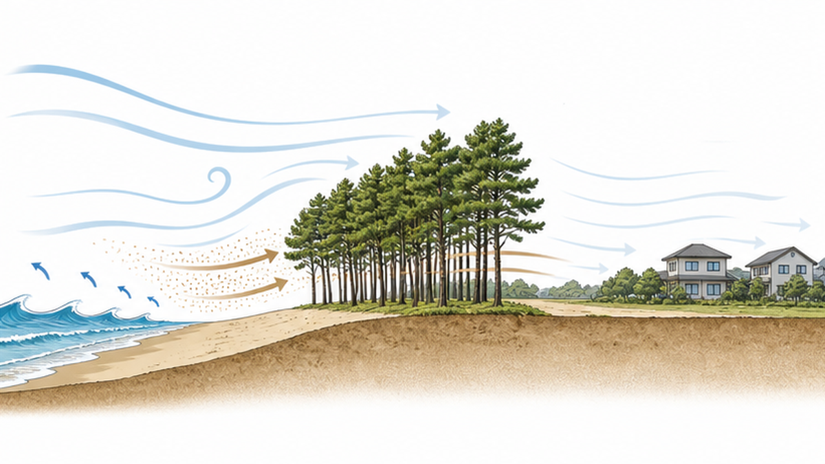
These four functions are not independent — they reinforce one another. For example, as the canopy grows denser and windbreak effectiveness rises, the volume of sand lifted by wind itself decreases, easing the burden of sand control. Conversely, if blown sand keeps accumulating on the forest floor, it can smother root respiration, weakening the trees and reducing windbreak function — a vicious cycle. Coastal forest managers time their thinning and undergrowth clearing while accounting for these interactions.
At the same time, maintaining a coastal forest requires continuous upkeep. In some areas, coastal erosion has thinned the foreshore and eroded the dunes that form the forest's base; in others, vehicle intrusion, littering, illegal dumping, and trampling of the pine grove hinder the regeneration of young trees. Local governments and volunteer groups conduct patrols, cleanups, and replanting activities across the country. A coastal forest is never truly "finished" once built — without ongoing care matched to changing surroundings, its function gradually declines. It is a living infrastructure.
That said, the effectiveness of coastal forests against tsunamis has clear limits. Analysis by the Forestry Agency and research institutions positions coastal forests not as seawalls that fully block a tsunami, but as "forests that buy time" by weakening its energy and delaying its arrival. This point became a central lesson of the 2011 disaster, discussed later.
The effectiveness of coastal forests has been verified repeatedly through field observation of wind speed and sand volume, model experiments, and computer simulations. Because wind-speed reduction and the reach of blown sand vary with forest-belt width, tree density, and height, this accumulated knowledge now serves as the basic data used to design new coastal forests. It is thanks to years of observation that coastal forests are treated today as disaster-prevention facilities backed by scientific evidence, not just tradition.
Coastal forests also play an ecological role beyond disaster prevention. The forest floor and edges create a unique environment distinct from both inland forests and marine ecosystems, providing habitat for plants, insects, and birds adapted to sandy terrain. In addition, forests facing the sea function as "fish-attracting forests," supplying nutrients and shade that support coastal fishery resources — a reason fishing communities themselves have long been involved in conserving coastal forests.
Why Black Pine? The Secret of a Tree Adapted to a Harsh Environment
How It Withstands Salt Wind, Salinity, and Poor Soil
Black pine (Pinus thunbergii) is an evergreen conifer native to Japan's coasts, long used in coastal forestry for its tolerance of salty winds and sandy soil. Its roots form a symbiotic relationship with mycorrhizal fungi, allowing it to efficiently absorb nutrients such as phosphate even from nutrient-poor sand. Its needles, covered by a thick cuticle layer, endure the drying stress caused by salt and spray, making it one of the few species able to grow on the very front line facing the sea, where salty wind blows directly and constantly. Its close relative, Japanese red pine, is found mostly in inland mountains, while black pine has spread specifically along coastal areas — a distinction that underlies how the two species are used differently.
Black pine roots are said to combine shallow, widely spreading lateral roots with a deep taproot, supporting both resistance to being toppled by strong wind and tolerance of dry, sandy conditions. For a tree growing on the unstable ground of a dune, the way its roots spread directly determines its windbreak and sand-control function; through dense planting, the intertwining roots of many trees are thought to give the forest as a whole a stability no single tree could achieve alone.
Fast Growth and Use as Timber
Because black pine gains height relatively quickly, the period between planting and the forest beginning to function is short, allowing windbreak and sand-control effects to appear early. In the past, pine timber was also used for construction materials and fuel, an integral part of life in coastal communities. Pine needles and fallen branches were gathered as fuel, and the resin was used as pine tar — the tree served not only a disaster-prevention role but also a role as a household resource. While its use as building material has declined today, the scenery of the pine grove itself has become a tourism resource that supports local identity.
Miho no Matsubara in Shizuoka Prefecture, Niji no Matsubara in Karatsu City, Saga Prefecture, and Kehi no Matsubara in Tsuruga City, Fukui Prefecture, are widely known as the "Three Great Pine Groves of Japan," each a black pine forest that local communities have protected and nurtured over a long span of time. These groves are tourist destinations while still functioning today as active coastal forests protecting the settlements and farmland behind them from salty wind and blown sand — a case where disaster-prevention value and scenic/cultural value have coexisted, a notable feature of Japan's coastal forests.
Miho no Matsubara is registered as a component asset of the Mount Fuji UNESCO World Heritage Site, and the combined scenery of Mount Fuji, the pine grove, and Suruga Bay has long been depicted in paintings and literature. Niji no Matsubara stretches about 4.5 kilometers and covers roughly 216 hectares along the Genkai Sea, while Kehi no Matsubara faces Tsuruga Bay and is considered a representative example of a coastal forest on the Japan Sea side. What all three share is that a practical function — windbreak and sand control — became, over time, a source of regional pride.
Because of these traits, black pine remains the primary species in coastal forests across Japan today. As discussed later, however, a forest made up of a single species carries pest and disease risk, and in recent years there has been a growing effort to reconsider forest composition itself.
Nursery cultivation of black pine is also a critical step that determines a coastal forest's quality. Collected seeds are raised in seedling nurseries for several years until large enough to transplant on site. Because climate and soil conditions differ by region, the concept of "regional provenance seedlings" — using seed stock raised in the same region as much as possible — is valued, since locally adapted individuals tend to establish better than seedlings brought in from elsewhere.
How Coastal Forests Are Built: From Dune Construction to Dense Planting
Protecting the Foreshore and Building Artificial Dunes
Even black pine cannot root itself where sand is constantly shifting. So building a coastal forest begins by protecting a "foreshore" beach on the seaward side, then setting up sand-fences further inland to trap blown sand and construct an artificial dune. Only once the movement of sand has settled do workers plant salt-tolerant species such as black pine. This dune, called the "fore-dune," serves as the foundation on which the forest's roots grow, while also acting as the first buffer to absorb wind and blown sand from the sea.
Sand fences range from those woven from bamboo or branches to, more recently, versions made from durable materials. Placing a fence on the windward side causes sand to accumulate on its leeward side; by moving the position and height of the fence in stages, the dune is gradually raised to the target height. This process is far from quick — in some regions and terrains, building the dune alone can take several years to over a decade.
The Wisdom of Dense Planting
Coastal forests are planted far more densely than ordinary mountain forestry. About 10,000 trees per hectare — roughly three times the density of typical mountain afforestation — is standard. Dense planting allows young trees to grow while sheltering one another from wind, closing the canopy earlier and producing windbreak and sand-control effects sooner. In the early stage of planting, auxiliary species are sometimes mixed in on the seaward side as a windbreak, allowing the main black pine forest to grow in their shelter. As the trees mature, thinning is carried out to bring the forest to an appropriate final density.
| Step | Description |
|---|---|
| 1. Protect the foreshore | Maintain the seaward beach to absorb the first impact of waves and wind |
| 2. Install sand fences | Trap blown sand with fences to control sand movement |
| 3. Build artificial dunes | Accumulate blown sand to form the dune foundation for the forest |
| 4. Densely plant black pine | Plant at a target of about 10,000 trees per hectare for early canopy closure |
| 5. Tend and thin | Thin the forest as it grows to raise a healthy stand |
In the first few years after planting, seedlings are at high risk of being smothered by weeds or buried by blown sand, so undergrowth clearing and sand removal are essential tending tasks. Neglecting management during this period can undo years of prior construction effort, which is why many regions maintain a system of ongoing patrols and upkeep.
This whole process does not finish in a few years — it takes decades for a forest to fully develop its disaster-prevention function. Many of the pine groves that have survived since the Edo period are the result of this patient construction and tending accumulated across many generations, and the 2011 earthquake reaffirmed that once such a forest is lost, restoring the same character takes a very long time.
This "slow infrastructure" character remains true of coastal forest development today. Reaching the density and height needed for a forest to fully function still takes decades after planting, and pursuing only short-term results risks producing a lower-quality forest. Long-term planning and a management system built to span generations are indispensable to coastal forest building.
The 2011 Earthquake and Coastal Disaster-Prevention Forests: What the Tsunami Revealed
The Scale of the Damage
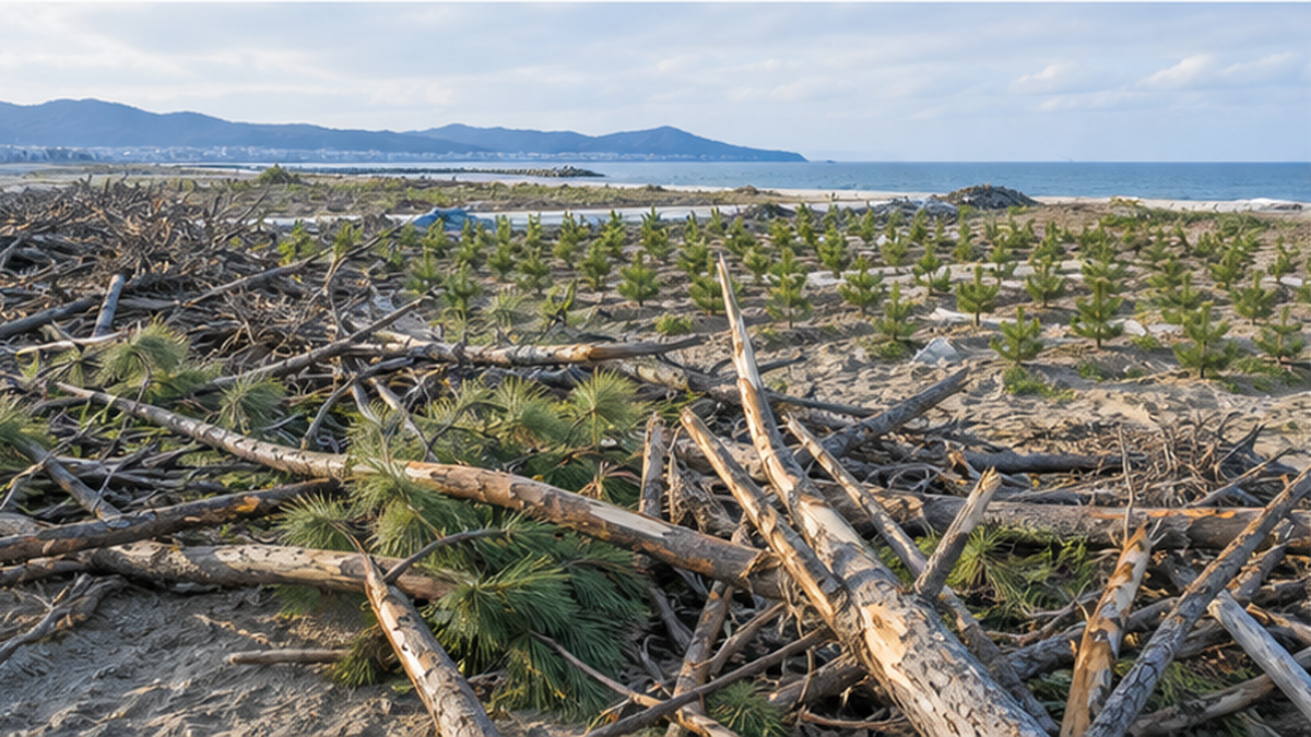
The tsunami triggered by the 2011 Great East Japan Earthquake devastated coastal disaster-prevention forests spread along the Pacific coast from Aomori to Chiba Prefecture. The total damaged area came to about 3,700 hectares, with Miyagi Prefecture suffering the largest loss at 1,753 hectares. The tsunami surged in at heights that overtopped the tree canopy, and many black pines were lost to uprooting and washing away. In areas like the Sendai Bay coast, where wide beaches and flat hinterland allowed the tsunami to travel further inland, coastal forest damage was correspondingly widespread.
The damage was not limited to the trees themselves. In some areas, the dunes that formed the forest's foundation were scoured away by the tsunami, while in others they were buried under sediment; where the terrain itself changed drastically, replanting using the same method in the same location was often impossible. As a result, post-disaster rebuilding projects in many areas had to start over with fresh topographic surveys rather than simply reproducing the pre-disaster forest.
To restore the damaged coastal disaster-prevention forests, the Forestry Agency's Tohoku Regional Forest Office established a dedicated Coastal Forest Restoration Office at its Sendai Forest Management Station in October 2011, building a system that carried out everything from damage surveys through design and construction while consulting local residents and experts. Of the roughly 164 kilometers of coastal disaster-prevention forest targeted for restoration, about 145 kilometers had been replanted by the end of March 2021, and the project has since moved into a phase of ongoing monitoring and tending.
Why the Tsunami Could Not Be Stopped
According to research institution analyses, a coastal forest's effectiveness against tsunamis depends heavily on forest-belt width and how well the trees' roots have spread. Where the forest belt was narrow, or where the dune foundation was shallow and roots had not spread sufficiently, many trees were uprooted and washed away by the tsunami's hydraulic force; in sections with a wide forest belt and well-developed root systems, reports show reduced flow velocity and debris volume on the inland side. Some point out that existing coastal forest designs had simply never anticipated a tsunami of this scale — pre-disaster coastal disaster-prevention forests were mainly built to withstand everyday storm surges, strong winds, and blown sand.
This lesson led to coastal disaster-prevention forests being redefined: not as structures meant to fully "block" a tsunami, but as facilities that weaken its energy, delay its arrival, and buy time for evacuation. At the same time, rather than relying on the coastal forest alone to counter a tsunami, the concept of "multiple defense" — combining it with seawalls, evacuation routes, and land-use regulation to reduce damage — was adopted as the guiding policy across subsequent coastal disaster-prevention forest restoration projects.
Redefining the Role of Coastal Disaster-Prevention Forests
- Repositioned not as structures that fully stop a tsunami, but as "resilient" facilities that weaken its energy and buy evacuation time
- Being developed as one layer of a "multiple defense" approach combined with seawalls and other disaster-prevention facilities
Affected prefectures such as Miyagi have continuously compiled and published the restoration status of erosion-control facilities — coastal seawalls and coastal disaster-prevention forests — since immediately after the disaster, allowing damaged area and restoration progress to be tracked over time. This kind of public disclosure has played an important role in helping residents understand how reconstruction is progressing and in advancing restoration projects through shared information with local government.
Takata Matsubara and the "Miracle Lone Pine": A Story That Bridges History and Renewal
A Pine Grove With Roots in the Edo Period
Takata Matsubara in Rikuzentakata City, Iwate Prefecture, traces its origins to between 1667 and 1673, when a local wealthy merchant, Kanno Mokunosuke, planted about 6,200 black pines with the cooperation of the Sendai domain, building a coastal forest to protect the Takata and Kesen River areas from salt damage and blown sand. The grove expanded through subsequent plantings, and before the disaster it was a beloved scenic spot of "white sand, green pines" spanning about 2 kilometers of beach with roughly 70,000 pines, ranked among Japan's "100 Scenic Spots" — a disaster-prevention forest that also served as a symbol of local tourism and culture.
The grove was also deeply tied to local life. While serving its windbreak and tidal-protection functions, it drew beachgoers in summer as a tourist destination and served as familiar nature where local children played and grew up, cherished across generations. Over roughly 340 years from its Edo-period planting until the disaster, the grove endured repeated typhoons and storm surges while remaining part of the community's living foundation.
What the Miracle Lone Pine Represents
The 2011 tsunami nearly destroyed this grove entirely, leaving only a single tree standing further inland out of roughly 70,000. Known as the "Miracle Lone Pine," it became a nationwide symbol of recovery, but damage from seawater immersion during the tsunami injured its roots, and its death was confirmed in May 2012. Rikuzentakata City preserved the tree on-site as a monument after treatment, positioning it as a disaster memorial that passes on the memory of the earthquake and the hope for recovery to future generations. The course of events — one pine surviving, and then eventually succumbing — gave many people a concrete image of just how far a coastal forest can withstand a tsunami.
Restoring the Grove Through 40,000 New Trees
After the disaster, Takata Matsubara underwent new planting on earthworks built with the lessons of the tsunami in mind, and the target of 40,000 new trees was completed in May 2021. Rather than simply reproducing its former appearance, the grove is being restored as a coastal forest with a stronger foundation. The planting effort drew participation from local residents, volunteers from across the country, and corporate support, giving it the character of a shared undertaking that hands the memory of the disaster to the next generation, not merely a public works project.
Around the restored Takata Matsubara, in addition to the "Miracle Lone Pine" disaster memorial, facilities that convey the height of the tsunami and a roadside station introducing the path of reconstruction have also been developed, positioning the area as one that combines disaster-prevention education with tourism. Coverage of tourism and storyteller activities centered on such disaster memorials is also introduced in our article on recovery tourism built around the sea.
Evolving Coastal Disaster-Prevention Forest Design: Earthworks, Forest-Belt Width, and Multiple Defense
Strengthening Root Systems Through Earthwork
After the 2011 earthquake, the Forestry Agency laid out a policy emphasizing the construction of growth foundations through earthworks in rebuilding coastal disaster-prevention forests. In many forests damaged by the tsunami, high groundwater levels had prevented roots from spreading deeply enough, contributing to trees being toppled; this led to the standardization of a method that raises soil to improve drainage and creates a stable foundation for healthy root growth before planting. In various regions, tsunami-deposited soil and earth generated by reconstruction projects have also been put to use in this earthwork, combining disaster-waste processing with coastal forest restoration.
The height and shape of the earthworks are designed region by region, based on the scale of tsunami or storm surge being planned for, the land use behind the site, and the height of any existing seawall. Beyond simply piling up soil, drainage layers are built into the earthworks and compaction methods are refined, with emphasis placed on creating stable ground where roots can spread deeply.
The Design Philosophy of Widening the Forest Belt
Forestry Agency analysis indicates that a wider forest belt is expected to dissipate wave force against larger tsunamis, and also reduces the wave force reaching trees further inland — meaning more trees survive and the forest as a whole gains greater resilience. In restoration projects along the Sendai Bay coast and elsewhere, securing forest-belt width has become one of the central pillars of design under a "multiple defense" concept that combines seawalls, roads, and coastal disaster-prevention forest. Specifically, the layout runs from the sea inward as a seawall, then a buffer of earthworks and dunes, followed by a wide belt of black pine forest — each facility responding to a different scale of disaster in stages. This green-infrastructure approach, combined with seawalls and evacuation planning, is also discussed in detail in our article on adapting to storm surge and coastal flooding.
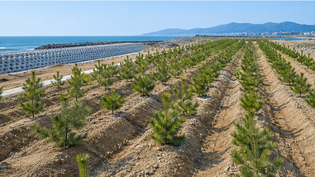
This design rethink is not limited to the disaster-affected areas of Tohoku. Across the Pacific coast, in regions anticipating future major earthquakes and tsunamis such as a Nankai Trough event, efforts are spreading to inspect the forest-belt width and earthwork condition of existing coastal disaster-prevention forests and to reinforce or rebuild them as needed. Coastal forests are never a "finish and forget" project — the ongoing efforts across the country since the disaster show that their function is maintained only by continuing to check and reinforce them after every earthquake and typhoon, treating them as living infrastructure.
Because restoration projects require many years and substantial manpower and funding, clearly communicating project progress to local residents is also considered an important task. Sharing the process from planting to a functioning forest through photographs and site tours, while building local consensus, supports the sustainability of these projects.
Restored coastal disaster-prevention forests also remain subject to regular monitoring even after completion. Managers across the country have built systems to continuously check the survival rate and growth of planted trees, as well as any settling or erosion of the earthworks, making repairs or replanting as needed to raise a forest that delivers the disaster-prevention function it was designed for.
The Fight Against Pine Wilt Disease and the Future of Coastal Forests
Pine Wilt Damage and Resistant Black Pine
Coastal forests face another challenge: pine wilt disease, caused by the pine wood nematode and spread by the Japanese pine sawyer beetle — commonly known as pine wilt damage. The beetle carries the nematode and infects healthy pines; infected trees can have their water-conducting pathways blocked and die within a short period, and damage continues in coastal forests nationwide. Countermeasures include selecting and propagating individuals with strong resistance as "resistant black pine" seedlings for planting across many regions, alongside early detection and felling of infected trees and preventive chemical spraying.
Developing resistant black pine takes many years. Researchers select disease-resistant individuals in trial forests around the country, propagate them from seed or cuttings, and repeat testing in cycles to breed increasingly resistant strains — a long-term effort to gradually replace forests with ones that maintain disaster-prevention function while standing up to pest and disease risk.
Securing Diversity Through Broadleaf Mixing
Because a monoculture pine forest risks losing its entire function at once if pine wilt disease spreads, recent coastal disaster-prevention forest projects have adopted a "multifunctional, diverse coastal forest" approach — keeping black pine as the primary species while mixing in salt-tolerant broadleaf trees such as machilus and Indian hawthorn to diversify forest composition. The aim is to reduce dependence on a single species and increase the whole forest's resilience against pests, disease, and weather damage. Because broadleaf trees differ from black pine in root spread and leaf-drop timing, the forest floor environment becomes more varied, which is also thought to have a positive effect on biodiversity.
While broadleaf mixing is expected to bring long-term benefits both for disaster prevention and ecology, some species are less tolerant of salty wind and sandy ground than black pine, so which species to plant where, and in what proportion, is carefully considered based on local weather and terrain conditions. Rather than simply replacing black pine, a design that combines the right tree in the right place is being explored.
This species diversification also serves as preparation for future environmental change beyond pest control — such as intensifying typhoons and shifting rainfall patterns tied to climate change. A forest that does not depend on a single species functions as a form of insurance against risks that cannot be fully anticipated, and is thought to enhance the long-term stability of coastal forests.
What We Can Do: Community Participation in Sustaining Coastal Forests
Planting Volunteers and Corporate CSR
Restoring coastal disaster-prevention forests is supported not only by government agencies but also by the participation of citizens and companies. In post-disaster coastal forest restoration, citizen volunteers from across the country and corporate CSR activities continue to support seedling cultivation, planting, and undergrowth clearing in many regions. Because planted pines need several years of tending — clearing undergrowth and removing debris carried in by sea wind — to grow properly, ongoing involvement in maintenance plays as important a role as one-time planting events.
Volunteers who visit once from afar to plant trees, and local residents or groups who provide ongoing maintenance year after year, play different but complementary roles. A single planting event is important for broadening interest in these activities, but the years of subsequent undergrowth clearing and monitoring are, in most cases, sustained by groups and neighborhood associations rooted in the local community. Building sustainable coastal forests requires thinking about how to combine both kinds of participants into a lasting system.
This kind of activity is spreading beyond disaster-affected areas, also helping to make up for work that aging local managers of pine groves across the country can no longer keep up with on their own. For companies, it serves as both a form of social contribution and an opportunity for employees to learn about disaster prevention and the environment, with mechanisms for cooperation among government, NPOs, companies, and local residents being explored in many regions.
As part of environmental education for children, local elementary and middle schools in various areas also hold planting and observation activities in nearby coastal forests. The experience of planting a seedling with one's own hands as a child can become, later in life, a reason to see that forest as "our coastal forest" — an important consideration for cultivating long-term stewards of these forests.
Visiting and Learning About Coastal Forests
Coastal forests are the kind of place people usually pass by without a second thought, yet beneath the surface lies a long history of construction and disaster-prevention design refined through the lessons of the 2011 earthquake. Visiting restoration sites such as Takata Matsubara or the Sendai Bay coast, and learning their story through information boards and museums, is one way to deepen understanding of coastal forests. Learning about this alongside the role coral reefs play as natural breakwaters gives a fuller picture of the natural systems that protect the boundary between sea and land. A coastal forest is a disaster-prevention facility, but it is also a forest that holds the scenery and memory of local life. The next time you visit the coast, it may be worth taking a moment to look at the pine grove just inland of the beach.
Ways to Learn About and Get Involved With Coastal Forests
- Check with your prefectural forestry department or organizations such as the National Land Afforestation Promotion Organization for local coastal forest restoration projects and volunteer opportunities
- Visit disaster memorials such as Takata Matsubara in Rikuzentakata to learn its history and lessons
- Look for information boards near coastal forests to learn what type of protective forest is designated there and the history of its development
References and Sources
- Forestry Agency – Designation purposes of protective forest categories
- Forestry Agency – On the future restoration of coastal disaster-prevention forests
- Forestry Agency, Tohoku Regional Forest Office, Sendai Forest Management Station – Restoration of coastal disaster-prevention forests along the Sendai Bay coast: the path of recovery since the Great East Japan Earthquake
- Forestry Agency – FY2020 Forestry White Paper, Chapter 5: Recovery from the Great East Japan Earthquake
- Miyagi Prefecture – Status of restoration of erosion-control facilities (coastal seawalls and coastal disaster-prevention forests) from Great East Japan Earthquake damage
- Rikuzentakata City – Takata Matsubara and the Miracle Lone Pine
- Ishikawa Prefecture – Understanding Ishikawa's Forests and Forestry No.10: Coastal Forests
- National Land Afforestation Promotion Organization – The role of coastal forests and the concept of restoration
- Karatsu City Tourism Association – Niji no Matsubara (about 4.5 km long, about 216 ha, one of Japan's Three Great Pine Groves, a Special Place of Scenic Beauty)
- Tsuruga Tourism – Kehi no Matsubara (facing Tsuruga Bay, one of Japan's Three Great Pine Groves, a national Place of Scenic Beauty)
Ordered by reliability: government/academic institutions > peer-reviewed papers > specialized organizations > reputable media