The ocean provides us with abundant blessings, but once it turns violent, it has the power to swallow entire towns. As climate change progresses, this fierce side of the sea is quietly but steadily intensifying. Even though typhoons themselves are the direct trigger, it is actually the "slowly advancing sea level rise" that is raising the baseline water height. Even with a typhoon of the same strength, a sea level just a few dozen centimeters higher can dramatically expand the area that floods.
This article organizes how we should prepare for the "storm surges" and "coastal flooding" that climate change is making more severe. The keyword is "adaptation" — a concept that, together with "mitigation" (reducing greenhouse gas emissions), forms the two wheels of climate action, and represents the practical work of protecting lives and livelihoods from changes that are already underway.
Understanding risk through hazard maps, physically defending with seawalls and floodgates, escaping through evacuation plans, and even enlisting the power of nature such as coastal forests and tidal flats — let's trace the full picture of coastal disaster prevention available to us, drawing on primary information from government bodies, municipalities, and research institutions, and breaking down technical terms along the way.
What you'll learn from this article
- How storm surges arise from two physical mechanisms — the "suction effect" and the "wind setup effect" — and how climate change amplifies this danger through sea level rise
- The real story and lessons of Japan's storm surge disasters, including the 1959 Isewan Typhoon and 2018's Typhoon No. 21
- How to read storm surge flood inundation assumption maps and hazard maps, and how to check the flood depth expected at your own home
- Grey infrastructure such as raised seawalls, floodgates, and super levees, and their limitations
- Building an evacuation plan around soft measures such as wide-area evacuation and "My Timeline"
- The disaster-mitigation role played by green infrastructure (Eco-DRR) such as coastal forests, sand dunes, coral reefs, and tidal flats
Why adaptation to storm surges is urgent now
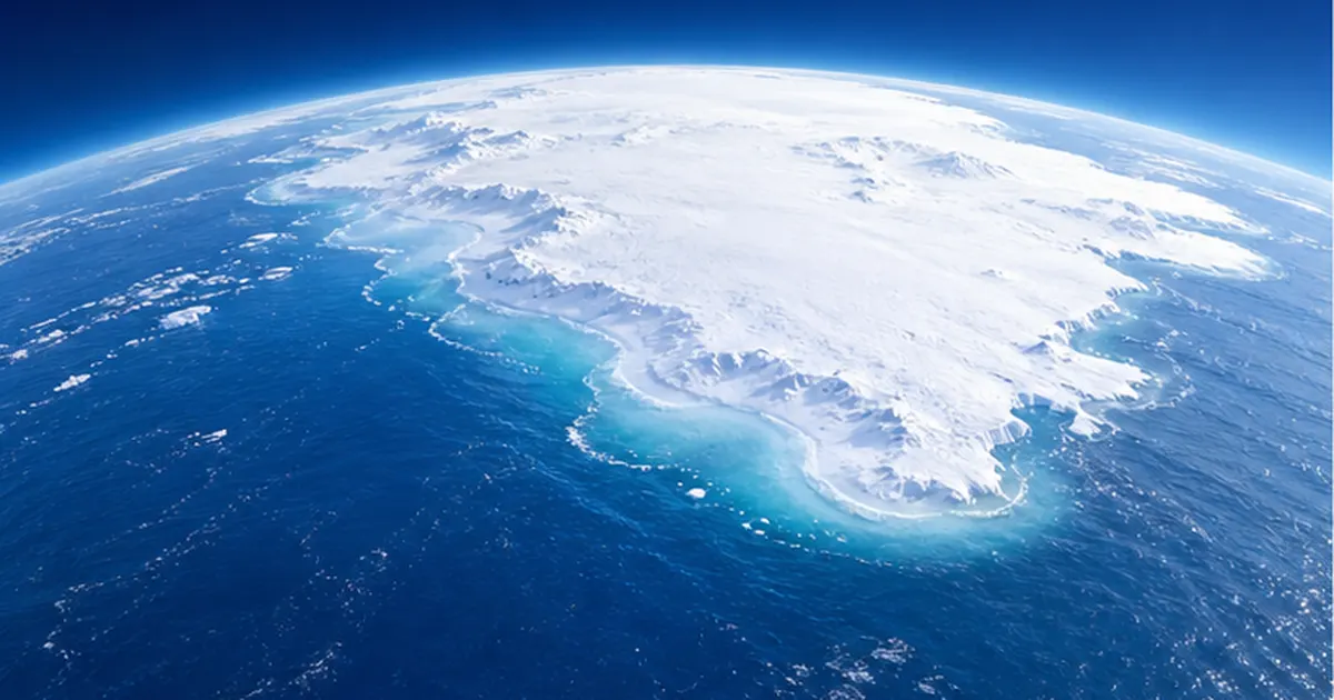
When people hear "global warming," most first think of rising temperatures and severe heat. But if we turn our attention to the ocean, another quiet change is underway: rising sea levels. As glaciers and ice sheets melt and rising water temperatures cause seawater itself to expand, the world's oceans are gradually gaining volume.
According to the 2025 report "Climate Change in Japan 2025," published by the Japan Meteorological Agency, the average sea level along Japan's coast is projected to rise by roughly 0.40m (under a 2°C warming scenario) to roughly 0.68m (under a 4°C warming scenario) by the end of the 21st century (2081–2100), compared to the end of the 20th century (1986–2005). Looking at the world as a whole, the IPCC's (Intergovernmental Panel on Climate Change) Sixth Assessment Report states that a rise of up to roughly 2m by 2100 is possible.
Sea level rise "raises the baseline" of storm surge danger
Sea level rise itself is an almost imperceptibly slow change, amounting to only a few millimeters per year. So why the urgency? The answer is that sea level rise raises the baseline of storm surge risk. If the underlying average sea level rises by a few dozen centimeters, the height that seawater reaches during a typhoon is pushed up by that same amount. Research in Japan and abroad warns that flooding that used to occur "once in a hundred years" will start occurring once every few decades, and eventually once every few years.
Moreover, climate change also affects the typhoons that trigger storm surges in the first place. Impact assessments by Japan's Ministry of the Environment show a tendency for typhoons approaching or making landfall in Japan to become more intense as global warming progresses. Rising sea temperatures are a broad issue that also affects marine ecosystems and fisheries, as discussed in more detail in our article on ocean warming and fisheries. Stronger typhoons and a rising baseline sea level — this double pressure is closing in on the feet of those living along the coast.
"Mitigation" and "adaptation" — two pillars of climate action
Responses to climate change can be broadly divided into two categories. One is mitigation, which reduces greenhouse gas emissions themselves. The other is adaptation, which prepares society for changes that are already underway by adjusting how we live. Because sea level rise will continue for decades to centuries even if emissions were reduced to zero immediately, storm surge countermeasures are a textbook example of adaptation. Even if the world could dramatically cut emissions starting today, the heat already accumulated in the atmosphere and absorbed by the ocean means sea levels will keep rising for some time. In other words, the sober conclusion of science is that no matter how hard we work at mitigation, a future in which "we don't need to adapt" will not arrive.
Moreover, Japan is a country with a particularly high stake in this issue. It is an island nation surrounded by sea, much of its plains are low-lying land spreading out from river mouths, and its population and assets are concentrated along the coast. Globally, densely populated and economically active regions tend to be located in low-lying areas close to the sea, meaning that it is precisely such cities that are hit hardest by sea level rise and storm surges. That is exactly why we need to think of adaptation to storm surges not as a distant future issue, but as a problem facing the towns we live in today.
The four pillars of adaptation covered in this article
- Know: Visualize risk using hazard maps and storm surge flood inundation assumption zones
- Defend: Protect with grey infrastructure such as raised seawalls, floodgates, and super levees
- Evacuate: Protect lives with evacuation plans, wide-area evacuation, and My Timeline
- Harness: Reduce disaster risk with green infrastructure such as coastal forests, sand dunes, coral reefs, and tidal flats

In the sections that follow, we'll dig into each of these four pillars one by one. First, let's get to know the enemy — starting with the physics of what a storm surge actually is.
What is a storm surge? The physics of "suction" and "wind setup"
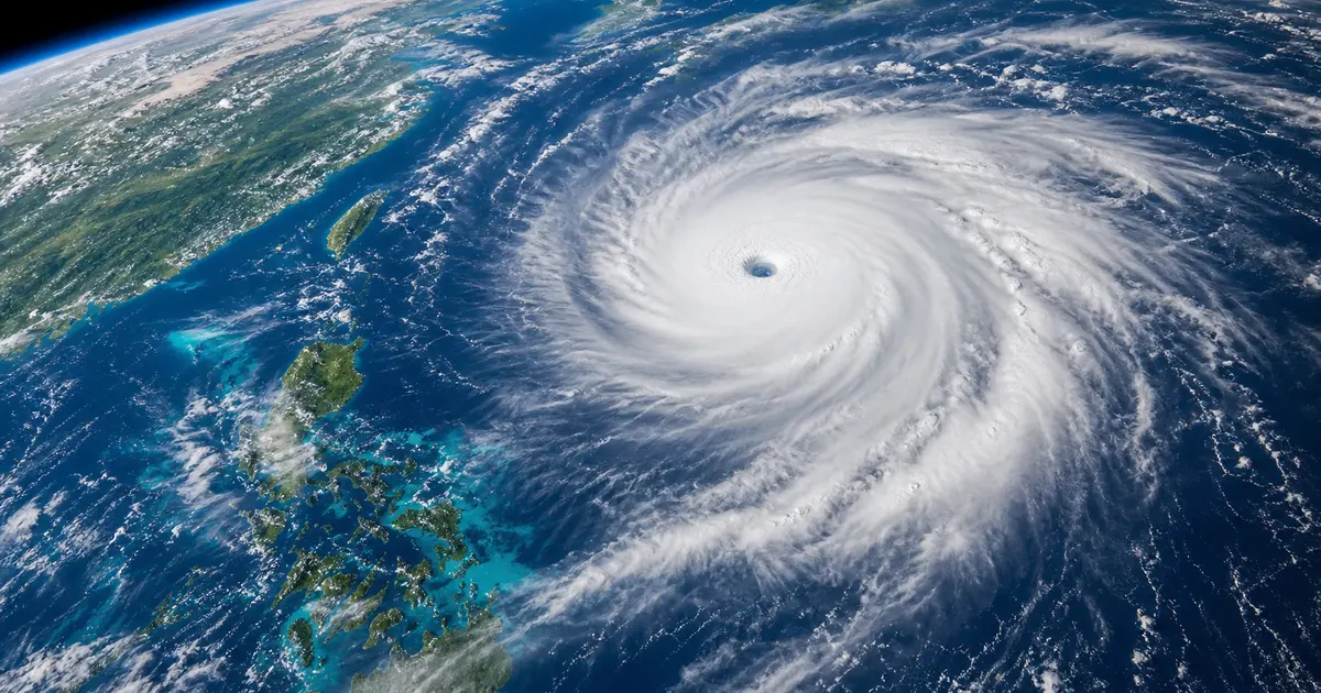
A "storm surge" is a phenomenon in which sea level rises abnormally as a typhoon or a developed low-pressure system approaches. Unlike the similar-sounding "tsunami," which is caused by seismic movement of the seafloor, a storm surge is critically different in that it is caused by weather. The height of a storm surge is determined mainly by a combination of two physical effects.
① The "suction effect" caused by falling pressure
Atmospheric pressure becomes extremely low at the center of a typhoon. When pressure is lower than the surroundings, the sea surface is lifted by that same amount. As a rough rule of thumb, a 1-hectopascal drop in pressure raises sea level by about 1cm. For a powerful typhoon whose central pressure is 50 hectopascals lower than its surroundings, this alone works out to roughly a 50cm rise in sea level. Because the sea surface bulges up much like a drink being pulled up through a straw, this is called the "suction effect."
② The "wind setup effect" caused by strong winds pushing seawater
The other mechanism is the "wind setup effect," in which a typhoon's strong winds push seawater from offshore toward the coast. This is especially dangerous when winds blow into the head of a bay, where seawater with nowhere else to go keeps piling up. Because the sea level rise from wind setup grows in proportion to the square of wind speed, the danger increases the stronger the wind, and the shallower and more enclosed the bay.
V-shaped and U-shaped bays are especially dangerous
Bays that open to the south in a pocket shape, such as Tokyo Bay, Ise Bay, and Osaka Bay, tend to concentrate seawater pushed by strong southerly winds at the head of the bay, making storm surges more likely to grow large. The fact that all three of Japan's major bays are home to large cities makes storm surge risk in Japan especially serious.
Furthermore, when waves (high waves) crash against seawalls on top of these effects and coincide with high tide, damage can escalate dramatically. The worst possible timing — when "storm surge + high waves + high tide + sea level rise" all coincide — is exactly the situation disaster-prevention experts warn about most. When several meters of high waves ride on top of a sea level that has already been gradually lifted by storm surge, "wave overtopping" occurs, in which waves surge over the top of the seawall to the landward side, even if the water level itself is within expectations. Even if the seawall does not break, the water and wave force that spills over can flood the town behind it on its own.
The relationship between a typhoon's path and the orientation of the bay also cannot be overlooked. Because winds blow counterclockwise into a typhoon, the strength of wind setup varies greatly depending on which side of the bay the typhoon passes. If a typhoon moves north along the western side of a bay, strong southerly winds blow into the head of the bay, maximizing the wind setup effect. Many of the great disasters of the past occurred when a typhoon followed exactly this "worst-case path." Even a typhoon of the same intensity can produce a very different storm surge height if its path shifts by just a few dozen kilometers — which is why storm surge prediction is so difficult, and why early vigilance is essential.
| Phenomenon | Main cause | Speed of onset | Predictability |
|---|---|---|---|
| Storm surge | Typhoons/low-pressure systems (falling pressure and strong winds) | Rises over several hours | Can be predicted to some degree via weather forecasting |
| High waves | Wind waves and swells from strong winds | Builds as the typhoon approaches | Can be predicted via wave forecasting |
| Tsunami | Earthquakes, submarine landslides, etc. | Strikes suddenly within minutes to tens of minutes | Mainly warned about after the fact |

Distinguishing "tide level" from "storm surge deviation"
The tide level reported in the news is the actually observed height of the sea surface. Meanwhile, storm surge deviation refers to how much the actual tide level rises above the astronomical tide (the normal ebb and flow of the tide determined by the gravitational pull of the moon and sun). For disaster prevention, whether this deviation happens to coincide with high tide is critically important. Even with the same deviation, if it arrives at high tide, the tide level itself becomes even higher, sharply increasing the risk of overtopping the seawall.
Japan's memory of storm surge disasters — the Isewan Typhoon and 2018's Typhoon No. 21
The true horror of storm surges is not captured in abstract numbers, but in the record of disasters that actually occurred. Let's look back at two disasters that fundamentally reshaped Japan's disaster-prevention system.
1959: The Isewan Typhoon — the worst storm surge disaster of the postwar era
In September 1959, the Isewan Typhoon struck the Tokai region directly. At the head of Ise Bay, a record-setting storm surge of 3.55m occurred, swallowing whole the below-sea-level "zero-meter zone" that had been urbanized without adequate disaster preparedness. The death toll, including those missing, exceeded 5,000, most of them from the storm surge itself. This remains the worst human toll from a typhoon disaster in Japan since the Meiji era.
This tragedy became a turning point for disaster prevention in Japan. Storm surge countermeasures were pursued in earnest from the following year, and the Disaster Countermeasures Basic Act was enacted in 1961, laying the foundation for a nationwide system of preparedness. Even today, many of the seawalls around Osaka Bay and Tokyo Bay are designed to withstand a storm surge on the scale of "the Isewan Typhoon." Put another way, the fact that we can now live safely and comfortably in coastal towns rests on the tremendous sacrifice of more than 60 years ago, and on the tireless work of those who came before us in building these seawalls.
The vulnerability of zero-meter zones
"Zero-meter zones," where land subsidence has caused the ground to sink below sea level, cannot drain naturally once water breaches a seawall, and the water can take a long time to recede. Roughly 1.76 million people live in such low-lying areas along Tokyo Bay, and about 1.38 million along Osaka Bay, making this a structural weak point against storm surges.
2018: Typhoon No. 21 (Jebi) — a storm surge that tested modern coastal defenses
Still fresh in memory is Typhoon No. 21 in September 2018. In Osaka Bay, Osaka City recorded a tide level exceeding its all-time record (329cm above sea level), while Kobe City recorded 233cm. On Kansai Airport Island in Tajiri Town, a maximum instantaneous wind speed of 58.1m/s was recorded, and the runway at Kansai International Airport was flooded by the storm surge; a tanker collided with the connecting bridge, cutting the airport off from the mainland. Deaths were also reported in the Kinki region.
This typhoon starkly demonstrated that even with today's high seawalls, storm surges, high waves, and violent winds exceeding assumptions can bring key infrastructure in a major city to a standstill. Sixty years after the Isewan Typhoon, seawalls have become far stronger, but as climate change progresses, the "assumptions" themselves must continue to be revisited — that is the lesson of Typhoon No. 21.

| Disaster | Year | Approximate peak storm surge/tide level | Main damage |
|---|---|---|---|
| Isewan Typhoon | 1959 | Approx. 3.55m storm surge at the head of Ise Bay | Over 5,000 dead or missing |
| Typhoon No. 21 (Jebi) | 2018 | 329cm tide level (above sea level) in Osaka City | Kansai Airport flooded and isolated; deaths in the Kinki region |
Long-term rises in average sea level are expected to raise the baseline impact of storm surges and high waves, thereby increasing the risk of flood disasters.
— Japan Meteorological Agency, "Climate Change in Japan 2025"
These two disasters share a common structure: in both cases, despite reasonably adequate preparations for their time, forces of nature exceeding those preparations struck low-lying areas where population and assets were concentrated. The lessons of the Isewan Typhoon gave rise to seawalls, and Typhoon No. 21 tested the assumptions built into those seawalls — the history of disaster prevention is, in a sense, a cat-and-mouse game between disaster and countermeasure. And climate change keeps moving the goalposts of this game even as we work to strengthen our defenses. Simply defending against the largest disaster of the past is not enough; what's needed is a shift in mindset toward anticipating the largest disaster of the future.
The first step in knowing risk — hazard maps and storm surge flood inundation assumption zones
The starting point of any adaptation measure is correctly knowing the risk facing the place where you live. The most basic and powerful tool for this is the hazard map, and the storm surge flood inundation assumption zone map that underlies it.
The "storm surge flood inundation assumption zone" born from the revised Flood Control Act
The 2015 revision of the Flood Control Act created a system for designating and publishing storm surge flood inundation assumption zones for coastlines at risk of major storm surge damage, in order to strengthen evacuation systems against the largest conceivable storm surges. In response, prefectures across the country have proceeded to create zone maps for coastlines including Tokyo Bay, Ise Bay, and Osaka Bay.
Storm surge flood inundation assumption zone maps are created by simulating the largest typhoons ever to make landfall in Japan (on the scale of the Muroto Typhoon), setting multiple possible paths, movement speeds, and levee-breach conditions, and showing the resulting flood depth and flood duration on a map using color coding.
How to read a hazard map
Municipalities create storm surge hazard maps by overlaying information such as evacuation sites and evacuation routes onto these zone maps, and distribute them to residents. Open yours during ordinary times, before a disaster strikes, and check the following points.
- What is the expected flood depth at your home, workplace, or school (below the floor, above the floor, or reaching the second floor)?
- How long is the flooding expected to last (if long, you should plan for the possibility of being isolated while awaiting rescue)?
- Where is your designated evacuation site, and will the route there stay dry?
- Is your location within a "zone at risk of house collapse from flooding" (where powerful currents could destroy homes)?
- Is there a tall building nearby (such as a tsunami evacuation building or high ground)?
Something you can do today: check your household's risk
- Search for your municipality's name plus "storm surge hazard map" and open the official page
- Enter your address into the Ministry of Land, Infrastructure, Transport and Tourism's "Overlay Hazard Map" (Kasaneru Hazard Map) to check storm surge, flooding, and tsunami risk together
- Share the flood depth with your family, and discuss whether vertical evacuation (moving upstairs) will be enough, or whether you'll need to evacuate away from the area
- Save the location of your evacuation site on your smartphone so you can find it even at night or during a power outage

"Flood duration" — an easily overlooked indicator
When looking at a hazard map, most people focus on the "depth" of flooding, but flood duration is just as important. In zero-meter zones especially, some areas are expected to take several days, or in some cases more than two weeks, to drain once water has entered, even with pumping. Water that fails to recede for a long time means electricity, gas, and water supply are cut off the entire time, roads become unusable, and rescue and supplies struggle to get through. Flooding that is "shallow but long-lasting" is something you cannot afford to overlook when deciding whether to evacuate. You need to factor in, ahead of time, the risk that staying home because the water seems shallow could leave you isolated for an extended period.
Also, during a storm surge, it's not just water overtopping the seawall that causes trouble — internal flooding (naisui hanran), in which rainwater that has fallen on the town cannot drain out to sea, tends to occur simultaneously. When storm surge raises water levels, drainage channels and pumps can no longer discharge water toward the sea, and rainwater with nowhere to go accumulates in the urban area. During a typhoon where storm surge, high waves, and heavy rain coincide, it is important to think about evacuation timing on the assumption that these multiple types of flooding will overlap.
This kind of risk information can also be an opportunity to reconsider the value of coastal natural environments such as tidal flats and sandy beaches. Reading our article on tidal flat conservation alongside this one will deepen your understanding of the connection between disaster prevention and nature conservation.
Defending with seawalls — raised levees, floodgates, and super levees as grey infrastructure
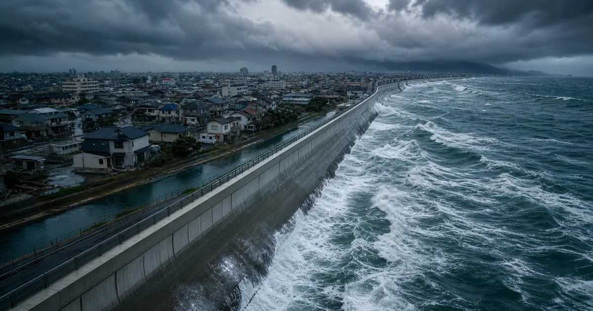
Once you know the risk, the next stage is to physically "defend" against it. Artificial disaster-prevention facilities made of concrete and steel are called grey infrastructure, in contrast with "green infrastructure," which harnesses nature. Grey infrastructure remains the mainstay of Japan's coastal disaster prevention today.
Raising seawalls — an adaptive form of preparation
The most direct countermeasure against sea level rise is raising the height of seawalls. The basic approach to climate change adaptation is to continuously monitor sea level to grasp long-term trends, while responding adaptively for structures, like levees, that can have height added later. Rather than building in the entire future rise all at once, the idea is to raise levees in stages while watching how sea level rise actually progresses.
On the other hand, structures that are difficult to modify later, such as drainage outlets and floodgate culverts, need to be designed with future sea level rise built in from the start. The harder something is to rebuild, the more important it is to give it "margin" that anticipates the future.
Two approaches to protecting cities — seawalls and large floodgates
Different regions take different approaches to storm surge protection in major cities. Tokyo mainly uses a "seawall approach," lining the coast with continuous seawalls, while Osaka is representative of the "large-floodgate approach," installing enormous floodgates at river mouths to stop storm surges from advancing upstream. In Osaka Bay, floodgates and seawalls have been developed to withstand a storm surge on the scale of the Isewan Typhoon.
Super levees (high-standard levees)
Super levees (high-standard levees) are built wide and with a gentle slope so that they are less likely to breach even if water overtops them. A distinctive feature is that their surface can normally be used as residential land or parks, and since 1987 they have been developed along the Tone, Edo, Ara, Tama, Yodo, and Yamato rivers — major rivers with zero-meter zones along their banks. However, because of the land acquisition and cost involved, development takes a long time and must proceed hand-in-hand with urban planning.
The limits of grey infrastructure — the "unexpected" always comes
Because levees are designed to protect up to a certain height, a storm surge that exceeds it cannot be fully stopped. Moreover, if people come to believe that levees are "absolutely safe," it can breed the kind of complacency (a "safety myth") that actually delays evacuation. Rather than relying on hard infrastructure alone, combining it with the soft measures and natural forces discussed in the following sections — a "layered defense" — is a global trend.

As a new trend that anticipates climate change, discussions are also beginning about society as a whole re-choosing "how far to protect." Continuing to protect every coastline with ever-higher seawalls is not realistic, whether in terms of cost or of landscape and environment. As a result, the option of "retreat," in which areas with concentrated population and assets are firmly protected by seawalls while residences and critical facilities in high-risk low-lying areas are gradually relocated to safer high ground over time, is also being considered internationally as a long-term adaptation measure. Protect, adapt, and retreat — wisely combining these three according to each region will be key to coastal planning going forward.
This kind of hard infrastructure is powerful, but it requires enormous cost and time both to build and to maintain, and it is not all-powerful in the face of forces that exceed its "assumptions." A levee is not something that's finished once built — it is like a living thing that requires ongoing inspection and repair against deterioration, along with continuous management to match ground subsidence. With finances and manpower both limited, there are limits to trying to protect everything through hard infrastructure alone — which is exactly why the "evacuation" preparedness discussed next is indispensable.
Preparing to evacuate — evacuation plans, wide-area evacuation, and My Timeline
No matter how high seawalls are built, a storm surge that exceeds expectations can still occur. When it does, what ultimately saves lives is not the seawall, but the act of "evacuating." Evacuation planning is the soft measure that makes up for what hard infrastructure cannot fully prevent, by relying on human action.
"Vertical evacuation" and "evacuation away from the area"
There are broadly two ways to evacuate from a storm surge. If the flood depth is shallow and the building is sturdy, vertical evacuation — moving to an upper floor — may be enough. On the other hand, in places where the flood depth is deep, the flooding is expected to last a long time, or there is a risk of house collapse, evacuation away from the area (horizontal evacuation), moving out of the danger zone early, is necessary. Deciding in advance, using a hazard map, which type applies to your home removes hesitation on the day it matters.
The challenge of zero-meter zones — "wide-area evacuation"
In areas like the zero-meter zones along Tokyo Bay, where hundreds of thousands to a million people could be endangered simultaneously, wide-area evacuation — moving large numbers of people out beyond municipal boundaries — becomes a challenge. Efforts are underway during ordinary times to build wide-area plans, including securing evacuation destinations, calling for early evacuation before train services stop, and avoiding severe traffic congestion during evacuation. The golden rule for evacuation timing is to work backward from typhoon-approach forecasts and move "before the weather turns bad."
Build your own My Timeline
"My Timeline" is a personal disaster plan that lays out, in chronological order, what you will do and when, from the time a typhoon approaches until your evacuation is complete. For example: "72 hours before the typhoon: recheck the hazard map and your evacuation destination," "24 hours before: move your emergency bag to the entrance, charge your phone," "Warning Level 3 (evacuation for elderly and others): begin evacuating with elderly family members," "Warning Level 4 (evacuation instruction): everyone must complete evacuation" — decide on specifics tailored to your family's makeup.
- Once Warning Level 3, "evacuation for the elderly and others," is issued, anyone who needs more time to evacuate should start moving at this stage
- Warning Level 4, "evacuation instruction," is the point by which everyone in the affected area should have completed evacuation
- Evacuating at night or in violent winds is actually more dangerous. Aim to act "while it's still light, before the wind picks up"
- Prepare a mobile battery, drinking water, regular medication, and cash in an emergency bag in case of power and water outages
- Decide in advance how to confirm the safety of family members living apart from you (such as disaster message boards)

Staying in a position to "receive" information
Early evacuation depends on accurate information reaching you at the right time. The Japan Meteorological Agency issues staged "storm surge advisories," "storm surge warnings," and "storm surge special warnings," and municipalities issue evacuation information (warning levels) in coordination with these. To make sure you receive them reliably, register in advance, during ordinary times, for your municipality's disaster-prevention email or app, and set up push notifications on a weather app. On a night when a power outage means you can't watch TV, the smartphone in your hand and a battery-powered radio become your lifeline.
And we must not forget consideration for those who find it difficult to evacuate on their own. Communities across Japan are working on "individual evacuation plans" that determine, in advance and during ordinary times, which households include people who need evacuation support — the elderly, people with disabilities, families with infants, foreign residents, and others — and who will call on them and who will accompany them. Storm surge damage can be minimized only when a whole community evacuates together. Alongside your own evacuation plan, it's worth paying attention to systems of mutual support with your neighbors.
In recent years, "compound disasters," in which river flooding and storm surges occur simultaneously, have also come to be anticipated. Rather than looking only at a storm surge hazard map, overlaying flood and tsunami maps as well, and choosing an evacuation destination that is safe regardless of which disaster occurs, is becoming a basic part of preparedness going forward.
Enlisting nature — disaster mitigation through green infrastructure and Eco-DRR
In contrast to grey infrastructure such as seawalls and floodgates, the idea of harnessing the power of nature — coastal forests, sand dunes, coral reefs, tidal flats, and wetlands — for disaster prevention and mitigation is now attracting worldwide attention. This is called green infrastructure, or, in the sense of ecosystem-based disaster prevention and mitigation, Eco-DRR (Ecosystem-based Disaster Risk Reduction).
Why Eco-DRR came into focus
One event that helped bring this idea to wide attention was the 2004 Sumatra earthquake and Indian Ocean tsunami. It was reported that there was a large difference in tsunami damage between areas where coastal forests and dunes had been preserved and areas where they had been lost. This provided renewed, real-world evidence that nature can function as a "buffer."
The ocean's green infrastructure
Along the coast, various natural disaster-prevention facilities line up, each with its own specialty.
- Coastal forests (such as black pine forests): soften storm winds and blowing sand, and dampen the energy of tsunamis and high waves. A "green levee" that has long been cultivated along Japan's coastline
- Sand dunes and beaches: a natural breakwater that stops high waves and storm surges from reaching settlements behind them; protecting them from erosion is directly linked to disaster prevention
- Coral reefs: break waves offshore, dramatically reducing the force of waves that reach the coast. In places like Okinawa, coral reef conservation is directly linked to reducing coastal disaster risk
- Mangrove forests: their complex root systems weaken wave force, protecting river mouths and tropical and subtropical coastlines
- Tidal flats, wetlands, and seagrass meadows: absorb wave energy while also purifying water quality and nurturing marine life
Coral reefs in particular are a good example of an ocean ecosystem itself performing a disaster-prevention function. However, rising sea temperatures from warming can cause coral bleaching, which risks undermining this disaster-prevention capacity as well. Protecting coral reefs is, in itself, a form of disaster mitigation. See also our article on seagrass meadow restoration for more on restoring seagrass and seaweed beds.
The "bonus" from green infrastructure is substantial
Disaster mitigation using nature also brings benefits (ecosystem services) beyond disaster prevention. Tidal flats, mangroves, and seagrass meadows are agents of "blue carbon," absorbing carbon dioxide and storing it on the seabed; they are also nurseries for fishery resources and cherished scenic landscapes for people. One measure solving multiple problems at once — this is a major appeal of green infrastructure.

Understanding the limits of green infrastructure
That said, the power of nature is neither all-powerful nor instantly effective. Even though coastal forests dampen the energy of tsunamis and high waves, they can be knocked down by waves that are simply too enormous, and the trees swept away can become debris that spreads damage further. Coral reefs and mangroves take decades to grow, and are fragile, easily lost to rising water temperatures, water quality degradation, and development. Rather than overestimating green infrastructure as a "silver bullet" for disaster mitigation, it is important to scientifically assess its effects and limitations, and position it as just one layer within a broader layered defense.
Even so, the value of protecting and nurturing nature extends far beyond disaster prevention. Healthy coral reefs, tidal flats, and seaweed beds not only provide disaster-mitigation power when needed, but also continue to deliver blessings day to day — through fisheries, tourism, carbon dioxide absorption, and comfort for the human spirit. Unlike grey infrastructure, which requires enormous expenditure purely for disaster prevention, green infrastructure is an investment that "pays for itself just by being protected." Protecting the ocean's nature may look like a roundabout approach, but it may in fact be one of the most cost-effective storm surge countermeasures available.
Getting the best of both grey and green
What matters is that green infrastructure is not the enemy of grey infrastructure. Rather, a hybrid (grey and green) approach that combines the two is considered the realistic solution. For example, in setups like "a seawall plus the beach and coastal forest in front of it" or "wave-dissipating blocks plus mangroves," artificial structures provide reliable protection while the nature in front of them shaves down wave force first, reducing the burden on the seawall and lowering the risk of overtopping. This perspective of maintaining the health of the entire marine ecosystem also connects to our article on blue carbon ecosystems and our article on marine biodiversity in Japan.
What we can do — adaptation actions for communities and individuals
Adapting to storm surges is not a job for national and local governments alone. There are things that can be done at the level of institutions, communities, and individuals, and it is only when these layers combine that the resilience of society as a whole increases.
The institutional foundation — the Climate Change Adaptation Act
The Climate Change Adaptation Act, which took effect in 2018, is a law that clarifies the legal standing of adaptation measures in Japan. It establishes a framework in which national and local governments, businesses, and citizens work together to advance adaptation, and the establishment of Regional Climate Change Adaptation Centers to consolidate information on climate change impacts and countermeasures is proceeding in each region. A-PLAT (the Climate Change Adaptation Information Platform), an information hub operated by the National Institute for Environmental Studies, clearly summarizes regional adaptation measures for storm surges and high waves.
What communities can do
- Participate in activities that conserve and restore coastal forests, beaches, and tidal flats as "disaster-prevention infrastructure"
- Join local disaster-prevention and evacuation drills, and walk actual evacuation routes to confirm them
- Share storm surge hazard maps at neighborhood associations and schools, and discuss systems to support the evacuation of people who need consideration (the elderly, people with disabilities)
- Reduce litter through beach cleanup activities, preventing secondary damage from clogged drainage channels and floating debris
What individuals can do
Storm surge preparedness you can start today
- Check the storm surge, flood, and tsunami flood depths at your home and workplace using the Overlay Hazard Map
- Create a My Timeline with your family, and decide on evacuation timing and a meeting point
- Keep an emergency bag (water, food, mobile battery, regular medication, cash) by your front door
- Register to receive the Japan Meteorological Agency's storm surge warnings/advisories and your municipality's disaster-prevention emails
- Before typhoon season, inspect storm shutters, drainage channels, and outdoor items that could be blown away
Adaptation is not a job for "someone special" — it is the accumulation of small, everyday checks and preparations. Efforts to protect the richness of the ocean's blessings are also tied to regional revitalization, as seen in the revival of the Sanriku fishing industry (see our article on the Sanriku seafood industry's revival). Disaster prevention, too, is part of the wisdom of living alongside the sea.
For businesses as well, adapting to storm surges is becoming an important management issue. If coastal factories, logistics hubs, or data centers flood, the impact ripples through supply chains nationwide and sometimes worldwide. As the 2018 isolation of Kansai Airport showed, the losses that a single site's shutdown can inflict on the wider economy are immeasurable. Incorporating flood-risk-informed site reviews, equipment elevation, and the securing of alternative sites into a BCP (Business Continuity Plan) to keep operations running is set to become a standard part of corporate preparedness going forward.

Don't forget "mitigation" either
This article has focused mainly on "adaptation," but progress on "mitigation" — reducing the greenhouse gases at the root of the problem — can shrink future sea level rise and storm surge risk itself. Everyday actions such as saving energy and choosing renewable energy also ultimately contribute to coastal safety. Adaptation and mitigation are the two wheels of the same vehicle.
Summary — know, defend, evacuate, and protect together with nature
Sea level rise from climate change is quietly but surely raising the baseline risk of storm surges and coastal flooding. As the Isewan Typhoon and 2018's Typhoon No. 21 showed, a storm surge has the power to swallow the low-lying areas of a major city in an instant. That's exactly why we need to keep building up "adaptation" measures to reduce damage, starting now.
There is no single cure-all for adaptation. Hard infrastructure like seawalls alone is not enough, soft measures like evacuation alone are not enough, and the power of nature alone is not enough. Layered defense, combining the strengths of each, is what will protect our coasts going forward. And its smallest unit begins with you, the reader, opening a hazard map today.
In the face of the vast tide of climate change, each individual's preparation may seem small. But the family that discussed a My Timeline together, the community that made a pact to support each other's evacuation, the business that protected its equipment in anticipation of flooding — each one of these accumulations will surely increase the number of lives and livelihoods that remain intact the next time a storm surge comes. Preparation does not betray you. Japan, a nation that has long faced the sea, surely has the capacity to correctly understand this threat and adapt wisely to it.

Summary of this article
- Sea level rise (up to +0.68m along Japan's coast by the end of the 21st century) raises the baseline reach of storm surges, even for the same typhoon
- Storm surges grow through the "suction" caused by falling pressure and the "wind setup" caused by strong winds, and the danger spikes when they coincide with high tide or high waves
- The four pillars of adaptation are "know (hazard maps)," "defend (seawalls and floodgates)," "evacuate (evacuation plans)," and "harness (green infrastructure)"
- Raise seawalls adaptively, and design structures that cannot be easily modified later to account for future sea level rise from the outset
- Eco-DRR measures such as coastal forests, sand dunes, coral reefs, and tidal flats provide disaster mitigation and ecosystem benefits at the same time
- An individual's first step is to check the flood depth expected at their own home, and to prepare a My Timeline and an emergency bag
The ocean is both a threat and, at the same time, the greatest blessing that sustains our lives. To keep a long and healthy relationship with the sea — without fearing it too much, but never underestimating it either — knowing it correctly and preparing for it is our new way of engaging with the sea in this era of a changing climate.
References and sources
- Japan Meteorological Agency – Climate Change in Japan 2025 — Observation and Projection Assessment Report on the Atmosphere, Land, and Ocean (Chapter 9: Sea Level; Chapter 11: Storm Surges and High Waves)
- Ministry of the Environment, Japan – On the results of impact assessments regarding the intensification of disasters due to climate change (the future shape of typhoons as global warming progresses)
- Ministry of the Environment, Japan – Overview of the Climate Change Adaptation Act
- National Institute for Environmental Studies, A-PLAT (Climate Change Adaptation Information Platform) – Natural disasters/coastal areas: adaptation measures for storm surges and high waves
- Ministry of Land, Infrastructure, Transport and Tourism / Fisheries Agency of Japan – Guide to Creating Storm Surge Flood Inundation Assumption Zone Maps, Ver. 2.11 (April 2023)
- Cabinet Office Disaster Prevention Information Page – 1959 Isewan Typhoon: Report of the Expert Committee on Passing Down Disaster Lessons
- Osaka District Meteorological Observatory – 2018 Typhoon No. 21 (record-breaking violent winds and storm surge): a call for vigilance citing past cases
- Cabinet Office Working Group on Large-Scale/Wide-Area Evacuation from Flood and Storm Surge Inundation – Zero-meter zones in the three major bays (Document 4)
- Ministry of the Environment, Biodiversity Center – Basic information on Ecosystem-based Disaster Risk Reduction (Eco-DRR)
※ Listed in order of reliability: government agencies/academic institutions > peer-reviewed papers > specialist organizations > reputable media