⚡ The answer in 30 seconds
- Adaptation in coastal cities means reducing damage as sea levels rise by combining not only higher seawalls but also land use, evacuation and the use of nature.
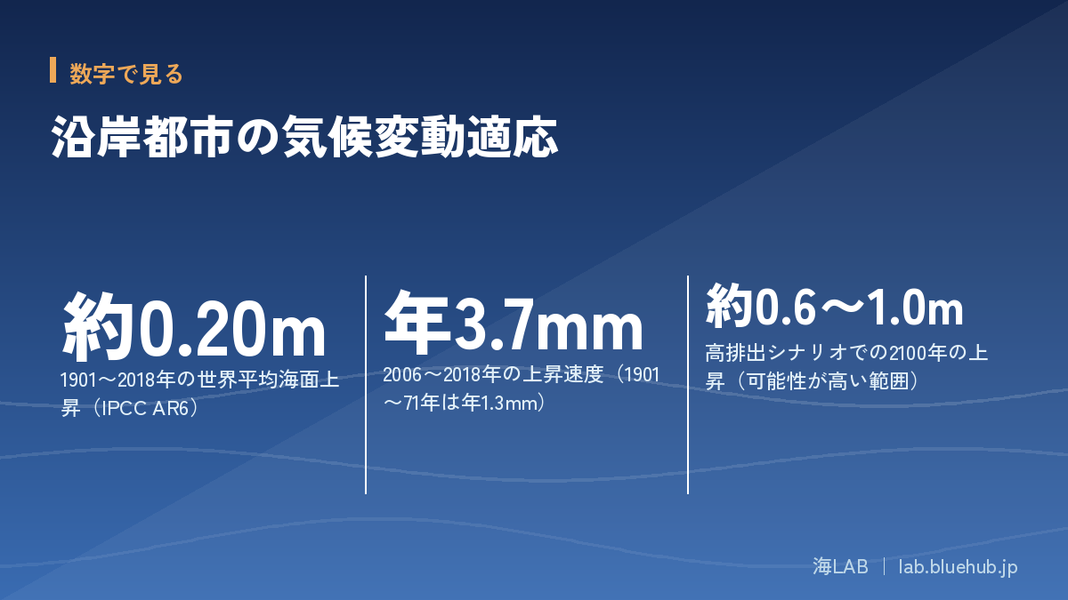
- Global sea level rose about 0.20 m from 1901 to 2018, and by 2100 it is likely to rise about 0.3-0.6 m under low emissions and about 0.6-1.0 m under high emissions.
- Layered defense, which uses protect, accommodate, retreat and avoid in the right mix and combines gray and green infrastructure, has become the global mainstream.
- Because the future is uncertain, adaptive management, which switches measures according to observed thresholds, is also considered effective in terms of cost-effectiveness.
Many of the world's coasts host large cities where population, industry and logistics are concentrated. Sea level rise slowly lifts the baseline water level, and when it coincides with storm surge and heavy rain, damage grows sharply. Climate adaptation for coastal cities is now a central issue in urban planning around the world.
This article draws on the latest IPCC assessment to outline the outlook for sea level rise, and explains gray infrastructure such as seawalls, green infrastructure that makes use of mangroves and beaches, and the four strategies of protect, accommodate, retreat and avoid.
We also introduce, based on primary sources, leading cases in Rotterdam, London, Singapore and Japan, how to think about cost-effectiveness, and what we can do ourselves to prepare.
What You'll Learn
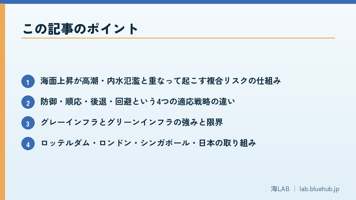
- How sea level rise combines with storm surge and pluvial flooding to create compound risk
- The differences among the four adaptation strategies: protect, accommodate, retreat and avoid
- The strengths and limits of gray and green infrastructure
- Initiatives in Rotterdam, London, Singapore and Japan
- Cost-effectiveness, and the idea of adaptive management that switches measures at thresholds
- Preparations that individuals and municipalities can start today
Why Climate Adaptation for Coastal Cities Is Urgent Now
Observed sea level rise and the fact of acceleration
Coastal cities concentrate population, industry, logistics and culture, yet they sit closest to the sea. Threats from the sea, such as sea level rise, storm surge and larger waves, directly shake the lives of these cities. The IPCC Sixth Assessment Report (AR6) Working Group I assessed that global mean sea level rose about 0.20 m (0.15-0.25 m) between 1901 and 2018. The rate is not constant, either: it accelerated from 1.3 mm per year in 1901-1971 to 1.9 mm per year in 1971-2006 and 3.7 mm per year in 2006-2018.
The figure of 3.7 mm per year may look small. What matters, however, is that this raises the foundation known as mean sea level. Storm surges from typhoons and low-pressure systems, high tides and big waves ride on top of that raised water surface. A rise of several tens of centimeters means that storm surges of a height that once occurred once in several decades will approach the crest of the seawall more often.
Point: sea level rise raises the "foundation of the water surface"
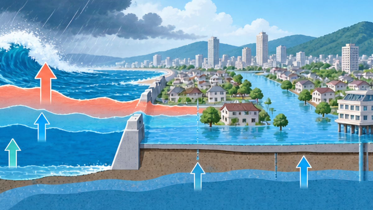
Sea level rise itself is a slow change. But when it overlaps with storm surge, waves, river flooding and land subsidence, damage increases sharply and non-linearly. Adaptation in coastal cities is the work of drawing up a blueprint for managing this overlap.
How much future sea level rise is expected?
AR6 gives the "likely range" of global mean sea level rise by 2100, relative to 1995-2014, for each emissions scenario. Even if emissions are cut, the ocean stores heat and expands, and ice sheets and glaciers melt with a delay, so the rise continues beyond 2100.
| Emissions scenario | Rise by 2100 (likely range) | Description |
|---|---|---|
| SSP1-2.6 (low emissions) | about 0.32-0.62 m | A path close to the Paris Agreement 2°C goal |
| SSP2-4.5 (intermediate) | about 0.44-0.76 m | A path close to continuing current policies |
| SSP5-8.5 (high emissions) | about 0.63-1.01 m | A worst-case path of continued fossil fuel dependence |
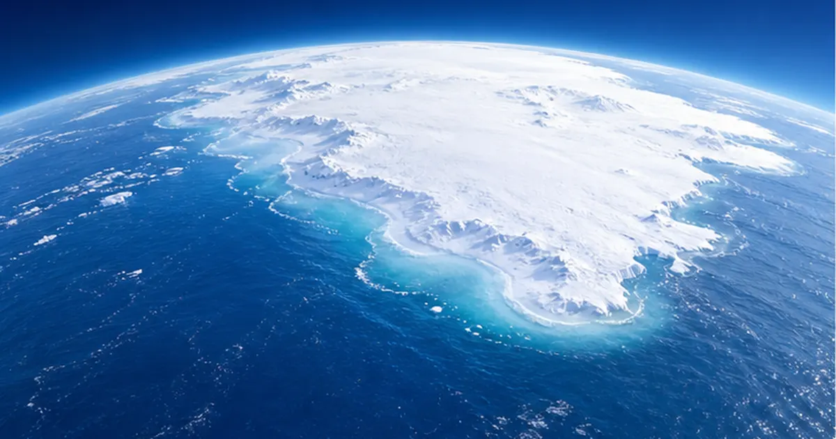
Furthermore, if low-probability, high-impact processes such as the destabilization of the Antarctic ice sheet are included, the possibility cannot be ruled out that under a high-emissions scenario the rise could approach 2 m in 2100 and reach up to about 5 m by 2150 (low confidence). Urban planning needs to take into account this "unlikely but catastrophic if it happens" tail as well.
What is "adaptation"? How it differs from mitigation
The population living in coastal areas keeps growing worldwide, and Asia's great river deltas and large cities in particular face a "double sinking" in which land subsidence and sea level rise progress at the same time. Subsidence caused by excessive groundwater pumping can, in some places, proceed much faster than sea level rise itself, sharply raising relative sea level (the height of the sea as seen from the land). Therefore, when considering adaptation, we need to look not only at global mean sea level rise but also at local land movement, tide gauge observations, and regional differences due to ocean currents and pressure patterns.
Climate action has two pillars: mitigation, which reduces greenhouse gases, and adaptation, which prepares for impacts that are already unavoidable. Sea level rise is also a delayed response to past emissions, so a certain amount of rise is unavoidable even if mitigation is pursued to the maximum. That is why it is essential to do both: limit the extent of the rise through mitigation and reduce damage through adaptation. For coastal cities, adaptation is not only about raising seawalls; it is a comprehensive endeavor that includes land use, evacuation, insurance, the use of nature and consensus building.
The Reality of Compound Risk When Sea Level Rise and Storm Surge Overlap
How a higher mean sea level pushes up storm surge damage
Coastal flood damage is determined by the sum of mean sea level, tidal variation (high tide), storm surge (the rise caused by low pressure and wind setup) and wave run-up. Of these, only mean sea level builds up steadily over the long term. In other words, even if a typhoon of the same strength takes the same path, the depth and extent of flooding will surely be greater in the future.
In addition, rising sea temperatures are thought to be able to affect typhoon intensity and the speed of development. As explained in Why Typhoons Intensify as Sea Temperatures Rise, if typhoons are more likely to approach the coast at greater strength, storm surge deviation (the sea level rise caused by low pressure and wind) also tends to become larger.
- Mean sea level rise: a long-term, certain change in the "foundation"
- Storm surge and waves: short-term sharp rises caused by typhoons and low-pressure systems (changes in intensity are still being researched)
- River flooding and pluvial flooding: when heavy rain overlaps with a high sea level, water cannot be drained
- Land subsidence: subsidence from groundwater pumping and other causes accelerates relative sea level rise
Pluvial flooding and backflow: flooding that starts inside the city
In coastal cities, the water that surges in from the sea is not the only problem. When the sea level is high, the capacity of drain pipes and pumps that discharge rainwater to the sea and rivers falls, making pluvial flooding, in which rainwater overflows inside the city, more likely. When heavy rain coincides with periods of high sea level, river mouth gates must be closed and water accumulates on the city side. This "simultaneous arrival of rain and sea" is called compound flooding and is being studied worldwide.
In cities where sewer outlets sink below sea level at high tide, "sunny day flooding" has also been reported, in which seawater flows back through pipes and spouts onto the streets. This is a typical example of sea level rise effects becoming routine even on days without storms.
Groundwater salinization and quiet impacts on ground and infrastructure
When sea level rises, the coastal water table is also pushed up, and the boundary of saltwater intruding beneath the freshwater layer moves inland. Hard-to-see impacts accumulate over the long term, such as salt damage to farmland and wells, and corrosion and changes in buoyancy of underground infrastructure (subways, underground malls, power facilities, foundation piles). The impact on Japan's sandy beaches is also covered in detail in Will 90% of Japan's Sandy Beaches Disappear with Sea Level Rise? Ports, Groundwater, Storm Surge Risk and Coastal Protection.
Another easily overlooked point is the vulnerability of logistics, energy and communications at river mouths and ports. Ports, thermal power and LNG terminals, substations, airports and landing points for submarine cables are concentrated on the coast. If these are flooded, the damage does not stay within the coastal city but spreads to wide-area economic activity and supply chains. For this reason, adaptation in coastal cities needs to be considered not only from the viewpoint of housing safety but also from that of the continuity of critical infrastructure that supports urban functions (business continuity planning: BCP).
Basic Adaptation Strategies: Four Options of Protect, Accommodate, Retreat and Avoid
Four approaches used around the world
Coastal climate adaptation can be broadly organized into four options. IPCC reports also discuss coastal responses in a framework of "Protect," "Accommodate," "Retreat" and "Advance/Avoid." There is no single right answer; the best combination changes depending on local population density, asset value, topography, the natural environment and social consensus.
| Strategy | What it means | Main methods | Suited to |
|---|---|---|---|
| Protect | Physically or naturally hold back the power of the sea | Dikes, seawalls, gates, beach nourishment, mangroves | Urban areas with concentrated population and assets |
| Accommodate | Tolerate flooding while reducing damage | Raised floors, flood barriers, evacuation buildings, improved drainage | Low-lying and built-up areas where full protection is difficult |
| Retreat | Move away from hazardous places | Relocation to higher ground, land use regulation, buyouts | Areas with heavy damage and high protection costs |
| Avoid | Do not build new in hazardous places | Zoning, siting regulations, development permits | New coastal districts yet to be developed |
The limits of relying only on protection
The idea that raising seawalls makes us safe is easy to understand and highly effective, but it has several limits. First, construction and maintenance costs are large, and as sea level keeps rising it tends to become a "never-ending race to raise heights." Second, there is "residual risk": when a seawall is overtopped, damage suddenly becomes severe, and the "safety myth," in which the sense of security from having a seawall draws land use into low-lying areas, has also been pointed out. Furthermore, building a wall between sea and land affects the landscape, ecosystems and access to the sea.
The "layered defense" approach of combining measures
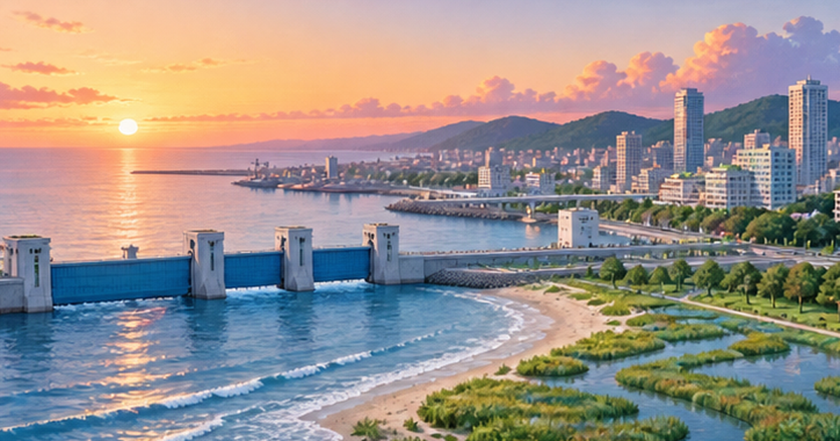
The current mainstream is layered defense, which stacks multiple measures rather than relying on a single one. For example, offshore, nature such as coral reefs, mangroves and seagrass beds weakens waves; at the shore, beaches and seawalls hold back storm surge and waves; in urban areas there are land use measures and drainage facilities; and as the last line of defense there are evacuation plans and information transmission. The three layers of protection, spatial planning and crisis management that the Netherlands promotes under the name "multi-layer safety" are a representative example.
In particular, "Retreat" is an option that meets strong emotional resistance. Leaving a familiar place involves not only economic burden but also the loss of community and culture. For this reason, actual relocation to higher ground or conversion of land use requires not only compensation and the provision of alternative land but also careful dialogue with participating residents, gradual transitions over time, and positive proposals such as turning the former site into a park or green infrastructure. Japan's experience after the Great East Japan Earthquake left important lessons on this point. For more, see also What Is Coastal Community Recovery?.
Term to know: residual risk
No matter how well seawalls are built, the possibility of forces exceeding the design can never be zero. This "risk that cannot be fully prevented" is called residual risk, and the basic stance of adaptation is to supplement it with soft measures such as evacuation, insurance and land use.
The Evolution of Gray Infrastructure: What Do Dikes, Gates and Seawalls Do?
Pioneering large storm surge defenses: the Netherlands and London
Dikes, gates and movable storm surge barriers built of concrete and steel are called "gray infrastructure." The Netherlands is the world's leading example. After the 1953 North Sea flood killed more than 1,800 people, the Netherlands carried out the "Delta Works" in the southwest, preparing against the intrusion of seawater with dams closing river mouths and storm surge barriers. The Maeslantkering, a movable storm surge barrier near Rotterdam, was completed in 1997, and its giant gates, weighing about 6,800 tons each, close automatically on a computer's decision to protect the city and port from storm surge.
London's Thames Barrier, in operation since 1982, is a movable flood barrier on the River Thames that closes its gates at times of storm surge to protect central London. What deserves attention here is that the barrier's design is not "finished once built." The UK Environment Agency's Thames Estuary 2100 plan (TE2100) has a mechanism for revising the timing and content of measures in line with measured sea level rise, and its 10-year review in 2021 concluded that raising the upstream embankments needs to be done by 2050, 15 years earlier than originally planned.
What the Netherlands and London have in common
- Drawing on the lessons of major disasters, they put in place legal systems and permanent budget frameworks
- They assume regular review and renewal rather than the "completion" of facilities
- They combine not only high dikes but also spatial planning, evacuation and crisis management
Japan's coastal protection facilities: dikes, revetments, detached breakwaters and gates
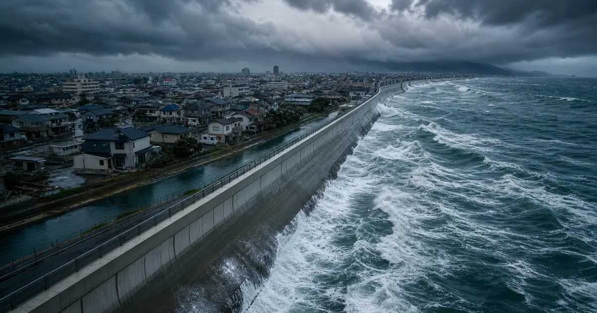
Japan's coasts have a wide variety of coastal protection facilities, including dikes, revetments, wave-dissipating blocks, detached breakwaters, groins, floodgates and land gates (rikko). Facilities built since the period of rapid economic growth are aging, and renewal and improvement that anticipate future sea level rise and increasing external forces are a challenge. The debate over giant seawalls after the Great East Japan Earthquake confronted Japanese society with the importance not only of the height of protection but also of landscape, livelihoods and consensus building. For details, see What Did the Giant Seawalls Protect and What Did They Change?.
Strengths and weaknesses of gray infrastructure
- Strengths: reliably effective against waves and storm surge below the design external force / effects are easy to calculate / works even in narrow places such as urban areas
- Weaknesses: large construction and maintenance costs / impacts on ecosystems, landscape and access to the water / damage becomes suddenly large when the design is exceeded / there is a limit to raising heights as sea level rises
In recent years, efforts to increase the "resilience" of dikes have also advanced. This is a method of reinforcing the back slope and toe of a dike so that it does not collapse immediately even when overtopping or overflow occurs. Even against external forces exceeding the design, it buys time until failure and secures a grace period for evacuation, so it is positioned as a realistic preparation for residual risk. However, we must not forget that these measures also work only when accompanied by a maintenance system that inspects facilities and renews them as they deteriorate.
In short, gray infrastructure is "necessary but not all-powerful." It is an essential core defense where population and assets are concentrated, but not relying on it alone and combining it with the green infrastructure and soft measures described below is important for both cost-effectiveness and sustainability.
Green Infrastructure: Coastal Protection That Uses Nature as an Ally
The roles of coral reefs, mangroves, beaches and seagrass beds
Coastal ecosystems are a "living line of defense" that weakens wave energy, retains sediment and, in some cases, grows on its own in step with sea level rise. Coral reefs break waves offshore, mangroves and salt marshes trap mud while weakening waves and currents, and beaches and dunes act as natural buffer zones that absorb wave energy. The disaster-protection function of coral reefs is covered in Coral Reefs as Natural Breakwaters, and the role of mangroves in The Role of Mangrove Forests in Carbon Storage and Disaster Protection.
A major advantage of green infrastructure is its "multifunctionality," which goes beyond disaster protection. Seagrass beds and wetlands serve as spawning and nursery grounds for fish, store carbon dioxide as blue carbon, and contribute to tourism, recreation and local pride. The ability to improve disaster protection, ecosystems, decarbonization and the local economy at the same time is also attractive from the viewpoint of cost-effectiveness.
Dealing with coastal erosion: beach nourishment and sediment management
In Japan, many beaches are shrinking because dams trap sediment, river gravel is extracted, and port structures block littoral drift. Sea level rise accelerates this erosion further. When a beach erodes, the water in front of a dike becomes deeper, wave force increases, and the risk of damage to the dike also rises. Beach nourishment, which supplies sand artificially, and comprehensive sediment management, which reviews the flow of sediment from the mountains to the sea, therefore become important. The background is also summarized in Why Does Coastal Erosion Progress?.
Understanding the limits of green infrastructure correctly
Nature-based solutions are not all-powerful. Against large typhoons and tsunamis, protection as reliable as that of a dike is hard to expect, and effectiveness depends on topography, species, growth stage and water quality. They also take time to grow and may not keep up if sea level rises too fast. Moreover, mangroves and corals themselves are affected by climate change, such as rising sea temperatures and acidification. What matters is to think of gray and green not as an "either-or" but as a "hybrid."
In practice, cases combining green and gray in the same place are increasing. Examples include "hybrid" designs that leave a beach or salt marsh in front of a dike to weaken wave energy and keep the dike's height and cross-section smaller, and eco-friendly structures that deliberately give revetments an uneven surface to encourage the attachment of organisms. Such efforts contribute not only to disaster protection but also to improving the seaside landscape, access to the water and biodiversity. Success depends on ecologists, civil engineers and local residents discussing together from the earliest stage of design.
| Comparison point | Gray infrastructure | Green infrastructure |
|---|---|---|
| Reliability of protection | High if below the design external force | Depends on conditions, with large variability |
| Initial cost | High | Relatively low but depends on the site |
| Maintenance | Needs response to aging | Needs monitoring and conservation |
| Keeping pace with sea level rise | Raising works are required | Can grow on its own if conditions are right |
| Co-benefits | Limited | Ecosystems, carbon storage, tourism, landscape |
Learning from Leading Cases at Home and Abroad: Rotterdam, London, Singapore and Japan
Rotterdam: the "sponge city" that coexists with water
Rotterdam, the second-largest city in the Netherlands, is a port city spread over land lower than the sea. Through the 2008 "Rotterdam Climate Proof" and the 2013 "Climate Change Adaptation Strategy," it has worked to turn the urban space itself into a vessel that receives water, in addition to dikes and storm surge defenses. In the city it combines underground storage facilities that temporarily hold rainwater (for example, a water storage space of about 10,000 cubic meters under a parking garage in Museumpark), "water squares" that hold water, green roofs, and blue-green corridors.
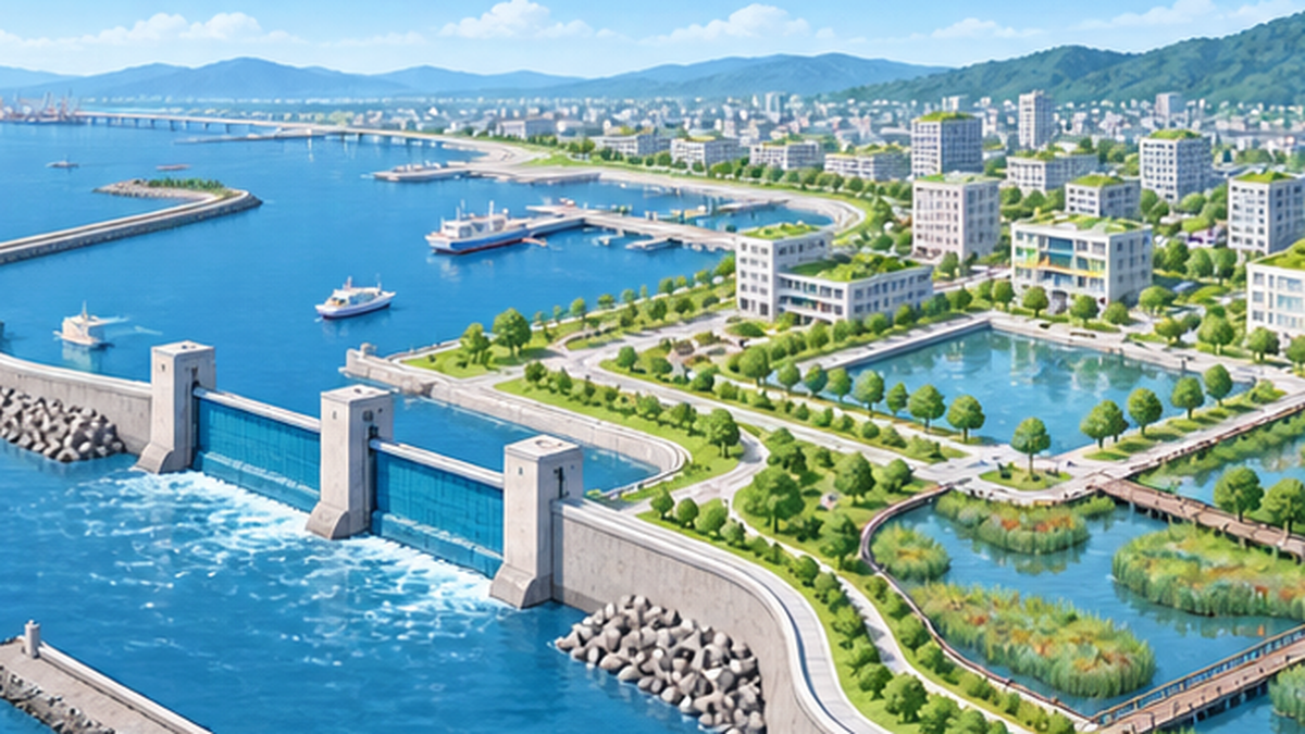
Lessons from Rotterdam
- Treat water not as an "enemy" but as an urban resource
- Multipurpose design: used as squares and parks in daily life and holding water only during heavy rain
- Design dikes, spatial planning and residents' actions as one
London: adaptive management that does not postpone decisions
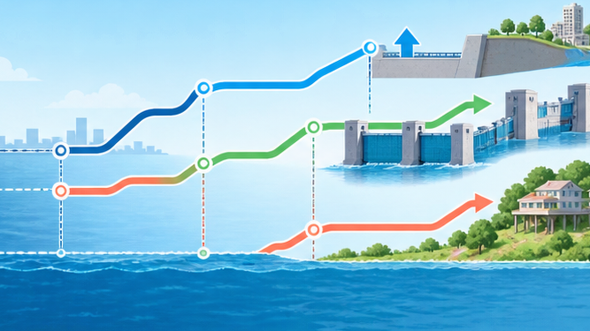
London's Thames Estuary 2100 plan is a representative framework for "not committing the full amount now to an uncertain future." Because the speed of sea level rise depends on emissions scenarios and ice sheet behavior, the plan prepares options for multiple future scenarios (raising, improving the barrier, building a new barrier and so on) and adopts staged decisions in which the next step is taken when the observed sea level rise reaches a certain "threshold." This is called the "adaptation pathways" approach.
Singapore: nationwide coastal and flood defense
Singapore, where about 30% of the land is less than 5 m above sea level, is preparing for sea level rise as a national, all-out effort. The Third National Climate Change Study, released in January 2024, showed that the mean sea level around it could rise by up to 1.15 m by 2100 and up to about 2 m by 2150. In response, the government added 5 billion Singapore dollars in the FY2025 budget to the "Coastal and Flood Protection Fund" it established in 2020, and plans to proceed by combining seawalls, gates and land reclamation (the Long Island concept).
Japan: the 2020 recommendation and a two-tier approach of "2°C and 4°C"
In Japan too, a study committee jointly set up by the Ministry of Land, Infrastructure, Transport and Tourism and the Ministry of Agriculture, Forestry and Fisheries compiled the recommendation "Coastal Protection in Light of Climate Change" in July 2020. The recommendation set out a shift from development centered on past data to measures that explicitly consider climate change impacts, and takes a two-tier approach: proceeding with development on the premise of a 2°C rise consistent with the Paris Agreement goal (RCP2.6) while promoting technology development that can also adapt to a 4°C rise (RCP8.5, assuming about 1 m of rise by 2100).
This recommendation was a turning point toward thinking about coastal planning "by factoring in the future rise in external forces." However, actual development takes a long time and money, so the national government, local governments, residents and businesses need to share roles and proceed while setting priorities.
What these cases have in common is that the country or city has a "long-term outlook" and has prepared planning over decades and a financing mechanism. The Netherlands secures long-term budgets through the "Delta Fund" under the Delta Act, the UK has institutionalized reviews every 10 years, and Singapore has established a dedicated fund. In Japan too, strengthening a framework that advances long-term coastal protection plans, funding and local consensus building together remains a challenge.
| City / country | Representative initiatives | Features |
|---|---|---|
| Rotterdam (Netherlands) | Delta Works, Maeslantkering, water squares | Integrated design of protection and urban space |
| London (UK) | Thames Barrier, TE2100 plan | Adaptive management based on thresholds |
| Singapore | Coastal and Flood Protection Fund, Long Island concept | National-scale long-term funding and land reclamation |
| Japan | 2020 coastal protection recommendation (2°C premise, 4°C response) | A shift to development that factors in climate change |
Cost-Effectiveness and "Adaptive Management": How to Prepare for an Uncertain Future
The cost of doing nothing, and the cost of adaptation
Coastal adaptation costs money. However, many studies show that, compared with the damage if nothing is done, the benefits of protection exceed the costs in many cases in areas where population and assets are concentrated. Past IPCC assessments have also said that in densely populated coastal areas the cost of protection is often smaller than the cost of damage.
A study by the University of East Anglia and others, based on the AR6 sea level rise scenarios, estimates that in the 21st century 4 million to 72 million people worldwide could be forced to migrate by coastal flooding, with net land loss of 2,800 to 490,000 km². It also reports that these impacts can be greatly reduced if standard protection such as dike construction and beach nourishment is introduced where it is cost-effective.
Avoiding "no-regret measures" pitfalls and "lock-in"
In fields with large uncertainty, it is wise to prioritize "no-regret" measures that will not be wasted whichever future scenario unfolds. For example, conserving wetlands and beaches, publicizing hazard maps, evacuation drills and restraining new development in low-lying areas retain value in disaster protection, the environment and the economy even if sea level rise is smaller than expected. Conversely, making large investments in rigid structures that cannot keep up with sea level rise can cause "lock-in," which narrows future options.
The four steps of adaptive management
- Set multiple future scenarios (low, medium and high)
- Decide the options for each scenario and the "thresholds" for switching
- Continuously observe and monitor sea level and damage
- When a threshold is approaching, move to the next measure agreed in advance
The advantages of this method are that decisions can be adjusted to future change and that social consensus building can proceed "in advance." Rather than scrambling to debate after a disaster, sharing with citizens in normal times "what we will do when which line is crossed" leads to adaptation that can actually be carried out.
When evaluating cost-effectiveness, it is desirable to include in the discussion not only a comparison of dike construction costs and damage but also "values that are hard to convert into money," such as ecosystem services, landscape, tourism, residents' sense of security and the community's future options. Economic evaluation is a useful tool, but conclusions change depending on assumptions such as the discount rate, future scenarios and the scope of evaluation, so it is important not to accept results uncritically and to disclose assumptions and share them with citizens.
Caution: cost-effectiveness figures vary greatly by region
Whether benefits exceed costs changes greatly with population density, asset value, topography and the discount rate setting. In sparsely populated areas, retreat or accommodation may be more rational than protection. It is important not to apply figures from other regions as they are.
Adaptation in Japan's Coastal Cities, and What We Can Do
A Japanese-style adaptation that layers hard measures, soft measures and land use
Japan's coastal cities are in one of the harshest environments in the world, where typhoons, storm surge, tsunami and earthquakes overlap. For that reason, the basic approach is "comprehensive disaster prevention and mitigation" that layers the construction of dikes and gates (hard measures), hazard maps, evacuation plans, information transmission and drills (soft measures), and land use regulation and siting guidance (urban planning). In recent years the idea of "watershed flood control," which prepares for floods across an entire river basin, has also spread, and measures that treat sea, rivers and city as one are emphasized. For basic preparation against storm surge and coastal flooding, An Introduction to Adaptation Measures for Storm Surge and Coastal Flooding is a helpful reference.
Three pillars for municipalities
- Making risk visible: updating inundation assumptions and hazard maps that factor in future sea level rise
- Building into plans: bringing an adaptation perspective into comprehensive plans, urban plans, disaster prevention plans and local climate change adaptation plans
- Prioritizing measures: ranking by size of damage, population, critical facilities, cost and urgency, and implementing in stages
In Japan, under the Climate Change Adaptation Act, the national government is required to formulate an adaptation plan, and prefectures and municipalities are required to formulate local climate change adaptation plans. The Climate Change Adaptation Information Platform (A-PLAT) of the National Institute for Environmental Studies compiles regional impact projections and cases for municipalities and businesses.
What each of us can do
Adaptation is not only the job of government. Residents, companies and schools can also act. First, check on the hazard map whether your home or workplace is in an expected inundation area, and talk with your family about evacuation sites, routes and timing. Next, check the coverage of flood insurance, review valuables and electrical equipment kept on the ground floor, and stock disaster supplies. In addition, taking part in local beach cleanups and in conservation of seagrass beds and beaches is a steady step toward strengthening nature-based protection.
Actions you can take starting today
- Check the expected inundation of your home and workplace on the hazard map
- Decide evacuation sites, routes and timing with your family
- Take part in local coastal conservation and cleanup activities
- Take an interest in local adaptation plans and coastal protection briefings
- Keep reducing emissions (mitigation) as well, to shrink the extent of the rise itself
Summary: leaving "options" for the future
Sea level rise is a slow change, but the dikes and townscapes that cities build last from several decades to a hundred years. That is why the decisions we make now should widen the options of future generations. Use protect, accommodate, retreat and avoid in the right mix, combine gray and green, and update flexibly while watching observations. That is a realistic path for coastal cities to keep living with the sea.
Summary of this article
- Global sea level rose about 0.20 m from 1901 to 2018, and the rate of rise is accelerating
- By 2100 it is likely to rise about 0.3-0.6 m under low emissions and about 0.6-1.0 m under high emissions
- Think of adaptation as a combination of "protect, accommodate, retreat and avoid" and as layered defense
- The keys are a hybrid of gray and green and adaptive management based on thresholds
- In its 2020 recommendation, Japan shifted to coastal development that factors in climate change
References & Sources
- IPCC Sixth Assessment Report, Working Group I (The Physical Science Basis) – Observations and projections of global mean sea level
- IPCC Special Report on the Ocean and Cryosphere in a Changing Climate (SROCC) – Sea level rise and its impacts on and adaptation in coastal areas
- Ministry of Land, Infrastructure, Transport and Tourism, Japan: Recommendation "Coastal Protection in Light of Climate Change" – July 2020: a shift in coastal protection policy
- UK Environment Agency: Thames Estuary 2100 (10-year Monitoring Review 2021) – The Thames Barrier and adaptation pathways
- UK Government: Thames Estuary 2100: taking an adaptive approach – The idea of adaptive management
- Public Utilities Board (PUB), Singapore: Strengthening Coastal Defences – The Coastal and Flood Protection Fund and sea level rise
- UNFCCC: Materials on the Dutch Delta Programme – The Delta Works and the adaptation framework
- University of East Anglia: Study on migration, land loss and costs due to coastal flooding – Estimates to 2100
- Climate Change Adaptation Information Platform (A-PLAT) – National Institute for Environmental Studies: adaptation information for municipalities
- Japan Meteorological Agency: Information on Climate Change – Changes in sea level along Japan's coasts
* Ordered by reliability: government and academic institutions > peer-reviewed papers > specialist organizations > reputable media