⚡ In short
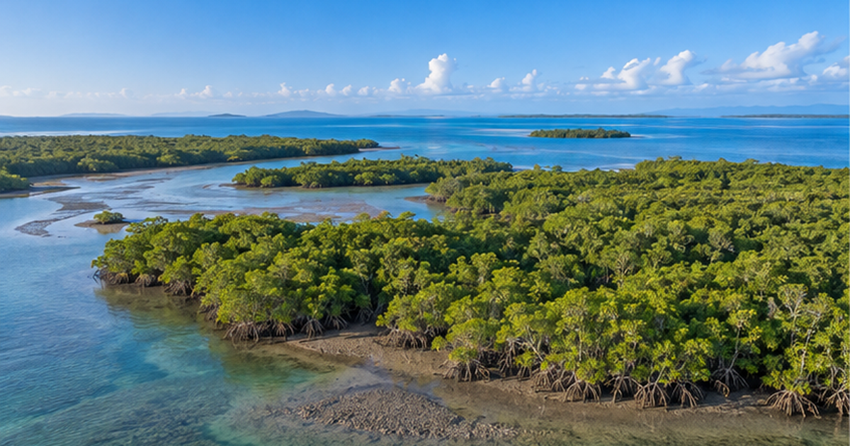
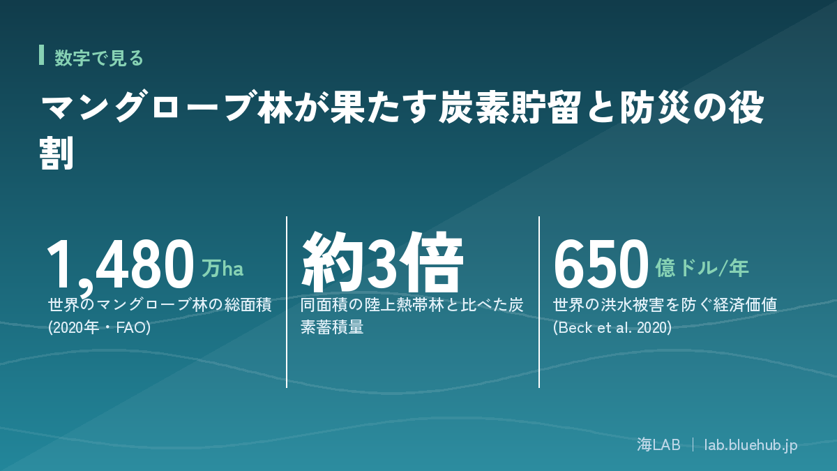
Mangrove forests span about 14.8 million hectares of tropical and subtropical coastline worldwide, storing up to three times the carbon of the same area of tropical rainforest as a blue carbon ecosystem. Their roots blunt storm surges and raise juvenile fish, delivering benefits worth $65 billion a year, yet 284,000 hectares have been lost since 2000, and the IUCN warns that more than half could collapse by 2050.
Mangrove forests are unique communities of trees that grow only in brackish tidal zones where seawater and freshwater mix.Their tangled roots hold the soil against the tides, store carbon, raise juvenile fish, and blunt the force of storm surges. Standing on the "border between sea and land," this ecosystem performs some of the most multifaceted work of any on Earth.
According to the UN Food and Agriculture Organization (FAO), the world's mangrove forests covered about 14.8 million hectares as of 2020. But conversion to aquaculture ponds and infrastructure caused 677,000 hectares to be lost over the two decades from 2000, and even after subtracting 393,000 hectares of new growth, the net loss was 284,000 hectares. The International Union for Conservation of Nature (IUCN) has assessed that more than half of the world's mangrove ecosystems are at risk of collapse by 2050.
This article organizes the three roles mangrove forests play — carbon storage, disaster prevention, and biodiversity — based on primary sources including FAO, IUCN, and peer-reviewed papers. It also covers the distribution of mangroves within Japan and the latest corporate blue carbon initiatives.
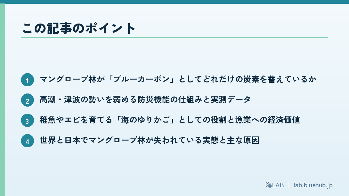
What you'll learn in this article
- How much carbon mangrove forests store as "blue carbon"
- How mangroves blunt storm surges and tsunamis, and what the measured data show
- Their role as a "nursery of the sea" raising juvenile fish and shrimp, and the economic value to fisheries
- The reality and main causes of mangrove loss worldwide and in Japan
- Concrete examples of companies and communities working on mangrove restoration and blue carbon projects
What Is a Mangrove Forest?
A mangrove forest is a general term for the forests that grow in the intertidal zones of brackish estuaries and inlets in the tropics and subtropics, where seawater and freshwater mix. It is not the name of a single species; rather, it refers to a community of multiple tree species that have evolved to survive in salty mud. Worldwide, species spanning several families, including the Rhizophoraceae and Verbenaceae, are distributed, and the mix of species differs by region.
Global distribution: concentrated on tropical and subtropical coasts
According to FAO's 2023 report, the world's total mangrove area was estimated at about 14.8 million hectares as of 2020. The largest distribution is in Southeast and South Asia, with Indonesia alone said to account for roughly a fifth of the global total. Mangroves also spread along the west coast of Africa, the Caribbean coast of Latin America, and northern Australia, with the tropics on either side of the equator roughly marking their northern and southern limits.
Around 70 true mangrove species are known worldwide, but their distribution is heavily skewed. The "Indo-West Pacific" region, including Indonesia and Malaysia, is home to more than 50 concentrated species — Indonesia alone records over 40 — making it the center of species diversity. In contrast, the "Atlantic-East Pacific" region, stretching from West Africa to Latin America and the Caribbean, has only around a dozen species, highlighting a stark regional gap in diversity. East Asia, including Japan, lies at the "edge of the range," outside this center of diversity.
Mangroves in Japan: found only in Kagoshima and Okinawa
In Japan, mangrove forests occur naturally only in Kagoshima and Okinawa prefectures, with recorded native sites spanning 214 locations across 20 islands in the two prefectures combined (39 locations on 6 islands in Kagoshima, 175 locations on 14 islands in Okinawa). The largest is on Iriomote Island in Okinawa Prefecture, covering 602.099 hectares — 68.3% of the national total. Next come Ishigaki Island at 101.824 hectares and the main island of Okinawa at 59.439 hectares, with these top three islands accounting for the great majority of Japan's mangrove forests. The northern limit is the mouth of the Kaminogawa River in Hioki City, Kagoshima Prefecture (around 31°37' north latitude), while the northernmost point of natural distribution is said to be the Minato River in Nishinoomote City on Tanegashima Island. Globally, this latitude band is counted among the northernmost points where mangroves grow naturally.
| Family | Species (common names) | Main distribution |
|---|---|---|
| Rhizophoraceae | Kandelia obovata, Bruguiera gymnorrhiza, Rhizophora stylosa | Kagoshima Prefecture to mainland Okinawa |
| Acanthaceae | Avicennia marina | Mainland Okinawa and south |
| Combretaceae | Lumnitzera racemosa | Mainland Okinawa and south |
| Lythraceae | Sonneratia alba | Ishigaki Island and south |
| Arecaceae | Nypa fruticans | Iriomote Island |
"Mangrove" is not the name of a single species
- Japan is home to mainly 5 families and 7 mangrove species
- The Rhizophoraceae family (Kandelia obovata, Bruguiera gymnorrhiza, Rhizophora stylosa) is the core group present at every native site
- Root shapes vary by species, including stilt roots, knee roots, and pneumatophores (breathing roots)
- Many species have mechanisms to excrete or accumulate salt in their leaves and roots, adapting to highly saline mud
The name "mangrove" and its relationship with people
The word "mangrove" itself is not an academic term for a specific taxonomic group; it is a common name that has become established worldwide for the tree communities that grow in brackish zones. Coastal communities in Southeast Asia and South America have long used mangroves as firewood and charcoal, as a source of tannin for dye and leather tanning, and their roots and trunks as building materials. In recent years, understanding has grown that the value of ecosystem services — carbon storage, disaster prevention, and fisheries resources — outweighs direct use as timber or fuel, and policy priorities are shifting from logging toward conservation and restoration.
The Ecological Mechanisms Behind Life at the Border of Sea and Land
The intertidal zone where mangrove forests grow is a harsh environment where water levels fluctuate by tens of centimeters to several meters twice a day with the tides. At high tide, the roots are submerged in seawater; at low tide, only exposed mud remains. Seawater also has a higher salt concentration than freshwater, making it difficult for most plants to draw water up through their roots. The tree species that make up mangrove forests have evolved unique forms to cope with this dual challenge.
Aerial roots: balancing respiration and anchorage
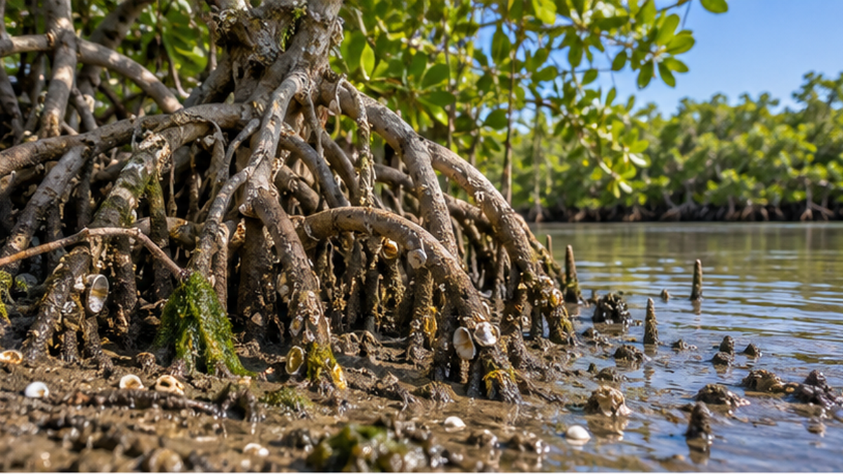
Because oxygen is scarce in the mud, many mangrove species develop "aerial roots" exposed above the ground or water surface. The arching stilt roots of species such as Rhizophora stylosa stabilize the trunk while taking in oxygen through the root surface. The knee roots found in Bruguiera species and the pneumatophores seen in Kandelia obovata are also known structures that protrude from the mud for respiration.
Zonation: species sorted by tidal height
Viewed from the side, mangrove forests often show "zonation," in which the mix of species gradually changes from the seaward edge toward the land. Species with the highest salt tolerance line the seaward fringe, most exposed to seawater, while species more influenced by freshwater take over further inland. This sorting occurs because each species tolerates different levels of salinity, submersion time, and soil hardness, showing that even within a single mangrove forest, a series of subtly different micro-environments exists from place to place.
Mechanisms for excreting and concentrating salt
Responses to salinity also differ by species. Species in the Avicennia group excrete excess salt through salt glands on the underside of their leaves, sometimes leaving white salt crystals on the leaf surface as it dries. Species such as Rhizophora stylosa filter salt at the root cell membranes, absorbing only water close to fresh. It is precisely because of these adaptations that mangrove forests can build a major ecosystem in brackish zones where other land plants cannot survive.
Vivipary: a reproductive strategy that germinates on the parent tree before falling into the sea
Many mangrove species have a distinctive reproductive method called "vivipary." Rather than germinating after falling to the ground, the seed germinates while still attached to the parent tree's branch, growing into a long, rod-shaped propagule that falls into the water only once fully developed. The fallen propagule floats on seawater, carried by the currents, and once it reaches a suitable tidal flat, it takes root and becomes established. In a brackish environment where seeds cannot sprout immediately after falling, this mechanism is thought to be an adaptation that stores up the nutrients needed for germination in advance.
The size and shape of propagules vary by species: Rhizophora species have rod-shaped propagules reaching several tens of centimeters, while species from other families, such as Avicennia, have small, cocoon-like propagules only a few centimeters long. Rod-shaped propagules are thought to float vertically in the water because their tip is heavier, allowing them to stick straight into the mud and take root easily wherever they drift ashore. It is this mechanism of drifting and establishment that is believed to have allowed mangroves to spread their range to new tidal flats and estuaries by riding ocean currents.
Carbon Storage: The Power of Blue Carbon
Mangrove forests, along with seagrass beds and tidal flats, are called "blue carbon ecosystems" — a term for the way marine and coastal ecosystems absorb atmospheric CO2 and lock it away in soil and plant tissue for long periods. Since the concept was proposed in a 2009 United Nations Environment Programme (UNEP) report, it has drawn attention in the context of climate change countermeasures.
Up to three times the carbon stock of tropical rainforest
According to research reviews, the average organic carbon stock of mangrove ecosystems is 711 to 766.8 tons of carbon per hectare, with an average carbon sequestration rate of 179.6 grams of carbon per square meter per year. This stock is said to be up to about three times the carbon held by the same area of tropical rainforest on land. The reason is that, beyond the trunks and leaves above ground, organic matter that accumulates undecomposed in the oxygen-poor mud continues to lock away carbon for hundreds to thousands of years.
Clearing and conversion mean "releasing stored carbon"
This characteristic also means the reverse: when mangrove forests are cleared and converted into aquaculture ponds or farmland, the carbon accumulated in the mud over hundreds of years rapidly decomposes and returns to the atmosphere as CO2. This is why the loss of mangroves is described as "breaking open a carbon piggy bank," and why conservation and restoration are also emphasized as climate change countermeasures. For more on the role the ocean as a whole plays in absorbing CO2, see the related article "What Percentage of Humanity's CO2 Does the Ocean Absorb?".
Three blue carbon ecosystems
- Mangrove forests: intertidal forests with especially high carbon stocks
- Seagrass beds (such as eelgrass meadows): communities of seagrass spreading across shallow seas
- Tidal flats and salt marshes: intertidal mudflats and wetlands
Integration into international carbon credit systems
In a 2013 supplement to its wetlands guidelines, the Intergovernmental Panel on Climate Change (IPCC) presented, for the first time, a method for including the carbon stocks of coastal wetlands such as mangrove forests in national greenhouse gas emission inventories. This spurred a worldwide expansion of schemes in which CO2 absorption generated by mangrove conservation and restoration is certified as carbon credits under international verification standards (such as the Verified Carbon Standard, VCS) and purchased by companies to offset their own emissions. In countries with extensive mangrove distribution, such as Indonesia, Kenya, and Madagascar, momentum is accelerating to use this mechanism to secure conservation funding.
Disaster Prevention: Blunting Storm Surges and Tsunamis
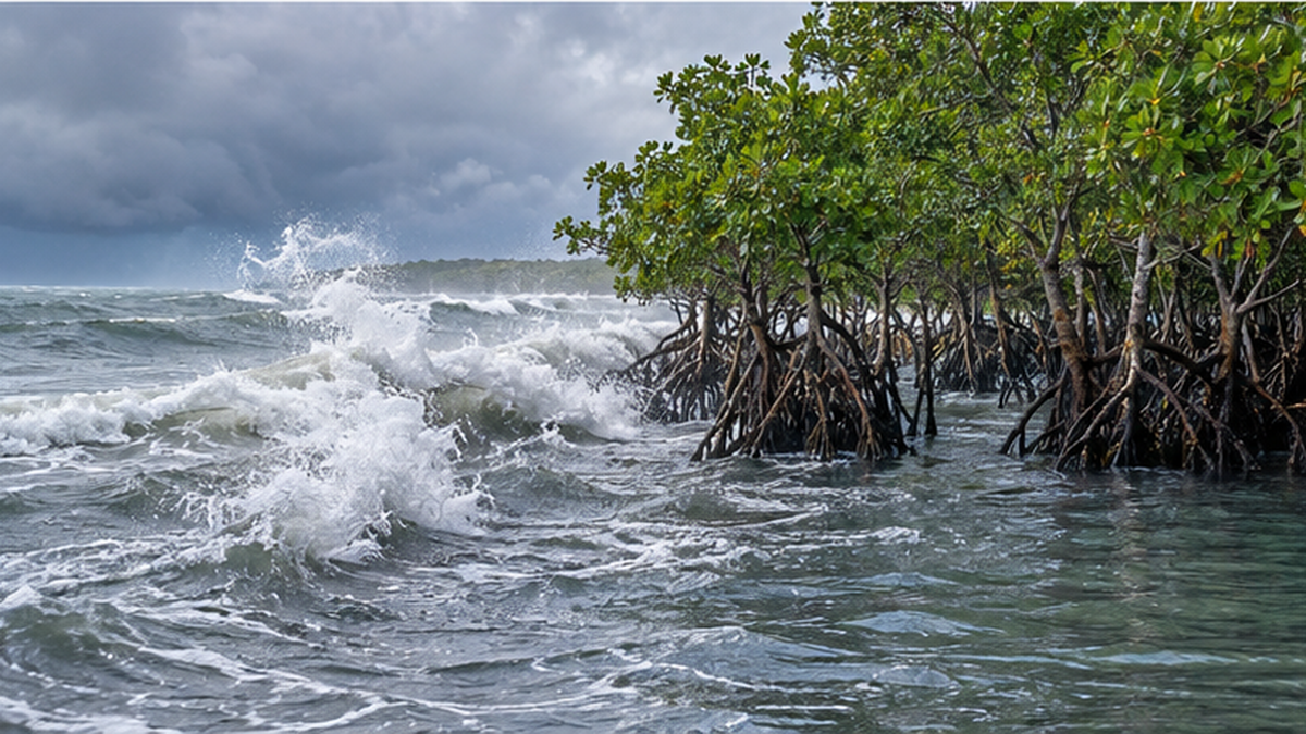
Dense mangrove forests function as "green infrastructure," with trunks, aerial roots, and leaves resisting the flow of water and progressively dissipating the energy of storm surges and tsunamis. In recent years, research has advanced in various countries into "hybrid" disaster-prevention approaches that combine mangroves with artificial structures such as breakwaters and seawalls.
What measured data show about attenuation effects
A study on Hatia Island in Bangladesh reported that a 600-meter-wide mangrove belt reduced storm surge water levels by about 0.45 meters. At a study site in New Zealand, observations found that waves passing through the forest were attenuated at an average rate of 0.24 meters per kilometer. Because the degree of attenuation depends on tree density, trunk thickness, and forest width, maintaining a certain size and healthy density is considered essential to maximizing the disaster-prevention effect.
The 2004 Indian Ocean tsunami and the "bioshield" theory
Immediately after the 2004 Indian Ocean tsunami, a series of observational reports from Indonesia, Sri Lanka, India, and elsewhere noted that villages behind coastal mangrove forests or coastal woodlands suffered relatively less damage, sparking international interest in using mangrove forests as a "bioshield." Among researchers, however, there is also the view that the effect varies greatly depending on conditions such as topography and the height and angle of incidence of the tsunami, and that mangrove forests alone cannot fully protect human life against tsunamis exceeding a certain height. The current consensus is that the disaster-mitigation effect of mangrove forests is maximized only when combined with secured evacuation routes and early warning systems.
Preventing $65 billion in damage and protecting 15 million people worldwide
A 2020 study by Beck and colleagues, published in the journal Scientific Reports, calculated the flood-prevention effect of the world's mangrove forests in monetary terms, estimating that they prevent more than $65 billion in damage every year. The same study also noted that if mangrove forests were lost, more than 15 million additional people worldwide would be newly exposed to flooding each year. Countries that benefit most include the United States, China, India, and Mexico, while on a per-capita basis Vietnam, India, and Bangladesh are said to benefit especially greatly.
Evidence from the 1999 Indian super cyclone
A study by Das and Vincent, published in the Proceedings of the National Academy of Sciences (PNAS), analyzed damage data from the super cyclone that struck Orissa (now Odisha) State, India, in 1999, and reported that villages with a wide mangrove belt between them and the coast had significantly fewer deaths even after controlling for socioeconomic conditions. Cases were also recorded in which villages directly exposed to the coastline were catastrophically damaged, while villages at a similar distance but shielded by mangroves suffered far less damage — evidence that, while not as effective as early warning systems, mangrove forests themselves have a life-saving effect.
Villages on the coast were destroyed, while those behind the mangroves escaped damage even though they were at a similar distance from the coast.
— From the analysis in Das & Vincent (2009), published in PNAS
A cost advantage over concrete seawalls
One point often raised when evaluating mangrove forests as disaster-prevention infrastructure is their cost advantage over concrete seawalls and revetments. Seawalls require ongoing maintenance costs on top of construction costs, whereas a healthy mangrove forest maintains its function naturally across generations while also providing secondary benefits such as carbon storage and fisheries resources. Not everything can be replaced by mangrove forests in place of artificial structures, but research has reported that adopting a "hybrid" design that preserves or restores a mangrove belt on the seaward side of a seawall can potentially reduce the required height and thickness of the wall.
A "Nursery of the Sea" Raising Juvenile Fish and Shrimp
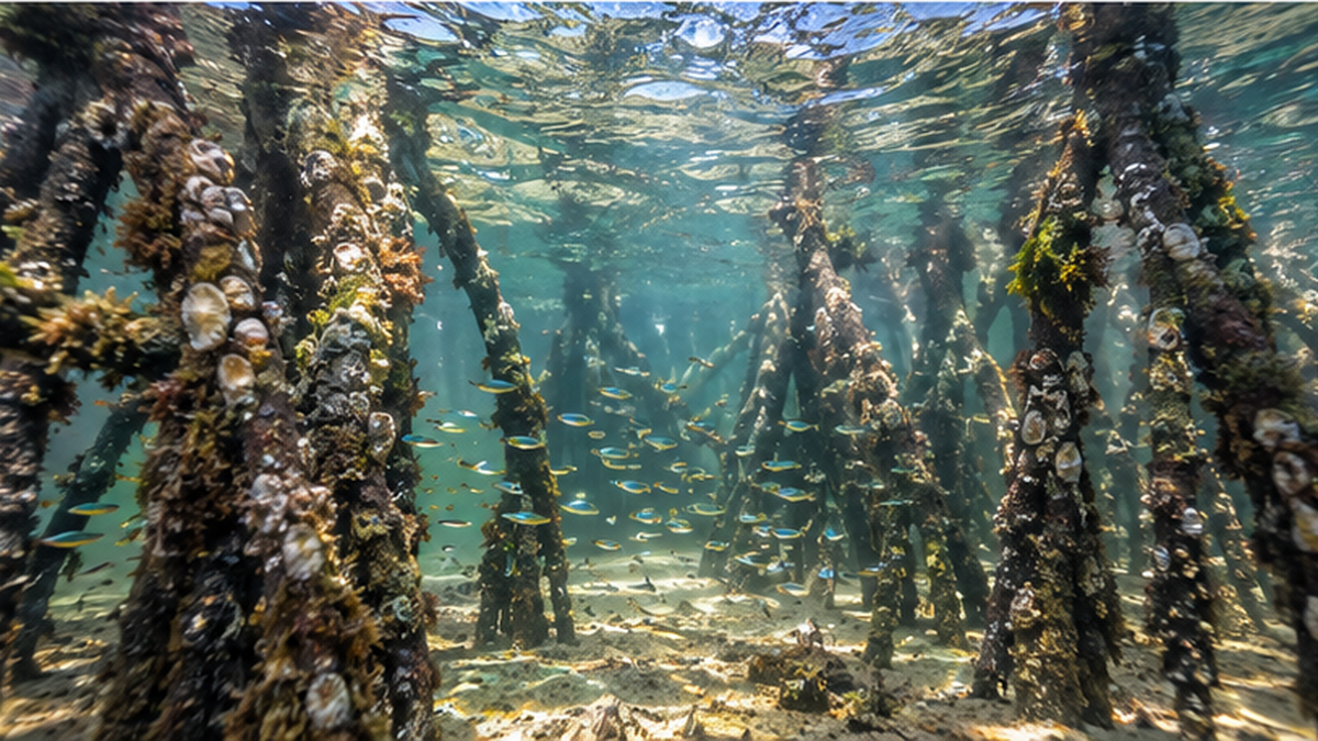
The gaps between roots extending into the water provide an ideal environment for hiding from predators while feeding. Combined with an abundance of plankton carried in by the tides and organic matter derived from fallen leaves, mangrove forests function as a "nursery" where many fish, shrimp, and crabs spend their early life stages. The detailed mechanism is covered in the related article "Mangroves Are the Sea's Nursery", so here we focus mainly on the connection to fisheries.
An analysis published by FAO in 2004 estimated that about 30% of the world's commercially caught fish species are mangrove-dependent, with the catch reaching roughly 30 million tons per year as of 2002. Furthermore, a 2025 study published in the journal Communications Earth & Environment estimated that mangrove forests worldwide support the growth of more than 700 billion juvenile fish and shrimp annually. Although the figures vary depending on the calculation method, multiple independent studies confirm a strong link between mangrove forests and the world's fisheries resources.
The economic value supporting coastal fisheries
Studies evaluating the economic value of the ecosystem services generated by mangrove forests estimate a global average of about $9,900 per hectare per year, of which fisheries-related value alone is estimated at $750 to $11,280. The figures vary widely by region: a study of the Gulf of California coast in Mexico found that mangrove fringe supports about $37,500 per hectare per year in fish and crab catches, with mangrove-related fish and crab species accounting for 32% of the region's small-scale fisheries landings.
A network connected to coral reefs and seagrass beds
Many juvenile fish raised in mangrove forests move on to seagrass beds and, eventually, offshore coral reefs as they grow. The three ecosystems are not independent; they function as a single connected corridor through the movement of juvenile fish. The observation that the loss of mangrove forests can also affect the fisheries resources of coral reefs further along this corridor reflects this interconnectedness between ecosystems.
The dilemma of shrimp and crab aquaculture and mangroves
Ironically, the aquaculture ponds for black tiger shrimp and whiteleg shrimp created by clearing mangrove forests have long been cited as one of the main causes of mangrove loss worldwide. Yet those very ponds originally relied on the wild juvenile shrimp raised by mangrove forests and the rich coastal ecosystem built on organic matter supplied by the forest. Ponds that have lost their surrounding mangroves often see water quality deteriorate within a few years and are abandoned — a contradiction in which short-term conversion undermines the long-term basis for production, which is part of why recent restoration projects increasingly involve aquaculture operators themselves.
- Mud crab (Scylla serrata): an important food species in Southeast Asia that grows among the roots
- Juvenile banana shrimp and kuruma prawns: use the gaps between mangrove roots as shelter
- Brackish-water gobies: feed on organic matter derived from fallen leaves
| Scope of assessment | Approximate economic value (per hectare per year) | Notes |
|---|---|---|
| Global average, all ecosystem services | About $9,900 | Comprehensive assessment including carbon storage, disaster prevention, fisheries, etc. |
| Global average, fisheries only | $750–$11,280 | Wide range depending on assessment method and region |
| Gulf of California coast, Mexico (fisheries) | About $37,500 | 32% of small-scale fisheries landings are mangrove-related species |
| Thai coast, all ecosystem services | $27,264–$35,921 | Includes tourism, timber use, and other values |
The Global Crisis of Mangrove Forest Loss
Despite these many functions, mangrove forests have continued to decline worldwide. According to FAO's analysis, 677,000 hectares were lost globally over the 20 years from 2000 to 2020, while 393,000 hectares were newly added through planting and natural regeneration, for a net loss of 284,000 hectares. Compared with past annual rates of decline, the pace is said to have slowed in recent years, but the net loss continues.
The main causes: conversion to aquaculture, farmland, and urban development
The main causes of loss repeatedly cited are conversion to shrimp and other aquaculture ponds, farmland development including rice paddies, and infrastructure development such as ports and residential areas. Because mangrove forests can appear, at a glance, to be low-value mudflats, they tend to be deprioritized in economic development, and short-term land-use conversions have led to the long-term loss of carbon storage and disaster-prevention functions.
Sharp decline since the 1980s, and a recent slowdown
A 2001 analysis by the ecologist Valiela and colleagues estimated that about 35% of the world's mangrove forests were lost in the 1980s and 1990s alone. Using 1980 as a baseline, some assessments suggest that roughly 30–40% of the world's original mangrove area has since disappeared. However, more recent satellite data analysis suggests that around 2010, new planting and natural regeneration worldwide began to exceed losses, resulting in a "net gain" — a sign that, while regional differences remain, the picture may be shifting from one of relentless loss toward early signs of recovery.
Regionally, loss has historically been concentrated in Southeast and South Asia. In Indonesia and Myanmar, which hold the world's largest mangrove areas, pressure to convert land has come not only from aquaculture ponds but, in some areas, from the expansion of palm oil plantations. Meanwhile, some countries — parts of Latin America such as Brazil and Ecuador, and northern Australia — have kept relatively stable areas, showing that the risk of loss is not uniform worldwide but strongly shaped by each region's land-use policy. The history of tidal-flat reclamation in Japan, another intertidal wetland, is covered in the related article "Why Were Japan's Tidal Flats Reclaimed?".
| Indicator | Value | Source |
|---|---|---|
| Global mangrove area (2020) | About 14.8 million ha | FAO (2023 report) |
| Area lost, 2000–2020 | 677,000 ha | FAO (2023 report) |
| New area gained in the same period | 393,000 ha | FAO (2023 report) |
| Net loss in the same period | 284,000 ha | FAO (2023 report) |
IUCN: over half at risk of collapse by 2050
The International Union for Conservation of Nature (IUCN), factoring in past losses along with future risks such as sea-level rise from climate change and more frequent, more intense cyclones and typhoons, warns that more than half of the world's mangrove ecosystems are at risk of collapse by 2050. In recent years, stronger regulations on land-use conversion in various countries are said to have slowed the pace of loss, but the new pressure of climate change makes the outlook uncertain.
Sea-level rise and the new threat of "coastal squeeze"
A phenomenon drawing particular attention in recent research is "coastal squeeze." As sea levels rise, mangrove forests would naturally try to survive by gradually shifting their range landward. But when the land immediately inland is already occupied by artificial land uses such as embankments, farmland, aquaculture ponds, or urban areas, the mangrove forest, with nowhere to retreat, is squeezed between erosion from the sea and barriers on land, and shrinks. One study estimated that under conditions where sea-level rise and coastal development overlap, more than 80% of suitable habitat for communities growing at higher tidal elevations could be lost. It is easy to overlook that even without any logging, development itself — by blocking the "escape route" — can be a factor driving mangrove forests toward collapse.
The top 5 countries hold about half of the world's mangrove area
- Indonesia: about 19% of the global total
- Brazil: about 9%
- Australia and Nigeria: about 7% each
- Mexico: about 6%
- These 5 countries alone account for about 47% of the world's mangrove area
A point to note carefully
- "Risk of collapse" is an assessment that includes future projections; not every community will be lost at the same rate
- There are large differences between regions showing signs of recovery and those where loss continues
The Challenge of Restoration: Corporate and Community Efforts
As the value of mangrove forests gains international recognition, more companies and local governments are investing funds in restoration and conservation. In particular, mechanisms are being developed in various countries to certify the CO2 absorption generated by planting and conservation as "carbon credits," which companies can use to meet their decarbonization targets.
Japanese companies planting mangroves in Indonesia and Africa
Japanese trading companies have also entered this field. In 2023, Sumitomo Corporation signed a contract to fund a mangrove afforestation project underway on Sumatra Island, Indonesia, and to procure over the long term the carbon credits generated as the trees grow. The company has also announced that in 2025 it will enter mangrove afforestation carbon credit businesses in Madagascar and Mozambique. Sumitomo Forestry also began a mangrove conservation project on Kalimantan Island, Indonesia, in 2023, generating blue carbon credits. Mitsui O.S.K. Lines (MOL) participated in a mangrove restoration and conservation project in Indonesia in 2022, and in 2025 established a joint venture with Marubeni to expand its nature-based carbon credit business.
See the company's initiativeSumitomo Corporation procures carbon credits from mangrove planting in IndonesiaSigned a contract in November 2023 to fund a mangrove planting project on Sumatra Island and procure carbon credits over the long term based on CO2 absorption🔗 sumitomocorp.comRestoration tied to local livelihoods is the key to sustainability
Research overseas has found that many planted seedlings die within a few years, showing that simply planting saplings does not guarantee successful restoration. Beyond the technical work of choosing species suited to tidal height and soil conditions, building a system in which local fishers and residents take part as the caretakers of the forest, tied to their own livelihoods, is said to determine the long-term success or failure of restoration.
A quarter-century of corporate CSR planting: the case of Tokio Marine & Nichido
There is also mangrove planting carried out as long-term corporate social responsibility (CSR) activity, not aimed at generating carbon credits. Since 1999, Tokio Marine & Nichido Fire Insurance has partnered with three Japanese NGOs — ACTMANG (Action for Mangrove Reforestation), OISCA, and ISME (International Society for Mangrove Ecosystems) — to continue a mangrove planting program called "Green Gift" across nine countries, including Thailand, Vietnam, and Indonesia, with a cumulative planted area reaching 12,970 hectares as of March 2025. Having continued steady planting for a quarter century, this initiative represents another form of long-term corporate environmental contribution, distinct from the carbon-credit-trading businesses that trading companies have pursued in recent years.
The world's first community-led blue carbon project: Kenya's "Mikoko Pamoja"
A case known for standing in contrast to corporate-led projects is "Mikoko Pamoja" (Swahili for "mangroves together"), which began in 2012 in Gazi Bay in southeastern Kenya. Regarded as the world's first community-led blue carbon project, it has local residents themselves conserving and restoring about 117 hectares of mangrove forest, selling the resulting carbon absorption as carbon credits under international verification standards (initially Plan Vivo, later also registered under the Verified Carbon Standard). The proceeds fund local infrastructure such as school textbooks, school building construction, and water supply facilities, and the project won the Equator Prize, co-hosted by the UN Environment Programme, in 2017. Both large-scale, corporately funded projects and small-scale projects run by residents themselves serve as the two wheels supporting mangrove restoration worldwide.
Japan's domestic blue carbon system and mangroves
Within Japan, the "J Blue Credit" system, which certifies the CO2 absorption of seagrass beds and tidal flats conserved or created in ports and coastal areas, is operated by the Japan Blue Economy Association. Because the area of mangrove forest within Japan is itself small, credit certification to date has focused mainly on seagrass beds and seaweed aquaculture sites, but the mechanism itself is considered applicable to mangroves as well, making it one field where expansion is expected in the future. For now, Japanese companies' direct involvement in mangrove planting is centered on overseas projects such as those in Indonesia and Africa described above, rather than on domestic activity.
What We Can Do
Most mangrove forests spread across distant tropical and subtropical countries, but our connection to them is not so remote. Given that conversion to shrimp aquaculture ponds has been one cause of loss, choosing seafood while paying attention to farming methods and country of origin is one indirect way to get involved. Donating to domestic and international NGOs and organizations that support mangrove planting and conservation activities, or joining an ecotour that visits the sites in person, are also ways to bring funding and attention to the field.
A choice we can make while shopping: certification labels as a guide
Under the standards of the Aquaculture Stewardship Council (ASC), the international certification scheme for farmed shrimp, farms built by clearing mangrove forests or natural wetlands after the Ramsar Convention resolution of May 1999 cannot be certified. Choosing frozen or farmed shrimp bearing the ASC certification mark at the supermarket is one concrete and easy-to-understand action that avoids contributing, through consumption, to further mangrove loss.
Within Japan, numerous tours operate on Iriomote and Ishigaki islands that let visitors observe mangrove forests up close by kayak or canoe. A guided experience touring the forest while learning about root structures and wildlife is an opportunity to appreciate the value of mangroves as part of one's own country's ecosystem, not as a story from a distant land. When visiting, it is also essential to keep the impact on the ecosystem to a minimum — for example, by observing the timing of high and low tides and the rules for entering protected areas, and by taking care not to trample the roots.
Key points of this article
- Mangrove forests are a blue carbon ecosystem storing up to three times the carbon of tropical rainforest on land
- They progressively weaken the energy of storm surges and tsunamis, preventing an estimated $65 billion in flood damage every year
- The gaps between roots shelter juvenile fish and shrimp, economically supporting coastal fisheries
- Worldwide, 284,000 hectares were lost net between 2000 and 2020, and the IUCN warns that more than half are at risk of collapse
- In Japan, mangroves are found only in Kagoshima and Okinawa prefectures, with the largest communities remaining on islands such as Iriomote
- Efforts toward restoration, including corporate blue carbon projects, are spreading in many regions
Summary
Mangrove forests are a rare ecosystem living at the border of sea and land, simultaneously storing carbon, blunting storm surges, and raising juvenile fish. Even as loss continues worldwide, restoration efforts by companies and communities are also spreading. Understanding the work this forest performs is a first step toward protecting distant coastal ecosystems.
The places in Japan where mangrove forests can be seen in their natural state — mainly Iriomote and Ishigaki islands — are very limited, but the root structures and wildlife activity observed there are directly connected to the story of carbon storage, disaster prevention, and biodiversity playing out along tropical and subtropical coasts worldwide. Understanding the value of this forest standing at the border of sea and land also offers a way to imagine distant coastal ecosystems and the lives of the people who depend on them.
References and Sources
- FAO – The World's Mangroves 2000-2020 (global mangrove area and change data)
- IUCN – Red List of Ecosystems assessment of mangrove ecosystem collapse risk
- Beck, M.W. et al. (2020) – "The Global Flood Protection Benefits of Mangroves," Scientific Reports
- Biodiversity Center of Japan, Ministry of the Environment – Distribution information on Japan's tidal flats, mangrove forests, and other coastal ecosystems
- Kagoshima-Okinawa Mangrove Expedition – Detailed data on Japan's mangrove native sites and species composition
- Sumitomo Corporation – Carbon credit procurement contract for mangrove planting in Indonesia (November 2023)
- Sumitomo Forestry Co., Ltd. – Start of mangrove conservation project on Kalimantan Island, Indonesia (January 2023)
- Mitsui O.S.K. Lines – Participation in a mangrove restoration and conservation project
- UNEP – Information related to the 2009 report that proposed the concept of blue carbon
- IUCN – "Mangroves: nurseries for the world's seafood supply"
- Das, S. & Vincent, J.R. (2009) – "Mangroves protected villages and reduced death toll during Indian super cyclone," PNAS
- Plan Vivo Foundation – Mikoko Pamoja (a community-led blue carbon project in Gazi Bay, Kenya)
- Tokio Marine & Nichido Fire Insurance – Results of the "Green Gift" mangrove planting program
※ Listed in order of reliability: government and academic institutions > peer-reviewed papers > specialized organizations > reliable media


