⚡ In short
When the tide comes in, the forest of mangrove roots fills with countless juvenile fish. Why is this 14.8-million-hectare habitat called the ocean's cradle? Drawing on primary sources, this article covers the structure of the roots, why juveniles gather there, the invisible link to coral reefs, and Japan's own mangroves on Iriomote Island.
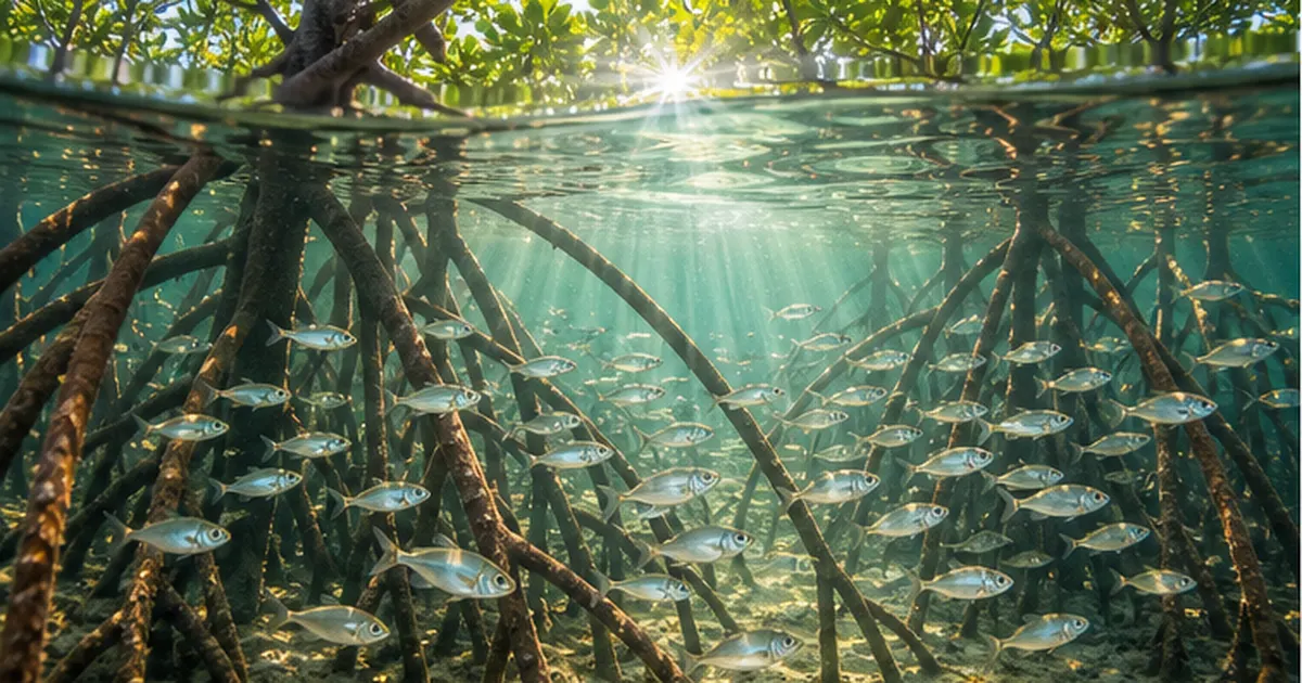
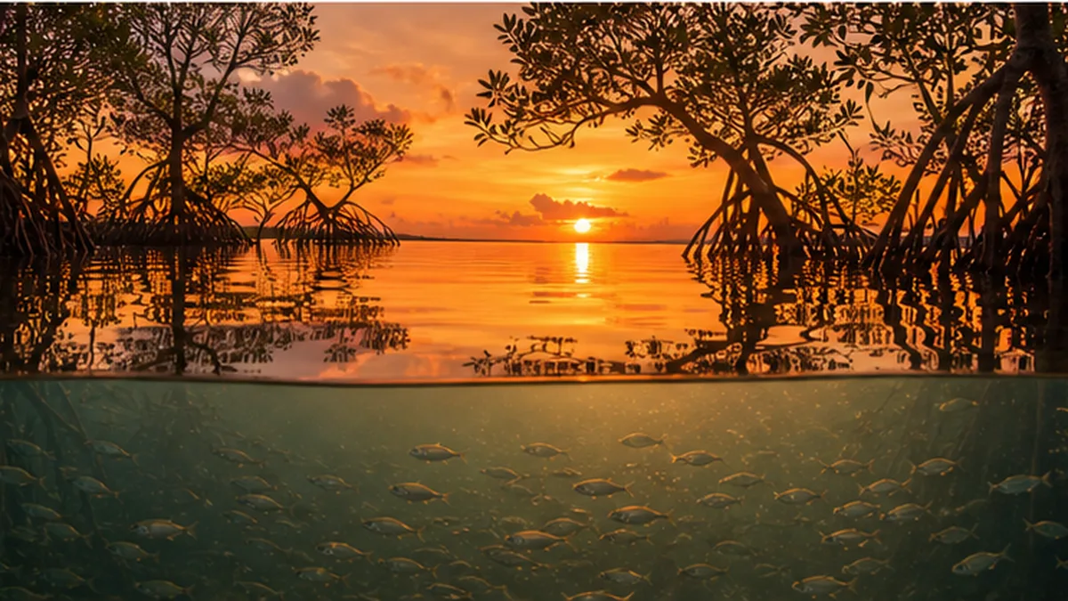
At low tide, a mangrove forest looks rather unwelcoming: countless roots jutting out of bare mud. But when the tide rises and that forest of roots sinks beneath seawater, everything changes. Juvenile fish a few centimetres long, freshly moulted shrimp and small crabs appear, filling every gap in the tangle of roots. This is precisely why mangroves are called the ocean's cradle.
Mangroves are forests that establish themselves in one of the harshest settings on Earth: tropical and subtropical estuaries and intertidal zones, where salinity and water level swing violently within a single day. According to the Food and Agriculture Organization of the United Nations (FAO) report The World's Mangroves 2000-2020, the global mangrove area stood at about 14.8 million hectares in 2020. That is a tiny fraction of the world's land surface, yet the sheer quantity of life it supports is far greater than the area alone would suggest.
This article takes the familiar phrase "mangroves are a nursery for young fish" and unpacks it carefully, using the language of ecology and actual field data. Why are the juveniles there? How do we confirm that a place really functions as a nursery? And what form does all this take in Japanese waters? The answers are more intricate than you might expect, and all the more interesting for it.
What you'll learn in this article
- What the word "nursery" actually means in ecology, and its strict definition
- Why mangrove roots differ so much between species, from octopus-like prop roots to bent knee roots
- Four explanations for why juvenile fish and shrimp gather in mangroves — shelter, food, turbidity and temperature — and how well each is supported
- The Caribbean study showing that fish biomass more than doubles on coral reefs connected to mangroves
- Where Japan's mangroves are, how much there is, and how many species grow there
- Three threats — shrimp farming, coastal development and sea level rise — and the conservation efforts under way worldwide and in Japan
What "the ocean's cradle" actually means
Almost every article and information board about mangroves uses the phrase "the ocean's cradle." It is a gentle-sounding metaphor, but ecology has a properly defined concept behind it: the nursery habitat. Let us start by unpacking what that term contains.
A nursery is not simply "a place with lots of juveniles"
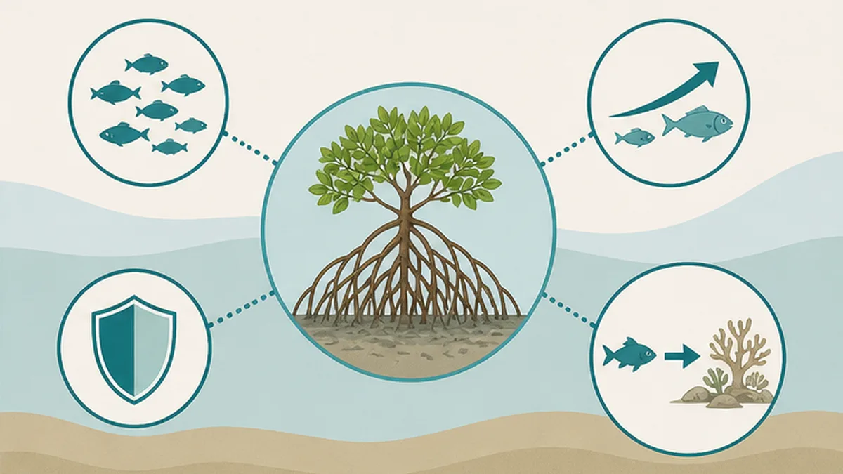
Intuitively, we want to say that anywhere holding plenty of small fish must be a nursery. The definition proposed by the ecologist Beck and colleagues in 2001, which has since become the foundation of the debate, is rather stricter. A place qualifies as a nursery only when its contribution per unit area to the production of individuals that recruit to the adult population is, on average, greater than that of other habitats where juveniles occur.
The distinction matters. Juveniles may congregate somewhere and still be eaten in large numbers, grow too slowly to reach maturity, or fail to reach the adult habitat at all. In that case the site is a gathering point for young fish, but it is not functioning as a nursery. In other words, high density alone is not enough; you have to confirm that the animals survive and leave.
The four conditions for recognising a nursery
- 1. Density: more juveniles per unit area than in other habitats
- 2. Growth: growth rates during the residence period are fast, or at least adequate
- 3. Survival: mortality from predation and other causes is low, so a high proportion survives
- 4. Movement: individuals that have grown actually move on to the adult habitat
Do mangroves meet the conditions?
The short answer is that many tropical mangroves do meet them, but not uniformly across every site and every species. Recent work in particular has reported that when mangroves are compared with adjacent mudflats, the total abundance of juveniles is often not very different. Even so, the cast of species that gathers in each habitat is usually clearly distinct, and it has been confirmed repeatedly that some species cannot grow up anywhere but in mangroves.
So the argument "if the mudflats survive, the fish will be fine even without mangroves" does not hold. The value of an ecosystem lies not only in total quantity but in combinations found nowhere else.
A three-dimensional maze of roots: how a mangrove is built
The main reason mangroves can serve as a cradle lies in the shape of their roots. The mud beneath seawater is extremely low in oxygen; an ordinary tree would suffocate. Mangrove plants solved the problem by pushing roots up above the water. The result is a three-dimensional maze woven through the sea.
Root shapes differ completely between species
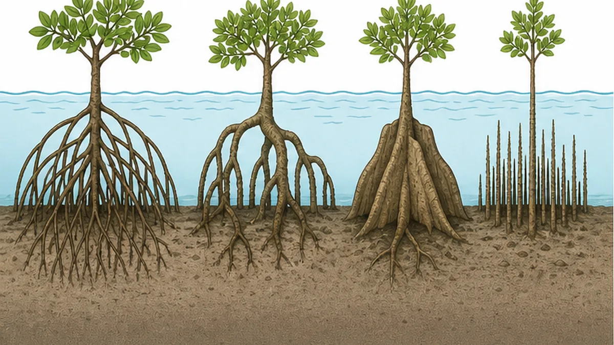
According to the Forestry and Forest Products Research Institute (FFPRI) of Japan, the three species that typify Japan's mangroves each have a different root form. Rhizophora stylosa has prop roots that radiate from the trunk like the arms of an octopus; Bruguiera gymnorrhiza has knee roots that look like bent knees; and Kandelia obovata has plank-like buttress roots spreading at the base of the trunk. In every case, aerenchyma tissue inside the roots takes in oxygen from the air.
| Japanese name | Scientific name | Root form | Distinguishing features |
|---|---|---|---|
| Yaeyama-hirugi | Rhizophora stylosa | Prop roots | Many roots angle out from the trunk like octopus legs; grows on the seaward edge of the forest |
| Ohirugi | Bruguiera gymnorrhiza | Knee roots | Bent, knee-like roots project from the mud; the red calyx is conspicuous |
| Mehirugi | Kandelia obovata | Buttress roots | The base spreads out like a plank; grows furthest north in Japan |
| Hirugi-damashi | Avicennia marina | Pneumatophores | Countless slender, rod-like roots stand up out of the mud |
Vivipary: a startling way to reproduce
The Rhizophoraceae have another peculiar trait: viviparous seeds, or propagules. The seed germinates while still attached to the parent tree, extending a long rod-like shoot before it drops. If it lands on mud, it lodges there and puts out roots. If it lands in the sea, its corky interior lets it float, so the tide can carry it to a distant shore before it germinates.
Thanks to this mechanism, mangroves can extend their range while minimising the risk of failed germination, even in unstable, highly saline environments. Dispersal by ocean current is also why mangrove stands are scattered across remote islands.
Three physical effects created by the maze of roots
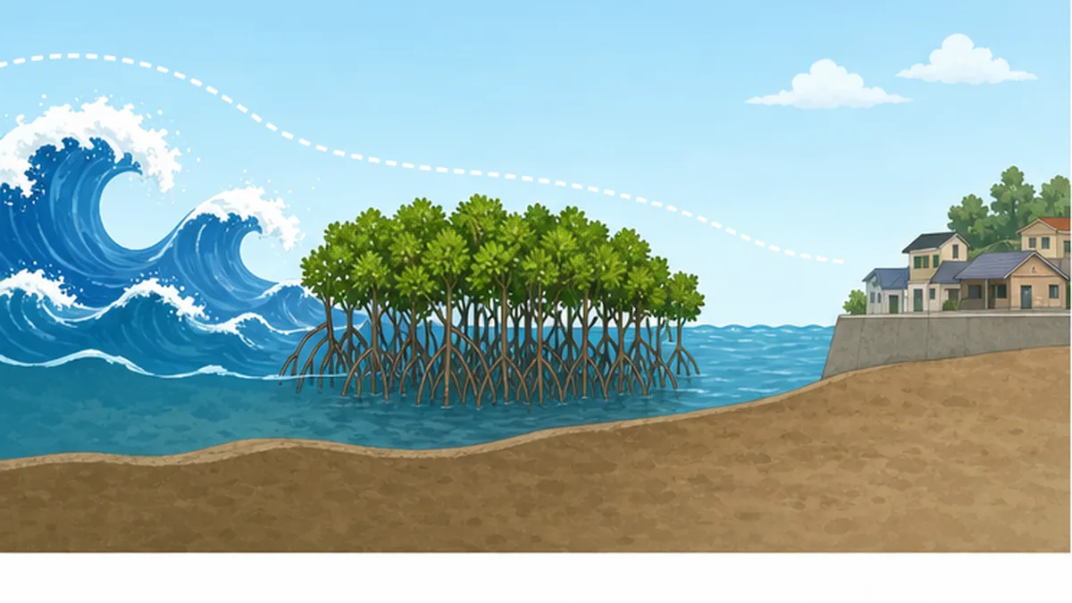
- Weakening waves and currents: drag from the roots slows the water so small animals are less likely to be swept away
- Trapping sediment: as flow slows, fine mud settles out and builds an organic-rich seabed
- Subdividing space: the intricate gaps create refuges that larger fish cannot enter
Why do juvenile fish and shrimp gather in mangroves?
A maze of roots alone does not guarantee that juveniles will gather. In practice several factors are thought to combine, and researchers generally point to four explanations. Let us look at each, including how far it has been tested.
Explanation 1: they can hide from predators
The oldest and most widely supported idea is the shelter hypothesis. The gaps between interlocking roots are structured so that large predatory fish cannot get in. Tank experiments and field measurements of predation pressure both show that juvenile survival is higher where root density is greater.
One caveat is needed, though. Small predators do get into mangroves, and at low tide the water retreats and the available refuge shrinks. It is more accurate to think of mangroves as a place where predation is relatively less likely, not a place that is completely safe.
Explanation 2: food is abundant
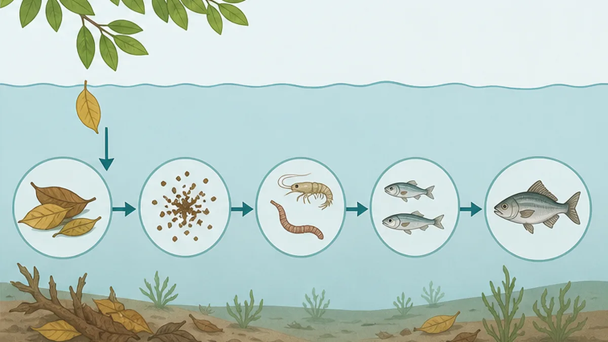
Large quantities of organic matter (detritus) accumulate on the floor of a mangrove forest as fallen leaves break down. Small crustaceans and polychaetes multiply on that detritus, and juvenile fish feed on them, forming a complete food chain. What sets mangroves apart from other habitats is that a structurally complex, highly productive environment supplies feeding grounds and refuge at the same time.
Studies comparing the stomach contents of fish caught in mangroves and on mudflats have in fact shown that the same species eats different things depending on the habitat. On the mangrove side, prey tied to the leaf-litter food web is more common, and this has been suggested as a possible source of differences in growth rate.
Mangroves for shrimp: a round trip that defines a lifetime
Mangrove areas are decisive not just for fish but for penaeid shrimp. Many of these shrimp spawn in offshore waters; the hatched larvae ride the currents inshore and grow as juveniles in estuarine brackish water and mangrove areas. Once large enough, they move back offshore to join the spawning population. The strategy is to spend only the most defenceless period of life inside the mangroves.
That round trip is severed when mangrove habitat disappears. Even if the offshore adults are healthy, without a place for the juveniles to grow, the next generation is never recruited. This is the mechanism behind the frequent observation that regions in Southeast Asia and Latin America where shrimp catches collapsed had also lost large areas of mangrove.
Explanation 3: turbid water works as camouflage
Estuarine mangrove waters are often clouded with mud carried down by rivers. That turbidity works against predators that hunt by sight. In other words, low visibility is itself a defence for juveniles, an idea supported by comparisons between water bodies of differing turbidity.
Explanation 4: shallow, warm water means faster growth
Shallow intertidal water warms readily in the sun, raising the metabolism of fish and shrimp, which are ectotherms. Where food is sufficient, higher temperature means faster growth. Because growing quickly is itself the best strategy for escaping predation, this effect also feeds indirectly into survival rates.
Which of the four explanations is correct?
Researchers do not take the view that any single one is the answer. This is understood as a compound phenomenon whose components vary in strength by place, season and fish species. In recent years, analysis of stable isotope ratios in otoliths (ear stones) has been used to trace the history of individual fish, providing direct proof that individuals raised in mangroves do move on to coral reefs.
The invisible corridor linking mangroves and coral reefs
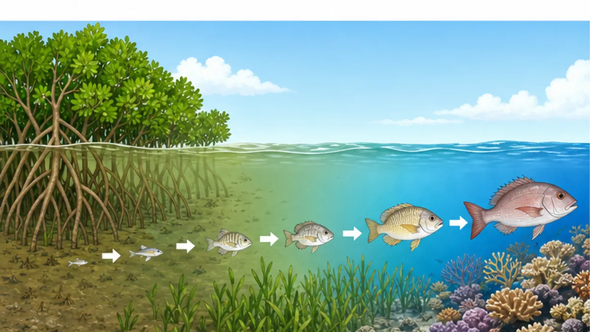
The decisive point in assessing the value of mangroves is that the forest is not self-contained. Many of the fish raised in mangroves pass through seagrass beds as they grow and eventually move to coral reefs. That chain of connections is invisible beneath the sea, but it is unquestionably real: a corridor.
The Caribbean result: fish biomass more than doubles
The study that demonstrated this connection most vividly was published by Mumby and colleagues in Nature in 2004. Comparing Caribbean coral reefs with and without nearby mangroves, they showed that for several commercially important species, biomass on reefs connected to mangroves was more than double.
Even more striking was their finding about Scarus guacamaia, the largest herbivorous fish in the Atlantic. This parrotfish is functionally dependent on mangroves, and the study reported that it had suffered local extinction in regions where mangroves were lost. Herbivorous fish graze algae from reefs, cleaning the rock surface and creating new settlement space for corals. The loss of mangroves therefore reaches all the way to the health of distant reefs.
Mangroves function as an intermediate nursery habitat that may increase the survivorship of young fish, and the biomass of several commercially important species is more than doubled when adult habitat is connected to mangroves.
― Summarised from the abstract of Mumby et al. (2004) Nature 427: 533-536
What happens when the connection is broken
If any one link in this corridor is lost, the rest suffers even if it remains healthy. Reclaim the mangroves and the supply of juveniles thins; lose the seagrass beds to turbidity and the staging post disappears; bleach the coral reef and there is nowhere left to arrive. The idea that coastal ecosystems must be protected as a continuous network rather than as isolated points was born here.
For more on how fish diversity is maintained on the reef side, see our article on the fish diversity that coral reefs support.
Japan's mangroves: from Iriomote Island to Kagoshima
Mangroves have an image of belonging to the tropics, but they grow wild in Japan too. Their northern limit here is remarkably high in latitude by global standards, and the ecosystem that results has a character of its own.
Distribution and area
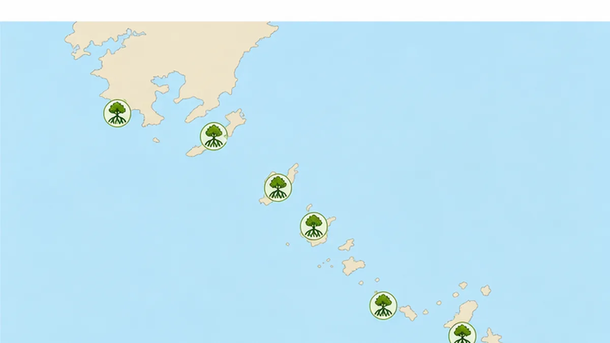
Japan's mangroves reach their northern limit at Kiire in Kagoshima City, Kagoshima Prefecture, and are distributed across the southern Kagoshima islands (Tanegashima, Yakushima, Amami Oshima and others) as well as Okinawa Prefecture, including Okinawa Island, Miyakojima, Ishigaki Island and Iriomote Island. A 2004 report by the International Society for Mangrove Ecosystems put Japan's total mangrove forest at roughly 770 hectares, most of it in Okinawa Prefecture. Set against the global mangrove area, that is less than 0.01 percent: a very small area indeed.
Iriomote Island holds Japan's largest mangrove forest, and every mangrove plant species found in Japan has been confirmed there. The stands spreading across the mouths of the Nakama and Urauchi rivers can be observed from boats travelling upstream, and they form one of the structural elements of the natural heritage inscribed in 2021 as "Amami-Oshima Island, Tokunoshima Island, the northern part of Okinawa Island, and Iriomote Island."
The creatures that live in Japan's mangroves
Being subtropical, Japan's mangrove areas do not hold as many fish species as tropical ones. What they do have is a dense concentration of creatures found nowhere else: mudskippers hopping across the mud at low tide, fiddler crabs with one grotesquely enlarged claw, barnacles and oysters encrusting the roots, and all manner of juvenile fish arriving with the flood tide. As the tide turns, an entirely different cast of characters takes over the same ground.
- Barred mudskipper: moves by hopping across the mud at low tide and takes in oxygen from the air through its skin
- Fiddler crabs: males wave their oversized claw in courtship; by turning over the mud they also help aerate the sediment
- Mud crabs (Scylla spp.): the large crabs that typify mangrove areas and an important local fishery resource
- Juvenile fish of many species: enter from offshore on the flood tide and leave again before the ebb, repeating the round trip
The particular value of being at the northern limit
Seen against the world as a whole, Japan's mangroves are modest in both area and species count. But populations at the northern limit of a range carry a special biogeographical significance. Northern-limit populations may hold traits absent from the tropical core, such as cold tolerance, and are therefore regarded as a clue to how mangroves will adapt as climate change shifts their distribution.
In fact, mangrove ranges are already observed to be expanding polewards in many parts of the world as the climate warms. In Japan too, mangroves may establish themselves on coasts where they have never grown before. That is not simply a matter of "more greenery": it means the sandy beach or mudflat ecosystem that was there before is replaced. Should such change be welcomed, or managed? Japan's northern-limit seas are among the first places that will have to answer.
Two ecosystems that swap places with the tide
At high tide a mangrove forest is a sea of fish and shrimp; at low tide it is dry land for crabs and birds. The same area is used twice a day as two entirely different ecosystems, and that is what underpins the extraordinary productivity of this environment.
The fisheries and livelihoods that mangroves support
The cradle function connects directly to the human dinner table. The economic value mangroves generate has been quantified in a number of studies.
Fisheries value per hectare
An analysis of penaeid shrimp production supported by mangroves, drawing on 43 datasets worldwide, arrived at an average of about 162 kilograms per hectare per year. Converted to money that is on the order of 1,100 US dollars, but regional variation is enormous: the least productive sites yield 13 kilograms per hectare and the most productive 756 kilograms, a spread of more than fiftyfold.
That range means the value generated by the same area differs completely depending on the quality of the mangrove, the conditions of the surrounding sea, and how developed the local fishery is. We should be cautious about reducing mangroves to a single figure per hectare. At the same time, the numbers make it unmistakably clear that the old assessment of these places as "worthless wetland" was wrong.
| Type of value | Content | Principal beneficiaries |
|---|---|---|
| Fishery supply | Supports catches by serving as a nursery for shrimp, crabs and fish | Coastal fishers and consumers |
| Disaster risk reduction | Attenuates waves and storm surges, limiting flood damage | Coastal residents and local governments |
| Carbon storage | Holds large amounts of organic carbon in the soil over long periods | The whole planet (climate stability) |
| Water purification | Captures nutrients and sediment flowing off the land | Coastal waters and coral reefs |
| Culture and tourism | A setting for canoeing, ecotours and environmental education | The local economy and visitors |
What it means to be able to show value
These numbers are more than trivia. When a plan is proposed to fill in a mangrove for aquaculture ponds or a port, the development side used to be the only one with concrete figures, while the conservation side had nothing but the words "nature is precious." Quantitative valuation of ecosystem services grew up precisely to close that asymmetry.
Add fishery value, disaster risk reduction and carbon storage together, and in many places the economically rational conclusion is to keep the mangrove. As the study by Menendez and colleagues showed, there are places all over the world where the flood protection benefit alone exceeds the cost of conservation. Protecting nature has stopped being synonymous with sacrificing the economy, and that is the major shift of recent years.
Disaster protection worth more than 65 billion dollars a year
A study by Menendez and colleagues published in Scientific Reports in 2020 estimated the reduction in flood and storm surge damage delivered by the world's mangroves at more than 65 billion US dollars a year. The same study calculated that if mangroves were lost, 15 million more people would be flooded each year worldwide. In terms of damage avoided, the United States, China, India and Mexico gain most; in terms of people protected, Vietnam, India and Bangladesh.
Carbon storage as climate action
A study by Donato and colleagues published in Nature Geoscience in 2011 measured 25 mangrove forests across the Indo-Pacific and found that they store an average of 1,023 tonnes of carbon per hectare across the whole ecosystem. Crucially, 49 to 98 percent of that is held not in the trees above ground but in organic soils ranging from 0.5 metres to more than 3 metres deep.
That carbon returns rapidly to the atmosphere the moment the soil is dug up, not merely when the trees are felled. This is why development that excavates the ground, the construction of shrimp ponds being the classic case, does particular damage to the climate among all forms of mangrove destruction. For more on carbon storage by marine ecosystems, see our article on blue carbon ecosystems.
Mangroves under pressure: three threats
For all that value, mangroves were lost rapidly through the second half of the twentieth century. Recent statistics do, however, show that the situation is slowly improving. Let us start by getting the numbers right.
Still declining, but more slowly
According to the FAO report The World's Mangroves 2000-2020, the annual area of mangrove loss fell from 46,700 hectares a year in 1990-2000, to 36,300 hectares in 2000-2010, to 21,200 hectares in 2010-2020: less than half the rate over three decades. The annual rate of loss also dropped from 0.12 percent for 2000-2020 to 0.07 percent for 2010-2020.
Across the twenty years from 2000 to 2020, 677,000 hectares were lost while 393,000 hectares expanded, leaving a net loss of 284,000 hectares. Destruction continues, but planting and natural regeneration are advancing at the same time. That is the picture today.
| Period | Annual area lost | Annual rate of loss |
|---|---|---|
| 1990-2000 | about 46,700 ha/year | - |
| 2000-2010 | about 36,300 ha/year | 0.12% (average for 2000-2020) |
| 2010-2020 | about 21,200 ha/year | 0.07% |
Threat 1: conversion to shrimp ponds
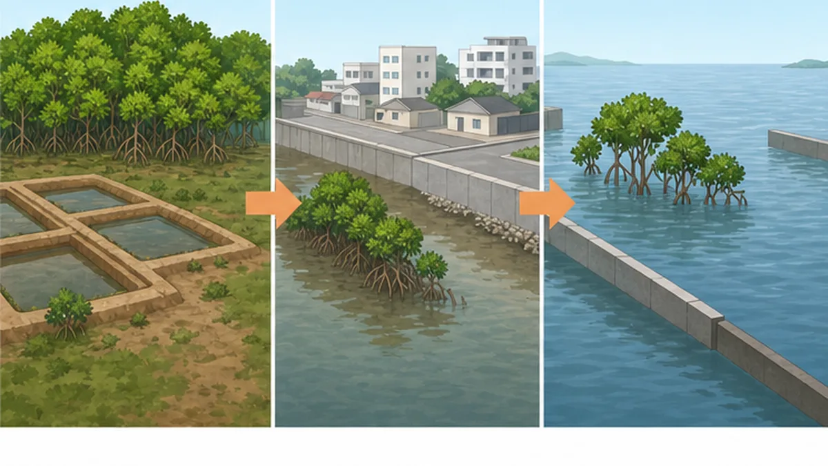
The single largest driver of mangrove loss in the late twentieth century was conversion to ponds for farming black tiger prawns and similar species. Demand for high-value seafood for export brought large-scale clearing and excavation to coasts across Southeast Asia and Latin America. Ironically, shrimp ponds are often abandoned within a few years as water quality deteriorates, leaving barren ground where neither forest nor pond survives.
Threat 2: reclamation, urbanisation and infrastructure
Reclamation for ports, roads and housing is another major factor. The intertidal zone where mangroves grow tends to be cheap and to have ambiguous ownership, which makes it structurally prone to development. The fact that it looks like "unused land", combined with the invisibility of its ecosystem services, has long helped drive its destruction.
Threat 3: sea level rise and reduced sediment supply
Sea level rise driven by climate change cannot be ignored either. Mangroves normally keep pace with rising seas by accumulating sediment and maintaining ground elevation. But when dams and revetments upstream cut off the sediment supply, they cannot keep up and are drowned. And if there is a seawall or a built-up area behind them, they cannot retreat inland either.
Planting does not simply restore what was lost
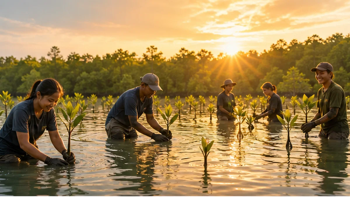
Planting seedlings in lost mangrove areas goes on all over the world, but the success rate is far from high. Seedlings planted where tidal level, salinity and soil conditions do not suit them fail to establish, and a stand of a single species planted in rows cannot reproduce the complex root structure or biodiversity of a natural forest. It is now understood that the first step in restoration is not planting but restoring the flow of water so that the forest can regenerate on its own.
Protecting and recovering mangroves: global and Japanese efforts
Now that the value of mangroves can be expressed in numbers, conservation has moved beyond the frame of environmental protection to be positioned as disaster-risk investment and climate action. Here are the main recent developments.
The Mangrove Breakthrough
The largest international framework is the Mangrove Breakthrough, led by the Global Mangrove Alliance (GMA) together with the UN High-Level Climate Champions and partners. It sets out to secure 15 million hectares of mangroves by 2030 and mobilise 4 billion US dollars. Since COP28, 29 governments have endorsed the initiative.
The goal rests on four pillars: halting further loss; restoring half of the area recently lost; doubling the area under protection; and securing sustainable finance for all existing mangroves. What distinguishes it is that the design goes beyond "stop the decline" to include "increase the total".
The four pillars of the Mangrove Breakthrough
- STOP: halt the loss of mangroves
- RESTORE: recover half of the area recently lost
- DOUBLE: double the world's protected mangrove area
- FINANCE: secure sustainable finance for all existing mangroves
Efforts within Japan
In Japan, the distribution of mangrove forest is tracked continuously through the Ministry of the Environment's National Survey on the Natural Environment. Okinawa Prefecture also issued Guidelines for Mangrove Planting in March 2016, setting out how to judge site suitability and how to carry out the work. What the guidelines emphasise is determining in advance whether a site is genuinely suited to mangrove growth, rather than planting casually.
At the same time, Japan has seen problems caused by planting too much. Where Kandelia obovata and other species were planted on mudflats that never held mangroves naturally, the result was the loss of habitat for the birds and benthic animals that depended on the mudflat. The difficulty here is that increasing greenery is not always the right answer.
Managing coastal ecosystems as a whole
The idea of managing mangroves, seagrass beds, mudflats and coral reefs as a single connected seascape rather than treating them separately is spreading. In Japan too, seagrass restoration and satoumi initiatives are under way in many regions, and they rest on the same thinking as mangrove conservation. For mangrove restoration itself, see our article on efforts to restore mangrove forests.
What we can do: bringing a distant forest closer
For most people living in Japan, a mangrove may be something seen once on a trip, if at all. Even so, there are moments when everyday choices really do connect to this forest.
The link runs through the dinner table
The most direct connection is shrimp. Among the production sites for imported shrimp are ponds that were once mangrove. Choosing a certification label such as ASC, which indicates aquaculture with attention to environmental and social conditions, is a concrete way of expressing intent about a distant coastal forest. Certification does not solve everything, of course, but the existence of consumers who ask how something was produced changes decisions on the production side.
How to visit
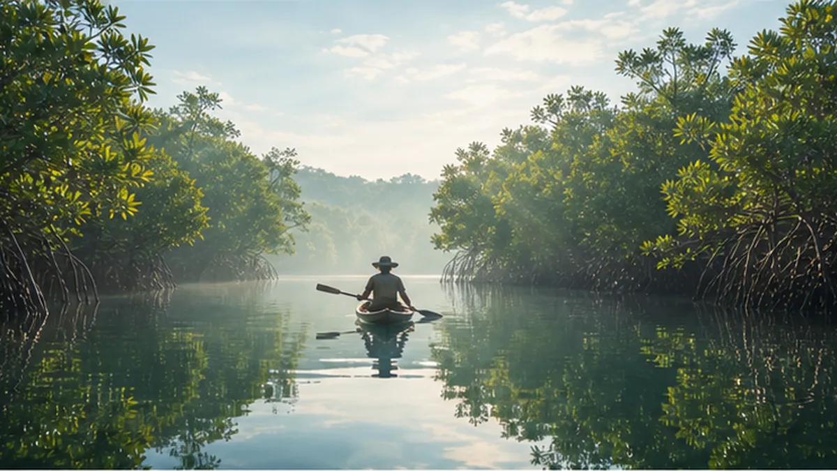
On Iriomote, Ishigaki and Amami Oshima you can observe mangrove forests by canoe or boat. Keeping the following in mind when you go will reduce your impact on the forest.
- Stay on the designated routes and boardwalks; do not tread on roots or seedlings
- Do not dig up crab burrows on the mudflat, and do not take living things home
- In motorised boats, avoid throwing up a large wake (it scours the mud around the roots)
- Use local guides, so that money flows into conservation in that area
- If you use sunscreen or insect repellent, choose products with less impact on the water
Knowing is where conservation starts
When a mangrove is filled in, the site has often been treated as "worthless mudflat." What changed that assessment was the accumulation of research of the kind described in this article. How much seafood does a hectare produce in a year, how many people does it shield from storm surge, how much carbon does it hold? Only once those could be stated as numbers did comparison with development become possible.
Knowing is itself part of conservation. If, the next time you see the word mangrove in the news, you remember the countless juvenile fish moving in and out with the tide behind it, this article will have done its job.
Summary of this article
- A nursery, in the ecological sense, requires not just density but growth, survival and movement to the adult habitat
- Prop roots, knee roots and buttress roots weaken waves, trap sediment and create a three-dimensional refuge that predators cannot enter
- Juveniles gather for a combination of reasons, including shelter, abundant food, turbid water and warm temperatures, and no single factor explains it
- On coral reefs adjacent to mangroves, the biomass of commercial fish more than doubles; the ecosystem works as a continuous corridor
- Japan has about 770 hectares of mangrove, with its northern limit at Kiire in Kagoshima City and its largest forest on Iriomote Island
- The global rate of loss has fallen by more than half over three decades, but net loss continues, and the value of conservation is now demonstrated through disaster protection, carbon and fisheries alike
References and sources
- FAO, The World's Mangroves 2000-2020 – Primary statistics on global mangrove area and rates of loss (14.8 million ha in 2020; 21,200 ha lost annually in the most recent decade)
- Mumby et al. (2004) Nature – "Mangroves enhance the biomass of coral reef fish communities in the Caribbean": commercial fish biomass more than doubles on reefs adjoining mangroves
- Donato et al. (2011) Nature Geoscience – "Mangroves among the most carbon-rich forests in the tropics": an average of 1,023 t C per hectare
- Menendez et al. (2020) Scientific Reports – "The Global Flood Protection Benefits of Mangroves": more than 65 billion dollars a year in flood protection, 15 million people spared
- Biodiversity Center of Japan, Ministry of the Environment – National Survey on the Natural Environment: mangrove survey (baseline data on the distribution of Japan's mangrove forests)
- Forestry and Forest Products Research Institute – Nature Watch, April 2022: "Mangroves" - prop roots, knee roots, buttress roots and viviparous seeds
- Okinawa Prefecture – Guidelines for Mangrove Planting (issued March 2016): judging site suitability and how to carry out the work
- National Institute for Environmental Studies – NIES News Vol. 26 No. 4, "Mangroves and environmental problems"
- Mangrove Breakthrough – International initiative aiming to secure 15 million hectares and mobilise 4 billion dollars by 2030
- Ministry of Agriculture, Forestry and Fisheries, Japan – "Tell me about mangroves": a basic explanation of mangroves
* Listed in order of reliability: government/academic institutions > peer-reviewed papers > specialized organizations > reliable media