⚡ In short
A waterfall is not an accident in a river. It is the inevitable product of differing erosion rates between hard and soft rock, of faults, lava flows and springwater. Using Nachi Falls, Kegon Falls, Shomyo Falls and Niagara as examples, this article traces the life of a waterfall — birth, upstream retreat, and eventual disappearance — and the sediment it sends to the sea.
Nachi Falls, with a 133-metre drop. Shomyo Falls, Japan's tallest at 350 metres across four tiers. And Angel Falls, the world's greatest at 979 metres. Standing before a waterfall tends to leave people lost for words — yet ask why that particular waterfall is there, and few can answer. A waterfall is not something a river produced by chance when it happened to meet a cliff. Where hard rock meets soft rock, where the earth has cracked, where lava once dammed a valley — a waterfall is subsurface structure laid bare at the surface, and it is thoroughly logical.
Geomorphology defines a waterfall as a step that departs sharply from a river's longitudinal profile — the curve of elevation from headwaters to river mouth. Over long spans of time a river approaches a smooth curve, steep upstream and gentle downstream. A waterfall is the bump that disrupts that curve, a knickpoint, and it marks a place the river has not yet finished cutting through. That is precisely why waterfalls do not stay put. Year by year, at rates from a few centimetres to tens of centimetres, they retreat upstream.
This article works through the five causes of waterfall formation — contrasts in rock strength, faults, lava, springwater, and glaciers or sea-level change — with figures from real waterfalls. It also follows the flow of material that links mountain to ocean: rock shattered by a waterfall travels downstream and becomes beach sand. A waterfall is mountain scenery, but it is also the entrance to the factory that builds the sea's beaches.
What you will learn
- Why a waterfall is defined as a step that departs from a river's longitudinal profile (a knickpoint)
- How differing erosion rates between hard and soft rock (differential erosion) create waterfalls
- The undercut to overhang to collapse cycle that drives a waterfall upstream
- Four variations on waterfall formation: faults, lava, springwater and glaciers
- Real examples and figures from Nachi, Kegon, Shomyo, Shiraito and Niagara Falls
- How rock shattered by a waterfall travels downstream and becomes the sand of a beach
What Is a Waterfall? A Step Born in the River's Profile
The definition of a waterfall is surprisingly simple: a place where a river's flow drops abruptly. In Japan a drop of five metres or more is conventionally called a waterfall, though there is no strict legal definition. What matters geomorphologically is not the height itself but what the very existence of that step tells us.
Rivers naturally aim for a smooth curve
A river is steep upstream and grows gentler toward its mouth. Plotted as elevation against distance, it traces a smooth, upwardly convex curve known as the longitudinal profile. Over tens or hundreds of thousands of years a river cuts rock in an effort to approach this ideal curve — the graded profile. The Geospatial Information Authority of Japan explains this division of labour, in which rivers erode upstream, transport in their middle reaches and deposit downstream, as the process that shapes landforms.
Real rivers, however, have bumps that depart sharply from that curve — places where the river has failed to cut down. Such a point is called a knickpoint, and a knickpoint expressed as a distinct step is a waterfall. In other words, a waterfall marks a place the river has not yet defeated.

Why Japan has so many waterfalls
Japan has an unusually large number of waterfalls, for three reasons. First, it rains a great deal: annual precipitation averages around 1,700 millimetres, roughly twice the global mean. Second, the terrain is steep. About 70 percent of the land is mountainous and rivers are short and steep, so they cut rock with real force over a short distance from source to sea. Third, Japan sits in a tectonically active belt. Positioned over subducting plates, it experiences vigorous uplift and faulting and hosts many volcanoes. The resulting geology, in which hard and soft rock meet in complex patterns, seeds steps everywhere.
In 1990 the Ministry of the Environment and partners selected the Top 100 Waterfalls of Japan. Spanning Hokkaido to Okinawa and covering widely different origins and scales, the list doubles as a survey of the diversity of Japan's geology. If you plan to visit a waterfall, looking up which type it is beforehand will transform what you see.
Waterfalls can be classified by form
When observing a waterfall, starting with its shape makes its origin easier to infer. The following classification is widely used in Japan.
| Type | Characteristics | Example | What it reveals about the geology |
|---|---|---|---|
| Plunge (chokubaku) | Falls vertically down a rock face in a single drop | Nachi Falls (Wakayama) | Hard rock above, soft rock below |
| Tiered (danbaku) | Falls in several separate steps | Shomyo Falls (Toyama) | Rock hardness varies layer by layer |
| Segmented (bunkibaku) | Splits into multiple strands during the fall | Shiraito Falls (Shizuoka) | Springwater seeping out at many points |
| Cascade (keiryubaku) | Slides down an inclined rock surface | Fukiware Falls (Gunma) | The entire riverbed is hard bedrock |
| Subterranean-fed (senryubaku) | Groundwater bursts from partway up a cliff | Shiraito Falls (Shizuoka) | A boundary between permeable and impermeable layers |
Three things to look for at a waterfall
- Does the rock differ above and below? Look for changes in colour, fracture pattern and smoothness
- Is the back of the fall hollowed out? A notch is evidence that retreat is under way
- Is there a gorge below the plunge pool? Its length is exactly how far the waterfall has walked
The Biggest Reason: Hard Rock and Soft Rock — How Differential Erosion Works
If you tally the origins of waterfalls worldwide, the most common by far is a difference in rock hardness. Given the same river and the same discharge, easily eroded rock is lowered quickly while resistant rock stands high. This gap in erosion rate is called differential erosion.
The same water, different rock, different rate of cutting
How readily rock erodes is not determined by mineral hardness alone. The density of fractures (joints), how strongly the grains are bonded and how easily the rock breaks down when wet all matter. Even among volcanic materials, a welded tuff — pyroclastic flow deposits fused solid by their own heat and weight — is hard, whereas a layer of ash that merely settled can be dug with a shovel.
| Rock type | Resistance to erosion | Role in a waterfall |
|---|---|---|
| Granite, granite porphyry | Very high | Forms the rock wall of the fall itself |
| Welded tuff, andesite lava | High | Builds plateau edges; the rim becomes the fall |
| Dolostone, limestone | Medium to high | Tends to form the overhanging ledge above |
| Sandstone | Medium | Can occupy either the upper or lower position |
| Mudstone, shale, tuffaceous sediment | Low | Erodes first below, undercutting the rock above |
| Unconsolidated ash and pumice layers | Very low | A frequent cause of collapse |
Nachi Falls: the boundary between hard igneous rock and soft sedimentary rock
With a drop of 133 metres, Nachi Falls in Wakayama Prefecture is regarded as Japan's tallest single-drop waterfall and is a textbook case of differential erosion. According to the Nanki Kumano Geopark, the fall formed at the boundary between the granite porphyry of the Kumano acidic igneous rocks and the surrounding sedimentary rocks of the Kumano Group. The hard granite porphyry resisted erosion while the softer sedimentary side was lowered first, leaving a large step along the contact.
Nachi Falls is designated a National Place of Scenic Beauty and forms part of the World Heritage site "Sacred Sites and Pilgrimage Routes in the Kii Mountain Range." That a waterfall revered for more than a thousand years also has a clear geological reason for being exactly where it is gives it a double significance.
See the geology of Nachi FallsNachi Otaki, Japan's tallest waterfall at 133 m | Nanki Kumano GeoparkThe local geopark explains, with photographs, how Nachi Falls formed at the boundary between the granite porphyry of the Kumano acidic igneous rocks and the sedimentary rocks of the Kumano Group.🔗 nankikumanogeo.jp
Caprock structure: when hard rock lies on top
The most typical arrangement of all is hard rock above, soft rock below. The hard upper layer acts as a lid — a caprock — keeping the lip of the fall sharp. The soft layer beneath, meanwhile, is worn back by spray and swirling water and retreats inward. The result is a cavity behind the fall and the distinctive vertical or overhanging face that waterfalls are known for.
Why hard rock on top produces a vertical waterfall
When the upper layer is hard, the lip does not round off as it retreats but keeps its edge. Water is thrown clear into the air and falls without touching the rock face. The rock below is therefore cut not by falling water but by rebounding spray and eddies, so it is hollowed out inward. When the upper layer is soft, by contrast, the lip rounds, the gradient eases, and the waterfall gradually becomes a sliding cascade.
Waterfalls Walk Upstream: The Cycle of Undercutting and Collapse
The most counterintuitive fact about waterfalls is that they do not stay in one place. Every year a waterfall moves a little further upstream. It is far too slow to notice in a human lifetime, yet on geological timescales it is startlingly fast.
The plunge pool is a drilling machine
Falling water sets up powerful eddies in the plunge pool, drawing in pebbles and sand. Those stones spin and grind at the bedrock, boring the round holes known as potholes. At the same time, where fast flow drops the local pressure, tiny bubbles form and the shock of their collapse fractures the rock surface — a process called cavitation. A plunge pool is a natural drill powered by water, sand and bubbles.
Potholes form not only in plunge pools but throughout fast-flowing riverbeds. At Fukiware Falls in Numata, Gunma Prefecture, the tuff of the riverbed has split along the flow, producing a striking landscape of deep clefts and countless potholes. Designated both a National Natural Monument and a Place of Scenic Beauty, it is a rare place to watch rivers cutting rock right at your feet. Consider that the same thing happens at the bottom of a plunge pool many times more violently, and the pace of retreat starts to make sense.
Undercut, overhang, collapse: three steps
- Undercutting: eddies and spray cut back the soft lower layer, forming a notch
- Overhang: the notch deepens until the hard upper layer loses support and juts out like eaves
- Collapse: unable to bear its own weight or the stress of freeze and thaw, the overhang falls away and the lip jumps several metres upstream
- Restart: at the new lip, the cycle begins again from step one
Retreat, then, does not proceed smoothly. It happens as decades of stillness punctuated by a sudden drop of several metres. An average retreat rate is simply those jumps divided across long spans of time.

Niagara Falls: 11 kilometres in 12,000 years
The classic example of retreat is Niagara Falls, on the river linking the Great Lakes of North America. When the ice sheet withdrew some 12,000 years ago, water began falling much further downstream, near the shore of Lake Ontario. The falls have an ideal caprock structure — hard Silurian dolostone above and soft shale below — and by repeatedly undercutting and collapsing they have migrated upstream ever since. Their track is the present-day Niagara Gorge, about 11 kilometres long. The gorge is literally the footprint of a walking waterfall.
The rate of retreat has changed dramatically with time and human activity. Until the early twentieth century it was put at roughly one metre a year, but large volumes of water were diverted for hydroelectric generation and remedial work in the 1960s reshaped the crest. Recent retreat is described as no more than a few centimetres a year. It is a rare case of humans extending a waterfall's life.
Why the area around a waterfall is closed to entry
Retreat happens through collapse, and collapse happens suddenly. Directly above the lip and directly beneath the plunge pool are the least stable places on the whole landform. Stepping past a fence or rope, or entering a stream when water is rising, is not merely bad manners — it is a direct threat to life. Viewing platforms and trails are placed where they are only after collapse risk has been assessed.
Waterfalls Where the Earth Has Cracked: Faults and Plateau Rims
Alongside contrasts in rock strength, the other great cause is crustal movement. When a fault displaces the ground, a drop appears in an instant. The river has no choice but to cross it, and a waterfall is born.
Waterfalls on fault scarps
When faulting lifts one side (or drops the other), a straight cliff called a fault scarp appears at the surface. Any river crossing it must fall at the edge. Japan lies in one of the world's most tectonically active belts, with active faults distributed nationwide, so fault-related waterfalls are far from rare. Rock along a fault is often finely shattered, and because that crushed zone erodes first, waterfalls take on straight-edged forms and gorges run unusually straight.
Victoria Falls: a waterfall that retreats in zigzags along fractures
Victoria Falls on the Zambia–Zimbabwe border, known locally as Mosi-oa-Tunya, "the smoke that thunders," is the definitive example of fractures making a waterfall. A thick basalt plateau spreads across the region, cut by large fractures running in two directions. Softer sediment filling those fractures erodes first, so the Zambezi River grows its waterfall along the line of a fracture until it meets the next one, then turns and retreats in a new direction.
The result, seen on a map, is a distinctive zigzag gorge. According to a report by the Fukada Geological Institute, the process began about 100,000 years ago, the river has switched direction seven times, and the present falls are the eighth in the series. The drop is roughly 100 metres and the width exceeds 1.7 kilometres in the wet season, earning it the title of the world's largest sheet of falling water measured by width times height.
Angel Falls: 979 metres from the rim of a table mountain
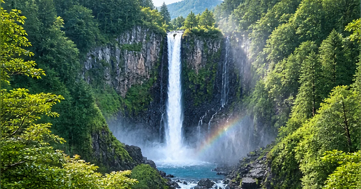
Angel Falls, the world's greatest at 979 metres, lies in Canaima National Park in Venezuela. The Guiana Highlands bristle with tepuis — vast table mountains with flat summits and sheer vertical flanks. Water drops from the rim of one of them, Auyán-tepui, and the fall is so high that much of it disperses into mist before reaching the ground. The rock forming the plateau is extremely resistant, and because its flanks do not crumble but stay vertical, a drop of this magnitude is possible.

| Waterfall | Location | Drop | Main cause |
|---|---|---|---|
| Angel Falls | Venezuela | About 979 m | The vertical rim of a table mountain (tepui) |
| Victoria Falls | Zambia / Zimbabwe | About 100 m | Retreat along fractures in a basalt plateau |
| Niagara Falls | United States / Canada | About 50 m | Hard dolostone over soft shale |
| Shomyo Falls | Toyama Prefecture, Japan | 350 m (four tiers) | Deep incision into a welded tuff plateau |
| Nachi Falls | Wakayama Prefecture, Japan | 133 m | Boundary between granite porphyry and sedimentary rock |
| Kegon Falls | Tochigi Prefecture, Japan | 97 m | Outflow from a lake dammed by lava |
Waterfalls of a Volcanic Archipelago: Steps Built by Lava and Pyroclastic Flows
No account of Japan's waterfalls is complete without volcanoes. Lava flows and pyroclastic flows lay down thick, hard sheets of rock in a very short time. They divert rivers, or dam them outright, and waterfalls follow.
Kegon Falls: the outlet of a lake dammed by lava
Kegon Falls in Nikko, Tochigi Prefecture, with a drop of 97 metres, is counted among Japan's three great waterfalls. Its story begins with an eruption of Mount Nantai roughly 15,000 years ago. Lava dammed a valley, and Lake Chuzenji formed behind it. The Ojiri River flowing out of the lake pours over that lava barrier — and that is Kegon Falls. The rock wall exposes a cross-section of the lava of the time, the Kegon lava, showing two stacked flows and well-developed vertical columnar jointing in the massive portions.
See official information on Kegon FallsAbout Kegon Falls | Kegon Falls ElevatorThe official guide to the origins of the 97-metre Kegon Falls and to the elevator that descends to the viewing platform near the plunge pool.🔗 kegon.jpFragile volcanic deposits and repeated collapse
Precisely because it is the outlet of a lava-dammed lake, the geology around Kegon Falls includes crumbly ash and pumice and is anything but stable. In 1986 the bedrock at the lip collapsed on a large scale and the appearance of the falls changed. According to Tochigi Prefecture, reinforcement work on the overhanging upper section has been carried out in stages since fiscal 1990, with care taken over the landscape. A waterfall is not something to be preserved unchanged; it is something whose retreat must be managed for safety.
Shomyo Falls: 350 metres, Japan's tallest
Shomyo Falls in Tateyama, Toyama Prefecture, is Japan's tallest at 350 metres. It descends in four tiers of 70, 58, 96 and 126 metres from top to bottom. The falls sit at the head of the Shomyo Corridor, a V-shaped valley the Shomyo River has cut deep into the welded tuff plateau of Midagahara, formed by eruptions of the Tateyama volcano.
The record of retreat is remarkable. Shomyo Falls is thought to have stood some 15 kilometres further downstream about 100,000 years ago, which works out at roughly 10 to 15 centimetres a year of retreat through welded tuff. The deep gorge before you is exactly the distance the waterfall has walked in that time. It is designated a National Place of Scenic Beauty and Natural Monument and is one of the Top 100 Waterfalls of Japan.

What is welded tuff?
When a pyroclastic flow accumulates thickly while still hot, its own weight and heat fuse the ash particles together into hard rock. That is welded tuff. From the same volcanic ash, the welded version is extremely hard while the unwelded version crumbles in the hand. This contrast in strength has produced many of the striking waterfalls and gorges of Japan's volcanic regions.
Waterfalls That Seep: The Boundary Between Permeable and Impermeable Layers
So far we have looked at waterfalls where a river drops over a step. Japan, however, also has waterfalls where water falls with no river above them: subterranean-fed falls, where groundwater seeps directly out of a cliff face.
Layers that pass water, and layers that do not
Strata include permeable layers that readily transmit water — porous lava flows and gravel beds — and impermeable layers that barely transmit it at all, such as clay-rich mudflow deposits. Rain and snowmelt soaking in from above travel sideways through the permeable layer until they meet the impermeable one and have nowhere to go. Where a cliff cuts that boundary, water emerges in a line along it.
Shiraito Falls: a 150-metre curtain of water
Shiraito Falls in Fujinomiya, Shizuoka Prefecture, is Japan's foremost example of this mechanism. According to the city, meltwater from Mount Fuji emerges from a cliff at the boundary between the permeable Shiraito lava flow of the New Fuji volcano above and the impermeable Old Fuji mudflow deposits below. From a curved cliff about 20 metres high and 150 metres wide, several hundred fine threads of water descend like hanging silk, which is how the falls got their name — shiraito means white threads.
Discharge is about 1.5 tonnes per second and the water temperature holds at roughly 12°C year-round. Because the water has travelled slowly underground it is insulated from air temperature, so it feels cold in summer and warm in winter. The falls are a National Place of Scenic Beauty and Natural Monument and a component of the World Cultural Heritage site "Fujisan, sacred place and source of artistic inspiration."
See official information on Shiraito FallsShiraito Falls | Fujinomiya City, Shizuoka PrefectureThe city's official page explains, together with the stratigraphy, how about 1.5 tonnes of springwater per second fall from a cliff roughly 20 metres high and 150 metres wide.🔗 city.fujinomiya.lg.jp
Another feature of subterranean-fed falls is the stability of their flow and temperature. Surface rivers swell with rain and dry up in drought, but groundwater moves slowly through thick strata, so seasonal variation is small. The springs around Mount Fuji have long supplied domestic water and the paper and food industries, and have supported rainbow trout farming and wasabi cultivation, both of which demand clean, cold water — all thanks to that stability. A waterfall is a tourist attraction, but it is also a water resource laid bare, sustaining local industry and daily life.
Springs and waterfalls in limestone country
Something similar happens in limestone terrain. Limestone dissolves in mildly acidic rainwater, creating underground cavities and conduits. There are dramatic cases in which a river flowing on the surface is swallowed underground and bursts out again from a cliff some distance away as a waterfall. Asking where the water came from opens up a world that surface rivers alone cannot explain.
Glaciers, Sea Level and Uplift: How Scale of Time Reshapes Waterfalls
There is one more, larger-scale set of causes: the cycle of glacial and interglacial periods, the rise and fall of sea level and the uplift of the land. These move the very target elevation that a river is cutting down toward.
Hanging valleys: when only the main valley is deepened
Glaciers erode far more powerfully than rivers, gouging valley floors into U-shaped troughs. Glaciers develop mainly in large main valleys, however, and small tributary valleys never grow enough ice. So when the ice disappears at the end of a glacial period, only the main valley floor has been deepened, leaving tributary floors stranded high above. Such a valley left hanging is called a hanging valley, and the tributary's water plunges as a waterfall at the junction.
The same thing happens without glaciers. If the main river carries overwhelmingly more water than a tributary, it alone incises quickly and deeply, and a step forms at the confluence. Waterfalls can arise anywhere there is an imbalance in cutting power.
When sea level falls, rivers start cutting from the bottom
The lowest elevation to which a river can cut is called its base level, normally the sea it flows into. During glacial periods enormous volumes of water were locked up as ice sheets on land and sea level dropped more than 100 metres. With the target suddenly far lower, rivers incised furiously from near their mouths. The front of that incision travels upstream, and the steps along the way are again knickpoints — waterfalls. Sea level and waterfalls seem far apart, yet they are directly linked.
When sea level rises, the reverse happens: deposition dominates downstream and waterfalls are gradually buried. What the sea-level rise now under way means for Japan's coastline is covered in detail in Will sea-level rise erase 90% of Japan's beaches?.

Waterfalls that drop straight into the sea
On rapidly uplifting coasts and on steep islands, rivers sometimes fall directly into the sea from the edge of a sea cliff. Examples can be found on Yakushima, the Izu Peninsula and the coast of the Kii Peninsula. At such falls fresh water and seawater mix directly, creating an unusual environment where distinctive distributions of organisms are sometimes observed.
The Life of a Waterfall, and What It Sends to the Sea
Waterfalls are not eternal. They are born, they retreat, and eventually they vanish. And for as long as they exist, they shatter enormous volumes of rock and send it downstream — ultimately to the sea.
How waterfalls disappear
There are two main endings. One is retreating until exhausted: once the hard layer supporting the fall has been cut through, or once there is no hard rock left upstream, the step gradually softens, passes through a cascade stage and becomes ordinary rapids. The other is burial: landslides, debris flows, volcanic deposits or the impoundment of an artificial reservoir hide the waterfall beneath sediment or water.
| Waterfall | Record of retreat | Approximate average rate |
|---|---|---|
| Niagara Falls | About 11 km in roughly 12,000 years | Once about 1 m/year; in recent years a few cm/year, partly due to water diversion |
| Shomyo Falls | About 15 km in roughly 100,000 years | Around 10–15 cm/year |
| Victoria Falls | Now the eighth falls in the series over roughly 100,000 years | Intermittent jumps along fractures |
| Kegon Falls | Said to have retreated about 800 m to its present position | Stepwise retreat through collapse |
The rock a waterfall shatters becomes beach sand
Rock brought down by collapse at a waterfall does not simply vanish. It is broken up in the plunge pool, rounded and reduced as it tumbles downstream, becomes gravel and then sand, passes out of the river mouth into the sea, and is carried by longshore currents to build beaches. Much of the sand on Japan's beaches was supplied this way from the mountains. A waterfall is mountain scenery and, at the same time, the upstream end of the sediment-supply system that maintains the coastline.
Today, however, that flow is broken in many places. Dams and check dams trap sediment, gravel extraction adds to the loss, and far less material reaches the sea. As a result beaches along many coasts are thinning. This problem is examined in the relationship between dams and coastal erosion. If sediment stops arriving, the maintenance of tidal flats at river mouths is affected too.

The life of a waterfall in summary
- Birth: a step forms in a river through contrasts in rock strength, faults, lava, springwater or glaciers
- Growth: the plunge pool bores into rock, the base is undercut and the top juts out
- Migration: the overhang collapses and the lip jumps upstream; the track becomes a gorge
- End: the hard layer is cut through and the gradient eases, or the fall is buried by sediment or impounded water
- Legacy: the shattered rock becomes sand, is carried to the sea, and sustains beaches and tidal flats
Waterfall Ecosystems, and How to Enjoy and Protect Them
Finally, let us look at waterfalls not as landforms but as places where living things gather. To an ecosystem a waterfall is a barrier and, at the same time, a special habitat.
A waterfall is a wall for fish
A tall waterfall is impassable for most fish. The species found above and below therefore differ, and populations stranded upstream can acquire distinctive genetic characteristics over long periods. River connectivity is a condition of survival above all for diadromous fish that move between sea and river, such as ayu, eels and gobies of the genus Rhinogobius. The Ministry of the Environment's Biodiversity Center also treats the relationship between river connectivity and the distribution of diadromous fish as an important indicator.
It is worth stressing that a natural waterfall and an artificial weir are not the same thing. A natural waterfall has stood for thousands or tens of thousands of years, and organisms have built their distributions under those conditions. A weir or dam built in recent decades severs a river that had been connected until then. The same impassable step has entirely different ecological consequences. That difference is why fishways and weir modifications are being pursued across the country.
A small universe of moss and ferns, raised by spray
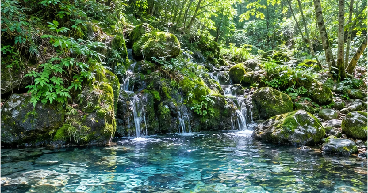
Around a waterfall lies a spray zone kept permanently humid by mist. Humidity stays high year-round and temperature swings are small, making it ideal for drought-sensitive mosses, ferns and lichens. That is why the green is deeper and the rocks are cloaked in moss just around a waterfall, even when the surrounding forest is dry. A waterfall creates its own microclimate within a radius of a few tens of metres.
That environment is delicate. A drop in flow, or a change in light and wind after nearby trees are cut, can wipe it out with surprising ease. When water diversion or upstream development reduces a waterfall's flow, it is not only a question of scenery — it means the loss of a community of organisms that exists nowhere else.

Waterfalls have also been places of faith and culture
In Japan, waterfalls themselves have long been objects of worship. Nachi Falls is the sacred body of Hiro Shrine, a subordinate shrine of Kumano Nachi Taisha, and the practice of praying directly to the waterfall rather than to a shrine building continues today. Takigyo, ascetic practice under a waterfall, is handed down in many regions, and waterfalls have been understood as boundaries between the everyday world and sacred ground. The sheer physical strangeness a waterfall creates — the great drop, the ceaseless roar, the air changed by spray — seems to have taken on religious meaning directly.
This cultural legacy matters for conservation too. Forests around waterfalls held sacred were often spared from logging as shrine groves, and as a result many have become hotspots of biodiversity. Places people left untouched out of awe became refuges for nature.
Protection through scenic beauty and natural monument status
In Japan, many of the most valuable waterfalls are designated Places of Scenic Beauty or Natural Monuments under the Act on Protection of Cultural Properties. Nachi Falls is a Place of Scenic Beauty; Shomyo Falls and Shiraito Falls are both Places of Scenic Beauty and Natural Monuments. Waterfalls inside national and quasi-national parks are further regulated under the Natural Parks Act, which restricts development and construction. Japanese waterfalls are protected from two directions at once: as cultural value — landscape, faith and history — and as natural value, landform and ecosystem.
Because the geology is inherently unstable, however, preserving a waterfall exactly as it is forever is impossible. As with the reinforcement work at Kegon Falls, the practical response is to manage collapse risk so that people can view the falls safely. Protecting a waterfall does not mean freezing it in place; it means reconciling human safety with natural processes on the assumption that the waterfall will change.
When you visit a waterfall
Enjoying a waterfall safely and deeply
- Stay out of streams after rain and on rainy days — rain upstream can raise water suddenly even under clear skies
- Do not cross fences or ropes — directly above the lip and below the plunge pool are where collapse is most likely
- Compare the rock above and below — differences in colour, fracture pattern and smoothness reveal why the waterfall is there
- Look at the length of the gorge downstream — that is exactly how far the waterfall has walked over tens of thousands of years
- Do not tread on mosses and ferns — the vegetation of the spray zone is a tiny ecosystem found nowhere else
- Read the interpretation from a nearby geopark or museum — primary information from local researchers is the most accurate
When you stand before a waterfall, try not to stop at "how beautiful" but to ask why there is a step here at all. The rock above and the rock below, the hollowed-out back, the gorge stretching downstream — all of it records a contest between water and stone lasting tens of thousands of years. And that water eventually reaches the sea. To understand a waterfall is to understand that mountain and ocean are one continuous thing.
References and sources
- Geospatial Information Authority of Japan – 4. Landforms produced by river action (erosion, transport and deposition)
- Geological Survey of Japan, AIST – Research information on the geology and geological maps of Japan
- Ministry of the Environment, Japan – National parks: the natural park system and how protection works
- Agency for Cultural Affairs, Japan – Monuments: the designation system for Places of Scenic Beauty and Natural Monuments
- Biodiversity Center, Ministry of the Environment – River connectivity: watershed fragmentation and the distribution of diadromous fish
- Nanki Kumano Geopark – Geological commentary on Nachi Otaki, Japan's tallest waterfall at 133 m
- Fujinomiya City, Shizuoka Prefecture – Shiraito Falls: discharge, stratigraphy and World Heritage component status
- Tochigi Prefecture – Nature, waterfalls and gorges: Kegon Falls, the 1986 collapse and remedial work
- Fukada Geological Institute, Annual Report No. 21 – Landforms of the Zambezi River downstream of Victoria Falls, southern Africa
- National Park Service (United States) – Commentary on the geology and retreat of Niagara Falls
* Listed in order of reliability: government and academic institutions > peer-reviewed papers > specialist bodies > trusted media