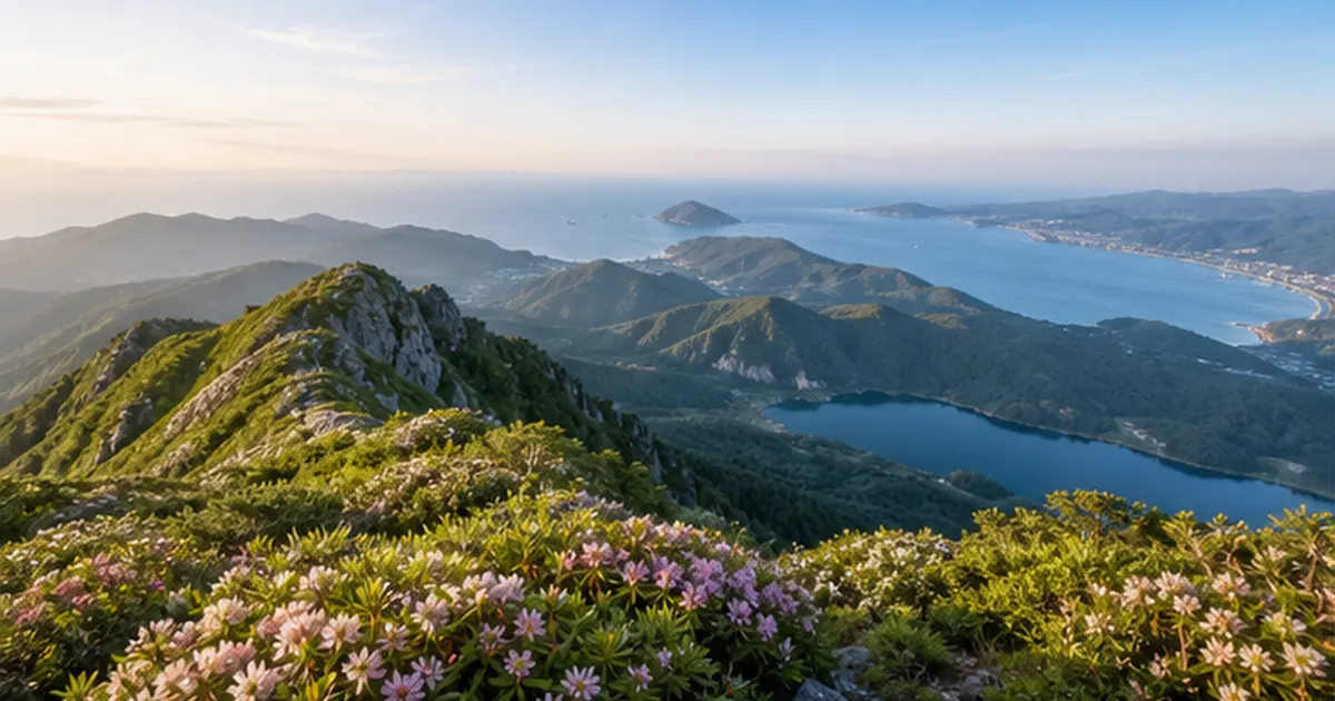
Do you assume a low mountain is safe simply because it's low? Japan's "low-mountain hiking" — trips up peaks under 1,000m — is easy to enjoy on a day trip, but step off a maintained trail and the terrain can be far more tangled than it looks from town. National Police Agency statistics show that the single largest cause of mountain accidents is getting lost, and most of these incidents happen on low mountains popular with inexperienced hikers.
Many of these low mountains are "satoyama" — secondary nature that has been maintained by continuous human activity. Satoyama, a patchwork of farmland, ponds, and coppice woodland, offers both easy access from cities and a rich sense of wildlife, making it a distinctly Japanese kind of hiking field.
This article draws on statistics and official material from the National Police Agency, the Ministry of the Environment, and other public bodies to cover why low-mountain hiking is so popular, how satoyama came to be, how to read the accident statistics, the basics of gear, maps, and bear safety, and what to look for season by season.
What you'll learn in this article
- Why low-mountain hiking has become so popular, and how satoyama landscapes came to exist
- Why the risk of accidents doesn't drop just because the elevation is low, backed by the latest statistics
- What search-and-rescue actually costs, and why mountain insurance is worth considering
- Basic gear and the idea of "layering" to prevent getting lost or falling
- How to read maps and use a hiking plan (tozan todoke)
- How to avoid encounters with bears and other wildlife, and what each season has to offer
Why low-mountain hiking is popular right now
Over the past few years, "low-mountain hiking" — day trips up peaks under 1,000m — has kept growing in popularity. Without full mountaineering gear or a high level of fitness, a few hours walking a corner of satoyama reachable by train or bus is enough to enjoy the smell of the forest, birdsong, and the changing seasons — an accessibility that's part of the appeal.
Three tailwinds behind the low-mountain boom
- Satoyama near cities is easy to reach by train, bus, or car for a day trip, with no need for overnight gear
- The spread of hiking map apps such as YAMAP and Yamareco has made it easier for beginners to check routes and their current location
- Sharing of mountain scenery on social media is drawing in people who previously had no connection to hiking
The symbol of this trend is Mt. Takao, a 599m peak in Hachioji, Tokyo. An estimated 3 million people visit it every year, making it one of the most-climbed mountains in the world. In 2007 it received three stars in the Michelin travel guide, prized for its easy access from central Tokyo and its rich natural environment. Its elevation alone marks it as "low," but its trails branch into several routes, some of which take on the character of a proper mountain path.
While Mt. Takao is thoroughly maintained, with signage, benches, and even shops along some routes, it's not unusual for another low mountain to lead, just one step off the main trail, into paths with few markers that only locals ever walk. Rather than lumping all low mountains together, checking in advance how well-maintained your specific route actually is, is the first step toward enjoying low-mountain hiking safely.
| Mountain | Elevation | Notes |
|---|---|---|
| Mt. Takao (Tokyo) | 599m | Visited by an estimated 3 million people a year; awarded three Michelin stars; a leading example of a low mountain near a city |
| Mt. Tsukuba (Ibaraki) | 877m (Nyotai-san peak) | The lowest of Japan's "100 Famous Mountains"; served by a cable car and ropeway |
How low-mountain hiking differs from full-scale mountaineering
What separates low-mountain hiking from full-scale mountaineering on higher peaks is not elevation itself but the shorter itinerary and the ease of an escape route. Being able to go there and back in a day, with several possible descent routes, reduces the gear burden — but it also makes it easy to assume "I can turn back quickly if something happens." The ease that comes with a low mountain and the risk inherent in any mountain need to be considered separately.
Lower mountains also tend to have more transportation options to the trailhead, making it easy to set off on a whim. That spontaneity is part of the appeal of low-mountain hiking, but it also makes it easy to head out without taking enough time to prepare. Basic steps such as checking the weather forecast and your gear matter regardless of the elevation of your destination.
A field open to everyone
Another feature of low-mountain hiking is how low the barrier to entry is, regardless of fitness or experience. Families with small children, older hikers who have stepped back from full mountaineering, and people who just want a light walk after work can all choose a route to match their goals and pace — that's the broad appeal of low mountains. But as the accident statistics below show, ease of entry and low risk are two different things.
What is satoyama?
The Ministry of the Environment defines "satochi-satoyama" as "an area positioned between urban zones and untouched nature, where the environment has been shaped through various forms of human activity, consisting of secondary woodland surrounding settlements together with the farmland, ponds, and grassland intermixed with it." Satochi-satoyama is said to make up roughly 40% of Japan's land area, and many low-mountain hiking routes pass through it.
The idea of an environment maintained through ongoing human involvement also connects to the concept of "satoumi," which originated in the Seto Inland Sea. It's an interesting parallel — on land and at sea, the same idea, that human involvement can make nature richer, shows up in both places.

What is satoyama? A refuge for wildlife
Satoyama is not simply "a low mountain" — it's an area where diverse environments, including secondary woodland, farmland, ponds, and grassland, combine in a mosaic. Each of these environments serves as a habitat for different creatures, nurturing a form of biodiversity distinct from both old-growth forest and the city.
| Component | Example | Role |
|---|---|---|
| Secondary woodland (satoyama forest) | Coppice woodland of konara and kunugi oak | Source of firewood and charcoal material; habitat for insects and birds |
| Farmland | Rice paddies and fields | Food production; a substitute function for wetland environments |
| Ponds | Agricultural irrigation ponds | Refuge for still-water creatures; a stopover for migratory birds |
| Grassland and footpaths | Grassy banks and fallow land | Habitat for grassland insects and plants |
Nationally important satochi-satoyama sites
Japan's National Biodiversity Strategy, adopted by the Cabinet in 2012, positioned the conservation and use of satochi-satoyama as one of its priority measures. In response, the Ministry of the Environment selected and published 500 sites nationwide in 2015 as "satochi-satoyama important for biodiversity conservation." Many of the mountains visited on low-mountain hikes fall within these designated sites or their surroundings.
Everyday signs of satoyama changing
Because satoyama has been kept in place by ongoing human upkeep, it changes shape once that management stops. Two examples visible even during a hike are the "spread of untended bamboo groves" into surrounding coppice woodland once maintenance stops, and the "ecosystems of agricultural ponds" that are dwindling due to aging infrastructure and land reclamation. Knowing this background as you walk adds resolution to what you see.
Even on a well-maintained hiking trail, you may notice a dim plantation off to the side, or a pond whose surface is covered in algae. That's not neglect — it's a trace of satoyama's history alongside human life. Seeing satoyama not as "untouched nature" but as "a landscape jointly created by people and nature" opens up new ways to enjoy low-mountain hiking.
In recent years, a shortage of farming successors and an aging population have left more and more satoyama without adequate upkeep. Walking through both a well-managed satoyama and one that has been left to change on its own lets you feel, firsthand, just how much of a difference human involvement makes to nature — a lesson that low-mountain hiking offers as lived experience, not just textbook knowledge.
The people who maintain satoyama
Satoyama doesn't maintain itself — its landscape and the habitats it provides only survive because of continuous work such as clearing undergrowth, thinning trees, and dredging silt from ponds. In many parts of Japan, this upkeep, including the maintenance of hiking trails, is carried out by local residents, municipalities, and NPO volunteers. Knowing that this quiet, ongoing management lies behind the trail you're walking can change how you relate to satoyama.
Familiar creatures you can meet in satoyama
Along low-mountain trails live creatures distinct from those of old-growth forest. Ponds and rice paddies are home to medaka killifish and diving beetles, fireflies appear in early summer, and the great purple emperor butterfly, a symbol of satoyama, can sometimes be seen at the edge of coppice woodland. Many of these creatures have survived because farmland and ponds continue to be managed. It's good etiquette to observe them from a distance rather than touching or taking them.
The assumption that "low means safe" causes accidents
According to the National Police Agency, FY2024 saw 2,946 mountain accidents nationwide involving 3,357 people, of whom 300 were dead or missing. After three straight years of increases starting in FY2020, FY2024 saw a slight decrease from the previous year, but the level remains high.
| Item | Detail |
|---|---|
| Cases (FY2024) | 2,946 cases (3,357 people affected) |
| Top 3 prefectures | Nagano (321), Hokkaido (189), Tokyo and Kanagawa (183 each) |
| Most common purpose | Hiking/mountaineering (including hiking, ski touring, stream climbing, and rock climbing) at 79.7% |
| Most common cause | Getting lost (30.4%), followed by falling (20.0%) |

Why low mountains breed carelessness
When you think of mountain accidents, you probably picture high peaks or serious rock climbs, but in reality, the thought "this mountain is easy, I'll be fine" is what leads to many accidents. Low mountains tend to have trails that branch frequently, trees that block your view and make it easy to lose track of your location, and forests that grow dark far faster than the city once the sun starts to set. Precisely because the elevation is low, people tend to cut corners on gear and planning — and that's exactly what raises the risk.
"Falling," the second most common cause of accidents after getting lost, is also closely tied to the terrain typical of low mountains. Roots crossing the trail, rocks hidden under wet fallen leaves, and steep descents may look less dramatic than a real rock face, but they're common points where a twisted ankle or a fall leads to a fracture. It's worth remembering that fatigue in your knees and concentration on the way down makes falls more likely than at the start of a hike.
Age groups of accident victims and the risk of hiking alone
National Police Agency statistics show that people 40 and older account for roughly 80% of mountain accident victims, and those 60 and older for roughly half. Given how many middle-aged and older people hike, changes in physical strength and judgment appear to contribute to accidents. FY2024 statistics also show that among solo hikers who had accidents, 13.7% ended up dead or missing, more than double the 5.9% rate among hikers in groups. Even on a low mountain, hiking alone carries the risk that no one can call for help, or that discovery is delayed, if something goes wrong.
A low elevation doesn't reduce health-related risks either. In summer, humidity and temperature can run high even inside the tree cover, leading to heatstroke from insufficient water and salt intake. Conversely, getting wet in the rain and exposed to wind can cause hypothermia even at a low elevation, so it's important to prepare for "wet" and "wind," not just temperature.
Patterns of carelessness common on low mountains
- Setting out without a map or compass, then losing track of location when the smartphone battery dies
- Deciding "I can go light" and skipping warm layers or rain gear
- Starting to walk without deciding a time to turn back, ending up hiking after dark
- Assuming the trail is maintained and wandering into a junction or animal trail without noticing
- Hiking alone, so that getting lost or feeling unwell goes unnoticed for a long time
The cost of an accident, and mountain insurance as a safeguard
It's easy to think "it's not much of a mountain" and take preparation lightly, but even on a low mountain, finding and rescuing someone who has had an accident takes people and time. Rescue by public agencies such as the police or fire department is free in principle, but if a private rescue team or helicopter is called in, the actual cost generally falls on the person who had the accident.
What private rescue actually costs
Search and rescue by private helicopter is said to run into the hundreds of thousands of yen per hour, and can cost 500,000 to 800,000 yen even when the location is reasonably well known. When a private mountain rescue team is deployed, the cost per team member runs to tens of thousands of yen per day, and the total can exceed a million yen if the search drags on. One past tally put the average search-and-rescue cost at 264,000 yen, with a median of 112,000 yen.
Mountain insurance as a safeguard
One way to prepare for these costs is mountain insurance, which covers search-and-rescue expenses incurred while hiking. Some plans are available for an annual premium of just a few thousand yen, and can substantially ease the burden on your family even after a day hike on a low mountain. Like gear and map reading, this isn't something to lean on as an excuse to skip other precautions — it's simply one more thing worth considering as part of your preparation.
Things to know about the cost of an accident
- Rescue by police or fire departments is free in principle, though some municipalities have introduced paid disaster-response helicopters
- Calling in a private helicopter or private rescue team results in an actual-cost bill, which can be expensive
- Mountain insurance and some hiking app compensation services can cover search-and-rescue costs
Location-tracking services as an option
More hikers are turning to membership-based mountain search services as a way to reduce the potential cost. COCOHELI, for example, has members carry a keychain-style transmitter; if the member goes missing, a partner private helicopter picks up the transmitter's signal to locate them, and shares the coordinates with police and fire departments to connect to a public rescue. Because the transmitter works even where there's no smartphone signal, it's worth considering especially for people who often hike alone. Rather than skipping precautions because the mountain is low, it's worth combining a location-tracking service or mountain insurance with your gear, map reading, and hiking plan.
Private search services are, ultimately, just a way to connect to public rescue agencies. Once the coordinates are identified, the actual rescue is usually carried out by police or fire departments, with the cost divided along those lines as well. As with gear and a hiking plan, knowing about this kind of system as "preparation you hope never to use" helps minimize the damage if the worst happens.
Preparing for the cost also lightens the burden not just for the person who had the accident, but for the family who has to respond to the news. The longer a search drags on, the greater the financial and emotional burden on the family becomes. Because low-mountain hiking is so easy to enjoy, it's tempting to put off preparing for "just in case" — but like gear and map reading, it's something worth taking care of before you set out.
Gear that prevents accidents: the idea of layering
Even on a low-mountain hike, you need gear that prepares you for sudden weather changes or an unexpectedly long time on the trail if you get lost. The basic idea behind hiking clothing is "layering" — controlling your body temperature by adding or removing layers.
The base, mid, and outer layer structure
- Base layer (against the skin): choose synthetic fiber or wool that wicks sweat away quickly and dries fast; avoid cotton
- Mid layer: fleece or a thin down jacket, an insulating layer that retains body heat
- Outer layer: rain gear or a wind shell that blocks wind and rain — worth carrying even on a low mountain
A cotton T-shirt stays wet with sweat and draws away body heat, so even on a low mountain, a synthetic or wool base layer is the basic choice. The advantage of layering is that it's easy to adjust: take a layer off when it gets hot during the day, and put it back on for a break or as the temperature drops after sunset.
Footwear is part of your gear too
Some people head out in ordinary sneakers because the mountain is "just a low one," but tree roots and wet rocks are more slippery than they look, and the difference in waterproofing and sole grip can make a big difference to your risk of falling. Even without proper mountaineering boots, choosing waterproof trekking shoes noticeably improves your footing in rain or along streamside trails.
Essential gear even for a low-mountain day hike
| Item | Why it matters |
|---|---|
| Map and compass | Backup for a dead smartphone battery or poor signal |
| Rain gear | Mountain weather changes quickly; prevents a drop in body temperature (hypothermia) |
| Headlamp | In case descent is delayed and you end up hiking after dark |
| Trail food/emergency food | Prevents impaired judgment from running out of energy |
| Water (extra) | Guards against dehydration and heatstroke in any season |
| Phone and a spare battery pack | Ensures you can call for help if something goes wrong |

Official mountaineering guides from outdoor brands repeatedly cover this same idea of layering and basic gear. If you're not sure what to buy, an official guide article is a good place to check.
See the gear guideBasic Mountaineering Gear Guide | mont-bell officialAn official guide covering the idea of layering and basic gear for day hikes🔗 montbell.jpChecking maps and routes: the GSI map and hiking plans
Even on a low mountain, trails are maintained and corrected based on topographic maps from the Geospatial Information Authority of Japan (GSI). The GSI's online "Chiriin Map" lets you view a standard map layered with a shaded relief map, and the agency is also working to correct topographic maps using actual trail data.
Paper maps versus smartphone map apps
Smartphone map apps are convenient for showing your current location, but they're useless if the battery dies, the phone breaks, or you're in a valley with no signal. Using a paper topographic map and compass together, and treating the app as a backup, is a safer approach.
Open the Chiriin MapChiriin Map | Geospatial Information Authority of JapanAn official topographic map service with standard maps and shaded relief layers🔗 maps.gsi.go.jpWhat you can do with the GSI map
Beyond the standard map, the Chiriin Map lets you overlay a "slope map" that color-codes steepness, and a "shaded relief map" that shows terrain in three dimensions. Understanding where steep slopes or cliffs are in advance, something contour lines alone can be hard to convey, makes it easier to spot hazardous points along a route even on a low mountain. Combined with an app that logs your GPS track, you can also compare the route you actually walked against the topographic map afterward.
Planning your schedule and reading standard trail times
The "standard trail time" printed on hiking maps and guidebooks usually doesn't include rest breaks. When you actually hike, adding 10–20% on top of the standard time, and planning roughly a 10-minute break for every hour walked, gives you a more realistic estimate that leaves room for error. Even on a low mountain, it pays not to take the standard time at face value, and instead build in a margin that matches your own fitness and that of anyone hiking with you.
Why filing a hiking plan matters
A hiking plan (tozan todoke) is an important document that gives searchers a lead if you have an accident. In Nagano Prefecture, the Nagano Prefecture Mountaineering Safety Ordinance requires hikers to submit a hiking plan for designated trails. In Toyama Prefecture, the Toyama Prefecture Hiking Plan Ordinance requires hikers around Mt. Tsurugi to file a plan at least 20 days in advance, with penalties for violations.
Items worth including in a hiking plan
- Start date, expected descent date and time, and the latest time you should be down
- Your specific route, including any escape routes
- Names and emergency contacts of all members
- An overview of your gear (including whether you'll be camping)
Even on a low mountain, simply telling family or friends your route and expected return time can significantly speed up the start of a search if something goes wrong. Depending on the prefecture, you can file a hiking plan at a police station, a box at the trailhead, or through a website. Filing one takes only a few minutes, and it's worth making a habit of it even in areas where it isn't required.
Avoiding encounters with bears and other wildlife
Satoyama is a place where you can feel close to wildlife, but in recent years, injuries from bear encounters have been running at record levels. According to Ministry of the Environment figures, 238 people nationwide were injured by bears in FY2025 (13 of them fatally), surpassing the previous record of 219 in FY2023. Over 60% of the injuries occurred in the six Tohoku prefectures, concentrated in September through November, when bears become more active ahead of hibernation.
Why bear sightings are increasing
Several factors are cited behind the rise in bear sightings: poor harvests of acorns and other food sources, a shrinking buffer zone between human and wildlife habitats due to inadequate satoyama upkeep, and stalled population management as the number of hunters declines. Some see this not simply as "more bears," but as a structural shift in which the distance between people and wildlife is narrowing overall. Those of us who walk through satoyama also need to make a habit of checking sighting information with this background in mind.
Brown bears and Asian black bears: different ranges
Japan is home to two species of bear: the brown bear, found in Hokkaido, and the Asian black bear, found in Honshu and Shikoku. The species is considered extinct in Kyushu, and numbers in Shikoku are extremely small, but both species have been expanding their range in recent years, with sightings increasing even in areas that previously saw few. You can't assume a low mountain, or one close to a city, is free of bear risk — checking the latest local sighting information is essential.
What bear bells and radios can and can't do
The Ministry of the Environment's bear-response manual recommends carrying something that makes noise, such as a bell or radio, to signal your presence early and prevent a sudden close encounter. That said, sound doesn't travel well along a stream with poor visibility, in strong wind, or where rushing water is loud, so it's worth remembering that "ringing a bell" is not an absolute guarantee of safety.
How to check sighting information
- Check bear sighting maps published on municipal or prefectural websites before you go
- Check the latest sighting notices posted at the trailhead or a local government office
- Build in extra time, since bears tend to be more active around dawn and dusk
- Always take food-scented trash back with you
Many prefectures and municipalities publish sighting maps on their websites showing recent bear encounters. Simply checking recent sightings near your route before you set out gives you a basis for reconsidering your destination or timing. Prioritize information confirmed and published by local governments over individual sightings shared on social media.
If you do encounter a bear
- Don't run. Bears can outrun a person
- If there's distance between you, move away quietly without drawing the bear's attention
- At close range, back away slowly without breaking eye contact
Measures beyond the bear bell
Besides a bell or radio, talking with your hiking companions as you walk is another way to signal your presence. Bear deterrent spray is also sold commercially, but using it correctly requires judging wind direction and distance — simply carrying one without knowing how to use it properly won't deliver much benefit. The core principle remains avoiding an encounter in the first place, through checking sighting information and being mindful of the time of day you're hiking.
What satoyama offers season by season
One of the pleasures of low-mountain hiking is that the same route looks completely different depending on the season. Knowing what to look for in satoyama through the year makes it easier to choose when to go next.
Spring: fresh greenery and wild vegetables
The pale green of budding broadleaf trees and wild vegetables (sansai) poking up underfoot are the pleasures of satoyama in spring. Layering, which makes it easy to adjust for pollen and swings in temperature, suits this season well. Getting absorbed in foraging for wild vegetables and wandering off the trail is also a common way to get lost in satoyama, so it's worth being careful not to focus on gathering too intently.
Summer: cool mornings and signs of wildlife
Even in wooded areas, low mountains can heat up quickly in summer, so it's best to hike in the cool of early morning or evening. You can enjoy cicada song and the cool air along a mountain stream, but don't skip water and salt intake as protection against heatstroke. Streamside routes may feel refreshingly cool, but watch out for rising water levels and slippery rocks.
Autumn: autumn leaves and mushrooms
Autumn, when the foliage colors satoyama, is also the busiest season for low-mountain hiking. With sunset coming earlier, it's essential to plan with extra margin for your descent time. Bears are also more active during this period, making it more important than ever to check sighting information. Wild mushrooms are hard to identify correctly, and accidents from mistaking a toxic mushroom for an edible one do happen, so it's safest to just observe rather than pick them.

Winter: frost columns and bird watching
With leaves fallen, satoyama offers better visibility and suits bird watching. Daylight hours are short and trails can freeze, so it's reassuring to bring warm layers and shoes with good grip.
| Season | Highlights | Things to watch for |
|---|---|---|
| Spring | Fresh greenery, wild vegetables, blooming flowers | Temperature swings and pollen |
| Summer | Cool streamside routes, insect sounds | Heatstroke; drink water frequently |
| Autumn | Autumn foliage, mushrooms | Crowds, earlier sunset, more bear activity |
| Winter | Good visibility, bird watching | Icy trails, cold-weather gear |
A pre-departure checklist and the right mindset
The final key to enjoying low-mountain hiking safely is what you prepare before you leave, and the judgment calls you make along the way. The statistics and examples covered here point to one thing: don't skip any single piece of preparation — gear, maps, or information — combine them all. Here's a checklist that pulls it all together before you set out.
Things to check the day before and on the day
- Check the weather forecast (mountain weather can differ from the lowlands) and sunset time
- Write a hiking plan and share it with family or friends
- Check basic gear: map, compass, headlamp, rain gear
- Check for bear or other wildlife sighting information
- Build margin into your trail-time estimate, and decide your descent time and turn-back criteria in advance
Having the courage to turn back
If you feel you've gotten lost, the basic rule for avoiding an accident is not to push forward but to retreat to a point you're certain about. Don't take a low mountain lightly — using the descent time and turn-back criteria you set in advance as your judgment standard is, ultimately, what lets you keep enjoying satoyama hiking for the long run.
Etiquette for walking through satoyama
Satoyama is also a place connected directly to local farmland and daily life. Always take your trash home with you, don't enter farmland or private property, and don't wander off the trail and damage vegetation — being mindful of both the local way of life and the ecosystem helps keep this environment available for low-mountain hiking in the future.
Using your record of the hike next time
After you get home, jotting down how long you actually walked, how it compared to the standard trail time, and when you started to feel tired helps with planning your next hike. Saving the GPS log from a map app also lets you look back at your actual pacing. Because low-mountain hiking is a field you can return to again and again, each outing's experience can build toward a safer plan for the next one.
Summary
- Behind the popularity of low-mountain hiking, roughly 30% of accidents are caused by getting lost
- Satoyama is nature maintained by human hands, combining secondary woodland, farmland, and ponds
- Private rescue can be costly if an accident happens; mountain insurance is one way to prepare
- Prepare with layering and basic gear, map reading, and a hiking plan
- Bear injuries are at a record high; check sighting information and carry a bear bell
- Know what each season offers, and plan with plenty of time to spare

References
- National Police Agency, Community Safety Bureau, "Overview of Mountain Accidents in FY2024" – Mountain accident statistics
- Ministry of the Environment, "Satochi-Satoyama and Biodiversity" – Definition of satochi-satoyama
- Ministry of the Environment, "Satochi-Satoyama Important for Biodiversity Conservation" – Selection of 500 important satochi-satoyama sites
- nippon.com, "Bear Sightings Top 50,000 in FY2025 — Ministry of the Environment Figures" – Bear sighting and injury statistics
- Nikkei, "238 People Injured by Bears Nationwide in FY2025, a Record High" – Bear-related injuries
- Nagano Prefecture, "Nagano Prefecture Mountaineering Safety Ordinance" – Hiking plan filing system
- Toyama Prefecture, "Filing a Hiking Plan Under the Toyama Prefecture Hiking Plan Ordinance" – Mandatory hiking plans around Mt. Tsurugi
- Geospatial Information Authority of Japan, "Fundamental Geospatial Data (Digital Map Information)" – Maintenance of topographic maps including trail data
- COCOHELI, "How COCOHELI Works" – Membership-based mountain search service
※ Listed in order of reliability: government/academic institutions > peer-reviewed research > specialist organizations > trusted media