⚡ The answer in 30 seconds
- Since 2011, the Atlantic has seen repeated Sargassum blooms and mass strandings on coasts, and 2025 was among the largest in satellite records.
- Stranded seaweed decays and releases hydrogen sulfide, affecting tourism, fisheries and power plant intakes. Assessments of health effects vary between agencies.
- In the open ocean it is habitat for juvenile fish and sea turtles, but heavy strandings on coasts cause low oxygen and degrade nesting beaches.
- Countermeasures combine monitoring, barriers, early collection and reuse, and no single fix exists yet.
Since around 2011, floating Sargassum in the Atlantic has been washing ashore in huge amounts on Caribbean and West African coasts almost every year. In 2025 it reached one of the largest scales in satellite records.
The problem becomes serious once the seaweed is thrown onto beaches and begins to rot. Hydrogen sulfide, damage to tourism and fisheries, and ecosystem effects pile up together.
Based on the latest primary sources, this article organizes the impacts after stranding, countermeasures, and how this differs from Japan's drifting seaweed.
What you will learn in this article
- How the Atlantic Sargassum bloom developed and how large it is
- The decay and hydrogen sulfide problem after seaweed lands on shore
- Impacts on tourism, fisheries and infrastructure
- The two faces of its ecosystem role as open-ocean habitat
- How it differs from Japan's drifting seaweed
- Barriers, collection, reuse and their challenges
What is happening with mass Sargassum strandings?
Sargassum (genus Sargassum) is a group of brown algae with small float-like bladders called pneumatocysts on their stems. Most species anchor to rock and form seaweed beds, but in the Sargasso Sea of the Atlantic, species that spend their whole life floating on the surface (S. natans and S. fluitans) are known. For a long time they were like floating islands scattered across the open ocean.
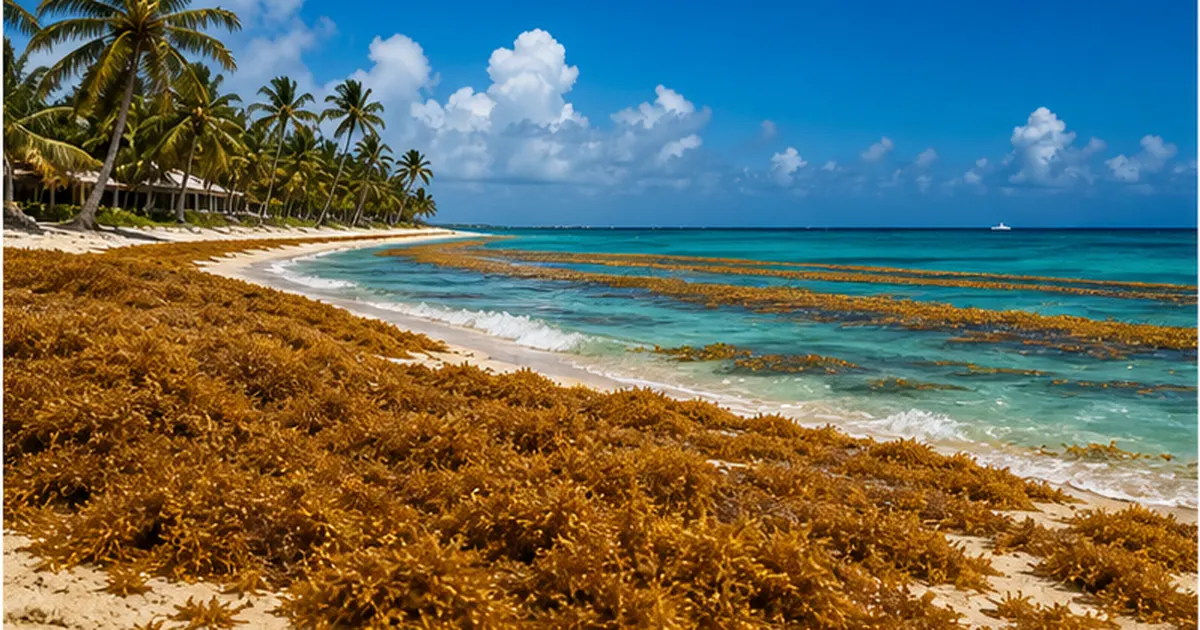
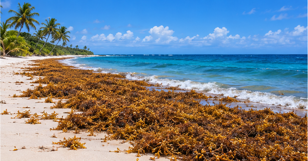
Around 2011, the situation changed. Huge amounts of Sargassum, rarely seen before, began arriving on the coasts of the Caribbean, West Africa and Brazil. The piled-up seaweed rots and smells, affecting resort beaches, fishing ports and even power plant intakes. Because of its color, the phenomenon is also called the "golden tide."
Where this article fits
The mechanism of the blooms themselves is explained in our existing article "Why Does Sargassum Bloom? The Truth About the Golden Tide." This article focuses on what happens after the seaweed reaches the coast (health, industry, ecosystems and countermeasures).
The "new normal" that began in 2011
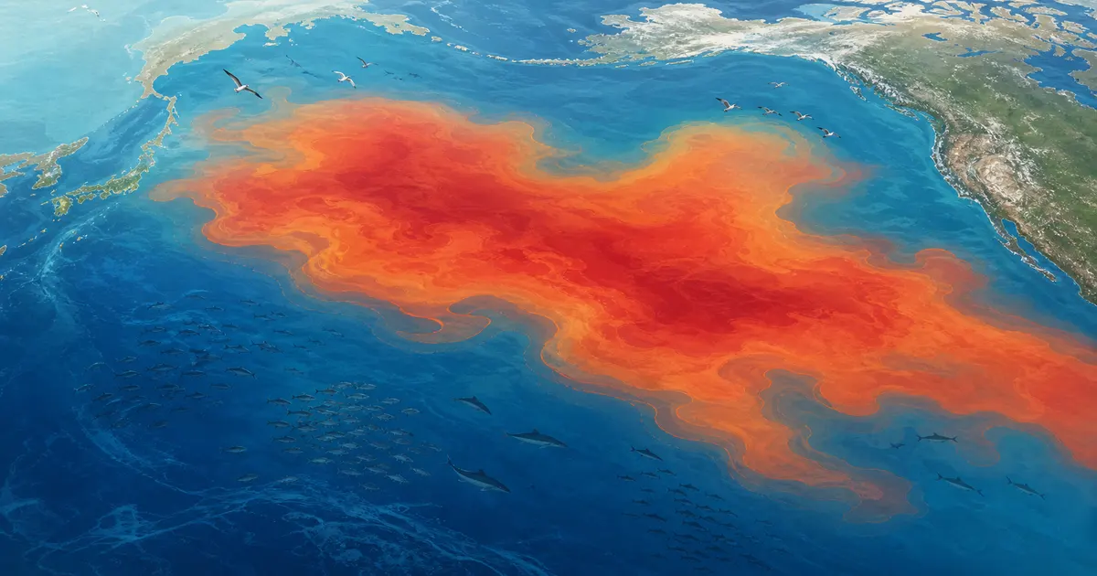
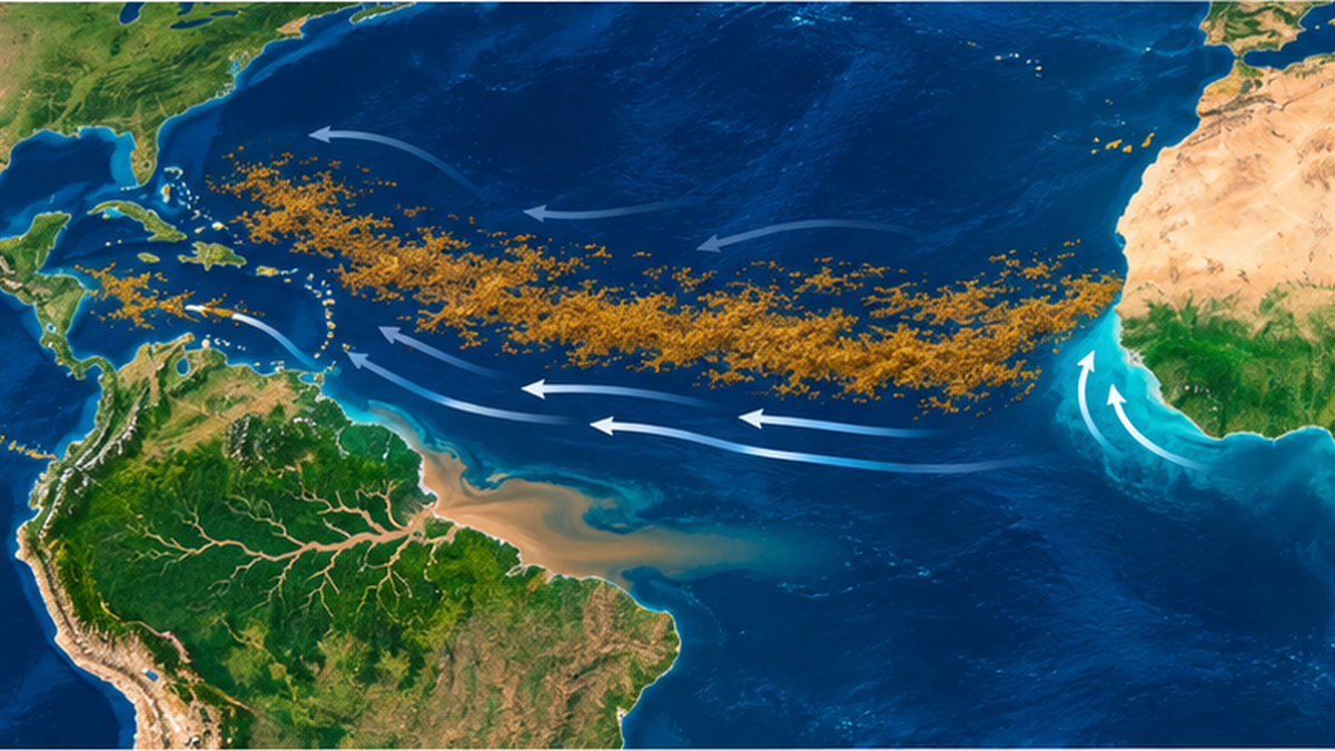
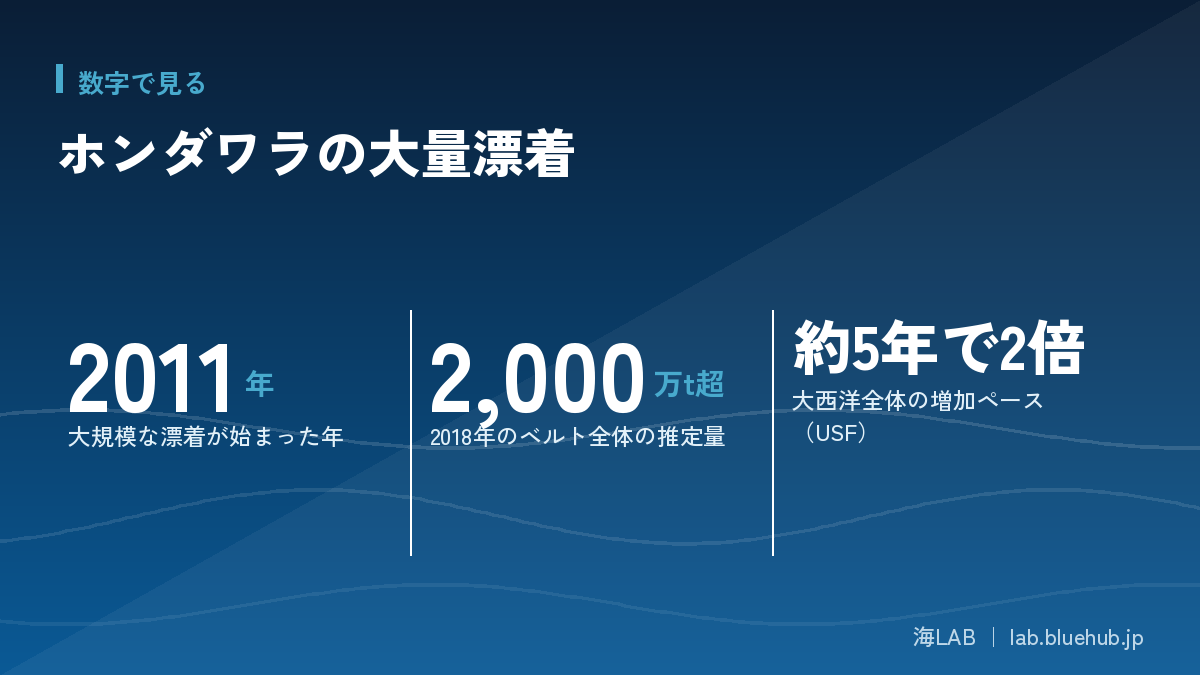
A 2019 study in the journal Science (Wang et al., vol. 365, pp. 83–87) used satellite records to systematically describe a huge east–west band of seaweed in the equatorial Atlantic, the Great Atlantic Sargassum Belt. According to the study, the 2011 bloom appears to have been triggered by nutrient input from the Amazon River in preceding years and other factors. There are also years such as 2013 with no bloom, so year-to-year variation is large.
Growth since then has been rapid. Observations by Prof. Chuanmin Hu and colleagues at the University of South Florida (USF) report that the total amount of Atlantic Sargassum has grown at a pace of more than doubling roughly every five years since 2011. Over 20 million tonnes of biomass were estimated for the whole belt in 2018, and in 2025 it reached one of the highest levels on record.
| Year | Event | Source / notes |
|---|---|---|
| 2011 | First large-scale strandings in the Caribbean, West Africa and Brazil | Wang et al. (2019) |
| 2013 | A year with no bloom (few seed populations the previous winter) | Wang et al. (2019) |
| 2018 | Over 20 million tonnes of biomass estimated for the whole belt | Wang et al. (2019) |
| 2025 | One of the largest on satellite record (about 37–39 million tonnes) | USF Optical Oceanography Lab |
| 2026 | Second-highest year on record as of June; Caribbean Sea and Gulf of Mexico at record highs | NASA Earth Observatory / USF |
The Sargasso Sea and Sargassum: a floating seaweed known for a long time
Floating Sargassum is by no means a new discovery. The Sargasso Sea lies near the center of the North Atlantic subtropical gyre, surrounded by currents. Strong flows such as the Gulf Stream act as an invisible wall around it, and inside, surface water swirls slowly. Floating Sargassum gathered in this calm area.
It also appears in Columbus's logs
Columbus's logbook from the late 15th century is said to record large amounts of seaweed drifting on the Atlantic surface. A well-known anecdote says sailors feared the seaweed would entangle their ships. In reality ships rarely become immobilized by it, but a "sea of seaweed" has long stirred the imagination.
Moves to protect the sea area
The Sargasso Sea lies on the high seas beyond national jurisdiction. In 2014, surrounding countries and others signed the Hamilton Declaration, and the Sargasso Sea Commission was established. The declaration is known as an international cooperation framework for conserving the Sargasso Sea ecosystem. It is a valuable open-ocean habitat, yet a separate problem, mass strandings on coasts, has overlapped in recent years, so the same seaweed now has two faces: something to protect and something to deal with.
What changed before and after 2011
Before 2011, large accumulations of Sargassum were mostly limited to the Sargasso Sea and parts of the Gulf of Mexico. After 2011, the seaweed began to form bands across a wide area of the tropical Atlantic, including near the equator. A key feature of the recent stranding problem is that this band flows further west and reaches the Caribbean. This shows a source and transport route different from the traditional "floating seaweed of the Sargasso Sea," and researchers have begun to treat it as a new normal.
Why it blooms in the Atlantic: currents, nutrients and temperature
Why has floating seaweed in the open ocean increased this much? Researchers cite not a single factor but several conditions thought to have overlapped. Here is an overview.
West African upwelling and Amazon outflow
The study by Wang et al. concludes that winter upwelling off West Africa (deep, nutrient-rich water rising) and spring-to-summer Amazon River discharge governed the increase since 2011 and its year-to-year variation. Deforestation and fertilizer use in the Amazon basin may be linked to rising nutrients, but the authors themselves state that part of the causal chain is inferred and further research is needed.
Currents as a "conveyor belt"
Floating Sargassum cannot move by itself. It is carried west to the Caribbean and Gulf of Mexico by currents and winds near the equator. So even for the same bloom, what reaches which coast changes greatly with currents and wind. In the 2026 example, NASA reported that Florida's west coast was spared while large amounts reached the Florida Keys and the east coast.
Key points to remember
- The main cause is thought to be a combination of factors such as nutrients, currents and temperature
- Year-to-year swings are large, so next year cannot simply be predicted from this year
- Part of the causal chain is still inferred; research is ongoing
Counting seaweed from satellites: how monitoring and forecasting work
How do we measure the amount of seaweed floating on the surface? We cannot survey the vast open ocean by ship alone, so satellite observation plays the central role.
The idea of the Floating Algae Index (FAI)
Prof. Hu and colleagues at USF used the fact that floating algae strongly reflect near-infrared light to develop an index that distinguishes them from seawater. Called the Floating Algae Index (FAI), it lets satellite sensors such as MODIS map the area and distribution of seaweed. The MODIS record begins in March 2000, which makes it possible to confirm the change around 2011 as a long time series.
From area to weight
What satellites directly detect is the "area" of the sea surface covered by seaweed. Converting it to "weight (biomass)" requires combining it with field data on the density and thickness of collected seaweed. Figures reported in the news such as "about 38 million tonnes" are estimates based on this conversion. Numbers can differ slightly between reports depending on the conversion method and how months or years are taken. When reading them, it helps to check when, over what area and by what method the estimate was made.
Forecasts reach "a few months ahead"
The USF Optical Oceanography Lab publishes outlooks up to a few months ahead based on satellite image analysis. The June 2026 outlook reported that both the Caribbean Sea and the Gulf of Mexico reached record highs. However, which coast it actually reaches changes with wind and currents. Broad forecasts are useful, but accurately predicting the amount on an individual beach is still difficult.
Tips for reading the numbers
- "Area" and "weight" are different quantities; values change with the conversion method
- Distinguish monthly peaks from annual totals
- Check news figures against primary sources (USF, NASA)
What happens after it reaches the coast: decay and gas
Floating Sargassum is not necessarily "trash." Things become serious all at once after it is thrown onto the beach.
How decay progresses
Seaweed piled on the shore starts to decompose within days under sun and heat. In the process, microbes use sulfur-containing compounds to produce hydrogen sulfide (H₂S). This gas smells like rotten eggs and irritates the eyes, nose and throat even at low concentrations. Concentrations tend to be high where seaweed is thickly piled, and problems grow in poorly ventilated coves and near settlements.
Health effects: views differ between agencies
Assessments of health effects vary. A clinical study in Martinique (Clinical Toxicology, 2021) analyzed 154 patients seen during the mass stranding of 2018 and estimated that people living in heavily affected areas could be exposed to hydrogen sulfide above 5 ppm for about 50 days a year. A 2024 study of 685 people in Science of the Total Environment also indicated an association between chronic exposure to low-to-moderate concentrations and central sleep apnea.
In contrast, Florida Department of Health material takes the position that the main effect of hydrogen sulfide is eye, nose and throat irritation and that other health effects are not normally expected. Observational studies cover limited groups, and conclusions about chronic effects are not settled. For that reason, without declaring it dangerous or claiming it is safe, precautions such as staying away from seaweed piles and not lingering in poorly ventilated places are a realistic way to prepare.
| Perspective | Main points | Notes |
|---|---|---|
| Acute effects | Irritation of eyes, nose and throat, headaches, etc. | Severe symptoms have been reported at high concentrations |
| Chronic effects | Associations such as with sleep apnea have been reported | Observational studies; causation not established |
| Official positions | Some say irritation is the main effect, depending on the region | Check the latest local guidance |
Caution
This article is general information and not medical advice. If you feel unwell, follow the instructions of local health authorities or medical institutions.
Impacts differ by region: Caribbean, West Africa and Brazil
Mass strandings are not a problem of a single region. Depending on currents and winds, where it arrives and how it affects people differ.
The Caribbean and Gulf of Mexico
The most closely watched is the Caribbean coast with its many tourist areas. Mass strandings are reported almost every year in Mexico's Yucatán Peninsula (Quintana Roo), Florida and the West Indies. NASA, based on USF observations, reported that in 2026 both the Caribbean Sea and the Gulf of Mexico reached record-high levels.
West Africa
Strandings are also a problem on the West African coast, close to the bloom area. In fishing villages such as those in Ghana, seaweed piled on the shore is reported to hinder small boats and the use of nets and to raise sanitation concerns. Compared with tourism, the impact on local fishing and livelihoods is a distinguishing feature.
Northeastern Brazil
Strandings have also increased on the coast of northeastern Brazil since the 2010s. This region near the equator is close to the source, and when and how much arrives is closely tied to Amazon outflow and currents.
| Region | Main impacts | Characteristics |
|---|---|---|
| Caribbean and Gulf of Mexico | Tourism, beach odor, effects on coral reefs and seagrass | High dependence on tourism; large economic impact |
| West Africa | Fisheries, sanitation | Direct impact on livelihoods |
| Northeastern Brazil | Coastal strandings, tourism | Close to the source; large year-to-year variation |
Blows to tourism, fisheries and infrastructure
Sargassum strandings do more than spoil the scenery of beaches. The more a region depends on tourism, the larger the economic impact.
Tourist beaches
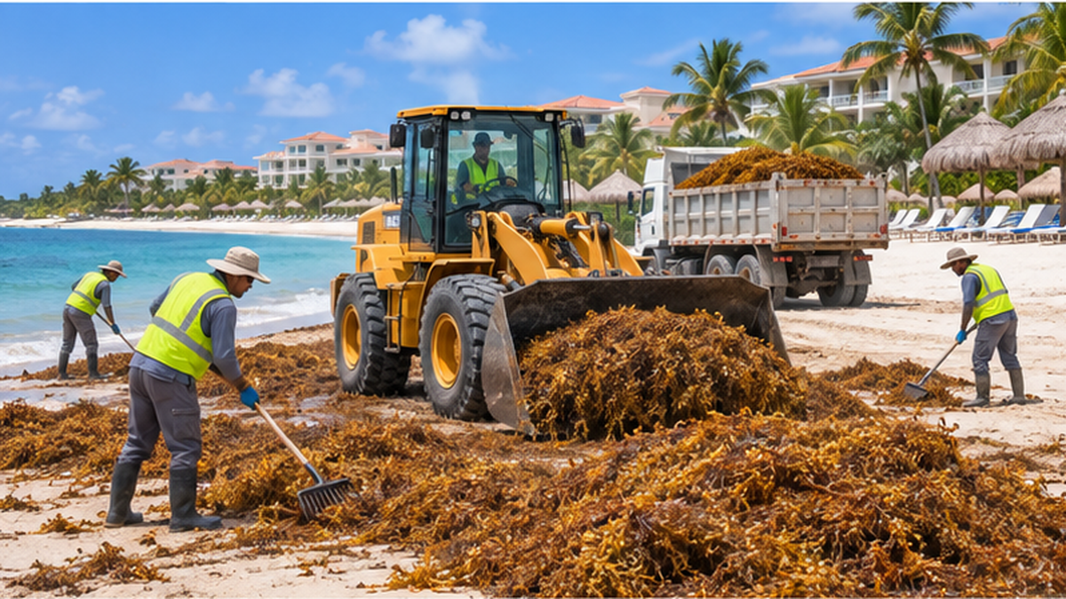
Caribbean resorts sell white sand and clear water. When brown seaweed piles tens of centimeters thick and smells, guest satisfaction is directly affected. In Quintana Roo, Mexico, seaweed is collected daily with heavy machinery and manual labor, but local media report that collection capacity covers only about 30% of what arrives (figures for volume and cost vary by reporting body and time).
Fisheries and ports
Layers of stranded seaweed hinder boats entering and leaving harbor and tangle in nets and propellers. They also affect coastal aquaculture and animals that spawn on shallow bottoms. In West Africa, including Ghana, strandings are reported to affect catches and sanitation in fishing villages.
Power plants and seawater intake
Power plants and desalination facilities that use seawater for cooling risk having intakes clogged by seaweed. Because Sargassum holds a lot of water, collection and transport are also costly.
The impact is not limited to the direct cost of collection. If travelers cancel bookings after seeing seaweed or repeat visitors decline, the effect spreads to lodging, restaurants, transport and souvenir shops. Residents' living environments suffer from odor, and some worry about property values. Such indirect economic losses are hard to calculate, and published figures vary widely depending on the scope and method of the survey.
The burden on those responding
For municipalities, where to put the collected seaweed is also a headache. Freshly collected seaweed contains sand, salt and shell fragments and is full of water, so burying it as is lets it decompose and release odor and gas. Continuous budgets are needed for trucks and machinery for transport, securing disposal sites, and even workers' health management. In Mexico both state budgets and federal investment are being used, which shows the scale.
What is happening under the sea: the two faces of the ecosystem
Sargassum tends to be spoken of as a villain. But floating Sargassum in the open ocean is originally also a valuable habitat for many creatures.
A "floating forest" in the open ocean
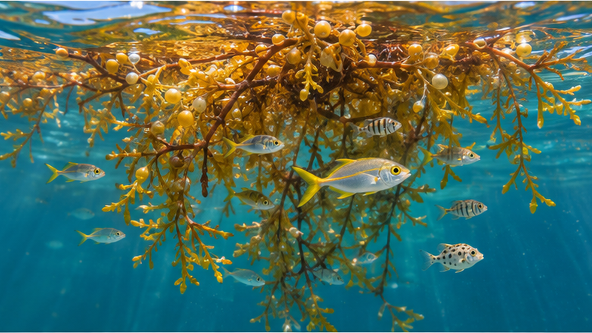
Floating Sargassum in the Sargasso Sea shelters juvenile fish, crustaceans and young sea turtles. The area is also known as a passage for eel larvae, and floating seaweed serves as an oasis in the open ocean. The U.S. National Oceanic and Atmospheric Administration (NOAA) also designates Sargassum as "essential fish habitat."
Effects on coral reefs and seagrass beds
When seaweed accumulates thickly in shallow waters near the coast, less light reaches coral reefs and seagrass beds. Both the symbiotic algae of corals and seagrass need photosynthesis, so a long period in shade slows growth. There is also concern that as the seaweed decomposes, nutrients in the water increase and other algae grow more easily. Coral reefs already face bleaching from rising sea temperatures, so this is noted as a compound stress. For corals, reading our existing article "What Is a Marine Heatwave?" also helps with the background.
It reverses when there is too much
The issue is amount and timing. Seaweed washing ashore in excess blocks sunlight and casts shade on seagrass beds and coral reefs. Because oxygen is consumed during decomposition, coastal water can become hypoxic and mass fish deaths can occur. Piled on beaches where sea turtles nest, it can make it hard for mothers to come ashore and affect eggs and hatchlings.
Summary of the two faces
- In the open ocean it works as habitat for juvenile fish and sea turtles
- Excessive coastal strandings cause low oxygen, shading and worse nesting grounds
- Think of it not as good versus bad but as a matter of amount and place
Japan's Sargassum and "nagare-mo" (drifting seaweed): a familiar viewpoint
Japan's seas also have many kinds of Sargassum. Species such as hondawara, akamoku and yatsumata-moku form seaweed beds in many places and serve as spawning grounds and shelter for fish. From spring to early summer, "nagare-mo" torn from rocks and drifting on the surface have long been known as places where juvenile fish, including young yellowtail (mojako), take shelter. Juveniles attached to nagare-mo have been caught as seedlings for farmed yellowtail (hamachi).
Akamoku is also food
In Japan there are regions where akamoku (also called gibasa) is a familiar food, known for its sticky texture. The fact that the same Sargassum group becomes a nuisance when piled on a coast but food in some regions shows the breadth of how people relate to seaweed.
Could it happen in Japan too?
The Atlantic bloom does not directly affect Japan. However, in China's Yellow Sea, green tides of a different seaweed (the green alga Ulva prolifera) have occurred almost every year since around 2007 and wash up in large amounts along the Shandong Peninsula. Mass seaweed strandings are becoming a shared issue around the world. For more background, see our existing article "Why Does Sargassum Bloom? The Truth About the Golden Tide."
Countermeasures: stop it offshore, collect it on the beach
Countermeasures fall broadly into three stages: catching it offshore, blocking it along the coast, and collecting it on the beach. All cost money, and no single decisive solution exists yet.
1. Early monitoring and forecasting
Satellite observation and forecasting are the foundation of countermeasures. The USF Optical Oceanography Lab and others analyze satellite images to estimate the amount and position of seaweed and publish outlooks several months ahead. This lets municipalities and tourism operators prepare personnel and equipment for collection in advance.
2. Barriers offshore and along the coast
To keep seaweed from reaching beaches, floating barriers (fences) are used in various places. In Quintana Roo, Mexico, barriers several kilometers long have been laid, and the federal government's first phase is reported to invest about 768.7 million pesos to provide collection vessels and barriers. However, they are easily damaged in high waves and maintenance is a heavy burden.
3. Early collection and reuse
The earlier seaweed on the beach is collected before decay advances, the more odor and environmental burden can be reduced. Research and commercialization of uses after collection are under way, including fertilizer, building materials (blocks and bricks), biogas, and raw material for paper and textiles. However, the seaweed may contain salt and heavy metals such as arsenic, so safety must be confirmed depending on the use.
Weighing cost and effect
Every method has strengths and weaknesses. Barriers can protect beaches, but the large amount stopped offshore must still be collected by boat. Faster collection limits decay but raises personnel and equipment costs. For reuse, whether demand can be created is the key to profitability. For this reason, many experts recommend not relying on a single measure but an "integrated management" approach combining forecasting, prevention, collection and reuse.
Nutrient management as a fundamental measure
Since nutrients from areas such as the Amazon basin are suspected to underlie the blooms, in the long run fertilizer use and forest management on land also become subjects of discussion. However, measures across large river basins that cross national borders cannot be advanced by one country alone. A viewpoint is needed that treats the ocean problem as a land-use and agriculture problem.
| Stage | Main methods | Challenges |
|---|---|---|
| Monitoring and forecasting | Satellite observation; publishing outlooks months ahead | Forecast accuracy; response capacity on site |
| Offshore and coastal | Barriers, collection vessels | Damage from waves; cost |
| Beach | Collection by machinery and manual labor | Speed before decay; disposal and transport costs |
| Reuse | Fertilizer, building materials, biogas, etc. | Heavy metals and salt; profitability |
What we can do and what will be asked next
It may sound like a story about the faraway Caribbean. But behind mass strandings are global-scale changes such as nutrients from land, rising sea temperatures and shifting currents. Here are points that also concern us in Japan.
As a traveler
If you visit the Caribbean, Mexico, Florida or similar places, it is useful to check the latest local stranding information (from municipalities, tourism boards, USF forecasts, etc.). Basic care also matters, such as not approaching seaweed piles, and taking particular care with small children and people with respiratory conditions.
As a consumer and citizen
Reducing nitrogen and phosphorus runoff from land is also common to measures against red tides and eutrophication in Japan. Our existing article "Where Do Nitrogen and Phosphorus Come From?" explains nutrient loads from watersheds and ways to reduce them in detail.
Rethinking seaweed as a resource
Seaweeds including Sargassum are attracting attention for blue carbon (carbon storage in the ocean) and as food and materials. However, whether mass-stranded seaweed can become a "resource" must be verified in terms of both safety and cost. For a related topic, see also "The Potential of Seaweed and Algae Biofuels."
What you can do today
- Check the latest stranding information for your destination through public agencies or university forecasts
- Do not linger near seaweed piles; if you feel unwell, follow local instructions
- Take interest in Japan's seaweed beds and nagare-mo and learn about local conservation activities
参考文献・出典
- Wang et al. (2019) The great Atlantic Sargassum belt, Science 365 – The foundational paper on Sargassum blooms
- USF Optical Oceanography Lab: Sargassum Watch – Satellite observation and forecasting of seaweed
- NASA Earth Observatory: Sizing Up the Sargassum Belt – Scale in 2026 and regional conditions
- USF College of Marine Science: Scientists discover the biggest seaweed bloom in the world – The 2019 announcement
- PAHO: Sargassum invasion in the Caribbean(Rev Panam Salud Publica, 2019) – Warning on hydrogen sulfide and health effects
- Florida Department of Health: Sargassum – State health department view (check the latest materials)
- NOAA Fisheries: Sargassum – Position as fish habitat
- 環境省 – Information on Japan's marine environment
* Ordered by reliability: government and academic institutions > peer-reviewed papers > specialist bodies > reliable media