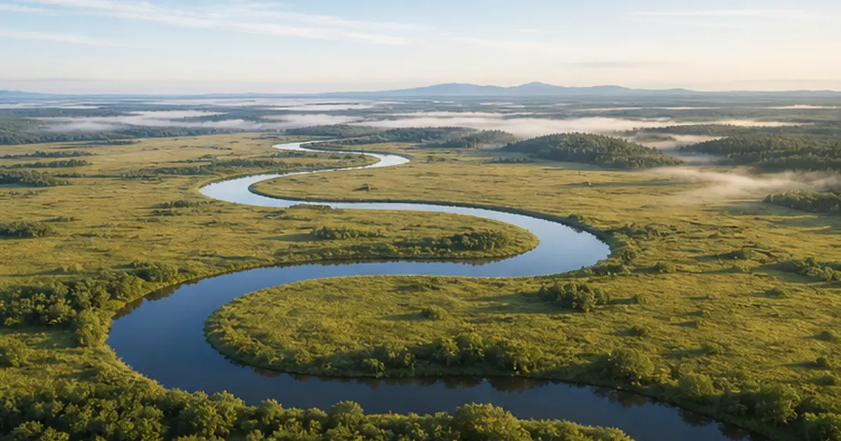
Scoop up river water and taste a faint hint of salt — if that's ever happened to you, it's a sign you live near a tidal river. Far inland from the coast, there are stretches near river mouths all over Japan where the water level rises and falls with the tide, and where seawater itself sometimes pushes upstream.
The tidal rivers and brackish-water zones covered in this article are a distinctive meeting point of freshwater and seawater — a cradle for creatures like the Japanese basket clam (yamato-shijimi) and mudskippers that can't survive anywhere else. At the same time, when drought or climate change pushes saltwater too far upstream, it can cause serious "salt damage," making it impossible to draw drinking or irrigation water.
The lower reaches of Japan's major rivers — the Tone, the Chikugo, the Shimanto — almost always include a tidal stretch. This article explains, based on primary sources, how tidal rivers work, the creatures that live in them, the saltwater-intrusion problems occurring in Japan and around the world, and the risks that climate change poses for the future.
What you'll learn in this article
- The difference between three related terms — tidal reach, brackish-water zone, and saltwater intrusion zone — and what each one covers
- How creatures such as the yamato-shijimi clam and mudskippers are adapted to a constantly shifting-salinity environment
- Why the physical phenomenon known as a "salt wedge" pushes upstream during droughts
- The history behind the construction of the Tone River estuary barrage, and the challenges that remain
- The future risks that climate change and sea-level rise pose to tidal rivers in Japan and worldwide
What is a tidal river? The stretch where the tide reaches upstream
In the lower reaches of rivers that flow into the sea, there are stretches where the water level and flow speed change periodically in step with the tide. This is called the tidal reach, and a river that includes such a stretch is called a tidal river. Japan's Ministry of Land, Infrastructure, Transport and Tourism (MLIT) defines a tidal river as one with a range where water level and flow speed change periodically along with tidal changes. At high tide, the river's flow can temporarily reverse or pool as if dammed — behaving in a way completely unlike the river further upstream.
Tidal reach, brackish-water zone, saltwater intrusion zone — three similar but different terms
Confusingly, there are several terms used to describe the lower reaches of a tidal river. The tidal reach refers to the range where water level and flow speed are affected by the tide, and doesn't necessarily mean seawater itself has entered. The brackish-water zone, on the other hand, refers to the area where river water and seawater actually meet and mix, defined as water with salinity between 0.5‰ and 30‰. The saltwater intrusion zone refers to the actual range that saltwater reaches upstream from the river mouth — if a barrage designed to block saltwater intrusion is in place, the zone is defined as extending up to that barrage.
In other words, the tidal reach is a matter of water level and flow speed — "how far the tide's influence reaches." The brackish-water zone is a matter of water quality — "where salinity is actually mixed in." And the saltwater intrusion zone is about the phenomenon itself — "how far the saltwater has actually come." The three overlap but don't point to exactly the same range. This article uses "tidal river" as an umbrella term, switching to the more precise terms where needed.
| Term | Meaning | How the range is determined |
|---|---|---|
| Tidal reach | The stretch where water level and flow speed vary with the tide | Range where tidal level changes are observed |
| Brackish-water zone | The area where freshwater and seawater mix, with salinity of 0.5–30‰ | Measured salinity values |
| Saltwater intrusion zone | The range saltwater actually reaches upstream from the river mouth | Up to any saltwater-blocking structure, if one exists |
Where freshwater and seawater clash: a highly variable environment
In brackish-water zones, the tidal movement of saltwater stirs up fine sediment from the riverbed, creating turbid "high-turbidity water masses" — meaning both water quality and water volume change dramatically. Shimane University's research division on brackish-water ecosystems lists three fundamental traits of these zones: extremely large environmental fluctuation, extremely high biological productivity, and high vulnerability to human activity. This sheer degree of fluctuation is the starting point for understanding what a tidal river really is.
Tidal reach length varies greatly from river to river
How far a tidal reach extends depends heavily on a river's gradient and flow volume. In steep, fast-flowing mountain rivers, the tidal reach can be limited to just a few hundred meters from the mouth. By contrast, rivers flowing through gentle alluvial plains — like the Tone River across the Kanto Plain, or the Chikugo River — can be influenced by the tide for 20km or more from the mouth. Even though we use the single word "river" for all of them, the face each one shows in its lower reaches can be completely different.
How it's actually monitored
Saltwater intrusion in tidal rivers is tracked using salinity meters and water-level gauges installed along the riverbank, continuously logging changes over time. Even in urban rivers, university researchers bring measuring equipment into the field to record the actual characteristics of tidal and saltwater intrusion, and this steady accumulation of observational data underpins decisions about barrage operation and water-intake management during droughts. A tidal river isn't just "vaguely under the tide's influence" — it's a river under continuous, numerical monitoring.
Tidal rivers exist all across Japan
Tidal reach length varies greatly from river to river. Rivers flowing through gently sloping lowland plains tend to have longer tidal reaches — the Tone and Chikugo rivers, for instance, feel the tide's influence for 20km or more from their mouths. Urban rivers such as the Arakawa, Sumida, and Old Edo rivers are tidal rivers too — this environment exists right alongside our everyday lives.
Why does seawater push upstream? The mechanics of the salt wedge
The main reason seawater pushes upstream in a tidal river is the density difference between freshwater and seawater. Because seawater contains more salt, it's denser and heavier, so it creeps upstream along the riverbed in a wedge shape. This phenomenon is called a "salt wedge," producing a two-layer flow: freshwater flowing seaward on top, and seawater intruding upstream underneath.

When tides, drought, and terrain align, intrusion reaches further
How far a salt wedge reaches upstream depends on several conditions coming together. At high tide, sea level rises and saltwater is pushed in more easily; conversely, when the volume of freshwater flowing down from upstream (river discharge) is high, that momentum pushes the saltwater intrusion back. In other words, the less rain falls upstream and the lower the river's water volume — a drought period — the further saltwater tends to push upstream. In addition, rivers with a gentle riverbed gradient and greater depth provide terrain that's more conducive to a wedge-shaped seawater intrusion.
The "reversal" observed on the Tone River
At the Tone River estuary barrage, located 18.5km from the river mouth, tidal fluctuation reaches roughly 1.5m, and it's known that at high tide the water level downstream of the barrage can rise higher than upstream — a phenomenon called the "reversal." The Japan Water Agency uses automatic controls, such as closing the gates at the moment this reversal occurs, to hold back the intrusion (backflow) of saltwater. Without a man-made structure like this barrage, that difference in water level would otherwise become a force pushing saltwater upstream.
- High tide: sea level rises, making it easier for saltwater to push in
- Drought: less freshwater flows from upstream, weakening the force pushing saltwater back
- Terrain: gentle gradients and greater depth make it easier for a salt wedge to intrude
- Man-made structures: estuary barrages and gates physically block saltwater intrusion
What's especially watched for is the moment high tide and drought coincide. When sea level peaks during a spring tide at the same time that low rainfall upstream has reduced the river's water volume, the balance between the force pushing saltwater back and the force pushing it in breaks down, and saltwater reaches far further upstream than usual. For those managing water-intake facilities, this becomes a tense period requiring constant monitoring, cross-checking tide tables against upstream dam discharge and rainfall forecasts.
Creatures that live only in brackish-water zones
A brackish-water zone, with its constantly shifting salinity, is a harsh environment for most living things. Yet, turning that harshness to their advantage, creatures uniquely adapted to brackish water have built their own distinctive ecosystems here. Many of them make use of a place with few predators, where organic matter flows in from both the freshwater and marine sides, as a rich site of biological production.

The yamato-shijimi clam and its wide salinity tolerance
If there's one creature that represents the brackish-water zone, it's the yamato-shijimi (Japanese basket clam). It dominates brackish lakes such as Lake Shinji and estuarine areas thanks to a physiological trait that lets it tolerate an extremely wide salinity range, from 0 to 22 psu (practical salinity units). Surveys of its habitat have also been conducted in the lower Arakawa River, confirming the same kind of adaptation in tidal rivers flowing into Tokyo Bay. The yamato-shijimi is also a filter feeder that strains organic matter from the water, playing a role in purifying water quality.
How gobies, mullet, and other brackish-water fish adapt
The fish community in brackish-water zones is often dominated by the yellowfin goby (mahaze), forming a distinctive community together with bottom-dwelling animals such as barnacles, mussels, and polychaete worms. These creatures have evolved mechanisms to regulate the osmotic pressure of their body fluids so they can withstand an environment where salinity can shift dramatically within hours. For juvenile fish, a brackish-water zone that's hard for large predators to enter makes an ideal nursery, and many marine fish species spend their early life here.
Ariake Sea endemics: mudskippers, blue-spotted mudskippers, and Coilia fish
The Ariake Sea, into which Kyushu's Chikugo River flows, is home to the mudskipper (mutsugoro), found in Japan only here and in Yatsushiro Bay. This goby relative, which crawls across the tidal flats using its pectoral fins, is a symbol of the Ariake Sea's mudflats. The blue-spotted mudskipper (tobihaze), also a member of the goby family, likewise lives in Japan only in the tidal reaches of rivers flowing into the Ariake Sea. In the Chikugo River's tidal reach, a brackish-water fish called Coilia (etsu) is also landed — a species found almost nowhere else in Japan except the Ariake Sea and the lower Chikugo River — illustrating just how distinctive an ecosystem a tidal river can nurture.
| Creature | Classification | Characteristics in brackish water |
|---|---|---|
| Yamato-shijimi clam | Bivalve | Wide adaptability, tolerating salinity of 0–22psu; also purifies water quality through filter feeding |
| Yellowfin goby (mahaze) | Fish (goby family) | Dominates the fish community of brackish-water zones; highly capable of regulating osmotic pressure amid salinity swings |
| Mudskipper (mutsugoro) | Fish (goby family) | An endemic species found in Japan only on the mudflats of the Ariake Sea and Yatsushiro Bay |
| Blue-spotted mudskipper (tobihaze) | Fish (goby family) | Found in Japan only in the tidal reaches of rivers flowing into the Ariake Sea |
| Coilia (etsu) | Fish | A brackish-water fish found almost exclusively in the Ariake Sea and the lower tidal reach of the Chikugo River |
Brackish-water zones are among the most biologically productive waters
- Nutrients flow in from both freshwater and seawater, nourishing abundant plankton and bottom-dwelling life
- They serve as a nursery ground supporting many marine fish species
- Creatures living in tidal-flat mud filter the water, contributing to water purification
The brackish-water bounty behind Japan's clam fishery
The yamato-shijimi is not just part of the ecosystem — it's also an important fishery resource supporting Japanese dining tables. Shimane Prefecture's Lake Shinji is known as one of the nation's leading yamato-shijimi fishing grounds, a prime example of how a brackish lake or zone can economically support a local fishery. For yamato-shijimi to thrive steadily in a brackish zone where salinity is prone to change, an appropriate balance must be maintained between freshwater supply from the river and salt supply from the sea — meaning that dam development or changes in water intake far upstream can affect fisheries at a river mouth many kilometers away.
A brackish-water ecosystem that works hand in hand with tidal flats
A tidal river's brackish-water zone usually forms a single ecosystem together with the tidal flats spreading out downstream. The mud of a tidal flat — submerged at high tide and exposed at low tide — is home to countless microorganisms and bottom-dwelling animals that break down and absorb organic matter flowing in from the river. Creatures of the tidal river, such as the yamato-shijimi, yellowfin goby, and mudskipper, can only maintain their populations because this tidal-flat "stage" exists. Protecting the tidal river alone isn't enough — if the tidal flats at its mouth are lost, many of the creatures that depend on them lose their habitat too.
Walking Japan's tidal rivers — the Tone, Chikugo, and Shimanto
The character of a tidal river differs greatly depending on the river. Here we look at the tidal reaches of three rivers with very different personalities: the Tone River, which supports the capital region; the Chikugo River, which nurtures endemic species of the Ariake Sea; and the Shimanto River, known as "Japan's last clear stream."
The relationship between tidal rivers and human life is by no means a modern development. In the Edo period, river transport that made use of the tide's ebb and flow was common on tidal rivers across the country. Riding the flood tide, boats could travel upstream without relying on human or wind power, and on the ebb tide, they could return downstream just as quickly. Tidal rivers have long supported people's lives in terms of logistics and transportation, too.

The Tone River — the tidal river that supports the capital region's water supply
The Tone River, which flows across the Kanto Plain, is one of Japan's foremost tidal rivers — saltwater has been recorded reaching more than 40km upstream from the mouth (near Katori City). Its lower reach is home to the Tone River estuary barrage, discussed later, which handles both the intake of urban and agricultural water and the prevention of salt damage.
The Chikugo River and the Ariake Sea — a cradle for endemic species
The Chikugo River, Kyushu's largest, has a tidal reach of about 23km near its mouth before flowing into the tidal-flat-lined Ariake Sea. The mudskipper, blue-spotted mudskipper, and Coilia fish introduced in the previous section can only sustain their populations because the Chikugo's tidal reach and the Ariake Sea's tidal flats form one integrated environment. The Ariake Sea's tidal flats are said to account for roughly 40% of all tidal flats in Japan — a striking example of just how tightly the ecosystems of a tidal river and its tidal flats are linked.
The Shimanto River — the brackish zone of "Japan's last clear stream"
On the Shimanto River in Kochi Prefecture, the brackish-water zone extends roughly 10km from the mouth to near the old Akatetsu Bridge in what was once Nakamura City. This zone is home to fish found nowhere else in the same way, such as the aka-me (a sea perch species) that lives only within about 6km of the river mouth, and the black-spot silver-belly (kuro-hoshi-manjūdai), rarely seen in any other river. The Shimanto River is also famous for its wild ayu (sweetfish); the ayu, too, is a migratory fish that passes through the river-mouth brackish zone to travel between river and sea, and its life cycle couldn't exist without that tidal reach.
The fundamental characteristics of brackish-water zones are extremely large environmental fluctuation, extremely high productivity, and high vulnerability to human activity.
— Shimane University, Center for Coastal Lagoon Ecosystem Research
Tidal rivers are closer to home than you'd think
Tidal rivers aren't only a story about major rivers in rural areas. The lower reaches of rivers flowing through large cities — the Arakawa, Sumida, and Old Edo rivers in the capital region; the Kiso Three Rivers (Kiso, Nagara, and Ibi) in the Tokai region; and the Yodo River, which flows into Osaka Bay in the Kansai region — are, more often than not, tidal rivers too. Even if we don't usually notice it, standing on a bridge near a river mouth is often enough to see a clear difference in water level between high and low tide.
- The Arakawa, Sumida, and Old Edo rivers (Tokyo) — representative tidal rivers flowing through the lowlands of Tokyo's eastern "Koto 5 Wards"
- The Kiso Three Rivers (Kiso, Nagara, Ibi; Aichi, Gifu, Mie) — the tide's influence spreads widely across the Nobi Plain
- The Yodo River (Osaka) — a major tidal river in the Kansai region, flowing into Osaka Bay
The urban and agricultural water problems caused by saltwater intrusion
While tidal rivers nurture rich ecosystems, when saltwater pushes further upstream than expected, it can cause "salt damage" that directly affects people's lives. If saltwater reaches an intake point, that water becomes unusable, as-is, for either drinking or agricultural purposes.
Water-intake failures caused by drought
On the Naka and Kuji rivers in Ibaraki Prefecture, when rainfall is scarce in early spring — just as agricultural water intake is increasing — reduced river flow can let saltwater push upstream, causing intake failures at facilities in the lower reaches. In the Tone River basin, too, the extreme drought of 1958 (Showa 33) caused serious water problems, with damages in Chiba Prefecture alone reaching 400 million yen. This kind of drought-triggered salt damage is a challenge that many regions with tidal rivers have experienced in the past.
Groundwater salinization: a hard-to-see crisis
The effects of saltwater intrusion aren't limited to the river water itself. Around tidal rivers, when the river's water level drops or groundwater is pumped excessively, saltwater from the sea side can intrude into underground aquifers — a process called "groundwater salinization." In areas that rely on well water for agriculture or daily life, water quality can be gradually degraded in ways that are harder to notice than changes on the river's surface.
What makes groundwater salinization particularly troublesome is that, once it progresses, recovery takes a long time. Salt that has intruded an underground aquifer can only be gradually diluted through rainwater infiltration and the natural flow of groundwater — a process that can take anywhere from several years to several decades. For this reason, many regions place great importance on preventive water management, such as keeping well-water extraction within the range that the aquifer can naturally replenish.
What goes wrong when salt damage occurs
- Water supply sources become saline, raising treatment costs or making intake impossible altogether
- Rice paddies exposed to saltwater see their crops wither, leading to agricultural damage
- Salt mixed into industrial water can cause unexpected trouble, such as equipment corrosion
Tokyo's zero-meter zone — an urban water problem living alongside a tidal river
The urban water problems caused by tidal rivers aren't limited to salt damage. Eastern Tokyo's "Koto 5 Wards" — Sumida, Koto, Adachi, Katsushika, and Edogawa — contain a "zero-meter zone," land whose elevation sits below sea level, surrounded by tidal rivers such as the Arakawa and Sumida. In Minamisuna 2-chome, Koto Ward, land subsidence caused by excessive postwar pumping of groundwater for industrial use and natural gas is recorded as having reached a cumulative total of about 4.5m. Roughly 1.5 million people live in this area, and in many stretches, the water level at high tide sits higher than the surrounding ground.
Although land subsidence itself has different direct causes from saltwater intrusion, both are rooted in the same history: people reclaiming and developing the low-lying land at a river's mouth. Once people live on land below sea level, they inevitably live alongside the risk of flooding and storm surges without levees and pumped drainage systems. A tidal river is at once a place that nurtures living creatures and a mirror reflecting how these cities have grappled with water.
The estuary barrage as a countermeasure — the case of the Tone River
To prevent serious salt damage, structures known as "estuary barrages" have often been built on Japan's major tidal rivers. Here, we look concretely at the role such a barrage plays, using the Tone River estuary barrage — Japan's best-known example — as a case study.

The history and purpose behind its construction
Construction of the Tone River estuary barrage began in 1965 (Showa 40) and was completed in 1971 (Showa 46). One of its main purposes was the prevention of salt damage — as noted earlier, saltwater has historically been recorded reaching over 40km upstream from the mouth (near Katori City). Since the barrage's completion, it has been able to stably supply roughly 20 cubic meters per second of urban water combined to Tokyo, Chiba, Saitama, and Choshi City.
Its effects, and the challenges that remain
By closing its gates at high tide, the estuary barrage physically blocks saltwater intrusion, keeping the water upstream fresh. This has greatly improved the stability of water intake, but it's also been pointed out that cutting off the river's continuity in this way can affect natural river processes such as fish migration and sediment transport. How to balance the sometimes-conflicting goals of preventing salt damage and conserving ecosystems is a common theme across many tidal rivers.
- Construction began in 1965, completed in 1971; located 18.5km from the river mouth
- Uses the high-tide water-level reversal, operating gates to suppress saltwater intrusion
- Supplies roughly 20 cubic meters per second combined for urban and industrial water
- Challenges remain on the ecosystem side, including effects on river continuity
Large-scale barrages like the Tone River's have been built on tidal rivers across Japan, most sharing the same goals of preventing salt damage and stabilizing water use. Their operation involves judging when to open and close gates by cross-checking real-time data on upstream dam discharge, tide levels, and salinity — adjustments that become especially delicate during drought periods. It's through this kind of steady, unglamorous water management that we're able to reliably use tap water and agricultural water every day.
Future risks from climate change and sea-level rise
The saltwater-intrusion problem facing tidal rivers is projected to grow even more serious due to climate change, because rising sea levels alone make it physically easier for saltwater to reach further upstream. Here we look at a simulation case within Japan, and at conditions already causing real damage in the Mekong Delta.
What the Yura River simulation shows
On the Yura River, which flows through Maizuru City in Kyoto Prefecture, Japan's Ministry of the Environment has run a simulation, as part of a regional climate adaptation consortium project, of how climate change will affect saltwater intrusion. Under the RCP8.5 scenario (which assumes greenhouse gas emissions remain high), sea level in Wakasa Bay is projected to rise by about 22cm by the mid-21st century and about 79cm by the late 21st century. The same simulation found that while the number of low-flow days is projected to decrease in the future during the May–November period when saltwater intrusion is most likely, the rise in sea level itself means that saltwater intrusion distance will extend further, with the risk that high-salinity conditions near intake points could persist for longer.
| Period | Wakasa Bay sea-level rise (RCP8.5) | Notes |
|---|---|---|
| Mid-21st century | About 22cm (range: 16–29cm) | Low-flow days trending downward from roughly 5 per year currently |
| Late 21st century | About 79cm (range: 66–92cm) | Sea-level rise is expected to further extend saltwater intrusion distance |
Saltwater intrusion advancing worldwide — the reality in the Mekong Delta
In this way, sea-level rise affects not only coastal erosion and storm-surge risk, but also pushes further inland via saltwater intrusion in rivers. This same kind of risk is expected to grow in the future not just on the Yura River but on gently sloping tidal rivers across Japan.
Looking overseas, saltwater intrusion is already causing serious agricultural damage in Vietnam's Mekong Delta. Research has assessed the impact of saltwater intrusion under scenarios of a 20cm sea-level rise and 15% reduction in river flow by the 2030s, and a 45cm rise with a 29% reduction by the 2090s. During a major salt-damage event from 2015 to 2016, damages reached about 1.5 trillion Vietnamese dong (roughly 7 billion yen). Recent research has pointed out that a factor even stronger than sea-level rise or land subsidence in intensifying saltwater intrusion is the reduction in sediment supply and riverbed dredging caused by upstream dam construction. In areas where dry-season rice farming has become difficult, adaptation measures are underway, including switching to salt-tolerant crop varieties and converting rice paddies to shrimp farming. In recent years, restoring mangrove forests — which act as a natural breakwater, softening the force of saltwater intrusion and storm surges — has also drawn attention as an adaptation measure for river-mouth areas.
More than one factor drives saltwater intrusion
- Sea-level rise itself (climate change)
- Reduced river flow from increased upstream water intake or dams
- Increased water depth from reduced sediment supply and riverbed dredging caused by dams
- Relative sea-level rise caused by land subsidence
Visiting and enjoying tidal rivers and brackish-water zones
Up to this point, we've mostly focused on challenges like salt damage and climate-change risk. But tidal rivers and brackish-water zones are, at heart, nature you can enjoy up close. There are more places than you might expect where you can actually go and feel, firsthand, the planetary rhythm of the tides.
Timing your visit around low tide
To observe the creatures of a tidal flat or brackish-water zone, check the tide tables published by the Japan Meteorological Agency or the Japan Coast Guard, and aim for the period around low tide during a spring tide. This is when the water level drops the most, revealing tidal flats that are normally hidden underwater. The Ariake Sea boasts one of the largest tidal ranges in Japan — reaching roughly 6m during spring tides — and at low tide, its tidal flats stretch out far into the distance, a sight rarely seen along other coasts.
Events where you can get hands-on with tidal-flat life
In Kashima City, Saga Prefecture, which faces the Ariake Sea, a unique annual event called the "Kashima Gatalympic" takes place on the tidal flats. Started in 1984 on the initiative of local young people, this event has participants competing in games while covered in mud, drawing more than 1,000 participants each time. In this way, the tidal flats formed by a tidal river are both a treasure trove of living creatures and a place where people can experience the fun of nature directly.
Simply enjoying the river itself
You don't need to walk out onto a tidal flat to make discoveries — simply watching a tidal river itself can be rewarding. On the Shimanto River, sightseeing houseboats and excursion boats operate, letting visitors leisurely take in the river landscape, home to wild ayu and brackish-water fish, from near the water's surface. Even just watching the color of the water change from a bridge, or looking for signs of birds and fish from a riverbank near the mouth, is enough to sense the distinctive rhythm that a tidal river holds.
Tips for enjoying a tidal river
- Check the tide tables for the time of low tide during a spring tide before you go
- Wear clothing and footwear you don't mind getting dirty, since the ground on a tidal flat gets muddy
- Don't take creatures home — observe them and gently return them to where you found them
- Joining a guided tour run by a tidal-flat conservation group or visitor center will deepen your experience
Living alongside tidal rivers — a view toward conservation and coexistence
A tidal river is, in a sense, a "two-sided" environment: it poses flood and salt-damage risks to human life, while also nurturing creatures like the yamato-shijimi clam and mudskipper and naturally purifying water quality. Rather than treating this wide swing between the two sides as a nuisance to be eliminated, we need a perspective that understands its value and learns to live alongside it.
Brackish-water zones as an ecosystem service
The creatures of a brackish-water zone support our lives in ways that are easy to overlook — providing a nursery for juvenile fish, filtering organic matter, and maintaining water quality. Conserving tidal flats and brackish-water zones isn't just about protecting rare creatures; it's about sustaining an "ecosystem service" that ultimately returns benefits to human society in the form of fishery resources and water quality.
Tidal rivers in the age of climate change
As sea levels rise and drought patterns shift, the risk of saltwater intrusion is projected to keep growing. Given the limits and challenges of countermeasures built around structures like estuary barrages, approaches that rethink water use across an entire river basin — a "basin-wide flood management" mindset — and efforts that harness the natural buffering capacity of tidal flats and brackish-water zones themselves, will become increasingly important going forward.
Tidal rivers may not be something we think about often in everyday life. But once you learn that the water from your tap, or the clams in the miso soup on your table, are deeply connected to the ebb and flow of the tide at a river mouth, the way you see a river might change a little. The next time you have the chance to visit the mouth of a tidal river, take a moment to really look at that water's surface, which changes its expression between high tide and low.

Summary
- A tidal river is the lower reach of a river affected by the tide, with related terms including "brackish-water zone" and "saltwater intrusion zone"
- Creatures with unique adaptations, such as the yamato-shijimi clam and mudskipper, live in brackish-water zones
- Saltwater intrusion driven by drought and climate change causes urban and agricultural water problems in the form of water-intake failures
- Countermeasures like the Tone River estuary barrage bring both benefits and challenges
- Sea-level rise is projected to further increase saltwater-intrusion risk, both in Japan and worldwide, in the years ahead
References & Sources
- MLIT Water and Disaster Management Bureau, "Human Modification of Brackish-Water Zones and Its Effects on River Environments" – Definitions and characteristics of brackish-water zones
- MLIT, "Technical Standards for River and Erosion Control Surveys" – Definitions of tidal reach and saltwater intrusion zone
- Japan Water Agency, Tone River Estuary Barrage Office, "History" – Construction history of the Tone River estuary barrage
- Japan Water Agency, Tone River Estuary Barrage Office, "Q&A" – The barrage's role and water intake volume
- Climate Change Adaptation Information Platform, "Survey on the River Impact of Saltwater Intrusion Due to Sea-Level Rise, etc." – Simulation results for the Yura River basin
- Saga Ariake Sea Fisheries Cooperative, "Mudskipper (Mutsugoro)" – Ecology of an Ariake Sea endemic species
- Saga Ariake Sea Fisheries Cooperative, "Coilia (Etsu)" – A brackish-water fish of the Chikugo River tidal reach
- Shimanto City official website, "Aquatic Life in the Shimanto River" – The Shimanto River's brackish-water zone and its creatures
- Journal of Agricultural Meteorology (Japan), "Effects of Saltwater Intrusion Due to Sea-Level Rise and Reduced River Flow in the Mekong Delta" – Future projection scenarios
- Shizen-hatch, "The Advance of 'Salinization' Compounding Water Scarcity — Can Its Impact Be Stopped?" – Salt-damage case study from the Mekong Delta
- Kashima Gatalympic official website – Overview of the tidal-flat event on the Ariake Sea
※ Ordered by reliability: government and academic institutions > peer-reviewed papers > specialized organizations > trusted media