⚡ The answer in 30 seconds
- Estuaries and brackish water are zones of river–sea borderland where salinity of roughly 0.5–30‰ keeps shifting with tides and rainfall.
- Nutrients from rivers and benthic diatoms on tidal flats support a food web that nurtures Yamato clams, gobies and migratory birds.
- Tidal flats shrank by about 40% from 1945 to 1996, and estuary barrages and eutrophication add further pressure on brackish environments.
- Keeping salinity conditions through management and restoration, the satoumi idea and everyday actions are the keys to protecting brackish waters.
Where a river meets the sea lies a world of brackish water, neither fresh nor salty, home to Yamato clams, gobies, migratory birds and many other unique creatures.
These harsh, ever-changing salinity conditions are also highly productive thanks to nutrients carried by rivers. But reclamation, estuary barrages and water pollution have changed these environments across Japan.
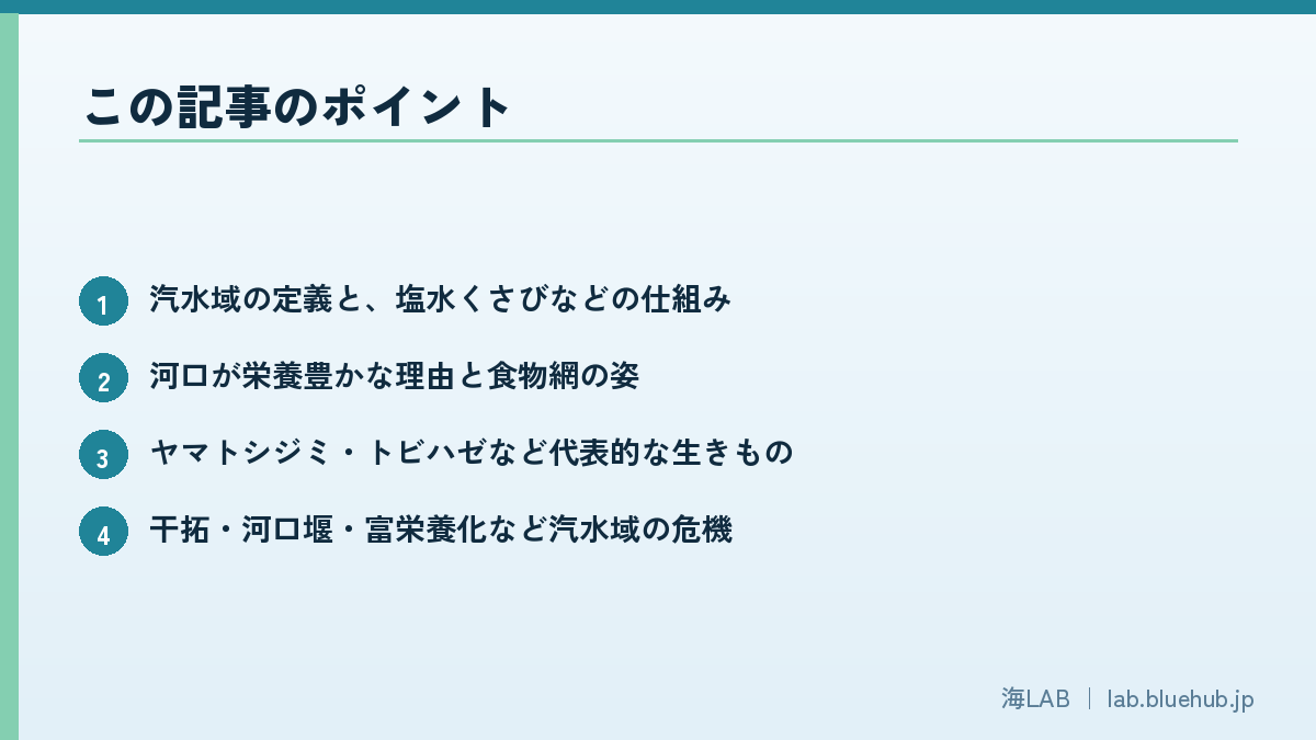
This article looks at how brackish waters work, their representative creatures, the crises they face now, and efforts to protect them.
What You Will Learn
- What brackish water is and how salt wedges work
- Why estuaries are rich in nutrients and how the food web works
- Key species such as the Yamato clam and mudskipper
- Threats: reclamation, estuary barrages and eutrophication
- The satoumi concept and what we can do
What Is Brackish Water? A "Salinity Gradient" Where River Meets Sea
A special environment created by a 0.5–30‰ salinity belt
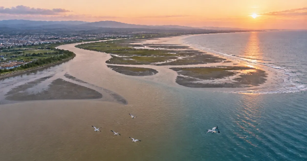
Standing at an estuary, you can see river flow and sea tide push against each other and mix. This mixed zone is brackish water, generally water with salinity of about 0.5–30‰ (parts per thousand). Fresh water is 0‰ and open-ocean seawater is about 34–35‰, so brackish water is a continuous "salinity gradient" between the two.
This gradient is not fixed. On a rising tide, seawater is pushed up the lower river; on an ebb tide, river water is pushed seaward. Heavy rain drops salinity sharply, while in dry spells seawater penetrates far upstream. Salinity swings widely within a day and across the year.
The "salt wedge" created by density differences
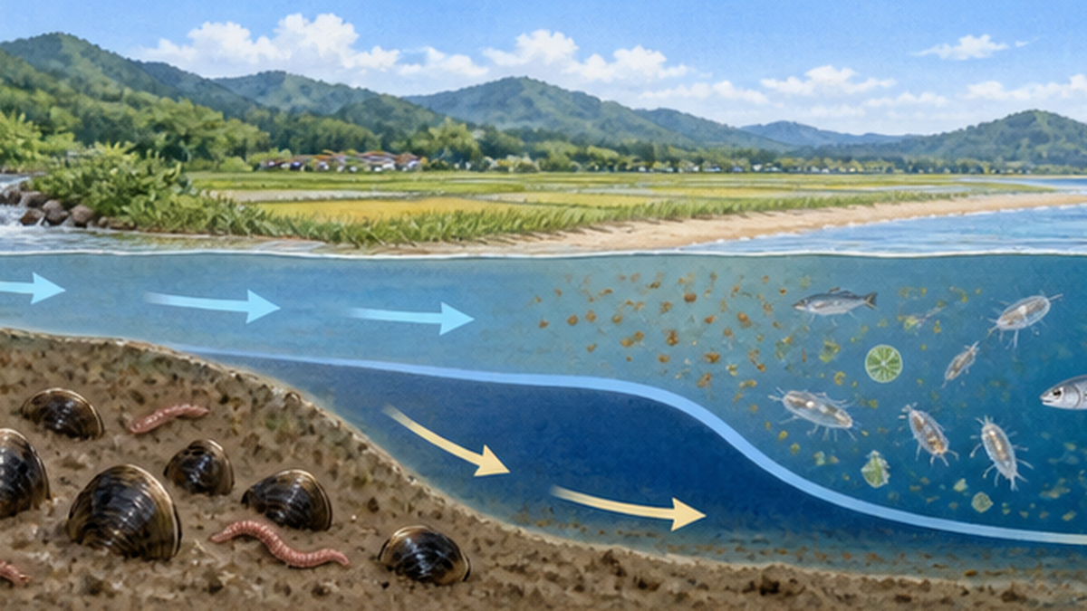
Seawater is heavier than fresh water, so when the river flows gently, seawater slips under the lighter river water as a wedge, forming two layers. This is called a salt wedge. The upper layer has low salinity and the lower layer high salinity, so the creatures living at one spot differ by depth. Clams and worms in the bottom mud experience salinity changes several times a day as the tide rises and falls.
Note: Intertidal zones vs. brackish water
- Intertidal zone: the band submerged at high tide and exposed at low tide; occurs on coasts and in estuaries alike
- Brackish water: water with salinity between river and sea, including tidal lower rivers, estuarine tidal flats and lagoons
- Estuarine tidal flats: where the two overlap, with especially high biodiversity
For definitions and classification, see our articles What Is Brackish Water? Life and the Impact of Estuary Barrages and Tidal Rivers: Salt Intrusion and Brackish-Water Life. This article focuses on what they did not cover: how the ecosystem works, its main players, and the crises now unfolding.
Why Are Estuaries So Nutrient-Rich? A Conveyor Belt Linking Land and Sea
Nutrients and organic matter carried by rivers
Rain that falls on forests, fields and cities carries nutrients such as nitrogen, phosphorus and silicon, plus organic matter from leaves and soil, down rivers to the estuary. Surface waters of the open ocean are often poor in nutrients, limiting phytoplankton growth. Estuaries receive a constant supply from rivers, making them highly productive.
Particles "filtered" by salt, and organic matter settling on the bottom
When river water meets seawater, fine suspended particles clump together under the influence of salt and sink more easily. Fine mud and organic matter therefore accumulate on estuary beds. This mud looks plain, but it is a rich food store for bacteria, diatoms, worms and shellfish living in it.
The "producers in the mud" at the base of the food web
On the surface of estuarine mud, microscopic algae called benthic diatoms photosynthesize and make organic matter. Bivalves, worms and small crustaceans eat them, and they in turn are eaten by gobies, crabs and migratory shorebirds. Organic matter from rivers and from the flats themselves together support a complex food web.
Role as a nursery for juvenile fish
Brackish water is also an important nursery for juveniles of fish that spawn at sea. Shallow waters with abundant food and few large predators act as safe, nutrient-rich nurseries. For how mangroves nurture juvenile fish, see Mangroves as the Sea's Cradle; temperate estuaries perform the same cradle function.
| Flow of nutrients | Players | Examples |
|---|---|---|
| Supply | River water and sediment | Nitrogen, phosphorus, silicon; organic matter such as fallen leaves |
| Production | Phytoplankton, benthic diatoms, reeds | Diatoms on flat surfaces, estuarine reed beds |
| Primary consumers | Shellfish, worms, small crustaceans | Yamato clams, polychaetes, amphipods |
| Secondary and higher consumers | Fish, crabs, birds | Gobies, juvenile sea bass, shorebirds |
| Decomposition and recycling | Bacteria and fungi | Decomposition of organic matter in mud, regeneration of nutrients |
Strategies of Creatures That Tolerate Changing Salinity
The invisible challenge of osmotic pressure
Body fluids contain salt, and when the salinity of surrounding water changes, the balance of osmotic pressure is upset. Marine fish tend to lose water, while freshwater fish tend to take in too much. Brackish water requires switching between these opposite challenges many times a day. Creatures there generally have fewer species than the open ocean or fresh water, but possess specialized physiology.
Shellfish close their shells and wait it out
Bivalves such as the Yamato clam can shut their shells tightly when salinity changes suddenly, isolating the body until conditions stabilize. They also adjust the concentration of body fluids at the cell level. But there are limits: if extreme low or high salinity lasts long, they run out of energy to stay closed and may die.
Fish regulate salt with gills and kidneys
Fish regulate salt and water using gills, kidneys and intestines. Migratory fish such as eels, salmon and ayu are thought to use estuaries as a "warm-up" zone to adjust their bodies before moving to the next environment. If an estuary is cut off, these fish cannot pass and their life cycle is broken.
Point: Brackish water is a world of "a few strong species"
- Few species, but each lives in large numbers, so they easily become fishery resources
- Species strong against salinity swings survive big changes, yet depend on the stable salinity pattern of the place itself
- When that pattern is disrupted (barrages, reclamation, drainage), adapted species suffer the most
Main Players 1: The Yamato Clam, Emblem of Brackish Water
A representative shellfish of Japan's brackish waters
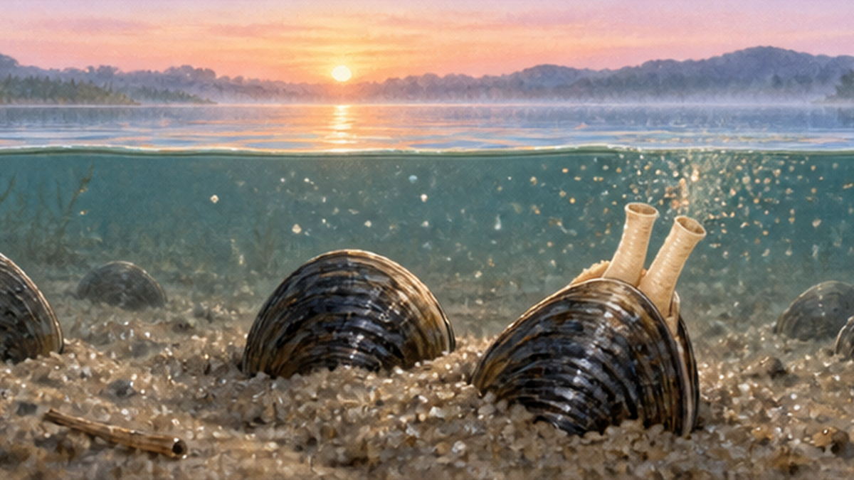
The Yamato clam (Corbicula japonica) is a bivalve living in estuaries and brackish lakes across Japan, the typical clam in miso soup. Unlike freshwater clams such as Masijimi and Sezeki clams, it lives in brackish water of moderate salinity and needs some salinity for spawning and larval drift. The very existence of properly salinity-maintained brackish water is thus a condition for its survival.
Fishery and fluctuating stocks at Lake Shinji
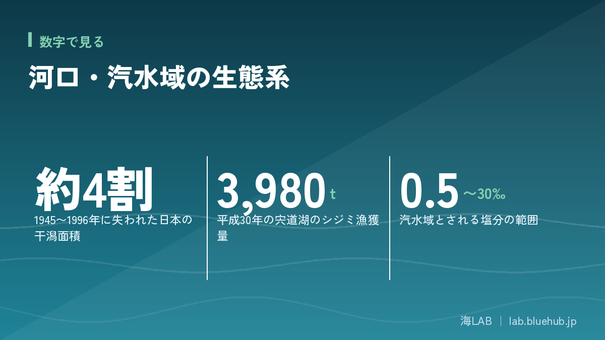
Lake Shinji in Shimane Prefecture is known as one of Japan's leading Yamato clam producers. According to prefectural materials, the 2018 clam catch was 3,980 tons, over 40% of the national catch, and Yamato clams account for over 90% of the lake's fishery products.
Stocks fluctuate greatly, however. A survey by the Shimane Prefecture Fisheries Technology Center estimated the spring 2024 (Reiwa 6) stock at about 31,000 tons (about 47.5 billion clams), down about 32,000 tons (51%) from about 63,000 tons the previous spring. No single cause is identified; salinity, oxygen-poor water, temperature and growth of algae and aquatic plants are thought to be involved. The prefecture manages stocks through limits on catch, fishing days and the mesh size of the dredge, plus juvenile release.
Also a "filter feeder" that cleans water
Bivalves draw water through siphons and strain phytoplankton and organic particles. Where many clams live, this filter feeding keeps water clear and draws organic matter to the bottom. Clams are thus both a fishery target and an ecosystem engineer that maintains water quality.
What the Yamato clam teaches us
- A "living indicator" that brackish salinity is maintained
- A fishery resource that also provides water-purifying ecosystem services
- Stock changes depend on multiple factors such as weather, salinity, low oxygen and aquatic plants
Main Players 2: Gobies, Crabs and Migratory Birds on the Mud
Goby diversity and dependence on brackish flats
Many goby species (family Gobiidae) live in Japan's estuaries and flats. Gobies are small and live in many ways: burrowing into mud or sand, digging holes, or crawling over the flats. The Ministry of the Environment's description of marine areas important for biodiversity notes that around the Obitsu River estuary tidal flat, the largest in Tokyo Bay, brackish fish such as Edo goby and flat-specific benthic animals such as Cerithidea rhizophorarum, thin-shelled clams and burrowing crabs have been recorded.
The mudskipper that leaps across the flats
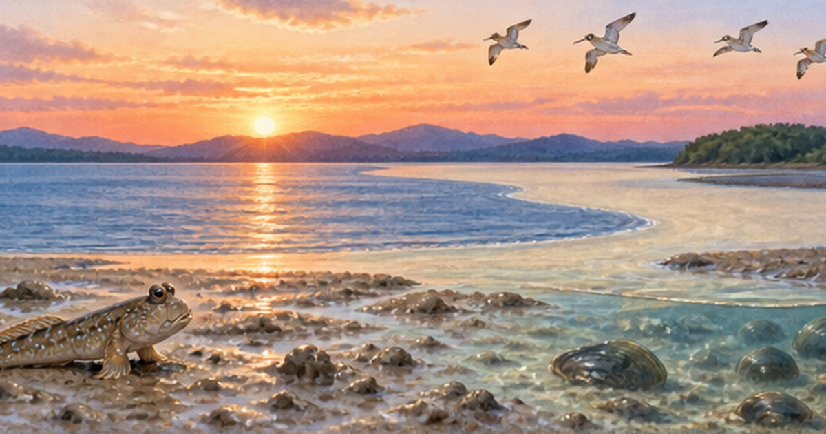
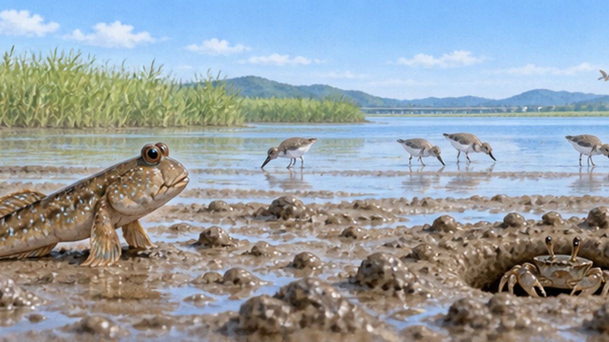
The mudskipper (Tobihaze) lives on muddy estuarine flats and salt marshes, propping itself on its pectoral fins to crawl and using its tail to jump. Spawning is June–August, when males build burrows and leap to attract females. It ranges from Tokyo Bay to Okinawa, but with its habitat lost to reclamation it is listed as Near Threatened in the Ministry of the Environment's Red List 2020.
A "refueling station" for migratory birds
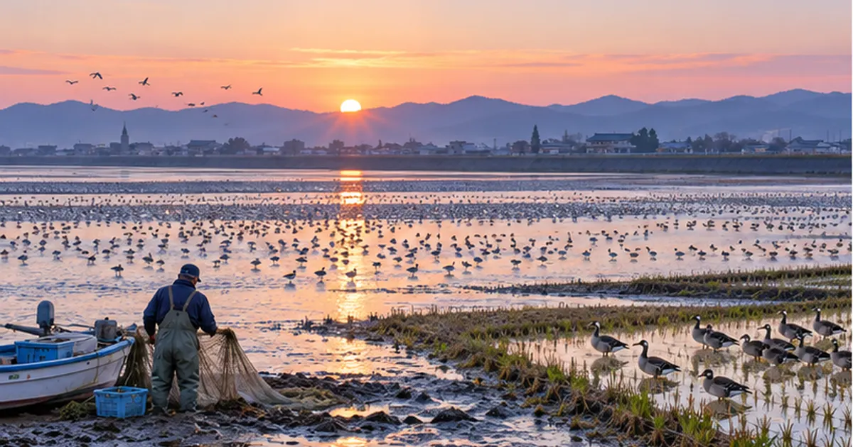
Tidal flats are essential stopover sites on migration routes linking East Asia and Australia, where birds restore energy before and after long flights. Abundant shellfish, worms and crustaceans in estuarine mud feed shorebirds. See Shorebirds and the Crisis of Tidal Flats for details.
| Creature | Habitat | Link to brackish water |
|---|---|---|
| Yamato clam | Sandy-muddy bottoms of estuaries and brackish lakes | Needs moderate salinity for spawning and growth; filtering helps water quality |
| Mudskipper | Muddy estuarine flats and salt marshes | Spawns on brackish flats; Near Threatened in MOE Red List 2020 |
| Gobies such as the Edo goby | Around estuarine flats | Depend on the environment specific to brackish flats |
| Crabs | Burrows in mud and reed beds | Decompose organic matter and stir the mud |
| Shorebirds | Whole tidal flats | Feed on shellfish and worms as a migration stopover |
Threats 1: Loss of Habitat to Reclamation, Landfill and Embankments
A history of lost tidal flats
According to the Ministry of the Environment's national survey, Japan had about 82,621 ha of tidal flats in 1945, about 53,856 ha in 1978 and about 49,380 ha in 1996—a loss of about 40% in half a century. Losses were large in inner bays such as Ariake Sea, Yatsushiro Sea and Tokyo Bay. Of about 3,857 ha lost from 1978 to 1992, 42% was due to landfill.
Development pressure concentrated on estuaries
Estuaries are flat and wide, easy to use for ports, factories and farmland, and have long been developed. Once embankments and concrete revetments are built, gentle shorelines and reed beds vanish and the salinity gradient and tidal exposure are lost. Creatures like the mudskipper that depend on continuous flat–salt-marsh habitat can no longer live there after even slight alteration.
The background to tidal flat reclamation is summarized in Why Were Tidal Flats Reclaimed?.
Lessons from the Isahaya Bay reclamation
In Isahaya Bay, Nagasaki Prefecture, the tidal embankment was closed in 1997, turning part of the vast flats at the head of the bay into dry land and fresh water. The merits and environmental impact of the project have been debated for years among fishers, government and researchers, with lawsuits. The common lesson is that altering tidal flats and brackish waters can affect not only the site but also surrounding marine ecosystems and fisheries.
Threats 2: Changes in Salinity and Flow from Estuary Barrages and Dams
The case of the Nagara River estuary barrage
On the Nagara River (Gifu, Aichi, Mie), an estuary barrage was built about 5.4 km upstream from the mouth and began full operation in 1995. It blocks saltwater intrusion to support water withdrawal and flood control. After operation began, the brackish environment above the barrage was lost, Yamato clams declined, and by 1999 almost none were caught upstream of it. The stop in tidal movement also reduced reed beds and benthic animals, and lower dissolved oxygen near the barrage was pointed out.
Since 2011 the Ministry of Land, Infrastructure, Transport and Tourism has run trial "more flexible operation" of the Nagara River barrage, bringing in seawater by gate operation, but evaluation of the effect and the degree of brackish recovery is still under debate.
When sediment flow is cut, the river mouth changes too
Dams and barrages stop not only water but also sediment. Less sediment reaching the mouth thins tidal flats and sandbars and accelerates coastal erosion. See Dams and Coastal Erosion. As estuary landforms shrink, so does the habitat of brackish creatures.
Note: River works are not about "finding villains"
- Barrages and dams were built for flood control and water use, real social needs
- The question is whether impacts are assessed in advance and operation can be revised
- Efforts to improve the environment through "flexible operation" are also under way
Threats 3: Water Pollution, Eutrophication and Climate Change
The problem of "too many" nutrients
Nutrients are the source of ecosystems, but too many cause abnormal phytoplankton blooms (red tides, blue-green algae). When the blooms die and decompose, oxygen is consumed heavily and the bottom layer becomes oxygen-poor. Brackish water, with a heavy, still lower layer under a salt wedge, tends to trap oxygen-poor water. Creatures living on the mud surface, like the Yamato clam, are thought to be vulnerable. For how nitrogen and phosphorus reach the sea, see Where Do Nitrogen and Phosphorus Reach the Sea From?.
Climate change and sea-level rise
Rising air and water temperature, changing rainfall patterns and sea-level rise alter salinity distribution. More extreme drought and downpours widen salinity swings and may exceed what adapted creatures can bear. Tidal flats with nowhere to retreat landward (backed by seawalls) may shrink as submergence time grows with sea-level rise, a concern known as "coastal squeeze".
Plastic waste inflow
Estuaries are also where waste carried by rivers finally accumulates. Plastic Waste Flowing from Rivers to the Sea can tangle in mud and reeds and may be taken up by benthic animals as microplastics.
Protecting and Restoring: The Satoumi Idea and What We Can Do
Restoration efforts
Efforts to restore brackish waters and flats are under way across Japan: regrading revetments to gentle slopes, restoring reed beds, reviewing barrage operation and releasing juvenile clams to support stocks. See also Nature-Oriented River Works on river restoration.
The satoumi concept
The idea that moderate human involvement raises marine biodiversity and productivity is called satoumi. Brackish waters are among the seas closest to human life, used for fishing, tourism and learning. What Is Satoumi? introduces this idea that originated in the Seto Inland Sea.
Five things you can do from today
Action
- Visit a nearby estuary or tidal flat and join observation events or cleanups
- Choose brackish-water foods such as clams with attention to origin and fishery efforts
- Reduce oil, detergent and fertilizer from the home to cut nutrients from the watershed
- Never litter—river waste ends up at the estuary
- Take interest in local river and coastal plans such as barrages and reclamation, and attend briefings
Brackish water is where river and sea, land and water, people and nature overlap. Its richness rests on an invisible condition: the salinity gradient. Turning our eyes to nearby estuaries is the first step toward protecting the sea.
Common Questions: Tips for Observing Brackish Waters
When and where to observe
Tide information is essential. When walking on tidal flats, the two hours around low tide are best. Check low-tide times in tide tables published by the Japan Meteorological Agency and others. Mud can be deep, so wear non-slip shoes and always return before the tide starts to rise.
Signs of wildlife to look for
Rows of small holes on the flat are burrows of crabs, shellfish and worms. Thin trails on the mud may be tracks of snails. Mudskippers sometimes bask at the base of reed beds. Do not grab animals or dig up the mud heavily; return anything you move to its place.
Records of observation help conservation
Recording observations at the same place each season gives valuable clues to environmental change. Joining citizen-science surveys by local governments and environmental groups is also a good way. Small accumulated records build the eye to notice change at the estuary.
References and Sources
- Shimane Prefecture Fisheries Technology Center: Spring 2024 Yamato Clam Stock Survey Results – Yamato clam stock of Lake Shinji
- Shimane Prefecture: Clam Fishery of Lake Shinji – Fishery and stock management
- Ministry of the Environment: Decline of Tidal Flats, Seagrass Beds and Corals (Tidal Flat Area Trends) – National Survey on the Natural Environment
- Ministry of the Environment: Around the Obitsu River Estuary Tidal Flat (Marine Areas Important for Biodiversity) – Estuarine tidal flat organisms
- Ministry of the Environment: Marine Biodiversity Conservation Strategy, Chapter 3 – Marine biodiversity and ecosystem services
- MLIT: Environmental Survey of Brackish Waters and Estuaries (River and Erosion Control Technical Standards) – Brackish water surveys
- MLIT: About the Nagara River Estuary Barrage – Overview of the barrage
- Aichi Prefecture: Current Issues and Optimal Operation of the Nagara River Estuary Barrage – Summary by the optimal operation committee
- Ministry of the Environment Chubu Office: Jumping Fish of the Tidal Flat – Mudskipper – Ecology of the mudskipper
- Nature Conservation Society of Japan: Impact of the Nagara River Barrage on Brackish River Ecosystems – Impact of the barrage
* Listed in order of reliability: government and academic institutions > peer-reviewed papers > specialist organizations > reliable media