⚡ The answer in 30 seconds
- A flyway is a broad aerial corridor covering breeding, stopover and wintering sites, and tidal flats are a lifeline for waterbirds.
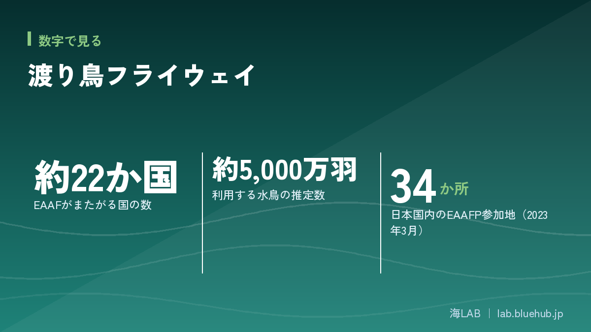
- The East Asian-Australasian Flyway spans about 22 countries and is estimated to be used by about 50 million waterbirds.
- Tidal flat loss and climate change are major threats, so both international cooperation and citizen conservation are needed.
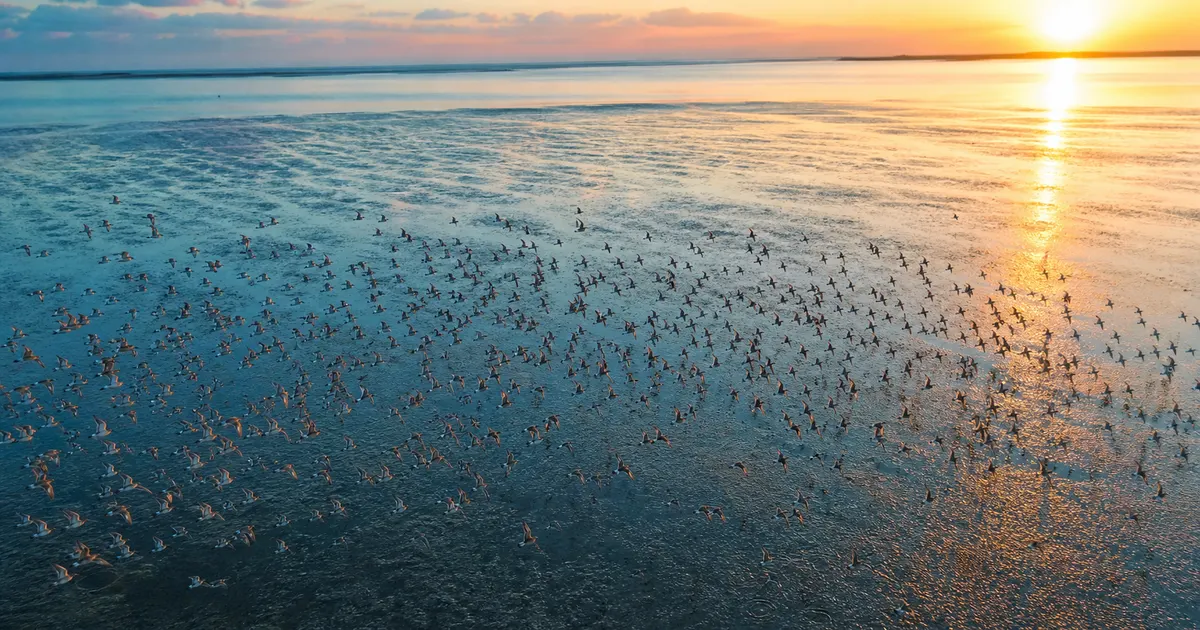
Each spring and autumn, small shorebirds that travel between the Arctic and Australia land on Japan's tidal flats. The East Asian-Australasian Flyway they follow is a global-scale aerial road linked by coastal tidal flats and wetlands.
This article covers the basics of flyways, Japan's position, tidal flat loss and climate change, international frameworks, and what each of us can do.
What you will learn
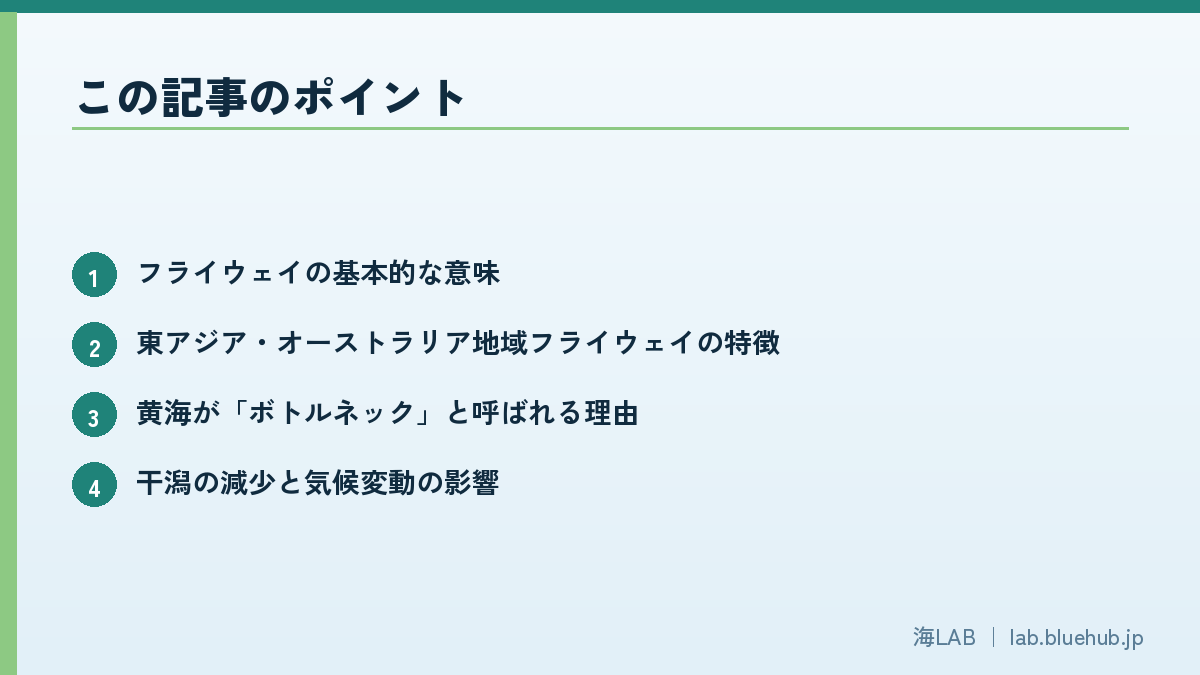
- The basic meaning of a flyway
- Features of the East Asian-Australasian Flyway
- Why the Yellow Sea is called a bottleneck
- Tidal flat loss and the impact of climate change
- International frameworks such as the EAAFP and the Ramsar Convention
- Conservation actions citizens can take
What is a flyway? Understanding the migratory birds' "sky road"
A fixed route used by birds
Migratory birds travel between breeding and wintering grounds along almost the same route every year. This route, together with the stopover sites where they rest and feed and their breeding and wintering grounds, is called a flyway. It is easier to picture it not as a thin line but as a broad band running north to south across the globe. Waterbirds such as shorebirds depend heavily on coastal tidal flats and wetlands, so flyway conservation is directly linked to protecting the marine environment.
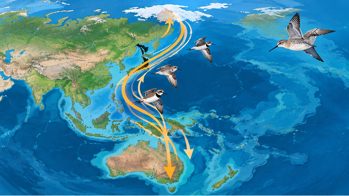
The world is said to have eight major flyways, and the one passing through the Japanese archipelago is the East Asian-Australasian Flyway (EAAF). It is a long route from the Russian Far East and Alaska through East and Southeast Asia to Australia and New Zealand. According to UNESCO documents, it spans about 22 countries and is used by an estimated 50 million waterbirds.
Why are "waterside birds" connected to the sea?
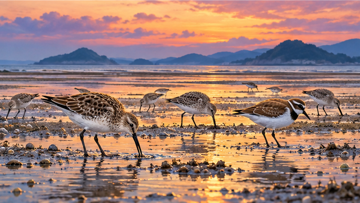
Shorebirds mainly feed on shellfish, polychaete worms and crustaceans living in tidal flat mud. The energy to fly thousands of kilometers depends on how much they can eat and store as fat at stopover flats. In other words, rich benthic life on tidal flats connects to breeding success in far-off breeding grounds.
- Breeding grounds: places such as the Arctic tundra where insects are briefly abundant in summer
- Stopover sites: tidal flats, wetlands and rice paddies where birds refuel (fat) during migration
- Wintering grounds: coasts and estuaries from Southeast Asia to Australia where they spend winter
Key points of this section
- A flyway is a "band-shaped space" including breeding, stopover and wintering sites
- The EAAF spans about 22 countries and is said to be used by about 50 million waterbirds
- The quality of stopover tidal flats determines the success of the whole migration
The big picture of the East Asian-Australasian Flyway
A great migration from the Arctic to the southern hemisphere
Waterbirds using the EAAF include diverse groups such as shorebirds, geese and ducks, cranes and herons. The bar-tailed godwit, for example, has been tracked flying more than 10,000 km nonstop from Alaska to New Zealand in the southern hemisphere, one of the longest bird migrations known. To power such flights, some individuals store nearly half their body weight as fat before departure.
The Yellow Sea as a "bottleneck"
Among the EAAF, the most important area is the tidal flats of the Yellow Sea, surrounded by China, South Korea and North Korea. During the northward spring migration, many shorebirds stay here for one to two months to regain strength before heading to the Arctic. UNESCO World Heritage Committee documents also describe the wetlands along China's Yellow and Bohai Sea coasts as a bottleneck used by more than 10% of the waterbirds migrating along the flyway.
If these sites are lost, alternative stopovers are not easy to find, and some species may struggle to survive. The Critically Endangered (CR) spoon-billed sandpiper is a symbolic species that depends on a limited range of places including the Yellow Sea coast.
| Category | Main regions | Role |
|---|---|---|
| Breeding grounds | Siberia, Alaska, Arctic | Raising chicks (concentrated in the short summer) |
| Northern stopovers | Tidal flats and wetlands in Japan, Korea and China | Resting and feeding in spring and autumn |
| Central stopovers | Yellow Sea coast (China and Korea) | The most important refueling base |
| Wintering grounds | Southeast Asia to Australia and New Zealand | Wintering and molting |
Japan's position: tidal flats and wetlands as stopovers
Japan is both a "passage" and a "rest stop"
The Japanese archipelago sits right where the EAAF connects north and south. In spring and autumn, shorebirds stop at tidal flats from Hokkaido to Kyushu and Okinawa. Japan's flats are smaller than those of the Yellow Sea, but they are spread out like a chain of small "refueling stations" along the route.
According to the Ministry of the Environment, as of March 2023, 34 sites in Japan participate in the EAAFP Site Network described below. Networks are set up for three groups: shorebirds, geese and ducks, and cranes.
Familiar tidal flats
Yatsu Tidal Flat in Narashino, Chiba, on Tokyo Bay, is known as a Ramsar wetland and network site even though it lies in a city, and shorebirds can be seen there in spring and autumn. Places like the Notsuke Peninsula and Notsuke Bay in Hokkaido are used by several groups, including shorebirds, cranes, and geese and ducks.
Related article
The relationship between Japan's tidal flats and shorebirds is also explained in Tidal Flats as Stopovers for Migration.
Tidal flats are disappearing: a crisis for stopover sites
Tidal flat loss in the Yellow Sea
Research using satellite imagery shows that since the 1950s, vast tidal flats along the Yellow Sea coast have been lost to reclamation, land filling and port development. A 2014 study by Murray and colleagues estimated that the Yellow Sea's intertidal zone had shrunk by about 65% over roughly 50 years. A 2019 global survey of tidal flats published in Nature reported that the world's tidal flats decreased by about 16% between 1984 and 2016.
South Korea's Saemangeum reclamation project closed off vast tidal flats when its seawall was completed in 2006, and it has been pointed out that this sharply reduced birds that relied on them, such as the bar-tailed godwit and the great knot. This is a typical example of how losing one stopover affects the whole flyway population.
Challenges in Japan
In Japan too, many tidal flats were reclaimed during the period of rapid economic growth. Remaining flats face issues such as coastal erosion, invasive species, changes in water quality and disturbance from people (which interferes with resting).
- Loss of tidal flat area due to reclamation and shoreline works
- Environmental change caused by invasive species (e.g., changes in oyster reefs, spread of vegetation)
- Submergence of tidal flats by sea level rise and storm surges (climate change)
- Risks to birds from plastic waste and fishing line
- Disturbance of resting birds by recreation and dog walking
Easily overlooked
A stopover may look like a place birds merely pass through, but for migratory birds it is a refueling site that decides breeding success. Loss of one site can affect populations even at far-off breeding grounds.
Climate change and sea level rise
Tidal flats have few places to "escape"
Tidal flats exist through the balance between time under water and time exposed as tides rise and fall. When sea level rises, areas that were flats stay underwater, and where seawalls stand inland the flats cannot move landward and shrink, a phenomenon called coastal squeeze.
Shifts in migration timing
If Arctic snowmelt comes earlier, the peak of insect emergence may also come earlier. Birds arriving on their usual schedule could miss the insect peak their chicks need, a "mismatch" that is a concern. Effects differ by species, and research is ongoing.

| Factor | Impact on tidal flats | Impact on birds |
|---|---|---|
| Sea level rise | Decrease in flat area | Less foraging time and space |
| Warming | Shifts in benthic species distribution | Changes in food quality and quantity |
| Extreme weather | Landform change from storm surge and waves | Loss of resting sites |
International frameworks: the EAAFP and the Ramsar Convention
The East Asian-Australasian Flyway Partnership (EAAFP)
Migratory birds that cross borders cannot be protected by one country alone. The East Asian-Australasian Flyway Partnership (EAAFP), launched in 2006, brings together governments, international organizations and NGOs. According to the Ministry of the Environment, 39 countries and organizations currently take part and exchange information and technology on bird status and conservation. Its secretariat is in Incheon, South Korea.
The EAAFP has a "Flyway Site Network" that registers important wetlands. Registration recognizes a site as internationally important and makes conservation and awareness activities easier to advance.
The Ramsar Convention and World Heritage
Wetlands of international importance as waterbird habitat are also protected under the Ramsar Convention (adopted 1971). In addition, China's Yellow and Bohai Sea coastal wetlands (2019 and 2024) and South Korea's Getbol (Korean Tidal Flats, 2021) were inscribed as UNESCO World Natural Heritage sites. Getbol has four component parts, all of which are also EAAFP network sites.
Differences among the three frameworks
- EAAFP: a voluntary partnership cooperating across the whole flyway
- Ramsar Convention: an international treaty calling for the wise use of wetlands
- World Heritage: registration of places with outstanding universal value
What we can do: citizen science and daily choices
Contribute through observation and records
Shorebird counts are supported by many citizen volunteers, through the Ministry of the Environment's monitoring projects and birdwatching events run by NGOs and local bird clubs. Recording and sharing the species, numbers, dates and places of birds you see on tidal flats also provides valuable data on flyway change.
Choices in daily life
- Join beach cleanups to reduce the risk of plastics and fishing line tangling birds
- When visiting tidal flats, do not get too close to resting birds and keep dogs on a leash
- Support industries that value the coastal environment, such as choosing local seafood
- Slow sea level rise through climate action (energy saving, renewable energy)
An opportunity to learn with children
Spring and autumn tidal flat watching events are a great chance for children to feel the link between sea and sky. Looking through a telescope at a distant sandpiper and imagining it may have come from the Arctic is a deeply memorable environmental learning experience.
Conclusion: protecting the invisible road linking sea and sky
The East Asian-Australasian Flyway is a global-scale "sky road" spanning about 22 countries and used by an estimated 50 million waterbirds. Its success depends on the quality of stopovers running from the Yellow Sea to Japan's small tidal flats. Tidal flat loss and climate change affect populations even at distant breeding grounds.
That is why both international cooperation (EAAFP, Ramsar Convention, World Heritage) and the observation and conservation activities of ordinary citizens are essential. The next time you visit a tidal flat, think about how the small bird pecking at the mud may have traveled thousands of kilometers.
What you can do today
- Look for a tidal flat or estuary birdwatching event near you
- Join a beach cleanup
- Share the story of flyways with family and friends
References and sources
- UNESCO World Heritage Committee Decision 7925 (Getbol, Korean Tidal Flats) – Scale of the flyway and inscription of Getbol
- UNESCO World Heritage Committee Decision 7358 (Yellow and Bohai Sea coast) – Inscription of Yellow and Bohai Sea coastal wetlands
- UNESCO World Heritage Committee Decision 8595 – Yellow and Bohai Sea coast (Phase II)
- Ministry of the Environment: East Asian-Australasian Flyway Partnership – The EAAFP and Japanese network sites
- EAAFP official website – Overview of the partnership and network sites
- Ramsar Convention Secretariat – International treaty for wetland conservation
- Murray et al. (2019) Nature, "The global distribution and trajectory of tidal flats" – Global trajectory of tidal flats
* Listed in order of reliability: government and academic institutions > peer-reviewed papers > specialist organizations > reliable media