⚡ The answer in 30 seconds
- A Geopark is a locally certified area that protects geologically significant landscapes while putting them to use for education, tourism, and regional revitalization
- As of April 2026 there are 241 UNESCO Global Geoparks across 51 countries worldwide, 11 of which are in Japan
- Many coastal geosites, such as San'in Kaigan, the Izu Peninsula, and Muroto, were shaped by sea cliffs and uplifted undersea volcanoes
- Certification is not permanent — sites undergo revalidation every four years, and some have had their status revoked
Have you ever walked along the coast and come across a sheer cliff or a strangely shaped rock? It may well be a "record of the earth" — the result of millions of years of tectonic movement, volcanic eruptions, and relentless wave erosion.
A "Geopark" is a system of local certification designed to protect such geologically valuable landscapes while putting them to use for education and tourism. In April 2026, the number of UNESCO Global Geoparks worldwide reached 241, with Japan's "Mine-Akiyoshidai" (Yamaguchi Prefecture) newly added, becoming the country's 11th UNESCO Global Geopark.
This article organizes, based on information from government and academic institutions, what a Geopark actually is, the difference between UNESCO Global Geoparks and Japanese Geoparks, the representative geosites shaped by coasts and undersea volcanoes, and how the certification system contributes to regional revitalization. We hope this offers a new perspective for choosing your next destination — one that lets you take home a sense of the deep timescale behind how the land was formed.
What you'll learn in this article
- That a Geopark is a local certification system that integrates the conservation of geological heritage, education, and geotourism
- The differences in certification standards and review processes between UNESCO Global Geoparks and Japan's domestic Geoparks
- How representative sea-related geosites such as San'in Kaigan, the Izu Peninsula, Muroto, and the Shimabara Peninsula were formed
- How Geoparks are put to use for regional economies, disaster-prevention education, and geotourism
- That certification includes revalidation every four years, and can even be revoked (via a "yellow card" and similar measures)
What Is a Geopark? Defining the "Earth's Park"
A Geopark refers to a region where landscapes and rock strata of significant geological value are managed together under three purposes: conservation, education, and sustainable tourism. What sets it apart is not simply having unusual landforms or rocks, but treating the ecosystems, history, and culture the land has nurtured as part of a single "story of the earth."
Three pillars: conservation, education, and geotourism
- Conservation: protecting valuable geological heritage (geoheritage) for future generations
- Education: creating opportunities to learn about the earth's history and disaster-prevention wisdom from rock strata and formations
- Geotourism: sustaining the local economy through tourism

A Geopark is not a "special protected area"
- Unlike national parks, which are protection systems with strong development restrictions, Geoparks are said to be characterized by balancing conservation and use while coexisting with the lives and industries of local residents.
Why it's called a "museum of earth science"
Rock strata and formations are like "pages" recording the environment in which each piece of land was born. Sand and mud deposited on the seafloor become strata, lava hardens through volcanic activity, and the movement of tectonic plates repeatedly raises and lowers the land — a Geopark can be described as an open-air museum where these events, spanning millions or tens of millions of years, can be experienced firsthand as tangible landforms. Whereas national parks focus primarily on protecting ecosystems and landscapes themselves, Geoparks place their emphasis on conveying the story of how those landscapes and ecosystems came to be.
A management system led by local residents
Geoparks are typically managed not by government alone but through a promotion council in which specialists in geology, ecology, and history and culture work together with local residents. At the Toya-Usu Geopark, local residents are certified as "Toya-Usu Volcano Meisters," trained to pass on both the appeal of the volcano and the wisdom of disaster prevention. A Geopark is not a tourist site unilaterally developed by the government, but also a system through which residents themselves learn about, talk about, and hand down the story of how their land was formed to the next generation.
The broad scope implied by the word "geo"
The "geo" in Geopark does not refer only to geology and landforms. Another feature of this system is that it treats geology and landforms (geology, geomorphology) as a foundation, while also encompassing the ecosystems that grow upon them (bio), and the history, culture, and industry (history, culture) of the people who have lived on that land. Castle towns built atop raised marine terraces, crops grown in volcanic-ash soil, hot springs welling up along fault lines — Geoparks across the country frequently showcase places where geology and human life are intertwined.
The Difference Between UNESCO Global Geoparks and Japanese Geoparks
The term "Geopark" actually covers two tiers: the domestically certified "Japanese Geopark," awarded by the Japan Geopark Committee, and the "UNESCO Global Geopark," a subset that is further certified as an official UNESCO programme.
Domestic certification: Japanese Geoparks
The Japan Geopark Committee (operating under the Japanese Geoparks Network) certifies regions after reviewing their geological value, conservation systems, education programmes, and tourism infrastructure. As of April 2026, 48 regions nationwide hold this certification.
International certification: UNESCO Global Geoparks
On November 17, 2015, "UNESCO Global Geoparks" was established as an official UNESCO programme. Its purpose is to protect internationally valuable geological heritage, deepen understanding of the natural environment and local culture, and put these resources to use in scientific research, education, and regional development, thereby achieving coexistence between nature and people and sustainable development. As of April 2026, 241 sites in 51 countries have been certified, including 11 regions in Japan.
| Category | Certifying body | Number as of April 2026 |
|---|---|---|
| Japanese Geopark | Japan Geopark Committee | 48 regions (domestic) |
| UNESCO Global Geopark | UNESCO | 241 sites (51 countries) / 11 in Japan |

Japan's first UNESCO Global Geopark (2009)
Japan's first UNESCO Global Geopark certifications came in 2009, when Toya-Usu (Hokkaido), Itoigawa (Niigata Prefecture), and the Shimabara Peninsula (Nagasaki Prefecture) were selected simultaneously. Since then, Oki, Muroto, the Izu Peninsula, Aso, Apoi Geopark, San'in Kaigan, and Hakusan Tedorigawa have been added one after another, and in April 2026, "Mine-Akiyoshidai" (Yamaguchi Prefecture) became the 11th.
The Japan Geopark Committee as the domestic review gateway
A region aiming for UNESCO Global Geopark status must first receive certification from the Japan Geopark Committee, then proceed through a domestic nomination process before advancing to UNESCO's international review (on-site inspection and expert evaluation). Both the domestic and international reviews share a common trait: they examine not just geological value but also the effectiveness of conservation systems, education programmes, and local management.
Geosites Born of the Sea (1): San'in Kaigan Geopark
Stretching roughly 120 km east to west from Kyotango City in Kyoto Prefecture to Tottori City in Tottori Prefecture, the San'in Kaigan Geopark is a precious region where visitors can trace the geological and geomorphological changes from the formation of the Sea of Japan around 25 million years ago right up to the present.
Genbudo Cave and the site of the geomagnetic reversal discovery
"Genbudo Cave" in Toyooka City, Hyogo Prefecture, is a nationally designated Natural Monument — a basalt cavern formed by volcanic activity, marked by striking columnar jointing. The magnetism discovered here became the origin of the name "basalt," and the site is also known as the place where evidence of a Quaternary geomagnetic reversal was first identified.
Rias coastline and the intricate Tajima coast
- Kasumi Coast (a nationally designated Place of Scenic Beauty): an intricate coastline shaped by crustal movement and sea erosion
- Tajima Mihonoura (Place of Scenic Beauty and Natural Monument): cliffs and sea caves born of volcanic activity
- A landscape unified with the clear waters of the Sea of Japan

The grand theme of the Sea of Japan's formation
What makes the San'in Kaigan Geopark particularly highly regarded is not simply the number of individual attractions, but the fact that a single coastline lets visitors observe an almost continuous record of geological processes, from the formation of the Sea of Japan roughly 25 million years ago to the present day. At the time, the Japanese archipelago, then part of a continental margin, is thought to have been torn away and separated, with seawater flowing in to create the Sea of Japan. The volcanic rock erupted and the strata deposited during that process are now exposed along today's Tajima coast and the Kyotango coastline. Being able to observe geological events from entirely different eras — continental separation, volcanic activity, and coastal erosion — within a single region is what has earned this Geopark international recognition.
Highlights on the Kyoto and Tottori sides
- Kyotango City, Kyoto Prefecture: the marine terraces of the Tango Peninsula, the cliffs around Cape Kyoga-misaki
- Toyooka City, Hyogo Prefecture: Genbudo Cave, the dunes of Takeno Beach
- Tottori Prefecture: the sea caves and cliffs of Uradome Coast, and the Tottori Sand Dunes (one of Japan's largest coastal dune systems)
Geosites Born of the Sea (2): Izu Peninsula Geopark
The theme of the Izu Peninsula Geopark in Shizuoka Prefecture is "a gift from volcanoes that came from the south." Around 20 million years ago, Izu was a cluster of volcanoes active on the seafloor several hundred kilometers south of Honshu, near present-day Iwo Jima.
Undersea volcanoes carried north by a tectonic plate
The undersea volcanoes and volcanic islands that formed atop the Philippine Sea Plate migrated northward along with the plate. They began colliding with Honshu around one million years ago, and the peninsula is thought to have taken roughly its current shape about 600,000 years ago.
The only landmass of Honshu sitting on the Philippine Sea Plate
Unlike the rest of Honshu, the Izu Peninsula is the only landmass situated on the Philippine Sea Plate. The Pacific Plate subducts beneath the Philippine Sea Plate, supplying magma, while the Philippine Sea Plate itself subducts beneath the Eurasian Plate (on which Honshu sits) at the Nankai Trough, at a rate of about 4–5 cm per year. Only the "protrusion" formed by the undersea volcanoes has been stripped from the plate and driven into the bedrock of Honshu — that, in essence, is the Izu Peninsula.
A rare, still-active collision zone
- The Izu Peninsula continues to be pushed into Honshu at a rate of several centimeters per year even today, making it a rare landform where a "collision in progress" can still be observed. It is also considered important as a research subject for earthquake and volcanic activity.
Jogasaki Coast and Mount Omuro — living traces of volcanic activity
Jogasaki Coast, on the east coast of the Izu Peninsula, is a "columnar lava coast" formed when lava from the eruption of Mount Omuro roughly 4,000 years ago flowed all the way to the sea and was rapidly cooled and hardened by seawater. Its sheer cliffs and intricate coastline preserve, in an easily observable form, the traces of relatively recent volcanic activity. Mount Omuro itself is a beautiful scoria cone (a conical hill built up from accumulated volcanic fragments) with a bowl-shaped crater, and a chairlift takes visitors to the summit, where a walking trail circles the crater rim.
Daruma-yama Highlands and Cape Osezaki — walking the border between land and sea
The Izu Peninsula Geopark offers several geosites where visitors can experience the region firsthand — from the panoramic view of the volcanic range seen from the inland Daruma-yama Highlands, to the sandbar (tombolo) formed by undersea volcanic activity at Cape Osezaki on the west coast, which visitors can actually walk across. Geoguides often explain, while comparing the actual landforms on site, how the "when and how" of formation differs from place to place even within the same peninsula.
A deep connection with hot springs
The abundance of hot springs on the Izu Peninsula is directly tied to this history of undersea volcanism. Heat from magma remaining underground warms groundwater, which then rises to the surface through faults and cracks in volcanic rock, giving rise to numerous hot spring towns such as Atami, Ito, and Shuzenji. Viewed through the lens of a Geopark, even the hot springs that draw tourists can be seen as one of the gifts of how the land itself came to be.
Geosites Born of the Sea (3): Muroto Geopark
Japan is home to several other UNESCO Global Geoparks deeply connected to the sea.
Muroto Geopark (Kochi Prefecture)
Cape Muroto, facing the Nankai Trough, is known for a landform shaped by repeated seismic uplift (raised coastal terraces). It is a leading geosite for observing the crustal deformation caused by the subduction of the Philippine Sea Plate. Simply walking along the marine terraces lets visitors experience, firsthand, the record of past massive earthquakes — a rare kind of place.

Toya-Usu Geopark (Hokkaido)
Centered on Lake Toya, a caldera lake formed by a massive eruption roughly 110,000 years ago, and Mount Usu, which has remained active for about 20,000 years, this Geopark lets visitors observe firsthand a landscape shaped by repeated eruptions. Traces of Jomon-period settlements and Ainu culture also remain in the area. It is also known as a model region for volcanic disaster-prevention education, since the evacuation advisory issued ahead of the 2000 eruption resulted in zero casualties.
Aso Geopark (Kumamoto Prefecture)
Centered on Mount Aso, home to one of the world's largest calderas, this Geopark is valued for its agricultural and grazing culture that coexists with the volcano, including the maintenance of grasslands through controlled burning. Located near the Ariake and Yatsushiro Seas, the story of crops nurtured by volcanic-ash soil also serves as teaching material for understanding the connection between the sea and the land.
Mine-Akiyoshidai Geopark (Yamaguchi Prefecture, certified 2026)
"Mine-Akiyoshidai," certified in April 2026 as Japan's 11th UNESCO Global Geopark, centers on Akiyoshidai — one of Japan's largest karst plateaus (a landform created when limestone is dissolved by rainwater) — and Akiyoshido, the vast limestone cave that lies beneath it. Limestone originally forms from the accumulated remains of coral and calcareous algae on the seafloor, so this landform, now an inland plateau, is itself evidence that this area was once the bottom of the sea in the distant past.
Geoparks Not Facing the Sea — Itoigawa, Hakusan Tedorigawa, and Apoi Geopark
A Geopark's highlights are not limited to coastlines. Regions tied to the "Fossa Magna," the great rift that divides the Japanese archipelago from east to west, also hold geosites of extreme scientific importance.
Itoigawa Geopark: the western edge of the Fossa Magna
Itoigawa City in Niigata Prefecture is one of the UNESCO Global Geoparks first certified in Japan, back in 2009. The Itoigawa-Shizuoka Tectonic Line runs almost through the center of the city and is known as the major fault forming the western edge of the Fossa Magna. At the "Fossa Magna Park," visitors can actually see rock roughly 16 million years old on the eastern side meeting rock roughly 270 million years old on the western side, across a fault-fracture zone. Itoigawa is also known as the source of jade that formed deep underground roughly 500 million years ago and was designated Japan's national stone in 2016; raw jade nodules can still occasionally be found along the Sea of Japan coast here.
Hakusan Tedorigawa Geopark (Ishikawa Prefecture)
This Geopark is characterized by the alluvial fans and gorge landforms created by the volcanic activity of Mount Hakusan and the Tedori River. Cretaceous dinosaur fossils have also been discovered in the Tedori River basin, letting visitors experience the geological and ecological diversity nurtured by a single continuous river system running from the mountains to the sea.
Apoi Geopark (Hokkaido)
Centered on Mount Apoi, a rare mountain where the unusual rock "peridotite" (mantle material) is exposed at the surface, this Geopark is considered internationally important for understanding the structure of the earth's interior, since rock normally found only deep in the mantle can be observed here at the surface. Because peridotite soil has unusual nutrient conditions, it fosters plants that struggle to grow elsewhere, giving rise to a unique ecosystem, including multiple plant species found only on Mount Apoi. As a rare mountain where alpine-like vegetation appears even at low elevation, it has also drawn attention from a botanical perspective.
Even inland Geoparks carry "memories of the sea"
- Both the gorges of Hakusan Tedorigawa and the Fossa Magna of Itoigawa were formed through strata deposited on the seafloor and the subduction of tectonic plates. Even in regions that do not face the ocean, tracing the geology back far enough always reveals a connection to the sea.
Another Story Tied to the Sea — the Shimabara Peninsula and Oki
Shimabara Peninsula Geopark (Nagasaki Prefecture)
The 1990–1995 eruption of Mount Unzen (Fugendake) caused pyroclastic flows that claimed 43 lives, including the missing. This experience prompted the Shimabara Peninsula Geopark to develop into a center for volcanic disaster-prevention education, passing on the lessons of that eruption through facilities such as the "Gamadasu Dome" (Unzen Disaster Memorial Hall). Facing both the Ariake Sea and Tachibana Bay, the region offers a place to learn about both the bounty of the sea and the threat of volcanic activity at once.
Oki Geopark (Shimane Prefecture)
The Oki Islands, rising from the Sea of Japan, carry a history of land that was once part of the continent before separating and drifting. Because they sit where a warm current (the Tsushima Current) meets a cold current, the islands host a unique ecosystem in which southern and northern species coexist in the same waters, along with a wealth of cliffs and unusual rock formations shaped by sea erosion.
The geological uniqueness of the Oki Islands
The Oki Islands are geologically notable for the way islands formed by volcanic activity tied to the expansion of the Sea of Japan since roughly 25 million years ago sit alongside much older continental rock. On Dogo (Okinoshima Town), volcanic rocks from multiple eras can be observed within a short distance, while on Dozen (the islands of Nishinoshima, Nakanoshima, and the village of Chibu), a complex coastline can be seen where part of a caldera landform shaped by sea erosion appears to have sunk into the ocean.
Overlap with the Daisen-Oki National Park
Part of the Oki Islands is also designated as the "Daisen-Oki National Park," making it an example of two systems — a Geopark and a national park — overlapping in the same region. This reflects a division of roles: the national park primarily handles protective regulation of the landscape and ecosystem, while the Geopark carries the educational and touristic framework for telling the story of the region's geology.
The Global Geopark Landscape and Japan's Position in It
UNESCO Global Geoparks, which became an official UNESCO programme in 2015, trace part of their origins to the "European Geoparks Network" (founded in 2000), which existed before that. Europe has long had a culture of geological tourism, and certified sites remain concentrated in Europe and Asia to this day.
Why "geo" certification became an international programme in the first place
Behind UNESCO's decision to create a "Geopark" framework separate from natural World Heritage sites lies an intent to prioritize practical use — through education, tourism, and regional development — for places that are geologically valuable but not necessarily "the only one in the world," rather than strictly protecting only a handful of exceptional landscapes and ecosystems as World Heritage sites do. Whereas World Heritage places its emphasis on the act of protection itself, a Geopark can be described as a more community-driven framework built on the premise of "protecting while putting to use."
China and Japan's growing presence in Asia
China holds a large number of UNESCO Global Geoparks domestically, rivaling the scale of European countries in terms of certified sites. Japan, with its 11 regions, is counted among the countries in Asia that have actively pursued certification. Neighboring countries such as South Korea, Vietnam, and Indonesia also have certified regions, and exchange and cooperation among Geoparks across East and Southeast Asia continues to grow.
Building networks among Geoparks
UNESCO Global Geoparks are connected through the "Global Geoparks Network," which shares management know-how across regions, and domestically the Japanese Geoparks Network provides a similar forum for information exchange and joint training. Rather than operating as isolated tourist destinations, these Geoparks improve the quality of their management by sharing knowledge with similar regions around the world — another defining feature of the system.
Geopark Certification Standards and How "Revocation" Works
Certification as a UNESCO Global Geopark is not permanent. A revalidation is conducted every four years, and if the state of conservation or management is judged not to meet the required standards, a "yellow card" demanding improvement is issued; if improvements are not made, certification can ultimately be revoked.
Key points examined during review
- Geological value (whether the site holds internationally significant geological heritage)
- Conservation systems (whether mechanisms exist to protect geological heritage from development or mining)
- Education programmes (the depth of school-based and general-public educational content)
- A management system integrating local residents, municipalities, and the tourism industry
- Contribution to a sustainable regional economy through geotourism
Certification is really just the beginning
- It is emphasized that certification is not a finish line but a "starting point," from which a region continues to raise the quality of its conservation, education, and tourism over time.
Monitoring never really ends
After certification, regions continuously check the state of their conservation activities, education programmes, and tourism infrastructure through annual activity reports and peer-review-like mutual evaluations conducted through the domestic Japanese Geoparks Network. If a typhoon or earthquake damages landforms or facilities, the recovery process itself can even become part of the Geopark's disaster-prevention educational content.
Regions that have actually been asked to make improvements
UNESCO Global Geopark revalidation is carried out around the world, and regions judged not to sufficiently meet the review criteria are given a "yellow card" along with a period for improvement. If the improvements cannot be confirmed, certification may be revoked — much like with UNESCO World Heritage sites, this shows that continued effort is expected even after certification has been granted.
The path from application to certification
A region aiming to become a UNESCO Global Geopark must first accumulate years of geological survey and evaluation work, building up systems such as resident briefings and geoguide training, before receiving certification as a Japanese Geopark (domestic certification). After that, following a domestic nomination, it submits an application to UNESCO and goes through stages including a multi-day on-site inspection by review teams and deliberation by an expert panel. It is not uncommon for a region to take around ten years to reach certification.
Geotourism and Its Impact on Regional Revitalization
Geoparks are said to protect a region's geological resources while, through geotourism, generating new sources of income and contributing to new business ventures, employment, and quality training opportunities for local companies.
Geoguides: a specialized profession
Many Geoparks are working to train "geoguides" who explain how the local geology and landforms came to be in an accessible way. Their role goes beyond simple tour guiding — they also help raise disaster awareness in the community and support science education.
Value as disaster-prevention education
The stories of volcanic disaster prevention on the Shimabara Peninsula and the seismic activity revealed by Muroto's uplifted coastline show how learning about the earth's formation at a Geopark doubles as material for understanding the natural disaster risks facing a region. Alongside nature reserves such as national parks, Geoparks are increasingly used as hubs for disaster-prevention and environmental education.
For more on how the national park system works, see What Is a National Park in Japan? The Nature Protected by 35 Parks and the Unique "Territorial Park" System.
The concrete changes certification brings to a region
What changes most, before and after Geopark certification, is the process by which a region re-articulates its own geology and landforms as "tourism resources." Cliffs and rock strata that were once "just part of the everyday scenery" for locals gain a story of how they formed and expert commentary, instantly raising their value in the eyes of visitors. In many Geoparks, certification prompts the installation of information signs, geopark museums, and walking trails, alongside a strengthening of local guide organizations and councils.
Regional industry and the "geo brand"
Once certified, a region often sees a movement to brand its agricultural products, seafood, and crafts collectively as "gifts of the Geopark." On the Izu Peninsula, for example, touring routes have been created that combine hot springs and seafood tied to the local geology, while San'in Kaigan has proposed touring plans pairing local specialties such as Tajima beef and matsuba crab with geological sightseeing. Geology itself cannot be sold as a product, but it is being used to add value to tourism and local specialties as "a story that could only exist on this particular land."
Regions still working toward certification
The Japan Geopark Committee currently has candidate regions seeking new certification, and regions across the country continue working toward the goal of stepping up to UNESCO Global Geopark status. Certification is not a finish line; rather, it is said that meaning lies in the long-term process itself, through which a region discovers the value of its own geology and landforms and reshapes that value into education and tourism.
Partnerships with local businesses and lodging
Many Geoparks partner with local lodging operators, restaurants, and transportation providers to offer touring plans that combine geosite visits with accommodation and meals. Small-to-medium-sized landforms and landscapes that would be weak as standalone tourism resources can, by being packaged together into a "geotourism route" spanning multiple geosites, extend visitors' stays and boost local consumption.
Use in school education and study trips
Many Geoparks offer outdoor learning programmes for local elementary and junior high schools, used for hands-on lessons aligned with the science and earth-science curriculum guidelines. They are valued not only for geology but also from a disaster-prevention education standpoint, and regions with experience of major disasters, such as the Shimabara Peninsula and Toya-Usu, have become established destinations for school trips and training excursions.

Enjoying Geoparks Through the Science of Landforms
When visiting a Geopark, learning "why this landform came to exist" through information signs and geoguide commentary changes the way the scenery looks. Viewing things through the three lenses of erosion, uplift, and volcanic activity makes it easier to understand.
Landforms created by erosion
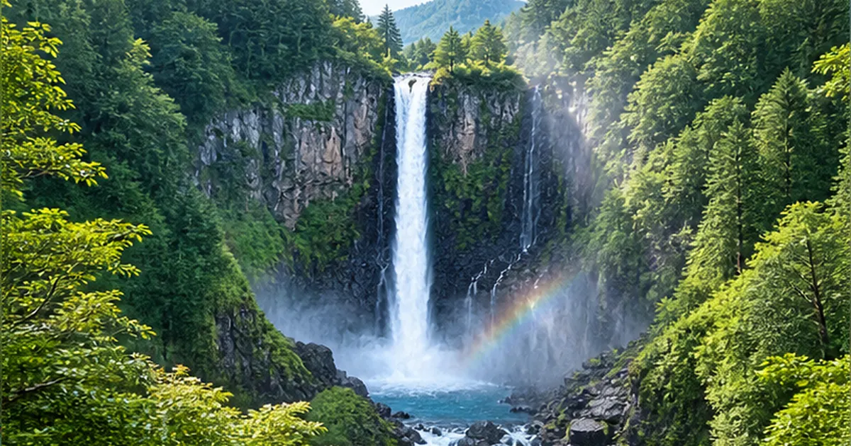
Erosion by waves and rivers produces a wide variety of landforms, including sea cliffs, unusual rock formations, and waterfalls. For more on how waterfalls form, see How Do Waterfalls Form? The Science of Landforms Shaped by Hard and Soft Rock, Faults, and Erosion.
Coastal erosion and future risk
At the same time, coastal landforms are also affected by rising sea levels driven by climate change. For more on the future risks facing Japan's sandy beaches, see Could 90% of Japan's Beaches Disappear as Sea Levels Rise? Ports, Groundwater, Storm-Surge Risk, and Coastal Protection.
What you can do when you visit
- Listen to the explanations at a Geopark visitor center before setting out — it deepens understanding
- Collecting or taking home geological heritage is prohibited in many locations, so check the local rules first
- Joining a local geoguide tour will get you commentary that covers disaster prevention and ecosystems as well
Landforms created by volcanic activity
Many landforms are also created by volcanic activity, including the columnar jointing of lava, calderas, and volcanic-ash soil. For more on the fertility and risks of volcanic-ash soil, see Why Is Volcanic Ash Soil So Fertile? The Benefits and Risks of Kuroboku Soil.
Landforms created by calderas and alluvial fans
Landforms such as the calderas of Aso and Toya-Usu, and the alluvial fan of Hakusan Tedorigawa, created by eruptions and the transport and deposition of sediment by rivers, are also important highlights of Geoparks. A caldera is a large depression formed when a volcanic edifice collapses or subsides following a massive eruption, and the lakes or grasslands that form within it often nurture their own unique ecosystems and agricultural cultures. An alluvial fan is a landform created where a river, emerging from the mountains onto flat land, deposits the sand and gravel it has carried in a fan shape; because groundwater is abundant there, such areas have long been favored sites for human settlement.
Viewing it all on the timescale of plate tectonics
Like the collision zone of the Izu Peninsula or the uplifted coastline of Muroto, many geosites are a cross-section of a phenomenon unfolding on a "planetary scale, over millions of years" — the movement of tectonic plates. Few people visit the same site repeatedly to track how the scenery changes, but when the view in front of you is layered against survey data and the historical record of past eruptions and earthquakes, you can genuinely feel that the cliff or rock before you is part of a "still-moving Earth."
References and Sources
- Japan Geopark Committee – List of UNESCO Global Geoparks and an explanation of the certification system
- Japanese Geoparks Network – What a Geopark is and a list of domestic Geoparks
- Ministry of Education, Culture, Sports, Science and Technology, Japanese National Commission for UNESCO – Introduction to the UNESCO Global Geoparks programme
- San'in Kaigan Geopark – Overview of geology and landforms, and geosite highlights
- Izu Peninsula Geopark official site – How the Izu Peninsula formed, undersea volcanoes, and plate structure
- Hyogo Prefecture, San'in Kaigan Geopark – Information on the Genbudo Cave and Tajima coast geosites
* Listed in order of reliability: government/academic institutions > peer-reviewed papers > specialized organizations > reliable media