⚡ In short
Rainwater seeps into the ground and fills aquifers through a process called groundwater recharge. This article explains how excessive pumping causes land subsidence, drawing on the history of Japan and case studies from around the world.
The water that flows from a tap, or fills a well irrigating farmland, often started as rain or river water that slowly seeped through the ground over months or even decades to become groundwater. When the balance behind this replenishment process, called "recharge," breaks down and pumping exceeds recharge, the ground itself can begin to sink.
During Japan's postwar high-growth era, excessive pumping of groundwater for industrial use caused the ground to sink in many areas, leading to tilted buildings and chronic flooding. Overseas, cities such as Jakarta and Mexico City are seeing their very urban functions threatened by excessive groundwater extraction.
This article draws on primary sources to organize how groundwater recharge works, the history of land subsidence in Japan and around the world, and the efforts of cities like Kumamoto that coexist with groundwater.
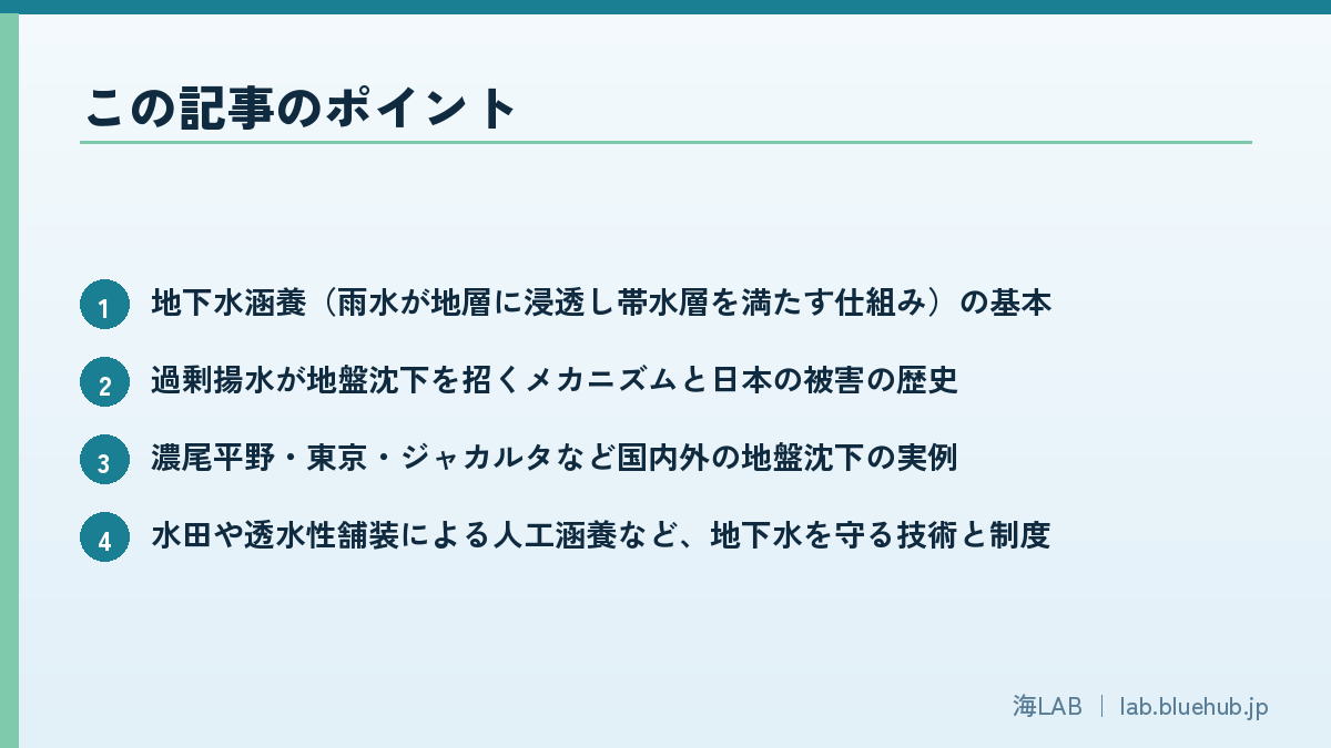
What you'll learn in this article
- The basics of groundwater recharge (how rainwater seeps into the ground and fills aquifers)
- The mechanism by which excessive pumping causes land subsidence, and the history of damage in Japan
- Real-world cases of land subsidence at home and abroad, including the Nobi Plain, Tokyo, and Jakarta
- Technologies and systems that protect groundwater, such as artificial recharge via rice paddies and permeable pavement
- How "groundwater cities" such as Kumamoto balance recharge and pumping
What Is Groundwater Recharge? How Rainwater Fills an Aquifer
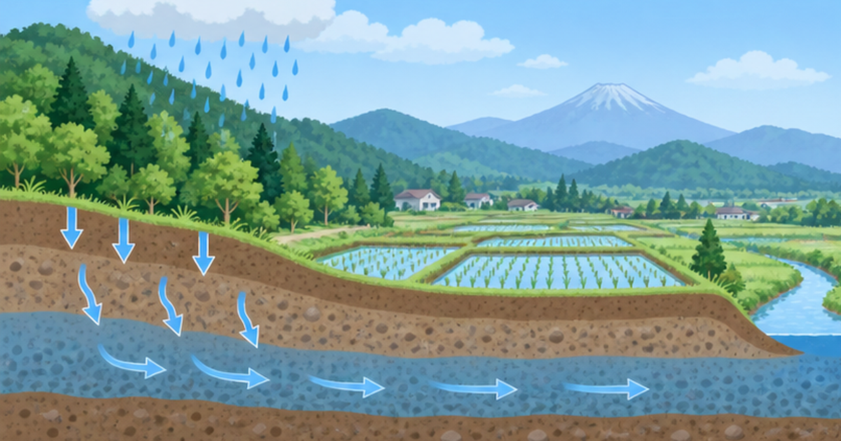
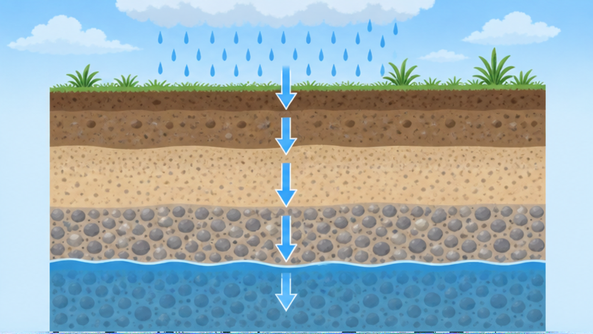
Groundwater recharge refers to the process by which rain and river water seep from the surface into the ground and accumulate in an "aquifer," a layer made of sand or gravel. Japan's Ministry of Land, Infrastructure, Transport and Tourism (MLIT) notes that groundwater recharge plays a multifaceted role, including reducing road and building flooding, preventing land subsidence and saltwater intrusion, restoring springs and streams, and mitigating the urban heat island effect.
What is an aquifer?
Groundwater does not pool underground like an "underground lake"; instead, it fills the gaps between grains in layers of sand and gravel. A layer that readily transmits water this way is called an aquifer, and when it is sandwiched between clay or other water-resistant layers above and below, water can be stored stably for long periods. A well is simply a hole dug down to this aquifer so groundwater can be pumped up.
Urbanization that hinders recharge
According to Japan's Ministry of the Environment, as urbanization progresses, farmland, wasteland, and bare ground with high recharge capacity are replaced by housing and paved roads, making it harder for rainwater to seep underground. Rain that falls on paved surfaces flows directly into sewers or rivers before it has a chance to soak in, so the share of water that runs off along the surface increases while the share that reaches the ground below decreases accordingly. For this reason, local governments are promoting permeable pavement, infiltration basins, and infiltration trenches to artificially supplement recharge.
Another role of groundwater: supporting the ground
Groundwater is valuable not only as drinking or agricultural water but also for maintaining the structure of the ground itself. Within an aquifer, water fills the space between sand and gravel particles, acting like a cushion that eases part of the pressure created when particles press directly against one another. Because this water pressure (pore water pressure) helps distribute the weight of the overlying layers, when the water is removed, the pressure borne directly by the particles (effective stress) suddenly increases, and the layer compacts more easily. This property underlies the physical mechanism of land subsidence described in the next section.
Types of groundwater: unconfined and confined aquifers
Groundwater can be broadly divided into two types based on how it exists. "Unconfined groundwater," found in shallow aquifers close to the surface under the same pressure as the atmosphere, rises to roughly that depth when a well is dug. "Confined groundwater," on the other hand, sits in a deep aquifer sandwiched between water-resistant layers and is under pressure from its surroundings, so when a well is dug the water rises above the level of the water table itself — and under some conditions can even flow out at the surface on its own. Land subsidence is particularly linked to cases where confined groundwater extending over a wide area is pumped in large volumes, because the drop in pressure can trigger compaction of clay layers across a broad region.
How recharge volume is measured
Because groundwater recharge cannot be measured directly by eye, it is estimated using a combination of methods. The most common is the water balance method, which subtracts evapotranspiration (water returned to the atmosphere from plants and the ground) and river runoff from the precipitation that falls on a given watershed, treating the remainder as the amount that infiltrates underground. This is often combined with continuous monitoring of water level fluctuations in observation wells, from which the timing and volume of recharge across the seasons can be estimated. In areas such as Kumamoto, where the area and permeability of recharge sources like rice paddies are well understood, recharge volume is also calculated by measuring the infiltration rate per paddy and multiplying it by the total paddy area across the region.
| Estimation method | Approach | Characteristics |
|---|---|---|
| Water balance method | Precipitation − evapotranspiration − river runoff = recharge | Suited to rough estimates across an entire watershed |
| Groundwater level fluctuation method | Back-calculated from seasonal changes in observation well levels | Good for grasping recharge timing at specific points |
| Land-use-based aggregation method | Infiltration rate × area, by land use type (paddy, forest, urban, etc.) | Suited to areas with detailed land data, such as Kumamoto |
The concept of groundwater "age"
Groundwater varies greatly in "age" depending on its type. Water in shallow aquifers is often rain that fell months to years earlier, while water in deep aquifers can be closer to "fossil water," recharged hundreds or even tens of thousands of years ago. Because current precipitation contributes almost nothing to the recharge of such deep aquifers, water pumped from them is not quickly replenished. Whether a water source counts as a "renewable resource" or is effectively a "one-time-use resource" depends greatly on the depth of the aquifer a well draws from.
Saltwater intrusion, a side effect
Excessive groundwater pumping from coastal aquifers creates another problem distinct from land subsidence. As the groundwater level drops, saline seawater can intrude into the aquifer from the sea side, contaminating well water with salt. As MLIT materials note, groundwater recharge is positioned as effective for "preventing both land subsidence and saltwater intrusion of groundwater," meaning that maintaining recharge and appropriate pumping volumes is essential not just for protecting the ground but for protecting water quality itself. In coastal farming areas and remote islands, restoring a well that has become saline to fresh water is extremely difficult, making pumping management even more critical.
The connection between groundwater and the sea
Groundwater is not a resource confined to land — it is ultimately connected to the sea as well. "Submarine groundwater discharge," where groundwater seeps from coastal aquifers into the seabed, has drawn increasing attention in recent years as a pathway that supplies nutrients to coastal ecosystems. If excessive pumping lowers groundwater levels, the volume and quality of this submarine discharge may also be affected. Managing groundwater is not just a matter beneath our feet in cities — it is also part of keeping coastal marine environments healthy.
What Happens When Pumping Exceeds Recharge: The Mechanism of Land Subsidence
Groundwater not only fills the spaces between sand and gravel particles in an aquifer but also helps support the weight of the layers above. When excessive pumping lowers the water level, water contained in clay layers is squeezed out, causing the particles to compact. Once this compaction occurs, the original volume is not restored, and the surface simply sinks.
Why land subsidence tends to be irreversible
- Clay layers shrink in volume once water is squeezed out, and even if the groundwater level recovers later, the layer does not return to its original thickness
- This means land subsidence, once it has progressed, does not recover naturally — advance management of pumping is the only real preventive measure
The history of land subsidence in Japan
According to MLIT materials, land subsidence from excessive groundwater extraction was already confirmed in the southern Kanto Plain from the mid-Meiji era (early 1890s) and in the Osaka Plain from the early Showa era (mid-1930s). From 1955 onward, against the backdrop of surging industrial water demand during the postwar high-growth era, land subsidence spread nationwide.
Tokyo's land subsidence and the Building Water Law
According to Tokyo Metropolitan Government Bureau of Environment materials, land subsidence progressed in Tokyo's wards from the 1950s through the 1960s due to excessive groundwater pumping, mainly for industrial use, causing damage to residents' lives and economic losses for restoration. In response, the Industrial Water Law was enacted in 1956 and the Building Water Law (the law regulating groundwater extraction for buildings) in 1962, followed by strengthened pumping regulations under Tokyo's 1970 Pollution Prevention Ordinance. Today, under the "Tokyo Metropolitan Environmental Ordinance to Ensure Citizens' Health and Safety" (enacted 2001, revised 2016), even small wells with pumps of 300 watts or less are subject to regulation. All of Tokyo except Okutama Town, Hinohara Village, and the outlying islands is covered by pumping regulations under one of these three laws or ordinances.
| Region | Main period | Trigger / characteristics |
|---|---|---|
| Koto Ward, Tokyo (southern Kanto Plain) | 1890s to the Taisho era | Increased groundwater extraction driven by industrialization |
| Osaka Plain | From the mid-1930s | Expanded groundwater use by textile and chemical industries |
| Nobi Plain (Aichi, Gifu, Mie) | After the 1959 Isewan Typhoon, peaking 1972-1974 | Industrial water pumping during the postwar high-growth era |
Concrete damage caused by land subsidence
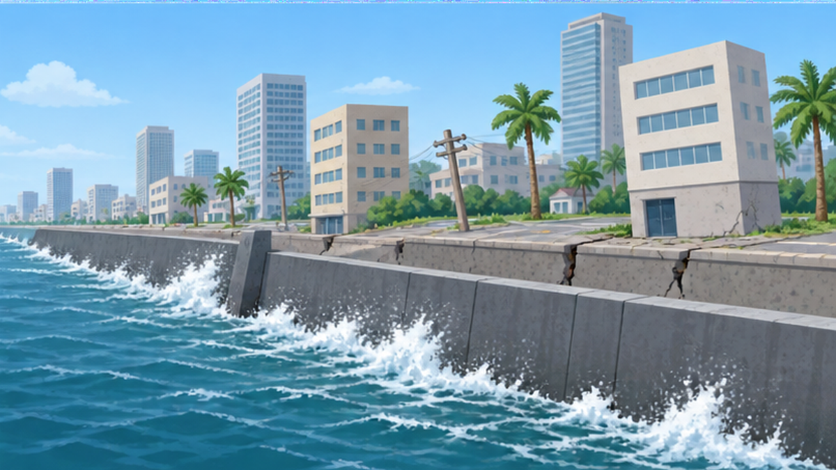
Land subsidence may look like nothing more than the ground slowly sinking, but in reality it causes a complex range of damage. In areas such as Koto Ward in Tokyo and western Osaka City, where subsided areas were already close to sea level, drainage during storm surges and heavy rain becomes impossible, and flooding becomes chronic. Uneven subsidence has also been reported to crack and tilt building foundations, and to break buried water, sewer, and gas pipes. In Koto Ward, subsidence accumulated since the Taisho era left a large part of the ward below sea level at high tide, turning it into land that requires permanent protection through levees and pumping stations.
Main damage caused by land subsidence
- Poor drainage and chronic flooding during storm surges and heavy rain (expansion of below-sea-level zones)
- Cracking and tilting of building foundations from uneven subsidence
- Damage to buried infrastructure such as water, sewer, and gas pipes
- Reduced river and channel flow capacity as gradients become gentler
How is land subsidence measured?
Land subsidence has long been tracked using a method called leveling survey. The elevation of benchmarks set at key points nationwide is measured periodically and compared with past records to track how many centimeters a given point has sunk. In Japan, prefectures and the national government continue point observations, and the Ministry of the Environment compiles the results annually as an "Overview of Land Subsidence Areas Nationwide." In recent years, as seen in the Mexico City example, satellite radar interferometry (InSAR) has made it possible to capture broad-area ground movement over wide areas at high frequency without needing ground-based observation points, and its use is spreading as a complement to conventional leveling surveys.
Lessons from the Nobi Plain: From Excessive Pumping to Groundwater Extraction Controls
The Nobi Plain, spanning Aichi, Gifu, and Mie prefectures, is a representative case in the history of Japan's land subsidence countermeasures. According to Aichi Prefecture materials, the severity of land subsidence drew attention after storm-surge damage from the 1959 Isewan Typhoon, and subsidence was subsequently observed across nearly the entire plain, peaking between 1972 and 1974.
Regulation through the Industrial Water Law and ordinances
As countermeasures, parts of Minami Ward and Minato Ward in Nagoya City were designated under the Industrial Water Law in June 1960, and the designation was expanded in July 1984 to cover 21 municipalities in western Owari, including Ichinomiya City. Aichi Prefecture also added groundwater extraction controls to its Pollution Prevention Ordinance in April 1974, and from April 1976 further expanded and tightened the regulated areas.
The Nobi Plain Land Subsidence Prevention Guidelines
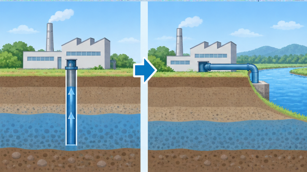
The "Nobi Plain Land Subsidence Prevention Guidelines," decided in April 1985, set a target groundwater extraction volume of 270 million cubic meters per year in the regulated area. Combined with the development of alternative water sources that shifted industrial water use from groundwater to surface water such as rivers, land subsidence in the Nobi Plain moved toward stabilization.
The idea of switching to alternative water sources
Simply regulating groundwater extraction alone would make it impossible for factories and businesses that depend on water to continue operating. What the Nobi Plain and Tokyo countermeasures had in common was that, alongside regulation, they developed industrial water systems drawing from rivers, creating conditions where water could be secured without relying on groundwater. While groundwater can be pumped at close to zero cost, industrial water systems using surface water require investment to install and maintain. Even so, compared with the permanent costs of infrastructure damage and storm-surge countermeasures caused by land subsidence, the shift to alternative water sources is considered to have been a rational choice in the long run.
Subsidence has eased, but the problem isn't "over"
Land subsidence in the Nobi Plain and Tokyo has slowed dramatically thanks to regulation and the development of alternative water sources, and most locations now see only minor changes of a few millimeters per year. However, this does not mean the ground has "returned to its original height." Because compacted layers generally do not return to their original thickness, land that has already subsided, such as in Koto Ward, must permanently remain a below-sea-level zone requiring ongoing protection from drainage facilities and levees. The fact that land subsidence countermeasures can "stop" the problem but find it extremely difficult to "reverse" it is the main reason prevention should be prioritized.
Related reading
- For how mountains and forests store rainwater and release it into rivers, see The Role of Water-Source Forests: How Forests Store Rain and Release It Into Rivers
Land Subsidence and Groundwater Depletion Worldwide: Satellites Capture an Abrupt Freshwater Decline
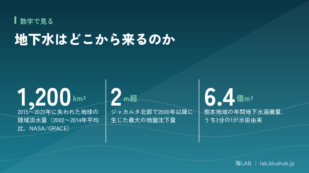
Excessive groundwater extraction is not just a problem in Japan. According to a research team using NASA's GRACE gravity-measuring satellites, the average amount of freshwater stored on land from 2015 through 2023 was about 1,200 cubic kilometers lower than the 2002-2014 average — equivalent to about 2.5 times the volume of Lake Erie. Major aquifers worldwide, including those in the Middle East, India, North Africa, Central Asia, and California's Central Valley, are reportedly being depleted faster than they can be recharged.
Jakarta: subsidence severe enough to trigger a capital relocation
In Jakarta, the capital of Indonesia, piped water infrastructure covers only 64% of the city area, so many residents and buildings rely on illegal or informal wells to pump groundwater for daily use. As a result, North Jakarta has experienced land subsidence of more than 2 meters at its maximum since 2000, and 60% of the urban area now lies below sea level. Combined with sea-level rise from global warming, estimates suggest more than 95% of North Jakarta could be submerged by 2050. The Indonesian government has been proceeding since 2024 with a phased plan to relocate the seat of government to Nusantara, a new capital on the island of Kalimantan.
Lessons from Jakarta
- Underdeveloped piped-water infrastructure led to informal groundwater pumping, accelerating land subsidence
- When land subsidence coincides with sea-level rise, the risk of urban submersion progresses faster than either factor alone
Mexico City: a century of subsidence, observed from space
Mexico City, built atop a basin that was once a lake, is another city suffering severe land subsidence. The urban area sits on water-retentive sandy and clay sediment layers, and groundwater pumping to support the daily lives and industry of roughly 20 million people has compacted the underlying clay layers for decades. The subsidence itself has been documented since at least 1925, making it a problem that has continued for more than a century. Satellite radar interferometry (InSAR) observations have recorded subsidence of up to 35 cm per year in some locations, with observations from October 2025 to January 2026 showing roughly 2 cm per month — over 24 cm annualized — in some districts.
Lessons from Mexico City
- Once land subsidence begins, it can continue as a long-term phenomenon spanning decades to a century or more
- Satellite interferometry (InSAR) now makes it possible to capture broad-area subsidence rates over regions where ground surveys would be difficult
Aquifer depletion in India and California
According to research teams analyzing NASA/GRACE observation data, 54% of roughly 4,000 groundwater wells monitored in India show declining water levels. Driven by population growth and expanding irrigated agriculture, groundwater continues to be pumped at a pace that outstrips recharge from precipitation. In California's Central Valley as well, a structure persists where agricultural water depends on groundwater during every drought, and in some parts of the state, land subsidence has reportedly affected the structure of agricultural canals and bridges. A common thread is that the drier the surface water supply — rain, rivers, dams — becomes during drought, the greater the reliance on groundwater, creating a chain reaction between drought and groundwater decline.
The vicious cycle of climate change and groundwater dependence
NASA's research team also notes that the nine years since 2015 coincide with the nine warmest years on record. Higher temperatures increase evapotranspiration, meaning that even with the same amount of precipitation, a smaller share of water ends up infiltrating underground. Changes in how rain falls — increasingly concentrated in short, intense bursts that run off the surface quickly rather than soaking in — are also cited as a factor hindering recharge. When drought reduces surface water, agricultural and domestic use is forced to rely more heavily on groundwater, creating a vicious cycle in which pumping increases at exactly the moment recharge is declining — a pattern occurring simultaneously in aquifers around the world.
Kumamoto City's Challenge: Artificial Recharge Supporting a 100% Groundwater City
A leading example of a city coexisting with groundwater is Kumamoto City. Despite a population of roughly 740,000, it is said to be the only city in Japan that supplies 100% of its tap water from groundwater. Annual groundwater recharge across the wider Kumamoto region totals about 640 million cubic meters, with roughly one-third coming from infiltration through rice paddies.
The role rice paddies play in artificial recharge
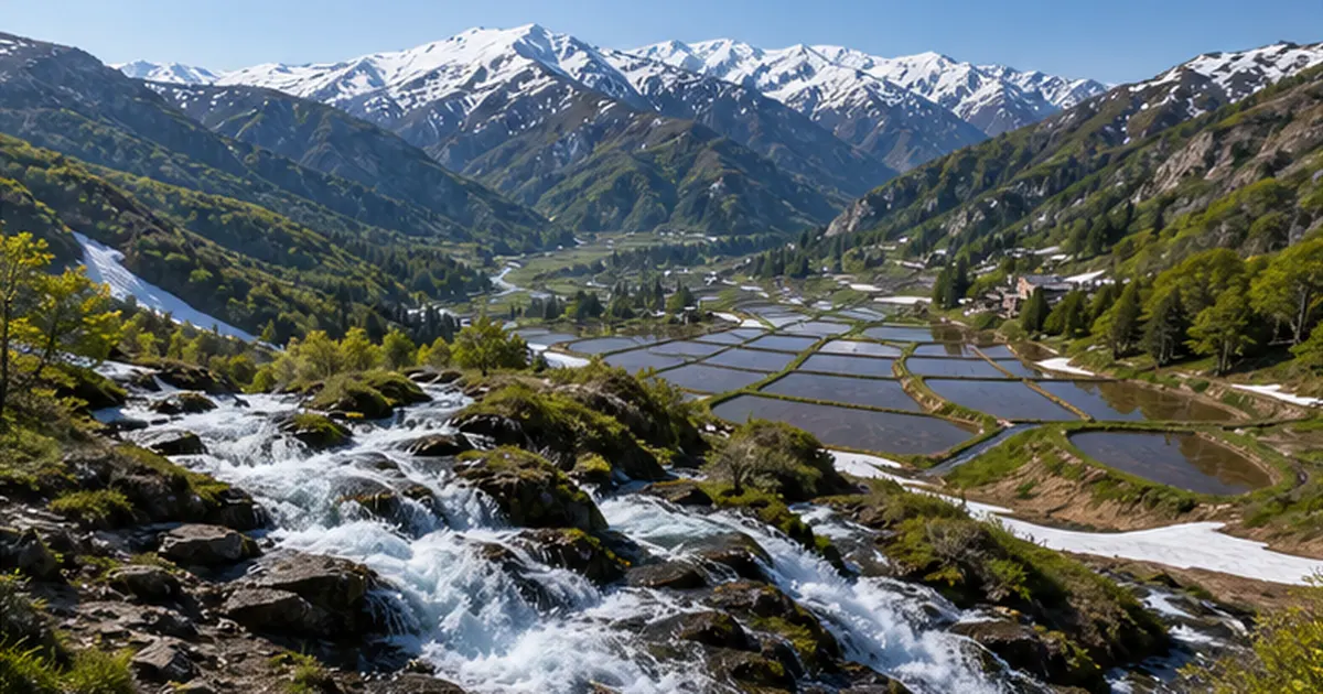
Rice paddies in the middle reaches of the Shirakawa River in particular are said to allow water to infiltrate underground five to ten times faster than ordinary paddies, contributing substantially to regional groundwater recharge. This is because the Shirakawa basin sits on highly permeable soil derived from the eruptions of Mount Aso, allowing water held in the paddies to seep deep underground in a short time. Combined with the management of agricultural irrigation channels, this geological condition has allowed the Kumamoto region to maintain a water cycle that could be described as a giant natural purification-and-recharge system. However, the shrinking area of paddies and ongoing urbanization have reduced the region's recharge zone, and declining groundwater volumes year after year have been identified as a growing challenge.
Groundwater that becomes famous spring water
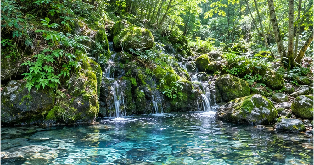
Around Kumamoto City, numerous locations exist where groundwater naturally rises to the surface as springs, and spring clusters such as Kamie-zu Lake and Shimoe-zu Lake are used by residents and visitors alike. Beyond serving as a source of tap water, the fact that recharged groundwater returns to the surface as high-quality spring water is a symbolic sign of a healthy water cycle in the Kumamoto region. Conversely, if recharge declines and groundwater levels drop, these springs also risk drying up.
A long-term strategy built on citizen participation
A defining feature of Kumamoto's groundwater conservation efforts is that they have been built on long-term consensus involving not only government and businesses but also residents. The city's water and sewerage bureau regularly publishes data on groundwater conditions, and schools continue to teach the importance of groundwater. Because groundwater is an invisible resource, it can be hard to build a shared sense of crisis around it — but ongoing data disclosure and education have helped citizens maintain an awareness of themselves as living in a "groundwater city," a factor that underpins the sustainability of the Kumamoto model in a way other cities lack.
The semiconductor industry's arrival and new challenges
In recent years, Kumamoto Prefecture has seen a series of large-scale semiconductor-related factories move in. Semiconductor manufacturing requires large volumes of high-purity water for cleaning processes, and Kumamoto's groundwater-rich location has become a strength for this industry — while at the same time drawing attention to how new corporate groundwater use will affect the region's overall supply-demand balance. Prefectural and city governments are also requiring newly locating businesses to participate in existing recharge programs, and how the Kumamoto model's principle — "the more an industry uses groundwater, the more that company itself invests in recharge" — can keep pace with expanding demand is a key focus going forward.
A system built on "if you pump, you recharge"
Under Kumamoto Prefecture's groundwater conservation ordinance, businesses seeking new permits to extract groundwater in priority areas (the Kumamoto region) are required to work toward recharging a volume comparable to their extraction — in principle 100%. Recharge projects that bring together businesses, local governments, and farmers, such as paying incentive fees to flood fallow paddies with water, are also underway.
Recharge projects linking business, government, and farmers
Kumamoto City's water and sewerage bureau and Kumamoto Prefecture continue a "recharge project" in which local companies pay incentive fees to have paddies flooded with water for a set period after the rice harvest, increasing the volume that infiltrates underground. Rather than being a purely public-works effort, this project is notable for the way that companies with large groundwater footprints — beverage manufacturers and semiconductor-related firms among them — themselves participate as recharge providers. The core of the Kumamoto model is the idea that rather than simply relying on government regulation, the businesses that use the water also invest in recharging it: "nurture what you use."
Related reading
- For how rice paddies nurture living creatures, see A Field Guide to Rice Paddy Life: Rice Paddies as Constructed Wetlands
- For the geological conditions behind famous spring water, see The Science of Japan's 100 Famous Waters: The Geological Conditions Behind Spring Water
What Can Be Done to Protect Groundwater: Systems and Individual Action
Sustainably using groundwater requires two things working together: increasing recharge and keeping pumping volumes within the range of that recharge. In urban areas, permeable pavement, infiltration basins, and rain gardens are increasingly being adopted as ways to boost recharge.
Making groundwater levels visible
| Region | Main cause | Direction of countermeasures |
|---|---|---|
| Japan (Nobi Plain, Tokyo) | Industrial water pumping during the postwar high-growth era | Stabilized through pumping regulations plus a shift to surface water sources |
| Jakarta (Indonesia) | Informal groundwater use due to underdeveloped piped water infrastructure | Expanding piped water coverage, well registration/taxation, capital relocation |
| Mexico City (Mexico) | Roughly 20 million people's daily and industrial water dependence on groundwater | Restoring water storage infrastructure, leak countermeasures, reducing groundwater dependence |
| India | Excessive pumping driven by expanding irrigated agriculture | Spreading water-saving irrigation technology, developing recharge ponds |
In recent years, satellite observation and IoT sensors have helped build systems both in Japan and abroad for continuously monitoring groundwater levels and ground movement. In addition to global-scale systems like NASA's GRACE satellites that track freshwater increases and decreases, local governments in Japan are increasingly publishing observation-well data so that residents can check long-term groundwater level trends. This kind of data disclosure gives both those who pump and those who recharge groundwater a shared understanding of the situation, forming a foundation for catching excessive pumping early.
The value of rice paddies and forests as "green infrastructure"
Unlike concrete water storage facilities, the recharge function of Kumamoto's rice paddies and mountain forests has the added value of storing water while coexisting with agriculture and forestry, the land's original productive uses. Infrastructure that harnesses these natural functions is called "green infrastructure," and groundwater recharge is one of its representative examples. The idea that maintaining rice paddies and properly managing forests is itself an investment in the social infrastructure that protects groundwater is knowledge Japan has accumulated precisely because of its experience with land subsidence.
- Check whether your area falls under local groundwater extraction regulations or ordinances, and confirm whether a permit is required before drilling a well for business use
- Consider recharge measures that can be adopted at the household or property level, such as rainwater infiltration basins or permeable pavement
- Consider supporting or participating in local recharge activities, such as preserving rice paddies or flooding fallow fields
- Make a habit of checking groundwater level and land subsidence monitoring data on your local government's website
Groundwater risk for businesses
Groundwater is a vital resource for industries that require stable water quality, such as food, beverages, and semiconductor manufacturing, but it also carries risks of fluctuating procurement costs due to drought or tightened regulation. For companies operating internationally, understanding in advance whether an area they are expanding into carries risks of land subsidence or water resource depletion — as seen in Jakarta or Mexico City — and, where necessary, considering alternative water sources such as surface water or recycled water, or participating in recharge projects like Kumamoto's, can help manage water-related business risk.
Small-scale recharge individuals can practice
For a single-family home, installing infiltration basins to channel rainwater from gutters, or leaving parts of a yard unpaved with permeable soil or gravel, can contribute to recharge on a small scale. Some local governments offer subsidies for installing rainwater storage and infiltration facilities, so it's worth checking what's available where you live. While any single person's actions are small, they add up across an entire city to boost overall recharge.
Groundwater as an "invisible shared resource"
Groundwater is not something that belongs only to a particular landowner — by nature it is a resource shared across an entire region that draws on a common aquifer. Pumping too much in one location can affect wells and springs elsewhere. The difficulty of perceiving this "invisible connection" has been one reason problems tend to surface only after excessive pumping is already well underway. As the examples of the Nobi Plain and Kumamoto City show, sustaining long-term groundwater use requires all three elements — government regulation, corporate investment in recharge, and public understanding — working together. How to hand down the water flowing quietly beneath our feet to the next generation is a question we all share.
Summary
- Groundwater is a finite resource that depends on a balance between recharge and pumping
- Drawing on lessons from excessive pumping in areas like the Nobi Plain, Japan has stabilized subsidence through regional extraction controls and alternative water sources
- Overseas, in cities like Jakarta, land subsidence from excessive pumping still threatens the survival of urban areas today
- Designing systems that recharge as much as is pumped, as Kumamoto City does, is key to using groundwater sustainably over the long term
References and Sources
- Ministry of Land, Infrastructure, Transport and Tourism – Water resources: current state of groundwater conservation and land subsidence
- Ministry of Land, Infrastructure, Transport and Tourism – Water resources: land subsidence prevention guidelines
- Aichi Prefecture – Overview of land subsidence
- Ministry of the Environment – Promotion of the Nobi Plain Land Subsidence Prevention Guidelines
- Ministry of the Environment – Environmental White Paper (history of land subsidence)
- Kumamoto City – Kumamoto, a groundwater city the world can be proud of
- Kumamoto Prefecture – Guidelines on rational groundwater use and recharge
- NASA JPL – NASA Satellites Reveal Abrupt Drop in Global Freshwater Levels
- JICA – Indonesia: Jakarta Land Subsidence Countermeasures Project
- Edogawa River Office (MLIT) – Water quality glossary: groundwater recharge
*Listed in order of reliability: government/academic institutions > peer-reviewed papers > specialized organizations > reliable media