⚡ The answer in 30 seconds
- A Kuroshio large meander is a state in which the current, separated at Cape Shiono, extends south of 32°N off Tokai; it often lasts more than a year.
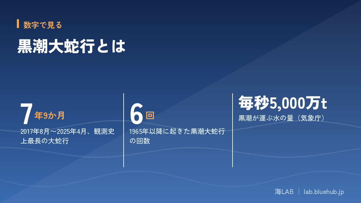
- The latest one began in August 2017 and, at 7 years 9 months, was the longest on record; JMA announced it ended in April 2025.
- Effects reach fishing grounds, coastal sea level and weather, but the cause is not necessarily the large meander alone.
From August 2017 to April 2025, the Kuroshio kept taking a wide detour south of Japan for 7 years and 9 months. This is the "Kuroshio large meander," the longest since JMA's records began in 1965.
News has linked it to topics such as "no shirasu are being caught," "storm-surge worries" and "muggy summers," but how far changes in the current are really involved needs careful examination.
Based on primary sources such as JMA and JAMSTEC, this article organizes the definition of the large meander, its mechanism, effects on fisheries and weather, and its end in 2025.
What you will learn
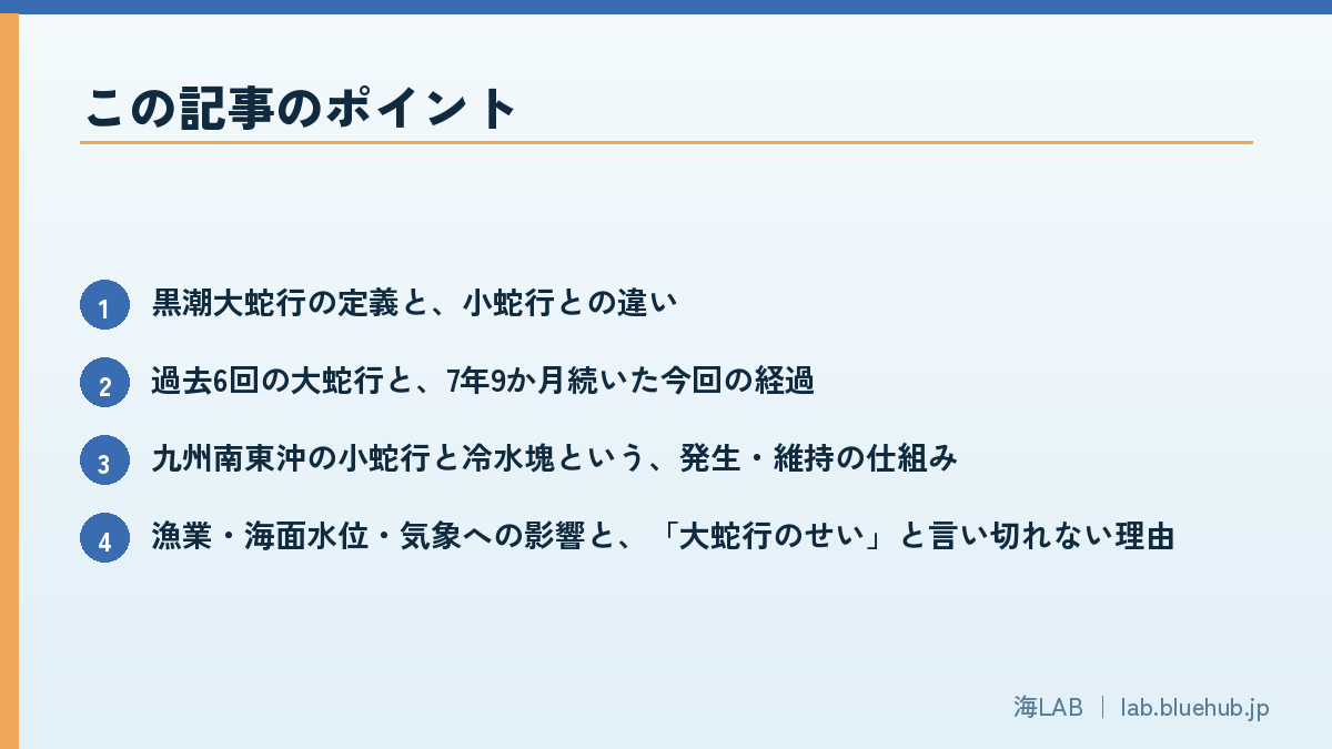
- Definition of the Kuroshio large meander and how it differs from a small meander
- The six past large meanders and the course of the 7-year-9-month latest one
- The mechanism of formation and persistence: a small meander off southeast Kyushu and a cold water mass
- Effects on fisheries, sea level and weather, and why we cannot simply say "it's the large meander"
- The basis for the 2025 end and how to check the latest path
What is the Kuroshio large meander? Definition and overview
A big detour of the Kuroshio south of Honshu
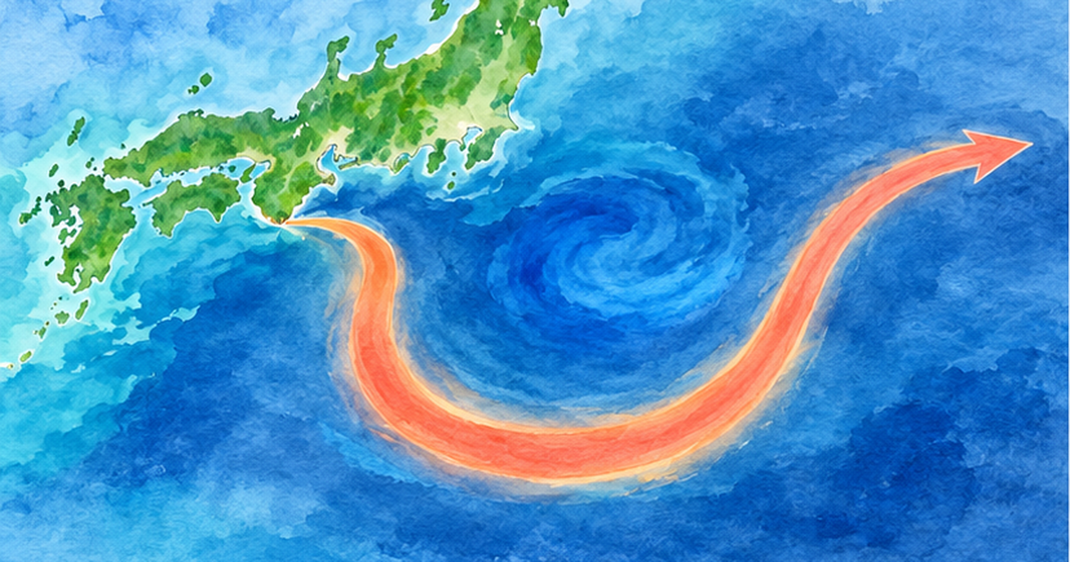
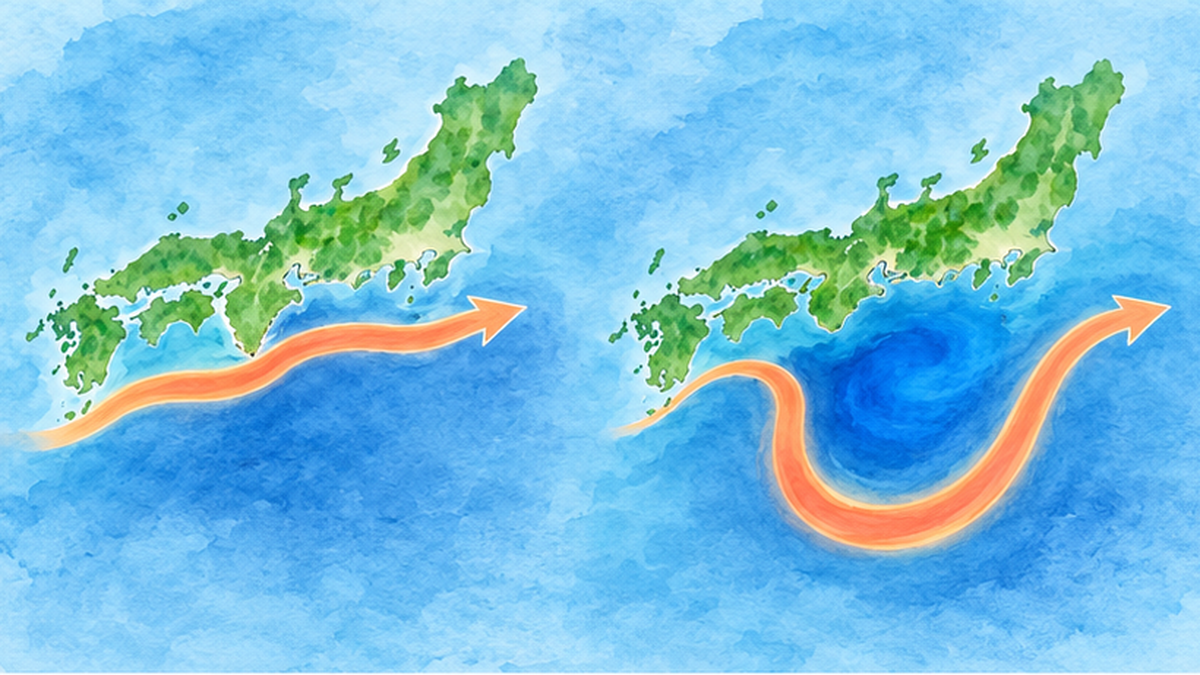
The Kuroshio is one of the world's major warm currents. It flows from east of the Philippines and Taiwan along Japan's southern coast and out into the Pacific. Normally it passes close to Cape Shiono (Shionomisaki) and heads east off Tokai and Kanto. Sometimes, however, it leaves the coast at Cape Shiono and swings far to the south off Tokai. This state is the Kuroshio large meander. The current takes a wide detour like a sideways "U", and a mass of cold water (a cold water mass) forms between the current and the southern coast of Honshu.
The Japan Meteorological Agency (JMA) judges a large meander when two conditions are met: (1) the Kuroshio stably separates from the coast at Cape Shiono, and (2) its southernmost point off Tokai (136°E–140°E) lies south of 32°N. Small meanders occur almost every year and are distinguished from the large meander.
The key point: it lasts a long time
What makes a large meander troublesome is that, once it starts, it often lasts more than a year. According to JMA, six have occurred since 1965, and the longest ran from August 2017 to April 2025: 7 years and 9 months, the longest in the observational record. Over that period, effects on fisheries, weather and coastal sea level became a topic of daily life.
Terms in plain language
Many similar words appear in this topic, so let us sort them out first.
| Term | Meaning |
|---|---|
| Separation (offshore) | The Kuroshio flows away from the coast (e.g. Cape Shiono) |
| Approach (nearshore) | The Kuroshio flows close to the coast |
| Small meander | A small meander that appears off southeast Kyushu and elsewhere. It occurs almost every year and mostly drifts east and disappears |
| Large meander | The Kuroshio stably separates at Cape Shiono and extends south of 32°N off Tokai; often lasts over a year |
| Cold water mass | A mass of cold water upwelled from deeper layers between the Kuroshio and the south coast of Honshu |
Why does a meander matter for daily life?
When the position of an ocean current shifts by tens to hundreds of kilometers, it shows up along Japan's Pacific coast as changes in water temperature, sea level and the amount of humid air. The sea is hard to see, but the Kuroshio path is connected to everything from the contents of a fisher's net to flood risk after a typhoon. That is why JMA and the Japan Coast Guard monitor the path continuously, and researchers treat the large meander as an important theme in climate research.
Key point of this section
A large meander is a state in which the Kuroshio, separated at Cape Shiono, extends south of 32°N off Tokai. It is distinguished from small meanders and often lasts more than a year.
Basics of the Kuroshio: 100 km wide, 50 million tonnes of water per second
A great "river of the sea"
According to JMA, the Kuroshio flows at more than 2 meters per second where it is fast, its strong flow is about 100 kilometers wide, and it carries as much as 50 million tonnes of water per second. It is a current of a different order of magnitude, and it also carries heat from low to high latitudes, fundamentally supporting Japan's climate and marine life.
Three path patterns of the Kuroshio
JMA classifies the Kuroshio path along the south coast of Honshu into three patterns.
| Path pattern | Features off Tokai to Kanto |
|---|---|
| Non-large-meander, nearshore path | Flows almost straight east off Tokai and passes north of Hachijojima, close to Cape Shiono |
| Non-large-meander, offshore path | Makes a small southward meander near the Izu Islands and passes south of Hachijojima |
| Large-meander path | Meanders far south of 32°N between 136°E and 140°E |
Researchers also classify paths in finer detail using symbols such as "N-type," "A-type," "B-type" and "C-type." For example, monthly forecasts by the Mie Prefecture fisheries research institute say whether a small meander born off southeast Kyushu will move east and stay N-type near Cape Shiono, or develop into B-type after passing it. The large meander is the particularly large and long-lasting state in such classifications.
The Kushimoto–Uragami sea-level difference as a sign of separation
Kushimoto and Uragami in Wakayama Prefecture are two tide-gauge stations on either side of Cape Shiono. When the Kuroshio is close to the cape, the sea-level difference between the two becomes large and fluctuates strongly day by day. When the Kuroshio leaves the cape, the difference becomes small and stable. This is explained by the sea surface rising from north to south across the several-hundred-kilometer width of the Kuroshio. JMA introduces this difference as a guide to separation at Cape Shiono, one of the judgment conditions. It is a neat mechanism in which a familiar number, the height of the sea, reveals where a current is.
Kuroshio and Oyashio: two great currents around Japan
Around Japan there are two big currents: the Kuroshio carrying warm water from the south and the Oyashio carrying cold, nutrient-rich water from the north. The Kuroshio is warm and relatively low in nutrients, known for clear "blue sea" water. The Oyashio is rich in nutrients and plankton and is called the "sea that raises fish." Where they meet, from off Sanriku to off Boso, tide rips form and make some of the best fishing grounds in the world. When the Kuroshio path changes, the position of this rip and the way cold and warm water mix change, and the coastal marine environment changes in a chain.
Carrying heat, linked to climate
The Kuroshio is part of a global route that carries heat from low to high latitudes. This heat is also released to the atmosphere and affects temperature and cloud formation on Japan's Pacific side. When a high sea-surface-temperature area approaches the coast, the air passing above becomes warm and humid. This is why it is said that, during the large meander, warm humid air tends to enter the Kanto–Tokai coast. For heat storage in the ocean as a whole, see Record ocean heat content: the sea absorbs about 90% of warming heat.
The six past large meanders and the long road of 2017–2025
Comparing the six since 1965
JMA lists six large meanders since 1965. The latest one stands out for its length.
| Rank | Period | Duration |
|---|---|---|
| 1 | Aug 2017 – Apr 2025 | 7 years 9 months |
| 2 | Aug 1975 – Mar 1980 | 4 years 8 months |
| 3 | Nov 1981 – May 1984 | 2 years 7 months |
| 4 | Dec 1986 – Jul 1988 | 1 year 8 months |
| 5 | Jul 2004 – Aug 2005 | 1 year 2 months |
| 6 | Dec 1989 – Dec 1990 | 1 year 1 month |
Even the runner-up (1975–1980) lasted 4 years 8 months, so this one was about 1.6 times longer. It used to be thought of as a phenomenon that ends in a few years; the prolonged event was a big shock even to researchers.
Starting in August 2017, announced as "first in 12 years"
On August 30, 2017, JMA announced that the Kuroshio had separated widely off Tokai. On September 29 it announced "Kuroshio in a large meander for the first time in 12 years." The previous one ran from July 2004 to August 2005, so this was a recurrence about 12 years after it ended.
2020: shrank, then developed again
There were moments when it seemed to be ending. According to reports, in October 2020 a large eddy was cut off and the meander shrank for a while; later the eddy moved west and reattached to the Kuroshio near Kyushu, and the meander developed again. A large meander is thought to persist through repeated exchanges with eddies like this.
The 2022 record
On May 25, 2022, JMA announced that the duration had become the longest on record. From around then, how to think about long-term effects on fisheries and weather became a major media topic.
Advances in observation supported our understanding
The Kuroshio path is grasped through a combination of observations. JMA's ocean weather ships cross the Kuroshio measuring temperature, salinity and current strength. The Japan Coast Guard analyzes the Kuroshio position from ships and satellites. Satellite altimeters measure sea-surface height and let us estimate currents, and tide gauges indirectly show whether the Kuroshio is separated, as in the Kushimoto–Uragami example. Thanks to these overlapping eyes, even the 7-year-9-month meander was recorded without a break. Long continuous observation is a valuable asset for future research.
For the history of sea-level observation, see A century of sea level read through tide gauges and satellite altimetry.
Timeline so far
- Aug 2017: Kuroshio separates widely off Tokai
- Sep 2017: JMA announces "first large meander in 12 years"
- Oct 2020: shrinks after an eddy is cut off, then redevelops
- May 2022: duration becomes the longest on record
- Apr 2025: the large meander ends (judgment announced in Aug 2025)
Why does it happen? Mechanism of the Kuroshio large meander
The trigger: a small meander off southeast Kyushu
According to explanations by JAMSTEC researchers and others, the starting point of a large meander is a small separation off southeast Kyushu, a small meander. It is like a counterclockwise eddy on the Kuroshio and occurs almost every year. Normally it is carried east and disappears.
But when several conditions overlap, for example merging with other eddies, a small meander does not vanish and develops greatly. Researchers at the Meteorological Research Institute have pointed out that a clockwise warm eddy forms offshore of the small meander and acts on its north side, helping the meander grow. A study using satellite altimeters in the 1990s also suggested that the interaction between eddies and the Kuroshio may have triggered the eastward movement of a small meander.
The "cold water mass" between the meander and Honshu
When the Kuroshio extends south, a cold water mass of upwelled lower-layer water settles inside it (between it and the south coast of Honshu). The cold water mass works like a prop that holds the meander path, which is why a large meander tends to last. Conversely, when this cold water mass collapses, the large meander tends to head toward its end.
In 2025, cold water masses were "pinched off"
A JAMSTEC researcher explained in the press that in February and April 2025 the cold water mass was pinched off to the south, the cold area between the Kuroshio and Honshu shrank, and the width of the meander became smaller. The end of the large meander is consistent with such collapses occurring one after another.
How a large meander persists (summary)
- A small meander off southeast Kyushu moves east and develops
- A cold water mass forms against Honshu and supports the path
- Exchanges with eddies change its strength; when the cold water mass collapses it heads toward its end
Relation to ocean variability on decadal scales
The Kuroshio path is thought to be linked to slow changes over several to a dozen or so years. One view is that variations in which winds and water temperatures over wide parts of the Pacific change patterns propagate to the sea south of Japan and affect how the Kuroshio flows. A meander lasting several years may be the result of such background variability combined with a local trigger, the small meander off southeast Kyushu. However, detailed verification of this relationship is still underway, so it is important not to rush to conclusions and to wait for new results.
Another thing not to overlook is the accumulation of observation data. Having observed a 7-year-9-month meander continuously on the same basis was a valuable opportunity even worldwide. This record becomes the foundation for studies verifying the link between path changes, ecosystems and weather, and it will help us prepare for the next large meander.
Reproducing the large meander with numerical models
To understand how a large meander starts and persists, researchers use numerical models that reproduce ocean motion on supercomputers. Changing the size of small meanders and the position of eddies little by little, they test under what conditions a large meander forms and when it collapses. This research is the foundation for improving future path forecasts. However, the real ocean is complex, with eddies, winds and seasonal variation intertwined, so correctly predicting the path several months ahead remains difficult. Forecasts always carry uncertainty.
What is still not known
Why the 2017 large meander began and why it lasted so long has no simple explanation even among researchers. Changes in Pacific winds, decadal ocean variability and climate change are discussed, but there is currently no decisive answer. Some press reports mention researchers' suggestion that changes in Pacific winds accompanying climate change could make large meanders more frequent or longer-lasting, but this too is at the hypothesis stage. Please read with the same caution and avoid assertions.
Impact on fisheries: fishing grounds shift and the catch changes
When the current changes, fishing grounds move
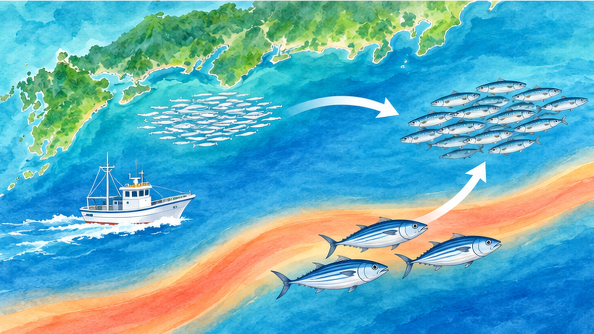
JMA explains that changes in the Kuroshio path affect the position of fishing grounds and the species caught. Most fish gather where the water temperature is suitable and food plankton is abundant. When the path changes, temperature and current strength change, and fishing grounds themselves can move tens to hundreds of kilometers.
Shirasu fishery: "large meander = poor catch" is not always true
The Kanagawa Prefecture Fisheries Technology Center reports that, contrary to the conventional explanation that during a large meander the flow in the bay becomes fast and fishing grounds are hard to form, there were years without poor catches even during the large meander. It suggests that not only the Kuroshio path but also small-scale environmental changes in the bay may affect ground formation. This valuable survey shows that "large meander = poor catch" cannot simply be asserted.
Higher water temperature and poor-catch tendencies in Kumano-nada
The Mie Prefecture fisheries research institute reports that, in Kumano-nada during the large meander, water temperature tended to be higher and poor catches were seen for species such as Japanese anchovy. Changing temperature changes the environment where eggs and larvae grow and the routes along which schools migrate.
Migratory fish such as skipjack and tuna
Researchers at the Japan Fisheries Research and Education Agency and elsewhere have studied changes in ocean conditions around Cape Shiono in Wakayama and their influence on the skipjack pole-and-line/trolling fishery associated with the large meander. Because the way fishing grounds form differs between the meander and non-meander periods, research to improve ground-prediction accuracy is also progressing. Reports mention changes in the catch of skipjack, yellowtail, amberjack, Pacific bluefin and yellowfin tuna, but the cause is not necessarily the large meander alone.
Do not jump to "it's the large meander"
One caution here is not to swallow explanations that attribute every poor catch to the large meander. Some experts point out that rather than blaming the sea environment alone, we should also look at overfishing (resource management), the long-term rise in sea temperature and other environmental changes. Ocean-current change is one major factor, but catches are determined by multiple factors overlapping. See also Fish disappearing as seas warm: saury and squid declines and the future of Japanese fisheries.
A word of caution
- Do not conclude "poor catch because of the large meander"; also consider the long-term rise in sea temperature and resource management
- Effects differ by region and species (in Kanagawa's shirasu fishery there were years without poor catches)
What consumers see: fish prices and the table
Shifts in fishing grounds and species also spread to the kinds, volumes and prices of fish at the market. For example, if a fish landed locally decreases, products from other production areas may increase. But fish prices depend not only on landings but on demand, imports and fuel costs, so the large meander cannot be called the direct cause. What matters is to accept sea changes in daily life on the premise that "seasonal" and "local" foods can change.
What fishers are doing in response
- Switch fishing grounds flexibly based on temperature and current data
- Review fishing gear and operating seasons to match changing catch species
- Use sea-condition information and forecasts published by prefectural fisheries institutes in daily operations
- Develop sales channels for new species and stabilize income through processing and distribution
For the overall picture of these efforts, see also What is smart fisheries? The frontline of IoT, AI and drones in fishing and aquaculture.
Impact on weather, sea level and the coastal environment
Sea level rises and storm-surge risk increases
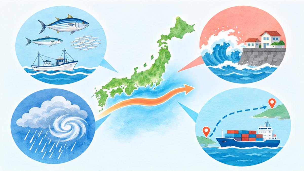
JMA explains that during a large meander warm water tends to flow into the Tokai–Kanto coast, and sea level can rise. Warm water expands and pushes the sea surface up. If a typhoon arrives on top of that, storm-surge damage can grow. Reports say that the possibility that the large meander contributed to storm-surge damage around Shimizu Port in Shizuoka during Typhoon No. 21 in 2017 and Typhoon No. 19 in 2019 has been discussed. However, the strength and track of the typhoon and other factors are also large, so the size of the effect needs careful evaluation.
Long-term sea-level change is covered in Will 90% of Japan's beaches vanish with sea-level rise? Ports, groundwater, storm-surge risk and coastal protection.
Heat, rain and snow: how are they related?
When the Kuroshio approaches Honshu, warm humid air tends to enter coastal Kanto to Tokai. Reports sometimes cite the large meander as one cause of muggy weather and record heat. It has also been discussed in connection with possible increases in heavy rain and thunderstorms, and with the heavy snowfall in Tokyo in January 2018 through south-coast lows. However, these phenomena involve many factors such as atmospheric conditions and seasonal patterns and cannot be explained by the large meander alone. Quantitative evaluation of the effect is an ongoing research theme.
Spreading to marine life and the environment
Reports have mentioned, during the large-meander period that began in 2017, changes in seaweed growth, a mass die-off of corals in winter 2018, and more frequent whale sightings in Tokyo Bay. While the large meander cannot be called the only cause, these are symbolic topics for thinking about the link between currents and the coastal environment. The relation between corals and water temperature is explained in detail in What is a marine heatwave?.
Ship routes and marine leisure
Riding the Kuroshio saves fuel, and going against it requires extra fuel. During a large meander, economical ship routes therefore change. Water clarity also changes, which can affect marine leisure such as diving.
Storm-surge preparedness for coastal residents
A storm surge is a rise in sea level caused by the suction of low pressure and the pile-up by strong winds during a typhoon or a developed low. When high tide, or a rise in mean sea level due to the large meander, overlaps, the risk of flooding increases. When a typhoon approaches, please check the following.
- Check the storm-surge and flood assumptions for your home and workplace on the municipal hazard map
- Check, using JMA tide information, when the typhoon's approach overlaps with high tide
- Move to a safe place early when evacuation information is issued
- Be careful about parking cars or storing goods near ports, river mouths and low-lying seaside land
Disaster-prevention hint
Just knowing that "sea level goes up and down daily not only because of typhoons but also because of currents and seasons" makes tide information in the news easier to understand.
The large meander ended in 2025: the basis for judgment and what followed
May 2025: signs of the end
On May 9, 2025, JMA announced "signs that the 7-year-9-month Kuroshio large meander is ending." As of May 8 the large meander was no longer seen, and if this state continued it would be judged to have ended. On June 11, JMA's ocean weather ship Ryofu Maru made a Kuroshio crossing observation and confirmed there was no large meander. The July 10 announcement said meanders were seen off Shikoku and Tokai but no separation off Cape Shiono, so the signs of the end were unchanged.
August 29, 2025: official announcement of the end
Then on August 29, JMA and the Japan Coast Guard announced that the large meander had ended in April 2025. The basis was the trend of the southernmost latitude of the Kuroshio off Tokai and the state of approach off Cape Shiono. In late August the Kuroshio was flowing east of Cape Shiono, near 32°N off Tokai, and south of Hachijojima among the Izu Islands. JMA gave an outlook that, although temporary meanders were expected over the next month, the state without a large meander would likely continue.
| Date | Announcement |
|---|---|
| May 9, 2025 | JMA announces "signs that the 7-year-9-month Kuroshio large meander is ending" |
| June 11, 2025 | Observation ship Ryofu Maru crosses the Kuroshio and confirms no large meander |
| July 10, 2025 | Meanders off Shikoku and Tokai, but no separation off Cape Shiono |
| August 29, 2025 | JMA and the Japan Coast Guard officially announce the end in April 2025 |
Taking about three and a half months from the "signs" announcement to confirming the "end" is because even a meander that seems to have ended can develop again. In fact in 2020 a meander that had shrunk grew large again. This careful assessment raises the reliability of the judgment.
Points of the judgment
- The trend of the southernmost latitude of the Kuroshio off Tokai
- The state of approach off Cape Shiono
- A non-large-meander state continuing stably
What about the sea after the end?
Even after the end, things do not return to normal immediately. When the path changes, temperature and food distribution also change, so fishing grounds and fish arrivals are thought to change gradually over several years. The Kuroshio also repeats small meanders, so coastal temperature and sea level can change temporarily. For example, the one-month forecast issued in June 2026 by the Mie Prefecture fisheries research institute predicted that a Kuroshio small meander off southeast Kyushu would move east, shrink between Cape Muroto and Cape Shiono and stay N-type, while also showing the possibility of developing into B-type after passing Cape Shiono. This is a small-meander forecast, not a large meander, but an example showing that the path keeps moving after the end.
Where can you see the latest status?
At the time of writing, no report of a recurrence of the large meander has been confirmed. Conditions can change, however, so the latest path is best checked on JMA's Kuroshio large-meander portal, the one-month forecast of sea surface temperature and currents, and the Japan Coast Guard's current charts. The portal also notes that additions of observation results from JMA's ocean weather ships ended in February 2026.
The Kuroshio from now on: how to look at it and what we can do
Will a large meander happen again?
The record shows six events in about 60 years since 1965, roughly one per decade. On the other hand, some press reports introduce researchers' views that wind changes accompanying climate change might alter the frequency or duration of large meanders, but no firm conclusion has been reached. It is important to keep observing on the premise that "it will happen again someday."
Efforts by fisheries, local governments and research
- JMA and the Japan Coast Guard monitor the path continuously and publish the information
- Prefectural fisheries institutes issue monthly forecasts of fishing-ground temperature and small meanders
- The Japan Fisheries Research and Education Agency and others study improving the accuracy of ground-prediction models for meander and non-meander periods
- Coastal local governments reflect long-term sea-level change in storm-surge risk assessment and disaster plans
What we can do
- Look at the latest Kuroshio path on the JMA site (a first step to feeling close to the sea)
- Take an interest in seasonal fish and local seafood, and read "poor catch" news from multiple angles
- In typhoon season, be aware of storm surges and high-tide times and check coastal disaster information
- Deepen understanding with How ocean currents change as seas warm and Why typhoons intensify as seas warm
How it differs from El Niño and resource fluctuations
Kuroshio path changes move on a different time scale from climate variation of several years such as El Niño and La Niña and from decades-long sardine stock fluctuations. When these overlap, effects on fisheries and weather can be amplified or cancelled out. Instead of explaining things by one cause, thinking of several overlapping "rhythms" changes how the news looks.
Five checkpoints when reading the news
- Source: primary information from JMA, the Japan Coast Guard or research institutes?
- Scope: which sea area, period and species is it about?
- Causality: does it avoid saying "because of the large meander" outright and mention other factors?
- Numbers: is the baseline for comparison (normal or past average) shown?
- Date: is it information from before or after the end?
In particular, articles written during the large meander and the latest ones after its end have different premises. Checking the date is the first step to accurate understanding.
Summary
The Kuroshio large meander is a phenomenon in which the Kuroshio, separated at Cape Shiono, extends south of 32°N off Tokai, and it often lasts more than a year. The latest one began in August 2017, lasted 7 years 9 months, the longest in the record, and ended in April 2025. Effects on fisheries, sea level and weather are discussed, but the cause is not necessarily the large meander alone and effects differ by region and species. The Kuroshio keeps moving after the end, so the latest path is best checked in public information such as JMA's.
References and sources
- JMA / Japan Coast Guard: End of the Kuroshio large meander – a record 7 years 9 months (Aug 29, 2025) – Announcement of the end, periods of the six past events, basis for judgment
- JMA: Signs that the 7-year-9-month Kuroshio large meander is ending (May 9, 2025) – Announcement material on signs of the end
- JMA: Kuroshio – Speed, width and transport of the Kuroshio, path patterns, judgment criteria
- JMA: Kuroshio large-meander portal (Aug 2017 – Apr 2025) – Sea-level difference (Kushimoto–Uragami), related announcements, observation data
- Miyama T.: Mechanism of the Kuroshio large meander, Kagaku, June 2018 (JAMSTEC Kuroshio-Oyashio Watch) – Explanation of how the large meander forms and persists
- Japan Science and Technology Agency Science Portal: Kuroshio large meander – Explanatory article on the occurrence of the large meander
- Kanagawa Prefecture Fisheries Technology Center material (shirasu ground formation during the large meander) – Report that there were years without poor catches even during the large meander
- Mie Prefecture Fisheries Research Institute: Kuroshio and ocean-condition information – Kumano-nada conditions and catches, one-month Kuroshio path forecast
- Weathernews: The record 7-year Kuroshio large meander may be ending: impact on fisheries and weather – Press report including expert comments (May 2025)
* Arranged in order of reliability: government agencies > academic institutions > peer-reviewed papers > specialist organizations > reliable media