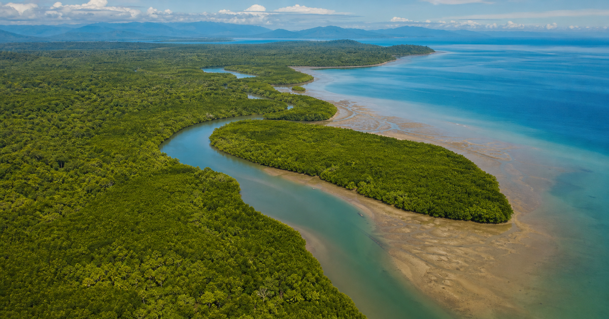
Walk along a tropical or subtropical coastline and you may encounter a curious forest where countless roots stretch from the base of each trunk toward the sea, revealing themselves on the mud every time the tide goes out. This is a mangrove forest. Growing sturdily even while submerged in salt water, protecting people's lives from tsunamis and storm surges, locking away vast amounts of carbon in the soil, and serving as a nursery for juvenile fish, crabs, and birds — mangroves are among the hardest-working forests on Earth.
And yet this forest is now vanishing three to five times faster than the world's forests as a whole. Conversion into shrimp farming ponds, urban development, and sea level rise from climate change have quietly but steadily driven mangroves into a corner. At the same time, their value is being scientifically reassessed, and large-scale planting and restoration efforts are accelerating, especially in Southeast Asia.
This article carefully traces everything from the basics of what a mangrove is, to its three functions — disaster prevention, blue carbon, and biodiversity — to the mangroves spreading across Okinawa and Kagoshima in Japan, and the front line of restoration in Southeast Asia, based on primary sources such as the Ministry of the Environment, the FAO, and university research.
What you'll learn in this article
- The three roles mangroves play at the boundary between sea and land (disaster prevention, carbon absorption, and biodiversity)
- Global and Japanese distribution, spanning from Iriomote Island in Okinawa to the northern limit in Kagoshima
- How "blue carbon" works, storing about 1,000 tonnes of carbon per hectare
- The science and latest research behind the "green seawall" that softens tsunamis and storm surges
- Why Southeast Asian tree-planting efforts fail, and how "the flow of water" is the key to success
- Ways we can connect with mangroves in our daily lives
What is a mangrove? — A forest standing at the border of sea and land
A mangrove is not the name of a specific plant, but a general term for trees that grow in tropical and subtropical river mouths and coastlines, in places submerged by seawater with the rise and fall of the tide. About 80 species are known worldwide, and 7 in Japan. While ordinary land plants wither in salty soil, mangroves have deliberately chosen this harsh environment as their home and undergone unique evolution as a result.
A distinctive shape, rooted in the mud
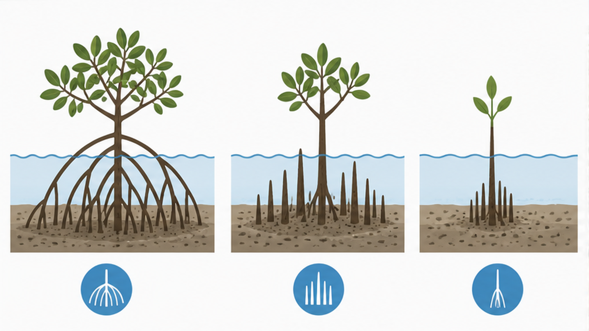
What first catches the eye about mangroves is the shape of their roots. To breathe in mud with little oxygen, they push part of their roots out into the air, or spread arch-shaped roots to support their trunks. As we'll see later, these roots play an important role in softening waves and providing hiding places for creatures.
- Prop roots: Many roots extend like an octopus's legs partway up the trunk, supporting the tree on the soft mud (as in Rhizophora stylosa)
- Knee roots: Underground roots bend like a knee and poke up above the surface to take in air (as in Bruguiera gymnorhiza)
- Pencil roots (pneumatophores): Countless roots rise up from the ground like bamboo shoots to breathe (as in Sonneratia alba and Avicennia marina)
Three strategies for withstanding salt
Seawater contains about 3.5% salt, which is toxic to many plants. To overcome this, mangroves have developed clever mechanisms in their roots, leaves, and seeds respectively.
- Keeping salt out: Root cells act like a filter, preventing much of the salt from entering the body
- Getting rid of salt: Salt glands on the leaf surface excrete excess salt, and salt is stored in old leaves before they are shed
- Viviparous seeds: Seeds germinate while still attached to the parent tree, growing into slender seedlings that can root themselves in the mud as soon as they drop (a characteristic of the Rhizophora family)
What are "viviparous seeds"?
Species in the Rhizophora family sprout while the seed is still attached to the tree, growing into a slender, pencil-like seedling (propagule) before it falls. A fallen seedling either plants itself directly in the mud or gets carried by the tide to another shore. This is a reproductive strategy unique to mangroves for leaving offspring in the harsh environment of salt water and tidal currents.
Mangroves of the world — distribution and rapid decline
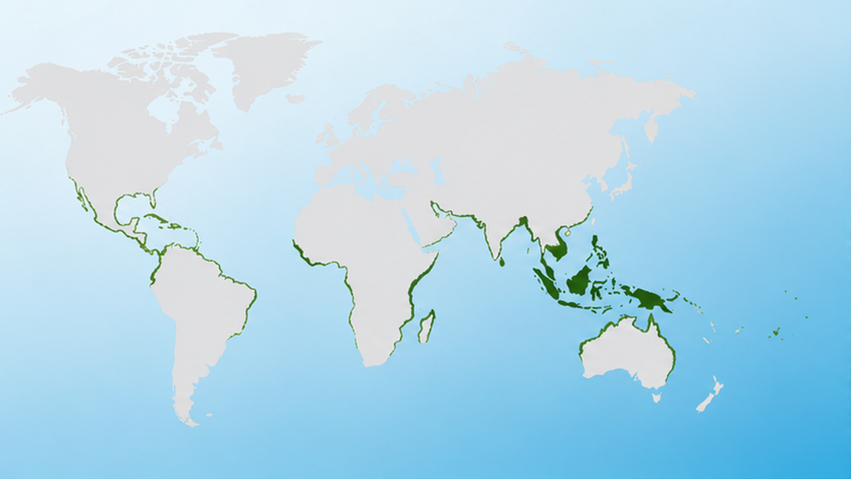
Mangroves are distributed in a band along tropical and subtropical coastlines straddling the equator. According to "The State of the World's Mangroves," a report published in 2024 by the Global Mangrove Alliance, an international research network, the total area of the world's mangrove forests is about 15 million hectares. That is an area equivalent to about 40% of Japan's total land area.
"A third of the world" concentrated in Southeast Asia
Distribution is heavily skewed. About a third of the world's mangroves are concentrated in Southeast Asia, and Indonesia alone accounts for about 21% of the world total. In recent years, satellite observation technology has dramatically improved, and the 2024 edition of the Global Mangrove Watch (v4.0) world mangrove map now tracks changes in the forest at a highly detailed 10-meter resolution with 95.3% accuracy.
| Region | Characteristics | Representative countries/locations |
|---|---|---|
| Southeast Asia | The world's largest area. Also among the highest carbon density | Indonesia, the Philippines, Malaysia |
| South Asia | One of the world's largest mangrove wetlands | Bangladesh/India (the Sundarbans) |
| Latin America and the Caribbean | The main distribution area on the American continents | Brazil, Mexico |
| West Africa | Spread along the Atlantic coast | Nigeria, Guinea |
| East Asia (northern limit region) | The northernmost edge of distribution. Small-scale | Japan (Okinawa, Kagoshima) |
Vanishing 3 to 5 times faster than forests overall
The problem is that this precious forest is being lost rapidly. Mangrove forests once vanished at a rate of about 1% a year (recently down to about 0.3–0.6% a year thanks to conservation progress), a pace of decline said to be 3 to 5 times that of the world's forests as a whole. The biggest causes are conversion into shrimp and fish farming ponds, agricultural development, and coastal urbanization. On top of that, sea level rise from climate change and increasingly powerful typhoons are also squeezing the mangrove habitat.
When mangroves are lost, coastal communities lose both a disaster-prevention forest and fishery resources at the same time. What's more, as we'll see in more detail later, the enormous carbon stored in the soil over many years is released into the atmosphere, creating a vicious cycle that accelerates climate change.

An invisible carbon outflow
Organic carbon accumulated over hundreds of years lies dormant in mangrove soil. When the forest is cleared and the soil is disturbed, this carbon escapes into the atmosphere as carbon dioxide. Not just cutting down the trees above ground, but the soil beneath one's feet itself being a huge piggy bank of carbon, is one reason mangrove conservation is so urgent.
The green seawall — the power to soften tsunamis and storm surges
Mangroves drew their most dramatic attention in the context of disaster prevention. Their densely intertwined roots and trunks absorb the energy of incoming waves, functioning as a "green seawall" that protects the settlements and farmland behind them.
Lessons from the 2004 Indian Ocean tsunami
The Indian Ocean tsunami, triggered by the earthquake off Sumatra in December 2004, claimed more than 230,000 lives across coastal nations. After this unprecedented disaster, reports poured in from various regions that "settlements behind mangrove forests suffered less damage," becoming an opportunity for mangroves' disaster-prevention function to be reassessed worldwide.
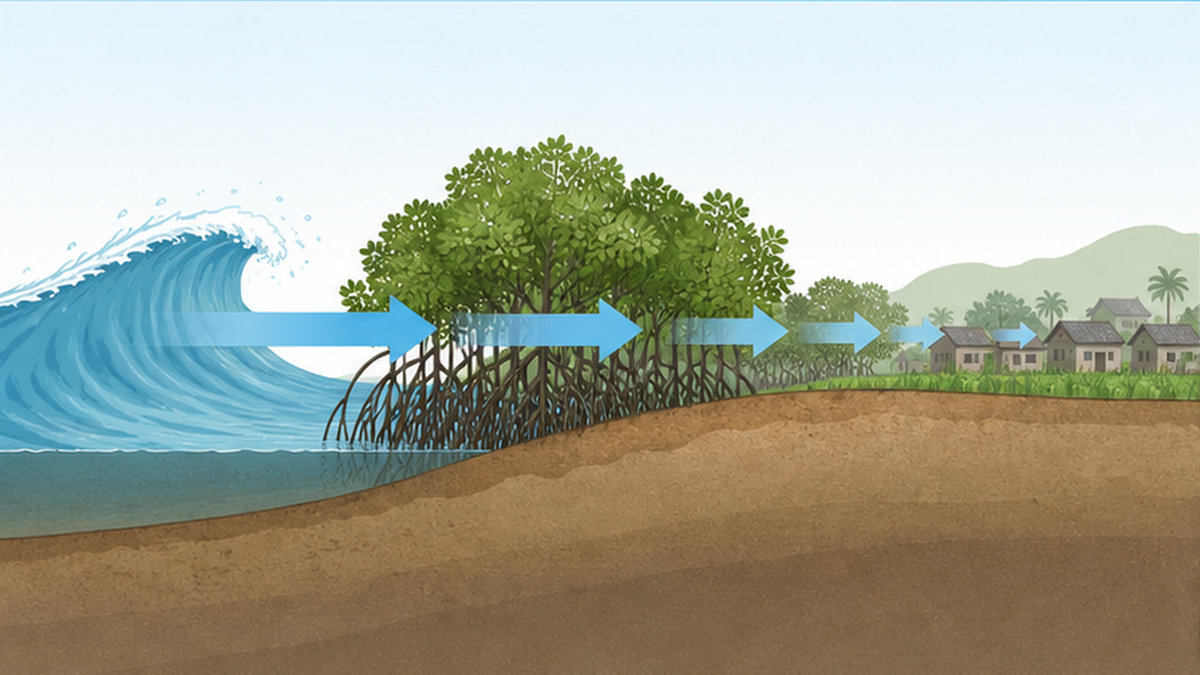
A simulation from a survey conducted by the International Society for Mangrove Ecosystems (ISME) after the 2009 Samoa earthquake and tsunami showed that mangrove forests reduce tsunami height by about 10% and water pressure by about 30%. Mangroves are not an all-powerful barrier, but they are valued as "natural infrastructure" that, combined with artificial structures such as seawalls, can reliably reduce damage.
Unraveling the "science" of how roots weaken waves
In recent years, research has also progressed to precisely capture this damage-reduction effect in numbers. A group led by Professor Nobuhito Mori of Kyoto University's Disaster Prevention Research Institute precisely measured the complex structure of representative mangrove roots with a laser scanner to create 3D models, and reproduced wave damping using tank experiments and numerical models. As a result, they found that the wave-weakening effect ranges from 5% to 30% depending on root shape and water depth, bringing the field closer to being able to design which species should be planted where to maximize disaster-prevention effect.
- The denser the roots, the more wave energy they absorb
- The shallower the water, the greater the proportion of roots in contact with waves, increasing the damping effect
- The wider the forest (the depth from sea toward land), the more the wave weakens as it passes through
Mangroves are not "all-powerful"
The damage-reduction effect of mangroves is real, but they cannot completely stop a massive tsunami. The effect is heavily influenced by the forest's width, density, species, and the scale of the wave. What matters is combining mangroves with seawalls and evacuation plans, using them as part of a multi-layered defense. The idea of "green infrastructure," which lowers risk through a combination of natural and artificial defenses, is now becoming mainstream in disaster prevention worldwide.
Blue carbon — locking atmospheric CO2 into the soil
Carbon absorbed and stored by marine ecosystems is called "blue carbon." Mangroves are a leading player in blue carbon alongside seagrass meadows and tidal flats, and they far outstrip forests on land in their ability to store carbon per unit area. The bigger picture of this field is also covered in detail in the article explaining blue carbon ecosystems.
Why is it the "king of carbon storage"?
According to Donato et al. (2011, Nature Geoscience), which examined carbon storage in tropical forests, mangroves store an average of about 1,000 tonnes (approximately 1,023 tonnes) per hectare of carbon, making them one of the most carbon-rich forests in the tropics. Notably, most of this (estimates in various studies range from about half to over 90%) lies dormant not in the trees above ground, but in the soil beneath their feet. Because organic matter accumulates without decomposing in waterlogged mud, far more carbon is stored underground than in above-ground biomass.
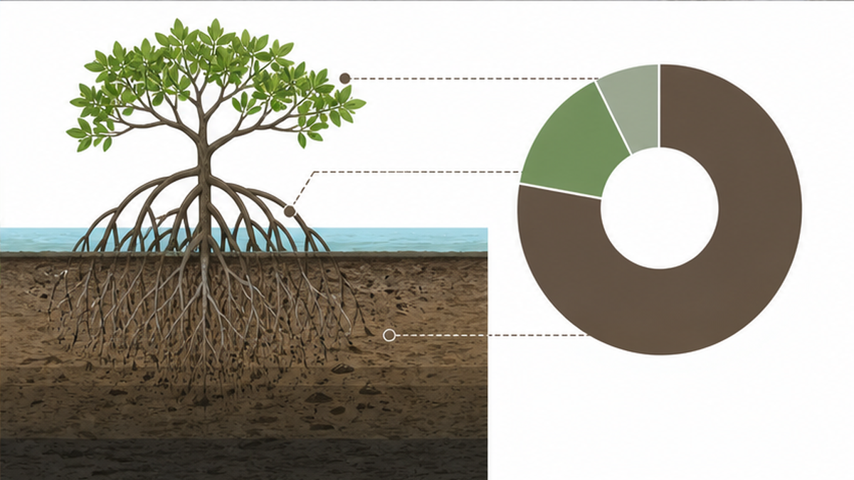
Inside waterlogged mud, oxygen is scarce, so fallen leaves and dead roots barely decompose. As a result, organic matter — that is, carbon — keeps piling up in the soil over hundreds of years. The carbon dioxide mangroves absorb is estimated at 25 to 44 tonnes per hectare per year, about twice that of Japan's forests (10 to 20 tonnes).
| Ecosystem | Characteristics of how carbon is stored | Approximate storage amount |
|---|---|---|
| Mangrove forests | Carbon accumulates over long periods in waterlogged mud | Average of about 1,000 tonnes per hectare |
| Temperate terrestrial forests | Stored mainly in tree biomass | A fraction of mangroves' amount |
| Seagrass meadows and tidal flats | Carbon stored in seabed mud | An important contributor to blue carbon |
J-Blue Credit and Japan's efforts
In Japan too, momentum is building to use blue carbon as a climate change countermeasure. The "J-Blue Credit" system, run by an organization certified by the Ministry of Land, Infrastructure, Transport and Tourism, has since fiscal 2020 been a mechanism to certify and turn into credits the amount of CO2 absorbed by domestic marine and coastal ecosystems, covering mangroves, seagrass meadows, tidal flats, and more. We have entered an era in which protecting coastal ecosystems is directly linked not only to regional disaster prevention and fisheries, but also to decarbonization. Reading the related article on tidal flat conservation alongside this one will deepen your understanding.
The term "blue carbon"
Blue carbon is a relatively new concept, proposed in a 2009 report by the United Nations Environment Programme (UNEP) and others. It has become clear that coastal ecosystems such as mangroves, seagrass meadows, and salt marshes, despite covering only a tiny fraction of the world's oceans by area, account for a large share of the ocean's overall carbon sequestration. Among them, mangroves stand out as an exceptional "carbon piggy bank."
A cradle of life — supporting biodiversity and fishery resources
Mangrove forests are also called the "cradle of ocean life." The intricately tangled spaces between the roots are a safe haven from predators, and rich in nutrients. That's exactly why an astonishing diversity of creatures spend part of their lives here.
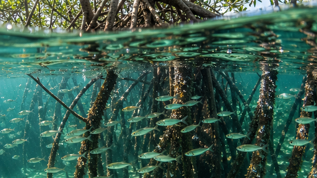
The rich food web nurtured by the roots
Fallen mangrove leaves are broken down by microorganisms, crabs, and shellfish, and the resulting nutrients nurture plankton and small fish in the water. At high tide, juvenile fish come in from offshore; at low tide, crabs retreat into their burrows in the mud while shorebirds hunt for them — a distinctive rhythm of the food web unfolds in sync with the ebb and flow of the tide. This ecosystem's richness is also essential to any discussion of marine biodiversity in Japan.
- Fish: Many marine fish spend their juvenile stage in mangrove habitats
- Crustaceans: Mud crabs, fiddler crabs, pistol shrimp, and more
- Shellfish and snails: Attach to mud and roots, and take on the job of decomposing fallen leaves
- Birds: Herons and migratory birds use the area as a feeding and resting ground
- Others: In some regions, crocodiles, monkeys, and otters also live here
Supporting coastal fisheries and livelihoods
This biodiversity connects directly to people's dinner tables. In Southeast Asia and elsewhere, mud crabs are an important source of food and income, and many of the shrimp and fish that are landed are ones raised in mangrove habitats. Catches declining when mangroves are lost has been reported in many regions, so conserving the forest is directly linked to the sustainability of coastal fisheries. On the effects of rising sea temperatures on fishery resources, the article on ocean warming and fisheries is also a useful reference.
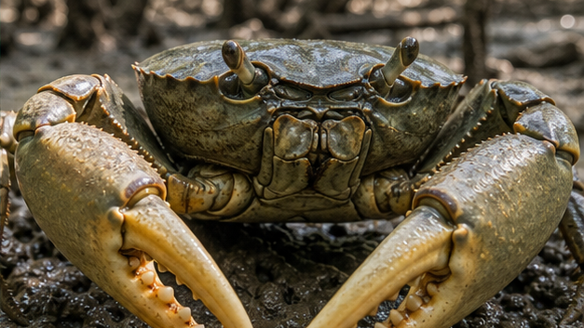
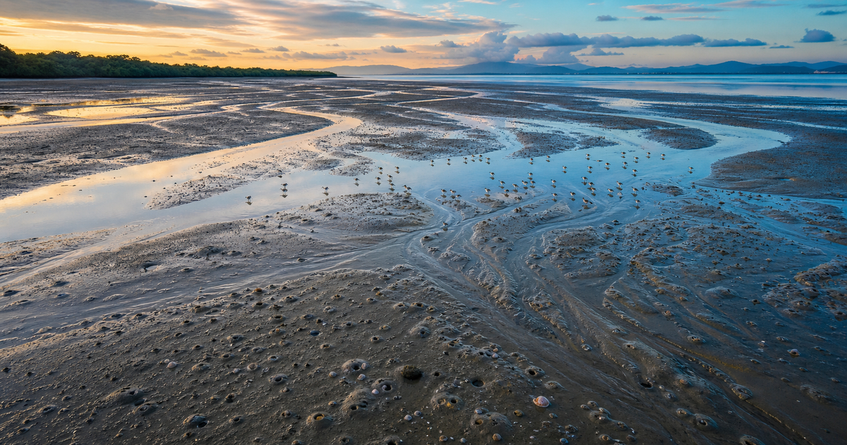
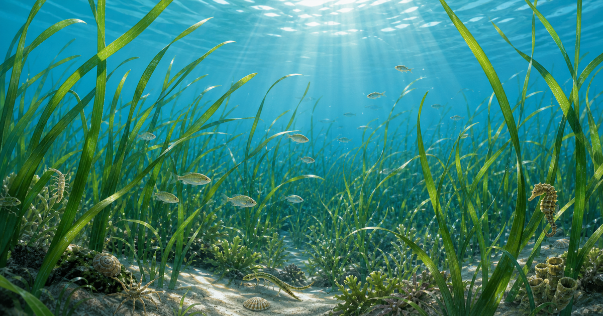
Mangroves, tidal flats, and coral reefs come as a set
Along tropical and subtropical coasts, mangrove forests, seagrass meadows, and coral reefs are connected and work together. By trapping sediment and nutrients and keeping the water clear, mangroves protect offshore coral reefs, and juvenile fish move their growing grounds from mangroves to seagrass meadows to coral reefs. Protecting a single ecosystem alone is not enough; a perspective that conserves the entire coastline as a unit is essential. On the crisis facing coral, see also the mechanism of coral bleaching.
Mangroves of Japan — from Iriomote Island, Okinawa, to the northern limit in Kagoshima
Mangroves are not only found in southern countries. Japan too has mangrove forests that mark the northern limit of the global distribution. The total domestic area is only about 600 hectares — a tiny amount by global standards — but 7 precious species grow here, many of them designated as natural monuments or protected areas.
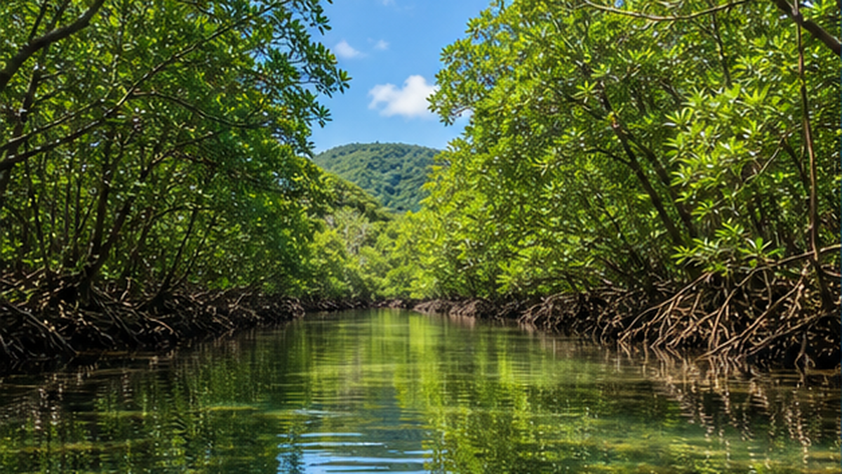
Iriomote Island — Japan's foremost mangroves
The center of Japan's mangroves is the Yaeyama Islands in Okinawa Prefecture, and above all Iriomote Island. Forests have developed at the mouths of the Nakama, Urauchi, and Shiira rivers, and all 7 domestic species can be found here. In particular, about a quarter of Japan's total mangrove area is concentrated in the Nakama River basin, designated a natural protected area and a national natural monument. This region, including Iriomote Island, was also registered as a UNESCO World Natural Heritage site in 2021.
| Species | Root type/characteristics | Approximate distribution |
|---|---|---|
| Rhizophora stylosa | Distinctive octopus-leg-like prop roots | Amami to Iriomote. World's northernmost population is on Okinawa's main island |
| Bruguiera gymnorhiza | Knee roots. Beautiful red calyx | Amami Oshima southward to Iriomote Island |
| Kandelia obovata | The most widely distributed and cold-tolerant species in Japan | Kagoshima (Hioki City) to Iriomote Island. The northern-limit species |
| Sonneratia alba, Avicennia marina, and others | Pneumatophore types | Mainly Iriomote Island and elsewhere in Yaeyama |
Gesashi on Okinawa's main island, and on to the northern limit
On Okinawa's main island, the largest primeval mangrove forest on the island spreads along the lower reaches of the Gesashi River in Higashi Village, with 3 Rhizophoraceae species growing across about 7.7 hectares of forest. This is also known as the world's northernmost population of Rhizophora stylosa, and it has become a well-known spot for canoe experiences.
The distribution continues further north still. The cold-tolerant Kandelia obovata grows naturally as far as mainland Kagoshima Prefecture, with the northernmost natural habitat being the Kannokawa River in Hioki City, Kagoshima Prefecture. The distance from the southern tip of Iriomote Island to here is a full 1,032 kilometers. The Kandelia obovata population in Kiire, Kagoshima City, is designated a special national natural monument, and stands as a precious marker of the northern edge of mangrove distribution worldwide.
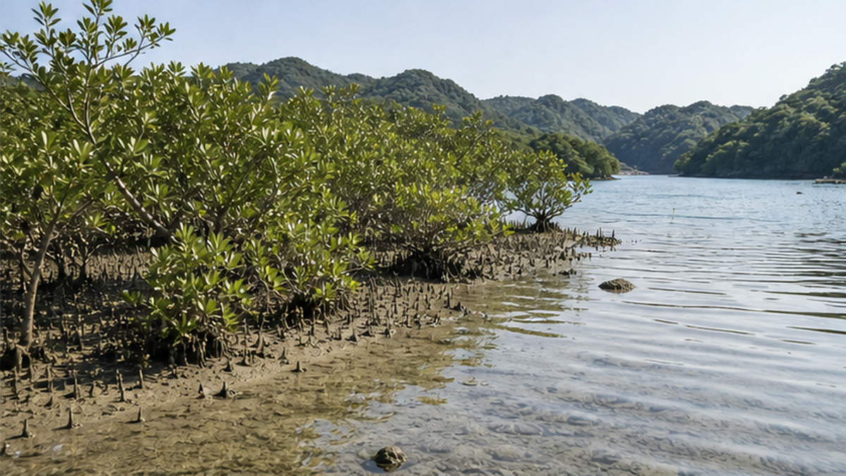
The Ministry of the Environment continues to monitor distribution
The Ministry of the Environment's Biodiversity Center regularly surveys and maps the distribution of Japan's mangrove forests as part of its "Basic Survey on the Preservation of the Natural Environment." Although the area of Japan's mangroves is small, they occupy an academically important position as the northern limit of global distribution, making them a valuable subject for monitoring how distribution changes with climate change.
Restoration in Southeast Asia — why planting fails, and how to succeed
The world has set a major goal to reclaim vanishing mangroves. At the 2022 United Nations Climate Change Conference (COP27), the international framework "Mangrove Breakthrough" was launched, aiming to conserve and restore 15 million hectares of mangroves by 2030, with about $4 billion in funding mobilization pledged.
The pitfall of "just plant it and it will grow"
However, mangrove restoration is not as simple a matter as "plant seedlings and it will succeed." Research reports that more than 70% of conventional planting projects fail. The biggest cause pointed to by an analysis in an overseas academic journal (PLOS ONE) was, surprisingly, ignoring the flow of water (hydrological conditions).
- Planting seedlings in tidal flats with too much tidal exchange, or in poorly drained locations
- The original river channel or waterway remains blocked, so proper tidal flow has not been restored
- Choosing and planting species unsuited to the land based only on appearance
- Altering the topography changes the water level, causing salinity to become too concentrated and killing the seedlings
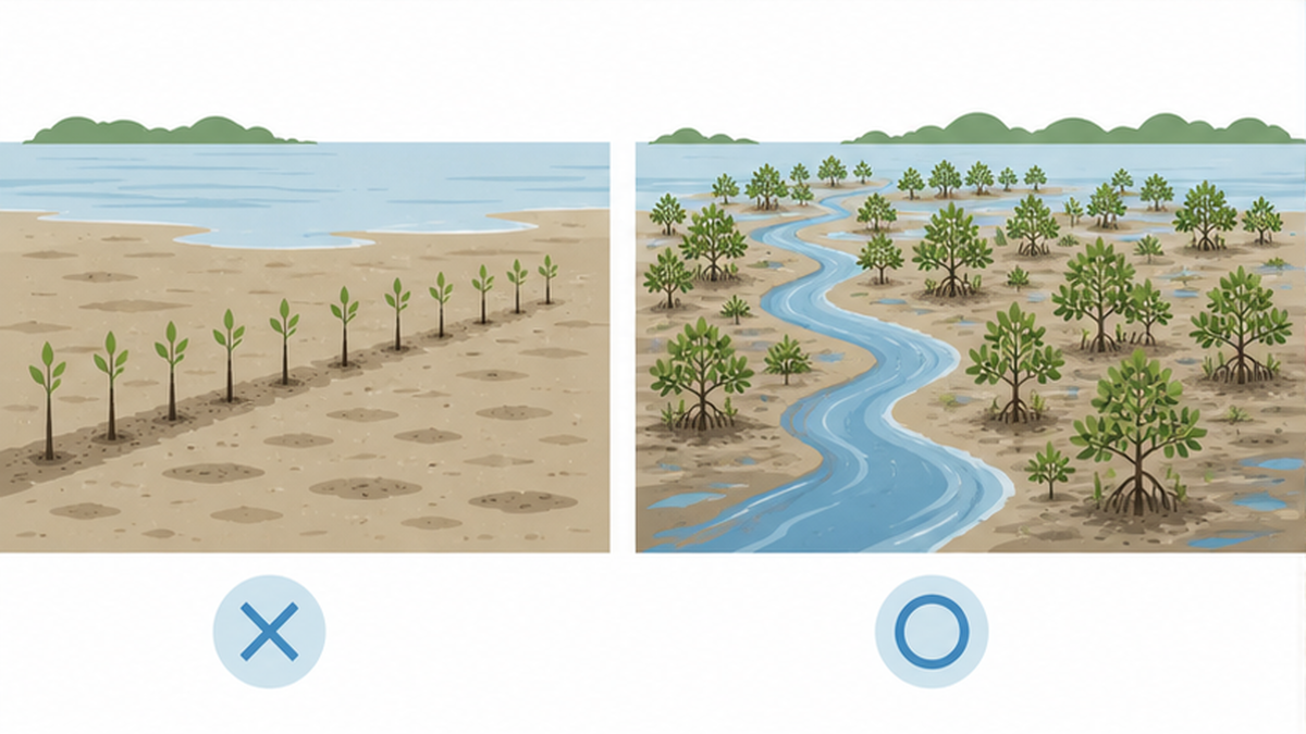
The concept of Ecological Mangrove Restoration (EMR)
Out of this reflection has come a spreading method called Ecological Mangrove Restoration (EMR/CBEMR). Rather than planting seedlings right away, it first fixes the cause of the site's loss (often a blocked waterway or altered topography) and restores the balance of tidal flow and fresh/salt water. In many cases, this alone allows seeds to be naturally carried in from the surroundings, letting mangroves suited to that land regenerate on their own. Success has been confirmed in Florida, Costa Rica, the Philippines, Thailand, and elsewhere.
Japan joins the international cooperation
Japan is also contributing in this field. JICA (Japan International Cooperation Agency) signed a technical cooperation agreement in September 2024 to support "sustainable management of mangroves for ecosystem-based adaptation to climate change" in Indonesia, the world's largest holder of mangroves. Frameworks for sharing best practices and lessons across the ASEAN region as a whole are also being developed, shifting the focus away from simple tree-planting and toward sustainable, science-based management.
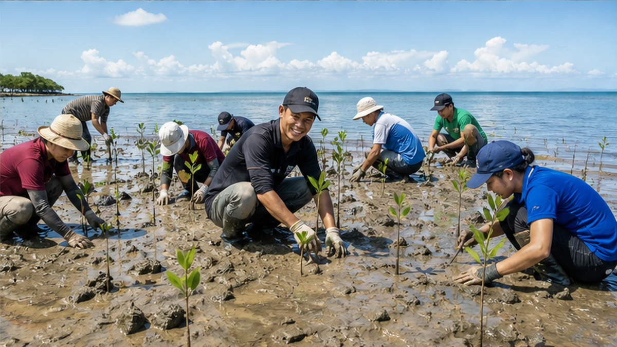
Three ways to spot a good restoration project
- Does it talk about "how many years it survived as a forest," rather than just "how many seedlings were planted"?
- Before planting, has it addressed the "cause of loss," such as waterways and topography?
- Do local residents participate in planning and management, in a way that coexists with their livelihoods?
Summary — our connection with mangroves
Mangroves protect people from tsunamis and storm surges, lock away vast amounts of carbon in the soil, and nurture countless creatures — a rare presence in which a single forest works simultaneously across three fronts: disaster prevention, climate, and biodiversity. While rapid loss continues in Southeast Asia, home to about a third of the world's total, new restoration methods that restore the flow of water, together with international cooperation, are becoming a ray of hope.
For those of us living in Japan too, mangroves are by no means a distant, faraway story. The forests of Iriomote Island in Okinawa and the northern-limit forests in Kagoshima are accessible natural sites we can visit ourselves, and they are deeply connected to the shrimp and fish we eat, and to the stability of the climate.
- Visit a mangrove forest in Okinawa or Kagoshima and experience how it works through a guide's explanation
- When buying farmed shrimp and the like, choose environmentally certified (sustainably farmed) options
- Learn about and support the activities of organizations and local governments working on blue carbon and coastal conservation
- Share the value of the "forest of the sea" as a climate change countermeasure with family and friends
Summary of this article
- Mangrove is a general term for trees that grow along tropical and subtropical coasts, with about 80 species worldwide and 7 in Japan, possessing unique mechanisms for tolerating salt
- The world total area is about 15 million hectares. About a third is concentrated in Southeast Asia, and it is vanishing 3 to 5 times faster than forests overall
- It simultaneously fulfills three roles: disaster prevention (reducing tsunami height by about 10%), blue carbon (storing an average of about 1,000 tonnes of carbon per hectare), and biodiversity
- Japan's mangroves cover about 600 hectares. Iriomote Island is the center, and Kagoshima (Kannokawa River, Kiire) marks the northern limit of global distribution
- The key to restoration is less about "planting seedlings" and more about "restoring the lost flow of water." EMR and international cooperation are beginning to show results
References and sources
- Ministry of the Environment Biodiversity Center – Basic Survey on the Preservation of the Natural Environment (mangrove survey)
- Ministry of the Environment Inter-Ministerial Liaison Council on Blue Carbon – Compilation of blue carbon initiatives in Japan (2023)
- Ministry of Land, Infrastructure, Transport and Tourism, Ports and Harbours Bureau – Blue carbon / J-Blue Credit system
- JICA (Japan International Cooperation Agency) – Technical cooperation on sustainable mangrove management in Indonesia (2024)
- Nikkei – Mangroves reduce tsunamis and storm waves; Kyoto University and others develop a numerical model
- Global Mangrove Alliance – The State of the World's Mangroves 2024
- PLOS ONE – Hydrological Classification, a Practical Tool for Mangrove Restoration
- Nature Geoscience (Donato et al. 2011) – Mangroves among the most carbon-rich forests in the tropics
- International Society for Mangrove Ecosystems (ISME) – What is a mangrove? The importance of mangrove ecosystems
- Sasakawa Peace Foundation, Ocean Policy Research Institute – Ocean Newsletter: Conservation and international cooperation for mangrove ecosystems
※ Listed in order of reliability: government/academic institutions > peer-reviewed papers > specialized organizations > reputable media