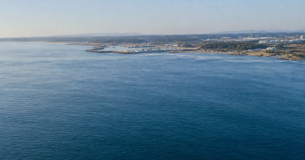
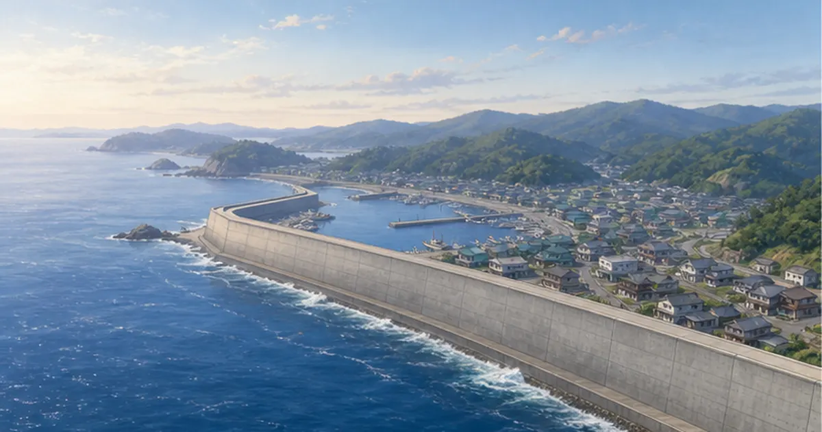
At 4:10 p.m. on January 1, 2024, a magnitude 7.6 earthquake centered in the Noto region of Ishikawa Prefecture struck the Noto Peninsula. Beyond the violent shaking and tsunami, this earthquake had a feature almost unheard of in past disasters: the coastline along the northern shore of the peninsula rose by more than 4 m in places.
When a coast is uplifted, the water inside a harbor drains away and the places where boats were moored dry out. Quay walls end up far above the sea, so boats cannot tie up alongside to unload fish. Sixty of the 69 fishing ports in Ishikawa Prefecture were damaged, and fishers faced the reality that their ports had stopped being ports.
This article draws on primary sources from the Fisheries Agency, the Geospatial Information Authority of Japan, the Geological Survey of Japan, and Ishikawa Prefecture, together with research from Kanazawa University and others, to lay out the scale of the uplift damage, the unprecedented thinking behind the recovery, the current state of Wajima and Kaiso ports, and what happened to the exposed seabed ecosystem and seaweed beds.
What you'll learn in this article
- How large the coastal uplift from the Noto earthquake was (about 100 km long, about 4.4 km² of new land)
- Why uplift keeps fishing ports out of service far longer than a tsunami does
- The two-phase approach of temporary and full restoration set out by the Fisheries Agency, and the three restoration options
- The timeline of emergency repairs and fishing resumption at Wajima, Kaiso, and Noroshi ports
- What happened to the exposed seabed ecosystem, seaweed beds, and the sediment carried by heavy rain
- The return of ama diving and the Sea Map Project, among other efforts supporting the rebuilding of livelihoods
What Happened in the Noto Peninsula Earthquake: One of the Largest Coastal Uplifts Ever Recorded
The 2024 Noto Peninsula earthquake struck at 4:10 p.m. on January 1, 2024. According to preliminary figures from the Japan Meteorological Agency, it had a magnitude of 7.6 and a focal depth of about 16 km, and it registered the maximum seismic intensity of 7 in the town of Shika and the city of Wajima. The focal mechanism was a reverse fault with a compression axis running northwest to southeast, and an active fault extending offshore along the northern coast of the peninsula is believed to have ruptured.
The Coastline Rose by More Than 4 m
The Geospatial Information Authority of Japan analyzed data from the Advanced Land Observing Satellite "Daichi-2" and confirmed uplift of up to about 4 m in western Wajima. In an emergency survey by the Geological Survey of Japan at the National Institute of Advanced Industrial Science and Technology (AIST), the positions of oysters and other organisms attached to a seawall around Kaiso Fishing Port in Wajima indicated uplift of 3.8 to 3.9 m, and a flat wave-cut platform had been raised about 3.6 m and left high and dry.
Later research revealed the full picture. A team from Hiroshima University, Kanazawa University, the Natural History Museum and Institute, Chiba, and other institutions measured uplift at 510 points along the coast and found values of 0.1 to 5.2 m. The uplifted zone extended about 100 km, and the area newly turned into land reached about 4.4 km². The area of new land is comparable to that of the 1804 Kisakata earthquake, but the length is among the longest in the world. The findings were published in the international journal Geomorphology in January 2026.
The damage from the earthquake itself was also devastating. According to the Fisheries White Paper, as of the end of March 2024 the death toll, including disaster-related deaths, exceeded 244, and housing damage amounted to roughly 9,000 homes destroyed, 19,000 half-destroyed, and 84,000 partially damaged. Up to about 40,000 households lost power and about 56,000 lost their water supply. Many fishers were themselves disaster victims, facing the recovery of their ports while rebuilding their lives at home or in evacuation shelters.
The Noto Peninsula had already experienced a magnitude 6.9 earthquake in March 2007, and a swarm of earthquakes had continued around the city of Suzu since December 2020. An earthquake of intensity 6-upper struck in May 2023. The main shock of New Year's Day 2024 came at the end of a long period of seismic activity.

The Fourth Major Uplift in 6,000 Years
According to the AIST survey, the northern coast of the Noto Peninsula has three marine terraces (surfaces L1 to L3) that formed roughly 6,000 years ago or later. This earthquake created a fourth terrace that should be called surface L4, suggesting that uplift large enough to form marine terraces has occurred at least three times in the past in this area. Seen over a long time scale, the Noto coast is land that has been lifted in steps with each major earthquake.
Why the Uplift Varied So Much From Place to Place
- The active fault that caused the uplift extended continuously, almost parallel to the coastline
- Movement on a reverse fault dipping to the south lifted land closest to the fault the most
- No uplift was found on the Nanao Bay or Toyama Bay side; damage was concentrated on the outer (Sea of Japan) coast
When a Port Stops Being a Port: 60 of 69 Fishing Ports Damaged
According to the Fisheries Agency's technical review report on the restoration and reconstruction of fishing communities after the 2024 Noto Peninsula earthquake, 60 of the 69 fishing ports in Ishikawa Prefecture (86.9%) suffered ground uplift, damage to breakwaters and quays, damage to port roads, and other harm. Uplift damage was concentrated on the outer coast of Wajima and Suzu, making it hard to use anchorages (the water areas where boats moor) and navigation channels.
Uplift: A More Stubborn Problem Than a Tsunami
In the Great East Japan Earthquake, the tsunami destroyed quays and facilities, but the sea itself stayed where it was. Repair what was broken and the port could be used again. Uplift, however, takes away the very foundation of a port: its water depth. The harbor floor is exposed, the remaining anchorage becomes too shallow for boats to enter or leave, and quay walls end up too high for boats to tie up alongside. On top of that, debris and sediment carried by the tsunami piled up in the channels, and boats stayed stuck in port.
Repairing damaged facilities would not solve the problem. What was required was a decision to redesign the port itself: dig out the seabed, push the port farther offshore, or consolidate operations at another port. The Fisheries Agency concluded that uplift damage on this scale had no precedent in Japanese fisheries and that new recovery approaches and technologies were needed.
A fishing port has basic facilities that include water areas (channels and anchorages), outer facilities (breakwaters and seawalls), and mooring facilities (quays, landing places, and slipways). Uplift affects all of them at once. Channels and anchorages become shallow, breakwaters rise and change their role, quays and landing places move away from the water, and slipways (the ramps used to haul boats ashore) no longer reach the sea. The Fisheries Agency's technical report organized representative restoration methods and construction approaches for each type of basic facility and set out points to consider.
Damage to fishing boats was also severe. According to the Fisheries White Paper, more than 230 boats capsized, sank, ran aground, or suffered other damage, and the final tally from the Ministry of Agriculture, Forestry and Fisheries reached 366. For fishers who lost not only their port but also their boat, the road back was doubly steep. The Fisheries Agency dispatched staff immediately after the disaster, and support staff from 22 prefectures contributed a total of 781 person-days to damage surveys and recovery planning for the ports.
Ground Movement at Each Fishing Port
| Municipality | Port | Ground movement (preliminary) |
|---|---|---|
| Wajima | Kaiso Fishing Port | 4.1 m uplift |
| Wajima | Fukami Fishing Port | 3.7 m uplift |
| Wajima | Kuroshima Fishing Port | 3.7 m uplift |
| Wajima | Minazuki Fishing Port | 3.6 m uplift |
| Suzu | Nagahashi Fishing Port | 2.8 m uplift |
| Wajima | Osawa Fishing Port | 2.5 m uplift |
| Wajima | Nafune Fishing Port | 2.2 m uplift |
| Suzu | Noroshi Fishing Port (Takaya district) | 1.8 m uplift |
| Wajima | Wajima Port | 1.5 m uplift |
| Suzu | Takojima Fishing Port | 0.2 m uplift |
| Suzu | Ukai Fishing Port | 0.4 m subsidence |
| Wajima | Hegurajima Fishing Port | 0.1 m or less |
The table shows that even within Wajima, the ports near the northwestern tip of the peninsula, Kaiso, Fukami, Kuroshima, and Minazuki, rose an extreme 3.6 to 4.1 m, while Wajima Port rose 1.5 m and Hegurajima, about 50 km offshore, barely moved. On the inner coast, Ukai Fishing Port in Suzu actually subsided 0.4 m. Differences in uplift translate directly into differences in how hard recovery will be.

Fisheries Damage Alone Reached ¥107.7 Billion
According to figures released by the Ministry of Agriculture, Forestry and Fisheries in January 2025, damage to agriculture, forestry, and fisheries from the Noto Peninsula earthquake totaled ¥365.8 billion, of which fisheries accounted for ¥107.7 billion. Damage to fishing port facilities (73 ports) made up the bulk at ¥100.2 billion, and 366 fishing boats were damaged. Port recovery is so costly because uplifted ports must be rebuilt, not simply repaired.
Recovery Without Precedent: The Fisheries Agency's Technical Review and the Two-Phase Approach
How do you restore an uplifted fishing port? Because experience from past disasters was of little use, the Fisheries Agency set up a technical review committee of experts on the restoration and reconstruction of fishing communities after the 2024 Noto Peninsula earthquake. After three meetings starting in May 2024, it compiled technical methods and procedures for recovery and reconstruction in July of that year.
Short-Term Temporary Restoration and Medium- to Long-Term Full Restoration
The basic idea in the report is to restore ports that suffered severe damage such as ground uplift in two phases: temporary restoration to allow livelihoods to resume in the short term, and full restoration to improve functions over the medium to long term. First secure the minimum functions fishers need to go to sea, and in the meantime consider what the port should look like in the future. Alongside the recovery plan, the report also called for thinking about reconstruction that leads to a new form of fishing community, including the promotion of marine-based businesses.
Behind this two-phase approach is a race against time. Full restoration takes years, including design, consensus building, and construction. If fishers cannot fish at all during that period, their income stops, successors move to other jobs, and the fishing village itself ceases to function. That is why priority went to temporary restoration that quickly puts boats back on the water, while discussions on full restoration proceed in parallel. Emergency works covered a total of 20 fishing ports across Ishikawa, Toyama, and Niigata prefectures.
Three Options Depending on the Amount of Uplift
The committee classified damage into three patterns, large, medium, and small, according to the amount of uplift, and set out typical options for each.
| Phase | Option | Approach |
|---|---|---|
| Temporary | 1. Excavate within the port | Use existing facilities and dig out part of the harbor to secure an anchorage |
| Temporary | 2. Build a pier offshore | Extend a pier toward deeper water offshore to allow mooring and landing |
| Temporary | 3. Build a ramp to the water | Construct a ramp from the uplifted ground down to the sea so small boats can be launched and hauled |
| Full | 1. Excavate within the port | Dredge the harbor thoroughly to restore the original depth |
| Full | 2. Move offshore | Build new breakwaters and quays farther out where depth can be secured |
| Full | 3. Use adjacent waters outside the port | Develop a new anchorage and mooring facilities in adjacent waters |

For a port with small uplift, for example, digging out the harbor a little restores its original function. A port with medium uplift needs quay heights adjusted and piers added in addition to excavation. And at a port with large uplift like Kaiso, where the harbor floor is completely exposed, building a new anchorage and quay offshore may make more sense than digging the harbor down by 4 m. How deep must you dig for boats to move safely? Where does the excavated sediment go? Can fishing continue during construction? Conditions differ at every port, so there is no single right answer.
Which option to choose depends not only on the amount of uplift but on local conditions and users' needs. The report notes that the criteria differ between temporary and full restoration and calls for weighting evaluation items accordingly. It also stresses the importance of confirming the intentions of fishers and other users at each stage, and organizes points to bear in mind.
Seven Perspectives Emphasized for Recovery and Reconstruction
- Division of roles among fishing ports (share functions rather than restore every port as it was)
- Development of facilities with a view to the port's future form
- Integration of fishing ports with fishing villages and fishing grounds
- Resilience of fishing communities in light of the disaster
- Strengthening of distribution and production functions
- Promotion of marine-based businesses using fishing ports
- Use of digital technology
It is significant that division of roles comes first. In Noto, where fishers are aging and their numbers are falling, is it realistic to spend years rebuilding every small uplifted port? Recovery became a process of questioning the very future of the region's fisheries. For more on the challenge of securing the next generation of fishers, see Why Japan's Shortage of Fishers Is So Serious.
Wajima, Kaiso, and Noroshi: How Recovery Actually Unfolded on the Ground
This section follows the progress at representative ports, drawing on the status of port recovery released by Ishikawa Prefecture at the governor's press conference in November 2025 and on Fisheries Agency announcements.
Wajima Port: From 200 Boats Stranded to Emergency Repairs and the Return of Fishing
Wajima Port is the logistics and fisheries hub of the Oku-Noto region. The earthquake lifted the ground by about 1.5 m, leaving too little water at the moorings, and about 200 fishing boats were unable to leave port. Under a system in which the national government carries out works on behalf of the prefecture, the Ministry of Land, Infrastructure, Transport and Tourism dredged the harbor floor and carried out other work. Emergency restoration was completed in June 2024, and fishing resumed in October of that year.
One major point of debate in the recovery of Wajima Port was whether to relocate the port or restore it in place. With the whole port made shallow by 1.5 m of uplift, building a new port elsewhere was a real option. In May 2024, however, the national government, the prefecture, the city of Wajima, and local fishers agreed to restore the port where it stands, a decision that protects the integration of the long-used port with its market, processing plants, and homes. In July of that year, Ishikawa Prefecture adopted a policy of aiming for full restoration in two to three years, centered on dredging the seabed.
In June 2025 the Wajima Port Recovery and Reconstruction Plan was drawn up. The national government and the prefecture are working together toward full restoration of the main quays and landing places by the end of fiscal 2026. The plan goes beyond simply restoring what was there. It calls for creating reclaimed land from dredged sediment and consolidating several shared fisheries facilities there to strengthen their functions, for building shallows against the No. 4 breakwater using dredged material to reinforce the breakwater and create habitat for juvenile fish, and for improving the port's capacity to receive cruise ships. In the Ama district, a roughly 150 m mooring facility was completed in August 2025, extended 6 m seaward of the existing structure, making it possible for fishing boats to land their catch.
According to media reports, 25 boats set out from Wajima Port on the opening day of the bottom-trawl season in September 2025 and landed flounder and blackthroat seaperch. At the same time, the catch was reported to be about 40% of pre-earthquake levels, and fishing continues while port recovery remains incomplete.
Kaiso Fishing Port: 4 m of Uplift and a Temporary Landing Place Built From Giant Sandbags
At Kaiso Fishing Port in Wajima, where uplift was greatest at 4.1 m, the harbor floor was left completely exposed. Ishikawa Prefecture drew up a reconstruction policy for the port in August 2024 and built a temporary landing place by stacking large sandbags on the exposed seabed. The temporary landing place was completed in March 2025, and set-net fishing resumed on April 25 of that year. In July a temporary slipway for small boats was also completed, and boats from nearby ports whose recovery plans have not yet been decided are using it as well. While fishing continues, the national government, the city, and fishers are studying full restoration and reconstruction with an eye to the future.
The temporary landing place at Kaiso can be seen as a combination, adapted to local conditions, of two of the Fisheries Agency's temporary restoration options: excavating within the port using existing facilities and building a ramp to the water. By using the exposed harbor floor itself as a foundation, it made it possible for set-net boats to land their catch without waiting for full-scale dredging. Nearby ports with large uplift, such as Fukami, Kuroshima, and Minazuki, are still studying their recovery plans, and the temporary facilities at Kaiso function as a base that accepts their boats. This is the division of roles among ports that the committee emphasized, anticipated in practice on the ground.
Noroshi Fishing Port: Restoring a Port of Refuge Through National Works
Noroshi Fishing Port in Suzu is a Class 4 fishing port where boats from inside and outside the prefecture take shelter in rough weather. Uplift made the anchorage and channel shallow and raised the quay walls. The Fisheries Agency began disaster recovery works on the prefecture's behalf in May 2024. Part of the anchorage became usable in September of that year, and in March 2025 dredging of part of the anchorage and temporary restoration of the 3.0 m-depth quay were completed, allowing catches to be landed. Full restoration of the breakwaters and other structures is still under way.
Under this system, the national government carries out works directly in place of a disaster-stricken local government. All 10 ports managed by Ishikawa Prefecture were damaged, and at six of them, Wajima, Iida, Ogi, Ushitsu, Anamizu, and Nanao, the Ministry of Land, Infrastructure, Transport and Tourism carried out works on the prefecture's behalf. Of the eight prefecture-managed fishing ports, seven were damaged, and the Fisheries Agency took on the works at Noroshi. With the help of the prefectural construction association and others, emergency restoration was completed at all prefecture-managed ports by March 2025. Emergency restoration, however, only brings a port to a usable state; full restoration is the real work ahead.
Ishikawa Prefecture's Recovery Timeline (as of November 2025)
- January to March 2024: Set-net fishing resumed at Togi Fishing Port in Shika and Takojima Fishing Port in Suzu; bottom trawling resumed in Suzu in late March
- June to July 2024: Emergency restoration completed at Wajima, Iida, Nanao, and Ushitsu ports
- October 2024: Fishing resumed at Wajima Port
- March 2025: Emergency restoration completed at all prefecture-managed ports; temporary facilities completed at Kaiso and Noroshi
- June 2025: Wajima Port Recovery and Reconstruction Plan adopted
- End of fiscal 2026: Target for full restoration of Wajima Port's main quays and landing places
After the Great East Japan Earthquake, some areas needed more than 10 years to restore their fishing ports. For the lessons of that recovery, see Thirteen Years of Fisheries Recovery After the Great East Japan Earthquake.
How the Sea Changed: Exposed Seabed Ecosystems, Seaweed Beds, and Sediment
Uplift affected not only ports but marine life directly. When rocky reefs that were underwater are suddenly thrust into the air, the organisms living there cannot survive. In Noto, this exposure of the seabed also became a scientifically valuable record.
Seabed Creatures Appeared on Land Just as They Had Lived
A joint research group including Lecturer Kei Sato and Associate Professor Robert Jenkins of Kanazawa University, researcher Seinosuke Teruya of the Natural History Museum and Institute, Chiba (Marine Science Museum), and researcher Moe Kato of the Kyushu University Museum began field surveys on the rocky shore around Kaiso Fishing Port just 66 days after the earthquake. There, uplift of about 3.6 to 3.9 m had exposed on land, in the arrangement in which they had lived, subtidal biological communities that normally can only be reached by diving surveys.
The group analyzed in detail the death assemblages of benthic organisms and seaweeds such as the coralline alga Corallina pilulifera, and succeeded in reconstructing the structure of the rich pre-earthquake ecosystem with unprecedented precision. The results were published online in the journal Plankton and Benthos Research in February 2026. They provide baseline data on the pre-earthquake state for monitoring how the ecosystem recovers after the disaster.

Three to Five Years to Recover From a Dead Zone
According to media reports, Associate Professor Jenkins found in surveys around Kaiso Fishing Port and Cape Saruyama that dead algae and barnacles remained stuck to the rock and that sea urchins and turban shells were still absent. He has suggested that the dead zone created by uplift and the tsunami could take at least three to five years to recover. Small organisms under 5 mm begin returning in about six months, he says, but larger organisms need years.
The speed of recovery differs by organism. Seaweeds and small attached organisms that spread by spores and larvae return relatively quickly, but animals that take years to grow, such as turban shells, abalone, and sea urchins, need still more time for their populations to rebuild after the seaweed they feed on has returned. The observation by ama divers that turban shells and abalone seem fewer and smaller than last year likely reflects this time lag in the food chain.
Dried-Out Seaweed Beds and Mud From Heavy Rain
Seaweed beds, which are vital to fisheries, also suffered a heavy blow. According to a paper by Ryoko Ishikawa of the Wajima Seaweed Lab, who has studied Wajima's seaweeds for many years, published in Fisheries Engineering (Vol. 62, No. 1, 2025), uplift dried out seaweed beds along the Wajima coast and killed large numbers of the organisms living in them. From July 2024, fine mud accumulated mainly around river mouths, sharply degrading the seabed environment and the remaining seaweed beds, and the Oku-Noto heavy rain that began on September 21 of that year is judged to have caused extensive damage to the beds.
The Oku-Noto heavy rain struck the peninsula from September 21 to 23, 2024, causing widespread river flooding and landslides. In Wajima, a temporary spillway for a landslide dam formed when the January earthquake blocked a river was destroyed by the rain, and large volumes of sediment flowed into settlements. The flow of sediment from the mountains to the sea passed through the villages and settled as fine mud on the seabed at river mouths. Mud prevents seaweed spores from attaching to rock and interferes with the breathing and feeding of shellfish. Even the seaweed beds that had escaped uplift were damaged by this mud.
Mountainsides collapsed in the earthquake, and before they could be stabilized, heavy rain carried the sediment down rivers into the sea. Water made shallow by uplift is especially prone to being smothered by that mud. With earthquake and rain coming one after the other, Noto's coastal environment bore a double burden. For the role of seaweed beds in spawning and the growth of juvenile fish, see Restoring Seaweed Beds, the Cradle of Fish.
Compound Impacts on the Coastal Environment
- Uplift: subtidal reefs and seaweed beds dried out, killing attached organisms, seaweeds, and shellfish in large numbers
- Tsunami: debris and sediment flowed into harbors and along the coast
- Heavy rain (September 2024): fine mud settled around river mouths, degrading even the surviving seaweed beds
- Recovery outlook: about six months for small organisms and several years for large ones, according to researchers
Ama Divers and Set Nets: The Path to Rebuilding Livelihoods
A port is the life of the people who fish from it. This section follows the return of two livelihoods that define Noto: ama diving and set-net fishing.
Wajima's Ama Divers: Back to Hegurajima After a Year and Nine Months
The ama divers of Wajima have long practiced free diving for turban shells, abalone, seaweed, and other products around the island of Hegurajima, about 50 km off Wajima Port. The techniques of Wajima's ama fishing are designated an Important Intangible Folk Cultural Property of Japan. The uplift of Wajima Port made it impossible for boats to leave at all, and the port on Hegurajima was damaged by the tsunami, so ama diving was forced into a long suspension.
Wajima's ama fishing has a history said to date back to before the Edo period, with the waters around Hegurajima and the Nanatsujima islands as its main fishing grounds. During the summer season the divers cross to the island and stay there, free diving to gather turban shells, abalone, and seaweed from the rocky bottom. According to Ishikawa Prefecture's cultural property records, the practice is distinguished by its minimal tools and its reliance on diving skill and knowledge of the sea. The uplift of the port temporarily severed a culture handed down over centuries. That is why the resumption of fishing at Hegurajima has been received locally as something far more than a recovery in landings.
Hegurajima Fishing Port is one of the few ports that Ishikawa Prefecture has declared fully restored. According to the Hokkoku Shimbun, about 120 ama divers resumed free diving at Hegurajima in July 2025, a year and nine months after the earthquake, and no major changes from the earthquake were found on the seabed of the fishing grounds. On the opening day of the following season, July 3, 2026, about 130 divers took part and landed about 3.5 tonnes of the seaweed ishimozuku on the first day.
Challenges remain, however. Stocks had been declining even before the earthquake, and sediment carried into the sea by the earthquake and heavy rain has made growing conditions harsher still. The divers have set voluntary daily limits of 30 kg of turban shells and 20 kg of mozuku seaweed to protect the resource while they fish. The head of the preservation association said of the 2026 opening day that the shells seemed fewer and smaller than the year before, and the recovery of stocks is only halfway there.
Set Nets and Bottom Trawls: Fishing Returns in Stages
Set-net fishing can resume as soon as even part of a quay is usable, and it supported the early phase of recovery. Set nets were back in operation at Togi Fishing Port in Shika within January 2024 and at Takojima Fishing Port in Suzu in late January, and bottom trawling returned around Suzu and Nanao in March. Nanao's public regional wholesale market reopened on February 1. Even at Kaiso, where uplift was greatest, set-net fishing resumed in April 2025 once the temporary landing place was complete.
Catching fish means nothing without somewhere to sell it. The reopening of Nanao's public regional wholesale market on February 1 was a major event in that it kept the distribution of Noto fish from stopping. In Wajima and Suzu, on the other hand, damage to markets, ice plants, and processing facilities piled up, and some catches were trucked toward Kanazawa for sale. The Fisheries Agency's technical report lists strengthening of distribution and production functions as a perspective for reconstruction precisely because rebuilding the system that delivers fish to buyers matters as much as port construction.
In restoration, (1) the division of roles among fishing ports and (2) the development of facilities with a view to their future form are important; in reconstruction, consideration should be given to (3) integration of fishing ports with fishing villages and fishing grounds, (4) resilience of fishing communities in light of the disaster, (5) strengthening of distribution and production functions, (6) promotion of marine-based businesses using fishing ports, and (7) use of digital technology.
— Fisheries Agency, Technical Review Report on the Restoration and Reconstruction of Fishing Communities After the 2024 Noto Peninsula Earthquake (detailed edition), July 2024
Even when port restoration is finished, a port does not come back to life unless fishers return. Commuting from temporary housing, rebuilding processing plants and markets, and securing successors all proceed on a different timeline from port construction. For thinking on the regeneration of fishing communities, see What Does It Mean to Rebuild a Coastal Community?.
The Sea Map and Creative Reconstruction: Data Supporting the Next Generation of Fishing
Nobody can know what the uplifted sea looks like beneath the surface without taking a boat out. What proved invaluable here was seabed topography data that happened to have been collected before the earthquake.
The First Case in the World of Comparing Seabed Topography Before and After an Earthquake
The Sea Map Project, launched in 2022 by the Nippon Foundation and the Japan Hydrographic Association, is a 10-year plan to map the seabed of shallow coastal waters down to 20 m using airborne laser surveys, covering about 90% of Japan's roughly 35,000 km of coastline. Northern Noto was surveyed in September and October 2022, shortly before the earthquake. The project resurveyed the area in April and May 2024, becoming the first in the world to obtain detailed seabed topography data for shallow coastal waters before and after an earthquake accompanied by major uplift. It surveyed again in October 2024, after the heavy rain.
The comparison showed maximum seabed uplift of about 5.2 m near Cape Saruyama and maximum uplift on land of 4.1 m. Horizontal displacement was also confirmed: an average of 2.5 m and a maximum of 4.3 m toward the west-northwest to northwest between Shimizu and Nagahashi in Suzu, and an average of 2.2 m and a maximum of 3.0 m toward the west to west-southwest between Cape Saruyama and Kaiso Fishing Port. Large-scale movement of sediment was also revealed, including new rocky areas appearing where the bottom had been sandy before the earthquake.
Changes in seabed topography were also confirmed by survey vessels of the Japan Coast Guard. According to materials from the Headquarters for Earthquake Research Promotion, the Coast Guard surveyed the seabed around the source region and helped establish the uplift near the coast and the displacement of the seabed. Combining airborne laser surveys of shallow waters with ship surveys farther offshore brought the full picture of the uplifted sea into view.
From Divers Seeking Fishing Grounds to Construction Works
The seabed maps were first provided to fishers in the Wajimazaki and Nashimi districts and are to be extended to Suzu and Noto Town. Because they show the distinction between sand and rock and the depth contours, ama divers and fishers can use them to re-examine their fishing grounds and search for new ones. Newly emerged rocky areas could become seaweed beds in the future. The maps are also being used to secure safe navigation routes and to plan seawall works and dredging.
Not Restoring the Old, but Creating the Next Form
The idea in the Wajima Port plan of building shallows from dredged sediment to create habitat for juvenile fish is emblematic. Sediment produced by recovery works is used to regenerate the sea, reinforcing the breakwater and creating habitat at the same time. In the seawall restoration at Wakura Onsen, too, plans call for using the restored seawall as a site for creating seaweed beds once the construction yard is removed. Noto's reconstruction carries a determination to turn the disaster into an opportunity to rethink how people relate to the sea.
The marine-based businesses cited in the Fisheries Agency's report are efforts to draw income from the sea's bounty beyond fishing alone, through tourism, hands-on experiences, food service, and direct sales that make use of the resources of fishing ports and villages. As the number of fishers falls, keeping a port alive requires that it be a place where people come, stay, and spend, not only a place where fish are caught. The inclusion in the Wajima Port plan of stronger facilities for receiving cruise ships and a renewal of the Marine Town plaza reflects this idea of supporting the port through both fishing and tourism.
Examples of Creative Reconstruction (from Ishikawa Prefecture Materials)
- Wajima Port: consolidate shared fisheries facilities on land reclaimed with dredged sediment; build shallows against the No. 4 breakwater
- Iida Port: use concrete rubble from publicly funded demolition and sediment from recovery works in port development
- Wakura Onsen: use the restored seawall as a site for creating seaweed beds
- Sea Map: provide fishing-ground information to fishers for identifying new grounds and navigation routes
Lessons From Noto for Everyone Who Lives by the Coast
The uplift damage of the Noto Peninsula earthquake could happen in any part of Japan that faces the sea. The research team points out that submarine active faults very close to the coastline have been hard to survey and have received too little attention, and it argues that surveys and mapping of active faults should be advanced in other coastal areas and applied to disaster prevention planning.
Treat Uplift as a Disaster That Can Happen
Compared with tsunami or liquefaction, ground uplift has rarely been built into disaster planning. But in areas like Noto, where submarine active faults run along the coast, an earthquake can lift ports and shorelines. Anticipating the loss of water depth in port design and disaster planning will determine how quickly recovery can proceed.
The research team aims to clarify the long-term activity history of submarine active faults, including their recurrence intervals and slip rates, and to survey and map active faults in other coastal areas for use in disaster prevention planning. The Japanese archipelago has a long coastline, and its population and infrastructure are concentrated along it. Because many regions share Noto's setting, the geomorphological and geodetic findings from this earthquake are expected to be directly useful for disaster scenarios and mitigation policies elsewhere.
Watch the Changing Sea Over the Long Term
The record of the exposed seabed ecosystem and the seabed topography data from before and after the earthquake are the starting point for following the sea's recovery over the years ahead. How will seaweed beds and shore life return? Will seaweed take hold on the new rock? How long will the effects of sediment last? Continuously observing and recording these changes is also preparation for the next disaster.
Such long-term monitoring draws strength not only from researchers but from the observations of fishers, ama divers, and citizens. When people who go to sea every day notice that this year's turban shells are small, or that seaweed has started to grow on a certain rock, they are picking up early signs of change that an academic survey conducted once every few years would miss. Just as the Sea Map Project provides seabed maps to fishers, a system in which data is shared between researchers and people on the ground, and observations are pooled, will help sustain the recovery of Noto's sea.

What You Can Do as a Consumer
- Choose seafood from Noto, Wajima, and Suzu. Even when fishing resumes, livelihoods cannot continue unless the catch sells
- Learn about ama diving and other local traditions and resource management efforts, and support them within reason
- If you visit the sea in the affected areas, follow the rules at ports and beaches under repair and do not get in the way of fishers at work
- Stay interested in a reconstruction debate that aims not for the old state but for the next one
Summary of This Article
- The Noto Peninsula earthquake of January 1, 2024 lifted the coast by more than 4 m (0.1 to 5.2 m at 510 measured points), and the roughly 100 km uplifted zone is among the longest in the world
- Sixty of Ishikawa's 69 fishing ports were damaged. Fisheries-related damage came to ¥107.7 billion, of which ¥100.2 billion was to ports
- Because uplift removes water depth itself, repairing facilities is not enough; ports must be redesigned through excavation, moving offshore, or using adjacent waters
- Wajima Port resumed fishing in October 2024 and aims for full restoration by the end of fiscal 2026. Kaiso resumed set-net fishing in April 2025 from a temporary landing place built of giant sandbags
- The exposed seabed ecosystem, dried-out seaweed beds, and mud from heavy rain have had compound effects on the coastal environment, and recovery is expected to take years
- Ama diving resumed in July 2025. Creative reconstruction that uses data, such as the Sea Map Project, is under way
References and Sources
- Fisheries Agency of Japan – Technical Review Report on the Restoration and Reconstruction of Fishing Communities After the 2024 Noto Peninsula Earthquake, detailed edition (July 2024)
- Fisheries Agency of Japan – FY2023 Fisheries White Paper: Recovery and Reconstruction from the 2024 Noto Peninsula Earthquake
- Fisheries Agency of Japan – Part of the quay at Noroshi Fishing Port (Noroshi district) now available for use (March 28, 2025)
- Ishikawa Prefecture – Recovery and reconstruction from the 2024 Noto Peninsula Earthquake (Fisheries Division)
- Ishikawa Prefecture – Governor's press conference materials: Status of recovery and reconstruction of ports and fishing ports (November 7, 2025)
- Geospatial Information Authority of Japan – Crustal deformation from the 2024 Noto Peninsula Earthquake based on analysis of Daichi-2 observation data
- Geological Survey of Japan, AIST – Emergency survey report on the 2024 Noto Peninsula Earthquake (coastal uplift), Report No. 4
- Kanazawa University – Submarine active faults that caused the Noto Peninsula Earthquake produced one of the world's longest seismic uplifts (January 20, 2026)
- Kyushu University – Survey of the coastal ecosystem exposed by coastal uplift in the 2024 Noto Peninsula Earthquake
- J-STAGE, Fisheries Engineering Vol. 62 No. 1 – Ryoko Ishikawa, Changes in seaweed bed resources associated with uplift of the Wajima coast in the Noto Peninsula Earthquake (2025)
- Ocean Policy Research Institute, Sasakawa Peace Foundation – The Sea Map Project: Toward the Reconstruction of Noto
- Hokkoku Shimbun – Free diving for turban shells and abalone begins at Hegurajima with 130 ama divers (July 2026)
Ordered by reliability: government/academic institutions > peer-reviewed papers > specialized organizations > reputable media