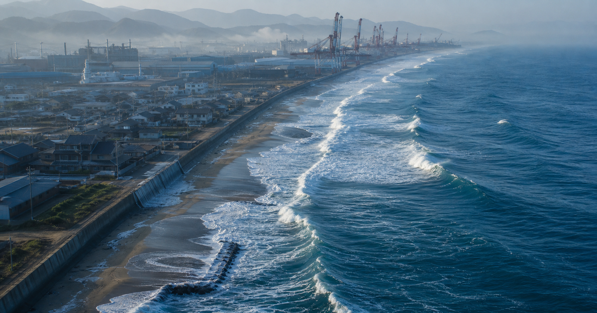
The sandy beaches that so many people visit every summer in Japan are not just spaces for leisure. They are a "natural breakwater" protecting the land from high waves and storm surges, and a stage for an ecosystem where sea turtles lay their eggs and diverse creatures make their home. But as global warming drives sea level rise, these beaches could lose as much as 90% of their area nationwide — a startling future revealed by estimates from Japan's Ministry of the Environment.
Sea level rise tends to be seen as a distant problem — something happening to "sinking islands in the south." But according to observations by the Japan Meteorological Agency (JMA), the average sea level along Japan's coast has shown a clear upward trend since the 1980s, and reached its highest level on record in 2020. Beach loss, declining port functionality, groundwater salinization, and worsening storm surge and flood damage — these are quietly becoming reality right beside our daily lives.
This article draws on primary sources — the JMA, the Ministry of the Environment, the Ministry of Land, Infrastructure, Transport and Tourism (MLIT), and the IPCC (Intergovernmental Panel on Climate Change) — to organize what sea level rise means for Japan's coastlines, ports, and groundwater. We then take a concrete look at how far "coastal protection" (adaptation measures) has progressed in halting beach loss and protecting towns from flooding.
What you'll learn in this article
- Sea level rise is driven by "thermal expansion of seawater" and "melting ice sheets and glaciers," and a clear upward trend has appeared along Japan's coast since the 1980s
- Sea level along Japan's coast is projected to rise 0.40–0.68m by 2100, and a low-probability worst-case scenario approaching 2m cannot be ruled out
- A 30cm rise could destroy about half of Japan's beaches, and a 1m rise about 90% — beaches are essential for disaster prevention, tourism, and ecosystems
- Sea level rise "raises the floor" for storm surge and wave damage, so extreme storm surges once seen only once a century could occur every year by the end of this century
- "Saltwater intrusion" into coastal groundwater threatens agriculture and drinking water
- The thinking behind coastal protection (adaptation) — beach nourishment, offshore breakwaters, levee heightening, revised port standards — and concrete measures already underway in Japan
Why Does Sea Level Rise Happen? — Thermal Expansion and Melting Ice
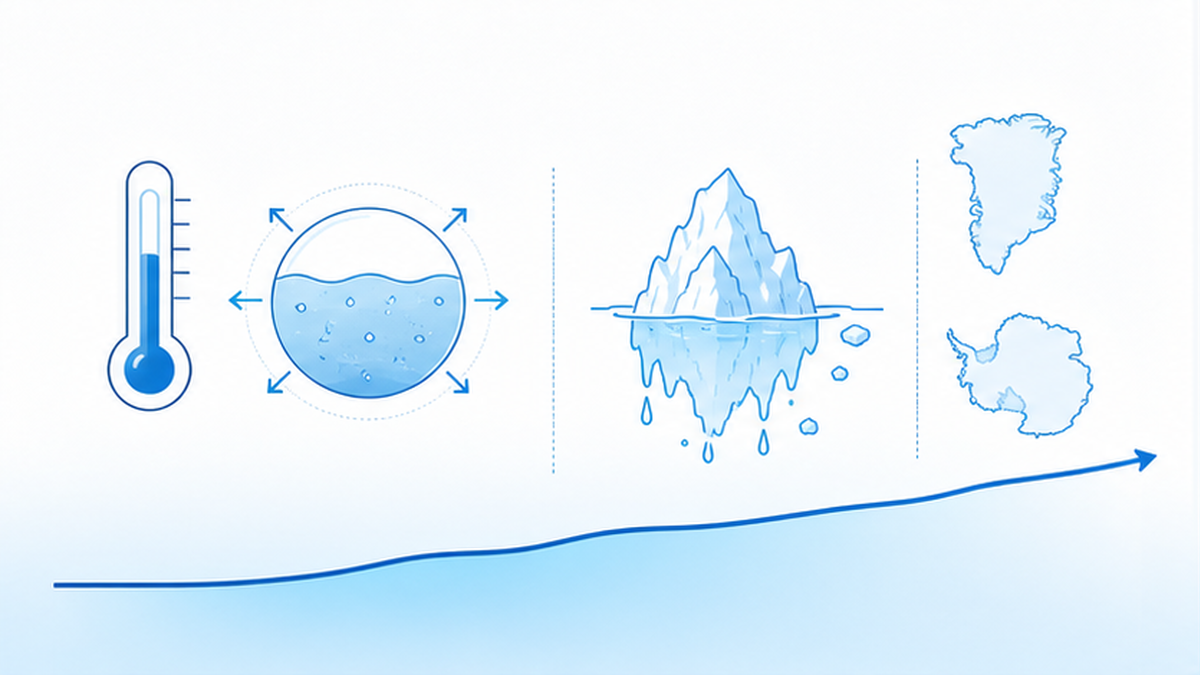
We often hear the explanation that "melting ice adds water to the ocean," but that's only half the story. According to the IPCC's Sixth Assessment Report (AR6), the main drivers behind the sea level rise now being observed are two: "thermal expansion of seawater itself" and "melting of land-based ice sheets and glaciers." A warmer ocean simply expands in volume as its temperature rises — the same phenomenon that makes the water level in a heated swimming pool rise slightly, but happening on a planetary scale.
The other factor, melting ice, adds to the volume of seawater as thick ice sheets covering Greenland and Antarctica, along with mountain glaciers around the world, melt and flow into the ocean. IPCC AR6 notes that the loss of ice sheets and glaciers became the dominant contributor to sea level rise during 2006–2018, showing that the center of gravity behind the cause is shifting from "thermal expansion" to "the loss of land ice."
A Global Average of 0.2m Over 110 Years — and Accelerating
IPCC AR6 reports that global mean sea level rose by about 0.20m between 1901 and 2018. What stands out is that this pace is not constant — it is accelerating. While the average rate for 1971–2018 was 2.3mm per year, it sped up to 3.7mm per year for 2006–2018. That works out to a rise in speed of more than 1.5 times within half a century.
The IPCC further states plainly that "it is very likely that human influence was the main driver" of the sea level rise observed since at least 1971. Sea level rise can no longer be explained by natural variability alone — it is a phenomenon directly linked to the greenhouse gases we emit. The effects of rising sea temperature on ocean currents are covered in detail in our article on how rising sea temperatures are changing ocean currents.
The Two Engines of Sea Level Rise
- Thermal expansion: warmed seawater expands in volume (the rise in water temperature itself is the cause)
- Melting ice: ice sheets in Greenland and Antarctica, and mountain glaciers, melt and add to the ocean
- From 2006–2018, ice sheets and glaciers became the largest contributor
- The pace of rise has accelerated from 2.3mm/year (1971–2018) to 3.7mm/year (2006–2018)
Tides and Sea Level Rise Are Different Things
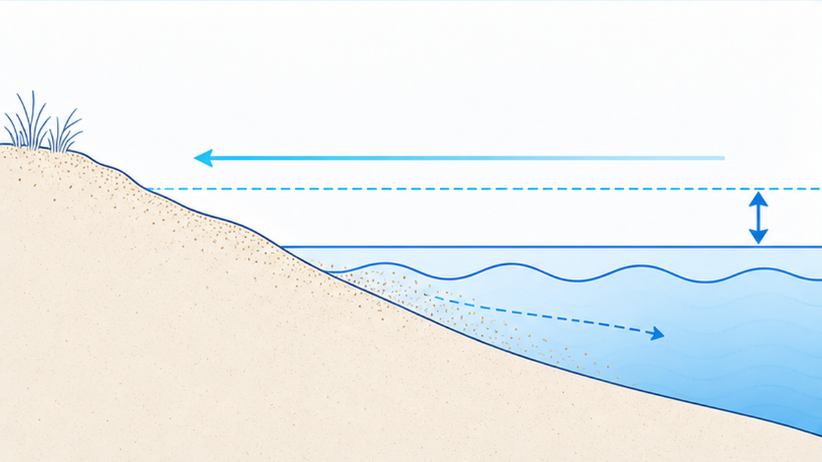
The daily rise and fall of the tide is a short-term fluctuation driven by the gravitational pull of the moon and sun, averaging out over each cycle. Sea level rise from global warming, by contrast, is an irreversible, long-term trend in which the average water level itself is raised year after year. Even if the tides themselves stay the same, if the baseline average sea level rises, high tide reaches a higher point, making it easier for storm surges and high waves to reach the land.
In other words, the real danger of sea level rise lies in the fact that even a rise of just a few tens of centimeters in the average water level can substantially "raise the floor" for damage from extreme storm surges and high waves. This "floor-raising effect" is the fundamental mechanism behind the beach loss and flood risk we will examine in later chapters.
Sea Level Keeps Rising for a While Even After Emissions Stop
Another troublesome characteristic of sea level rise is its "delayed effect." The ocean slowly stores an enormous amount of heat, and ice sheets take a long time to melt. Because of this, even if we could reduce greenhouse gas emissions to zero right now, sea level is expected to keep rising for centuries to millennia to come, driven by the heat already stored and ice that continues to melt. The IPCC describes this as "already committed" sea level rise.
This fact fundamentally shapes how we must approach the problem. With temperature rise, stopping emissions can lead relatively quickly toward stabilization, but once sea level rise gets underway, it does not stop easily. That is precisely why we need both efforts to keep future sea level rise as small as possible through emissions reduction (mitigation), and adaptation measures (coastal protection) that prepare for the rise that is already unavoidable — simultaneously.
The speed and extent of sea level rise are also not the same everywhere in the world. Ocean currents, the rise and fall of the land itself, and the distribution of sea temperatures all cause differences in how sea level rises from region to region. For a coastline like Japan's, affected by complex ocean currents and crustal movement, it is essential to estimate the future based on the country's own observation data, separately from the global average.
How Much Has Japan's Sea Risen? — What the Observation Data Shows
Talking about sea level rise only in terms of a "global average" can make it feel like someone else's problem. But when we look at observation data focused specifically on Japan's coastline, it becomes clear that the rise is already advancing right under our feet. The JMA has recorded sea level at tide stations across the country for more than 100 years, and this accumulated data reveals trends unique to Japan.
Japan's Coast Is Rising at 3.4mm a Year
According to the JMA, the average sea level along Japan's coast rose at a pace of about 3.4mm per year between 2004 and 2024 (a figure corrected for the vertical movement of the land beneath tide stations). This is roughly the same speed as the global average over the same period (about 3.7mm per year). A few millimeters may seem trivial at first glance, but accumulated over 20 years it amounts to about 7cm, and over 100 years, more than 30cm.
What matters is that natural variability on a 10-to-20-year cycle overlays the long-term record of sea level along Japan's coast dating back to 1906. So while it fluctuates up and down in the short term, a clear upward trend has appeared since the 1980s, and 2020 recorded the highest level since records began. Even after subtracting the waves of natural variation, a definite upward trend is visible.
| Period / Subject | Pace of sea level rise | Source |
|---|---|---|
| Global average, 1971–2018 | 2.3mm/year | IPCC AR6 |
| Global average, 2006–2018 | 3.7mm/year (accelerating) | IPCC AR6 |
| Japan's coast, 2004–2024 | About 3.4mm/year | JMA |
| Global average, cumulative 1901–2018 | About 0.20m rise | IPCC AR6 |
Accurately measuring sea level along Japan's coast is not a simple task. Because the Japanese archipelago experiences vertical land movement from earthquakes and crustal deformation, water levels measured at tide stations mix together "did the sea rise?" and "did the land sink (or rise)?" To address this, the JMA precisely measures the vertical movement of land using tide stations equipped with GPS, and corrects for that movement to determine the net rise in sea level itself. The figure of 3.4mm per year is a highly reliable value that has already been corrected in this way.
In addition to these coastal tide stations, satellite observation of sea level has also become well established since the 1990s. Satellites precisely measure the distance to the sea surface from space, capturing changes in sea level across the entire globe, including the open ocean. The fact that two independent methods — ground-based tide stations and satellites — show the same upward trend confirms that sea level rise is not a measurement error, but a solid reality. Multiple lines of evidence agreeing with each other — this is the basis for scientific confidence.
A 0.40–0.68m Rise Projected by 2100
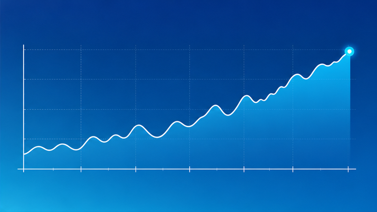
So how much further will it rise? The JMA's latest report, "Climate Change in Japan 2025," projects sea level rise along Japan's coast under different greenhouse gas emissions scenarios. According to it, even under a low-emissions scenario (SSP1-2.6) in line with the Paris Agreement's targets, a rise of about 0.40m is projected by the end of this century, while a high-emissions scenario (SSP5-8.5), in which measures fail to advance, projects a rise of about 0.68m (the global averages are 0.44m and 0.77m, respectively).
The nearer future is not unrelated either. The same report projects a rise of about 0.17–0.19m by 2031–2050, regardless of scenario. In other words, by the middle of this century — around the time today's children become adults — sea level is likely to have risen by nearly 20cm. At this stage, the difference between emissions scenarios is still minimal, but the choice of scenario matters more and more as the latter half of the century approaches. The choices we make now will determine how high the sea stands decades from now.
You might think, "0.68m still isn't even a full meter." But as noted in the previous chapter, on gently sloping terrain like a beach, a vertical rise of just tens of centimeters translates into a horizontal retreat measured in tens of meters. What's more, when this rise in average sea level combines with storm surges and high waves, the damage doesn't simply add up — it can jump sharply once a "threshold" is crossed, such as whether or not water overtops a levee. A few tens of centimeters is never a small number.
A "Low-Probability, High-Impact" Scenario We Cannot Ignore
Separately from the likely range, IPCC AR6 warns that if instability or collapse of the Antarctic ice sheet were to begin, sea level could approach 2m by 2100 and reach 5m by 2150 — a possibility that cannot be ruled out. Even at low probability, such an event, once it occurs, would cause irreversible damage, so protection planning must include "preparing for the worst."
| Scenario | Japan's coast, 2100 | Global average, 2100 |
|---|---|---|
| Low emissions (SSP1-2.6 / roughly 2°C) | About 0.40m | About 0.44m |
| High emissions (SSP5-8.5 / roughly 4°C) | About 0.68m | About 0.77m |
| Near future (2031–2050) | About 0.17–0.19m | Roughly the same |
Before treating Japan's figure of a few tens of centimeters as "not so bad," it's worth looking at the wider world. In low-lying Pacific island nations such as Tuvalu and Kiribati, the same sea level rise translates directly into the submersion of the land itself, and "climate refugees" who lose their homes are becoming a real and present issue. Sea level rise is a threat shared by the entire world, and the actions of high-emitting developed nations shape the fate of distant island countries. Japan is both on the receiving end of the damage and among those responsible for the world's overall sea level rise.
Beaches Are Disappearing — What "90% Lost at a 1m Rise" Really Means
Among all the effects of sea level rise, the one most symbolic for Japan is the loss of sandy beaches. According to estimates by the Ministry of the Environment, a 30cm rise in sea level could destroy about half of the nation's beaches, and a 1m rise could destroy about 90%. As we saw in the previous chapter, a rise of 0.68m is projected by the end of this century under the high-emissions scenario, with even larger rises possible in the worst case — so this "90% loss" is by no means an unrealistic figure.
Why Does a Rise of Just Tens of Centimeters Wipe Out So Much Beach?
You might wonder, "why would just 30cm wipe out half?" Because beaches slope so gently, even a small vertical rise in sea level causes the waterline to retreat many times that distance in the horizontal direction. The gentler the slope, the more a small rise in water level translates into the loss of a wide area of beach. What's more, as sea level rises, wave energy reaches farther up the beach, accelerating erosion that carries sand out to sea.
Adding to the problem is a "shortage of sand supply." Beaches have traditionally been replenished little by little with sediment carried by rivers, maintained by a balance between erosion and supply. But the construction of dams and coastal revetments has reduced the flow of sediment from rivers, and erosion is already dominant along many coastlines. Add sea level rise on top of that, and beaches have no chance to recover before they thin out further.
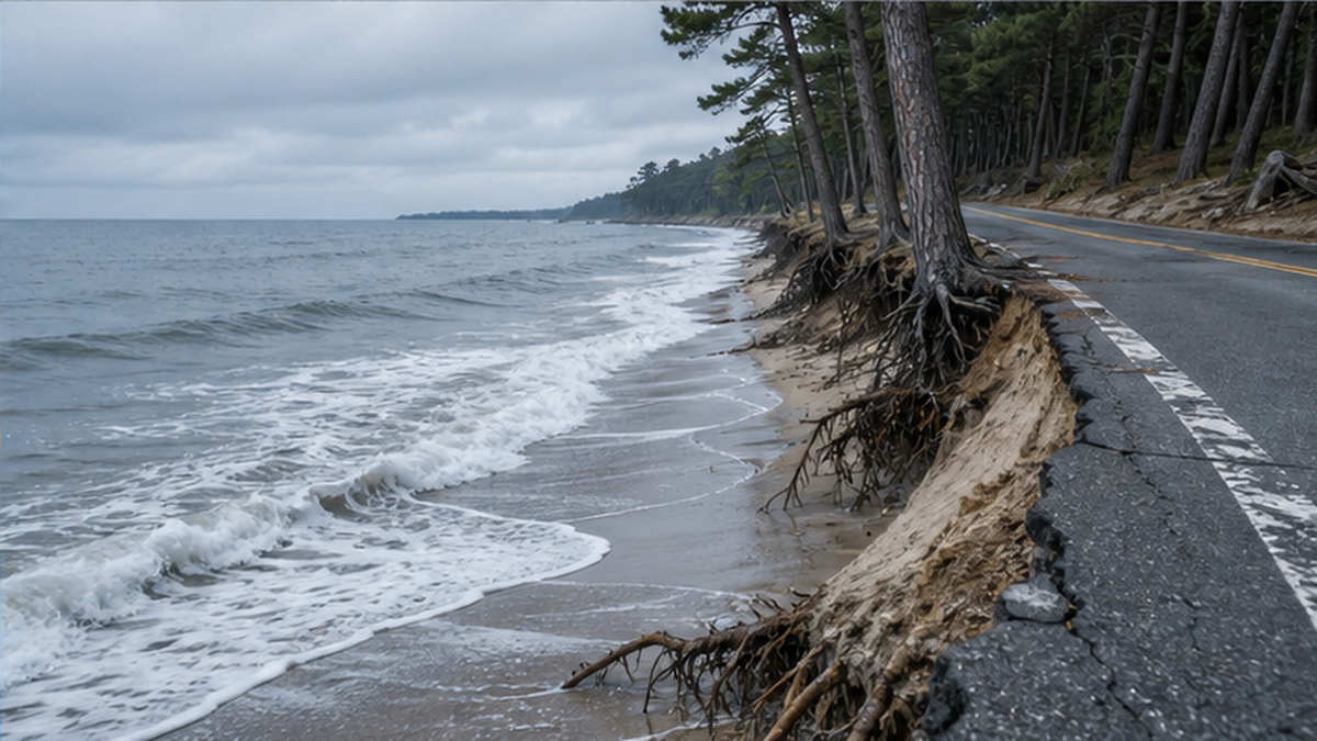
In fact, the shrinking of Japan's beaches had already begun before sea level rise took hold in earnest. Along coastlines across the country, cases have been reported of once-wide beaches retreating by tens of meters, pine groves being washed by waves, and coastal roads being eroded away. Most of these causes trace back to reduced sediment supply and the disruption of sand flow by coastal structures, but as sea level rise adds to this, the pace of erosion is expected to accelerate further. Sea level rise is delivering a final blow to beaches that are already weakened — this is the reality facing Japan's coastline.
Beaches Are Multi-Purpose Infrastructure We Cannot Afford to Lose
If we think of beaches merely as a tourism resource, we misjudge the gravity of losing them. Beaches are a natural breakwater that absorbs and weakens the energy of incoming waves, and as beaches thin out, waves can reach levees and residential areas behind them more directly. From a disaster-prevention standpoint, the beach itself is the first line of defense.
Beaches are also important from an ecosystem perspective. They serve as nesting sites for sea turtles, and diverse creatures live in the sand and the intertidal zone. If beaches disappear, the habitats of these creatures are lost at the same time. For issues around sea turtle conservation, see our article on how marine protected areas safeguard ecosystems. On top of this, tourism and leisure activities like swimming and surfing are an important source of income for coastal regions, so beach loss directly affects the local economy.
It's easy to overlook, but as beaches thin out, the burden on the levees behind them also increases. Once the buffer zone provided by the beach is gone, waves strike the levee directly, scouring away the sand at its base. As this progresses, the levee itself becomes unstable, raising the risk of collapse or breach. Protecting the beach is, in effect, also protecting the levee — beaches and artificial structures are not opposing forces, but a single, integrated defense system that protects the coast by supporting each other.
Four Roles Played by Beaches
- Disaster prevention: a natural breakwater that absorbs wave energy and protects the land behind it
- Ecosystems: a nesting site for sea turtles, habitat for creatures of the intertidal zone
- Tourism and economy: a resource that supports local communities through swimming, surfing, and more
- Culture and scenery: the classic Japanese landscape epitomized by white sand and green pines
Research cited by IPCC AR6 (Vousdoukas et al., 2020) estimates that without countermeasures such as coastal defenses, a significant portion of the world's beaches will suffer severe erosion by the end of this century. Even under a scenario that strongly curbs warming (RCP4.5), about 36% of beaches could be lost, and under a high-emissions scenario where measures fail to advance (RCP8.5), about 50% — roughly half — could be lost. Beaches are under threat around the world. White sand and green pines — the classic Japanese landscape known as "hakusha-seishou" — is quietly at risk of being lost.
Rising Storm Surge and Flood Risk — Crisis in the "Zero-Meter Zones"
Sea level rise doesn't just slowly submerge land on its own. What's more serious is its destructive power when combined with storm surges during typhoons. As mentioned in the previous chapter, when the average sea level rises, storm surge and wave damage is "raised at the floor," so even a typhoon of the same intensity pushes water higher and further inland.
People and Assets Concentrated in Zero-Meter-Above-Sea-Level Zones
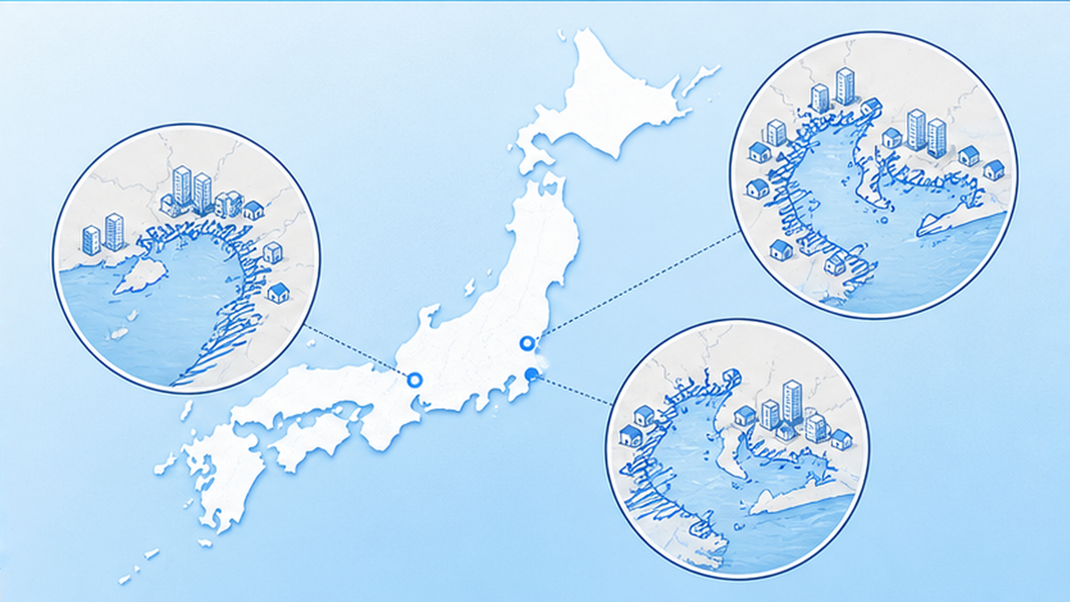
Along Japan's three major bays — Tokyo Bay, Ise Bay, and Osaka Bay — lie so-called "zero-meter zones," areas of land lower than the sea level at high tide (below the mean spring high water level). These low-lying areas formed partly due to land subsidence caused by groundwater pumping during the era of rapid economic growth, and they are extremely dangerous zones where, once a levee is breached, water does not naturally recede.
These zones are densely packed with both population and assets. Studies by the Cabinet Office and others estimate that if sea level were to rise by 59cm, both the area and population of the zero-meter zones around the three major bays would increase by about 50%. Sea level rise expands the dangerous low-lying zone itself.
"Once in 100 Years" Becomes "Every Year"
IPCC AR6 offers a detailed assessment of how the frequency of extreme sea levels is changing. According to it, extreme storm surges and high water levels that used to occur only once every 100 years are projected to occur at least once a year at many coastal locations by the end of the 21st century. In other words, a "rare disaster" is turning into "an annual expectation."
Japan's storm surge countermeasures have, in many places, been built around the scale of the 1959 Ise Bay Typhoon (which caused over 5,000 deaths and missing persons). But those standards do not account for future sea level rise, and raising levees requires enormous cost and long construction periods. Before storm surges exceeding current assumptions become the norm, protection standards themselves need to be updated.
What makes zero-meter zones so frightening is that water does not naturally recede once a levee is breached. Because the land itself sits below sea level, flooded water can only be removed by pumping, and in the meantime residents are left stranded in a submerged town. If this happens in a densely populated area, evacuation on the scale of hundreds of thousands of people would be needed, but evacuating all at once from low-lying land is constrained by both time and available routes. The Cabinet Office's ongoing study of "large-scale, wide-area evacuation" is precisely aimed at preparing for this difficulty of evacuation.
Climate change is also said to be linked to the intensification of the typhoons that generate storm surges in the first place. If the "floor-raising" from sea level rise combines with the "boost" from stronger typhoons, the damage compounds. How rising sea temperatures are changing typhoons and the marine environment is also covered in our article on changes in sea temperature and ocean currents. Multiple factors — average sea level, land subsidence, and typhoon intensification — pushing in the same direction is what makes coastal disaster prevention in Japan so difficult.
Three Overlapping Factors Pushing Up Storm Surge Risk
- Rising average sea level raises the height reached by storm surges and high waves
- Zero-meter zones formed by land subsidence amplify low-lying area risk
- Intensifying typhoons could make storm surges themselves larger
- Many existing levees do not account for future sea level rise
The long-term rise in average sea level raises the baseline impact of storm surges and high waves, increasing the risk of flood disasters.
— Japan Meteorological Agency, "Climate Change in Japan 2025"
Storm Surge Flooding That Has Already Become Reality
Storm surge flooding is not a story of the future — it has already become reality in various places in recent years. In 2018, Typhoon Jebi caused a storm surge in Osaka Bay of a scale unprecedented in recorded history, flooding the runway of Kansai International Airport, which sits on the water, and forcing it to close for an extended period. With terminals and power equipment submerged and many travelers left stranded inside the airport, this event demonstrated just how vulnerable coastal infrastructure built barely above sea level is to storm surges.
Given that such damage is already occurring today, it isn't hard to imagine what will happen once a further rise of tens of centimeters is added on top. Even a typhoon of the same scale would flood a wider area, and water would reach places previously considered safe. The sense of crisis that "the worst of the past could become the ordinary threat of the future" is driving an urgent review of disaster prevention planning.
Preparing for Storm Surges and Flooding
- Check the flood projections for your home and workplace using the "storm surge hazard maps" published by local governments
- Keep in mind "early evacuation" — moving to higher ground before flooding begins
- In zero-meter zones, assume that water will not recede, and decide evacuation routes and destinations with your family in advance
- Pay attention to JMA storm surge warnings and special warnings as typhoons approach
Impact on Ports and Infrastructure — The Arteries of Logistics Under Water
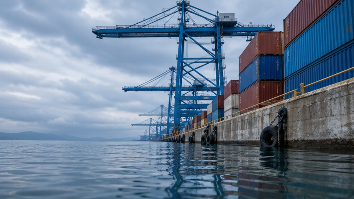
Japan is a maritime nation that relies on shipping for the vast majority of its trade, and its ports are the arteries of its economy. Those ports now stand on the front line of sea level rise. Because port facilities are designed at heights barely above sea level, even a rise of a few tens of centimeters in average sea level directly erodes the functionality and safety margin of quays.
Port risk is not just an issue for people who work there. Much of the food, fuel, clothing, and electronics we use every day is imported, and most of it arrives in the country through ports. If a major port were to stop functioning for even a few days due to storm surge or flooding, products would disappear from store shelves and factory production would grind to a halt, with effects reaching all the way to people's lives far inland. The flooding of a port ripples out to affect the lives of people far from the sea — this is a weak point for maritime nation Japan.
A Triple Impact on Quays, Cargo Handling, and Hinterlands
Sea level rise affects ports in many ways. First, the margin between the top of the quay and the sea surface shrinks, making it easier for seawater to overtop during storm surges and high waves. Second, if the cargo handling areas and terminals where containers are loaded and unloaded become submerged, logistics itself grinds to a halt. Furthermore, if the industrial zones and logistics warehouses spreading out behind the port become flooded, the effects ripple out across the entire supply chain.
- Reduced freeboard at quays and breakwaters raises the risk of overtopping and overflow
- Flooding of container yards and cargo-handling equipment halts cargo operations
- Flooding of industrial and logistics hubs behind the port stalls economic activity over a wide area
- Safety standards for mooring and navigation no longer match future conditions
The Government Has Begun Revising Port Design Standards
In response to this situation, MLIT's Ports and Harbours Bureau has begun taking action in earnest. In April 2024, it revised the "Technical Standards for Port and Harbour Facilities," shifting policy to require that the design of breakwaters, quays, revetments, and other structures account for external forces such as future projected rises in average sea level and increases in wave height. This marks a shift from "design based on past performance" to "design that incorporates future climate change."
Furthermore, in April 2025, it published a "Collection of Design Examples for Port and Harbour Facilities Responding to Climate Change," presenting concrete design methods, with case studies, that account for sea level rise and increased wave height. Because ports are infrastructure meant to be used for decades, whether the facilities being planned now will still function under future sea levels is now a critical question.
Key Developments in Ports' Response to Climate Change
- March 2024: Published the "Implementation Policy for Climate Change Adaptation Measures in Ports and Harbours"
- April 2024: Revised the technical standards for port and harbour facilities (accounting for future sea level rise and wave height)
- April 2025: Published the "Collection of Design Examples for Port and Harbour Facilities Responding to Climate Change"
- Future designs are shifting toward assuming external forces from future climate change
Behind this shift lies the fact that ports are long-lived infrastructure meant to be used for decades. Breakwaters and quays designed today must still function under the sea levels of 2050 and 2080. If built relying only on past data, standards risk being overtaken by reality by the time construction is complete. That is precisely why the idea of "designing ahead of future sea levels" has become essential, even at the cost of higher expenses. "Adaptive" approaches are also being considered — designing structures so that height can be added incrementally as future sea levels rise, rather than rebuilding everything at once.
Groundwater Salinization — "Saltwater Damage" Advancing Out of Sight
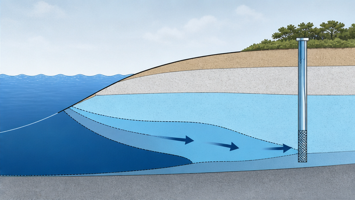
The effects of sea level rise are not confined to the visible coastline. They also quietly reach beneath the surface, into groundwater. In coastal areas, fresh groundwater on the land side is in constant tension underground with salt water seeping in from the sea. As sea level rises, this boundary is pushed further inland, and "saltwater intrusion" (saltwater damage) advances, mixing salt into groundwater that was previously fresh.
A Tug-of-War Between Fresh and Salt Water Underground
Underground in coastal areas, lighter fresh water sits above heavier salt water, with salinity increasing the closer you get to the coastline. As sea level rises, the salt water "wedge" pushes deeper inland, raising the salinity of wells and aquifers. In rivers, seawater can travel up from the river mouth during storm surges or droughts, sometimes reaching all the way to intake points used for water supply.
Threatening Agriculture and Drinking Water
When groundwater becomes saline, agriculture is often the first to suffer. When salty groundwater or irrigation water seeps into farmland, it impedes the growth of rice and vegetables, reducing yields. Damage tends to be worse in low-lying coastal farmland and river-mouth areas, where it can overlap with seawater backflow and flooding from storm surges. Within Japan, saltwater damage is a concern along the Ariake Sea coast and in the mouths of major rivers.
In regions that rely on groundwater for drinking water, securing the water supply itself becomes uncertain. Once an aquifer becomes salinized, it takes a long time to restore it to fresh water, and securing alternative water sources is costly. Sea level rise casts a shadow all the way down to the basics of our daily lives — what we drink and eat.
Because this salinization doesn't appear in a visible form the way beach loss or storm surges do, it comes with the difficulty that the damage is often already well advanced by the time it's noticed. Well water turning salty, crops growing poorly — such changes often accumulate before anyone realizes it's saltwater damage. And because pumping too much groundwater from an aquifer that has already experienced saltwater intrusion can draw in even more salt water, the way groundwater itself is used may need to be reconsidered. Precisely because it is subtle and hard to see, early monitoring and countermeasures are important.
Key Points on Groundwater Salinization
- Sea level rise pushes the underground boundary between fresh and salt water further inland
- Rising salinity in wells and aquifers threatens drinking water sources
- Saltwater damage reduces crop yields on farmland, compounded by seawater intrusion at river mouths
- Once salinized, restoring an aquifer to fresh water takes a long time
Coastal Protection as Adaptation — How to Protect Beaches and Towns
We are not simply standing by in the face of the risks examined so far. Alongside "mitigation" (emissions reduction) to stop warming itself, "adaptation" measures to prepare for effects already underway are becoming important. At the center of coastal adaptation is "coastal protection," which protects beaches and towns. MLIT is advancing comprehensive protection that combines multiple engineering methods.
What matters here is that mitigation and adaptation are not an "either/or" choice — both are needed. Cutting emissions through mitigation can shrink the scale of future sea level rise itself, but as we saw in Chapter 1, some amount of already-committed rise cannot be avoided. On the other hand, if we rely only on adaptation without cutting emissions, the rise won't stop, and no matter how high we build levees, they will eventually be outpaced. Mitigation is responsible for "how small we can keep the future damage," while adaptation is responsible for "how we prepare for what cannot be avoided" — this two-pronged approach is the basic policy. Our article on blue carbon and the ocean's potential is also a useful reference on how the sea absorbs carbon.
Methods to Protect and Nurture Beaches
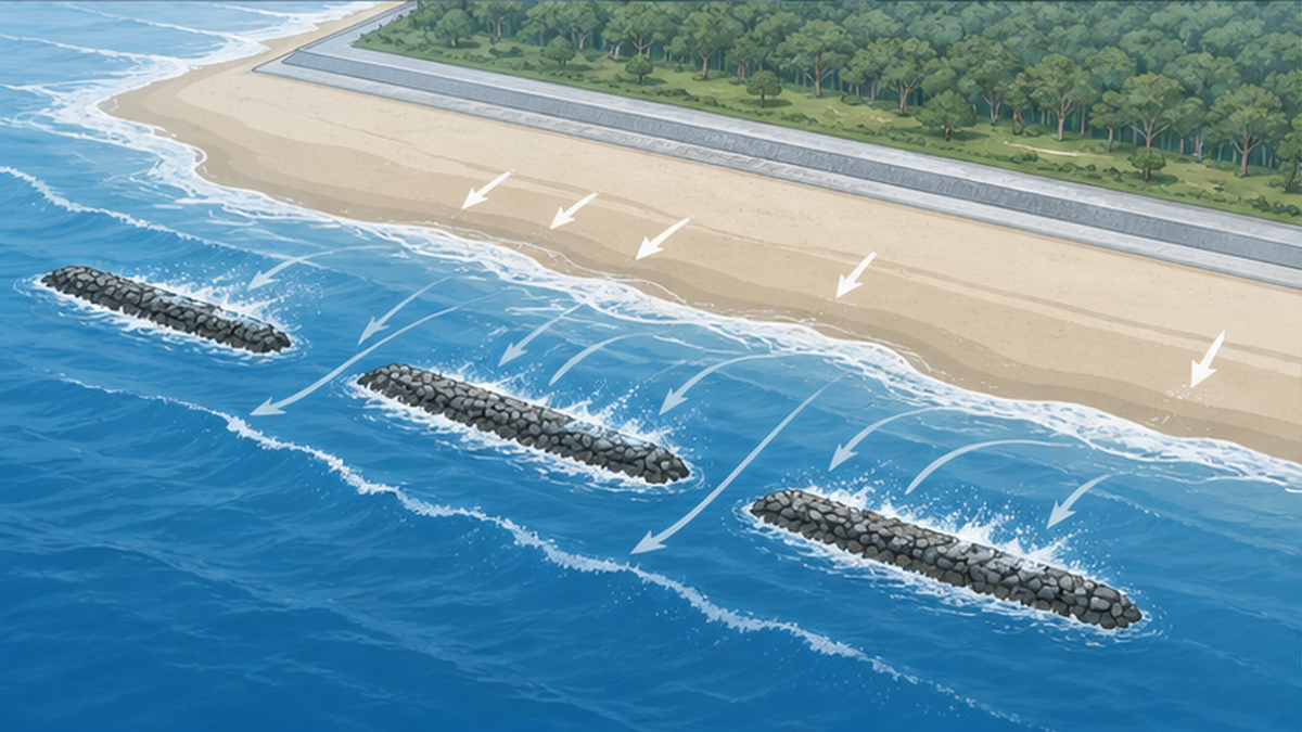
The leading method for restoring a thinned beach is "beach nourishment." This engineering approach artificially transports sediment to an eroded coastline, maintaining and regenerating the beach by hand. Related to this is "sand bypassing," which artificially reconnects the flow of coastal sand that has been interrupted by port structures and the like, moving sand accumulated upstream to the downstream side to restore the beach's natural circulation.
There are also facilities that weaken the waves themselves. "Offshore breakwaters," installed offshore of the waterline, dissipate waves to reduce overtopping while also controlling sediment movement to maintain and restore the shoreline. Rather than using such facilities in isolation, an "areal protection approach" that combines levees and wave-dissipating structures with offshore breakwaters and beaches is being promoted as superior not only for disaster prevention but also for the environment and usability.
| Method | How it works | Main effect |
|---|---|---|
| Beach nourishment | Artificially supplies sediment to an eroded coastline | Maintains and restores beach area, protecting the natural breakwater |
| Sand bypassing | Artificially reconnects sand flow interrupted by structures | Restores the beach's natural circulation |
| Offshore breakwater | Installs a breakwater offshore of the waterline to dissipate waves | Reduces overtopping, maintains and restores the shoreline |
| Areal protection approach | Combines levees, wave-dissipating structures, offshore breakwaters, and beaches | Balances disaster prevention, environment, and usability |
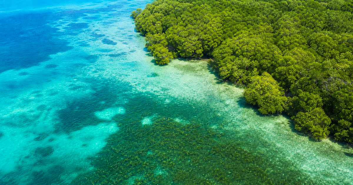
In recent years, attention has also turned to "green infrastructure," which harnesses the power of nature — beaches, tidal flats, mangroves — for disaster prevention, rather than relying solely on concrete structures. Healthy beaches and wetlands not only soften waves, but also serve as habitat for wildlife and play a role in storing carbon dioxide. There is a growing movement toward combining artificial structures with natural buffer zones to create resilient coastlines that take into account disaster prevention, the environment, and scenery all at once. The very approach to protection is now being fundamentally reconsidered.
Raising Levees and Revising Port Standards
As a direct means of preparing for storm surges and flooding, raising levees is the most straightforward measure. However, as noted earlier, many of Japan's levees do not account for future sea level rise, so standards need to be updated to incorporate the projected rise, with reinforcement prioritized for the most critical sections. In the port sector, efforts to build facilities based on future external forces are already underway, in the form of revised design standards and a published collection of design examples.
Beyond "Protecting" — the Option to "Retreat Wisely"
Coastal protection is not a cure-all. Raising levees requires enormous cost and ongoing maintenance, and it isn't always realistic to protect every stretch of coastline at the same level. As a result, an approach is spreading globally that combines "protection," in addition to "accommodation," which reduces damage through adjustments in land use, and "retreat," which relocates away from dangerous low-lying areas in a planned way — combined according to local circumstances. Deciding where to protect and where to wisely retreat requires building consensus from a long-term perspective.
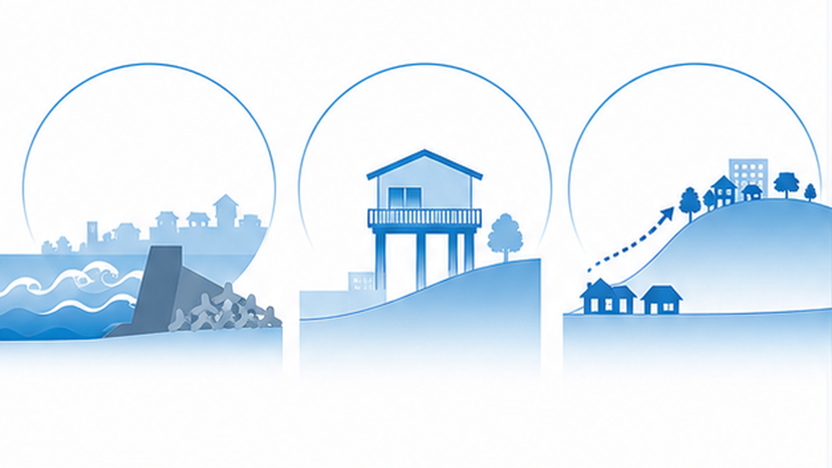
These are not choices that experts or government alone can make. Building protective facilities, revising land use, or relocating can only move forward with the consent of the people who live, work, and build their lives on that land. That's precisely why it matters that more people come to correctly understand the phenomenon of sea level rise and consider the risks to their own region as a personal issue — this is the foundation for every kind of countermeasure. Ocean environmental issues are all connected to one another, and learning about them alongside other topics, such as our article on ocean acidification and the crisis facing coral, gives a fuller, three-dimensional picture of how the ocean as a whole is changing.
What We Can Do
- Check flood and storm surge risk for your own area using local hazard maps
- Take an interest in community activities that protect beaches, such as beach cleanups and nourishment programs
- Work on reducing greenhouse gas emissions (mitigation) in daily life
- Learn about and share sea level rise as a familiar issue, not just "something happening on a distant island"
Responding to sea level rise cannot be accomplished through protective engineering alone. Only when fundamental emissions reduction, a locally tailored combination of protection, accommodation, and retreat, and the understanding of each individual all come together can we pass beaches and towns on to the next generation. Our article on how warming is changing Japan's fisheries is also a useful reference on the effects of global warming.
Adaptation measures take a long time. Raising levees, restoring beaches, and relocating away from dangerous low-lying areas all proceed over spans of decades, from planning to completion. Precisely because sea level rise is slow, many countermeasures are still achievable if we act now — but the longer we delay, the narrower our options become and the higher the costs climb. Not "it's still fine," but "while we still can" — this sense of time may be the single most important perspective for confronting the long-term challenge of sea level rise.
Conclusion — Preparing Now for the Quiet Advance of Sea Level Rise
Sea level rise is not a distant story confined to southern islands. Along Japan's coast, sea level is already rising at a pace of about 3.4mm a year, with a rise of up to 0.68m projected by 2100 — and potentially more in the worst case. Its effects — beach loss, intensifying storm surges and flooding, declining port functionality, and groundwater salinization — connect directly to our disaster preparedness, our economy, and our daily lives around food and water.
At the same time, coastal protection (adaptation) — areal protection through beach nourishment and offshore breakwaters, levee heightening, and revised port design standards — is steadily getting underway. Combining the technology to protect, the judgment to retreat wisely, and the fundamental measure of emissions reduction is the key to carrying our beaches and coastal towns into the future.
Summary of This Article
- Sea level rise is caused by the thermal expansion of seawater and the melting of ice sheets and glaciers, and the pace of rise is accelerating
- Japan's coast is rising at about 3.4mm a year, with a clear upward trend since the 1980s; a rise of 0.40–0.68m is projected by 2100
- A 1m rise in sea level could destroy about 90% of Japan's beaches, which are essential for disaster prevention, ecosystems, and tourism
- Sea level rise raises the baseline for storm surges and high waves, so an extreme high water level once seen "once in 100 years" could occur every year by the end of the 21st century
- Groundwater salinization threatens agriculture and drinking water, and ports are being forced to revise their design standards
- Coastal protection (adaptation) is advancing through beach nourishment, offshore breakwaters, areal protection, levee heightening, and revised port standards
- Combining "protect, accommodate, and retreat" with emissions reduction is how we carry beaches and towns forward to the next generation
Sea level rise is not a disaster that swallows a town in a single day. Precisely because of this, it is easy to overlook, and countermeasures tend to be pushed back. But a rise of just a few tens of centimeters could take away 90% of our beaches and turn a once-in-a-century storm surge into an annual threat — understanding this, and preparing starting now, is the most reliable step we can take.
References and Sources
- Japan Meteorological Agency – Climate Change in Japan 2025: Observation and Projection Assessment Report on the Atmosphere, Land, and Ocean (Chapter 9: Sea Level, Storm Surge, and High Waves)
- Japan Meteorological Agency – Tide and Sea Level Data: Long-Term Trends in Sea Level Along Japan's Coast
- Japan Meteorological Agency – Average Sea Level Along Japan's Coast in 2020 Recorded Its Highest Level on Record (press release)
- IPCC (Intergovernmental Panel on Climate Change) – Sixth Assessment Report, Working Group I, Summary for Policymakers (SPM), provisional Japanese translation
- Ministry of Land, Infrastructure, Transport and Tourism, Ports and Harbours Bureau – Publication of the "Collection of Design Examples for Port and Harbour Facilities Responding to Climate Change" (press release)
- Ministry of Land, Infrastructure, Transport and Tourism, Water and Disaster Management Bureau – Coasts (Approach to Coastal Conservation and Erosion Countermeasures)
- Cabinet Office, Disaster Management – Working Group on Large-Scale, Wide-Area Evacuation from Flood and Storm Surge Inundation, materials (Zero-Meter Zones of the Three Major Bays)
- Climate Change Adaptation Information Platform (A-PLAT / National Institute for Environmental Studies) – Sea Level Rise and Zero-Meter Zones / Adaptation Measures for Coastal Erosion
* Listed in order of reliability: government/academic institutions > peer-reviewed papers > specialist organizations > trusted media