⚡ In short
An atoll is a blue lagoon inside a ring of coral — and a record of coral growing upward on the rim of a sinking volcanic island. From Darwin's 1842 subsidence theory to the 1,266-metre drill hole on Enewetak, the atolls of the Maldives, and what rising seas mean for them today.
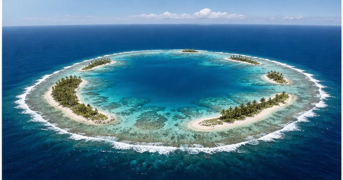
Look at the Pacific or the Indian Ocean from orbit and you will find islands that are nothing but a thin ring floating on deep indigo water. Inside the ring the sea is an improbably pale emerald; just outside it, the seabed drops to thousands of metres. This strange doughnut-shaped landform is an atoll.
The land riding on the ring is minimal — mostly sand and rubble islets only a few metres above sea level. And yet the ring closes with almost fastidious precision over tens of kilometres. Why does such an exact circle form in the middle of the ocean? And if there was once an island at the centre, where did it go?
The first person to give a coherent answer was Charles Darwin, then circling the globe aboard the Beagle. The explanation he published in 1842 uses just two movements — 'the foundation sinks, the coral grows upward' — to link three landforms that look nothing alike: fringing reefs, barrier reefs and atolls. And to find out whether he was right, humanity ended up drilling more than a kilometre straight down through an atoll. This article follows that story, the corrections modern research has added, and what lies ahead for atolls in an age of rising seas.
What you will learn
- How fringing reefs, barrier reefs and atolls differ — and why they may be a single continuous sequence
- How Darwin's subsidence theory explains the ring using only two movements: a sinking foundation and upward coral growth
- How the borings at Funafuti, Bikini and Enewetak tested the hypothesis over more than a century
- The tug of war between coral's upward growth rate and the seafloor's subsidence rate, and the 'Darwin Point' where growth can no longer keep up
- The modern model of atoll formation, which folds in glacial sea-level swings and karst dissolution
- What measurements actually show about how atoll islands are changing under rising sea levels
What an atoll is — an island reduced to a ring
An atoll is a landform in which a coral reef encircles a central lagoon. The English word atoll is generally traced to atholhu in Dhivehi, the language of the Maldives — a reminder in the name itself that the Maldives has long been the world's showcase for this kind of geography.
There are roughly 440 atolls worldwide, and most of them lie in the Pacific. The Maldives and the Chagos Archipelago in the Indian Ocean and a handful in the Caribbean also qualify, but the Atlantic has almost none. That imbalance is itself the first clue to how atolls form.
Three faces: fringing reef, barrier reef, atoll
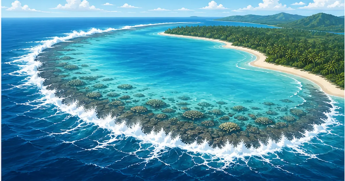
Coral reef landforms fall into three broad classes according to their relationship with an island. A fringing reef clings directly to the shore; a barrier reef stands offshore like a breakwater, separated from the land; and an atoll is what remains when the island itself has disappeared and only the ring is left. Japan's Nansei Islands are dominated by fringing reefs; Australia's Great Barrier Reef and Bora Bora in French Polynesia are barrier reefs; the Marshall Islands and the Maldives are atoll country.
The crucial insight is that these three are not separate kinds of reef but possibly three stages of the same place, changing over time. That reframing is exactly what Darwin contributed.
| Landform | Relationship to the island | Lagoon | Examples |
|---|---|---|---|
| Fringing reef | Attached directly to the shoreline | Almost none (at most a shallow moat) | Okinawa Island, Ishigaki and the rest of the Nansei Islands |
| Barrier reef | Stands offshore, separated from the land | A broad lagoon between island and reef | The Great Barrier Reef, Bora Bora |
| Atoll | The central island has vanished beneath the sea | A wide lagoon inside the ring | The Maldives, the Marshall Islands, Tuvalu |
Taking an atoll apart
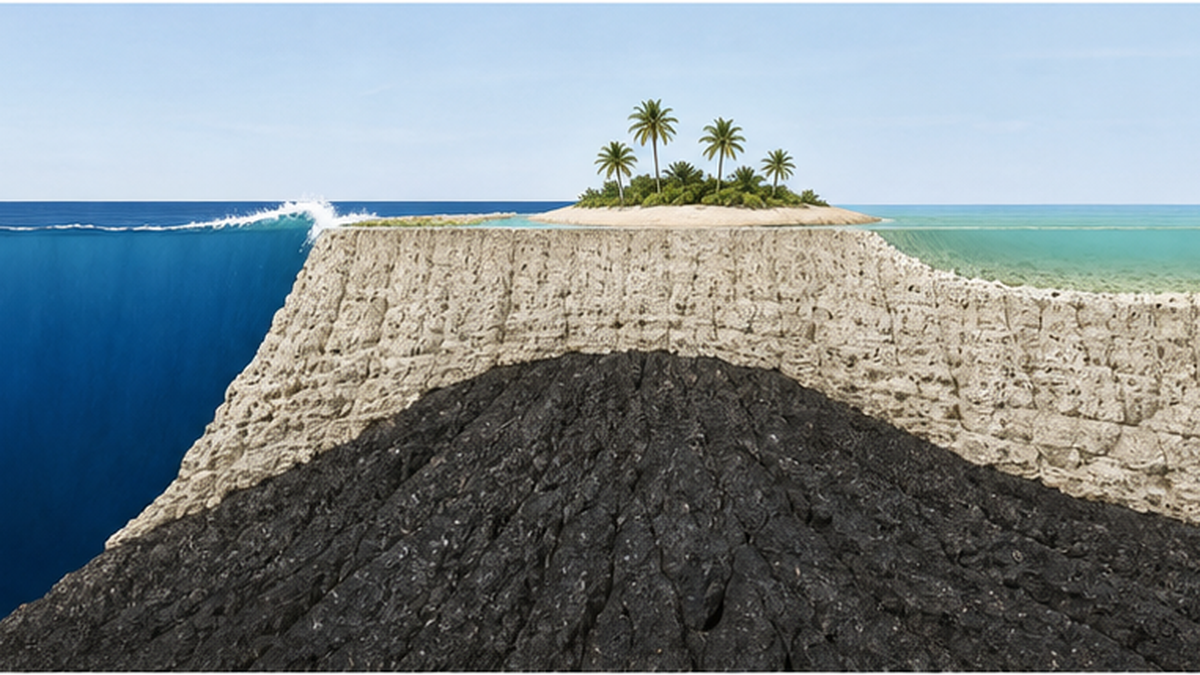
The ring is not a single uniform band. Working inward from the open ocean you pass the fore reef slope and the reef crest where the waves first break, the flat reef flat exposed at low tide, the low sand cays (motu) that waves and currents have piled on top of it, and the passes that cut the ring and connect lagoon to ocean.
- Fore reef slope: the steep drop toward the open sea, where reef-building corals grow most vigorously
- Reef crest and flat: the front line that absorbs wave energy, forming a flat, hard limestone platform
- Sand cay: a low island of coral fragments and foraminiferal shells heaped on the reef flat by waves. This is where people live
- Lagoon: the calm shallow water inside the ring, typically tens of metres deep — a different order of magnitude from the ocean outside
- Pass: the channel that flushes the lagoon, usually on the leeward side or where a river mouth once stood
The land is only the thinnest skin
What people usually miss about atolls is how little land there actually is. Kwajalein Atoll in the Marshall Islands comprises 97 islands and islets with a combined land area of just 16.4 square kilometres. The lagoon they enclose covers 2,174 square kilometres, one of the largest in the world. That is a land-to-lagoon ratio of more than one to 130. An atoll is a very thin trim of land surviving inside an overwhelming amount of sea.
Premises worth holding on to
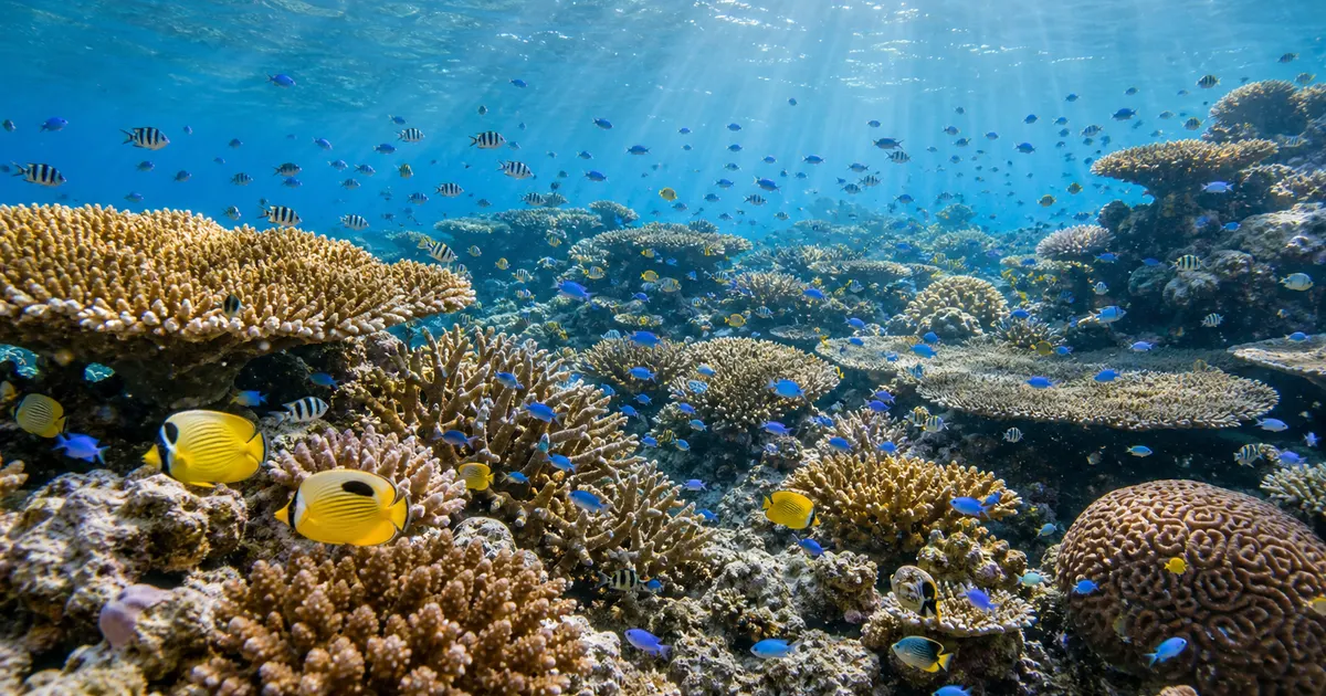
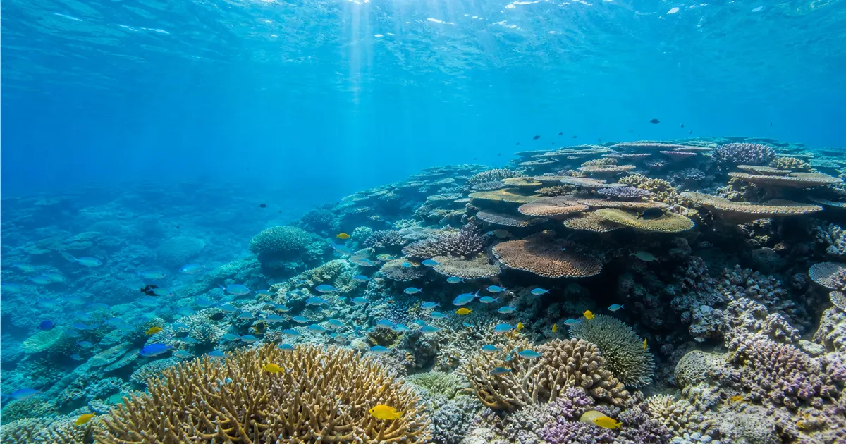
- Reef-building corals depend on photosynthetic symbiotic algae (zooxanthellae), so they can only grow in shallow, sunlit water
- Every part of an atoll's ring is therefore a record of a place that was once near the sea surface
- If thick limestone has accumulated beneath the ring, that place must have been sinking for a very long time
Darwin's subsidence theory — a sinking base and coral that keeps climbing
Between 1831 and 1836 Charles Darwin sailed around the world aboard the survey ship Beagle. Observing uplifted strata along the South American coast, seeing a barrier reef at Tahiti, and studying an atoll first-hand at the Cocos (Keeling) Islands in the Indian Ocean gave him the foundations of his reef theory.
The Structure and Distribution of Coral Reefs, 1842
After returning home, Darwin published The Structure and Distribution of Coral Reefs in 1842. In this book — seventeen years before On the Origin of Species — he strung the three reef landforms into a single narrative. The outline is remarkably simple.
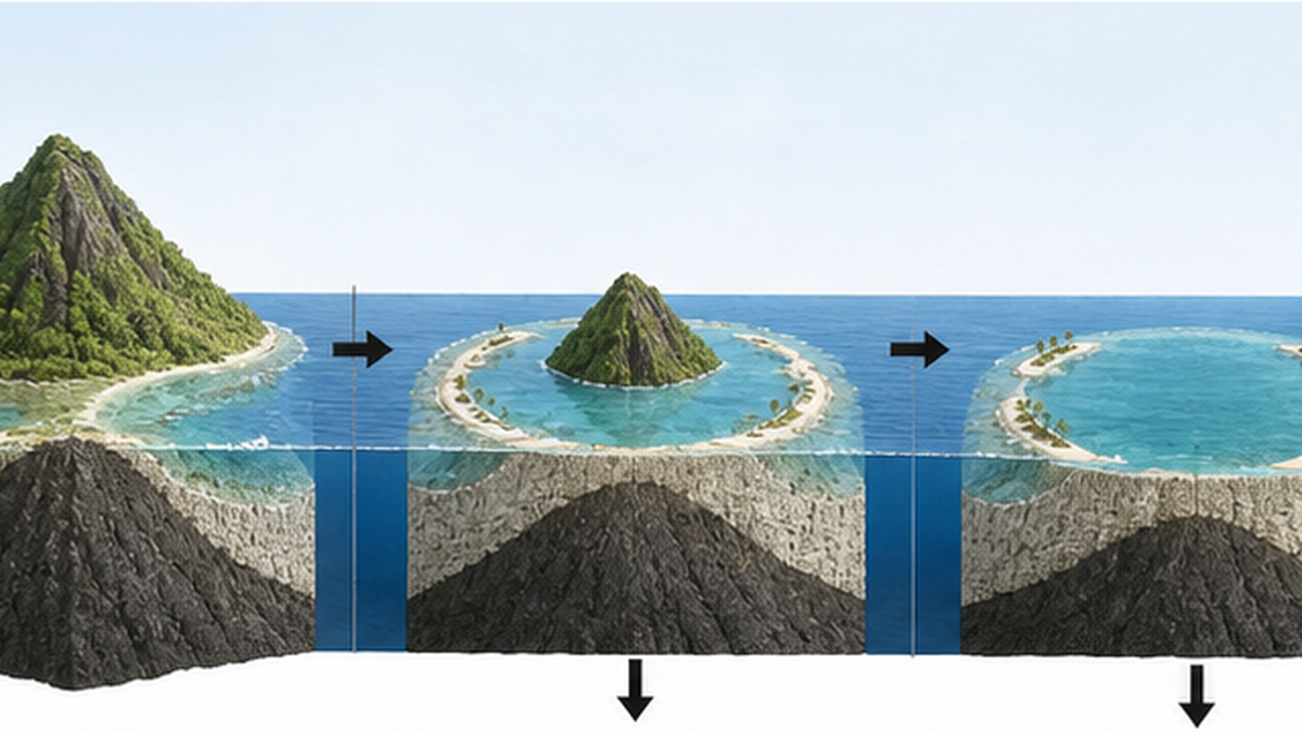
- A volcanic island rises in the open ocean, and reef-building corals colonise its shore to form a fringing reef
- The island subsides slowly while the coral keeps growing upward toward the light. The shoreline retreats, a lagoon opens between land and reef, and the reef becomes a barrier reef
- The island finally sinks entirely beneath the sea. The coral on the rim keeps climbing, leaving a ring that traces the island's outline — an atoll
In other words, an atoll's doughnut shape is a cast that coral took of a vanished volcanic island's coastline. The ring closes because the island's shore was a closed shape to begin with. Darwin ended with a striking line.
In every barrier reef we may see proof that the land there has subsided; and every atoll is a monument raised over an island now lost.
— paraphrased from Charles Darwin, The Structure and Distribution of Coral Reefs (1842)
Why 'sinking' was the only way out
The core of Darwin's insight was to use the reef as a depth recorder. Because reef-building corals depend on photosynthesis by their symbiotic zooxanthellae, they cannot build reef where light does not reach; in practice, vigorous reef building is confined to the upper few tens of metres. Yet immediately outside an atoll the seabed plunges past 1,000 metres.
Coral can only build in shallow water, and yet the reef stands on top of the deep sea. There are not many ways to resolve that contradiction. The most natural is that the foundation was carried downward while the coral kept growing. That is why Darwin cast an invisible process — subsidence — in the leading role. For more on corals and their algal partners, see our article on the symbiosis between coral and zooxanthellae.
The clash with Lyell's crater theory
There was a serious rival hypothesis at the time: the crater theory, favoured by the geologist Charles Lyell and others. If corals colonised the rim of a submerged volcanic crater or caldera, the argument ran, a ring would form on its own.
But the theory has weaknesses. Atolls run tens of kilometres across, and some approach 100 kilometres — far too large for a volcanic crater. Their sizes and shapes also vary enormously, rather than clustering around any typical crater dimension. Darwin's subsidence theory absorbed that diversity easily, as differences in the shape of the original island and in how far subsidence had progressed.
What makes the subsidence theory remarkable
- It explained three landforms using only two movements: the base sinks, the coral climbs
- It re-sorted a visual classification (fringing, barrier, atoll) into a sequence in time
- It made a testable prediction — drill through an atoll's limestone and volcanic rock should appear beneath
A century to test the idea — brute force by drill
Darwin's theory came with an unambiguous test. Drill vertically through an atoll and see whether volcanic rock — basalt — appears beneath the limestone. If the crater theory were right, the limestone would be a thin skin with volcanic rock just below. If subsidence were right, the limestone would be extraordinarily thick.
Funafuti, 1896–1898: the first attempt falls short
The first serious test was the boring campaign at Funafuti Atoll, in what is now Tuvalu, organised by the Royal Society at the end of the nineteenth century. Edgeworth David of the University of Sydney and colleagues made three attempts between 1896 and 1898, but the drilling rigs of the day were repeatedly defeated by the friable limestone and the cavities inside the coral framework. The first attempt in 1896 stopped at a little over 100 feet, about 30 metres.
Later expeditions penetrated far deeper, but the campaign ended without ever reaching basaltic basement. It established the important fact that the limestone was extremely thick, yet it was not decisive. Funafuti Atoll is today listed as an IUGS (International Union of Geological Sciences) geoheritage site precisely because of this history.
Bikini and Enewetak, 1947–1952: the moment the drill hit basement
The question was settled in the Marshall Islands in the mid-twentieth century. In the context of geological surveys for nuclear test sites, Harry Ladd of the U.S. Geological Survey and colleagues carried out deep drilling at Bikini Atoll and then at Enewetak (Eniwetok) Atoll.
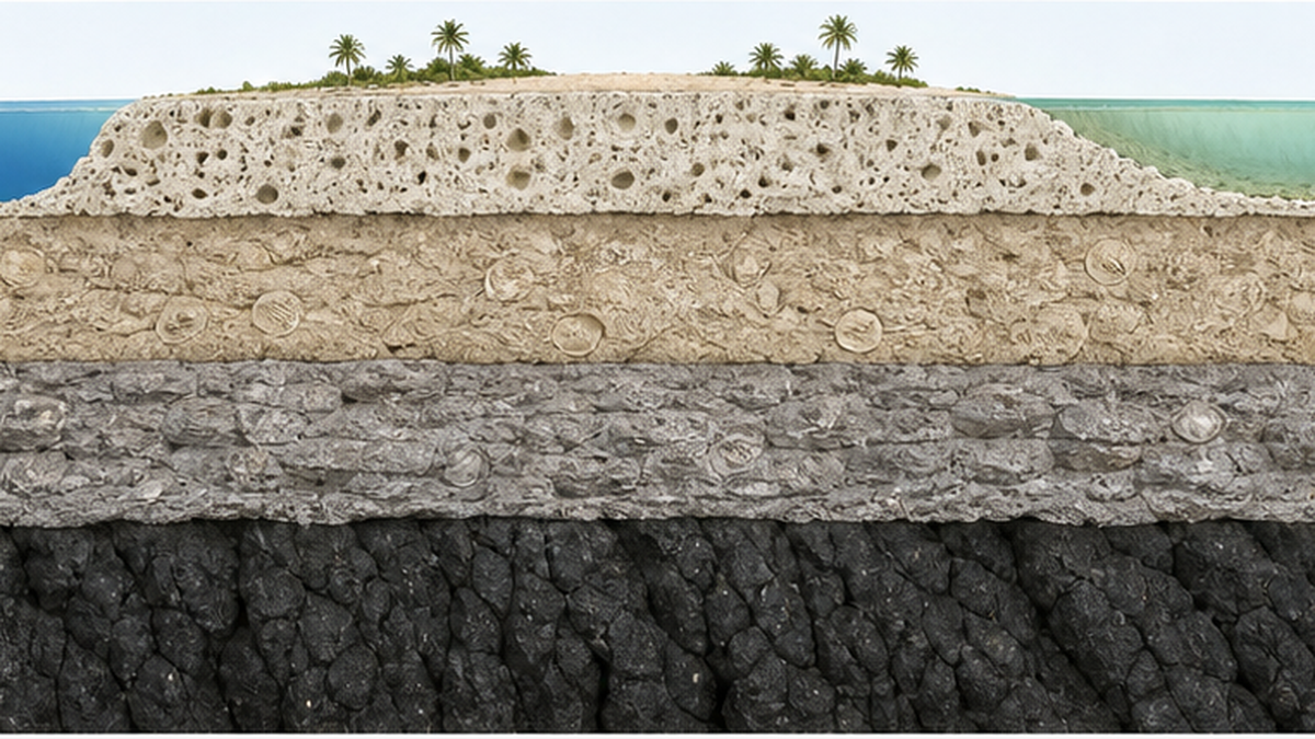
In 1952, hole E-1 on Enewetak recovered unweathered basalt cuttings from a depth of 4,154 feet (about 1,266 metres), and solid basalt core between 4,208 and 4,222 feet (about 1,283 to 1,287 metres). A separate hole, F-1, struck hard basement rock at 4,610 feet (about 1,405 metres). Directly above the basalt lay limestone of Eocene age (roughly 56 to 34 million years ago) formed in shallow water.
Limestone bearing the signature of shallow water, piled more than 1,200 metres thick, can only mean that the site sank slowly over tens of millions of years while coral kept building upward. The structure Darwin had predicted on paper more than a century earlier turned up as physical evidence in a drill core.
Why drilling an atoll is so difficult
Half a century was needed for more than technological reasons. Reef limestone has just about the worst properties a rock can have from a driller's point of view. Because it is an accumulation of skeletons, it is riddled with voids and caverns, and hard and soft layers alternate unpredictably.
If the bit suddenly drops into a cavity, the drill string snaps; if the drilling mud escapes into the voids, the cuttings cannot be lifted to the surface. It was exactly these voids that kept halting work at Funafuti in the 1890s. Seen the other way round, drilling almost 1,400 metres to basement at Enewetak was itself a high-water mark of the drilling technology of its day.
The recovered cores were far more than proof that the drill had reached basalt. The species of foraminiferal fossils in the limestone date each interval, and the alteration state of the minerals reveals periods when a layer stood above sea level and was exposed to rain. A single column of core is a résumé of tens of millions of years of sea level and crustal movement.
| Campaign | Date | Approximate depth reached | Result |
|---|---|---|---|
| Funafuti (Royal Society) | 1896–1898 | About 30 m on the first attempt, much deeper later | Confirmed thick limestone; basement not reached |
| Bikini Atoll (USGS) | 1947 | Around 700 m | Basement not reached, but a thick limestone section confirmed |
| Enewetak Atoll, hole E-1 | 1952 | About 1,266 m | Basalt cuttings recovered; overlain by shallow-water Eocene limestone |
| Enewetak Atoll, hole F-1 | 1952 | About 1,405 m | Hard basement rock reached |
What the drilling proved
- More than 1,200 metres of shallow-water limestone lies beneath an atoll
- Volcanic rock (basalt) sits directly below it — the site began as a volcanic island near the sea surface
- The base of the limestone reaches back to the Eocene, meaning subsidence continued on a scale of tens of millions of years
Can coral outpace subsidence? A race against sinking
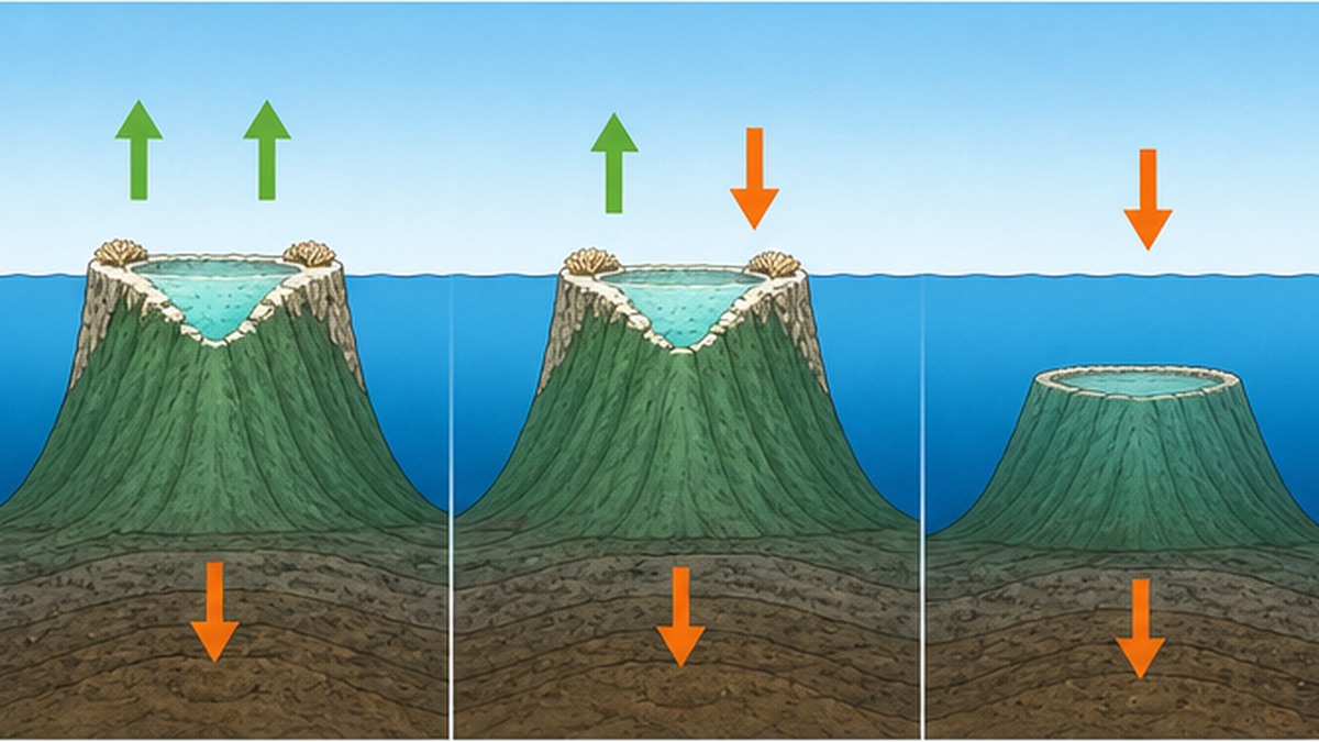
The subsidence theory only works under one condition: coral must grow upward faster than the foundation sinks. If subsidence were faster, the reef would be dragged down beyond the reach of light, stop growing, and become a drowned reef.
How fast a reef actually accretes
Some branching corals such as Acropora extend by more than ten centimetres a year, but that is the growth of a single branch. Averaged over breakage by waves and organisms, sediment accumulation and the infilling of voids, the vertical accretion rate of the reef as a whole comes to only a few millimetres to around ten millimetres a year, even in favourable settings.
Subsidence of a seamount riding on old oceanic lithosphere is far gentler. Plates sink as they cool and grow denser, but the rate typically falls to less than 0.1 millimetres a year. The numbers differ by orders of magnitude. That is precisely why a healthy reef can keep up with subsidence with room to spare.
When the reef falls behind
The danger comes not when subsidence accelerates but when coral growth slows. Cold water, turbidity, nutrient excess, bleaching — weaken the reef builders and growth stops easily. Reefs were also left behind when the relative rate of drowning outpaced growth, as during the rapid sea-level rise at the end of the last glacial period.
- Keep-up reefs: growth matches the rate of drowning, so the reef stays near the surface throughout
- Catch-up reefs: the reef falls behind at first, then catches up and reaches the surface later
- Give-up reefs: the reef never catches up, sinks into deep water and stops growing — a drowned reef
Corals are not the only reef builders
The name 'coral reef' suggests corals do all the work, but in reality many organisms supply the calcareous material. The most important are the crustose coralline algae, which cement the rock of the reef crest together. Where the waves are fiercest, coral piled up alone would simply shatter. It is coralline algae filling and binding the gaps that turn the reef into a structure capable of withstanding open-ocean swell.
The sand of the cays, meanwhile, is made largely of foraminifera along with fragments of shells and sea urchin tests. The 'star sand' famous in Okinawa is nothing but foraminiferal shells. An atoll's white beach is not broken rock but an accumulation of the remains of living things. This fact connects directly to the sea-level discussion below: because the sand supply is biological, a weakened ecosystem means less material to build islands with.
The Darwin Point — a limit set by latitude
Coral growth rates fall as latitude increases. At the northwestern end of the Hawaiian archipelago there is a place where that decline exactly balances subsidence, known as the Darwin Point. The concept was proposed by the researcher Richard Grigg in 1982 and placed at roughly 29°N.
Kure Atoll, the northwesternmost of the Hawaiian islands, sits right on that line. There, coral growth is only just outpacing subsidence. Carried further north, it will eventually fall behind. What lies beyond is shown by the entirely submerged Emperor Seamount chain: mountains that were once atolls now lie in the deep sea as guyots, their summits planed flat.
Guyots as witnesses
A seamount with a planed-off summit shows that its top once stood shallow enough to be attacked by waves. The countless guyots scattered across the deep Pacific are, in effect, headstones for drowned atolls — and geomorphological support for the subsidence theory.
A tour of the world's atolls — the Maldives and the Marshall Islands
In several cases an atoll is not merely a landform but an entire country. Here are the most notable atoll nations and groups.
The Maldives, where the word 'atoll' was born
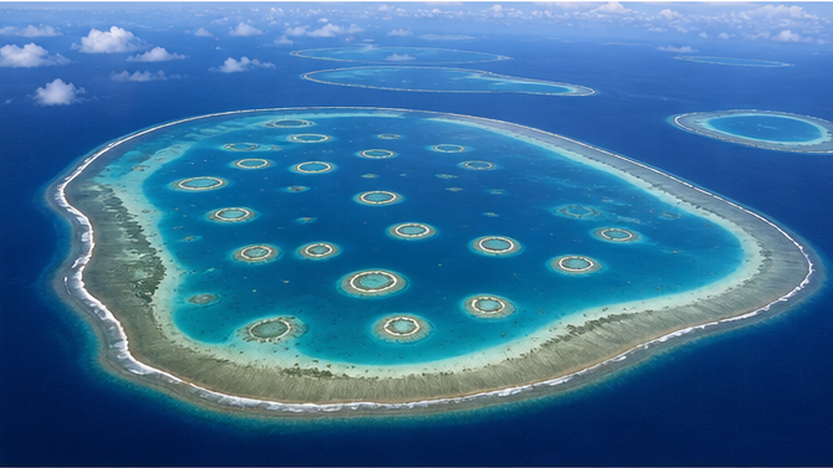
Stretching about 820 kilometres north to south and 130 kilometres east to west in the Indian Ocean, the Maldives is an island nation of some 1,192 islands riding on 26 atolls of varying size. About 200 are inhabited and around 145 are used as resorts. Almost all are low sand cays less than two metres above sea level.
Maldivian atolls display a nested structure in which smaller ring-shaped reefs sit inside the larger atoll; these are known by the local term faro. Atolls within atolls give the Maldivian seascape its distinctive complexity.
The Marshall Islands, the Pacific's atoll heartland
The Marshall Islands consists of about 30 atolls holding more than 1,000 islands and islets. Kwajalein, mentioned above, comprises 97 islands with 16.4 square kilometres of land enclosing a 2,174-square-kilometre lagoon. Enewetak and Bikini, where the drilling settled the question, also belong to this country.
The atolls of the Marshall Islands carry the history of nuclear testing, a place where geological discovery and twentieth-century politics are inseparably bound. The fact that the drilling was not undertaken out of pure scientific curiosity alone is part of what should be remembered.
Other major atolls
| Name / region | Ocean | Notes |
|---|---|---|
| Maldives | Indian Ocean | 26 atolls, some 1,192 islands. The source of the word 'atoll' |
| Marshall Islands | Pacific | About 30 atolls. Kwajalein has one of the world's largest lagoons (2,174 km²) |
| Tuvalu (Funafuti and others) | Pacific | Site of the first atoll drilling, at the end of the nineteenth century |
| Kiribati (Gilbert Islands and others) | Pacific | An atoll nation straddling the equator with a vast exclusive economic zone |
| Tuamotu Archipelago | Pacific (French Polynesia) | One of the world's densest concentrations of atolls, also known for black pearl farming |
| Chagos Archipelago | Indian Ocean | Studied as atolls with relatively little human impact |
For the people who live on them, these rings are not scenery. They are the breakwater that takes the force of the open ocean. On how reefs attenuate waves, see our article on coral reefs as natural breakwaters.
Subsidence alone is not enough — ice ages and karst
Drilling confirmed the backbone of Darwin's account. Modern researchers, however, point out that it does not explain everything — and the problem lies specifically in the uppermost few hundred metres of an atoll, that is, its most recent history.
The violent rise and fall of glacial cycles
Over the past few hundred thousand years, global sea level has swung sharply through glacial and interglacial cycles. At the height of the last glacial period, sea level is thought to have stood more than 100 metres below the present. Against a foundation sinking at less than 0.1 millimetres a year, glacial-cycle sea-level change is faster and larger by orders of magnitude.
In other words, the dominant driver of the 'relative water-level change' that reefs experienced — at least over the last few hundred thousand years — was not subsidence but the movement of sea level itself. The glacial control theory advanced by Reginald Daly in the early twentieth century was the rival hypothesis that emphasised this point.
Rain dissolves the exposed limestone
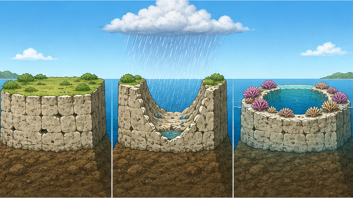
When sea level falls, a limestone platform that had been underwater is exposed to the air. Limestone dissolves readily in rainwater, so the surface turns into karst. In that process the centre of the platform tends to dissolve into a depression while the rim remains relatively high. When sea level next rises, a ring-shaped foundation is already waiting.
Corals then grow preferentially on the raised rim, where the water is shallower and light more abundant. The ring is reinforced again and again while the central depression survives as a lagoon — a view known as the antecedent karst model.
The modern model: subsidence and karst combined
Recent work has proposed models that integrate the two. In a 2021 review in Annual Review of Marine Science, André Droxler and Stéphan Jorry argued that the atoll shapes we see today were given their final form by sea-level oscillations and karst dissolution on a scale of hundreds of thousands of years.
In Droxler's survey work at North Malé Atoll in the Maldives, basalt around 55 million years old was found beneath nearly two kilometres of accumulated limestone. The long-term framework of a subsiding foundation is just as Darwin described; what is newer is the sculpting of the ring itself.
This is not 'Darwin was wrong'
- The backbone — that the subsidence of a volcanic island created the atoll's long-term foundation — has been confirmed by drilling
- What is being revised is the mechanism and timing by which the ring received its final shape
- Science does not discard hypotheses so much as sharpen them. The subsidence theory is a good example
Japan and atolls — Okinotorishima and the fringing-reef islands
Japan's coral reefs are concentrated in the Nansei Islands. Almost all of them, however, are fringing reefs attached directly to the shore, and classic atolls are very rare. That difference, too, makes sense within the framework of the subsidence theory.
Okinotorishima, Japan's southernmost reef
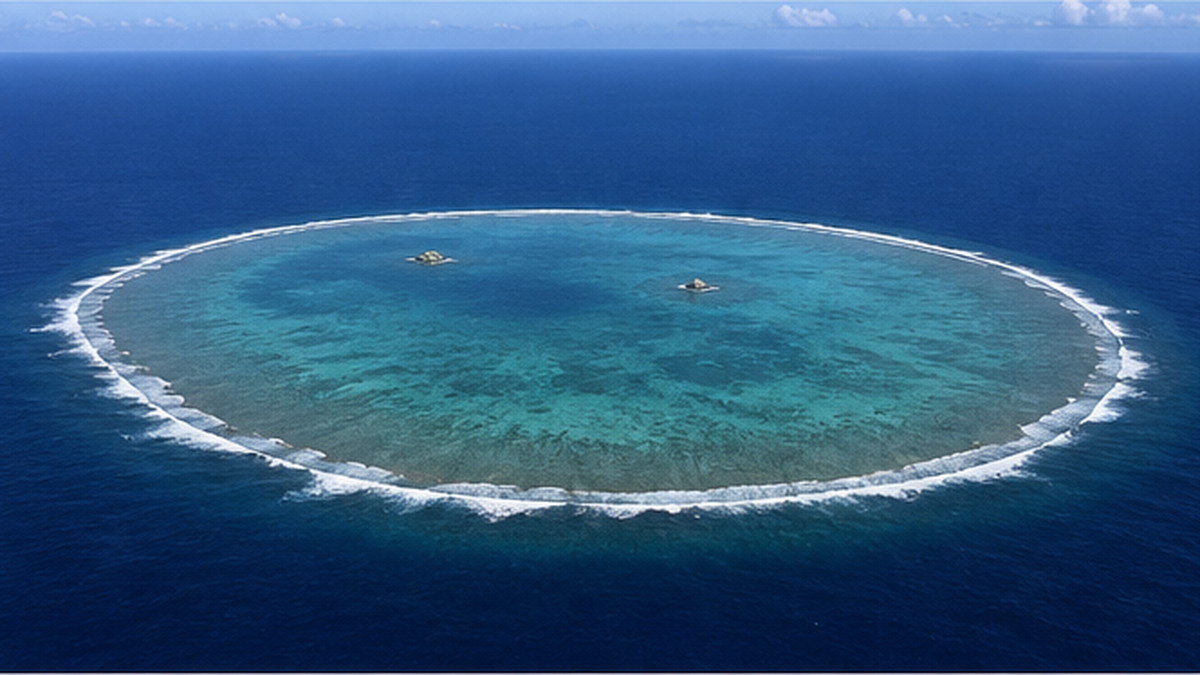
Okinotorishima, part of Ogasawara Village in Tokyo, is Japan's southernmost island: a coral reef roughly 4.5 kilometres east to west and 1.7 kilometres north to south. It sits on the Kyushu–Palau Ridge and is the only point on that ridge besides Palau to reach the sea surface. At high tide, all that remains above water are two small highs known as Kita-kojima and Higashi-kojima; everything else is submerged.
Geomorphologically it is usually classified as a table reef with a shallow central pool, but a ring-shaped reef crest enclosing shallow inner water closely resembles an atoll. Around it lies an exclusive economic zone of about 400,000 square kilometres — larger than Japan's total land area — making the island geographically and legally significant. The University of Tokyo and others have pursued research on supporting coral growth to conserve the reef.
Why the Nansei Islands have fringing reefs and little else
What has developed around Okinawa Island, Ishigaki and Miyako are fringing reefs hugging the shore. These are not isolated volcanic islands quietly subsiding on the Pacific plate; they belong to an island arc formed at a subduction zone. Crustal movement in an island arc is complex, and in many places the land is not sinking at all but rising.
Kikaijima in Kagoshima Prefecture, for instance, continues to rise at one of the fastest rates in the world, and former coral reefs survive on land as a staircase of terraces. Where the foundation is going up, a reef is lifted onto land before it can ever become an atoll. On the pressures facing Okinawan reefs, see also our article on protecting the coral reefs of Okinawa and the Nansei Islands.
| Setting | Movement of the foundation | Reef landform that results |
|---|---|---|
| Isolated oceanic volcanic islands (Hawaii, the Marshall Islands) | Subsiding with the cooling plate | Readily develops from fringing to barrier reef to atoll |
| Island arc (the Nansei Islands) | Uplift and subsidence mixed, with many uplifting areas | Mainly fringing reefs; terraces of raised coral reef remain |
| Isolated reef on a ridge (Okinotorishima) | Gentle subsidence over the long term | Table reef or atoll-like ring |
What happens to atolls in an age of rising seas
Understanding how atolls form also makes the changes now under way easier to read. Atoll cays stand only a few metres above the sea, which makes them among the landforms most exposed to sea-level rise.
The 'sinking islands' image versus the measurements
Atoll nations are often described as sinking islands. Studies based on satellite imagery and aerial photographs, however, show something more complicated. A 2019 review by Virginie Duvat in WIREs Climate Change reanalysed 709 islands on 30 Pacific and Indian Ocean atolls and reported that only 11.4 per cent had lost area, while 88.6 per cent were stable or had grown. No island larger than 10 hectares was found to have contracted.
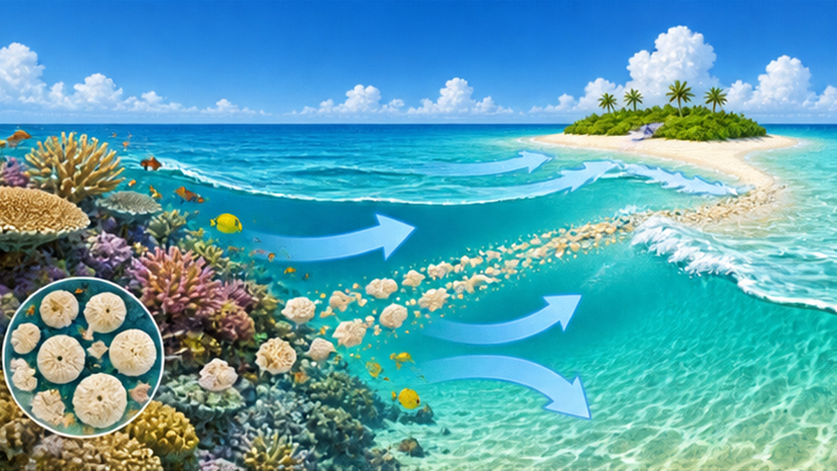
This does not mean sea-level rise is not a problem. It means that a cay is not fixed land made of rock but a dynamic landform of coral-derived sand and gravel piled up by waves and currents. As long as a healthy reef keeps supplying sediment, an island can shift and reshape itself while maintaining its elevation.
Three reasons this is still no cause for complacency
- The sand comes from the coral itself: if bleaching and acidification degrade the reef, production of the sand that sustains the island stops
- The fragility of the freshwater lens: a thin lens of fresh water lies beneath low islands, and it is easily salinised by seawater intrusion during storm surges and overtopping
- Fixing the island in place with structures: seawalls and reclamation immobilise the island, disabling the natural mechanism by which moving sand keeps its elevation
The third point is the one most often overlooked. Recent research has warned that human modifications such as seawalls and land reclamation may undermine the very capacity of atoll islands to adjust to climate pressures — the paradox that works built to protect an island can rob it of its flexibility in the long run. On sea-level rise along Japan's own coast, see our article on rising seas and Japan's coastline.
What atoll nations are actually doing
The response of atoll nations is not a simple choice between migration and last-ditch defence. Raising existing islands with fill, building artificial islands to concentrate population, and securing land abroad are all being considered at once. In the Maldives, many residents have moved to an artificial island created to relieve overcrowding in the capital, Malé, and debate over raising land and relocation continues in Kiribati and Tuvalu.
Every option carries a cost, however. The sand used for reclamation is often dredged from the lagoon floor or the reef flat, which risks the contradiction that works meant to protect the island damage the reef that has been protecting it. Understanding how atolls came to exist helps in judging those trade-offs accurately.
What atolls have to teach us
An atoll is evidence that living things have been building landforms for tens of millions of years. A volcanic island sank; coral inherited nothing but the memory of its shoreline; and through repeated washing by glacial sea-level swings, the ring has held its shape. The condition for that persistence is singular — that coral keeps growing healthily.
What you can do for atolls
- Engage, through daily life and choices, with cutting the greenhouse gas emissions that drive the warming behind coral bleaching
- Reduce the red-soil runoff and nutrient loading that stress reefs, through coastal land use and drainage management
- When visiting an atoll nation, follow local rules — do not touch coral, and be mindful of sunscreen and wastewater
- Describe changes to atoll islands as a dynamic landform rather than a binary of 'disappearing or surviving'
Summary
- An atoll is a ring in which coral has cast the coastline of a sinking volcanic island
- In 1842 Darwin linked fringing reef, barrier reef and atoll along a single axis: subsidence
- The 1952 drilling at Enewetak brought up basalt from about 1,266 metres down, confirming the hypothesis
- Modern research adds that glacial sea-level swings and karst dissolution gave the ring its final shape
- Most cays have been stable or growing even under rising seas — but only for as long as the reef keeps supplying sand
References and sources
- Charles Darwin, The Structure and Distribution of Coral Reefs (1842) – The original statement of the subsidence theory, available in full at Project Gutenberg
- Darwin Online (archive of Darwin's works) – Facsimile images and text of The Structure and Distribution of Coral Reefs
- U.S. Geological Survey Professional Paper 260 – The geological report series on the Enewetak drilling (Bikini and Nearby Atolls)
- R. W. Grigg, Darwin Point: A threshold for atoll formation, Coral Reefs (1982) – The paper proposing roughly 29°N as the limit for atoll formation
- Eos (AGU), Rethinking Darwin's Theory of Atoll Formation – An explainer on the karst and sea-level model of Droxler and Jorry
- V. K. E. Duvat, A global assessment of atoll island planform changes over the past decades, WIREs Climate Change (2019) – A reanalysis of 709 islands on 30 atolls, reporting 88.6 per cent stable or growing
- NOAA National Ocean Service, What is an atoll? – A primer on the definition and formation of atolls
- IUGS Geoheritage Sites, Funafuti Atoll (Tuvalu) – On the historical significance of the nineteenth-century atoll drilling
- Tohoku University, Iryu Laboratory: Coral Reefs and Seamounts – A Japanese-language explanation of reef development and its relationship to seamounts and guyots
- Tokyo Metropolitan Government, Japan's Southernmost and Easternmost Border Islands: Okinotorishima – Official information on the island's landform, dimensions and exclusive economic zone
- University of Tokyo Ocean Alliance, Okinotorishima and Small Island States Programme – Research on reef conservation at Okinotorishima
- Ocean Policy Research Institute, 22nd Ocean Forum: The Current State and Restoration of Okinotorishima (Hajime Kayanne) – Lecture summary on the island's landform and conservation
Ordered by reliability: government and academic institutions > peer-reviewed papers > specialist organisations > reputable media