⚡ The answer in 30 seconds
- The Sanriku Geopark is a Japan Geopark spanning 16 municipalities from Hachinohe in Aomori to Kesennuma in Miyagi, certified in September 2013.
- With the Miyako area as the boundary, the north is an uplifted coast and the south a ria coast of continuous inlets and capes, where blessings and tsunami risk coexist along the same coastline.
- By following earthquake remains and commemorative monuments with certified guides, you can learn how landforms relate to tsunami damage.
- In Miyako City, free Sanriku Geopark outreach classes are held for children and students, serving as an entry point to disaster education.
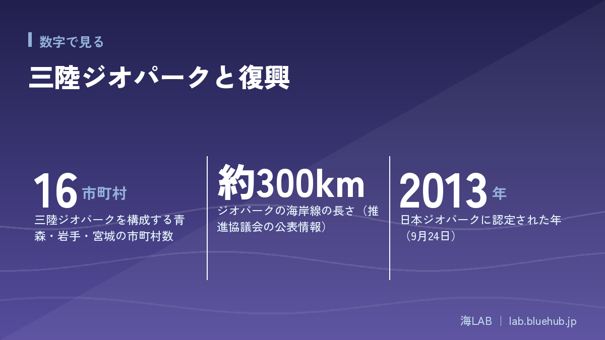
The Sanriku Geopark is a Japan Geopark spanning 16 municipalities from Hachinohe in Aomori Prefecture to Kesennuma in Miyagi Prefecture, with a coastline of about 300 km. It is not only a place to enjoy landforms and geology, but also a place that conveys the lessons of tsunami disasters.
The inlets of the ria coast nurture rich fishing grounds, yet they are also landforms where tsunamis can grow higher. The charm of this geopark is that you can understand this duality through local guides and earthquake disaster remains.
This article organizes the geopark's history, landforms, geosites, disaster education and ties to the community, based on publicly available primary sources.
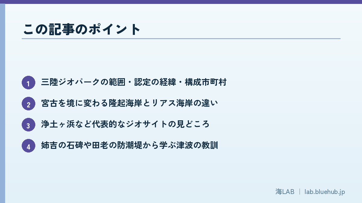
What you will learn
- The extent, certification history and municipalities of the Sanriku Geopark
- The difference between the uplifted coast and the ria coast on either side of Miyako
- Highlights of representative geosites such as Jodogahama
- Tsunami lessons from the Anekichi stone monument and the Taro seawall
- How disaster education works: outreach classes and certified guides
What is the Sanriku Geopark? One of Japan's largest parks of tsunamis and land
Basic information as a Japan Geopark
The Sanriku Geopark is a Japan Geopark that stretches from Hachinohe in Aomori Prefecture, along the Sanriku coast of Iwate Prefecture, to Kesennuma in Miyagi Prefecture. It is run by the Sanriku Geopark Promotion Council and is said to extend about 220 km north-south and about 80 km east-west, with a coastline of about 300 km. It was certified on September 24, 2013, and re-certified following a Japan Geopark Committee review on December 25, 2019. It is not a UNESCO Global Geopark.
It consists of Hachinohe City and Hashikami Town in Aomori, 13 municipalities along the Iwate coast, and Kesennuma City in Miyagi, for a total of 16 municipalities. A defining feature is that one geopark is run across prefectural borders, linking the different scenery of each area into a single story.
| Item | Details |
|---|---|
| Certification | September 24, 2013 (Japan Geopark) |
| Re-certification | December 25, 2019 |
| Municipalities | 16 (Aomori 2, Iwate 13, Miyagi 1) |
| Extent | About 220 km north-south, about 80 km east-west, coastline about 300 km |
| Theme | Keeping time since 500 million years ago, living now |
A geopark is not just for sightseeing
A geopark is a general term for efforts that conserve the value of landforms and geology while using them for education, tourism and community development. Unlike a national park, the main aim is not simply to protect scenery; the core is to learn how the land was formed and convey it in connection with local life. At the Sanriku Geopark, this idea overlaps with the mission of "passing the memory of tsunami disasters to the next generation."
For how the geopark system works across Japan and comparisons with other regions, see also What is a geopark? 11 regions of Japan and the stories of the land.
Origins of the Sanriku Geopark and its two pillars
A plan that began before the earthquake
The idea of a Sanriku geopark began in March 2010, before the Great East Japan Earthquake, when the Iwate-led "Iwate Sanriku Geopark Study Group" was formed. The "Iwate Sanriku Geopark Promotion Council" was established on February 2, 2011, and the earthquake struck the following month. Because of this history, the Sanriku Geopark can be described as a geopark shaped while taking in the experience of the disaster.
On October 30, 2012, Hachinohe and Taneichi Town (now Hirono Town) in Aomori and Kesennuma in Miyagi joined, and it was renamed the "Sanriku Geopark," forming the prototype of today's framework spanning three prefectures.
- March 2010: Iwate Sanriku Geopark Study Group formed
- February 2011: Iwate Sanriku Geopark Promotion Council established
- October 2012: Renamed "Sanriku Geopark" spanning three prefectures
- September 2013: Certified as a Japan Geopark
The direction set by the two pillars
The Sanriku Geopark sets out two pillars as its guiding policy. One is "facing recurring disasters and preparing for the future," and the other is "rich geo-resources and people's lives." The former is the disaster-prevention perspective of conveying the lessons of tsunamis and other disasters; the latter is the perspective of daily life, including mines, fisheries and other industries, and coastal ecosystems.
Thanks to this two-part structure, the same coast lets you learn about tsunami heights on one day, and about aquaculture or how scenic spots formed on another.
Key point
- Handling both disaster prevention and daily life/industry in one story is the Sanriku Geopark's character
- Since the planning stage before the earthquake, it has been positioned as a place to learn about tsunami disasters
How the land formed: Sanriku's landforms that record 500 million years
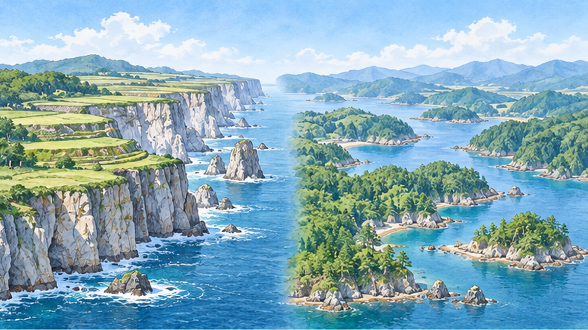
Theme: "Keeping time since 500 million years ago, living now"
The theme of the Sanriku Geopark is "Keeping time since 500 million years ago, living now." Coastal cliffs and rocky reefs consist of strata deposited on ancient sea floors and rocks formed by magma activity, and time on a scale of hundreds of millions of years appears as outcrops.
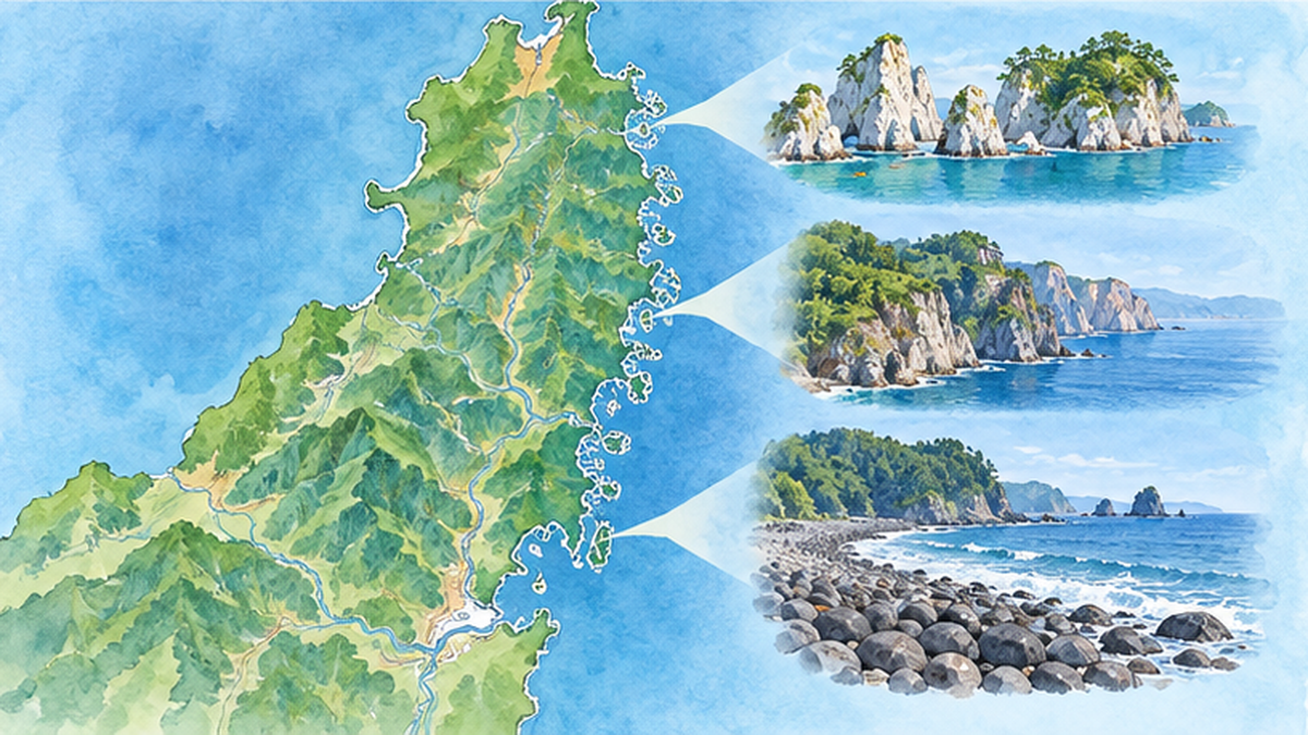
Uplifted coast in the north, ria coast in the south
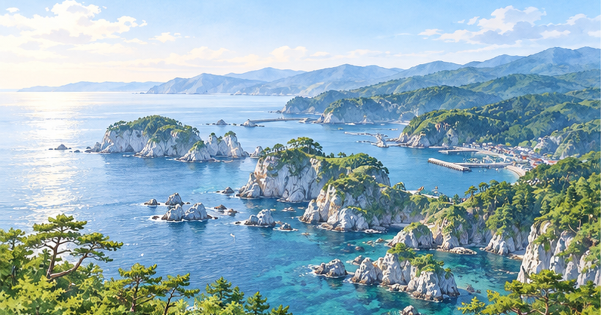
A Miyako City document explains that, with the Miyako area as the boundary, the north is an uplifted coast with developed sea cliffs and marine terraces, and the south is a ria coast with intricate inlets and capes. The Ministry of the Environment's Sanriku Fukko National Park page likewise says that a ria coast with continuous capes and inlets spreads around Kamaishi, Ofunato, Minamisanriku and the Oshika Peninsula.
A ria coast is a landform where a valley has sunk and seawater has flowed in. Its inlets have calm waves, suiting ports and aquaculture, but tsunami wave heights tend to grow toward the head of the bay. This picture of "blessing and threat coexisting in the same landform" is essential for understanding Sanriku.
Rhyolite and Cretaceous strata
Jodogahama in Miyako City is a scenic spot where the green of pines and the deep blue of the sea set off white rhyolite rock faces, and it is designated a national place of scenic beauty. Rock born of ancient magma activity is itself the star of the landscape.
Miyako also has "shiobuki-ana" (blowholes), formed when waves cut into strata of gravel and sand deposited on the sea floor in the Cretaceous, about 110 million years ago. A Miyako City document introduces 17 geosites within the city alone.
Walking the representative geosites
Eight places to know first
The Sanriku Geopark has many numbered geosites, and the official site's map lists them up to the 100s. Here we organize eight representative places often cited in regional introductions.
| Geosite | Location | Highlights |
|---|---|---|
| Tanesashi Coast | Hachinohe, Aomori | Marine terraces and lawn scenery |
| Kuji Amber | Kuji, Iwate | An area known for amber production |
| Kitayamazaki and Unosu Cliffs | Tanohata, Iwate | Rows of sea-cliff scenery |
| Ryusendo and Akka Caves | Iwaizumi, Iwate | Caves in limestone terrain |
| Jodogahama | Miyako, Iwate | White rhyolite coast |
| Hashino Iron Mine | Kamaishi, Iwate | Remains of modern ironmaking |
| Goishi Coast | Ofunato, Iwate | A coast of continuous marine-erosion landforms |
| Karakuwa Peninsula | Kesennuma, Miyagi | Peninsula scenery of the ria coast |
Not only geology but also industry and history
Places like Hashino Iron Mine, which conveys the history of underground resources and industry, are also geosites, which sets this apart from ordinary sightseeing of scenic spots. On the official site you can search for sites by categories such as "choose by area," "choose by purpose" and "choose by geo element," and there are also categories such as earthquake disaster remains and geology/fossils.
Tip for planning your visit
- First, experience the landforms at an easy-to-grasp scenic place such as Jodogahama
- Then learn tsunami lessons at an earthquake-remains site, and landforms and disasters connect
Conveying the memory of tsunami disasters: a hub for disaster education
The mission: passing on earthquake heritage
The promotion council's mission is to convey the heritage of past tsunami damage, including the Great East Japan Earthquake tsunami, to later generations through geopark activities. Knowing how the land formed lets you understand logically why damage was great in a particular place.
The Anekichi monument and its "lesson of high ground"
In the Anekichi district of Miyako City stands a stone monument erected at a point about 60 m above sea level after the Showa Sanriku tsunami, engraved with the importance of living on high ground. According to reports, all 11 households that continued to live above the monument escaped damage from the Great East Japan Earthquake tsunami. On the other hand, it is recorded that the settlement suffered devastating damage in the Meiji and Showa tsunamis.
A case in which a lesson left in words by earlier generations actually protected lives and homes is introduced nationwide as teaching material on tsunami prevention. For basics on tsunamis, see Tsunami disaster prevention basics: evacuation and "tsunami tendenko".
Seeing the Taro seawall and disaster remains
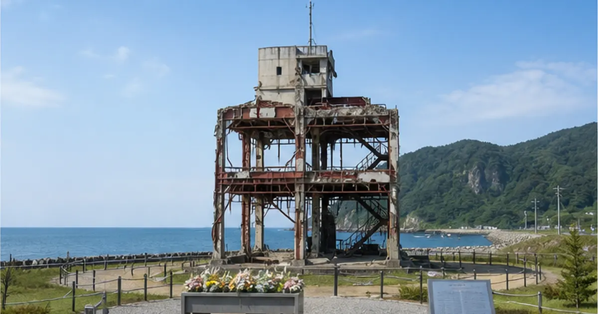
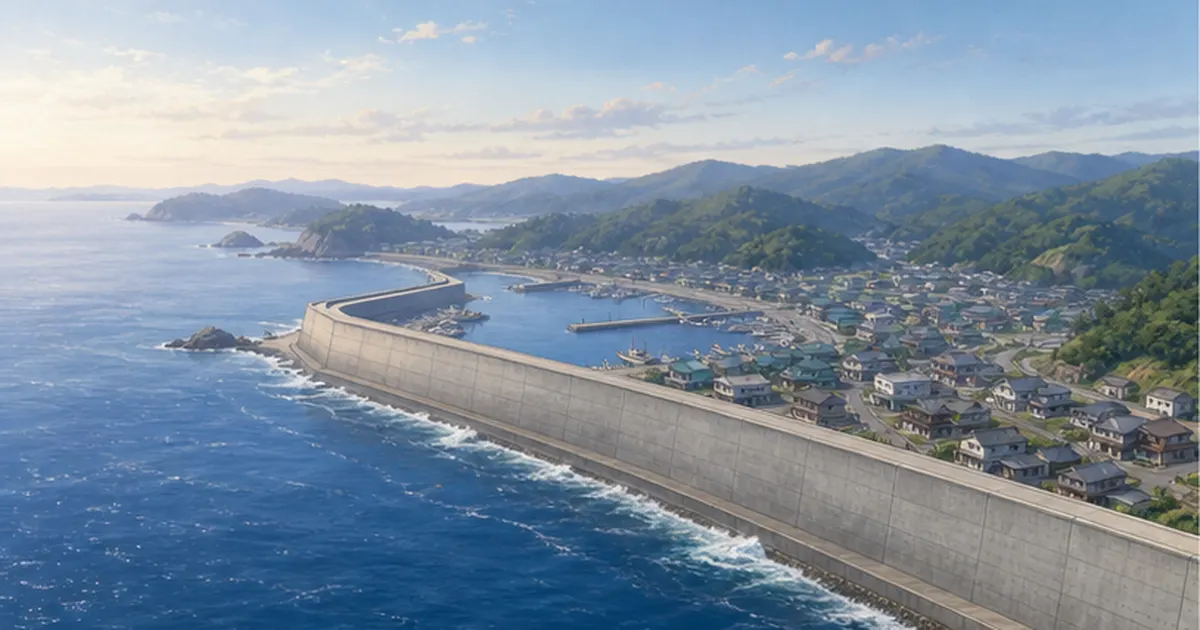
In the Taro district of Miyako City, with the roadside station as a base, a paid, reservation-only disaster-prevention guide tour takes visitors with a certified guide to the tsunami remains of the "Taro Kanko Hotel" and the Taro seawall. For the debate over huge seawalls, see What did the huge seawalls protect and change?.
- On-site visits to disaster remains: touch the reality of the damage the remains convey
- Checking commemorative monuments: read the evacuation lessons earlier generations left
- Guides' talks: hear both disaster experiences and landform knowledge at once
Learning that spreads to schools and communities: outreach classes, certified guides and the exam
Free outreach classes in Miyako
According to a Miyako City document, a feature of the Sanriku Geopark is that you can learn the lessons of tsunamis, and free "Sanriku Geopark outreach classes," including disaster-prevention learning, are held for children, students and pupils in the city. Some places, such as Miyagi's "Earthquake Memorial Park Nakanohama," are also used as field-trip destinations for classes.
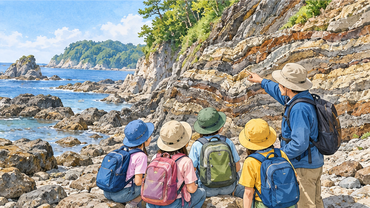
How certified guides are trained
Training courses for certified guides, who convey the appeal of the geo-heritage to visitors and residents, are held, and an Iwate Prefecture document reports four sessions a year. The official site announces certification courses for "certified guides" and "area guides," and a third course was announced again in October 2026. Guides are also local storytellers, and the depth of learning changes with the speaker even at the same place.
Study materials such as the exam textbook
The promotion council publishes the "Sanriku Geopark Exam Textbook" (edition published December 2023), a publicly available material for systematic learning. The official site's updates also list events such as a summer school for children on earthquakes, volcanoes and geology.
Tips for schools and families
- Ask your municipality's board of education or geopark office whether outreach classes are available
- Before field learning, look up your destination geosites on the official site
Local life and industry: ties to fisheries and community building
The sea's bounty is part of the geo-heritage too
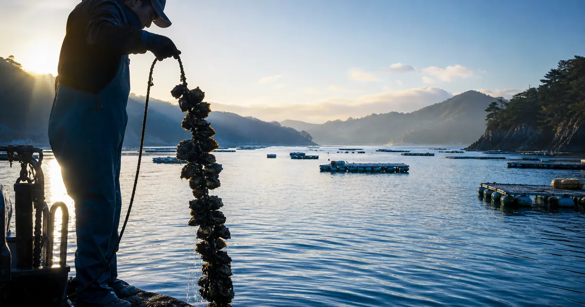
The second pillar of the Sanriku Geopark is geo-resources and people's lives. The calm inlets of the ria coast have created an environment suited to farming oysters, scallops and wakame seaweed. One can see the fishing grounds created by the landforms as supporting local industry and food culture.
For the post-disaster path of the fishing industry, see The path of Sanriku's seafood recovery.
Visitor numbers and reconstruction-oriented community building
Iwate Prefecture has set out a policy of expanding the number of visitors and exchange through the geopark, and eventually aiming for UNESCO Global Geopark certification. In coastal community development, initiatives led by residents are important, which overlaps with the perspective of rebuilding coastal communities.
Visiting disaster-affected areas as a tourist requires consideration for the burden on locals and for memory. Learning with a guide is regarded as a method that is less burdensome for both visitors and the community.
- Use local guides and follow local rules
- Treat remains and monuments with respect and check whether photography is allowed
- Give back to the community through lodging, meals and purchases
How to learn from the Sanriku Geopark: visiting and challenges
Planning your trip
Because the area stretches about 220 km north-south, it is unrealistic to visit everything at once. The shortcut is to decide on a theme of interest (landforms, industry or the disaster) and narrow down destinations using the official site's search. Travel combines rail and car, so it helps to check coastal transport conditions too.
Challenges ahead
Challenges include building a system that meets the national nomination criteria for Global Geopark certification, securing guides for the future, and maintaining cooperation among the 16 municipalities spread over a wide area. In Japan Geopark Committee reviews, in addition to the international importance of geological heritage, conservation, understanding, conveying value, and a system for using it through geotourism are cited as evaluation points.
From a disaster-prevention perspective, as memories of the earthquake fade, the question is how to maintain remains and monuments and keep telling their stories. This is deeply related to How do we pass on the memory of the earthquake?.
Summary
- The Sanriku Geopark is a Japan Geopark spanning 16 municipalities and about 300 km of coastline
- Its greatest feature is learning landforms, industry and tsunami lessons together
- Learning systems such as outreach classes and certified guides are taking shape
References and sources
- Sanriku Geopark official site – Geosites, certified guides, updates
- Sanriku Geopark Exam Textbook (published December 2023) – Sanriku Geopark Promotion Council
- Japan Geopark Committee – Certification, re-certification and review system
- Japan Geopark Committee re-certification results (December 25, 2019) – Re-certification of the Sanriku Geopark
- Ministry of the Environment: Sanriku Fukko National Park – Introduction to the ria coast and Jodogahama
- Miyako City Geo News – Miyako's geosites and outreach classes
- Iwate Prefecture: Sanriku area initiatives (FY2023) – Certified guide training courses, etc.
- Reconstruction Agency: Great East Japan Earthquake Memorial Guide – Guide to earthquake memorial facilities
- Japan Meteorological Agency: Tsunami height – Explanation of tsunami height
* Listed in order of reliability: government agencies > academic institutions > peer-reviewed papers > specialist organizations > reputable media