⚡ In short
Fifteen years after the Great East Japan Earthquake: from the disaster ruins of Kesennuma, Minamisanriku, and Okawa Elementary School to the aging of storytellers and the Edo-era tsunami stones of the Yaeyama Islands, this article traces how the sea's hardest lessons are being carried into the future.
A government office building left in ruins. A classroom clock stopped by the wave. Stones carved by the tsunami's force. Choosing to leave these things unrepaired, rather than tear them down, was never an easy decision for the disaster-hit areas. Among the bereaved families who lost relatives to the tsunami, some wanted the ruins demolished because "it's too painful to look at," while others argued for preservation, saying "if we don't pass this on, the same tragedy will happen again." Fifteen years have now passed since the Great East Japan Earthquake, as of 2026, and more than 300 disaster memorial facilities are registered along the Tohoku coast.
The sea gives, and at times it also bares its teeth. The Japanese archipelago lives permanently alongside the risk of massive tsunami-generating earthquakes, from the Nankai Trough to the Japan Trench to the plate boundaries near Okinawa. The 1771 Great Meiwa Tsunami, which struck the Yaeyama Islands, is said to have claimed roughly 12,000 lives, and the enormous tsunami stones it hurled ashore still sit on the coast more than 250 years later. Disaster ruins, storytellers, stone monuments — different in form, but each answering the same question: how do we hand down what we experienced, so that the next disaster causes less harm?
This article traces the story of the major disaster ruins and memorial museums of the Great East Japan Earthquake, the very real challenge of an aging generation of storytellers, and even stone monuments that carry memories of tsunamis from centuries before — following the many ways the sea's lessons are being carried into the future.
What you'll learn from this article
- How disaster ruins came to be preserved in their current form, after debate over "demolish or preserve"
- The roles played by major disaster ruins and memorial museums in Kesennuma, Minamisanriku, and Okawa Elementary School
- The spread of storyteller activities, and the real challenge of an aging population with too few successors
- The lessons predating the earthquake, carried by natural disaster monuments and the tsunami stones of the Yaeyama Islands
- How the memories held by disaster ruins and storytellers can be used in disaster education and regional revitalization
The choice to preserve disaster ruins — why leave them unrepaired?
Buildings reduced to bare steel frames by the tsunami. Seawalls left tilted. Boats swept far from the water. The disaster-hit areas came to hold many structures bearing the scars of the earthquake. Most were removed early on, but some were deliberately left untouched and preserved as "disaster ruins."
What is a disaster ruin, and what forms does it take?
A disaster ruin refers to a building or structure that collapsed or was damaged in the earthquake and has been preserved to pass the memory and lessons of the disaster on to future generations. According to the Reconstruction Agency, the category covers not only buildings such as school buildings and government offices, but also damaged pine trees, boats, and sections of seawall. Disaster ruins rarely stand alone; in most cases they are developed together with an adjoining memorial museum or archive, complete with panels explaining the damage and commentary from storytellers, so that visitors can concretely understand why the tsunami reached that spot and what happened there.
When the national government provides financial support for preserving a disaster ruin, the decision to simply "leave it unrepaired" is not enough on its own. In selecting projects for support, the Reconstruction Agency has weighed three factors: ① whether the ruin is connected to the broader reconstruction of the town, ② whether a realistic plan for bearing the ongoing maintenance costs is in place, and ③ whether agreement among residents and other stakeholders has been confirmed. Precisely because disaster ruins are a subject prone to emotional debate, these administrative criteria are meant to ensure that, once preserved, a site can be run sustainably over the long term.
Disaster ruins vs. disaster memorial facilities
- Disaster ruin: the damaged building or structure itself, preserved on site (e.g., Minamisanriku's former disaster management building)
- Disaster memorial facility: a broader category that includes disaster ruins as well as archives, memorial museums, monuments, and records of evacuation sites
- Both are registered and mapped across the region by the Disaster Memorial Network Council, whose secretariat is run by the Tohoku Regional Bureau of the Ministry of Land, Infrastructure, Transport and Tourism
Preserve or demolish: the conflicted feelings of bereaved families
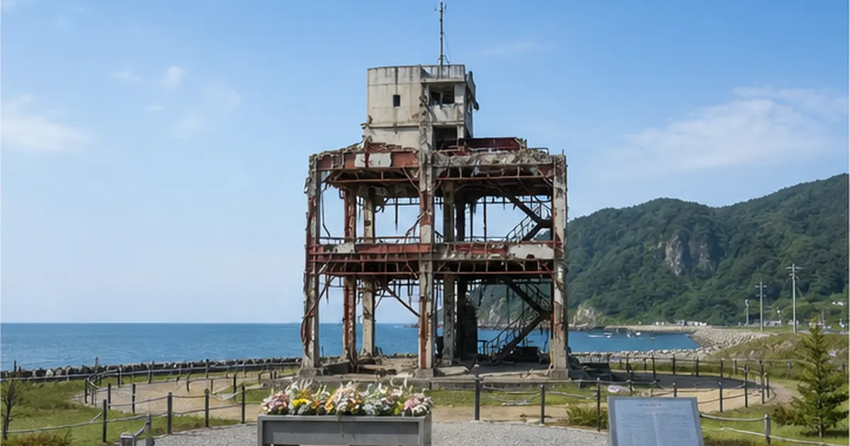
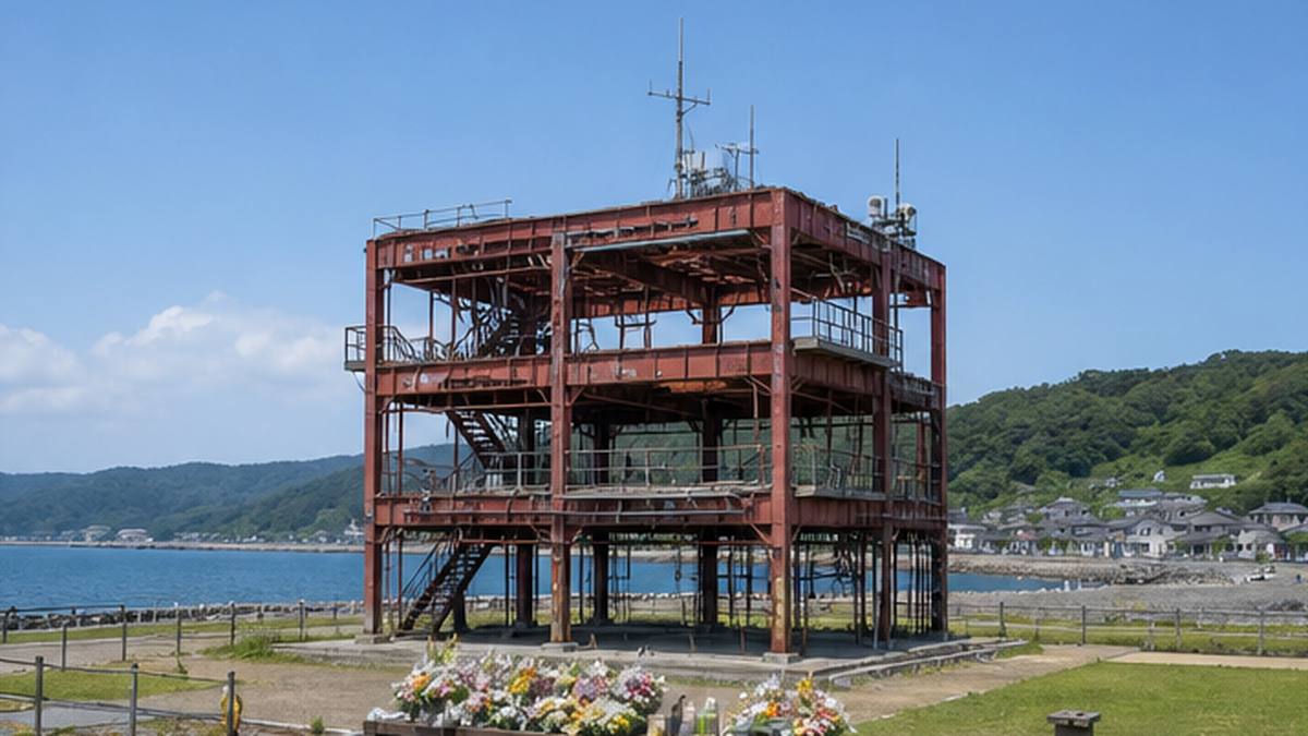
The preservation of a disaster ruin is never something the administration can decide unilaterally. A symbolic case is the former disaster management building in Minamisanriku, Miyagi Prefecture. Struck by a 15.5-meter tsunami, the three-story building saw 43 town employees and residents lose their lives, including staff who kept broadcasting evacuation calls until the very end. The scene was so devastating that in 2013 Minamisanriku once decided on a policy of demolition. Caught between bereaved families who said "it's too painful to look at" and voices insisting it should be kept "to convey the danger of tsunamis," the building ended up being kept in place, under the management of Miyagi Prefecture, through 2031.
The debate continued even after that. In January 2024, Minamisanriku informed the prefecture of its intention to take the building back under municipal ownership, and on March 1 of that year the town officially announced its policy of preserving it as a disaster ruin. Ownership formally returned to the town on July 1 of the same year. It took 13 years from the disaster for the town to finally arrive at the conclusion to "keep it." This history shows that preserving a disaster ruin is rarely settled by a single decision — it is something reached gradually, alongside shifts in bereaved families' feelings and the passing of generations, through a slow process of building consensus.
The idea of deliberately leaving the traces of a disaster in place, and opening them to the public as a lesson, is not unique to Japan. Efforts to preserve the scars of disaster and pass them on to future generations, like Hiroshima's Atomic Bomb Dome, take place around the world, and travel undertaken to visit and learn from such sites has come to be called "dark tourism" in recent years. Touring disaster ruins belongs to the same lineage — not mere sightseeing, but drawing lessons from the traces of tragedy. In the case of disaster ruins, however, one must not forget that many bereaved families are still alive and that debate over whether to preserve these sites continues even now, making them places with a far stronger personal stake for those involved. Visitors are asked to approach these sites not out of curiosity, but with an attitude of mourning for the dead and openness to the lessons offered. This is why many disaster ruins place a flower-offering stand at the entrance and post guidance on visiting etiquette.
Walking through the major disaster ruins of the Great East Japan Earthquake
According to figures released by the Fire and Disaster Management Agency, the Great East Japan Earthquake left 19,775 people dead and 2,550 missing (as of March 8, 2024). Miyagi Prefecture alone accounts for 10,571 deaths, more than half of the nationwide total. Rather than demolishing the sites bearing this immense loss, the disaster-hit areas chose to convey its memory by leaving it in place. The Tohoku coast is dotted with disaster ruins, each carrying a different story and set of circumstances. Here we look at some of the most representative sites.
The Kesennuma Great East Japan Earthquake Memorial Museum
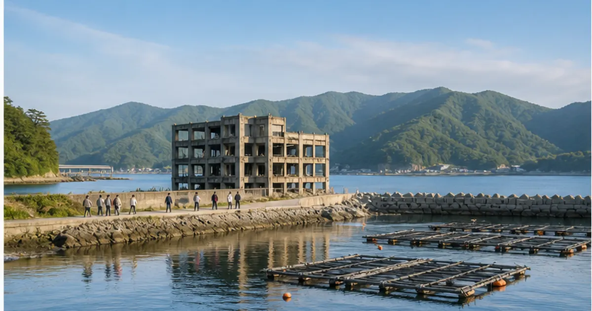
Housed in the former building of Kesennuma Koyo High School in Kesennuma, Miyagi Prefecture, the "Kesennuma Great East Japan Earthquake Memorial Museum" opened to the public on March 10, 2019. The tsunami that struck reached a height of roughly 12 meters, flooding above the floor of the fourth story of the four-story building — damage still visible inside the structure today. At the time of the earthquake, students happened to be attending classes in a temporary prefab building on the school grounds due to major renovation work on the main building, and the fact that every student was able to evacuate safely as a result is also told as a lesson in disaster education. Inside, guided commentary by storytellers and hands-on programs for experiencing disaster prevention and mitigation are offered, designed to help visitors not just "learn about" the disaster but grasp it as something personal.
Kadonowaki Elementary School Ruins, Ishinomaki — bearing the marks of a tsunami fire
Kadonowaki Elementary School, also in Ishinomaki, occupies a distinctive place among the disaster ruins of the Great East Japan Earthquake. A fire that broke out immediately after the tsunami burned for three days, as firefighting proved nearly impossible, and consumed 56,100 square meters of the surrounding land. At the time, as flames climbed to the third floor and threatened to spread to the roof, children and residents used a nearby platform as a makeshift bridge to descend to the first-floor roof, then escaped toward the hills of Mt. Hiyori behind the school, narrowly avoiding disaster. With the number of school-age children in the district no longer sustainable after the earthquake, the school merged with Ishinomaki Elementary School and closed in 2015; on April 3, 2022, it opened to the public as what is described as the only disaster ruin bearing the marks of both a tsunami and a tsunami-triggered fire.
Minamisanriku's former disaster management building
Okawa Elementary School
Okawa Elementary School in Ishinomaki, Miyagi Prefecture, was the site of the single worst school-related loss of life in the Great East Japan Earthquake, with 84 children and staff killed. In March 2016, Ishinomaki decided to preserve the entire site as a disaster ruin, leaving the school building in place, and carried out park development from fiscal 2019 at a cost of roughly 450 million yen. On July 18, 2021, it opened to the public as a roughly 3.35-hectare site comprising the ruins, an open plaza, and the Okawa Disaster Memorial Museum.
| Item | Details |
|---|---|
| Preservation decided | March 2016 (City of Ishinomaki) |
| Development cost | Roughly 450 million yen (from fiscal 2019) |
| Opened to the public | July 18, 2021 |
| Site area | Roughly 3.35 hectares |
| Hours | 9:00–17:00, free admission (exhibition room closed Wednesdays) |
What the Okawa Elementary School ruins force us to confront is not only the threat of the tsunami itself, but also how difficult it is to make evacuation decisions. The weight of the choice — stay in the schoolyard or head for higher ground, all within a narrow window of time — later fed into debates in various regions over the height and design of seawalls. That question of how far, and how, to build "hard" tsunami defenses such as seawalls is examined in detail in What Do Massive Seawalls Protect, and What Do They Change? The Reconstruction Debate and the Choices Made in Kesennuma and Onagawa.
Kesennuma Koyo High School, Kadonowaki Elementary School, Okawa Elementary School, and Minamisanriku's former disaster management building — each of these disaster ruins conveys a different facet of the disaster's reality: tsunami flooding, tsunami fire, the difficulty of evacuation decisions, and the sacrifice of staff who kept calling for evacuation until the end. No single disaster ruin can convey every lesson on its own; it is precisely this structure, in which multiple sites complement one another, that stands out as a defining feature of the disaster ruins as a whole.
The role played by memorial museums and the memorial network
The Great East Japan Earthquake and Tsunami Memorial Museum (Iwate TSUNAMI Memorial) and the nuclear disaster memorial museum
Beyond individual disaster ruins, the three hardest-hit prefectures also built central facilities to convey the full picture of the disaster. The Great East Japan Earthquake and Tsunami Memorial Museum (nicknamed "Iwate TSUNAMI Memorial") in Rikuzentakata, Iwate Prefecture, opened on September 22, 2019, under the theme "Protect life, and live together with the sea and the land," and shares the record and the lessons of the disaster. With 1,155 square meters of exhibition space and free admission, it drew more than 200,000 visitors within its first year, making it a central hub for disaster education in the affected region.
The "Iwaki Memorial Museum for the Future" in Iwaki, Fukushima Prefecture, opened on May 30, 2020, and conveys the memory and lessons of the disaster through the preservation and display of related materials and talks by storytellers. The "Great East Japan Earthquake and Nuclear Disaster Memorial Museum," adjoining the Reconstruction Memorial Park in Futaba, Fukushima Prefecture, opened in September 2020 and serves as a hub for recording the compound disaster of earthquake, tsunami, and nuclear accident, and for passing the path of recovery on to the future. Because Fukushima's memorial museums carry the added dimension of the nuclear accident on top of the tsunami damage, the themes covered in their exhibits and storyteller testimonies are correspondingly layered. Testimonies concerning the rebuilding of the fishing industry, in particular, connect the memory of "that day" conveyed by disaster ruins with the challenges of "the aftermath" that continue even now.
The Disaster Memorial Network Council and the "3.11 Densho Road"
The mechanism that links these individual facilities together is the "3.11 Densho Road." Its secretariat is run by the Disaster Memorial Network Council, made up of the Tohoku Regional Bureau of the Ministry of Land, Infrastructure, Transport and Tourism, the prefectures of Aomori, Iwate, Miyagi, and Fukushima, and the city of Sendai, and it has registered and mapped more than 300 sites along roughly 500 kilometers of the Pacific coast. Visitors can use the official website or map apps to plan a route through disaster ruins, memorial museums, and monuments that fits their own itinerary.

This kind of networking is meant to create not a one-off sightseeing trip, but a "circuit of learning." Visiting disaster ruins is itself increasingly generating demand for lodging, dining, and fishing experiences in the disaster-hit areas, and cases where the transmission of memory ties into local economic revival are introduced in What Is Sea-Based Reconstruction Tourism? Disaster Ruins, Storytellers, and Fishing Experiences That Draw Visitors.
The sites registered are not limited to large-scale disaster ruins and memorial museums. Monuments set up on the high ground where people evacuated, markers showing how far the tsunami reached, and memorial stones built independently by local residents are also included, so that the act of recording "what happened at this spot," regardless of scale, forms the memorial network as a continuous whole. For visitors too, touring not only the large memorial museums but these smaller monuments makes it possible to learn about the disaster in far finer detail, place by place.
The voices of storytellers — turning experience into words
The spread of storyteller activities
If the exhibits at disaster ruins and memorial museums speak through "objects," storytellers convey the disaster through "words." Storytelling began mainly with bereaved families and disaster survivors, but as time has passed, people who were children at the time of the disaster, and those who moved to or enrolled in schools in the region after it, have also come to take part as storytellers. In Kesennuma, Miyagi Prefecture, middle and high school students research the disaster themselves and speak to visitors based on testimonies they have gathered, an activity that reflects a widening role — from simply "carrying on" experience to actively "reconstructing" learning.
What storytellers convey is not uniform, either. Some speak of the memory of "that day" — the route they fled along, life in the shelters — while others speak of the journey "afterward": how they came to terms with the grief of losing family, and how they rebuilt their lives. The former serves as a lesson in evacuation behavior; the latter, as a clue for thinking about post-disaster mental care and community revival — each connecting to visitors' learning in a different way. Many disaster ruins and memorial museums partner with multiple storytellers of this kind, allowing visitors to choose a speaker suited to their purpose and age group.
Supporting these storyteller activities across the region is the public-interest incorporated association 3.11 Memorial Network, a partnership among memorial organizations and facilities in Iwate, Miyagi, and Fukushima prefectures. In October 2022 it merged with 3.11 Mirai Support, based in Ishinomaki, becoming an organization with 703 individual members and 77 participating groups. It works to fund memorial organizations using private-sector money and to train "memory-transmission supporters" who back up storytellers. At the Kesennuma Great East Japan Earthquake Memorial Museum's "Everyone's Storytellers" program, local middle and high school students take on guide roles alongside the storytellers active at the facility — a visible example of the baton of storytelling being passed from survivors to the region's young people.
Aging storytellers and a shortage of successors
At the same time, storyteller activities stand at a crossroads. The reconstruction and revitalization period is set to close at the end of fiscal 2025, and the various subsidy programs that have supported these activities are beginning to shrink or end. On top of that, the generation that has spoken as firsthand witnesses is aging, and the shortage of people willing to take on the role has become serious. There are also reports that the number of visitors to disaster memorial facilities has fallen for two consecutive years since 2024, and some facilities and storyteller organizations have begun to worry about the sustainability of their operations altogether.
Challenges facing storyteller activities
- As those who lived through the disaster age, the number of storytellers able to speak firsthand is declining
- Subsidies and funding are shrinking as the reconstruction and revitalization period ends (fiscal 2025)
- Visitor numbers at disaster memorial facilities have trended downward for two straight years since 2024
Passing the baton to a younger generation
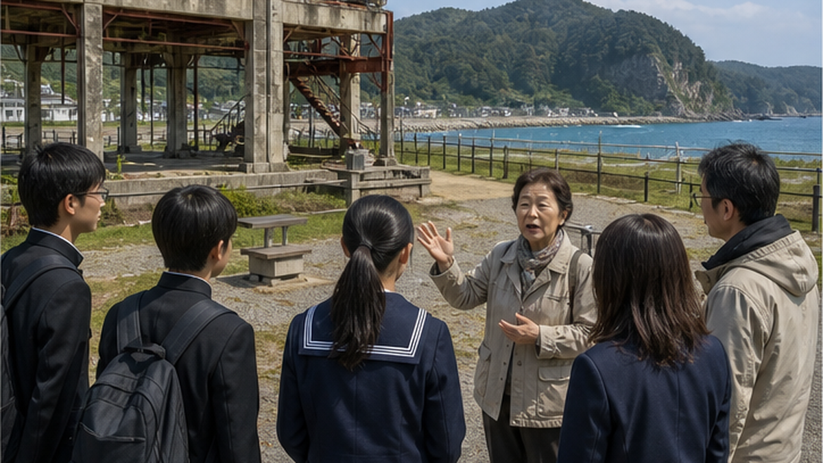
Alongside these challenges, a new form of storytelling is emerging, in which generations with no direct experience of the disaster think for themselves about why it should be passed on, research it, and put it into their own words. A relay format is taking shape as one possible model for the years ahead, as survivors continue to decrease: preserving firsthand testimony gathered right after the disaster as an archive, then having younger storytellers absorb and retell it.
Stone monuments that carry an even older memory of tsunamis
Natural disaster monuments and the Geospatial Information Authority's map symbol
Where disaster ruins and storytellers convey "new memory," all across Japan there remain numerous stone monuments carved with the record of disasters from decades, even centuries, ago. In 2019 the Geospatial Information Authority of Japan began collecting and registering these as "natural disaster monuments" in cooperation with local governments, and established a dedicated map symbol — a monument symbol with an added vertical line representing the inscription. By appearing on the Geospatial Information Authority's online maps and on 1:25,000-scale topographic maps, the reach and lessons of past disasters can now be checked by anyone, on a map.
Wakayama's tsunami monuments and "tsunami tendenko"
Wakayama Prefecture retains numerous tsunami monuments carved with the lessons of the Nankai earthquakes. Among them, the monument known as the "Record of Great Earthquake and Tsunami Preparedness" records an outline of the great Nankai earthquake, gives a concrete evacuation route ("if an earthquake strikes, pass in front of this temple and flee toward Mt. Tenjin"), and also warns later generations not to rely on oral tradition alone. It is now a Wakayama Prefecture-designated cultural property, and the prefectural museum, together with local governments and universities, continues to survey disaster monuments across the prefecture.
Should an earthquake strike, pass in front of this temple and flee toward Mt. Tenjin. But do not rely on oral tradition alone.
— Free translation from the "Record of Great Earthquake and Tsunami Preparedness" monument (a Wakayama Prefecture-designated cultural property)
At Shinjo Junior High School, also in Tanabe, Wakayama Prefecture, local residents' oral tradition of "tsunami tendenko" — the teaching that when a tsunami comes, each person should flee for high ground immediately, on their own, without waiting for others — has been built into the school's disaster education. What stands out is how combining the "static record" of a stone monument with the "living transmission" of oral tradition strengthens how effectively the lesson actually gets through. The Wakayama Prefectural Museum, working with the Shirahama town board of education and universities, continues to survey disaster monuments across the prefecture, driven by concern that as coastal communities depopulate, the existence and origins of these monuments risk being forgotten.
The tsunami stones of the Yaeyama Islands and the Great Meiwa Tsunami
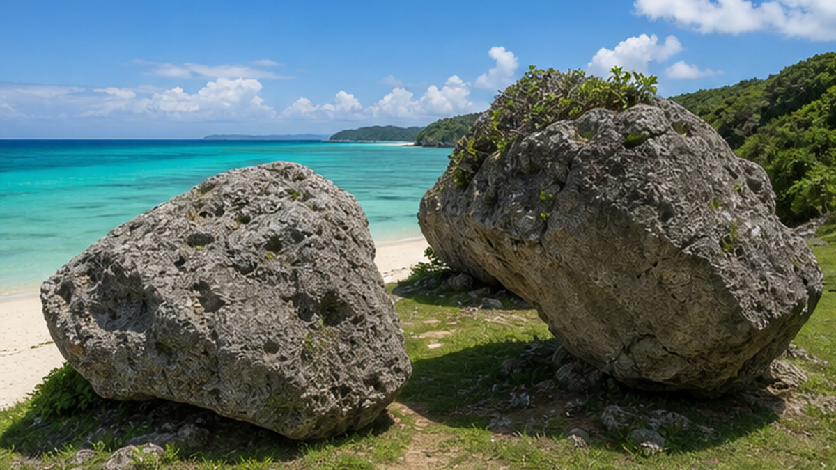
The memory carved by the sea can reach back further still than any stone monument. In 1771 (Meiwa 8), a massive tsunami generated by an earthquake centered near the Yaeyama Islands of Okinawa Prefecture — commonly called the Great Meiwa Tsunami — is said to have reached a height of roughly 30 meters on the southeastern coast of Ishigaki Island, and to have claimed an estimated 12,000 lives across the Miyako and Yaeyama islands. Coral-reef boulders hurled ashore by that tsunami are known as "tsunami stones," and enormous examples, including the one called "Takakoru Stone," still remain on Ishigaki Island's east coast today.
| Item | Details |
|---|---|
| Year | 1771 (Meiwa 8) |
| Epicenter | Near the Yaeyama Islands (the Yaeyama earthquake) |
| Estimated death toll | ~12,000 (across the Miyako and Yaeyama islands) |
| Maximum wave height on Ishigaki Island | Estimated ~30 meters (southeast coast) |
| Physical trace | Enormous tsunami stones, including "Takakoru Stone," still exist |
These tsunami stones scattered along Ishigaki Island's east coast — four sites collectively named the "Tsunami Stone Group of Ishigaki Island's East Coast" — were designated a national Natural Monument (geological/mineralogical) on March 27, 2013, with a fifth site added on October 17 of the same year. It was the first time in Japan that tsunami stones, rather than the earthquake or tsunami itself, were designated a Natural Monument, and they are valued as tangible evidence — corroborated in detail by historical documents — of the scale of the Great Meiwa Tsunami's damage, more than 240 years on.
One massive boulder in particular, known as "Takakoruse Stone," carries a remarkable record of movement. Geological surveys suggest that the stone was first carried to Koruse Utaki roughly 2,000 years ago by the Sakishima tsunami, and was then moved again, roughly 600 meters to the north, by the 1771 Great Meiwa Tsunami. The fact that a single stone was moved by two separate mega-tsunamis speaks, more eloquently than anything else, to how mega-tsunamis have recurred in these waters on a cycle spanning hundreds, even thousands, of years.
In 2018, the National Institute of Advanced Industrial Science and Technology (AIST) published research findings, based on the distribution and dating of tsunami stones, showing that tsunamis of similar scale had occurred repeatedly in the past. That geological survey can estimate the recurrence interval and scale of disasters even 250, or 2,000, years in the past provides an important clue for assessing future tsunami risk in the Southwest Islands as well. Where disaster ruins are "memory deliberately left behind by people," tsunami stones are "evidence moved by nature itself." Precisely because no human hand shaped them, they may speak all the more viscerally to the sheer force of a tsunami.
Unlike Tohoku, the Southwest Islands no longer have a living generation with direct memory of the most recent mega-tsunami. It may be precisely for this reason that, rather than an oral storyteller, the stone itself has come to function as the bearer of memory. Its designation as a Natural Monument provides an institutional basis for handing this stone down to the next generation not merely as a tourist attraction, but as scientifically and disaster-preparedness-wise valuable "evidence."
Using this memory in disaster education
Using disaster ruins and storytellers in school education
Disaster ruins and storytellers are also valued as teaching material for disaster education. The Cabinet Office's Disaster Prevention Education Challenge Plan highlights the importance of turning local disaster history and survivor testimony into teaching material, so that children and students can concretely imagine "what could happen where I live." What a textbook description alone struggles to convey — the urgency of evacuation and the difficulty of the decisions involved — is filled in by on-site visits and storytellers' testimony.
- Field trips and school excursions to disaster ruins and memorial museums
- Outreach lessons and online talks by storytellers
- Local disaster-history study using natural disaster monuments (using the Geospatial Information Authority's maps as teaching material)
- Workshops that combine evacuation drills with making the lesson personal
The lessons of the Great East Japan Earthquake are also reflected at the institutional level. In March 2012, the Ministry of Education, Culture, Sports, Science and Technology drew up its "Guidelines for Developing a School Disaster Prevention Manual (Earthquake and Tsunami Disasters)," reflecting issues brought to light by the earthquake. Organized around common points to keep in mind across three stages — preparation beforehand, response during the event, and school operations afterward — the guidelines serve as a foundation for each school to build its own manual suited to local conditions. Disaster ruins and storytellers' testimony give concrete, lived substance to this kind of institutional guidance, functioning as "living teaching material."
Use in disaster-preparedness tourism and school excursions
Trips built around visiting disaster ruins are also an opportunity for the disaster-hit areas to generate exchange population. Programs that combine touring disaster ruins with local fishing and seafood-processing experiences are spreading in various regions, contributing to both learning and the local economy. A growing number of schools nationwide now build visits to disaster ruins and memorial museums into their school-excursion itineraries; students study an outline of the disaster beforehand, visit the site, listen to storytellers, and then work what they learned into their own region's disaster plan afterward — a full learning cycle. The experience of "standing in that place," something hard to gain from classroom study alone, helps memory settle in as something personal.
The question of how to approach post-disaster regional revival and resident participation is examined in detail in What Is Coastal Community Revival? Relocation to Higher Ground, the Livelihoods of Fishing Villages, and the Participation of Women and Young People.
Challenges and efforts in carrying this memory into the future
Declining visitor numbers and the question of funding
As time passes since the disaster, visitor numbers at disaster ruins and memorial facilities are trending downward. In particular, the shrinking of funding as the reconstruction and revitalization period ends risks undermining the foundation for ongoing activity — updating exhibits, training storytellers, maintaining facilities. A disaster ruin is not something one simply finishes building; it carries an ongoing management challenge: keeping aging structures safe, and finding ways to make up for memory that inevitably fades with time.
Maintaining the structure itself, as a disaster ruin, also costs money. Concrete and steel exposed to salt damage will continue to deteriorate if left unattended, and could eventually become unsafe to view. Carrying out regular repairs and seismic inspection while still preserving the site's "damaged appearance" is, in many ways, a more labor- and cost-intensive task than ordinary cultural-property preservation. As more time passes since the disaster, each facility faces a mounting dilemma: this maintenance burden growing at the same time that declining visitor numbers reduce revenue.
Since 2013, the national government has used reconstruction grants to support the initial costs of preserving disaster ruins, backing nine projects to date. However, this support is limited to the initial development costs needed to spare a site from demolition; ongoing maintenance costs are not covered, leaving routine repairs and operating expenses to be borne by the municipality or operating organization itself. Moreover, these reconstruction grants were effectively discontinued as of fiscal 2020, meaning that any municipality now considering preserving a new disaster ruin faces an even steeper challenge in securing funding.
Digital archives as a new means of transmission
In response to these challenges, efforts are underway across the region to preserve testimony videos and disaster-era photographs as digital archives and publish them online. Even as survivors age and direct storytelling becomes harder, recorded testimony and 3D-scanned data of disaster ruins can be used repeatedly by educators and researchers. Combining what can only be seen on site — stone monuments, disaster ruins — with what can be accessed from anywhere — digital archives — is key to sustaining transmission to the next generation.
Digitization also has the advantage of being able to deliver the memory of the disaster to distant schools and overseas researchers for whom an actual visit is difficult. The sense of reality that only an on-site visit can give, and the reach that only being online can provide, are not in competition; building digital archives into the preparation before visiting a disaster ruin, and into reflection afterward, allows the two to complement one another.
Efforts that will support this transmission going forward
- Digitally archiving and publishing testimony videos and disaster-era photographs
- Offering remote experiences of disaster ruins through 3D scanning and VR content
- Secondary transmission, in which younger generations summarize and translate storytellers' testimony for wider distribution
- Building a database of natural disaster monuments and visualizing them broadly on the Geospatial Information Authority's maps
Living with the sea: the transmission of memory going forward
Balancing the revival of fisheries and tourism with the transmission of memory
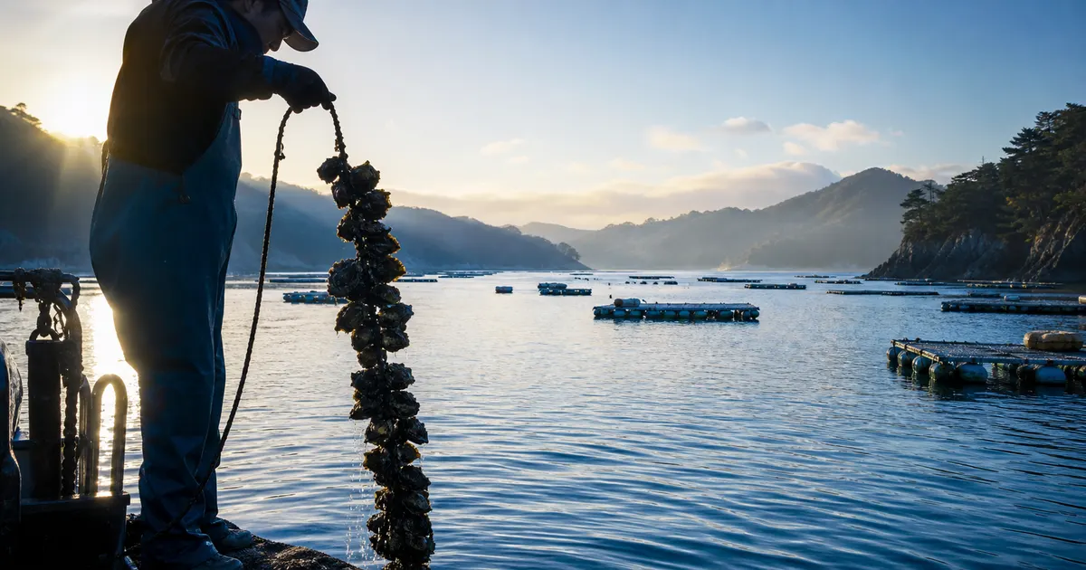
What disaster ruins and storytellers convey is not fear alone. The sea has, at the same time, continued to support local life through fishing and tourism. As symbolized by the rebuilding of wakame and kombu seaweed farming in Sanriku, restoring a way of life lived alongside the sea is itself proof of having come through the disaster. As also noted in What Is Sea-Based Reconstruction Tourism?, regarding the movement to reclaim what the sea provides, a place that conveys memory and a place where people enjoy the sea's blessings are by no means in conflict.
If anything, the experience of tasting locally landed seafood or gazing out over a fishing port after visiting a disaster ruin drives home the fact that the sea was not lost — that it continues to support people's lives today. Conveying not only the memory of grief, but also the full picture of people recovering from it and once again facing the sea, may be the true, complete form of the "story of reconstruction" that disaster ruins and memorial museums are ultimately meant to tell.
What we can do
For those of us living far from the disaster-hit areas, simply knowing that disaster ruins and storytellers exist, visiting and listening when the opportunity arises, and checking the natural disaster monuments in our own region are none of them grand gestures. Looking up whether there are disaster monuments or tsunami-flooding hazard zones near where you live on the Geospatial Information Authority's maps; talking with family about evacuation sites and how to stay in contact — only once the lessons carried by disaster ruins are translated into small actions like these do they become a force that reduces the harm of the next disaster.
Receiving the message the sea has repeatedly conveyed — "you could be next" — not as a distant event, but as something tied to one's own preparedness, is likely the true form of transmission that disaster ruins and tsunami stones are asking for. More than 300 disaster memorial facilities; storytellers, aging yet still speaking; and tsunami stones that have stood for more than 250 years — each, on its own timescale, is trying to convey one and the same thing. Disaster ruins will continue to change in appearance, little by little, going forward, but the wish held within them — "please protect life" — should be carried on regardless of what form it takes.
Summary of this article
- Disaster ruins have, in many cases, shifted from a policy of "demolition" to one of "preservation," after working through the complicated feelings of bereaved families
- Major disaster ruins in Tohoku, including those in Kesennuma, Minamisanriku, and Okawa Elementary School, are developed together with adjoining memorial museums
- Storytellers face the challenges of an aging population and shrinking funding, even as transmission to a younger generation continues to advance
- Natural disaster monuments and the tsunami stones of the Yaeyama Islands carry lessons from an era far older than the 2011 earthquake
- The use of digital archives is emerging as a new means of sustaining transmission as the number of survivors declines
References and sources
- Tohoku Regional Bureau, Ministry of Land, Infrastructure, Transport and Tourism – List of disaster memorial facilities
- Tohoku Regional Bureau, Ministry of Land, Infrastructure, Transport and Tourism – "3.11 Densho Road"
- Reconstruction Agency – Preservation of disaster ruins and development of memorial sites
- City of Ishinomaki – Okawa Elementary School disaster ruin
- Reconstruction Agency – Public opening of the Okawa Elementary School disaster ruin, Ishinomaki
- Geospatial Information Authority of Japan – Natural disaster monuments
- Wakayama Prefecture – Tsunami monuments within Wakayama Prefecture (prepared by JAMSTEC)
- National Institute of Advanced Industrial Science and Technology (AIST) – Clarifying the 1771 Yaeyama earthquake tsunami that struck Ishigaki and Miyako islands
- Great East Japan Earthquake and Nuclear Disaster Memorial Museum – Facility overview and storyteller information
- Cabinet Office (Disaster Management) – Disaster Prevention Education Challenge Plan guidelines
* Listed in order of reliability: government and academic institutions > peer-reviewed papers > specialized organizations > reputable media