⚡ In short
From why snow crystals form hexagons, to the meaning of the "letter sent from the sky" that Ukichiro Nakaya uncovered with the world's first artificial snow in 1936, how to read the Nakaya diagram, a step-by-step smartphone photography method using a cheap macro lens, and how to join a citizen science project — everything you need to start observing snow.
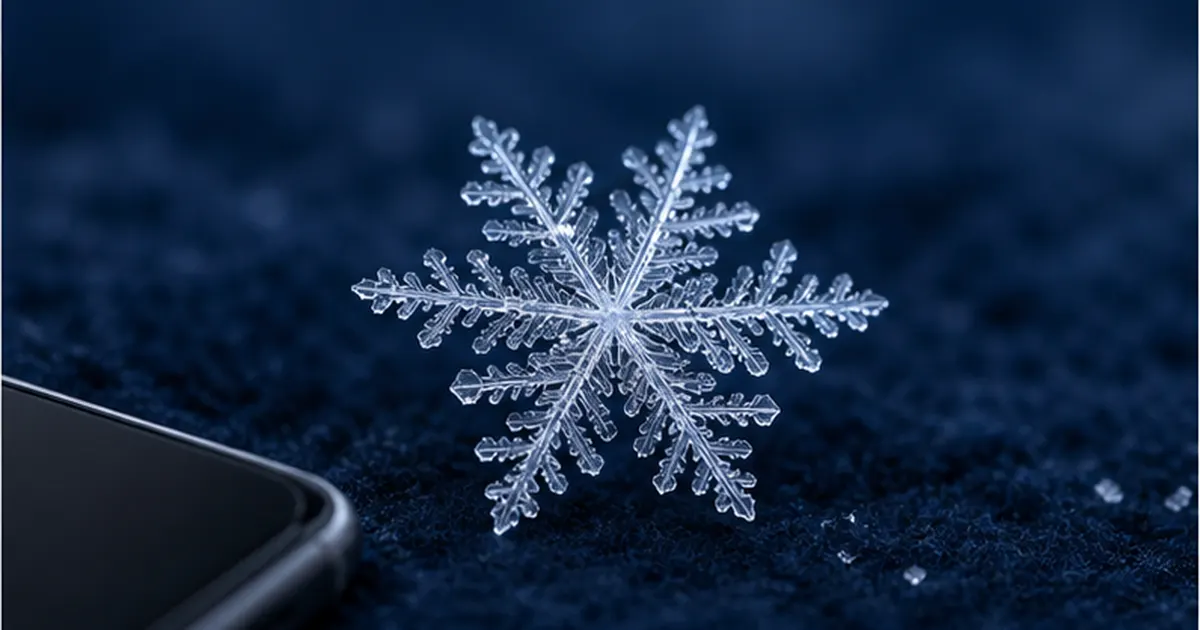
On a winter morning, have you ever held your phone close to a white speck that landed on your coat sleeve? To the naked eye it is only a white dot, but magnified to fill the screen it turns out to be a startlingly intricate hexagon. And the speck beside it has a slightly different shape. Encoded in that difference is information about what was happening several thousand metres above your head.
The first person to demonstrate this experimentally was Ukichiro Nakaya (1900–1962), a physicist born in Katayamazu, Ishikawa Prefecture, who studied snow at Hokkaido Imperial University. On March 12, 1936, Nakaya succeeded in producing the world's first artificial snow in his university's low-temperature laboratory, and established that a crystal's shape is determined by two conditions: temperature and the amount of water vapour. In his book Snow (Iwanami Shoten, 1938) he wrote: "Snow can be said to be a letter sent from the sky."
This article traces the whole path — from the physics of how a snow crystal forms, through Nakaya's work and how to read the "Nakaya diagram" that links crystal shape to weather conditions, to a photography method you can start today with one smartphone and a macro lens costing a few hundred yen. It also covers the citizen science through which such photos feed into real meteorological research, and the water cycle that ties snow to the sea — a guide to receiving and reading the letter from the sky yourself.
What you'll learn in this article
- Why snow crystals form hexagons, and how they grow inside clouds
- The life of Ukichiro Nakaya and the real meaning of "snow is a letter sent from the sky"
- How to read the Nakaya diagram — estimating upper-air temperature and humidity from crystal shapes
- Concrete steps and tips for photographing snow crystals with a smartphone and a 100-yen-shop macro lens
- How citizen science projects turn a single photo into research data, and what to watch out for when taking part
- How snow crystals connect to the ocean — water vapour from the Sea of Japan, meltwater, and changes driven by warming
What a snow crystal actually is — the letter that arrives from the sky
A snow crystal is a single ice crystal that forms when water vapour turns to ice inside a cloud and then keeps growing. It is not a frozen droplet of water: it is built up molecule layer by molecule layer through deposition, in which gas (water vapour) changes directly into solid (ice). That is precisely why such regular shapes emerge.
Crystals are born in clouds and grow as they fall
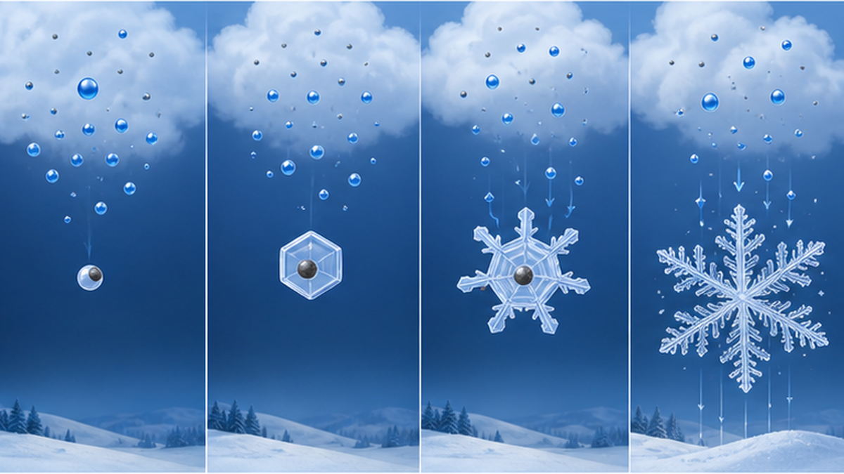
Inside a winter cloud, droplets often remain liquid even below 0°C — a "supercooled" state. When a tiny airborne particle (a mineral grain, a biological particle and so on) acts as an ice nucleus, water vapour freezes onto it and a small ice particle is born.
What happens next is the interesting part. At the same temperature, the saturation vapour pressure over ice is lower than over supercooled water, so the surrounding droplets evaporate and their vapour collects onto the ice crystal. The ice grows one-sidedly at the droplets' expense. Named after its discoverers, this is the Bergeron process (the Wegener–Bergeron–Findeisen process), and it is the origin of most snow and rain in the mid-latitudes, Japan included.
A grown crystal falls slowly, at speeds of a few tens of centimetres up to about one metre per second. It can take tens of minutes to reach the ground from a cloud several thousand metres up, and throughout that journey it keeps recording the temperature and humidity of every layer it passes through. If conditions change on the way down, the shape changes too. That is why "two-storey" crystals — a column at the centre with plates on the outside — are sometimes found.
Why hexagons? The molecular structure of ice
The reason lies in the shape of the water molecule itself and in how molecules bond. A water molecule is bent, with two hydrogen atoms attached to one oxygen atom at an angle of roughly 105 degrees. When these molecules link up through hydrogen bonds, hexagonal rings with oxygen atoms at their vertices line up in planes, and those planes stack. This is the structure of everyday ice, and because it belongs to the hexagonal crystal system it is called "ice Ih."
As a crystal grows, water vapour can only attach in directions dictated by that atomic arrangement. Growth along the plane of the hexagon (the a-axis) yields plates and dendrites; growth perpendicular to it (the c-axis) yields columns and needles. What decides which direction grows faster is temperature and the amount of water vapour — and that correspondence is exactly the Nakaya diagram described below.
The hexagon is dictated by molecular shape
- Hydrogen bonds between water molecules form hexagonal rings → ice Ih (hexagonal crystal system)
- Two growth directions: the a-axis (spreading sideways = plates, dendrites) and the c-axis (extending lengthwise = columns, needles)
- Which one dominates is decided by "temperature" and "how much water vapour there is (supersaturation)"
- The six branches resemble one another because all six directions experience nearly the same environment at the same time
"Snow" and "snow crystal" are not the same thing
Before you start observing, there is a distinction worth making. Most of what we call "snow" is not a crystal that fell on its own, but a snowflake (a cluster of many crystals stuck together) or graupel — a crystal made white and opaque by frozen droplets. Whether you can photograph one clean crystal is decided almost entirely by that day's temperature and the quality of the snow.
| Name | What it is | Appearance | Suitability for crystal observation |
|---|---|---|---|
| Snow crystal (single crystal) | A single ice crystal | Hexagonal; branches and plates clearly visible | ◎ The prime target |
| Snowflake (large wet flake) | Many crystals tangled together | A large white cottony clump | △ Crystals may appear if teased apart |
| Graupel (snow pellets) | A crystal coated with frozen supercooled droplets | White, opaque, rounded pellets | × The original shape is buried |
| Hail | Ice lumps grown inside cumulonimbus clouds | Hard ice particles 5 mm or larger | × A different phenomenon |
| Sleet | Snow that is partly melted | Wet, sticky snow | × Melts too fast to photograph |
Around 0°C, crystals stick to each other and form flakes, and they start melting the instant they hit the ground. A day when the temperature is −2°C or below and dry, powdery snow is falling is the very best for photography.
Ukichiro Nakaya and the "letter sent from the sky"
It was the physicist Ukichiro Nakaya who turned snow crystals from "something beautiful" into "something that can be read." That shift was achieved through patient observation in Japan's snow country and through the world's first artificial-snow experiment.
Born in Kaga, he studied snow at a northern university
Ukichiro Nakaya was born on July 4, 1900, in Katayamazu, Enuma District, Ishikawa Prefecture (present-day Kaga City). He studied under Torahiko Terada in the Department of Physics at Tokyo Imperial University, graduating in 1925. After a period at RIKEN he studied abroad at King's College London, becoming an assistant professor at Hokkaido Imperial University's Faculty of Science in 1930 and a full professor in 1932.
Nakaya himself wrote, in effect, that he took up snow research because there was simply so much snow after he came to Hokkaido. Choosing snow as a research subject was close to an accident of circumstance, but from there he accumulated and classified more than 3,000 microscope photographs of natural snow, searching out the regularities common to snow in Japan.
| Year | Event |
|---|---|
| 1900 | Born in Katayamazu, Enuma District, Ishikawa Prefecture (present-day Kaga City) |
| 1925 | Graduated in physics from Tokyo Imperial University; studied under Torahiko Terada |
| 1928 | Studied abroad at King's College London |
| 1930 | Appointed assistant professor at Hokkaido Imperial University; began snow research |
| 1932 | Promoted to full professor at the same university |
| March 12, 1936 | Produced the world's first artificial snow in the low-temperature laboratory |
| 1938 | Published his book Snow with Iwanami Shoten |
| 1943 | The Institute of Low Temperature Science opened at Hokkaido Imperial University; he became its chief researcher |
| 1962 | Died in Tokyo at the age of 61 |
March 12, 1936: making snow for the first time
No amount of observing natural snow can prove that "this shape forms under these conditions," because the conditions in the sky cannot be measured. So Nakaya chose a different route: build a cloud inside the laboratory, set the conditions yourself, and grow the crystals.
Inside an apparatus placed in the low-temperature laboratory, water vapour was supplied and a fine fibre was suspended to give the crystal a foothold. The nucleus used was rabbit hair: the microscopic projections on its surface act as ice nuclei, and crystals grow there. After much trial and error, on March 12, 1936, an artificial snow crystal appeared inside the apparatus — the first time in history that snow had been made by human hands.
The significance of artificial snow is not that snow could be "made." It is that temperature and vapour supply could now be varied one at a time, so that the shape produced under every condition could be mapped systematically. The accumulation of these experiments produced the Nakaya diagram discussed in the next section. In 1941, on the basis of this artificial-snow research, it was decided to establish the Institute of Low Temperature Science, which opened in 1943.
The sentence written in <em>Snow</em>
In Snow, published by Iwanami Shoten in 1938, Nakaya expressed what his research meant in the following words.
Snow can be said to be a letter sent from the sky
― Ukichiro Nakaya, <em>Snow</em>, Iwanami Shoten, 1938
The sentence is often quoted as poetry, but Nakaya's intention was far more concrete. The shape of a crystal is "writing" put down by the temperature and humidity aloft, and reading that writing reveals a state of the sky that cannot be measured directly — the metaphor of a letter was a practical declaration to that effect. In an era when neither radiosondes nor weather radar were widely available, a new means of knowing the sky had been presented.
What matters is that anyone who knows this "way of reading" can receive the sky's news. No special equipment is needed. A crystal that lands on your palm will tell you about the air far above, at this very moment.
The Nakaya diagram — reading the upper air from a crystal's shape
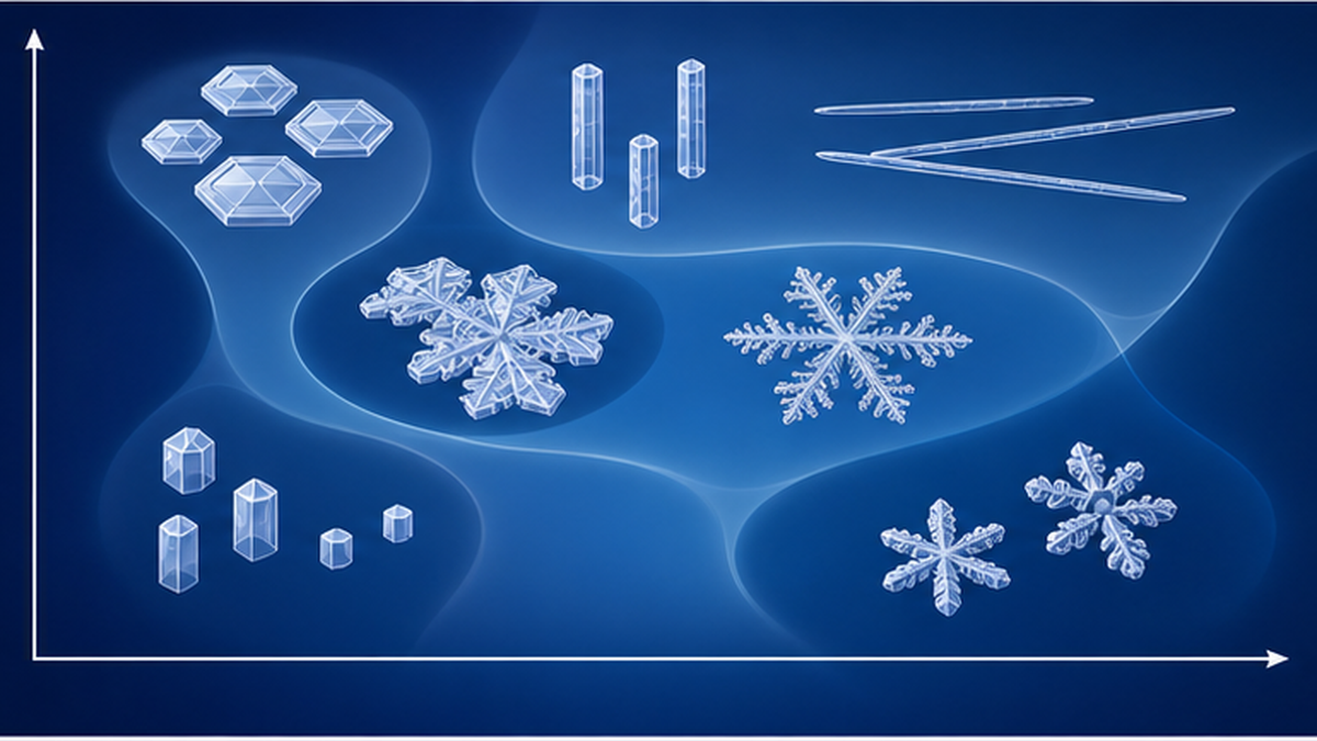
What Nakaya assembled from his artificial-snow experiments was a chart with temperature on the horizontal axis and vapour supersaturation (how much excess water vapour the air holds) on the vertical axis, showing which crystal shapes form where. This became known as the Nakaya diagram, and it is the starting point of snow crystal science.
Two axes decide the shape
The principle the diagram reveals is remarkably simple. Temperature decides whether the crystal becomes plate-like or column-like, and the amount of water vapour decides how elaborately it grows. At the same temperature, scarce vapour yields a crisp-edged hexagonal plate, while abundant vapour yields a dendrite branching again and again.
For example, the beautiful six-petalled dendrite familiar from textbooks forms at roughly −15°C when there is ample water vapour. Around the same −15°C but with little vapour, you get a plate with no branches. At around −6°C with plenty of vapour, slender needle crystals appear.
| Approximate temperature range | When vapour is scarce | When vapour is abundant |
|---|---|---|
| Around 0 to −4°C | Small hexagonal plates | Thin plates and sector plates |
| Around −4 to −10°C | Columns (pencil-like) | Needles and sheaths |
| Around −10 to −22°C | Plates and sector plates | Dendrites and stellar crystals (peaking near −15°C) |
| Below −22°C | Columns and bullets | Bullet rosettes and three-dimensional crystals |
What "reading the letter" means in practice
Suppose you find a great many dendrites at ground level. Tracing the diagram backwards, you can infer that there was a moist layer aloft at around −15°C. If needle crystals are mixed in, there was probably a humid layer near −6°C as well. If graupel dominates, there was a thick cloud containing abundant supercooled droplets.
This is not merely an intellectual game. In actual meteorological research, the temperature and humidity distributions computed by numerical weather prediction models are checked against the crystal shapes observed at the ground. Crystals are a physical record you can use to mark the model's answers. This matters especially for snow brought to the Kanto region by south-coast cyclones, where forecasting rain versus snow, and accumulation versus none, is notoriously hard.
What crystal shapes can tell you
- Many dendrites and stellar crystals → there was a vapour-rich layer aloft at around −15°C
- Needles and sheaths mixed in → there was also a moist layer near −6°C
- Mostly columns and bullets → they grew in a very cold layer (below −22°C)
- Crystals densely covered with white specks → they passed through a cloud rich in supercooled droplets (rimed)
- Many crystals stuck together as flakes → they became entangled in a layer close to 0°C
How later research widened the map
The Nakaya diagram is not a finished, final form; it has been tested and extended ever since. In Tenki, the journal of the Meteorological Society of Japan, discussions have appeared examining the relationship between the diffusion-type method of making artificial snow and the diagram, exploring how the resulting chart changes with experimental technique. That a chart drawn more than 80 years ago is still the basis of discussion is itself a measure of the work's reach.
Classifying snow crystals — from Bentley to the Global Classification
People often say no two crystals are alike. Strictly speaking, crystals matching down to the last detail of every branch essentially do not exist — yet the broad shapes fall into clear types. Efforts to organise those types began alongside the development of photography.
Wilson Bentley's 5,381 photographs
The first person to capture snow crystals on film was Wilson A. Bentley (1865–1931), a farmer from Jericho, Vermont, USA. Enchanted at fifteen by snow crystals seen through his mother's microscope, he built his own rig by coupling a bellows camera to a microscope and, on January 15, 1885, took the world's first photomicrograph of a single snow crystal.
He went on photographing throughout his life alongside his farm work, reaching a total of 5,381 images. In the autumn of 1931 a photographic collection titled Snow Crystals, containing 2,453 of them, was published; shortly afterwards Bentley died of pneumonia. His work made the diversity of snow crystals visible to everyone for the first time. When Nakaya began his research, Bentley's collection was also the largest photographic resource available to him.
From 7 types to 121
Based on his observations of natural snow, Nakaya systematically classified the crystals seen in Japan. Then in 1966, Choji Magono and C. W. Lee published a finer classification of 80 types (the Magono–Lee classification), which long served as the international standard.
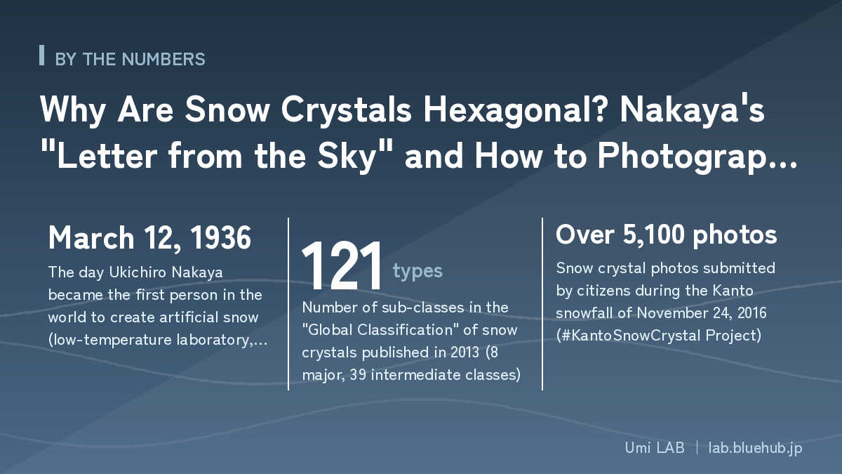
In 2013, a research group including Katsuhiro Kikuchi, Takao Kameda, Keiji Higuchi and Akira Yamashita published a new classification system in an international journal, based on observations from the mid-latitudes to the polar regions. This is the Global Classification, comprising 8 major classes, 39 intermediate classes and 121 sub-classes. Of those 121, ten are ice crystals 0.2 mm or less in diameter and six are solid precipitation such as ice pellets, sleet and hail; restricted to snow crystals alone, the count is 105.
| Classification system | Year | Number of classes | Characteristics |
|---|---|---|---|
| Bentley's photographic collection | 1931 | (A photo collection, not a classification) | Published 2,453 photomicrographs |
| Nakaya's general classification | 1930s | A system including 7 major classes | Japan's first systematic classification, based on natural snow observation |
| Magono–Lee classification | 1966 | 80 types | Long used as the international standard |
| Global Classification | 2013 | 121 types (8 major, 39 intermediate classes) | Covers observations including polar regions; 105 types are snow crystals |
The basic shapes to learn first
There is no need at all to memorise 121 types. To begin with, being able to tell these six apart is plenty, and most of the photos you take will fall into one of them.
- Stellar dendrite: six branches dividing again and again — the most popular shape. Forms near −15°C with abundant vapour
- Hexagonal plate: a flat hexagon with no branches. Forms where vapour is scarce
- Sector plate: fan-shaped plates spreading in six directions; intermediate between dendrite and plate
- Column and bullet: an elongated column like a pencil or a bullet. Grows in cold layers
- Needle: a cluster of fine needles. Forms near −6°C with plenty of vapour
- Rimed crystal: densely covered in tiny white droplets — evidence that it passed through a cloud rich in supercooled water
Don't overlook riming
Beginners naturally look for beauty of form, but what is especially valuable for research is whether the crystal is rimed. The white droplets attached to it are evidence that it travelled through a cloud full of supercooled water, and they are an important clue for inferring conditions inside the cloud. Focusing on the crystal's surface when shooting lets you judge this afterwards.
Photographing snow crystals with a smartphone — what to prepare
Now for the practical part. Photographing snow crystals sounds as if it requires a microscope, but today's smartphone cameras can capture crystal detail perfectly well once you add a macro lens costing a few hundred yen. Kentaro Araki, a cloud researcher at the Meteorological Research Institute, has repeatedly pointed out that beautiful crystal photos can be taken with a 100-yen-shop macro lens for smartphones.
You only need three things
| Item | How to choose | Alternative |
|---|---|---|
| Smartphone | Any model works; a macro shooting mode is an advantage | A digital camera with macro capability also works |
| Clip-on macro lens | Available at 100-yen shops and electronics stores; 10–20× is ample | Even without one, maximum zoom plus close focus will do |
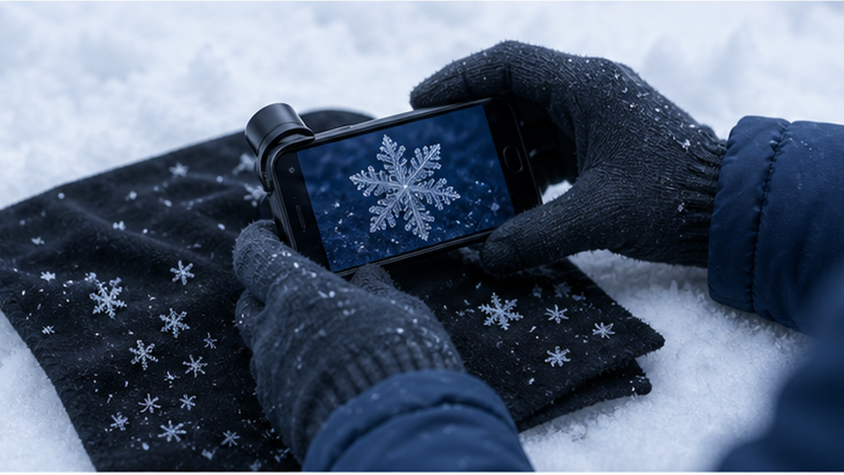
| Dark-coloured cloth | Black or navy felt or napped fabric, so crystals sit on top and stand out | Black gloves, a dark knit hat, a black desk pad |
| (Optional) millimetre ruler | For recording size; shoot it beside the crystal | A coin or anything of known size |
| (Optional) small brush | To move crystals without damaging them; a fine makeup brush works well | The tip of a toothpick |
The single biggest tip is to put the cloth and the phone outside in advance so they chill. If you catch crystals on cloth brought straight from a warm room, they melt into round droplets the instant they land. Put them outside 15–30 minutes before shooting. Chilling the phone too much drains the battery fast, so a realistic balance is to keep it lightly warm in a pocket and take it out just before you shoot.
Good days and bad days for shooting
However well you prepare, you cannot get clean crystals if the snow is wrong. Here are the conditions to aim for.
- Temperature at or below −2°C: near 0°C crystals melt on landing and stick to each other
- Dry, powdery snow: snow that does not turn watery on your palm
- Light wind: strong wind rolls crystals across the cloth and breaks them
- From the start of the snowfall and while it is falling: lying snow has already changed and lost its original shape
- Just before the snow gets heavy: the period when small crystals fall individually is prime time
Conversely, warm days with sticky snow, windy days, and trying to scoop up lying snow to photograph are the classic failure patterns. Snow on the ground gradually rounds off and bonds together (metamorphoses), so the rule is to catch it fresh as it falls.
Checklist for a day when snow is likely
- The day before, set the macro lens and dark cloth by the front door
- Once it starts snowing, put the cloth outside and let it acclimatise for at least 15 minutes
- Turn on the grid display in your camera settings and check how burst shooting works
- Choose gloves with usable fingertips, or touchscreen-compatible ones
- Have a way to check the temperature (an app is fine) and note it along with the time of shooting
- Fully charge the battery — in the cold it drains faster than the indicator suggests
Shooting technique — focus, burst mode and scale
Once you are ready, all that remains is practice. A crystal holds its shape only briefly; depending on conditions, its corners begin rounding within tens of seconds. Shoot decisively, all at once — that is the key.
The seven-step shooting procedure
- Spread the pre-chilled dark cloth on a flat, sheltered surface (a bench, a car bonnet, an umbrella)
- Catch falling snow for a few tens of seconds; sparsely scattered grains are ideal
- With your eyes or on the screen, pick one well-formed crystal that landed on its own
- Attach the macro lens and set the camera to maximum zoom
- Rest your wrist on the cloth or ground to steady it and move within a few centimetres of the crystal (about 10 cm without a lens)
- Focus by raising and lowering your body slowly; changing distance is more reliable than chasing focus with your finger
- The moment focus locks, shoot a burst. Don't aim for one shot — take dozens and choose later
Steps 5 and 6 matter most. Held in mid-air, the shot will always blur. Plant your wrist or elbow as a makeshift tripod, and focus by moving the phone back and forth — observing just these two points raises your success rate dramatically.
Three common pitfalls
Common failures and how to fix them
- Can't get focus: too much zoom, or too close. With a lens, 2–3 cm; without, around 10 cm. Vary the distance gradually to find it
- The crystal melts or rounds off: heat from the cloth, the phone or your breath. Chill the cloth thoroughly and never exhale directly above the crystal — shift your mask and breathe downward
- Too dark, or a blue cast: crystals are translucent and the background absorbs light. Avoid backlighting, face a brighter direction, and lower the exposure slightly to sharpen the outline
One more surprisingly common failure is breaking the crystal by touching it. To reposition one, use the tip of a fine brush, never a finger — body heat melts it instantly.
Turning a photo into a record
A well-shot photo is a pleasure in itself. But adding a little information turns it into scientifically valuable data. Four things are needed.
| What to record | Why it matters | The easy way |
|---|---|---|
| Date and time (to the minute) | Conditions aloft change within tens of minutes | The capture time is stored automatically |
| Location | To identify whose upper air the data describes | Municipality level is enough; avoid pinpointing your home |
| Size | It is a key clue for identifying the crystal type | Place a millimetre ruler or a coin alongside and shoot both |
| Temperature and weather | To compare against surface conditions | Note the temperature, or also photograph the sky at the same time |
Note that location data may be embedded in photos automatically. When posting to social media, check your settings so your home address cannot be pinpointed. Information down to the municipality is generally sufficient for research.
When your photo becomes research — the #KantoSnowCrystal Project
A photograph you took yourself becoming data for meteorological research — such a scheme genuinely exists in Japan. It is the "#KantoSnowCrystal" Project, launched in fiscal 2016 by Kentaro Araki of the Meteorological Research Institute, Japan Meteorological Agency.
Ultra-dense observation born of smartphones and social media
Snow in the Kanto Plain is often brought by south-coast cyclones and is notoriously hard to forecast. The rain–snow boundary is delicate, and a temperature difference just a few hundred metres up decides whether snow accumulates. Yet the means of measuring the upper air in fine detail are limited: there are only a dozen or so radiosonde sites in all of Japan.
The idea that emerged — inherited directly from Nakaya — was that collecting the shapes of crystals that reach the ground, in large numbers, allows the state of the upper air to be estimated across an area. Now that high-performance smartphone cameras and social media are ubiquitous, many people can observe simultaneously, each in their own location, with no special equipment. Participants simply photograph a crystal and post it with the hashtag "#関東雪結晶".
November 24, 2016: the day 5,100 photos arrived
The project's first major success came with the Kanto snowfall of November 24, 2016. On that day more than 5,100 snow crystal images were submitted by citizens, achieving the world's first ultra-dense, wide-area snow crystal observation through public participation. Snow accumulating in central Tokyo in November is a rarity in the observational record, and that rare event was documented simultaneously by a great many eyes.
Data has continued to accumulate with every snowfall, reaching a cumulative scale of over 100,000 images. The submissions are classified by crystal type and checked against the temperature and humidity distributions reproduced by numerical prediction models. Each individual's single photo becomes material for improving Japan's snowfall forecasts. The work also earned the Japanese Society of Snow and Ice Encouragement Award for fiscal 2016.
Take part (official)Meteorological Research Institute: the "#KantoSnowCrystal Project" official pageThe official page covering how to take part, a PDF guide to smartphone observation, and results so far. Check it before heading out on a day when snow is likely.🔗 mri-jma.go.jpWhat to keep in mind when taking part
The barrier to entry is low, but whether the data proves useful depends on the care taken in recording it. Add the date, location, size and temperature described in the previous section — and don't discard the photos that didn't come out well. Even the information that there was nothing but graupel and flakes has value.
At the same time, safety and privacy need attention. Photographing on roads or roadways in snow carries real risk. Choose a safe spot where you can check your footing and surroundings, and review your location-sharing settings before posting.
This kind of effort — in which non-specialists take part in observation and classification and contribute to science — is called citizen science, and it now spans fields from wildlife surveys to stargazing. Umi LAB has gathered Japanese examples in What is citizen science? Wildlife surveys anyone can join, and how the data gets used, which gives the broader picture.
Why snow crystal observation works so well as citizen science
- It achieves a density of observation points no public network could match
- Crystals carry information about "conditions aloft," so ground-level photos yield upper-air data
- You can take part with one smartphone, with almost no specialist training
- Snowfall is a short-lived phenomenon, and many eyes can cover it simultaneously
- Participants start looking up at the sky, which also builds disaster awareness
Snow and the sea are connected — the water cycle beyond the crystal
The tiny crystal on your palm is one scene in a grand journey of water. That water came from the sea, and in time it will return there. Take snow crystals as your entry point and the whole water system of Japan comes into view.
How the Sea of Japan becomes a snow factory
Heavy snow on the Sea of Japan side is produced by cold Siberian air and the relatively warm sea surface. When cold air blows across a warm sea, huge amounts of heat and water vapour are supplied from the surface to the atmosphere. This process, called air-mass transformation, converts dry cold air into moist snow clouds. In other words, the water in the snow falling on Niigata or Kanazawa was seawater in the Sea of Japan moments earlier.
What causes particularly heavy snow is the linear snowband stretching across the Sea of Japan known as the JPCZ (Japan Sea Polar Air Mass Convergence Zone). In February 2022, a research team from Niigata University, Mie University, the National Fisheries University and others captured the JPCZ's internal structure for the first time through shipboard observation. At the time of observation the sea surface temperature was 14°C and the air temperature 3°C — a difference of 11°C — with winds of 17 metres per second. It was shown that vapour evaporated from the broad sea surface concentrated into the JPCZ through airflow convergence, transporting an amount equivalent to two metres of snowfall per day.
The warmer the sea surface, the more vapour it supplies. In recent years the Sea of Japan's surface temperature has been rising over the long term, which is the background to the seemingly paradoxical possibility that even as temperatures rise, individual snowfalls may grow heavier. For persistent high sea temperatures, see What is a marine heatwave?
Snow is stored water — and it returns to the sea
The decisive difference between rain and snow is that snow stays where it lands and runs off later. Snow that piles up in winter is stored in the mountains and melts slowly from spring into early summer, feeding the rivers. That is largely why stable water is available for puddling rice paddies, and why rivers do not run dry in summer.
Meltwater then flows down the rivers, dissolving nutrients such as nitrogen, phosphorus and iron out of mountain soils, and enters the coast through river mouths. Those nutrients nourish phytoplankton and support rich fishing grounds. A single grain of snow that fell on a mountain ultimately feeds life in the sea — this chain is exactly what the phrase "the forest is the sea's lover" points to.
| Stage | What is happening | Connection with the sea |
|---|---|---|
| Evaporation from the sea surface | Seawater becomes vapour and enters the atmosphere | The water in snow starts out in the sea |
| Crystallisation inside clouds | Snow crystals grow on ice nuclei | Conditions aloft are recorded in the crystal's shape |
| Storage as snowpack | Held in the mountains for months | It becomes a natural dam spanning seasons |
| Melt and river runoff | Melts into rivers from spring to early summer | It dissolves nutrients as it descends |
| Supply to the coast | Nutrients reach the sea via river mouths | They support phytoplankton and fishing grounds |
How warming will change snow
As temperatures rise, the first thing to change is the form of precipitation. If the same amount of water increasingly falls as rain rather than snow, less is stored in the mountains, and the spring melt peak arrives earlier and smaller. Summer drought risk and impacts on agricultural and hydroelectric water are the concern.
At the same time, because warmer sea temperatures increase the atmosphere's moisture content, it has been suggested that short-duration snowfall may become more intense when cold air arrives. The shift is "fewer snowy days, but heavier dumps when it does snow." Year-to-year variation in snowfall is also strongly tied to El Niño and La Niña, explained in How El Niño and La Niña change fisheries and weather.
And what is needed to verify such changes is precisely a record of what kind of snow actually fell. The crystal photographs citizens accumulate become valuable observational material for checking models. A single photo taken as a hobby joins the foundation of climate research.
To enjoy it further — places to visit and next steps
You don't have to wait for a snowy day to touch the world of snow and ice. Finally, here are places and methods for taking your observations a step deeper.
The Ukichiro Nakaya Museum of Snow and Ice (Kaga City, Ishikawa)
Katayamazu, Nakaya's birthplace in present-day Kaga City, is home to the Ukichiro Nakaya Museum of Snow and Ice, which honours his achievements. It opened in November 1994, with architecture by Arata Isozaki. Facing Lake Shibayama, the building itself is built on a hexagonal motif — an homage to the snow crystal.
Alongside Nakaya's research materials and microscope photographs of natural snow, the museum offers hands-on exhibits such as diamond-dust demonstrations and ice pendant making. Another attraction is the chance to encounter the many sides of Nakaya, known not only as a physicist but as an essayist, documentary filmmaker and painter. Even in a snowless season, you can experience the science of snow.
Visit this museumUkichiro Nakaya Museum of Snow and Ice (Kaga City, Ishikawa)Opened in 1994, designed by Arata Isozaki. Exhibits let you experience snow and ice first-hand, from diamond-dust demonstrations to ice pendant making. Check opening hours and closing days on the official site.🔗 yukinokagakukan.kagashi-ss.comWhat to do on days when it isn't snowing
- Photograph frost crystals: on a clear winter morning, the frost on dead grass or a car window is also hexagonal ice. It lasts longer than snow, making it ideal practice
- Look for window frost: in cold regions, feather-like ice patterns form on window glass — good macro subjects
- Observe frost in your freezer: the frost inside is ice formed by deposition too. The same physics is happening in your home
- Sort through your past photos: rearranging your collection by crystal type reveals correspondences with the weather
- Read Snow: Nakaya's book is available on Aozora Bunko. The struggles and joys of the experiments are written in plain language
Frost photography is especially recommended. Unlike snow, there is time before it melts, so you can practise macro focusing calmly. Get used to it here and you won't panic on the day it snows.
Small habits for keeping records going
The trick to observing for the long haul is to reduce the burden of record-keeping. Make an album each time you shoot and jot down the date, place and temperature — that's enough. After a few seasons you will begin to see your own local patterns, such as "sector plates dominate here during south-coast cyclones".
Once you reach that point, you are already a reader of letters from the sky. Applying the correspondences Nakaya confirmed in his laboratory to the sky above your own patch of ground — that, differing only in scale, is a continuation of the work he began more than 80 years ago.
Summary of this article
- Snow crystals are hexagonal because hydrogen bonds between water molecules form hexagonal rings, giving the structure of ice Ih
- Ukichiro Nakaya produced the world's first artificial snow on March 12, 1936, showing that shape is determined by temperature and vapour supply
- "Snow can be said to be a letter sent from the sky," from Snow (1938), was a practical declaration that crystals let us read the state of the upper air
- With the Nakaya diagram you can infer, for instance, moist conditions near −15°C from dendrites, or near −6°C from needles
- With a phone, a cheap macro lens and a chilled dark cloth, anyone can photograph crystals: steady your wrist, focus by changing distance, and shoot bursts
- Your photos can become real meteorological research data through projects such as #KantoSnowCrystal
- The water in snow comes from the sea and returns to it. Looking at crystals means seeing Japan's water cycle and its link to the ocean
References and sources
- Meteorological Research Institute, Japan Meteorological Agency – The "#KantoSnowCrystal Project" — official page for citizen-participation snow crystal observation (with how to join and an observation guide)
- Ukichiro Nakaya Museum of Snow and Ice (Kaga City, Ishikawa) – Official site honouring Nakaya's achievements: biography, research and exhibits
- Aozora Bunko – Full text of Ukichiro Nakaya's <em>Snow</em> (source of "snow can be said to be a letter sent from the sky")
- Japanese Society of Snow and Ice – "Snow crystals" — photomicrographs and explanations of plates, dendrites, stellar crystals and more
- Meteorological Society of Japan, <em>Tenki</em> – Katsutoshi Tsushima, "The Nakaya diagram and problems of the diffusion method of making artificial snow" (October 2004 issue, Meteorological Forum)
- Meteorological Society of Japan, <em>Tenki</em> – Katsuhiro Kikuchi et al., "A new classification of snow crystals (the Global Classification)" (April 2012 issue)
- Institute for Space–Earth Environmental Research, Nagoya University – "50+10 Questions About Weather," No. 19: What does "snow is a letter from the sky" mean?
- Niigata University – "Shipboard observation over the Sea of Japan reveals the structure and mechanism of the JPCZ, the linear snowband that brings heavy snow" (2022)
- Japan Fisheries Research and Education Agency – "The JPCZ that brings heavy snow captured for the first time by shipboard observation over the Sea of Japan" (2022, National Fisheries University)
- Toyama Prefecture – "Snow crystals" — a guide mapping the Nakaya diagram onto crystal shapes
* Listed in order of reliability: government/academic institutions > peer-reviewed papers > specialized organizations > reliable media