⚡ The answer in 30 seconds
- Yakushima's forests are diverse because three conditions overlap: a roughly 2,000 m elevation gap, heavy rain from the Kuroshio and poor granite soil.
- On one small island, vegetation from the subtropics to the subalpine zone is stacked vertically.
- Slow growth on nutrient-poor soil gives dense rings and resin-rich wood, thought to let Yaku-sugi live past a thousand years.
- Tourism, climate change and deer browsing are the challenges for protecting the forests.
Yakushima is a small island about 130 km around, floating in the sea south of Kagoshima, yet Mt. Miyanoura rises 1,936 m and forests run from subtropical coastal woods to shrubland near the summit, like the Japanese archipelago folded vertically.
Why did this island alone nurture such varied nature and cedars more than a thousand years old? The keys are the heavy rain carried by the Kuroshio, poor granite soil, and a roughly 2,000 m elevation gap.
This article organizes how Yakushima's nature works through terrain, climate, vegetation, animals and links with the sea, and covers modern issues such as tourism and climate change, based on primary sources.
What you will learn in this article
- Why Yakushima is called the "Alps of the Sea"
- How the Kuroshio and mountains create heavy rain
- Vertical zonation from subtropical to subalpine
- How poor granite soil relates to Yaku-sugi longevity
- Forest-river-sea links, Yaku deer and sea turtles
- The tourism-conservation dilemma and climate change impacts
Yakushima at a glance|Basic data on the "Alps of the Sea"
Location, size and elevation
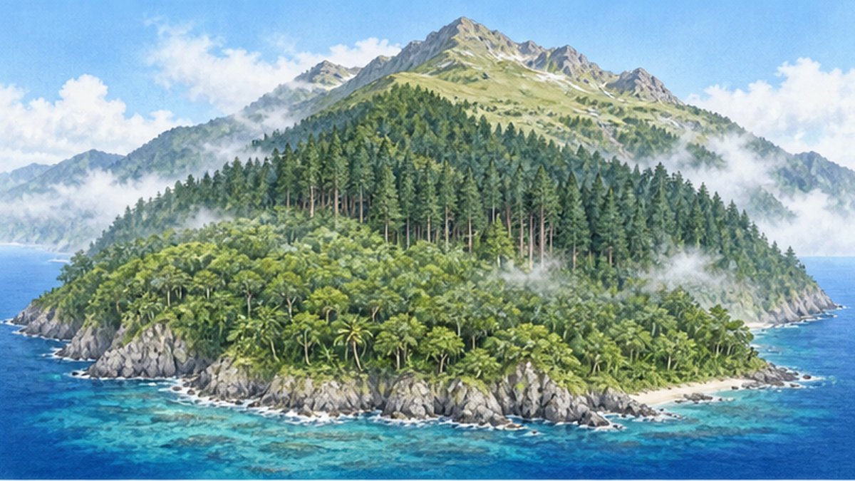
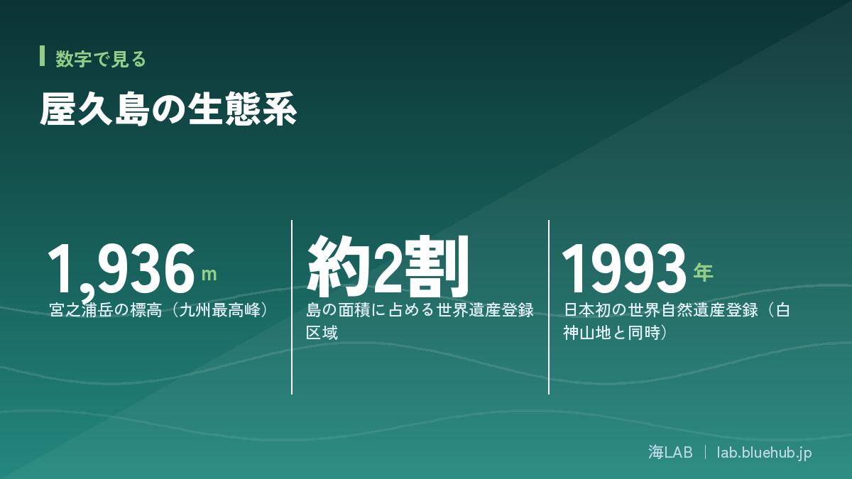
Yakushima is a nearly circular island about 60 km south of mainland Kyushu in Kagoshima Prefecture. It covers roughly 500 square kilometers and has a circumference of about 130 km, slightly smaller than Awaji Island. Yet on this small island rise Mt. Miyanoura (1,936 m), the highest peak in Kyushu, and a string of peaks around 1,800 m. Because the mountains climb straight out of the sea, the island has long been called the "Alps of the Sea."
What matters most is that these mountains stand so close to the coast. With a difference of about 2,000 m between sea level and the summit, environments with very different temperature, rainfall and wind are layered within a short distance. This "big mountain on a small island" geography is the first key to understanding Yakushima's ecosystems.
Registration as a World Natural Heritage Site
In December 1993, Yakushima was inscribed together with Shirakami-Sanchi as Japan's first World Natural Heritage Sites. The registered area is about 107 square kilometers, roughly one fifth of the island. Its value rests on the vertical distribution of vegetation, from subtropical coastal plants to subalpine vegetation near the summit, all within one island, and on the primeval forests of Yaku-sugi cedars that live for thousands of years.
In March 2012, about 40% of the island plus all of Kuchinoerabu Island were designated as Yakushima National Park, strengthening protection around the heritage area. Balancing conservation and use has remained a central theme ever since.
Three keywords for understanding the island
- High mountains: Mt. Miyanoura at 1,936 m and steep terrain rising directly from the sea
- Heavy rain: warm, moist air from the Kuroshio Current hits the mountains and drops rain
- Hard rock: granite covers nearly the entire island and forms thin, nutrient-poor soil
Why is Yakushima an "island of rain"? How the Kuroshio and mountains create precipitation
Moist air hitting the mountains
Yakushima is known as one of the rainiest places in Japan. According to Kagoshima Prefecture, annual precipitation exceeds 4,000 mm on lowlands and reaches 8,000-10,000 mm in the mountains. Tokyo gets about 1,500 mm a year, so this is several times as much.
The reason lies in terrain and ocean currents. The warm Kuroshio flows offshore, and the air above it is full of water vapor. When this moist air moves north and hits the steep mountains, it is forced up the slopes, cools, and forms rain clouds. This is called orographic rainfall. Because rainfall increases with altitude, the coast and the summit of the same island receive very different amounts.
Rainfall that differs more than twofold between coast and summit
In examples of observations introduced by the Ministry of Land, Infrastructure, Transport and Tourism, the coastal Nagata area averaged about 1,400 mm a year, while the mountain site Kosugidani recorded about 5,700 mm and Mt. Miyanoura about 7,000 mm, several times the coastal amount. Values vary by year and site and cannot be compared simply, but the pattern is consistent: calm along the coast, vastly wetter in the mountains.
| Location / zone | Approximate annual precipitation | Notes |
|---|---|---|
| Coastal lowlands | About 4,000 mm (varies greatly by site) | Overview from Kagoshima Prefecture |
| Mountain areas (e.g. Kosugidani) | About 5,700 mm (observed example) | Observed example from MLIT material |
| Summit area (around Mt. Miyanoura) | About 7,000-10,000 mm | Range varies by source |
| (Reference) Tokyo | About 1,500 mm | Approximate national average |
The famous saying that "it rains 35 days a month" on Yakushima is only a figure of speech. Still, locals have joked about it because rain is that much a part of daily life. This abundant rain is the source of the moss, epiphytes, streams and nutrient-rich water flowing to the sea described below.
From subtropical to subarctic-like: the vertically layered forests
Temperature drops with every 100 m of elevation
Temperature falls about 0.6°C for every 100 m of elevation. With about 2,000 m between coast and summit on Yakushima, the summit is roughly 12°C colder. This is comparable to the difference between Kagoshima and Hokkaido, which is why you can experience a "journey from south to north" vertically within Yakushima.
Vegetation zones by elevation
Near the coast you find subtropical plants such as Ficus superba (akou) and banyan. Higher up, warm-temperate evergreen broadleaf forest of machilus, Castanopsis (shii) and oaks takes over. Further up spreads a mixed forest of firs, hemlocks and Yaku-sugi, and near the summit the scenery shifts to subalpine-like landscapes with colonies of Yaku-zasa dwarf bamboo and Yakushima rhododendron.
| Approximate elevation | Main vegetation zone | Representative plants |
|---|---|---|
| Coast to about 200 m | Subtropical to warm-temperate forest | Akou, banyan, mangrove species (river mouths) |
| About 200-1,000 m | Warm-temperate evergreen broadleaf forest | Japanese chinquapin, machilus, oaks |
| About 1,000-1,600 m | Cool-temperate-like mixed forest (Yaku-sugi zone) | Yaku-sugi, fir, hemlock, Trochodendron (yamaguruma) |
| Above about 1,600 m | Subalpine-like shrubland and grassland | Yaku-zasa, Yakushima rhododendron |
This vertical zonation is not just plants arranged in bands. Each band hosts different insects, birds and fungi, forming a multilayered ecosystem. Vegetation that elsewhere would require traveling hundreds of kilometers can be seen on Yakushima within a dozen or so kilometers. It is also a valuable natural laboratory for tracking the effects of climate change by elevation.
Why vertical zonation is a "yardstick for climate change"
As temperatures rise, each vegetation zone is expected to be pushed gradually uphill. Plants near the summit have the least room to retreat. Yakushima, where zonation is clearly visible, attracts attention as a place to detect the effects of warming early.
The granite island: the secret of thousand-year cedars on poor land
The rock that makes up the island
The mountains in Yakushima's center are made of granite, formed when magma cooled deep underground about 15 million years ago. This granite body rose up, pushing through older layers deposited on the seabed. According to Kagoshima University and others, sedimentary rocks called the Kumage Group, deposited in the deep sea, lie near the coast, with granite mountains rising inside them.
Weathered granite becomes sandy soil that retains quartz and feldspar grains. It is poor in nutrients and holds little water. Yakushima's mountain soil is therefore thin and nutrient-poor, conditions that would normally make it hard for large forests to grow.
How "poor nutrients" produce longevity
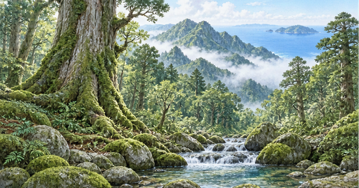
Paradoxically, this poor environment is thought to be linked to the longevity of Yaku-sugi. With few nutrients, cedars grow very slowly and form dense wood with extremely narrow annual rings. Dense wood contains a lot of resin, which resists decay fungi and insects, so trees can survive for a long time. On Yakushima, cedars over 1,000 years old are specifically called "Yaku-sugi," while younger ones are called "ko-sugi."
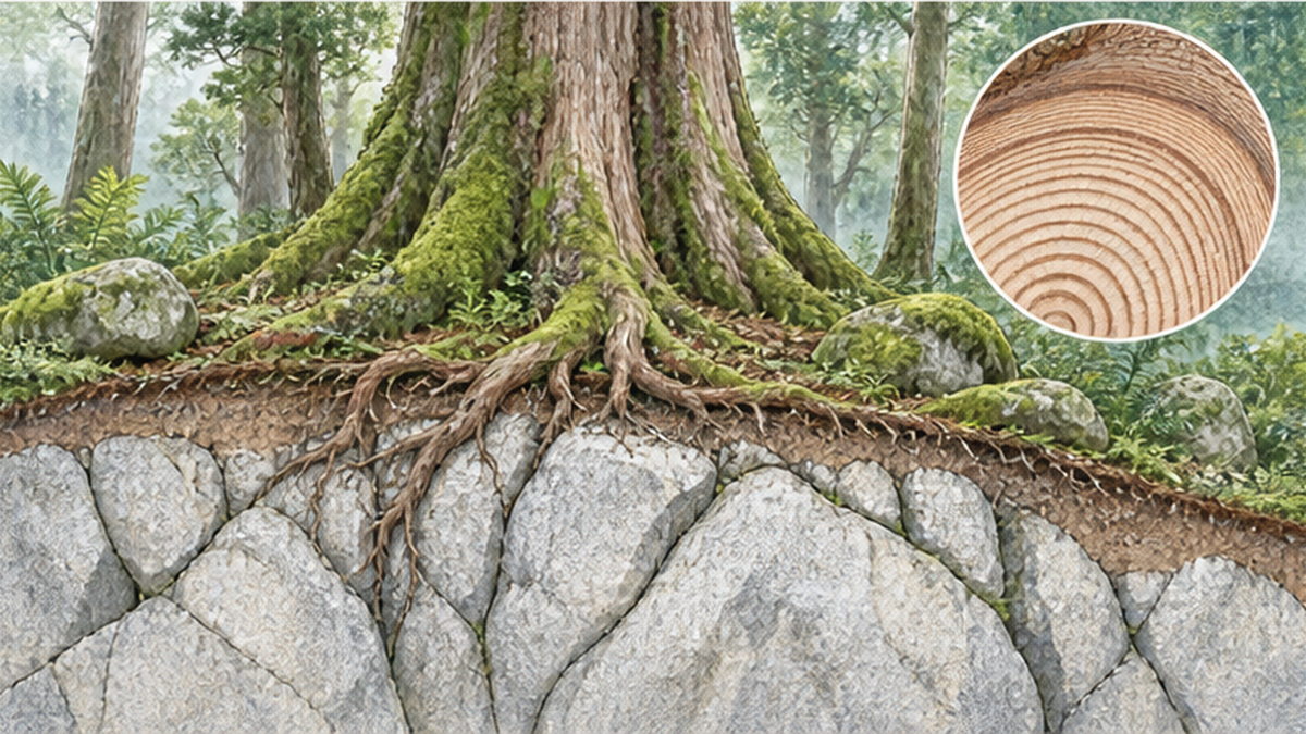
Of course, poor soil alone does not explain thousand-year cedars. Abundant rain supplies water, low temperatures slow growth, and forests survived in deep valleys and ridges even though the island lies on typhoon paths. Multiple conditions combined.
How old is Jomon-sugi?
The most famous Yaku-sugi, Jomon-sugi, is estimated to be over 2,000 years old. Because the inside of the huge trunk is hollow, rings cannot be counted directly, and estimates range from 2,170 to 7,200 years. Values based on trunk thickness and growth rate and radiocarbon dating results are mixed, and no figure is settled. "Alive since the Jomon period" is an appealing phrase, but scientifically the honest statement is that it is likely over 2,000 years old and the exact age is unknown.
Moss and epiphytes: small lives supported by the rain forest
Stars of the mossy forest
At about 700-1,500 m, the forests are humid and often shrouded in fog. Tree trunks, rocks and the ground are covered with thick moss carpets. Japan has some of the richest moss diversity in the world, and Yakushima is known for many species gathered in a small area. Several hundred bryophyte species are said to have been recorded on the island.
Moss has no roots and absorbs water directly through its surface. Yakushima, with constantly moist air, is ideal for moss. Thick moss layers act like sponges, storing rainwater and releasing it slowly, helping the forest hold water and preventing soil loss.
A garden in the trees
On huge Yaku-sugi, ferns, orchids and plants of the heath family grow on trunks and branches. "Nurse-log regeneration" is also common, where seeds that fall on fallen trees or stumps germinate. Decayed wood gives seedlings a foothold with more water and nutrients than the poor ground.
A fungal network
Underfoot, mycorrhizal fungi live in symbiosis with tree roots and help pass nutrients and water in the soil. This underground system is also explained in our related article "What is a mycorrhizal network? The underground system connecting trees." Giant trees growing in poor granite soil are thought to depend on symbiosis with fungi.
Endemic species and island animals: Yaku deer, Yaku monkeys and gifts of the sea
Island-specific subspecies
On islands separated from Honshu and elsewhere, animals can evolve independently. Yakushima is home to the Yaku deer (a subspecies of sika deer) and the Yaku monkey (a subspecies of Japanese macaque). The Yaku deer is smaller than Honshu deer, and the Yaku monkey is also small-bodied, each adapted to Yakushima's environment. Many plants also carry "Yakushima" in their names, such as Yakushima rhododendron and Yakushima gentian, including endemic species, subspecies and varieties.
Increased deer and their impact on the forest
In recent years the Yaku deer population has grown, and browsing that strips the understory and prevents forest regeneration has become an issue. The mechanism of deer overpopulation and the chain of effects, including soil loss, are explained in our related article "Sika deer overpopulation and soil loss: the chain triggered by vanishing understory." On Yakushima, population control through culling and deer-proof fences protecting rare plants have been put in place.
Conservation takes more than "leaving nature alone"
Even a World Heritage Site that looks untouched can lose its balance because of the absence of predators or human influence. Protection is not neglect; it also means continuing to observe and carrying out necessary management.
Life on the coast: sea turtles
Yakushima is not only a forest island. Nagata Inakahama Beach in the west is known as one of the major loggerhead nesting sites in the North Pacific, where many mother turtles come ashore, mainly in early summer. Nagata Beach was registered as a Ramsar wetland in 2005. Turtle nesting depends on forest water, nutrient-rich coasts shaped by the mountains, and the conservation of the sandy beach all together.
From forest to sea: how Yakushima's rain nourishes coastal ecosystems
Mountain water is food for the sea
Rain on Yakushima rushes down steep terrain into the sea. Water that has passed through the forest carries organic matter such as fulvic acid dissolved from fallen leaves and humus, and trace nutrients such as iron. These support phytoplankton growth and form the base of the coastal food web. The general mechanism of connections between forests, rivers and the sea is covered in our related article "What are the links between forest, river and sea? Watersheds that nurture rich oceans."
Submarine springs and the island's water cycle
Some of the rain that falls on the island soaks into the ground and wells up from the coast and seabed as groundwater. For how such unseen flows support coastal environments, see also "Submarine groundwater and groundwater conservation: the unseen water that nurtures the sea." On Yakushima, abundant mountain water has simultaneously supported drinking water, farming and hydroelectric power.
An island shore close to the mountains
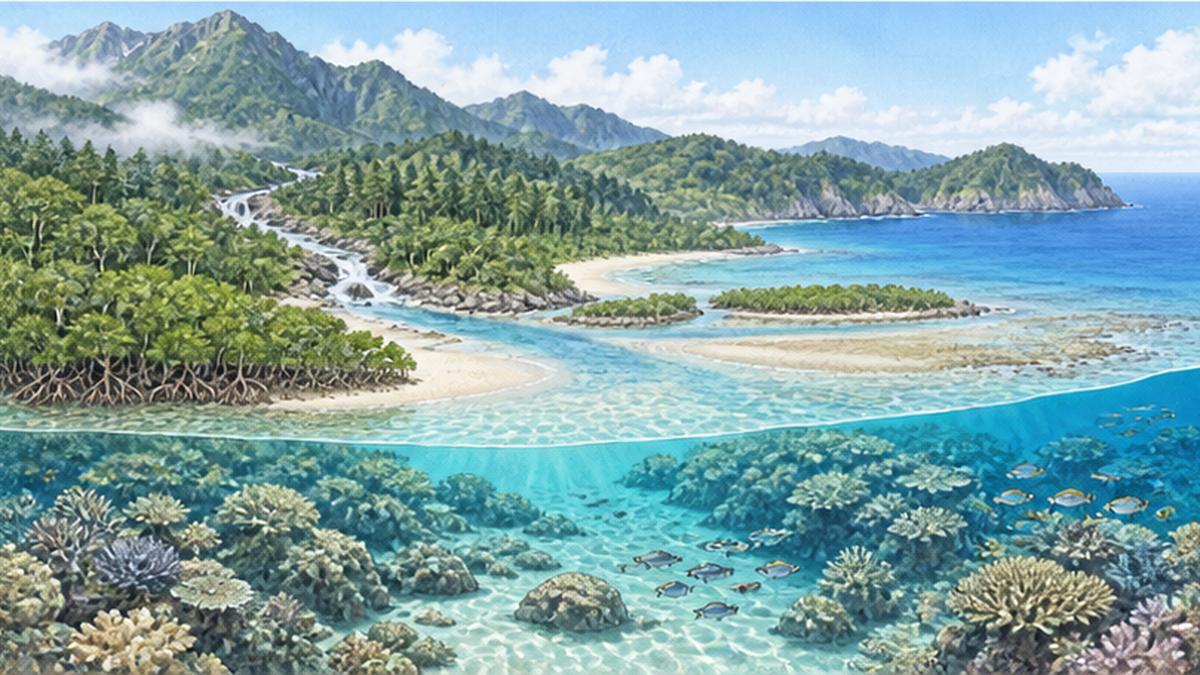
Coral reefs also develop along Yakushima's coast, and marine life from southern seas arrives on the Kuroshio. Having mountain forest and coastal sea so close means changes on land quickly reach the sea. Soil runoff from degraded forest, domestic wastewater and drifting litter burden coastal ecosystems. The island's nature cannot be protected without seeing land and sea as one.
People and the forest: logging, conservation movements and World Heritage
Use of Yaku-sugi and the "island of Yaku-sugi"
Yakushima's cedars have been tied to islanders' lives since ancient times. In the Edo period the Shimazu domain required islanders to pay taxes in hegi-ita (split boards), and people went into the mountains to cut cedar. The trees felled were mainly large, old ones. Among the stumps is the famous "Wilson stump," whose size tells the history of logging.
Modern logging and the conservation movement
From the Meiji era, most of Yakushima's forests became national forest, and large-scale logging took place in the postwar high-growth period. In response, calls for nature protection grew from inside and outside the island, and a conservation movement spread from the 1970s. Policy shifted toward protecting areas of primeval forest, and from the 1980s natural-forest logging was greatly reviewed. The 1993 World Natural Heritage listing was the culmination of this accumulation.
| Era | Event |
|---|---|
| Edo period | Islanders cut cedar in the mountains to pay hegi-ita taxes |
| Meiji to Showa | Most of the forest becomes national forest and large-scale logging proceeds |
| From the 1970s | Movement calling for nature protection spreads |
| 1993 | Inscribed with Shirakami-Sanchi as Japan's first World Natural Heritage Sites |
| 2012 | Designated Yakushima National Park |
What matters is that not only "untouched wilderness" remained: a history of use, damage and later efforts to protect has accumulated. The relationship between people and Yaku-sugi has followed its own path, different from everyday use as in satoyama and from pure protection. Comparing it with our related article "What is satoyama? The cycle of coppice woods, rice paddies and ponds, and the crisis of abandonment" reveals the variety of relationships between Japanese nature and people.
Tourism versus conservation: overuse and responses
The trail to Jomon-sugi
After World Heritage listing, visitors to Yakushima increased greatly. The trail to Jomon-sugi is about 10 hours round trip, and many hikers once concentrated on it. Trail erosion from trampling, exposed roots, toilet problems and human waste disposal emerged as serious issues.
Examples of countermeasures
Measures have included boardwalks and steps on trails, popularizing portable toilets, calls to spread out visitors, and better management of mountain toilets. Around Jomon-sugi, viewing decks protect the roots, and touching the tree directly is no longer possible. A nature guide certification system and an entry cooperation fee have also been introduced so visitors share conservation costs.
Tips for visiting Yakushima
- Stay on designated routes and use boardwalks and steps
- Bring and use a portable toilet
- Take your trash home and do not remove plants, animals or rocks
- Follow certified guides and local rules
- Prepare rain gear and warm clothing well (weather in the mountains changes quickly)
The point is not to reject tourism entirely but to convey the value of nature within what it can tolerate and to support local livelihoods. Protected areas abroad are also spreading ways to raise the quality of use, such as visitor limits, reservations and cooperation fees. For the expansion of protected areas in Japan, see also "What are 30by30 and OECM? The key to breaking the 13% marine protection barrier."
Climate change and Yakushima's future: can vertical zonation be protected?
Warming squeezes the high elevations
As temperatures rise, vegetation zones are expected to move uphill. Plants that can live only near the summit may have nowhere to go. High-elevation communities of Yakushima rhododendron and Yaku-zasa, and organisms that prefer cool conditions, have fewer places to escape than on other mountains.
Changes in rainfall and typhoons
Climate change is also pointed to as affecting rainfall patterns and typhoon strength. On Yakushima, heavy rain can easily cause landslides and trail damage, and may affect forest regeneration and the toppling of Yaku-sugi, so long-term monitoring is essential. Scientists continuously observe temperature and vegetation changes by elevation, looking for signs of change.
What we can do
Even if it seems like a faraway island, Yakushima's forests and sea are connected to our lives. We can cut greenhouse gas emissions, avoid producing marine litter, and support nature and local industries in various regions. If you visit, follow the rules and respect local life. Yakushima's story teaches us to protect nature across land and sea.
参考文献・出典
- Ministry of the Environment, Yakushima World Heritage Conservation Center – Overview of Yakushima World Heritage
- Kagoshima Prefecture: Overview of Yakushima – Overview of terrain and climate
- Kagoshima Prefecture: Nature of Yakushima – Introduction to the natural environment
- Forestry Agency, Kyushu Regional Forest Office: Forests of Yakushima – Overview of Yakushima national forest
- Forestry Agency: Miyanoura-dake National Forest – Page on the 100 Forests of Water Sources
- Kagoshima University Museum: Geology of Yakushima – Explanation of the granite body and Kumage Group
- MLIT: Climate of Yakushima – Observed examples of Yakushima rainfall
- Ministry of the Environment: Yakushima National Park – Outline and designation of the national park
* Ordered by reliability: government and academic institutions > peer-reviewed papers > specialist bodies > reliable media