⚡ In short
Every cloud in the sky, from cirrus to cumulonimbus, falls into just ten basic types defined by height and shape. This article explains the WMO's ten cloud genera, the science behind folk weather sayings like sunset skies and low-flying swallows, and the sea-lore sailors and fishers have long relied on to read the weather.
Look up at the sky and you'll see a different face every day — puffy clouds, wispy brushstroke clouds, dark clouds hanging low. In fact, all of these clouds fall into just ten types recognized worldwide, a classification system called the "ten cloud genera," defined by the World Meteorological Organization (WMO).
The wisdom of predicting the next day's weather from the sky and clouds is known in Japan as "kanten-boki" (weather-watching), and it supported the lives of fishers, farmers, and sailors long before weather forecasts existed. Sayings like "a red sunset means fair weather, a red sunrise means rain" and "low-flying swallows mean rain is near" are often backed by real meteorological principles involving changes in air pressure and humidity.
This article traces the origins and evidence behind the ten cloud types, the science underlying traditional weather sayings, and the sea-based forecasting wisdom passed down by coastal communities. By the time you finish reading, you should be able to recognize a bit more of what the clouds overhead are telling you.
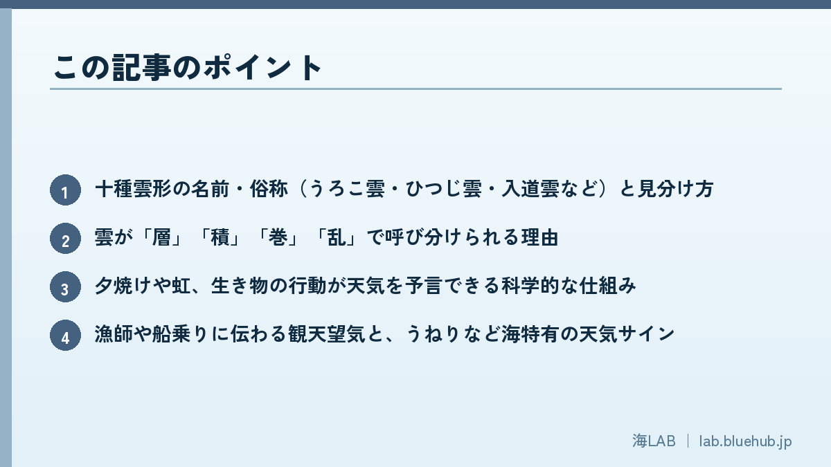
What you'll learn in this article
- The names and nicknames of the ten cloud types (mackerel sky, fleecy clouds, thunderheads, and more) and how to tell them apart
- Why clouds are named using terms like "stratus," "cumulus," "cirrus," and "nimbus"
- The scientific mechanisms behind weather omens like sunset colors, rainbows, and animal behavior
- The weather-reading traditions of fishers and sailors, including sea-specific signs like swell
- How to combine your smartphone forecast with your own eyes on the sky
The Science of Looking at Clouds — An Entry Point into Meteorology
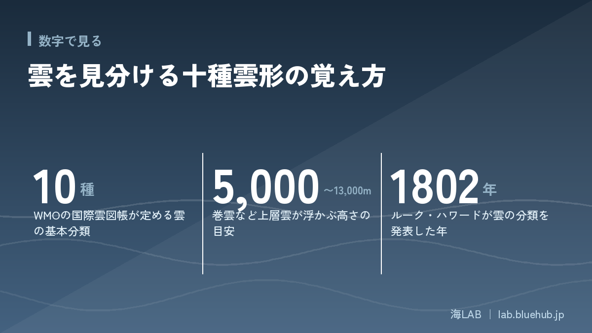
Cloud classification was born in early 19th-century England. Luke Howard, a pharmacist and amateur meteorologist, presented his cloud classification system to the Askesian Society in London in 1802 and published it as a paper the following year, in 1803. Using Latin, he organized clouds into three basic forms — "cirrus" (hair), "cumulus" (heap), and "stratus" (layer) — along with intermediate forms created when they mixed together. Until then, clouds had been known by scattered local names in different regions, making it difficult to share observational records. Howard's system was groundbreaking in that it could even express dynamic changes, such as clouds "building up" or "spreading out."
Howard's classification spread across Western Europe within about a decade and became the foundation of the cloud classification used today. The World Meteorological Organization (WMO) now publishes the *International Cloud Atlas* as the global standard; its first edition appeared in 1896, and the latest edition was published online in 2017. The Atlas further subdivides the ten cloud genera into "species," "varieties," "supplementary features," and "accessory clouds," and this more detailed classification is used in specialized meteorological observation. Japan's Meteorological Agency also observes and records clouds according to this international standard, applying the same cloud-type framework when analyzing images from the Himawari weather satellites.
Learning to identify clouds is more than a pleasant pastime. Pressure patterns and the movement of weather fronts are invisible, but the height, shape, and thickness of clouds offer visible clues that let us infer the state of the atmosphere beyond them. Even in an age when forecast apps update every few minutes, the ability to read clouds remains useful as a way to sense, in real time, that the sky is beginning to change.
Clouds Are Also a Key Topic in Climate Change Research
Clouds matter not only for day-to-day forecasting but also for understanding the climate of the entire planet. They both cool the surface by reflecting sunlight back into space and warm it by trapping heat radiating from the ground — a greenhouse effect of their own. Because of this dual role, even small changes in the amount, type, or altitude of clouds can significantly shift how much heat the Earth as a whole gains or loses. International scientific assessments of climate change continue to identify "how clouds will change in the future" as one of the largest sources of uncertainty in projecting future warming. Looking up and observing the clouds is, in that sense, both a piece of everyday weather wisdom and a doorway into understanding how mechanisms like El Niño and La Niña reshape weather and fisheries on a planetary scale.
From Visual Observation to Satellite Observation
For many years, Japan's weather stations relied on observers who looked up at the sky and recorded cloud cover, cloud type, and cloud height through "visual observation." Today, automated observation using weather satellites like Himawari and ground-based lidar (laser ranging devices) has become the norm, but the underlying classification concept hasn't fundamentally changed since Howard's time. Even when analyzing satellite imagery for cloud temperature (which indicates altitude) and texture, the judgment ultimately still comes down to the ten-cloud-type framework — is this cloud high or low, layered or convective? In aviation as well, reading cloud types is an essential skill for avoiding the turbulence and lightning associated with cumulonimbus clouds, making it important knowledge for pilots and air traffic controllers alike.
Cloud names are built from four building blocks
- Cirro- = thin clouds that form high in the sky
- Alto- = clouds that form at a middle altitude
- Strato- = clouds that spread out flat
- Cumulo- = clouds that pile up in heaps
What Are the Ten Cloud Types? A Classification by Height and Shape
The ten cloud types are broadly divided into three groups — high, mid-level, and low clouds — based on the altitude at which they appear. In temperate regions like Japan, high clouds typically form at roughly 5,000–13,000m, mid-level clouds at roughly 2,000–7,000m, and low clouds from ground level up to about 2,000m. These ranges overlap because the boundaries shift with the season and latitude: in the tropics, the troposphere itself is higher, so the lower limit for high clouds rises too, while in polar regions it drops.
| Group | Cloud name | Common nickname | Key features |
|---|---|---|---|
| High clouds | Cirrus | Mare's tail / streak clouds | Thin, fibrous clouds that look brushed across the sky, made entirely of ice crystals |
| High clouds | Cirrocumulus | Mackerel sky | Small white patches arranged in rows; often an early sign of an approaching low-pressure system |
| High clouds | Cirrostratus | Thin veil clouds | A thin, veil-like layer covering the whole sky; produces a halo around the sun or moon |
| Mid-level clouds | Nimbostratus | Rain clouds | A thick, gray layer covering the entire sky; brings continuous rain or snow |
| Mid-level clouds | Altocumulus | Fleecy clouds / sheep clouds | Round white or gray patches lined up like a flock of sheep |
| Mid-level clouds | Altostratus | Hazy clouds | Covers the sky in gray, making the sun look blurred as if seen through frosted glass |
| Low clouds | Stratus | Fog clouds | A gray layer near the ground; becomes fog if it touches the surface |
| Low clouds | Stratocumulus | Roll clouds | Gray or white clumps arranged in rolling rows; the most frequently seen cloud type in Japan |
| Low clouds | Cumulus | Fair-weather clouds | Puffy, well-defined clouds that float on clear days |
| Low clouds | Cumulonimbus | Thunderheads | Towers dramatically upward, bringing thunder, heavy rain, and sudden gusts; its top can reach the altitude of high clouds |
The trick to telling them apart is to pay attention to the root words in their names. Clouds with "strato-" spread out flat with blurry edges. Clouds with "cumulo-" pile up in heaps with clearly defined edges. And clouds with "nimbo-" — nimbostratus and cumulonimbus — are the ones that actually bring rain and thunder. Just keeping these three cues in mind narrows down which of the ten types you're looking at considerably.
The International Cloud Atlas further subdivides these ten "genera" into "species" and "varieties." Even within the single cumulus genus, for instance, a flat, well-defined "humilis" cloud and a towering "congestus" cloud develop in very different ways going forward. Specialized observation goes into this level of detail, but for everyday cloud-spotting, grasping the ten-cloud-type framework is more than enough.
You can get a rough sense of a cloud's height by comparing it against familiar landmarks. Comparing a cloud's position against the ridgeline of Mt. Fuji (elevation about 3,776m) or another tall nearby mountain, for example, tells you whether the cloud sits above or below the summit. Another rule of thumb: if a passenger jet appears to be flying above the clouds, they're probably high clouds; if it appears to be flying through or below them, they're probably mid-level or low clouds. Precise cloud-base altitude is measured with a ceilometer (a laser ranging instrument used in weather observation), but comparisons like these are more than adequate for a rough sense of whether a cloud is high, mid-level, or low.
Three steps to reading the sky
- ① Check the height (high = cirro-, mid = alto-, low = strato-/cumulo-)
- ② Check the outline (flat and blurry = strato-, puffy = cumulo-)
- ③ Check the color and thickness (gray and thick = nimbo- = a sign of rain)
High Clouds — Ice Clouds Floating High in the Sky
Cirrus, Cirrocumulus, and Cirrostratus Are "Ice Clouds"
At altitudes above roughly 5,000m, where high clouds form, temperatures drop to around -20°C to -40°C, so these clouds are made entirely of ice crystals rather than water droplets. The fibrous look of cirrus, and the halo (a ring around the sun or moon) produced by cirrostratus, both come from these ice crystals refracting and reflecting light in orderly patterns. Because this altitude roughly overlaps with the cruising altitude of passenger jets, contrails are sometimes classified alongside cirrus clouds. When the upper atmosphere is humid, contrails can linger and spread rather than disappearing quickly — the basis for the folk saying that "a lingering contrail means the weather is about to turn."
Conversely, when the upper air is dry, contrails evaporate and vanish almost immediately, because the ice crystals sublimate (turn directly from solid to gas) quickly on contact with the dry surrounding air. In other words, the rule of thumb "a contrail that disappears fast means fair weather for a while; one that lingers means moist air is approaching" directly reflects an actual meteorological indicator — the amount of water vapor in the upper atmosphere.
Mackerel Sky and Thin Veils Signal Weather on the Decline
Cirrocumulus (mackerel sky) and cirrostratus (thin veil clouds) are often the first clouds to spread across the sky, anywhere from several days to half a day before a low-pressure system or front arrives. This happens because warm, moist air ahead of the low slowly rises into the upper atmosphere; the ice clouds spread out at high altitude first, and the sky gradually thickens with lower clouds after that. Keeping this sequence in mind — cirrus → cirrostratus → altostratus → nimbostratus — lets you roughly gauge how much time you have before the weather turns. In practice, when a warm front is approaching, it often takes half a day to a full day between the appearance of cirrostratus and the start of real rain.
Hook-Shaped Cirrus and the Jet Stream
Among cirrus clouds, ones with hook-shaped tips — called "cirrus uncinus" — are considered a sign of strong winds aloft. This happens because ice crystals are swept downwind by the jet stream, which blows at around 10km altitude, meaning that even while the wind at ground level is still calm, strong winds have already begun blowing high above. Sailors have long passed down the experience-based knowledge that this hook-shaped cirrus formation signals worsening weather ahead — and behind that folklore lies the invisible phenomenon of the jet stream.

Mid-Level Clouds — Clouds That Signal a Change in the Weather
Fleecy Clouds and Hazy Clouds Signal an Approaching Front
Altocumulus (fleecy clouds) and altostratus (hazy clouds) form a bit lower than the high clouds, at roughly 2,000–7,000m. When the sun starts to look blurred, as if seen through frosted glass, that's a sign altostratus is spreading — and nimbostratus, which brings real rain, often follows close behind. Altocumulus is characterized by rounded lumps packed tightly together; when the individual lumps are large and the cloud base looks dark, it's a sign the atmosphere is becoming unstable (a form known as "altocumulus castellanus"), which can lead to sudden showers or thunderstorms.
Lens-Shaped Clouds over Mountains Signal Strong Winds
Among the altocumulus family is another form seen near mountains: lenticular clouds. Shaped like a smooth, UFO-like convex lens, they form when air flowing over a mountain ripples in a wave pattern known as a "mountain wave." A sharply defined lenticular cloud is evidence of strong winds aloft, and among people engaged in weather-sensitive mountain activities like climbing and paragliding, it's well known as a warning sign of sudden weather changes and strong winds.
Nimbostratus Is Literally a "Rain Cloud"
Nimbostratus blankets the entire sky in gray, thick enough to blot out even the outline of the sun. Its base can sink down to the height of low clouds, while its top can extend beyond the mid-level range, making it one of the thickest and most far-reaching of the ten cloud types. As the "nimbo-" in its name suggests, nimbostratus and cumulonimbus are the two cloud types that directly bring rain and snow within the ten-type system; a good rule of thumb is that a long, steady drizzle comes from nimbostratus, while a short, heavy downpour comes from cumulonimbus. When nimbostratus spreads across the sky, it tends to bring hours of continuous rain, so heading out without an umbrella is likely to get you caught in the rain before you make it home.
Low Clouds — Everyday Clouds Directly Tied to Daily Weather
From Fair-Weather Cumulus to Thunderheads: How Cumulus Clouds Grow
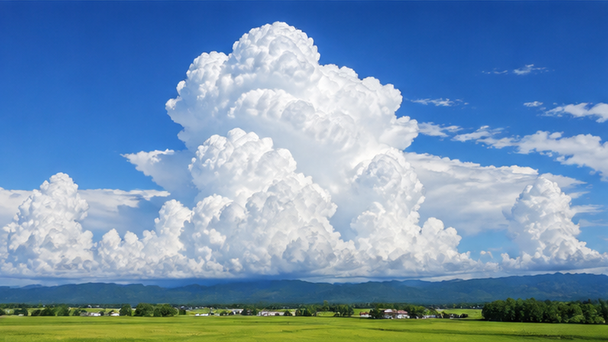
The puffy cumulus clouds that float on a clear day are formed by updrafts created when sunlight warms the ground. When the atmosphere becomes unstable, these cumulus clouds can grow rapidly upward, eventually developing into cumulonimbus — thunderheads. The summer-afternoon saying "when the thunderheads start building up, a sudden downpour is near" describes exactly this growth process. A cumulonimbus cloud's top can reach the altitude of high clouds, and once its peak flattens out sideways into an "anvil" shape, it's a strong sign that thunder and sudden gusts are already occurring, or about to.
The life of a cumulonimbus cloud is often described in three stages: developing, mature, and dissipating. The developing stage involves only updrafts and is relatively calm; the mature stage is the most violent, bringing rain, thunder, sudden gusts, and sometimes hail; and the dissipating stage sees downdrafts take over as the rain weakens. This whole sequence often plays out in roughly 30 minutes to an hour, so if you see dark clouds and lightning in the distance, it's safest to assume you don't have much time before it reaches where you are.
If you spot a cumulonimbus cloud
- A sudden darkening of the distant sky and a warm, humid breeze are signs of an approaching downpour or thunderstorm
- If you hear thunder, stop outdoor activities and take shelter in a sturdy building or vehicle
- Be especially careful of lightning strikes and sudden flooding near riverbanks, the sea, or other open areas
Stratus and Stratocumulus Are the Clouds You See Most Often in Japan
Stratus (fog clouds) form a gray layer near the ground and become fog itself if they touch the surface. "Radiation fog," created when the air near the ground cools through radiative cooling, and "sea fog," created when warm, moist air passes over a cold sea surface, both belong to this stratus family. Stratocumulus (roll clouds) is considered the most frequently seen cloud type in Japan's skies, characterized by gray or white clumps lined up in rolling rows. Neither typically brings heavy rain on its own, though a thickening layer of stratus can bring light drizzle.
Why Sea Fog Is So Common on the Pacific Coast in Summer
Sea fog, which frequently occurs in summer along Japan's Pacific coast, especially in Hokkaido, forms when warm, moist air blowing in from the south passes over the cold Oyashio Current offshore. As the warm air makes contact with the cold sea surface, it cools rapidly, and the water vapor it can no longer hold condenses into fine droplets that form fog. This phenomenon, known as "advection fog," forms through a different mechanism than the radiative fog seen inland. Because it can sharply reduce visibility, it has a major impact on ship navigation and fishing operations, and has long been regarded by coastal communities as a weather phenomenon requiring caution.
What Is Kanten-boki? The Meteorology Hidden in Folk Sayings
Kanten-boki refers to the traditional practice of predicting upcoming weather changes from the appearance of clouds, wind direction, and the behavior of plants and animals. In an era without weather satellites or radar, when a sudden change in the weather could be a matter of life and death for fishers and sailors, and could determine the fate of a farmer's harvest, the ability to read the sky was an essential skill passed down through accumulated experience. Countless regional variations of kanten-boki survive across Japan, each shaped slightly differently by local terrain and ocean currents.
Many of these sayings are far from mere superstition — they're grounded in real meteorological principles involving air pressure, humidity, and wind direction. Because weather in Japan generally moves from west to east under the influence of the prevailing westerlies, watching "the western sky" became the basic template for predicting the next day's weather. Modern weather forecasting only became widespread in the 20th century; for the centuries before that, people relied on this kind of accumulated experience to decide whether to go out to sea or bring in the harvest.
In Japan, weather tendencies have long been passed down in connection with the traditional calendar divisions of the 24 solar terms and 72 micro-seasons. Handbooks summarizing how to read the weather, aimed at fishers and ship captains, are said to have existed as far back as the Edo period, and the specific sayings used vary by region. Coastal areas tend to preserve more sayings centered on clouds and the sea, while inland farming communities tend to preserve more sayings centered on mountain clouds and the behavior of plants and animals — a reflection of each community observing most closely the changes most directly tied to their own livelihood.
If a cap cloud settles over the mountain, don't go out to sea tomorrow.
— A kanten-boki saying passed down among fishers in various regions
Passed down orally across generations, sayings like this one have shifted slightly in wording from region to region. What they share is a common approach: using "changes happening right now, right in front of you" as a clue to forecast the weather anywhere from a few hours to a day ahead. In an age before numerical weather prediction models existed, people essentially turned their own senses and accumulated experience into a forecasting system.
The basic principles behind kanten-boki
- Weather in Japan generally moves from west to east, due to the prevailing westerlies
- As a low-pressure system approaches, air pressure drops and humidity rises
- Changes in pressure and humidity show up not just in cloud shapes, but also in animal behavior and how sound travels
That said, kanten-boki has its limits. While effective for reading short-term changes over the course of a few hours to a day, it cannot accurately predict weather several days out or across a wide area. Modern forecasting, which crunches vast amounts of data from ground stations, ships, upper-air balloons, and satellites through numerical prediction models, far outperforms kanten-boki in accuracy. Rather than replacing official forecasts, kanten-boki is best understood as a way to fill in what forecasts can't cover: "right here, right now."
Signs in the Sky and Wildlife — Examples of Weather Folklore and the Science Behind Them
What Sunsets, Sunrises, and Rainbows Tell Us About the Weather
The saying "a red sunset means fair weather, a red sunrise means rain" is rooted in the fact that Japan's weather moves from west to east. A red sky in the western direction at sunset is evidence that the west is currently clear, and that clear weather is likely to arrive the next day. A red sunrise, on the other hand, suggests that while the east — where the sun rises — is clear, clouds are already building up to the west. Rainbows follow the same logic: a rainbow seen in the morning appears on the opposite side of the sun, meaning to the west, indicating rain clouds are there; a rainbow at sunset indicates rain clouds moving away to the east. How sharply a rainbow appears, or whether it appears as a double rainbow, also depends on raindrop size and the amount of moisture in the air.
Halos and Mackerel Skies Signal an Approaching Front
A halo — a ring-shaped glow around the sun or moon — is caused by ice crystals in cirrostratus clouds refracting light. Because cirrostratus tends to appear ahead of an approaching warm front, the saying "a halo around the sun or moon means rain is near" has a real meteorological basis. Similarly, when a mackerel sky (cirrocumulus) begins to spread across the entire sky, it can be read as an early sign that a low-pressure system or front is approaching.
Animal Behavior and Its Link to Air Pressure and Humidity
Plant and animal behavior is also sensitive to changes in air pressure and humidity. Small drops in pressure that are imperceptible to humans can have an outsized effect on smaller creatures. Below are some classic examples, along with the mechanism behind each one.
- Low-flying swallows mean rain is near — as a low-pressure system approaches and humidity rises, the wings of the insects swallows feed on become damp and heavy, forcing the swallows to fly lower to catch them
- Closed pine cones mean rain is near — the scales close when they absorb moisture and open when dry, a sign rooted in the pine cone's own strategy for not releasing seeds into damp conditions
- Fish surfacing to gulp air means the weather is about to turn — falling air pressure reduces the amount of oxygen dissolved in the water, so fish rise toward the surface seeking oxygen
- Old injuries aching means rain is near — a drop in air pressure is sensed by an organ deep in the inner ear, which can throw the autonomic nervous system out of balance and produce aches and general malaise, a mechanism related to what's known as "weather pain"
- Distant sounds carrying farther means rain is near — on clear days, warm air near the ground and cooler air aloft bend sound waves upward and away, but as a low-pressure system brings warm air aloft, sound bends back down toward the ground and travels farther
- A cat washing its face means rain is near — one theory holds that rising humidity makes a cat's whiskers damp and clingy, prompting it to touch and groom its face more often
- Twinkling stars mean stronger winds are coming — turbulent air currents aloft cause starlight to refract unevenly as it passes through the atmosphere, making stars appear to twinkle more
- A warm southerly breeze means the weather is about to turn — as warm, moist air flows north toward a low-pressure system, both temperature and humidity rise together, favoring the development of rain-bearing clouds soon after
- Frogs croaking means rain is near — rising humidity boosts activity in frogs, which breathe partly through their skin, and their mating calls tend to increase as well
- Ants moving in a line to higher ground means rain is near — small creatures living close to the ground are thought to be especially sensitive to falling pressure and rising humidity, prompting them to evacuate to higher spots before their nests flood
What all these animal behaviors have in common is a single underlying principle: smaller creatures react more sensitively to the smallest shifts in air pressure and humidity. Sayings like these can be seen as humanity's way of observing and recording the abilities that other living things evolved over vast stretches of time, sensing changes that we, without instruments, could never notice on our own — changes that, for them, were once matters of survival.
| Saying | What it signals | The science behind it |
|---|---|---|
| A red sunset means fair weather | Clear weather the next day | The western sky is currently clear, and that clear weather moves eastward with the prevailing westerlies |
| A red sunrise means rain | Rain that day or the next | Clouds are already building up to the west |
| A halo around the sun or moon | Rain within 1–2 days | Ice crystals in cirrostratus signal an approaching warm front |
| A mackerel sky spreads out | Weather turning within a few days | An early sign of an approaching low-pressure system or front |
| Thunderheads build up rapidly | A downpour or thunder within hours | Cumulus clouds are rapidly developing into cumulonimbus |
Reading Weather at Sea — Fishers, Sailors, and the Danger of Swell
In an era without weather satellites or GPS, the ability to read the sky and the sea was, quite literally, a matter of survival for fishers and sailors heading out to open water. Even Japan's Coast Guard has documented kanten-boki traditions passed down among coastal communities, including the saying that a cap cloud settling over a mountain peak signals worsening weather the next day — knowledge still put to practical use today in fishing and forestry to prepare for sudden weather changes. Along the coast in particular, people need to watch both the mountains and the sea at the same time, a somewhat different perspective from the inland kanten-boki traditions that focus solely on the sky.
Today, the Japan Meteorological Agency issues wave forecasts, strong wind advisories, and marine warnings for each coastal region, delivered to vessels in real time via fishing radio and the internet. Even so, once a boat is actually out at sea, it can still run into areas with no signal, or sudden changes that outpace the latest forecast update. In moments like these, the final source of information — now just as it was in the past — is still your own eyes: the clouds, the wind, and the state of the waves.
Swell: A Hard-to-See Sign of an Approaching Typhoon
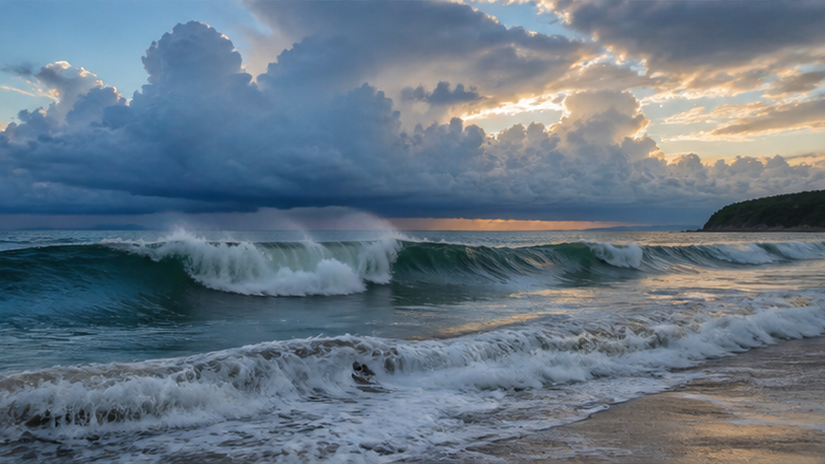
Ocean swell offers its own early warning of a coming weather change, distinct from the sky. Even when a typhoon is still far out at sea, the wind waves it generates can travel ahead of the storm and reach Japan's coast as "swell." Swell tends to be long-wavelength and rounded, making it hard to notice by sight, but once it reaches shallow coastal water, friction with the seafloor can sharply shorten its wavelength and rapidly increase wave height. The "doyo-nami" swell that hits Japan's Pacific coast from summer into autumn is a classic example — it can generate dangerous waves well before the typhoon itself arrives, which is why caution is advised. Depending on a typhoon's path and strength, swell can travel hundreds of kilometers or more to reach the coast, sometimes producing dangerously high waves even under a clear blue sky, long before any visible storm — a phenomenon sometimes called "clear-sky high surf." Understanding how rising sea temperatures drive rapid typhoon intensification can also help in reading how strong a distant typhoon might be from the strength of the swell it produces.
Reading Signs from the Sky and the Sea Together
Experienced fishers have long judged the weather not from clouds alone, but by combining multiple signs — shifts in wind direction, the color of the waves and the rhythm of the swell, and the flight patterns of seabirds. When a mackerel sky spreads out, the wind shifts to a southerly direction, and the swell grows stronger all at once, for instance, that combination of signs strongly suggests an approaching low-pressure system or typhoon. This approach — never relying on a single sign, but weighing multiple signals together — is, in essence, the same logic modern forecasting uses when it combines data from many different observation sources.
As stormy weather approaches, waves breaking against rocky shores offshore can also send white foam, known as "wave flowers," drifting onto the beach. A stronger-than-usual smell of the sea can likewise be a sign that rising waves are stirring up more seaweed and spray than usual — a shift in scent and sight that has long been passed down as another form of experiential kanten-boki. Today, checking official information such as the Japan Meteorological Agency's coastal wave forecasts, tsunami warnings, and storm surge warnings alongside these traditional, sensory cues remains a practical safety measure for anyone whose work or leisure involves the sea.
The danger of swell
- Even when it looks calm, swell can suddenly build into large waves in shallow coastal water
- Swell can arrive well ahead of the typhoon itself, even while the storm is still far away
- If you notice signs the sea is turning rough while shore fishing or similar activities, evacuate early
Conclusion — Reading the Sky with Your Own Eyes, Alongside the Forecast
The ten cloud types are a long-lived scientific achievement: a classification system organized by Luke Howard in the 19th century that remains the international standard to this day. Kanten-boki, meanwhile, is a form of everyday wisdom, one that distills years of accumulated experience about pressure and humidity into memorable sayings. Both, in the end, are the same activity in different forms — observing the sky and reading the signs of change.
Even now, when a smartphone weather app updates every few minutes, the shapes of the clouds overhead, the colors of a sunset, and the state of the ocean's swell continue to offer firsthand information about the sky right in front of you, right now. If a forecast tells you what to expect over the coming days, the signs in the sky and sea tell you what's about to happen right here, in the next few hours — two different timescales of information. Combining both gives you a fuller picture of how the weather is changing.
This ability to read "what's changing right here, right now" matters most for anyone spending long stretches outdoors — hiking, fishing, camping, or swimming in the sea. Getting a general sense of the weather from an official forecast, and then checking the sky and sea with your own eyes once you're actually out there, is arguably the most practical way to put kanten-boki to use today.
The next time you look up at the sky, try picturing the name of the cloud you're seeing, and the change in weather it might be pointing toward. A spreading mackerel sky suggests a shift within a few days; towering thunderheads suggest a downpour within hours. Quietly but reliably, the clouds overhead are telling you what's coming next — the very names Luke Howard gave them more than 200 years ago, and at the same time, the language of sky and sea that coastal communities have long risked their lives to read.
References
- Japan Meteorological Agency, "How to Read Satellite Imagery" – How cloud type and altitude are identified from satellite images
- JMA Meteorological Satellite Center, "Cloud Patterns and Water Vapor Patterns" – A technical explanation of cloud patterns observed in satellite imagery
- WMO International Cloud Atlas – The World Meteorological Organization's official international cloud atlas (2017 edition)
- Japan Coast Guard, "Kanten-boki" – Traditional weather-reading sayings passed down among coastal communities
- Weathernews, "The Ten Cloud Types: 10 Cloud Names Defined by Height and Shape" – An overview of the ten cloud types and their nicknames
- Weathernews, "Why Swell Is Dangerous Even Far From a Typhoon" – How swell forms and why it's dangerous along the coast
- Wikipedia, "Cloud Types" (Japanese) – The classification system for the ten cloud types and the history of Luke Howard's naming system
- Wikipedia, "International Cloud Atlas" (Japanese) – The history and revisions of the WMO's International Cloud Atlas
* Sources are listed in order of reliability: government and academic institutions > peer-reviewed research > specialized organizations > trusted media outlets