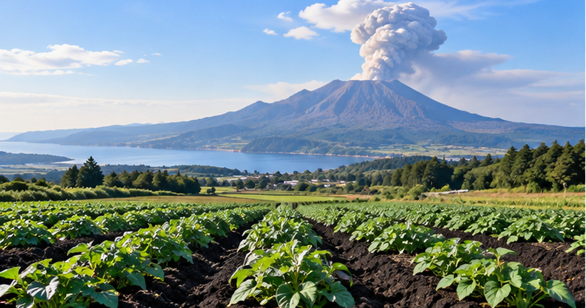
⚡ In short
Volcanic-ash-derived Kuroboku soil covers about half of Japan's farmland. Despite world-class humus content, phosphate is hard for plants to absorb — a soil that looks richer than it is. This article explains both the blessings and risks of eruptions.
Japan is one of the world's most volcanically active countries, and the ash that eruptions rain down slowly becomes soil over long spans of time. The representative example is Kuroboku soil, said to cover roughly half of Japan's farmland. Its jet-black color signals abundant organic matter (humus), but this soil is not actually as easy to farm as it looks.
That's because a clay mineral called "allophane," found in Kuroboku soil, strongly locks up the phosphate that crops need to grow. Until phosphate fertilizer was applied during postwar soil improvement, Kuroboku soil was treated as "poor soil."
Meanwhile, in places like the Shirasu plateau of Kagoshima Prefecture, the very nature of volcanic ash was turned to advantage, giving rise to thriving sweet potato cultivation. This article traces how the natural threat of eruptions has, at times, given birth to agricultural character and strength.
What you'll learn in this article
- Why Kuroboku soil isn't necessarily fertile despite its jet-black color
- How the clay mineral allophane locks away phosphate
- The historical background behind sweet potato cultivation on Kagoshima's Shirasu plateau
- The real damage ashfall from Sakurajima causes to agriculture, and disaster-prevention farming measures
- Why volcanic ash soil matters in agricultural regions worldwide
What Is Kuroboku Soil? Volcanic-Ash-Derived Soil Covering Japan's Farmland
Kuroboku soil is soil formed from volcanic ejecta such as ash and scoria, and it is widely distributed across Japan, including Hokkaido, Tohoku, Kanto, and Kyushu. Based on a 1:500,000 soil map, its area is calculated at about 60,641 km², roughly 16–31% of Japan's land area, and about 47% of farmland specifically is covered by Kuroboku soil. Looking across all of Japan's farmland, roughly one in three or four fields is Kuroboku soil — meaning a considerable share of the vegetables and grains we eat every day are grown on this soil.
Where the name "Kuroboku" comes from
The name "Kuroboku soil" comes from the soil being light and fluffy ("boku-boku") and black in color. This blackness comes from the large accumulation of humus — decomposed plant-derived organic matter — in the soil, and Kuroboku soil's humus content ranks among the highest in the world, let alone in Japan. Humus forms as plant roots, fallen leaves, and volcanic-ash-origin susuki grasslands decompose and accumulate over long periods, and the thick black layer of Kuroboku soil is itself a record of natural processes spanning thousands to tens of thousands of years.
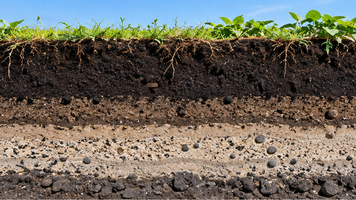
Regions where Kuroboku soil is widespread
- Hokkaido's Tokachi and Ishikari plains
- Plateaus around volcanoes in Tohoku
- The Kanto Loam layer (a wide area of the Kanto Plain)
- The Shirasu plateau of Kyushu (Kagoshima and Miyazaki)
The time it takes for volcanic ash to become soil
Immediately after it falls, volcanic ash is nothing more than mineral particles with almost no ability to nurture crops on its own. Only after a cycle repeats for hundreds to thousands of years — plants taking root, dying and decomposing, and microbes incorporating organic matter into the ground — does it come to function as "soil." Because Japan's volcanic activity is so intense, this soil-forming cycle has layered upon itself again and again across the archipelago.
The Kanto Loam layer, another representative example
One of the best-known examples of Kuroboku soil is the "Kanto Loam layer," widely distributed across the Kanto Plain. It is a geological layer built up from ash erupted by multiple volcanoes including Mt. Fuji, Hakone, and Mt. Akagi, and it covers much of the plateau areas of the Kanto Plain. While used as farmland, it is also frequently seen in residential development sites, and its reddish-brown to blackish-brown cross-section is a familiar geological layer to people living in the Kanto region.
The physical properties of Kuroboku soil
Kuroboku soil has distinctive characteristics not only chemically but also physically. A hallmark trait is its lightness, known as "keishō" — its bulk density is smaller than that of ordinary soil of the same volume. This is because the soil particles contain many voids, giving it excellent air and water permeability, but also a weakness: its structure is easily broken down by trampling or tilling. The light, fluffy feel of tilled Kuroboku fields comes from this abundance of voids.
Kuroboku soil's place in world soil classification
In international soil classification systems such as the World Reference Base for Soil Resources (WRB) and the United States' Soil Taxonomy, soils equivalent to Kuroboku soil are treated as an independent group called "Andisols/Andosols." "Ando" is said to derive from the Japanese word "ando" (dark soil), and the fact that a dedicated classification category exists internationally reflects how the distinctive properties of volcanic-ash-derived soil have long been recognized — a testament to the influence Japanese soil research has had on global soil science.
| Region | Main source volcanoes | Typical agricultural use |
|---|---|---|
| Tokachi, Hokkaido | Mt. Tarumae, Mt. Tokachi, etc. | Crop farming (beans, wheat, potatoes) |
| Kanto Plain | Mt. Fuji, Hakone, Mt. Akagi, etc. | Open-field vegetables, tea |
| Southern Kyushu | Aira Caldera, Sakurajima, etc. | Sweet potatoes, tea, livestock |
The Kuroboku soil supporting Hokkaido's Tokachi farmland
The Tokachi region of Hokkaido, one of Japan's leading crop-farming areas, is also a region widely covered by Kuroboku soil shaped by volcanic activity from Mt. Tarumae and Mt. Tokachi. The "four-crop rotation" production system of wheat, potatoes, beans, and sugar beets was established over many years to match the region's soil characteristics and climate, and soil-building and crop-rotation techniques that account for Kuroboku soil's properties underpin this large-scale crop farming.
Why It's Not as Fertile as It Looks: Allophane and Phosphate Absorption
Judging by humus content alone, Kuroboku soil looks as rich as chernozem, the world's most fertile soil class. Yet in actual agricultural use it has long been treated as "poor soil." The cause is a clay mineral unique to volcanic ash: allophane.
A soil that strongly locks in phosphate
Allophane is an amorphous clay mineral with a large surface area and high reactivity, and it strongly adsorbs phosphate ions in the soil. As a result, crops cannot absorb phosphate and their growth suffers. The phosphate absorption coefficient of Kuroboku soil can exceed 2,000, far higher than that of ordinary soils.

How postwar soil improvement turned it into farmland
From the era of high economic growth onward, soil improvement programs that focused heavily on applying phosphate fertilizer were carried out nationwide, and as a result, most crops became cultivable even in regions dominated by Kuroboku soil. Much of today's crop-farming and dairy regions is built on the accumulation of such improvements. The farmland created this way has also, at times, given rise to new coexistence challenges with wildlife, such as agricultural damage caused by Japanese macaques.
| Characteristic | Kuroboku soil | Typical alluvial soil |
|---|---|---|
| Color | Black (humus-rich) | Gray to brown |
| Phosphate availability | Low (locked by allophane) | Relatively high |
| Bulk density (lightness) | Light | Relatively heavy |
| Main distribution | Plateau and hillside farmland | Lowland paddy fields |
What exactly is allophane?
Allophane is an amorphous (non-crystalline) clay mineral that forms as volcanic glass weathers, characterized by extremely fine particles and a large surface area. This large surface area is the source of its strong attraction to water and nutrient ions, but it is also the cause of phosphate ions being bound to iron and aluminum in the soil and rendered insoluble. Crop roots can barely use phosphate locked this way, creating the troublesome property that fertilization often shows little effect.
The "poor black soil" problem in global agricultural history
Phosphate deficiency in volcanic-ash-derived soils is not unique to Japan; it has been reported consistently in volcanic regions worldwide, including around the Andes in South America, New Zealand, and Indonesia. While its black color and rich organic matter make it easy to mistake for "fertile soil," it is in fact a soil that requires specialized soil diagnosis and precise fertilization design for actual farming, and it is internationally treated as an independent soil category called "Andosol."
The historical impact of phosphate starvation on farming
Before chemical fertilizers became widespread, farmers in regions with Kuroboku soil often struggled with poor crop growth even after applying large amounts of compost and green manure. Agricultural texts from the Edo through Meiji periods contain records across the country describing how difficult volcanic-ash-region soils were to work with, and this accumulated experience became the foundation that later pushed forward the development of soil science and the systematization of fertilization techniques.
How it also pushed a shift from crop farming to dairy farming
In some Kuroboku soil regions considered unsuitable for grain cultivation due to poor phosphate availability, farmers instead found opportunity in growing pasture grass and feed crops. Because pasture grass requires less phosphate than vegetables or grains, some regions were able to shift toward dairy and livestock farming while reducing the burden of soil improvement. The spread of Hokkaido's dairy regions is also connected to this history of agricultural choices shaped by the properties of Kuroboku soil.
Types of phosphate fertilizer and how they're used
Several types of phosphate fertilizer are used to improve Kuroboku soil, including superphosphate of lime and fused phosphate, and they are chosen depending on soil pH and crop type. Fused phosphate is said to remain effective even in acidic soil, and because it suits Kuroboku soil's tendency toward acidity, it was widely used in postwar soil improvement. This knowledge of how to use different fertilizers has also been built up through the long relationship with Kuroboku soil.
- Superphosphate of lime: water-soluble phosphate with fast-acting effects
- Fused phosphate: citrate-soluble and effective even in acidic soil
- Compost and organic fertilizer: contribute to long-term soil-building
How soil diagnosis changed fertilization practices
Fertilization design once relied heavily on experience and intuition, but in recent years soil diagnosis analyzing chemical properties has become widespread, making it possible to determine optimal fertilizer amounts for each region and field. Because excessive phosphate application leads to soil accumulation, higher costs, and environmental burden, the idea of "precision agriculture" — applying the right amount in the right place — is now emphasized even in farming on Kuroboku soil.
The Shirasu Plateau and Sweet Potatoes: A Region Born from Poor Soil
The Shirasu plateau, spreading mainly across Kagoshima Prefecture, consists of deposits from the Ito pyroclastic flow associated with the massive eruption of the Aira Caldera about 29,000 years ago. It is a poor soil composed mainly of volcanic glass, with low water retention, prone to drought damage, and located in an area frequently hit by typhoons.
Why sweet potatoes were chosen
The Shirasu plateau was called a "waterless wasteland" until the Taisho era. Yet sweet potatoes — drought-tolerant, requiring little fertilizer, and as root crops resistant to typhoon damage — were able to turn the land's weaknesses into favorable growing conditions. Cultivation spread from the early 18th century, and Kagoshima Prefecture remains one of Japan's leading sweet potato producers today.
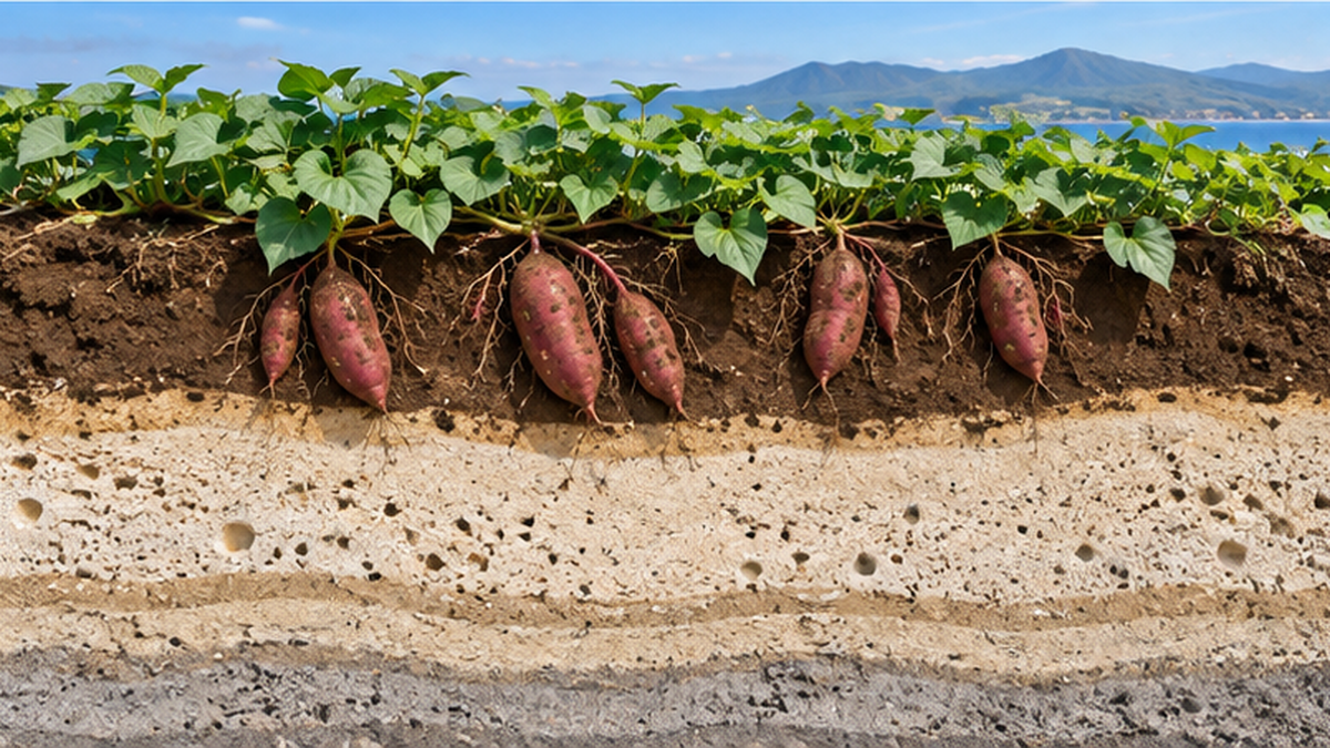
Key points about Shirasu soil
- Drains too well, resulting in low water retention
- Low in nutrients, unsuitable for crops that thrive on rich fertilizer
- Can offer favorable conditions for drought-tolerant crops and root vegetables
The turnaround from a "waterless wasteland"
Kasanohara Plateau, a representative part of the Shirasu plateau, was long considered unsuitable for agriculture because irrigation water could not be secured, remaining so until the Taisho era. The turning point came with the development of irrigation facilities from the postwar period onward; as channels drawing from groundwater and dams were built, it became possible to grow not just sweet potatoes but tea, vegetables, and flowers as well. The process by which land long called a "wasteland" transformed into a diversified agricultural region through infrastructure development is a symbolic example of the relationship between volcanic ash soil and human effort.
Disaster-prevention challenges Shirasu soil faces
Because Shirasu is coarse-grained and prone to collapse, it is also known as a geology susceptible to slope failure and debris flows during heavy rain. Alongside its use as farmland, preparing for slope disaster risk during heavy rainfall is an important regional challenge, and efforts such as building erosion-control dams and establishing evacuation systems are underway. Volcanic ash soil embodies both agricultural blessing and disaster risk — a geology truly characteristic of a volcanic country.
Crops beyond sweet potatoes
With irrigation facilities now developed, today's Shirasu plateau supports diverse agriculture beyond sweet potatoes, including tea, livestock feed crops, flowers, and open-field vegetables. Livestock farming in particular thrives, taking advantage of the plateau's vast flat land for beef cattle grazing and raising, forming one of the foundations that made Kagoshima Prefecture a leading livestock-producing region. The constraint of poor land became, in this case, a path toward diversified farm management.
Shirasu and life in southern Kyushu
Shirasu is used for more than agriculture; it also serves as a construction material, horticultural soil, and deodorizing/humidity-regulating material. Its porous structure, valued for its balance of air permeability and water retention, has led to efforts to reuse volcanic ash itself as a resource. It is intriguing that soil once called a "wasteland" is now finding new value beyond agriculture.
How irrigation projects diversified agriculture
In areas like Kasanohara Plateau and central Kimotsuki, national agricultural water-use projects developed field irrigation facilities, enabling stable farming less affected by weather. Before irrigation equipment became widespread, harvests of crops other than sweet potatoes were heavily affected by every drought, but a stable water supply enabled a shift toward higher-value items such as vegetables, flowers, and feed crops. Even without the soil itself changing, water infrastructure development greatly expanded agricultural options.
Three turning points that transformed farming on the Shirasu plateau
- Edo period: The spread of sweet potato cultivation opened a path in wasteland
- Postwar to high-growth era: Field irrigation facility development in earnest
- Present day: Toward diversified agriculture alongside disaster prevention
The Blessings of Eruptions: How Volcanic Ash Nurtures Soil
Volcanic ejecta causes damage to farmland immediately after an eruption, but as it weathers and turns into soil over a long period, it supplies inorganic nutrients such as potassium and phosphorus that are essential for plant growth. This has also nurtured genetic resources of crops adapted to environments unique to volcanic regions.
Volcanic ash soil agriculture around the world
The benefits of volcanic ash soil are not limited to Japan. Regions around major volcanoes worldwide — such as Java in Indonesia and the foothills of Mt. Vesuvius in Italy — have long been known as production areas for grains, orchard fruit, and wine grapes, and the fertility of volcanic soil is valued as an agricultural resource shared across the world.
The inorganic nutrients found in volcanic ash
Volcanic ash contains inorganic nutrients essential for plant growth, such as potassium, calcium, and magnesium, which gradually dissolve into the soil as weathering progresses. While not supplied in large amounts all at once, each new eruption brings fresh nutrients that help maintain the soil's long-term nutrient balance. In some rice-farming regions, ashfall has even been reported to contribute to soil improvement in paddy fields — a reminder that the story cannot be told simply in terms of "damage."
Biodiversity and agricultural genetic resources near volcanoes
Volcanic regions face harsh conditions such as eruptions, high temperatures, and poor nutrients, yet they have also nurtured unique plant communities adapted to these conditions. Some of these wild plants carry genetic traits resistant to drought and poor nutrients, drawing attention from agriculture as resources for breed improvement. It is an interesting paradox that the unstable environment of a volcano can, conversely, nurture diverse ecosystems and agricultural resources.
Agricultural use of geothermal areas
Volcanic activity brings benefits to agriculture not only through soil but also through geothermal heat. Greenhouse cultivation using hot spring heat has long been practiced around volcanoes in Kyushu and Tohoku, allowing year-round cultivation of vegetables and flowers while keeping winter heating costs down. It is an often-overlooked but important point that a single natural phenomenon — volcanism — supports agriculture through multiple channels: soil and geothermal heat.
Linking geothermal power with agriculture
In recent years, efforts to reuse waste heat from geothermal power generation for greenhouse cultivation and aquaculture — known as "geothermal cascade use" — have been advanced in various regions. The idea of using volcanic activity as an energy source not just for power generation but also, in stages, for agriculture and fisheries is drawing attention as a resource-circulation model unique to volcanic countries. Alongside the blessing of soil, volcanoes are increasingly becoming a presence that supports agriculture through energy as well.
Volcanic soil as a foundation for wine regions
Looking abroad, the foothills of Mt. Vesuvius and the area around Mt. Etna in Italy are known as renowned wine-grape production areas that take advantage of volcanic soil's excellent drainage and rich mineral content. The distinctive flavor produced by volcanic ash soil is prized among wine enthusiasts as "minerality," an example of how a shared volcanic geological background produces a different kind of agricultural character than in Japan.
The Risks of Eruptions: Ashfall Damage and Disaster-Prevention Farming
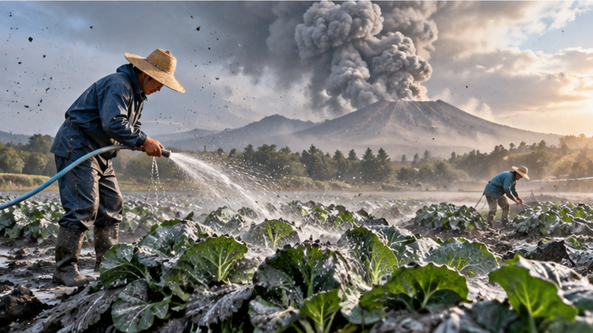
Behind the blessings of volcanic ash soil lies a history of repeated damage with every eruption. Sakurajima in Kagoshima remains an active volcano to this day, and in the great Taisho-era eruption of 1914, surrounding farmland suffered catastrophic damage and crops were nearly wiped out entirely.
Impact on leafy crops
Ashfall settles on leaf surfaces, blocking sunlight and inhibiting photosynthesis. Crops that use their leaves, such as tea and vegetables, are especially prone to delayed growth when covered in ash. Around Sakurajima, daily countermeasures such as washing and switching to greenhouse cultivation continue to this day.
The disaster-prevention farming program
Since 1975, Japan's Ministry of Agriculture, Forestry and Fisheries has led a "disaster-prevention farming program for areas around active volcanoes," promoting the selection of ash-resistant varieties and the development of protective facilities. This program helped halt the decline of agriculture around Sakurajima, and production of specialty crops such as Sakurajima radish and Sakurajima mandarin continues.
Preparing for ashfall
- Check ashfall amount and range in advance using the Japan Meteorological Agency's "ashfall forecast"
- Introduce greenhouse cultivation and washing equipment
- Select ash-resistant varieties and cultivation systems
Ashfall forecasting as a scientific safeguard
Since March 2015, the Japan Meteorological Agency has provided "ashfall forecasts" that include not just the areas where ash will fall but also the amount expected to accumulate. By predicting the range and amount of ashfall up to several hours after an eruption, these forecasts give farmers material for deciding on responses such as harvesting early or setting up protective sheeting. In the face of eruptions — a natural phenomenon that is difficult to predict — efforts to minimize damage through scientific information have steadily accumulated.
Sakurajima radish and mandarin: specialty crops that endured
Sakurajima radish, known as one of the largest daikon radishes in the world, and Sakurajima mandarin, said to be among the smallest citrus varieties, are specialty crops whose cultivation techniques were honed under the harsh, repeated conditions of ashfall. Variety selection and cultivation improvements under the disaster-prevention farming program form the foundation supporting these regional brands. Building a unique agricultural culture while coexisting with eruption risk is an example of the resilience of agriculture in volcanic Japan.
Shared challenges with other volcanic regions
Agricultural damage from ashfall and disaster-prevention measures are challenges shared not only by Sakurajima but also by areas around other active volcanoes across Japan, such as Mt. Unzen-Fugen, Mt. Aso, and Mt. Asama. While climate and crop mix differ by region, the basic approach to countermeasures — using ashfall forecasts, introducing ash-resistant varieties, and developing disaster-prevention farming facilities — is shared. The fact that knowledge on volcanic disaster countermeasures has been accumulated and shared across regions is also a feature of Japan's volcanic disaster prevention.
Cooperation between residents and farmers
Ashfall countermeasures are not the work of farmers alone; local governments, meteorological observatories, research institutions, and local residents work together to advance them. In municipalities around Sakurajima, evacuation plans tied to volcanic alert levels also incorporate protection measures for farmland and agricultural facilities, and a framework is being built to consider disaster prevention and agricultural promotion together.
Effects on fisheries and coastal environments
The effects of ashfall are not limited to farmland. When volcanic ash flows into coastal waters via rivers, it can temporarily increase seawater turbidity and affect aquaculture and coastal ecosystems. In Kinko Bay near Sakurajima, fishery workers closely monitor water quality and fishing ground conditions with every eruption, and coexisting with the volcano remains an important challenge not only for agriculture but for the fishing industry as well.
Ashfall's short-term effect on soil chemistry
Newly fallen volcanic ash can, depending on the type of eruption, contain alkaline substances that temporarily change soil pH. Because sudden pH changes affect root nutrient uptake, soil diagnosis after ashfall and, if necessary, applying soil-improvement materials are important for minimizing damage. Even volcanic ash that serves as a nutrient source in the long run requires careful handling on farmland immediately after it falls.
Living with Volcanic Ash Soil: Applications in Modern Agriculture
Modern soil diagnostic technology can now measure the phosphate absorption coefficient of Kuroboku soil and derive an appropriate amount of fertilizer accordingly. Because excessive fertilization leads to environmental burden and increased costs, precise fertilization design that accounts for each region's soil characteristics is now emphasized. In the same spirit of geological blessing, the spring water among Japan's "100 Famous Waters", which emerges after rainwater seeps through volcanic ash plateaus over long periods, is another good example of the connection between soil and geology.
The importance of understanding each soil's individuality
The examples of Kuroboku soil and the Shirasu plateau show that agriculture cannot be discussed through a simple binary of "poor soil" versus "fertile soil." Understanding each soil's weaknesses and choosing suitable crops and improvement methods is how Japanese agriculture has turned the constraints of being a volcanic country into strengths throughout its history.
Volcanic ash soil in an age of climate change
In recent years, the increase in concentrated heavy rainfall has drawn attention to a new risk: the low water retention and erosion susceptibility of volcanic ash soil. While Kuroboku soil and Shirasu drain well, their topsoil can wash away rapidly during heavy rain, sometimes leading to farmland degradation and sediment inflow into rivers and coastal areas. Soil management is becoming important not merely as a technique to boost yields but as a climate change adaptation measure.
The future of agriculture living alongside volcanoes
The history surrounding Japan's volcanic ash soils is a process of gradually turning demanding natural conditions into usable resources through wisdom, technology, and a long dialogue with the land. New technologies such as satellite and drone-based soil monitoring and AI-driven precision fertilization are extensions of this long accumulation. The agricultural wisdom that has turned the handicap of being a volcanic country into a blessing will likely continue to be passed down in new forms.
A useful perspective for home and community gardens too
The properties of Kuroboku soil matter not only for large-scale agriculture but also for home and community gardens. When starting a home garden in a Kuroboku-soil area such as the Kanto Loam region, applying a balanced mix of compost, dolomite lime, and phosphate-containing fertilizer — with the soil's poor phosphate availability in mind — becomes a key factor determining harvest yield. Understanding the origins of the soil close to home is a first step toward improving cultivation success, regardless of scale.
How to look up soil information
You can check what type of soil covers your area or field using web mapping services such as the "Japan Soil Inventory" published by NARO (the National Agriculture and Food Research Organization). Understanding the soil type and characteristics of a region in advance can improve the precision of fertilization design and crop selection, serving as an information base useful from home gardening to full-scale farming.
The role research institutions have played
Long-term research by public institutions such as NARO has greatly contributed to clarifying the properties of Kuroboku soil and establishing fertilization techniques. The development of nationwide soil maps classifying and charting soils, along with the establishment of soil diagnosis standards, forms the foundation that lets farmers understand their own fields and design appropriate fertilization. Research achievements in the hard-to-see world "underground" quietly support daily agriculture — a fact deserving of wider recognition.
A consumer's perspective on Kuroboku soil
Few people, when picking up vegetables and fruit at the supermarket, stop to consider what kind of soil they were grown in. Yet open-field vegetables grown in Kuroboku soil regions and sweet potatoes cultivated on the Shirasu plateau embody unique cultivation techniques and variety-selection efforts accumulated to overcome soil constraints. Paying attention to the soil of a growing region can also be a way to appreciate the local history and farmers' effort behind agricultural products.
The next step in the story of volcanoes and soil
Research into volcanic ash soil is expanding beyond simply improving agricultural productivity, into new themes such as soil carbon storage under climate change and the design of eruption-resistant agricultural infrastructure. The humus abundant in Kuroboku soil also plays a role as a carbon reservoir, and it has been suggested that appropriate soil management could help curb greenhouse gas emissions. The agricultural wisdom that has continually confronted the natural conditions arising from Japan's fate as a volcanic archipelago is beginning to take on new value in its application to future environmental challenges.
Summary of this article
- Kuroboku soil is rich in humus, but allophane locks up phosphate, making fertilization design essential
- The Shirasu plateau turned poor soil into a strength through sweet potato cultivation
- Eruptions bring both damage and blessings to agriculture — a dual nature
- Understanding soil properties is the foundation of sustainable agriculture
References and Sources
- NARO, "Volcanic Japan and Soil Fertilizer Science" – An explanation of the distribution and properties of Kuroboku soil
- Japan Soil Inventory (NARO), Kuroboku soil – Primary source on the classification of Kuroboku soil
- Ministry of Agriculture, Forestry and Fisheries, "Kids' Q&A: Sweet Potatoes on Kagoshima's Shirasu Plateau" – On the relationship between the Shirasu plateau and sweet potato cultivation
- Kagoshima Prefecture, "Ashfall Countermeasures: Preventing Crop Damage from Active Volcanic Eruptions" – Sakurajima ashfall countermeasures and disaster-prevention farming programs
- Japan Meteorological Agency, "Ashfall Forecast" – How ashfall amount and range forecasting works
- AIRIES, "Volcano-Originated Services for Agriculture," by Shuntaro Hiradate – Research on the benefits volcanic soil brings to agriculture
- Cabinet Office, "Japan's Volcanoes vol.01: Sakurajima" – Sakurajima's volcanic activity and disaster-prevention information
※ Listed in order of reliability: government/academic institutions > peer-reviewed papers > specialized organizations > trusted media