⚡ In short
Dugongs don't just nibble seagrass leaves — they dig up the rhizomes underneath, leaving behind roughly 30cm-wide "feeding trails" across the meadow. This unique grazing behavior helps researchers track a species on the brink of extinction in Okinawa, while shaping the seagrass ecosystem itself.
On the shallow seas around Okinawa, you can sometimes find strips of gouged-out seabed running roughly 30cm wide, one after another. Seagrass leaves chewed away, sometimes down to the rhizomes beneath — this is a "feeding trail", the trace a dugong leaves behind after eating.
The dugong is a marine mammal that, unusually, feeds almost exclusively on seagrass, much like a land-based herbivore grazes on grass. Beyond simply eating leaves, it has a distinctive feeding behavior: using its snout to dig up nutrient-rich rhizomes along with the leaves.
Because so few individuals remain, actually spotting a dugong is difficult. That's exactly why the feeding trails left in seagrass meadows are such valuable clues to their presence — researchers now combine drones and DNA analysis to trace them. This article looks at the science behind how dugongs eat, and what that means for the seagrass ecosystem itself.
What you'll learn in this article
- Why dugongs dig up seagrass rhizomes and roots, not just the leaves
- How "feeding trails" form in seagrass meadows and how researchers use them
- Differences in feeding trail, sighting, and fecal DNA reports between Okinawa and the Sakishima Islands
- How dugong grazing affects ecosystem services like blue carbon storage
- How UAV imaging and AI are being used to search for dugongs
The Dugong: A Marine Mammal Adapted to Grazing
The dugong (Dugong dugon) is the only living species in the family Dugongidae, a marine mammal related to manatees. Adults reach about 3 meters in length and weigh 300–400kg.
Unlike whales or dolphins, which feed on fish or zooplankton, the dugong's defining trait is that it feeds almost exclusively on seagrass — earning it the nickname "sea cow" in English. Among marine mammals, only dugongs and manatees, members of the order Sirenia, are fully herbivorous, occupying an ecological niche entirely distinct from cetaceans or seals and sea lions.
Just as land herbivores trace back through their own evolutionary lineage, the dugong's ancestors are thought to have evolved from land-dwelling plant-eating mammals, gradually adapting over tens of millions of years to a fully aquatic life. Fossil records suggest dugong relatives have depended on shallow seagrass meadows for tens of millions of years — a lineage whose fate has always been tied to this particular ecosystem.
Global Range and Australia's Population
Dugongs are widely distributed across tropical and subtropical coasts of the Indian Ocean and western Pacific, ranging from East Africa and the Red Sea to the Persian Gulf, India, Southeast Asia, and northern Australia. The largest population is concentrated in Australia, whose coastal waters are estimated to hold around 166,000 dugongs, making it one of the last major strongholds for the species.
By contrast, the northern limit of the dugong's range is Japan's Ryukyu Islands, where the resident population is an extremely isolated, small group relative to the species' overall distribution. Viewed from the core range in Australia and the Indian Ocean, the Ryukyu population is a "frontier group" cut off from the main population — considered highly vulnerable in both genetic diversity and numbers.
Body Structure and Lifespan
The dugong's body is streamlined, with front limbs modified into flippers and hind limbs reduced entirely, replaced by a dolphin-like, crescent-shaped fluked tail. The skin is thick and grayish-brown. Eyesight is poorly developed, but dense sensory bristles (vibrissae) around the upper lip are thought to help it locate seagrass rhizomes buried in the sand.
Dugongs can live around 70 years in the wild and typically reach sexual maturity around age 10. Calving intervals are long — often several years apart — and a female usually gives birth to just one calf at a time. This slow reproductive rate is one reason why, once a population declines, recovery takes an extremely long time.
Calves nurse from their mothers for about 1.5 to 2 years while gradually learning to feed on seagrass before becoming independent. During this period, mother and calf stay very close together as they move through the meadow, which is why clustered feeding trails are sometimes found together. In Okinawa's small population, the presence of a mother-calf pair is itself a critical observation for the population's future.
Dugong Status on the IUCN Red List
- Globally: Listed as "Vulnerable (VU)" on the IUCN Red List
- East Asia (including Japan's waters): Regionally assessed as equivalent to "Critically Endangered"
- Around Okinawa: Estimated fewer than 10 mature individuals
- Australian coast: An estimated 166,000 individuals, one of the world's largest populations
Digging Up Seagrass: The Dugong's Unique Feeding Style
The most distinctive trait of dugong feeding behavior is that it digs up not just the leaves but the underground rhizomes of seagrass. Seagrass, an angiosperm like land grasses, spreads its rhizomes through sandy or muddy seabeds to form meadows. These rhizomes store nutrients such as starch, making them a more energy-efficient food source than the leaves alone.
To put it in terrestrial terms: eating only leaves would be like a rabbit nibbling the tips of grass, while a dugong's feeding is closer to harvesting root vegetables by digging them up, soil and all. This "excavation-style" feeding means the seagrass loses not just its above-ground growth but the very rhizomes it needs to regrow — a significant impact on the meadow.
Dugongs press their snout against the seabed and use sensory bristles on the upper lip along with a muscular mouth to pull seagrass out by the roots. This feeding style differs from manatees and is considered a specialization unique to dugongs. Daily intake is estimated at about 7% of body weight, meaning a 400kg individual would eat roughly 28kg of seagrass per day.
What Okinawa's Stomach Content Surveys Reveal
A wide-area survey of dugongs and seagrass meadows conducted by Japan's Ministry of the Environment found that seagrass made up 95.5% of stomach contents in individuals examined around mainland Okinawa, with leaves accounting for 52.2% and rhizomes/roots for 43.2%. The fact that nearly half consists of rhizomes and roots supports the idea that dugongs actively dig rather than simply grazing the surface leaves.
This data came from analyzing the stomach contents of individuals that died from bycatch or were found stranded, not from capturing and dissecting live animals. In dugong ecology research, where the species is so rare, analysis of these "opportunistically obtained samples" provides invaluable clues.
| Seagrass part | Share of stomach contents | Main nutritional role |
|---|---|---|
| Leaves | 52.2% | Photosynthetic tissue; fibrous but digestible |
| Rhizomes/roots | 43.2% | Storage tissue; high in energy density |
| Other (algae, etc.) | Under 4.5% | Likely incidental, non-seagrass material |

Preferred Seagrass Species
Okinawa's meadows contain a mix of seagrass species, including Thalassia hemprichii, Halophila ovalis, and Enhalus acoroides. Dugongs tend to favor species with thinner leaves and softer rhizomes, which is thought to cause feeding trails to form unevenly depending on the species composition of a given meadow. Species that are nutrient-rich and easier to digest appear to be preferred over larger species with tougher leaves.
This selective feeding, in turn, affects the species composition of the meadow itself. Species favored by dugongs may temporarily decline while less-preferred species relatively increase — which is why meadow monitoring needs to track not just overall seagrass cover but also shifts in the proportion of each species.
Seasonal Changes in Feeding Behavior
Seagrass growth is influenced by water temperature and daylight hours, so meadow conditions shift with the seasons. In summer, vigorous growth and abundant new shoots make foraging easier for dugongs, while in the cooler winter months seagrass growth slows and overall meadow biomass tends to decline. These seasonal shifts are thought to affect how often and where feeding trails appear, underscoring the importance of year-round, continuous surveys.
How Dugong and Manatee Feeding Differs
- Dugong: Feeds primarily on seagrass, digging up rhizomes (excavation-style)
- Manatee: Eats a wider range of freshwater and brackish aquatic plants, feeding mostly on leaves near the surface
- Dugongs have a dolphin-like, fluked tail; manatees have a paddle-shaped tail, reflecting different habitats
- Dugongs are fully marine, while manatees can also live in freshwater — another key ecological difference
How Feeding Trails Are Formed
After a dugong digs up and eats seagrass, it leaves behind a strip of bare seabed, or seagrass cropped down near the rhizomes, roughly 30cm wide and several meters long. Researchers call this a "feeding trail."
Feeding trails often run in straight or meandering lines through a seagrass meadow, believed to reflect the path a single dugong dug over a period of time. They are most often observed in tidal-flat-like meadows at low tide, or in shallow areas within reef flats.
Feeding trails broadly fall into two types: "deep trails," where the rhizome is thoroughly dug out, and "shallow trails," where only the leaves are cropped and the rhizome remains. The depth, width, and meandering of a trail likely vary with the individual's size and how long it spent feeding, and areas where multiple trails overlap are interpreted as likely "favorite feeding grounds" that are repeatedly used.
Trace Surveys for a Species Rarely Seen
Dugongs are wary and extremely rare, making it difficult to assess their presence through boat- or aircraft-based visual surveys alone. Japan's Ministry of the Environment and research institutions have therefore long relied on recording the distribution of feeding trails in meadows as a way to estimate whether dugongs are using a given area, without needing to directly observe an individual.
Aerial visual surveys are heavily affected by weather and sea conditions — rough seas or overcast skies make it difficult to spot dugongs underwater at all. Boat-based surveys also suffer from lower detection rates, since dugongs tend to avoid approaching vessels. By contrast, feeding trail surveys examine "stationary evidence" in the meadow, making them less weather-dependent and comparatively more reproducible.
Around mainland Okinawa, surveys have confirmed that dugongs enter meadows formed inside reef flats through gaps in the reef (channels), feeding in areas close to those channels. This means the location of feeding trails also offers clues about meadow topography and dugong migration routes.
How Feeding Trail Surveys Are Actually Conducted
Field surveys are timed to low tide, when the meadow is exposed. Surveyors walk the meadow, and upon finding a strip of cropped seagrass, record its GPS position along with the trail's width, length, direction, the surrounding seagrass species, and the depth of digging, all documented with photographs. Repeating surveys of the same area across seasons allows researchers to assess, from the frequency and location of feeding trails, how important that area is as a feeding ground for dugongs.
Because feeding trails gradually disappear as seagrass regrows, whether a trail is "found or not found" can vary greatly depending on survey timing. For this reason, researchers avoid drawing conclusions about dugong presence from a single survey, instead emphasizing the accumulation of data across multiple years and seasons to identify trends.

Limitations of Feeding Trail Surveys
- Trails disappear within weeks to months as seagrass regrows, so they only reflect "recent" use
- Risk of confusing disturbance after typhoons, or feeding traces from other marine animals (e.g., sea turtles), with dugong trails
- Trails alone cannot determine population size or identify individuals — must be combined with sighting records and DNA analysis
From Okinawa to the Sakishima Islands: What the Trails Reveal About Distribution
Mainland Okinawa was once considered Japan's primary dugong habitat, where sighting and feeding trail reports were concentrated. Recent research, however, shows that while sightings were centered around mainland Okinawa before 2019, the number of feeding trail discoveries has increased in the Sakishima Islands — including Miyako and Yaeyama — since 2020.
This shift may partly reflect worsening habitat conditions around mainland Okinawa due to development and increased vessel traffic, but it also coincides with survey efforts expanding into the Sakishima Islands, revealing feeding trails that had previously gone unnoticed. In other words, rather than dugongs having "increased" in the Sakishima Islands, it's also possible that expanded surveys are simply revealing areas that were already being used.
According to a report by the Okinawa Times, a Ministry of the Environment habitat survey confirmed feeding trails across five sea areas in Okinawa prefecture, suggesting the Sakishima Islands may serve as a consistent feeding ground.
Fecal DNA Analysis: A New Approach
Visual sightings and feeding trails alone can't identify individuals or their genetic origins. Recently, researchers have begun analyzing DNA from feces collected near seagrass meadows to determine which population a dugong using a given area belongs to. In one case, fecal DNA collected from two distant sites — Irabu Island in the Miyako Islands and Kushi on mainland Okinawa — confirmed that dugongs had actually visited both locations.
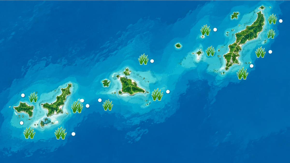
Combining these methods, some studies suggest that the population around mainland Okinawa is on a trajectory toward local extinction over the coming decades, while other evidence continues to accumulate showing that dugongs are still present across the Ryukyu Islands as a whole.
The Difficulty of Judging "Extinction"
Debate continues over whether the long-declining population around mainland Okinawa should be considered locally extinct, or close to it. One study analyzes the isolated Okinawa Island population as being on a trajectory toward local extinction, while other researchers have raised concerns about the political and conservation implications of rushing to such a judgment. This question matters directly for policy decisions about where and how broadly to prioritize dugong protection, making the interpretation of scientific survey results itself significant.
Differing Survey Results: Okinawa vs. the Sakishima Islands
- Mainland Okinawa: Sightings were the main evidence before 2019; confirmation rates have declined in recent years
- Sakishima Islands (Miyako, Yaeyama, etc.): Feeding trail discoveries have trended upward since 2020
- Fecal DNA: Confirmed dugong-origin feces at two distant sites (Irabu Island and Kushi)
How UAVs and AI Are Changing Feeding Trail Surveys
Searching vast meadows on foot for feeding trails is labor-intensive and prone to oversight. To address this, researchers are increasingly using UAVs (drones) to capture aerial images of meadows and automatically detect feeding trails from the images.
Foot surveys are constrained by tides, weather, and physical stamina, limiting how much area can be covered at once and requiring long hours with multiple surveyors. UAVs can cover a wide area in a short time around the low-tide window, and recorded images can be reviewed and verified repeatedly afterward. Accumulating this imagery also enables quantitative comparison of changes at the same site over time.
A method using deep neural networks to automatically extract dugong feeding trails from UAV images of tidal-flat seagrass meadows has been developed, demonstrating the potential for wide-scale, efficient monitoring.
What Technology Is Making Possible
Traditionally, surveys were limited to areas researchers could walk or reach by boat, but UAVs make it possible to cover wide areas in a short time regardless of tide level or terrain constraints. Combined with AI-based automatic detection, this reveals patterns that were previously hard to grasp, such as seasonal fluctuations in feeding trails or which parts of a meadow are used most intensively.
Deep learning models that automatically detect feeding trails from images are trained on large sets of labeled data — images of feeding trails paired with their locations — potentially allowing them to detect faint trails or ones hidden beneath algae that a human eye might miss. That said, factors like seabed substrate, light reflection, and wave patterns can introduce noise, so continued model refinement and double-checking through field surveys remain necessary.
What Technology-Based Surveys Are Revealing
- Feeding trails are unevenly distributed within meadows, tending to concentrate near channels
- A link between meadow recovery after disturbances like typhoons and the reappearance of feeding trails
- Strengthened monitoring in previously under-surveyed areas such as the Sakishima Islands
Potential for Citizen Science
Combining UAV aerial imaging with AI analysis is a method that could extend beyond specialist institutions to collaborations with local dive shops, fishers, and citizen science frameworks. In Okinawa, efforts already exist to broadly collect dugong sighting reports from the public, and momentum is building to combine expert surveys with citizen-provided information to build a wider, more frequent monitoring system.
How Dugong Grazing Shapes the Seagrass Ecosystem
Dugongs are not simply consumers that deplete seagrass from a meadow. Moderate grazing disturbance is known to encourage the regrowth of young seagrass shoots, influencing the productivity and species composition of the meadow overall. In this sense, the dugong also plays an "engineering" role in reshaping the meadow ecosystem.
| Aspect | Meadow with dugongs present | Meadow without dugongs (general tendency) |
|---|---|---|
| Seagrass turnover | Regular digging tends to encourage regrowth of young shoots | Older growth may accumulate, slowing turnover |
| Species composition | Softer, more nutrient-rich species tend to dominate | Less disturbance may allow species composition to remain more stable |
| Organisms using the habitat | Bare patches from feeding trails can become habitat for some benthic species | Fewer bare patches; seagrass cover tends to stay higher |
Seagrass meadows serve as spawning grounds and nursery habitat for fish and shellfish, while also gaining recognition as "blue carbon" ecosystems that lock away carbon in seabed sediments over long periods. Under international wildlife frameworks such as the Convention on the Conservation of Migratory Species of Wild Animals (CMS), there are ongoing calls to better quantify the carbon storage of seagrass meadows used and managed by dugongs, to strengthen the case for their conservation and restoration.
The "blue carbon" stored by seagrass meadows is drawing attention as a climate mitigation mechanism alongside "green carbon" stored by terrestrial forests. When dead seagrass tissue and roots become buried in oxygen-poor seabed mud, decomposition slows dramatically, locking carbon into the sediment for long periods. While dugong grazing removes some seagrass, it may also help sustain healthy meadow turnover — and by extension, this long-term carbon storage function.

What Australia's Case Shows About Climate Change
Even the Great Barrier Reef, home to the world's largest dugong population, has reported declining dugong numbers linked to seagrass loss and climate change. A 2022 aerial survey estimated a long-term decline of 2.3% per year in the urban coast dugong population since 2005. This illustrates how seagrass meadow loss can affect even large dugong populations across a wide area.
In the Great Barrier Reef, major flood events carrying turbid runoff and rising sea temperatures have severely damaged seagrass meadows, driving fluctuations in dugong distribution and numbers over time. Even in Australia, with its far larger population, the relationship between losing feeding grounds and population decline holds — a cautionary reference point underscoring the importance of meadow conservation for Okinawa's much smaller population. For more on the state of seagrass meadows themselves, see our articles on seagrass meadow biodiversity and seagrass meadow restoration efforts.
The Dugong as an "Ecosystem Engineer"
In ecology, organisms that reshape their physical surroundings through their own behavior are sometimes called "ecosystem engineers." Dugong grazing, through digging, is thought to periodically reset parts of the meadow and encourage new seagrass growth, helping maintain the age structure and species diversity of the meadow as a whole. This example of moderate disturbance sustaining ecosystem health closely parallels the role large herbivores play in terrestrial grasslands.
Efforts to Protect Okinawa's Dugongs
Based on accumulated sighting reports and habitat surveys, Okinawa Prefecture has identified key feeding grounds for dugongs and is advancing conservation measures. Japan's Ministry of the Environment has also continuously conducted meadow distribution surveys, dugong habitat surveys, and stomach content and genetic analyses since fiscal 1997. This long-term monitoring provides the foundation for evaluating recent changes in feeding trail distribution and fecal DNA results in a "compared to the past" context — capturing decades-long trends that a single year's survey cannot reveal.
Why Protecting the Meadow Itself Matters
Protecting the seagrass meadows that serve as dugong feeding grounds is essential to dugong conservation. These meadows face multiple threats, including land reclamation and water quality degradation from coastal development, physical damage from boat anchors, and decline due to rising water temperatures. Protecting a species like the dugong, which depends so heavily on a specific ecosystem, is inseparable from protecting that ecosystem as a whole. For a detailed look at the history and recent scientific evidence around dugong conservation, see our article on why the dugong became endangered.
Coexisting with Fisheries and Tourism
Many of the meadows dugongs rely on overlap with areas used for local fishing and leisure activities. Efforts to balance human activity with dugong conservation are being explored in various locations, including preventing bycatch and regulating vessel speed and anchoring near dugong feeding grounds. With Okinawa's population so small, each of these incremental measures directly affects whether the remaining population survives.
Globally, the main causes of dugong mortality include bycatch, vessel strikes, and habitat loss. Populations numbering in the hundreds or thousands can absorb some losses from these causes, but in a population like Okinawa's, with fewer than 10 mature individuals estimated, the death of even one animal could jeopardize the entire population's survival. This is what makes dugong conservation in Okinawa a particularly urgent issue.
Internationally, dugongs are also protected under frameworks such as CITES (the Convention on International Trade in Endangered Species of Wild Fauna and Flora) and CMS (the Convention on the Conservation of Migratory Species of Wild Animals), which support cooperative survey and conservation efforts among range states. Because Okinawa's population sits at the northern edge of the species' range, it holds significance not just for domestic policy but as an important reference point within this broader international conservation context.
What We Can Do
While dugong and seagrass research is largely the domain of specialist institutions, there are things travelers and local residents can be mindful of too. Avoiding shallow meadows when operating boats along the coast, reporting sightings to local authorities or research institutions, and participating in local seagrass conservation activities or beach cleanups all indirectly help support the environment dugongs depend on.
Article Summary
- Dugongs have a highly specialized feeding behavior among marine mammals, digging up seagrass rhizomes, not just the leaves
- The resulting "feeding trails" are a crucial clue for tracking a species rarely seen directly
- Feeding trail reports have expanded from mainland Okinawa to the Sakishima Islands in recent years, with fecal DNA analysis also aiding distribution studies
- Dugong grazing affects meadow ecosystems and blue carbon function, making conservation of the whole meadow essential
References
- Japan Ministry of the Environment: Wide-Area Survey of Dugongs and Seagrass Meadows (FY2001–2005 Summary) – Stomach content survey and meadow distribution survey around mainland Okinawa
- Japan Ministry of the Environment: Wide-Area Survey of Dugongs and Seagrass Meadows (FY2002) – Feeding patterns within reef-flat meadows
- Okinawa Prefecture Official Website: Dugong Conservation and Sighting Reports – Okinawa Prefecture's habitat surveys and feeding ground selection efforts
- Okinawa Times: "Feeding Trails of the Endangered Dugong Found in Five Sea Areas of Okinawa" – Report on the Ministry of the Environment habitat survey and the potential for the Sakishima Islands as a consistent feeding ground
- Scientific Reports: "Fecal DNA analysis...re-expanded a known distribution of dugongs in Ryukyu Islands" – Confirming dugong distribution across the Ryukyu Islands via fecal DNA analysis
- Scientific Reports: "Trajectory to local extinction of an isolated dugong population near Okinawa Island" – Study on the trajectory toward local extinction of the mainland Okinawa population
- PMC: "Deep neural networks based automated extraction of dugong feeding trails from UAV images" – Research on automated feeding trail detection using UAV imagery and deep learning
- WWF Japan: About Dugongs – Basic information on dugong ecology, distribution, and conservation
- Great Barrier Reef Outlook Report 2024: "Dugongs" – Great Barrier Reef dugong population survey results
* Listed in order of reliability: Government/academic institutions > peer-reviewed papers > specialist organizations > reputable media