⚡ In short
Japan loses about 160 hectares of land to coastal erosion every year, and a major cause is sediment trapped behind dams. Learn how the "journey of sand" from mountains to the sea sustains beaches and tidal flats, and how sediment flushing, bypass tunnels, and dam removal are bringing sand back.
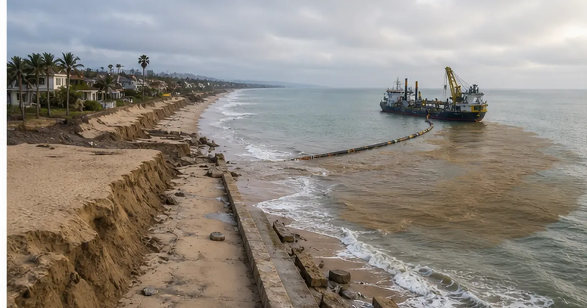
Japan's beaches are wasting away — quietly, but steadily. Roughly 160 hectares of national land are lost to coastal erosion every year, according to estimates in materials from the Ministry of Land, Infrastructure, Transport and Tourism (MLIT). One of the biggest reasons is that dams built upstream trap sediment from the mountains, choking off the supply of sand to the sea.
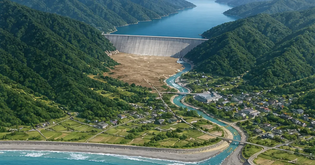
A beach is the final destination of a long journey of sediment: mountains crumble, rivers carry the debris, and waves push it back ashore. Since the 20th century, however, countless dams and weirs have been built on Japan's rivers, and much of that sediment now settles to the bottom of reservoirs. Sakuma Dam on the Tenryu River held about 140 million cubic meters of sediment as of March 2021 — more than 40% of its total storage capacity — while the shoreline of the Enshu-nada coast downstream keeps retreating. The impact reaches beyond beaches to the estuarine tidal flats that serve as nurseries for marine life.
This article explains the basics of how beaches and tidal flats are sustained by sediment, the mechanics of reservoir sedimentation, global cases such as the Nile Delta, and the challenge of "returning sediment to the sea" — flushing, bypass tunnels, sediment placement, and dam removal — based on public data from MLIT and peer-reviewed research.
What you will learn in this article
- How beaches and tidal flats are maintained by the "journey of sediment from mountains to the sea" (sediment routing systems and longshore drift)
- How dam sedimentation leads to coastal erosion and shrinking tidal flats, with Japanese examples such as Sakuma Dam and the Enshu-nada coast
- The reality of "sediment starvation" around the world, from the Nile Delta to the Colorado River
- Japan's front-line technologies for returning sediment to the sea: flushing gates, sediment bypass tunnels, and sediment placement
- What the removal of Arase Dam (Kuma River) and the Elwha River dams (USA) brought back to estuaries and the sea
- The concept of integrated sediment management across whole watersheds — and what each of us can do
Japan's Disappearing Beaches — 160 Hectares Lost Every Year
Japan's coastline stretches about 35,000 kilometers, one of the longest in the world — yet its beaches are vanishing fast. According to the MLIT River Bureau document "Current State and Challenges of Coastal Erosion" (2006), nationwide shoreline surveys indicate that Japan loses about 160 hectares of land to coastal erosion every year. That is roughly 34 Tokyo Domes' worth of beach swallowed by the waves annually.
The same document reports that of the roughly 19,000 hectares of sandy beach nationwide, about 2,400 hectares — around 13% of the total — were already lost to erosion over a span of about 15 years. Coastal erosion is not a one-off event like storm waves from a typhoon; it is a chronic shrinking of the land that proceeds whenever the balance between sand "income" and "expenditure" breaks down.
The main culprit: a shortage of sediment supply
Waves and storm surge may be the first causes that come to mind. But what the national documents list first is a decline in the absolute amount of sediment flowing from rivers to the coast. Dam and weir construction, gravel extraction from rivers, and erosion-control works in the mountains have greatly reduced the sediment that rivers deliver to the sea. On top of that, ports, breakwaters, and other structures have severed the flow of sand along the shore (longshore drift), accelerating erosion locally.
- Tenryu River mouth and the Enshu-nada coast (Shizuoka Prefecture) — reduced sediment supply from upstream dams has pushed the shoreline near the river mouth back dramatically over recent decades
- Niigata coast (Niigata Prefecture) — affected by the Shinano River diversion channel and gravel mining, some sections have retreated more than 300 meters since the Meiji era
- Kujukuri Beach (Chiba Prefecture) — cliff-erosion control at its supply sources and fishing-port construction changed the flow of sand, and erosion is advancing at both ends of the beach
Losing beaches is not just a matter of scenery or swimming. A beach is a natural breakwater that breaks and absorbs the energy of incoming waves; a wide berm alone greatly weakens the force of waves reaching roads and houses behind it. Where the beach has wasted away, seawalls take the waves head-on during storms and fail more easily, forcing ever taller and stronger structures to be built. In other words, beach loss comes back to society as rising disaster-prevention costs. That is why the national government positions beach conservation as an element of "resilient coastal protection."
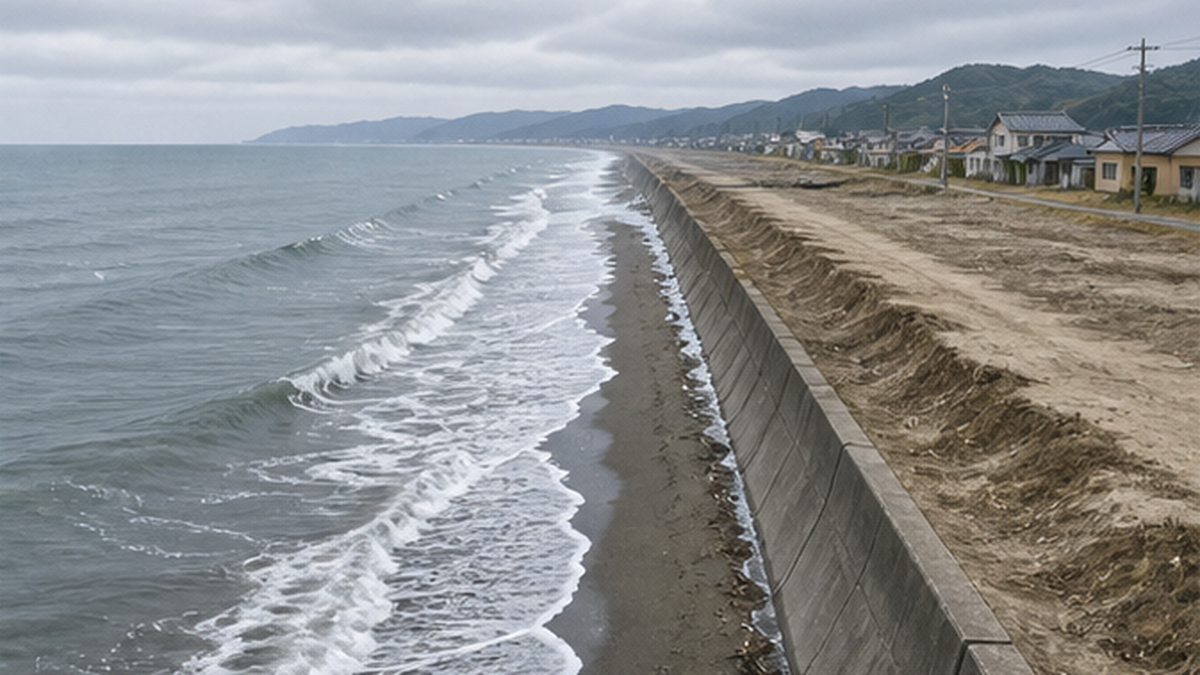
Coastal erosion is a "hard-to-notice disaster"
- Erosion often advances only a few meters per year, making the change hard to perceive in daily life
- When the beach disappears, the buffer that absorbs wave energy is lost, and storm surge and tsunami damage reach farther inland
- The impacts on tourism, fisheries, and ecosystems are large, and restoring a lost beach takes enormous time and money
Where Does Beach Sand Come From? A Long Journey from Mountains to the Sea
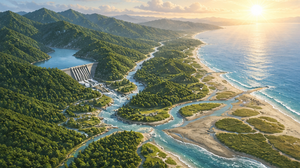
Where does beach sand come from in the first place? The answer is the mountains. Sediment produced as mountain rock weathers and collapses is washed from gullies into valleys and rivers with every rain, then carried downstream in bulk during floods. Once it exits the river mouth, waves and coastal currents transport the sand along the shore, building beaches, sandbars, and tidal flats. This continuous flow of sediment from the mountains to the coast is called a "sediment routing system" (ryūsakei in Japanese).
Rivers restock beaches with sediment
A beach may look static, but it is a dynamic landform where sand constantly comes and goes. Waves continually pull sand offshore and toss it back onto the shore, and every storm carves away part of the beach. Beaches have endured because rivers have delivered fresh sediment to the sea with every flood, replenishing what was lost. As explained by the National Institute for Land and Infrastructure Management (NILIM), beach maintenance comes down to a budget of "sediment supplied by rivers" versus "losses to waves." Cut off the income, and the beach wastes away like a household drawing down its savings.
What is easily overlooked is how long this journey takes. Sediment that collapses in the mountains needs decades to centuries to travel down the river and become part of a beach. Much of the sand we walk on today is "savings from the past," delivered by floods long ago. That is why beaches do not vanish immediately when a dam cuts the supply — and why countermeasures take just as long to show results. This time lag is the single greatest difficulty in responding to coastal erosion.
Longshore drift — the ocean's conveyor belt
Sand that reaches the river mouth does not stay there. Waves striking the shore at an angle generate a current that moves sand along the coast, carrying it for kilometers. This is longshore drift. The Enshu-nada coast was built from Tenryu River sediment spread east and west by longshore drift, and much of the sand of Kujukuri Beach was supplied by wave erosion of the cliffs at its two ends (such as Byobugaura). Every beach, in other words, is connected to distant rivers and cliffs by a "road of sand." Sever that road at any single point, and the effects ripple down the entire coast beyond it.
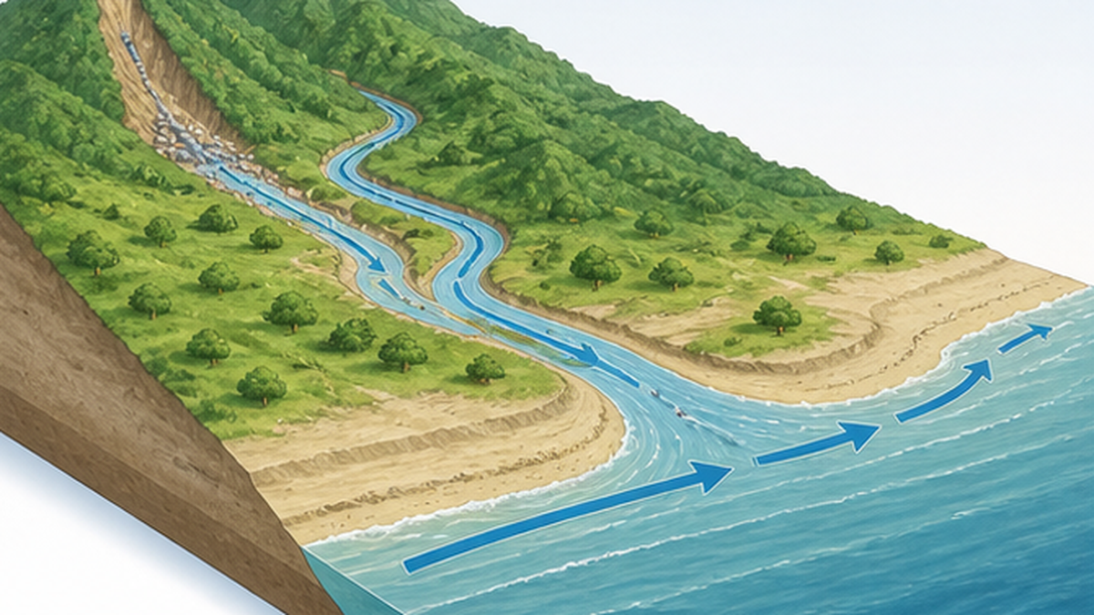
Key points
- Beach sand originates as mountain sediment, delivered to the sea by rivers with every flood
- Longshore drift moves sand along the coast, linking beaches together along a "road of sand"
- Even when supply is cut, beaches shrink slowly over decades — cause and effect are separated in time, making the connection hard to see
How Do Dams Trap Sand? The Mechanics of Reservoir Sedimentation
Dams store water — and, inevitably, sediment. When river water enters a reservoir, its velocity drops sharply. Because a river's capacity to carry sediment depends strongly on flow speed, the sand and gravel carried from upstream settle out the moment they enter the still water, piling up on the reservoir bottom. This is reservoir sedimentation. Coarse gravel settles at the upstream end of the reservoir while fine sand and mud accumulate near the dam body, sorted as if through a sieve.
Sakuma Dam — 40% of its storage capacity filled with sediment
The scale of the problem is epitomized by Sakuma Dam on the middle reaches of the Tenryu River (completed 1956, operated by J-POWER). As of March 2021 its accumulated sediment had reached about 140 million cubic meters — over 40% of its total storage capacity of roughly 327 million cubic meters. The Tenryu was once one of Japan's most sediment-rich rivers, fed by the Southern Alps upstream. With most of that sediment now trapped behind Sakuma and other dams, the supply to the Enshu-nada coast has plummeted, and MLIT Chubu Regional Development Bureau materials document striking shoreline retreat around the Tenryu river mouth.
Sakuma is no outlier. About 70% of Japan is mountainous, its geology young and fragile, its rivers steep — making the country one of the world's most prolific producers of sediment. Basins around the Central Alps and Southern Alps in particular receive heavy sediment inflows, and some dams have filled faster than planned. MLIT surveys and publishes sedimentation data for dams nationwide every year, and sediment management is now treated not as an issue of individual dams but as a national land-management challenge spanning dam networks and coastlines.
Crucially, sedimentation is a serious problem for the dams themselves, not just the coast. As a reservoir fills with sediment, it loses both the flood-control capacity that holds back floodwaters and the storage used for power generation and water supply. Passing sediment downstream thus protects the coast while also preserving dams as social infrastructure for future generations.
| Factor reducing sediment supply | What happens | Examples / notes |
|---|---|---|
| Sedimentation behind dams and weirs | Sediment settles in reservoirs and stops flowing downstream | Sakuma Dam (approx. 140 million m³ of sediment as of 2021) |
| Gravel extraction from rivers | Riverbed gravel is removed directly as construction material | Widespread during Japan's rapid-growth era; now heavily regulated |
| Erosion-control and bank-protection works | Sediment production from slopes and riverbanks itself declines | Necessary for disaster prevention; balancing with sediment management is the challenge |
| Ports and coastal structures | Longshore drift is interrupted and downdrift beaches waste away | Localized erosion downdrift of fishing ports and breakwaters |
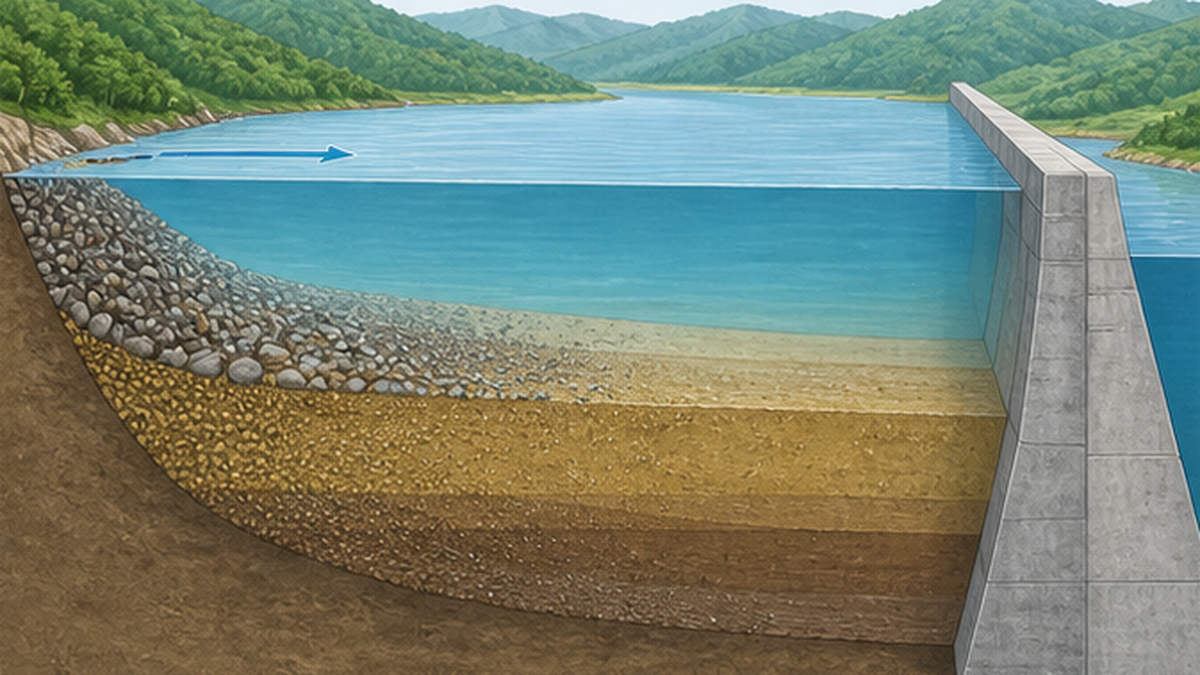
Sedimentation is also a "dam lifespan" problem
- Most dams are designed with sediment storage for 100 years, but inflows exceed projections at quite a few dams
- As reservoirs fill, flood-control and water-supply capacity declines, potentially affecting flood regulation
- Flushing sediment to extend the life of existing dams is considered cheaper and less environmentally damaging than building replacements
"Sediment Starvation" Is Happening Worldwide
Sediment trapping by dams is not unique to Japan. According to research published in the journal Science in 2005 by James Syvitski of the University of Colorado and colleagues, human activities such as agriculture increased the sediment carried by the world's rivers by about 2.3 billion tonnes per year — yet because reservoirs capture so much of it, the sediment actually reaching the ocean has fallen by about 1.4 billion tonnes per year. The cumulative total trapped in the world's reservoirs is estimated to exceed 100 billion tonnes. Researchers call this state "sediment starvation" and warn that deltas and coasts around the world are going hungry.
Humans have increased the sediment in rivers through soil erosion while simultaneously reducing the sediment that reaches the world's coasts through retention in reservoirs.
— paraphrased from the abstract of Syvitski et al. (2005), Science, vol. 308
The Nile Delta — after the Aswan High Dam
The most famous case is Egypt's Nile. The Aswan High Dam, completed in 1970, stores the annual flood in the vast Lake Nasser, enabling year-round irrigation and power generation. But the sediment the Nile once carried to the Mediterranean was almost completely trapped as well, and the Nile Delta — which had grown for millennia — flipped from accretion to erosion. Shoreline retreat on the order of tens of meters per year has been reported at the delta's Rosetta promontory, and combined with land subsidence and sea-level rise, the future of the low-lying delta — Egypt's breadbasket — is a growing concern.
The Colorado River — a great river that no longer reaches the sea
In the American West, the Colorado River's flow and sediment have been drastically reduced by giant dams such as Hoover and Glen Canyon along with large-scale water withdrawals, and years in which the river fails to reach its mouth at the Gulf of California (Sea of Cortez) have become the norm. The once-rich tidal flats and brackish wetlands of the Colorado River Delta have shrunk dramatically, taking habitat for migratory birds and fish with them. Since 2014 the United States and Mexico have conducted deliberate environmental releases known as "pulse flows" under a binational agreement, and vegetation and birdlife have shown recovery in parts of the delta.
The Yangtze — the Three Gorges Dam and a shrinking delta
The same story is unfolding in Asia. On China's Yangtze River, the Three Gorges Dam — which began impounding water in 2003 — and other dams across the basin have sharply cut the sediment reaching the river mouth. Studies report that the Yangtze's sediment delivery to the sea has fallen by roughly 70% compared with the 1950s–60s, and parts of the once-expanding tidal flats and submerged delta near the mouth have switched from accretion to erosion. With the megacity of Shanghai at the river mouth and vast tidal flats serving as an internationally important stopover for migratory birds, the decline in sediment supply is being watched closely for both disaster-prevention and ecological reasons.
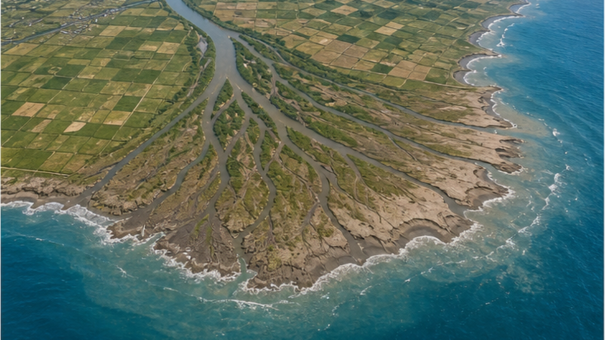
Global "sediment starvation" data (Syvitski et al. 2005 and others)
- Sediment reaching the world's oceans has fallen by about 1.4 billion tonnes per year due to trapping in reservoirs
- Cumulative sediment stored in the world's reservoirs is estimated at over 100 billion tonnes
- Impacts are greatest in the lower reaches of large rivers, where many deltas face subsidence, erosion, and salinization simultaneously
Beyond Beaches — Tidal Flats, Estuaries, and Marine Ecosystems
The consequences of reduced sediment supply go far beyond narrower swimming beaches. The sand and mud that rivers carry are the physical material supporting estuarine tidal flats, sandbars, and shallows — the "nurseries of marine life". When the supply declines, tidal flats are only eroded by waves and tidal currents, gradually thinning and deepening.
When tidal flats waste away, life unravels
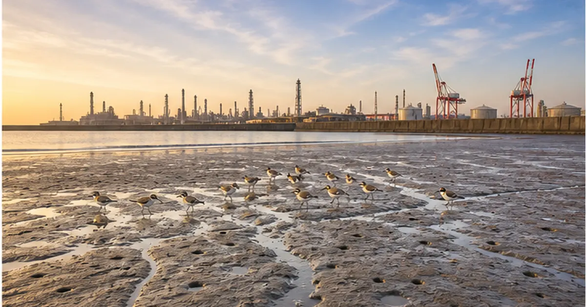
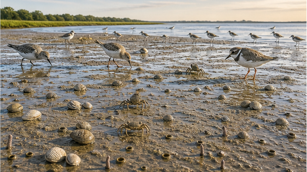
A tidal flat forms where fine sand and mud carried by a river settle near its mouth. Clams such as asari and hamaguri, polychaete worms, crabs, and mud shrimp live there at high densities, and the flats serve as stopover sites for migratory shorebirds — sandpipers and plovers — that feed on them. Tidal-flat organisms also filter seawater and purify it, so a wasting tidal flat translates directly into declining fishery resources and reduced water-purification capacity. Japan's tidal flats shrank greatly after the war through land reclamation, and the flats that remain are now under this less visible pressure of dwindling sediment supply. For more on how watersheds connect to the sea, including changing nutrient flows, see our article Where do nitrogen and phosphorus in the sea come from?.
Not just the "quantity" of sediment matters but also its "quality" — the mix of grain sizes. Fine mud and silt settle in calm estuaries to build tidal flats; coarser sand is carried by waves to build beaches; large gravel forms riffles on riverbeds. But because reservoirs sort and store sediment by grain size, the composition of what still flows downstream is itself altered. On coasts deprived of fine sand, beach sediment coarsens and the community of organisms changes. Protecting tidal-flat and beach ecosystems requires managing which grain sizes are passed downstream, and in what amounts — not simply releasing sediment.
The beach itself is an ecosystem
A beach is not merely a pile of sand. Loggerhead turtles can nest only on sandy beaches, and Japan's Pacific coast is a critical nesting ground for the North Pacific population. Ghost crabs and beach hoppers burrow in the sand, while coastal plants such as beach morning glory and kobomugi sedge stabilize the dunes. When a beach thins until waves reach the dunes, nests are washed away, the belt of coastal vegetation disappears, and the entire beach ecosystem contracts. Sea-level rise from global warming accelerates all of this. For future projections, see Will 90% of Japan's beaches disappear under rising seas?.
Ecosystem impacts of reduced sediment supply
- Shrinking, deepening tidal flats — habitat for clams and worms declines, and shorebirds lose feeding grounds
- Beach loss — nesting grounds for sea turtles, coastal plant communities, and beach fauna shrink
- Changes to river-mouth bars and shallows — brackish nursery habitat for juvenile fish is altered, affecting fisheries
- Reduced delivery of nutrients and organic matter that once traveled to the sea with the sediment
Returning Sediment to the Sea — Japan's Sediment Replenishment Technologies
So can the sediment accumulated behind dams be returned to the sea? Since the 1990s, Japan has adopted integrated sediment management — managing sediment across the entire routing system from mountains to sea — as national policy, and a range of technologies for letting sediment pass through dams has been put into practice. It is a field in which Japan is among the world leaders.
Flushing gates — the coordinated flushing of Dashidaira and Unazuki dams on the Kurobe River
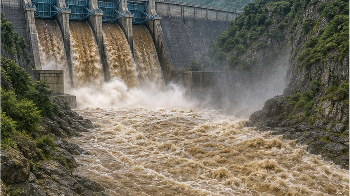
The Kurobe River in Toyama Prefecture drains such steep terrain that its sediment load is exceptionally heavy. Kansai Electric Power's Dashidaira Dam was the first dam in Japan built with sediment-flushing gates, operating them since 1991. After the completion of MLIT's Unazuki Dam downstream, "coordinated flushing" — both dams opening their gates simultaneously to pass sediment — began in 2001. The dams lower their water levels in time with natural floods, letting the flood's own power push sediment all the way to the sea; the annual operations and environmental monitoring results, including Toyama Bay, are published by MLIT's Hokuriku Regional Development Bureau. The first flushing in 1991, however, released mud that had accumulated and decomposed over years all at once, damaging downstream fisheries and prompting litigation. Learning from that experience, today's operations flush small amounts frequently — before too much builds up — under thorough environmental monitoring.
Sediment bypass tunnels — the Miwa Dam challenge
At Miwa Dam on the Mibu River in the Tenryu system (Nagano Prefecture), a sediment bypass tunnel about 4.3 kilometers long was completed in 2005 as the first permanent sedimentation countermeasure at any multipurpose dam in Japan. During floods, a diversion weir upstream of the reservoir intercepts the sediment-laden flow and routes it through the tunnel directly to below the dam. After test operations from 2005, full operation began in 2019. It keeps the reservoir from filling with sediment while preserving the sediment pathway downstream and to the sea — bypass surgery for a dam, so to speak.
Sediment placement and the Tenryu River Dam Redevelopment Project
A simpler method used at dams nationwide is "sediment placement" (okizuchi): sediment is excavated from the upstream end of the reservoir and placed on the riverbed below the dam, where the next high flow carries it naturally downstream. On the Tenryu, meanwhile, MLIT is advancing the Tenryu River Dam Redevelopment Project, which will modify Sakuma Dam itself — where sedimentation is most severe — into a structure that can pass sediment permanently. It is one of Japan's largest sediment-management projects, aiming to restore sediment continuity while preserving the dam's functions and to help curb erosion of the Enshu-nada coast.
What all these technologies share is a posture of adaptive management: release, observe, adjust. Get the volume or timing wrong, and the downstream riverbed can rise abruptly and increase flood risk, or prolonged turbidity can hurt fisheries. Each project therefore continuously monitors water quality, riverbed change, fish and benthic animals, and effects on the sea, reviewing results with committees that include experts and fishers, and feeding the findings into the next year's operations. Humans cannot fully engineer a natural sediment flow — which is precisely why observation and correction, repeated year after year, are the way to close in on getting it right.
| Method | How it works | Example | Challenges |
|---|---|---|---|
| Flushing gates | Gates open during high flows to flush accumulated sediment downstream | Kurobe River: Dashidaira + Unazuki dams (coordinated flushing) | Turbidity during flushing can affect fisheries and ecosystems; timing and volume must be managed |
| Sediment bypass tunnel | Routes flood-borne sediment through a tunnel to below the dam | Miwa Dam (approx. 4.3 km; full operation since 2019) | High construction cost; coarse gravel is hard to pass |
| Sediment placement | Sediment dug from the upper reservoir is placed downstream and carried off by high flows | Practiced at MLIT-managed dams nationwide | Hauling costs; the amount returned at one time is limited |
| Dam redevelopment / permanent countermeasures | Existing dams are modified into structures that pass sediment | Tenryu River Dam Redevelopment Project (Sakuma Dam) | Long project timelines and major investment |
Key points on sediment replenishment
- Never "store it up and release it all at once" — a sudden surge of decomposed mud devastates downstream ecosystems and fisheries
- Flush during natural high flows — timing close to a natural flood minimizes the impact on wildlife
- Combine flushing, bypassing, and placement basin by basin, operating adaptively under continuous monitoring
Coastal-Side Measures — Beach Nourishment and Sand Bypassing
Restoring river sediment supply takes a long time. On the coastal side, therefore, beach nourishment — adding sand to depleted beaches by hand — is widely practiced. Sand is delivered by dump truck or pump, and compared with hard defenses such as seawalls and tetrapods that simply block waves, nourishment restores protection while preserving the beach's landscape and ecosystem. Along Shizuoka Prefecture's Enshu-nada coast, a wide-area sediment-management program uses sediment excavated from the Tenryu River channel and sand dredged from fishing ports as nourishment material.
Nourishment is not as simple as dumping sand on a beach. If the added sand differs from the native beach in grain size or color, it may be swept away quickly or affect beach life and scenery, so matching the grain size of nourishment material to the original beach is essential. "Sand recycling" — excavating sand that has piled up downdrift and returning it to depleted updrift beaches — is also practiced around the country, circulating a limited stock of sand within the coast. Nourishment works quickly but must be repeated indefinitely unless the supply source recovers: it is symptomatic treatment, meaningful when paired with the root cure of returning river sediment.
The Fukude Fishing Port sand bypass — reconnecting the flow of sand by machine
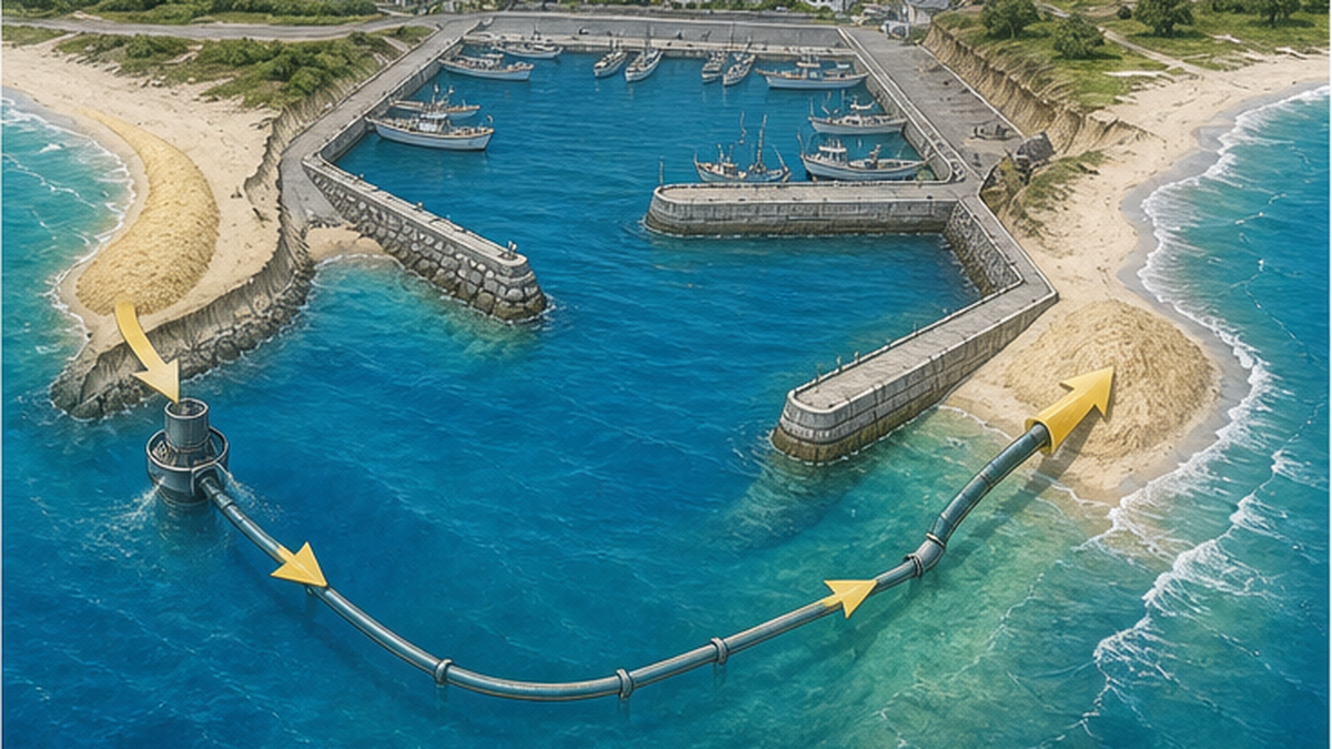
At Fukude Fishing Port in Iwata City, Shizuoka, sand accumulating updrift was burying the navigation channel while the downdrift Asaba coast eroded for lack of sand — the classic problem of a structure interrupting longshore drift. The solution installed there is a jet-pump sand bypass system. Jet pumps on the seabed suck up the sand accumulating updrift of the port and a pipeline carries it past the harbor to the downdrift beach. Reconnecting the severed "road of sand" by mechanical power, the system addresses channel siltation and coastal erosion at the same time.
Nourishment, however, always raises a fundamental question: where does the added sand come from? Mining the seabed disturbs the environment at the extraction site. Worldwide, sand extraction — including for construction — has become an environmental problem in its own right, as explained in our article How sand mining accelerates coastal erosion. Sand is not an infinite resource lying around everywhere; it must be managed as a finite resource circulating between watershed and coast.
Signs of erosion you can spot at the beach
- The beach is clearly narrower than in old photos, or a step-like scarp has formed on the berm
- Waves reach right up to seawalls or tetrapods, or foundations once buried in sand are now exposed
- The belt of coastal plants has vanished, or the beach sand has become coarse and gravelly — fine sand is lost first
The Dam-Removal Option — Recovery on the Kuma and Elwha Rivers
Removing a dam that has served its purpose to reconnect river and sea — that choice has now been made in Japan and abroad. Arase Dam on the Kuma River in Yatsushiro City, Kumamoto (a prefectural hydropower dam completed in 1955) was the first concrete dam in Japan to be fully removed. Aging and environmental impacts drove the decision; work began in fiscal 2012 and was completed in March 2018.
Life returning to the Kuma River and the Yatsushiro Sea
After removal, flow returned to formerly stagnant reaches of the Kuma River, and riffles and sandbars reappeared. Surveys report that benthic species such as mayflies and stoneflies increased severalfold compared with before removal, and riverbed suitable for ayu sweetfish spawning expanded. The change reached the sea as well: in the Yatsushiro Sea at the river mouth, improvements were confirmed, including recovering eelgrass beds and increases in kuruma-class shrimp such as kumaebi and in mud shrimp. With sediment and flow restored, not just the river but the estuarine tidal flats and the sea itself responded. That said, the Setoishi Dam still stands upstream, and some point out that the recovery has its limits as a result.
The Elwha River, USA — one of the world's largest dam removals
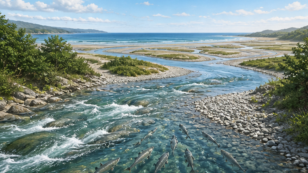
On the Elwha River in Washington State, two aging dams — Elwha Dam and Glines Canyon Dam — were removed between 2011 and 2014, the largest dam removal in history at the time. Much of the more than 20 million cubic meters of sediment stored in the reservoirs flowed to the sea over several years, forming new sandbars and tidal flats at the river mouth. The long-starved river-mouth delta visibly grew, and salmon migrated upstream for the first time in about 100 years. The Elwha showed the world that when sediment supply returns, estuaries and coasts respond faster than anyone expected.
What dam removal has taught us
- After Arase Dam's removal, benthic life increased in the Kuma River, and eelgrass beds and shrimp recovered in the Yatsushiro Sea
- On the Elwha, the river-mouth delta grew after removal and salmon returned upstream for the first time in about a century
- Not every dam can be removed — the era has begun of weighing flood control, water supply, and power against environmental impact, basin by basin
Thinking of the Watershed and the Sea as One "Road of Sand"
As we have seen, beach loss cannot be solved by looking at the coast alone. The cause lies at dams tens of kilometers upstream, and the effects extend from estuarine tidal flats to offshore ecosystems. That is why, since the late 1990s, national advisory councils have recommended "integrated sediment management": treating mountains, rivers, and coasts as a single sediment routing system, with agencies coordinating to manage both the quantity and quality of sediment. The Tenryu–Enshu-nada and Kurobe systems are its leading practice grounds, and flushing, bypassing, placement, nourishment, and sand bypassing are the toolbox for reconnecting the severed road of sand.
Climate change will only add weight to this challenge. Sea-level rise accelerates erosion, while intensifying rainstorms increase sediment production in the mountains and hasten reservoir filling. Watershed design that passes sediment safely to the sea while caring for ecosystems is set to become a central theme of land management — serving disaster prevention and environmental conservation at once.
What we can do
- Learn how your local coast is changing — comparing old photos or aerial photographs makes shoreline retreat tangible. Reporting changes you notice to the municipal coastal office is real participation
- Join beach cleanups and coastal monitoring activities — the more people frequent a beach, the sooner erosion is spotted
- Stay aware of your connection to the watershed — forest restoration upstream and river cleanups are continuous with protecting the sea
- Follow public-works information — dam flushing plans and coastal protection master plans are often open for public comment, and residents of the watershed can make their voices heard
Article summary
- Japan loses about 160 ha of land to coastal erosion yearly, and about 13% of its beaches are already gone — chiefly because sediment supply from rivers to the sea has declined
- Dam reservoirs trap sediment: Sakuma Dam holds about 140 million m³, and worldwide, reservoirs deprive the ocean of 1.4 billion tonnes of sediment per year
- The impacts reach beyond beaches to tidal flats, estuaries, sea-turtle nesting grounds, and entire marine ecosystems
- Japan has put into practice technologies that return sediment to the sea: coordinated flushing (Kurobe), bypass tunnels (Miwa Dam), sediment placement, and dam redevelopment (Tenryu)
- The Arase and Elwha removals showed that rivers and seas have the power to recover once sediment returns
- Integrated sediment management — seeing mountains to sea as one "road of sand" — is the key to protecting beaches and tidal flats
References and Sources
- MLIT River Bureau, "Current State and Challenges of Coastal Erosion" – National data including 160 ha/year of erosion and roughly 2,400 ha of beach lost
- MLIT Chubu Regional Development Bureau, "Tenryu River Dam Redevelopment Project" – Permanent sedimentation countermeasures at Sakuma Dam and curbing Enshu-nada coastal erosion
- MLIT Chubu Regional Development Bureau, "Miwa Dam Sediment Bypass Project" – Overview and results of the approx. 4.3 km sediment bypass tunnel
- MLIT Hokuriku Regional Development Bureau, "Sediment Flushing at Kurobe River Dams" – Coordinated flushing of Dashidaira and Unazuki dams and environmental surveys
- Syvitski, J.P.M. et al. (2005) Impact of Humans on the Flux of Terrestrial Sediment to the Global Coastal Ocean. Science 308: 376-380 – Estimate that reservoir trapping has cut sediment delivery to the ocean by 1.4 billion tonnes per year
- Shizuoka Prefecture, "Coastal Protection Measures (Sand Bypass and Beach Nourishment)" – Erosion countermeasures along the Enshu-nada coast and the Fukude Fishing Port sand bypass system
- MLIT, "Interim Summary on Beach Conservation (Reference Materials)" – The human relationship with beaches and adaptive beach management
- National Institute for Land and Infrastructure Management, Coast Division, "Beach Processes" – Explanations of beach sediment budgets and longshore drift mechanics
* Ordered by reliability: government and academic institutions > peer-reviewed papers > specialist organizations > trusted media