⚡ In short
The Kushiro Marsh in eastern Hokkaido is Japan's largest wetland. This article traces the 20,000 years that turned a sea into a peatland, the reality of the drying and sediment inflow that erased 87.78 km² in 53 years, and the results of a restoration project that bent a straightened river back into its meanders — all from primary sources.
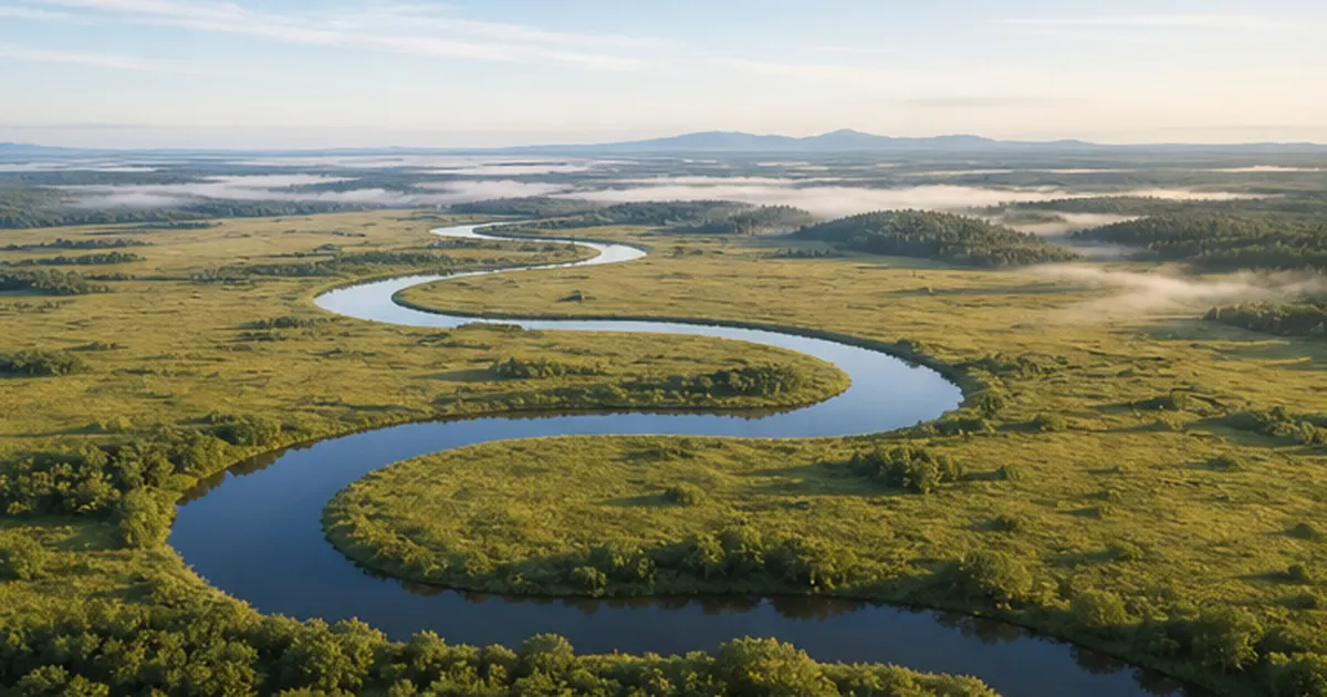
Drive about 30 minutes north from central Kushiro, in eastern Hokkaido, and the view suddenly opens up: a green plain stretching to the horizon, with a river winding brightly through it. This is the Kushiro Marsh (Kushiro Shitsugen), said to account for roughly 60% of all wetland area in Japan and the largest such landscape in the country. In 1980 it became Japan's first Ramsar Convention wetland, and in 1987 it was designated a national park.
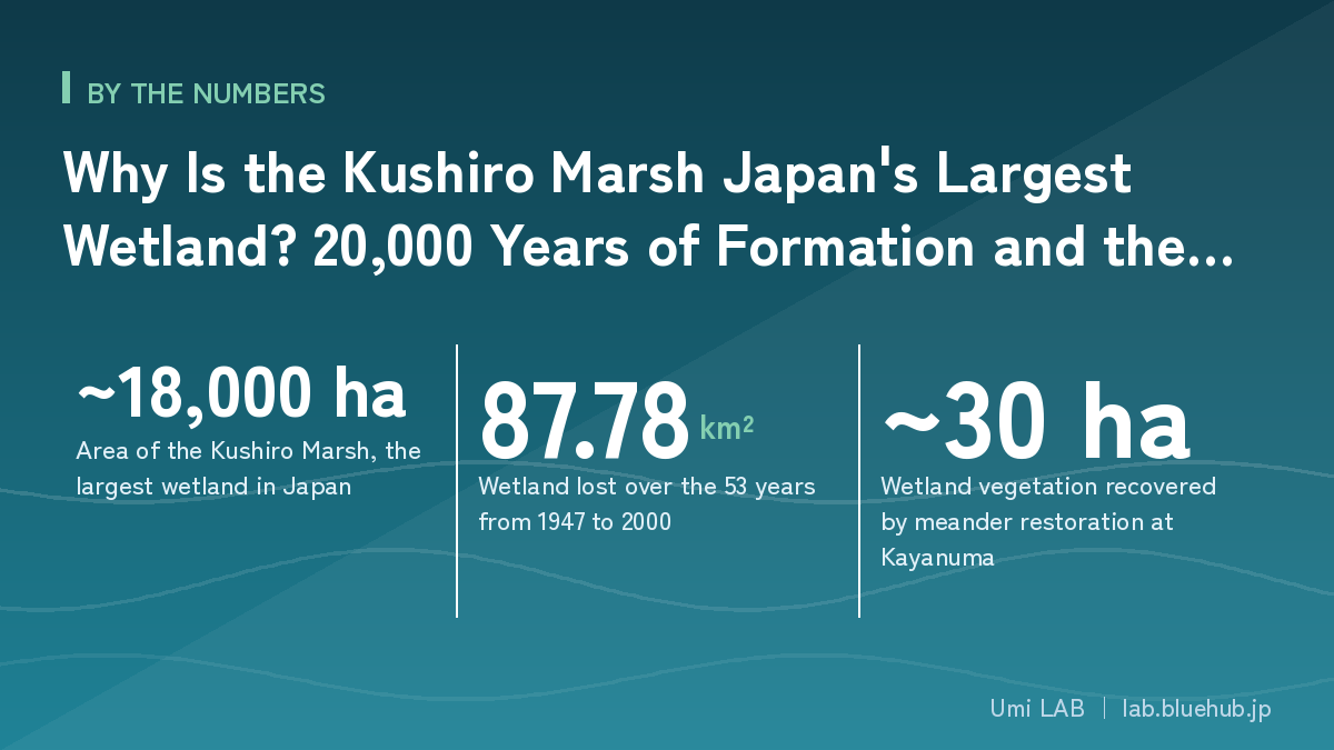
Yet this landscape is by no means an untouched wilderness that simply survived. In the drive for food production and urban expansion after the Second World War, the wetland was drained, its rivers were straightened, and the surrounding forests were cut. As a result, the wetland shrank from 281.35 km² in 1947 to 193.57 km² in 2000. That is a loss of 87.78 km² in 53 years — an area roughly 1.4 times the size of Tokyo's 23 special wards.
This article traces how the Kushiro Marsh came into being, why it shrank and dried, and what the unusual project of bending the rivers back into shape — begun after Japan's Nature Restoration Promotion Act took effect in 2003 — has actually achieved, drawing on primary sources from the Ministry of the Environment, the Hokkaido Regional Development Bureau of MLIT, and the Hokkaido Government. At the end, we also look at how to visit and enjoy the wetland. Before it is something to be protected, the Kushiro Marsh is simply a wonderful place to be.
What you will learn
- How the Kushiro Marsh was built up over time: an ice-age valley ~20,000 years ago, a sea ~6,000 years ago, a wetland ~3,000 years ago
- How peat works as a sponge, holding water in place and keeping the wetland a wetland
- The hard numbers behind postwar loss: a 30% decline in wetland area and a more than threefold expansion of alder woodland
- What Japan's pioneering nature restoration work — including bending a straightened river back into its old meanders — involves, and what it achieved
- The recent friction over mega-solar siting and where the ordinance Kushiro City enacted in 2025 fits in
- How wetland, river and sea form a single system — and how to go and enjoy the marsh on foot
What is the Kushiro Marsh? Japan's largest wetland in numbers
The Kushiro Marsh is a wetland complex, dominated by fen, that spreads across Kushiro City, Kushiro Town, Shibecha Town and Tsurui Village in eastern Hokkaido. It measures about 36 km north to south and about 25 km east to west. The core wetland area is roughly 18,000 hectares, said to be about 60% of the total wetland area in Japan.
That said, the phrase "the area of the Kushiro Marsh" changes meaning depending on which legal boundary you count. National park, Ramsar site, natural monument designation — each has a different purpose, so neither the extent nor the figures match. Because this is an easy place to get confused, let us sort it out first.
The Kushiro Marsh by the numbers
| Category | Area / figure | Designation year, notes |
|---|---|---|
| The wetland itself | About 18,000 ha | 193.57 km² by vegetation interpretation as of 2000 |
| Kushiro Shitsugen National Park | 26,861 ha | Designated 31 July 1987 (Japan's 28th national park) |
| Ramsar Convention wetland | 7,863 ha | Registered 17 June 1980 (Japan's first; later expanded) |
| Extent | About 36 km N–S / about 25 km E–W | — |
| Thickness of the peat layer | Several meters where thickest | Accumulation rate about 1 mm per year |
The Ramsar registered area of 7,863 ha is considerably smaller than the wetland as a whole (about 18,000 ha). This is because the registration is based on the special protection zone of the national wildlife protection area, which means part of the wetland sits outside that particular umbrella. The national park figure of 26,861 ha likewise covers a broad zone that includes not only the wetland but the surrounding hills, lakes and rivers.
Not a wasteland, but a machine for storing and releasing water
The first impression most people have of a wetland is "an empty plain." But below the surface, something entirely different is going on. The soil of a wetland is peat — dead plant material that has piled up without fully decomposing — and it holds water like an enormous sponge.
When it rains, the peat absorbs water and blunts the flood peak; in dry periods it releases water slowly and sustains river flow. At the same time, plants and microbes take up incoming nitrogen and phosphorus, purifying the water. And the carbon in the undecomposed plant remains stays locked underground, out of the atmosphere, for thousands of years. Far from being "a place where nothing happens," a wetland is remarkably hard-working land, performing four jobs at once: flood control, water purification, carbon storage, and habitat.
A map of this article
- Origins: ice age → the sea arrives with the Jomon transgression → sealed off by a sandbar and turned into wetland (chapters 2–3)
- Wildlife: what cranes, taimen and salamanders reveal about the wetland's health (chapter 4)
- Crisis: 87.78 km² lost in 53 years, alder woodland up 3.4-fold — the reality of drying (chapter 5)
- Restoration: bending the river back, sediment retention basins, forest recovery (chapter 6)
- Today: friction over mega-solar siting and the ordinance (chapter 7) / how wetland connects to the sea (chapter 8) / how to visit (chapter 9)
Land built by 20,000 years — this place was once a sea
The key to understanding how the Kushiro Marsh formed is the question of where sea level was. Over a long span of time, a place that was sea became land, and that land was fixed in place while still holding its water.
About 20,000 years ago: a valley in the last glacial period
At the peak of the last glacial period, some 20,000 years ago, much of Earth's water was locked up in ice sheets on land and sea level stood more than 100 m below today's. The Kushiro area at that time was not sea but a valley deeply carved by rivers. The old river-valley topography now buried far beneath the wetland dates from this era.
About 6,000 years ago: the Jomon transgression creates Paleo-Kushiro Bay
When the glacial period ended and the climate warmed, the ice sheets melted and sea level rose. This is the Jomon transgression, when the sea pushed into lowlands all across Japan. Kushiro was no exception: about 6,000 years ago nearly the entire lowland where the wetland now spreads lay beneath the sea as an inland bay. This is called Paleo-Kushiro Bay.
In other words, the plain where cranes now dance and reeds now sway was, to the people of the Jomon period, a bay with waves lapping at its shores. That is why digging into the wetland's strata can turn up fossils of marine shellfish — a memory of that age.
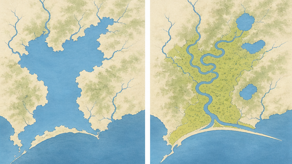
About 3,000 years ago: a sandbar closes the bay and peat begins to pile up
Afterwards the climate cooled somewhat and a marine regression began, lowering sea level. At the same time, sand carried by longshore currents built a sandbar across the mouth of the bay, gradually cutting it off from the open sea. By about 3,000 years ago the bay mouth was essentially closed, and the remaining water body freshened into a mosaic of shallow lakes and marshes.
From here the age of peat begins. Reeds and sedges grew thickly over the shallowing water, died, and sank. But in Kushiro's cool, damp climate, in waterlogged and oxygen-poor conditions, microbial decomposition cannot keep up. Undecomposed plant remains piled up at the almost unimaginably slow rate of about 1 mm a year. Roughly 1,000 years to build up a single meter. The peat layer beneath your feet today is, quite literally, several thousand years of time made thick.
Timeline: how the Kushiro Marsh came to be
- About 20,000 years ago: the last glacial period. Sea level more than 100 m lower than today; this area was a river-carved valley
- About 6,000 years ago: peak of the Jomon transgression. The lowland is submerged, forming Paleo-Kushiro Bay
- About 3,000 years ago: regression and sandbar growth close the bay mouth, and the water freshens. Reeds and sedges spread, and peat begins to accumulate
- From then to now: peat builds at roughly 1 mm a year, forming Japan's largest wetland
- 1858: Takeshiro Matsuura descends the Kushiro River by dugout canoe and records the wetland
- 1980: Japan's first Ramsar Convention wetland / 1987: designated a national park
How the wetland works: peat, groundwater level, and three types of mire
The condition for a wetland to remain a wetland is startlingly simple: the water must not drain away. That is the whole of it. Conversely, from the moment water begins to drain, a wetland starts to stop being one.
Peat is both a sponge for water and a vault for carbon
Peat is an extraordinarily water-retentive soil — water can account for 80–90% of its volume. The peat layer holds that water and keeps the groundwater table right at the surface, maintaining conditions in which wetland plants such as reeds and sedges can dominate. As long as the water table stays near the surface, the peat is protected by water from decomposition, and the carbon locked inside it does not move.
But when drainage ditches are dug or a riverbed incises and the water table falls, the upper peat is exposed to air. Microbial decomposition then accelerates sharply, the peat shrinks, the ground subsides, and the stored carbon begins returning to the atmosphere as carbon dioxide. Drying is not merely a change of scenery. It is a quiet but large-scale event in which carbon accumulated over thousands of years leaks out in a few decades.
Fen, transitional mire, and raised bog
Wetlands are classified into three types according to their water source and nutrient richness. The Kushiro Marsh is mostly fen, but raised bog also occurs in places such as around Akanuma, so the succession of a wetland can be observed in one location.
| Type | Water source | Nutrients | Characteristic plants |
|---|---|---|---|
| Fen (low mire) | River water, groundwater | Abundant (eutrophic) | Common reed, sedges, Japanese alder |
| Transitional mire | Between river water and rainwater | Moderate | Purple moor grass, some Sphagnum |
| Raised bog (high mire) | Almost entirely rainwater | Scarce (oligotrophic) | Sphagnum moss, small cranberry, sundew |
Why does drying happen? Three pathways
The drying that has advanced in the Kushiro Marsh has broadly three pathways. All of them come down to physical changes: water draining out, or sediment piling on.
- Drainage and river engineering: digging drainage ditches to create farmland or housing land, and straightening rivers, sends water downstream quickly and lowers the water table. A straightened river flows faster, scours its bed, and pulls surrounding water levels down further
- Sediment inflow: when logging and farmland development in the watershed expose bare ground, sediment washes into the rivers with every rain. Where sediment accumulates at the wetland's inflow points, the ground there becomes ordinary soil rather than peat, and turns into dry land
- Nutrient inflow: when nitrogen and phosphorus from livestock wastewater and fertilizer flow in, plants that thrive on nutrients — such as Japanese alder and goldenrod — gain the advantage over wetland plants adapted to poor soils, and the vegetation is replaced
When all three advance together, the wetland does not merely "dry" — it turns into a different ecosystem. The rapid expansion of alder woodland, which we look at in the next chapter, is the clearest indicator of this.
Yachibozu: the strange shapes the wetland makes for itself
Walk in the Kushiro Marsh and you may come upon a scene of grass tussocks 30–50 cm across standing scattered about like little wooden dolls. Known locally as yachibozu ("marsh monks"), these are a distinctive landform created by sedges.
Here is how they form. A sedge tussock roots itself in the ground, and as winter freezing and spring thawing repeat, the soil around it is heaved up by frost or scoured away by meltwater. The center of the tussock is not eroded because its roots grip the soil firmly, so only the surroundings are lowered. Continue this for decades and the tussock alone remains, standing like a pillar — a "monk." A single yachibozu is, in itself, a record of decades of freeze–thaw cycles.
Water collects in the hollows between yachibozu, while the tops of the tussocks become small dry islands. This relief of only a few tens of centimeters gives a place to both the creatures that prefer wet ground and those that prefer dry. The impression of the wetland as a "flat, featureless plain" collapses as you get closer. In reality it is an intensely uneven world, built up from undulations measured in millimeters and centimeters.
Life in the marsh: red-crowned crane, Sakhalin taimen, and Siberian salamander
The health of a wetland shows honestly in the creatures that live there. The Kushiro Marsh gathers species barely seen elsewhere in Japan, and each of them needs a different aspect of the wetland.
The red-crowned crane, a bird once believed extinct
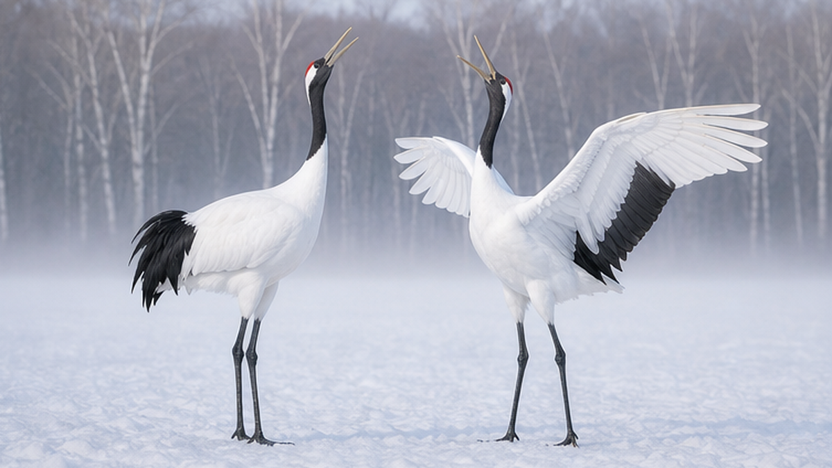
The red-crowned crane is the emblem of the Kushiro Marsh. Once widely distributed across Hokkaido, it collapsed under overhunting and wetland development from the Meiji era onward, and by the Taisho era was even thought to be extinct. In 1924 a little over a dozen birds were rediscovered in the Kushiro Marsh, and the history of their protection began there. Winter feeding started by local residents in the 1950s was the turning point, and numbers recovered steadily.
In the wintering-season census that Hokkaido conducts under contract to the Ministry of the Environment, the December 2025 survey confirmed 1,136 birds (982 adults, 113 juveniles, 38 captive individuals, and others). Note, however, that wintering grounds have dispersed across eastern Hokkaido in recent years and more birds no longer gather at feeding stations, so this figure is the number confirmed rather than the population itself. The actual population is estimated at roughly 1,800 birds.
The recovery is a success of conservation work, but it has created new problems. Concentration at feeding stations raises the risk of disease spreading, and the expanding range increases friction such as crop damage and collisions with power lines. Rather than declaring the job done, the work has entered a phase of reducing dependence on feeding while supporting natural dispersal.
Sakhalin taimen: Japan's largest freshwater fish needs a river that bends
The Sakhalin taimen is a large salmonid that can exceed one meter in length, making it Japan's largest freshwater fish. It once lived in many rivers of Hokkaido but now survives in only a handful of watersheds. It is listed as endangered on the Ministry of the Environment's Red List and carries a high threat category on the IUCN Red List as well.
The reasons for its decline connect directly to the wetland's problems. Spawning requires small gravel-bed streams, juveniles grow in slow-flowing backwaters, and adults lurk in deep pools — which means a river that winds and offers a variety of depths and flow speeds is a precondition for survival. In a straightened river with uniform flow, this separation of habitats cannot exist. The taimen is a fish that requires the complexity of a river itself.
The Siberian salamander, a survivor from the ice age
The Siberian salamander is a small amphibian that in Japan occurs only around the Kushiro Marsh, and is regarded as a glacial relict that crossed from the Eurasian continent during an ice age. In early spring it lays jelly-like egg sacs in shallow pools of snowmelt water.
This breeding style makes conservation difficult. What it needs is not a large lake or a river but shallow pools that appear only in spring, and the damp grassland around them. Places that look like "just vacant ground" on a map are often habitat, and are easily overlooked at the planning stage of development. On the Ministry of the Environment's Red List its category was raised by two ranks in 2020, and in 2022 it was designated under the Act on Conservation of Endangered Species. Kushiro City has also designated it a municipal natural monument, and cutting, filling or reclamation work that affects its habitat is subject to procedures under municipal ordinance.
The real protagonists underfoot: reeds, sedges, and seasonal flowers
Rare species get the attention, but what actually makes the landscape is the overwhelming abundance of reeds and sedges. Common reed grows to more than two meters, forming in summer a green wall far above head height. These dense stands conceal crane nests, provide homes for small birds and insects, and, once dead, become the peat that keeps building the wetland itself.
The flowers change with the seasons. In early summer, day lilies wash the wetland in orange-yellow and cotton grass waves its white tufts in the wind. On the raised-bog side, sundews (carnivorous plants) and small cranberries live in miniature atop carpets of Sphagnum moss. Sphagnum keeps its surroundings acidic, creating conditions other plants find hard to enter. It survives, in other words, by manufacturing its own harsh regime of low nutrients and high acidity.
This cast of plants is also a mirror of the water and nutrient conditions of a place. More reeds and alder is a sign that nutrients are rising and the ground is beginning to dry; healthy Sphagnum and sundew are a sign that poor-nutrient, wet conditions are being maintained. Look at the plants and you can, to a degree, run a health check on the wetland — which is exactly why vegetation interpretation is central to monitoring.
Three species, three different definitions of what a wetland must provide
- Red-crowned crane: broad, open wetland for nesting, and rivers that do not freeze in winter (the wetland as an expanse)
- Sakhalin taimen: a meandering river with pools, riffles and small streams (the complexity of the river)
- Siberian salamander: shallow pools that appear in spring and damp grassland (a mosaic of small water environments)
- Wetland conservation therefore only works if extent, river form and fine-scale water environments are all protected at once
The lost 30%: what happened to the wetland in 50 postwar years
Now to the heart of the matter. The Kushiro Marsh shrank rapidly in the second half of the twentieth century. And the shrinking was not confined to the period when development was most intense; it continued for some time afterwards.
87.78 km² in 53 years — disappearing at 1.66 km² a year
According to vegetation interpretation results published by the Ministry of the Environment's Kushiro Wetland Nature Restoration Project Data Center, the wetland area has changed as follows.
| Year | Wetland area | Change vs. 1947 |
|---|---|---|
| 1947 | 281.35 km² (28,135 ha) | — |
| 1970 | 240.87 km² (24,087 ha) | −14.4% |
| 2000 | 193.57 km² (19,357 ha) | −31.2% |
A loss of 87.78 km² over 53 years averages out to 1.66 km² a year — roughly 35 Tokyo Domes of wetland vanishing quietly every year. What is more, the decline was greater in 1970–2000 than in 1947–1970. Once drying begins, it proceeds under its own momentum even after the peak of development has passed.
Alder woodland grew 3.4-fold in 50 years — and more green is not good news
While the wetland shrank, one thing expanded: alder woodland. According to the interpretation results, the area of alder woodland grew from 21.0 km² in 1947 to 29.4 km² in 1977 and 71.3 km² in 1996. That is roughly a 3.4-fold increase over 50 years, with the rise in the most recent two decades especially steep.
Japanese alder is a native tree of wet ground, and is not a villain in itself. The problem is that its expansion is a signal that a place is no longer a reed-and-sedge wetland. Alder rapidly comes to dominate where the water table has fallen, oxygen has entered the soil, and nitrogen is supplied. From above, green is still green — but as an ecosystem it has been replaced by something else.
This "substitution of green" is easy to miss if you look only at satellite imagery or aerial photographs. Only careful interpretation of vegetation makes the transformation happening inside the wetland appear as numbers.
What set it off
- Postwar food production and farmland development: schemes to drain wetland and convert it into pasture and cropland were pursued widely, eating into the margins of the marsh
- Straightening of rivers: for flood control and land use, meandering rivers were replaced with straight channels. Flow accelerated and the surrounding water table fell
- Logging and bare ground in the watershed: clearing and farming of the hills exposed soil, and every rain carried large volumes of sediment into the wetland via the rivers
- Urban expansion: in the southern part of the wetland, drainage for residential development advanced and the wetland margin was replaced by built-up areas
Mind the time lag in drying
The drying of a wetland continues long after the development itself has ended. A water table once lowered by drainage or riverbed incision does not recover on its own, and peat decomposition and ground subsidence go on improving drainage further. That is precisely why active restoration, rather than leaving things alone, became necessary.
Bending the river back: the Kushiro Marsh nature restoration project on the ground
When the Nature Restoration Promotion Act took effect in 2003, the Kushiro Wetland Nature Restoration Committee was founded the same year, bringing together relevant government agencies, NPOs, researchers, local residents, and farmers, foresters and fishers. In 2005 the Overall Concept for Kushiro Wetland Nature Restoration was compiled (revised in 2015), and subcommittees were set up for themes such as wetland, rivers, forests, lakes and groundwater to carry out concrete projects. Among Japan's nature restoration efforts, it is pioneering in both scale and duration.
Old-channel restoration at Kayanuma: returning a straightened river to its meanders
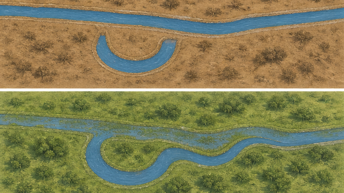
The best-known work is the old-channel restoration carried out in the Kayanuma district of Shibecha Town. This reach of the Kushiro River had been straightened in the 1970s for purposes including farmland development nearby. The result was a vicious circle: faster flow scoured the riverbed, the surrounding water table fell, wetland vegetation declined, and sediment transport increased.
The project took what was then a bold approach: re-excavating the old channel, which had survived without being filled, and backfilling the straightened waterway. Construction proceeded from 2007 and was completed in March 2011. About 1.6 km of straight channel was filled in, and water was returned to about 2.4 km of meandering old channel. The cost was approximately 900 million yen.
| Item | After straightening (before restoration) | After old-channel restoration |
|---|---|---|
| Channel form | Straight channel, about 1.6 km | Meandering channel, about 2.4 km |
| Diversity of flow | Uniform depth and velocity | Pools, riffles and backwaters restored |
| Behavior during floods | Rapid discharge downstream | Overflows onto the surrounding floodplain, raising the water table |
| Wetland vegetation | Declining; drying under way | About 30 ha of wetland vegetation recovered (monitoring result) |
| Fish and aquatic insects | Fewer species than the upstream straight reach | Increases confirmed in both species number and abundance |
Monitoring showed that with the meanders restored, water spilled more readily onto the surrounding floodplain during floods and the water table rose. An increase of about 30 ha of wetland vegetation was confirmed. Fish and aquatic insects showed more species than in the straight reach remaining upstream, and fish numbers had increased as well. The goals set at the planning stage are assessed as broadly achieved. Over the longer term, the reach is expected to recover about 100 ha of wetland vegetation and to reduce sediment inflow to the wetland's core by about 30%.
What is interesting is that the backfilled straight channel was not simply packed with soil: material excavated on site and sediment from the old channel were used, following a design philosophy of leaving the work to natural processes over time. Rather than humans building a finished form, room is left for the river to shape itself — a clear expression of what nature restoration means.
Sediment control on the Kuchoro River: settling silt at the wetland's doorstep
The other main driver of drying is incoming sediment. The Kuchoro River, which flows into the northern part of the wetland, carries a heavy sediment load owing to farmland development in its catchment, and has substantially altered the wetland environment.
The countermeasure being built is a sediment retention basin at the wetland inflow. During floods, turbid river water is deliberately allowed to spill into the basin, where the flow slows and fine sediment settles out. Only the cleaner water is then passed on to the wetland. Alongside this, farming practices that limit soil loss from fields and the restoration of riparian woodland are being advanced in the catchment. It is a clear demonstration that the sediment problem cannot be solved inside the wetland alone: it is a watershed-wide issue reaching all the way to upstream land use.
The Takkobu area: bringing back the forest, restoring the lake
Around Lake Takkobu in the eastern part of the wetland, forest restoration guiding degraded plantations toward natural forest is proceeding in parallel with work on the lake's water quality and ecosystem. Returning slopes once planted with larch to broadleaf-dominated forest is intended to reduce soil loss and stabilize the water flowing into the lake and the wetland.
At Lake Takkobu, the distribution of the signal crayfish — an invasive alien species designated under Japanese law — has also been surveyed, with concern about its impact on native aquatic life. Invasive species control, water quality improvement, forest restoration: even restoring a single lake involves several interlocking problems. It is a site that shows nature restoration to be not construction work but long-term management.
Key points of the Kushiro Wetland nature restoration project
- Following the 2003 Nature Restoration Promotion Act, government, NPOs, researchers, residents and primary industries formed a joint committee
- An overall concept was adopted in 2005 (revised 2015), with projects run through subcommittees for wetland, rivers, forests, lakes and more
- Kayanuma: 1.6 km of straight channel filled in and 2.4 km of meanders restored (2007–2011, about 900 million yen) → about 30 ha of wetland vegetation recovered
- Kuchoro River: a sediment retention basin at the wetland inflow settles out fine sediment, reducing what reaches the wetland
- Takkobu area: forest restoration guiding plantations toward natural forest, plus lake water quality and invasive species measures
- Citizen-participation monitoring is built in, and the verification of effects is published
Today's friction: mega-solar siting and where the lines are drawn
In recent years a new issue has arisen around the Kushiro Marsh: the siting of solar power facilities, particularly large mega-solar plants. It has drawn national attention as a textbook case in which two important goals collide — expanding renewable energy for decarbonization, and conserving biodiversity.
Why they are built around the edges of the wetland
The focus of the problem is not the wetland itself but the flat land along its southern and peripheral margins. Much of this lies outside the national park's special zones and outside the Ramsar registered area, so legal development restrictions are comparatively weak. At the same time, it holds important habitat for rare species including the Siberian salamander. The lines drawn by institutions on a map and the lines the creatures actually use did not match.
On top of that, the developers' own criteria lined up: flat ground, good sunshine, and relatively cheap land. Many parcels were legal under the rules yet hard to overlook from an ecological standpoint.
Kushiro City's ordinance, in force since October 2025
Responding to this, Kushiro City issued a "No More Mega-Solar Declaration" in 2025 and brought the Kushiro City Ordinance on Harmony between Nature and Solar Power Facilities into force on 1 October 2025. Projects installing solar power facilities in the city now require municipal permission, with commercial installations of 10 kW and above among those covered. In addition, under the city's cultural properties protection ordinance, cutting, filling and reclamation work affecting the habitat of the Siberian salamander — a municipally designated natural monument — is also subject to procedures.
How to think about this issue
- Expanding renewable energy remains important in itself as a response to climate change
- At the same time, getting siting wrong generates a different cost: the loss of biodiversity
- The key question is where to build. Mechanisms are needed to prioritize places with small ecological impact — existing rooftops, abandoned farmland, already-graded industrial land
- Municipal ordinances are an effective tool, but gaps have been pointed out, such as construction rushed through before enforcement begins; broader, higher-level institutional design remains a challenge
What this issue demonstrates is that drawing lines around protected areas is not enough to protect an ecosystem. Living things do not know institutional boundaries. If we are serious about conserving the wetland, we have to design for how the land outside it is used as well — which leads directly into the theme of the next chapter: the watershed.
Wetland and sea are connected: conservation at the watershed scale
The Kushiro Marsh looks like an inland landscape, but the Kushiro River, having passed through it, runs through the city and empties into the Pacific. What happens in the wetland arrives, unchanged, at the sea by the river mouth. Put the other way around, protecting the wetland is part of protecting the sea.
Peat is a savings account of carbon locked underground
The peat of a wetland stores thousands of years' worth of plant-derived carbon. The world's peatlands cover only a few percent of the land surface, yet are said to store carbon comparable to or greater than all forests combined. If they dry out and the peat decomposes, that carbon returns to the atmosphere as carbon dioxide. Wetland conservation is an unglamorous but reliable climate measure.
The equivalent role on the ocean side is played by the carbon stored in coastal ecosystems such as mangroves, seagrass meadows and salt marshes — what is known as blue carbon. Freshwater wetlands and coastal meadows are different ecosystems, but they share the same mechanism: carbon fixed by plants is locked for long periods in oxygen-poor soils. In accounting for Japan's carbon, the two lie on the same line of thinking.
Wetland to river to estuary to sea: one continuous system
While the wetland catches sediment and nutrients, clear water and moderate nutrients reach the estuary and coast downstream. If the wetland loses that function, turbid water and excess nutrients flow straight to the sea and can trigger red tides and oxygen depletion. When people talk about conserving tidal flats, what flows onto those flats is decided by upstream land use — and the wetland sits on the front line of that upstream side.
There is common ground in how humans relate to nature, too. The idea of satoumi, developed around the Seto Inland Sea, holds that moderate human involvement can raise the productivity and diversity of the sea. Nature restoration in the Kushiro Marsh shares that philosophy in choosing not "hands off" but "getting our involvement right." Since it was people who broke it, it is people's job to put it back — a quiet realism.
What it means to think about wetland conservation as a watershed
- Most causes of wetland drying lie outside the wetland — in the upstream forests, farmland and built-up areas
- Measures therefore cannot be completed by construction inside the wetland alone
- The three flows of sediment, nutrients and water must be managed continuously from forest to sea
- Carbon storage in peat is, alongside coastal blue carbon, one of the pillars of climate action
Visiting the marsh: boardwalks, observatories, and canoes
We have spent a lot of time on problems, but the Kushiro Marsh is first of all a place that feels good to visit. Conservation only lasts where there are people who love the place. So let us close with an introduction to enjoying the wetland.
Look from above, or walk through the middle
There are broadly two ways to enjoy the wetland: take in its whole expanse from an observatory, or walk a boardwalk and meet the details on the inside. Choosing only one would be a waste. The same wetland shows a completely different face when you change the scale.
| Type | Representative sites | Highlights |
|---|---|---|
| Viewing from above | Kushiro City Marsh Observatory, Hosooka Observatory, Kottaro Marsh Observatory | Wetland stretching to the horizon; evening light |
| Walking | Onnenai Boardwalk, trails at the Kushiro City Marsh Observatory | Wetland plants, seasonal flowers and birds seen up close |
| From the water | Canoe tours on the Kushiro River (Lake Toro to Hosooka and others) | The wetland seen at water level, and the life along the banks |
| Learning | Kushiro Wetland Wildlife Conservation Center, Onnenai Visitor Center | How the wetland formed; conservation of rare species in practice |
| By train | JR Senmo Main Line (Kushiro-Shitsugen and Hosooka stations, etc.) | Crossing the wetland from the window; snowfields in winter |
Seeing it from the water by canoe
The canoe changes the impression most of all. The rivers within the wetland flow gently, and the water surface sits lower than the tops of the reeds. Riding a canoe therefore means viewing the wetland not from above but from inside it, at eye level with its creatures. With no engine noise, birdsong and the sound of wind moving through the reeds come through directly. Several guided tours operate, and beginners can join easily.
Four seasons, four completely different faces
The Kushiro Marsh transforms with the season you visit. In spring (May–June) snowmelt fills the wetland and the Siberian salamander spawns; skunk cabbage blooms and migratory birds return. Early summer (June–July) brings day lilies and cotton grass, and the greenery at its freshest. Even in summer Kushiro stays cool thanks to sea fog, and many people come to escape the heat of Honshu.
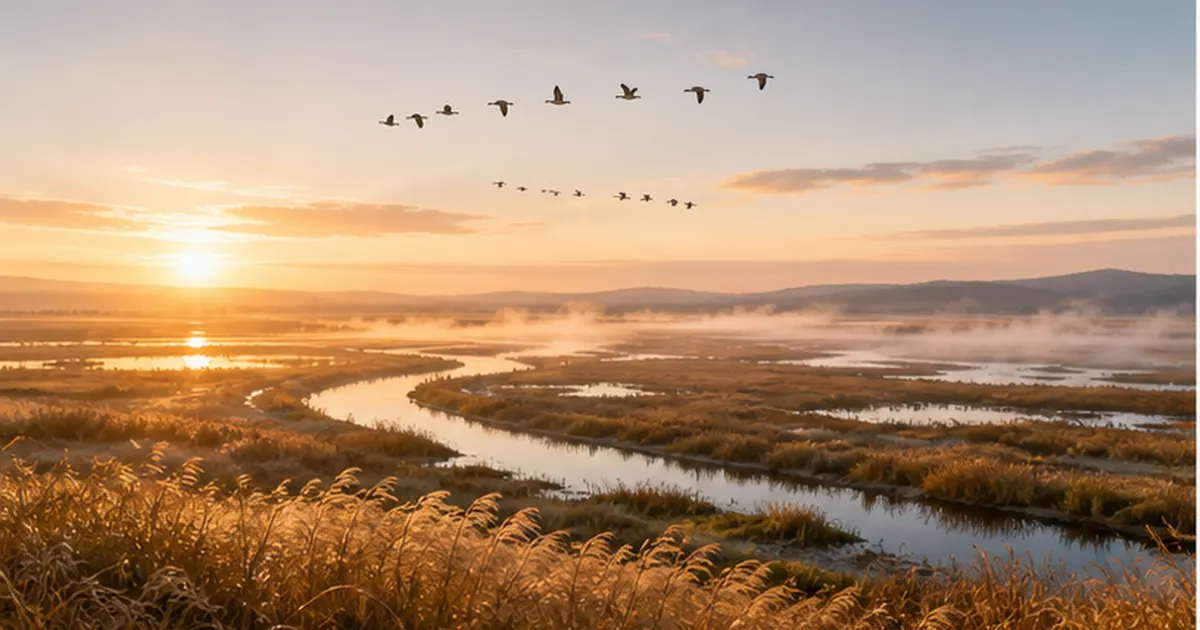
In autumn (September–October) the reeds turn golden and the whole wetland seems to glow; the evening view from an observatory is especially beautiful then. Then winter (December–February). The wetland becomes a snowfield, and cranes gathered along unfrozen riverbanks perform their courtship dance against the white. On mornings below −20°C you may encounter kearashi, the freezing steam that rises from the river's surface.
People tend to assume a wetland is something to see in summer, but winter in the Kushiro Marsh is crane season, and also the time when snow makes the relief of the land stand out sharply. Rather than a single visit, come back in a different season and the same place will look like another country.
Things to respect when you visit
- Stay on boardwalks and marked trails. Wetland vegetation and peat are extremely vulnerable to trampling, and a damaged spot takes a long time to recover
- Do not approach wildlife such as cranes too closely. Approaching nests during breeding can cause breeding failure. Photograph from a distance with a telephoto lens
- Do not collect plants or animals, and do not bring anything in (seeds of invasive species travel on the soles of shoes)
- Always take your rubbish home. Anything that reaches the river ends up in the sea
- This is brown bear country. Avoid going alone, announce your presence with a bell or radio, and follow local advisories
- In summer, prepare long sleeves, long trousers and insect repellent as protection against ticks carried by sika deer
What you can do, starting today
- Visit: combine observatories, boardwalks and canoes to experience the wetland at different scales
- Learn: read the published materials and monitoring results of the Kushiro Wetland Nature Restoration Committee; there are citizen observation events too
- Support: get involved with NPOs working on wetland conservation and restoration, or join citizen monitoring
- Connect the dots: the state of the wetland determines the state of the river and sea downstream. Look at wetlands as an ocean topic
References and sources
- Ministry of the Environment, Japan — Kushiro Wetland Nature Restoration Project Data Center – Baseline data on changes in wetland area, alder expansion, and the formation of the wetland
- Ministry of the Environment, Japan — Overall Concept for Kushiro Wetland Nature Restoration (adopted 2005, revised 2015) – The restoration committee's overall concept: target vision and approach for each theme
- MLIT Hokkaido Regional Development Bureau, Kushiro Development and Construction Department — Kayanuma Old-Channel Restoration – Planning, construction and monitoring results for the old-channel restoration
- MLIT Hokkaido Regional Development Bureau, Kushiro Development and Construction Department — Kuchoro River sediment inflow measures – Settling of fine sediment via the retention basin at the wetland inflow
- Ministry of the Environment, Japan — Lake Takkobu Nature Restoration Implementation Plan (March 2013) – Implementation plan for lake water quality, ecosystem restoration and forest recovery
- Hokkaido Government — Red-crowned crane page – Population figures from the wintering-season census, and conservation measures
- Ministry of the Environment, Japan — Kushiro Wetland Wildlife Conservation Center – Protection and propagation programs for rare wildlife, and the creatures of the wetland
- Kushiro City — Ordinance on Harmony between Nature and Solar Power Facilities – In force from 1 October 2025; makes installation of solar facilities subject to permission
- Japan Science and Technology Agency, Science Portal — "Meander restoration regenerated the nature of the Kushiro River" – Verification of the effects of meander restoration at Kayanuma (about 30 ha of wetland vegetation gained, among others)
- Conference of Municipalities with Ramsar Sites in Japan — Kushiro Marsh – Basic information as a Convention wetland, including registered area and year
Sources are ordered by reliability: government and academic institutions > peer-reviewed papers > specialist organizations > trusted media