⚡ In short
Why do tsunamis occur? A guide based on public sources to tsunami warnings, what to do from earthquake to evacuation, reading hazard maps, the lessons of the Kamaishi incident and tsunami tendenko, and everyday preparedness.
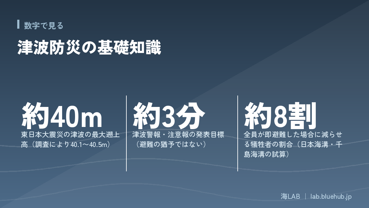
A tsunami strikes from the sea, quietly yet with tremendous force, after the shaking has stopped. In the Great East Japan Earthquake the run-up height reached about 40 m, and about 90% of the victims drowned. The core of tsunami preparedness comes down to one thing: when the ground shakes, move to higher ground at once.
This article explains how tsunamis occur, the Japan Meteorological Agency's tsunami warnings and advisories, what to do right after an earthquake, and how to read hazard maps. It also introduces "tsunami tendenko," a teaching handed down in Sanriku, the lessons from the children of Kamaishi who evacuated on their own initiative, and everyday preparedness.
It is relevant not only to people living by the sea but also to anyone approaching the coast for travel, fishing or swimming. It is based on materials from public institutions, and notes where figures vary by source or survey.
What you will learn
- How tsunamis form and how they differ from ordinary waves
- Types of tsunami warnings and advisories, and what "about 3 minutes" means
- What to do immediately after an earthquake, and the "higher, not farther" principle
- How to read hazard maps and damage estimates
- The lessons of tsunami tendenko and the "Kamaishi incident"
- Everyday preparedness at home, school and in the community
What is a tsunami? An undersea earthquake that moves the whole sea
How a tsunami forms
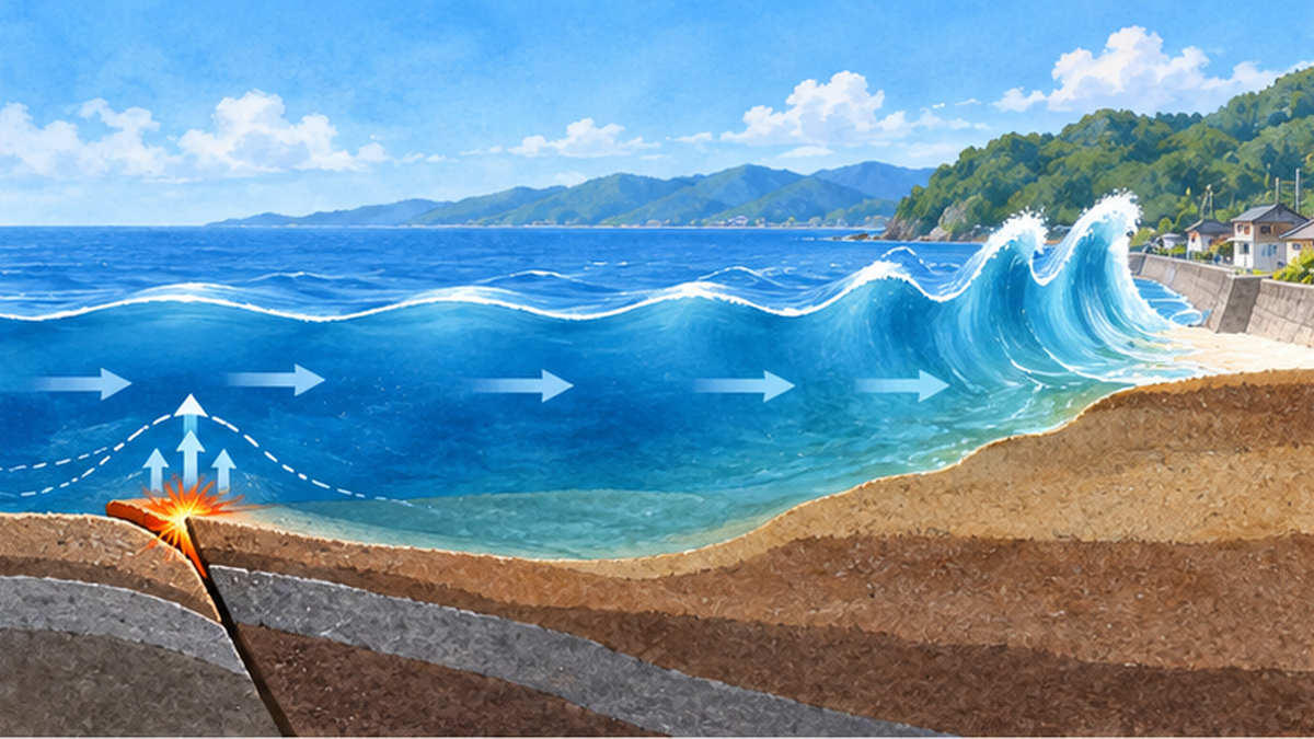
A tsunami is a wave created when a large undersea earthquake shifts the seafloor up or down and the entire column of seawater above it is lifted or dropped. Wind-driven waves move only the water near the surface, but in a tsunami the water moves all the way from the seafloor to the surface, so it carries enormous energy. Besides undersea earthquakes, tsunamis can also be caused by landslides on the seafloor or coast and by volcanic eruptions.
It is closer to the truth to think of a tsunami not as a "tall wave" but as "a water level that keeps rising." Ordinary waves arrive every few seconds to a dozen or so seconds, but a tsunami has a long period of several minutes to tens of minutes; the seawater that rushes in penetrates far inland and then drains away over a similar length of time. It therefore behaves quite differently from the waves you see at the water's edge.
About 800 km/h offshore: slower but higher near shore
A tsunami travels faster the deeper the water is. According to Hokkaido materials, it moves at about 800 km/h in deep offshore waters, comparable to a jet aircraft. As it nears the shallower coast it slows down, but the front of the wave is overtaken by the part behind it and the water level rises. In places where the inlet narrows, such as the inner part of a bay, it can become even higher.
Three characteristics to keep in mind
- Even if the wave is low offshore, the amount of water (energy) is enormous
- The first wave is not necessarily the largest; waves arrive repeatedly
- A tsunami does not always begin with a drawback; a surge can arrive without the sea receding
Why Japan is so prone to tsunamis
The Japanese archipelago sits where the Pacific Plate and the Philippine Sea Plate sink beneath the continental plate. When the strain stored by this subduction reaches its limit and the plate snaps back, a great trench-type earthquake and tsunami occur. The Sanriku offshore area, the Nankai Trough, and the Japan Trench and Kuril Trench are typical source regions, and Japan is one of the most tsunami-prone countries in the world.
The scale and damage of the Great East Japan Earthquake tsunami
A run-up height exceeding 40 m
The Tohoku-Oki earthquake of March 11, 2011 generated huge tsunamis over a wide area. According to the survey by the Tsunami Joint Survey Group, the run-up height (the height reached by the tsunami as it ran up the land) reached about 40.5 m at maximum, the largest ever observed in Japan. The figures vary somewhat depending on the location and timing of surveys, and sources give values of around 40 m.
This tsunami far exceeded earlier assumptions. Even in areas with seawalls and breakwaters, water overtopped the embankments and flowed into towns, damaging many buildings, fishing ports and farmland.
Most victims drowned
According to research based on National Police Agency figures, about 16,000 people died and about 2,500 are missing, for a total of about 18,000. In later figures published by the Fire and Disaster Management Agency, the death toll is in the high 19,000s including disaster-related deaths, so the numbers differ depending on when and by whom they were compiled. In every source, about 90% of the victims died by drowning. In other words, failing to escape in time was at the heart of the damage.
| Item | Details | Basis of the figure |
|---|---|---|
| Maximum run-up height | Around 40 m (40.1–40.5 m depending on the survey) | Tsunami Joint Survey Group, etc. |
| Dead and missing | About 18,000 (research based on National Police Agency figures) | Figures differ by date of compilation |
| Main cause of death | Drowning, about 90% | National Police Agency figures |
| Forecast tsunami height in the first report | 3 m in Iwate and Fukushima (the actual tsunami was far higher) | Japan Meteorological Agency |
The lesson of the underestimated first forecast
Immediately after the earthquake, the first forecast issued by the Japan Meteorological Agency was a tsunami height of 3 m for Iwate and Fukushima prefectures. The tsunami that actually struck was far higher. This first report is considered to have contributed to delayed evacuation, and the Agency worked to improve its warnings. Today, for great earthquakes above magnitude 8, whose size cannot be estimated accurately right away, the height is announced not as a number but with the words "huge" or "high."
Types of tsunami warnings and advisories and how to read them
The three categories and expected tsunami heights
When tsunami damage is expected, the Japan Meteorological Agency aims to issue tsunami warnings and advisories about 3 minutes after the earthquake. This "3 minutes" is a target for issuing the information, not a time limit for evacuating. A tsunami can arrive before the announcement, so when you feel strong shaking you must start evacuating without waiting for a warning.
| Type | Expected tsunami height | Figure announced | Action to take |
|---|---|---|---|
| Major Tsunami Warning | More than 3 m at the highest | Over 10 m, 10 m, 5 m ("huge" for great earthquakes) | Move immediately from the coast and riverbanks to high ground or a tsunami evacuation building |
| Tsunami Warning | More than 1 m up to 3 m at the highest | 3 m ("high") | Same as above. Stay away from the coast and river mouths |
| Tsunami Advisory | 0.2 m to 1 m | 1 m | Get out of the sea and stay away from the shore |
Even 20 cm is dangerous; at 30 cm you cannot walk
A "0.2 m" tsunami advisory may seem small at first glance. But a tsunami has a strong horizontal flow, and even in shallow water the current can sweep your feet out from under you. Materials from the Ministry of Land, Infrastructure, Transport and Tourism state that it is hard to stand even in 20–30 cm of water, and Kanagawa Prefecture materials say that even adults cannot stand at 50 cm. An advisory is especially dangerous when you are swimming, fishing or playing on the rocks.
The tsunami flag: a visual warning
At beaches and swimming areas, a red-and-white checkered "tsunami flag" may be raised. It conveys tsunami warnings to people with hearing impairments and to swimmers who can hardly hear announcements over the sound of waves and wind. If you see it, leave the sea at once and move to high ground.
Keep evacuating until the warning is lifted
- Tsunamis arrive repeatedly, and later waves can be higher
- Do not return from your shelter until the warning or advisory has been lifted
- Municipal evacuation orders target different areas depending on the type of warning
From earthquake to evacuation: what to do in the first minutes
When you feel strong or long shaking
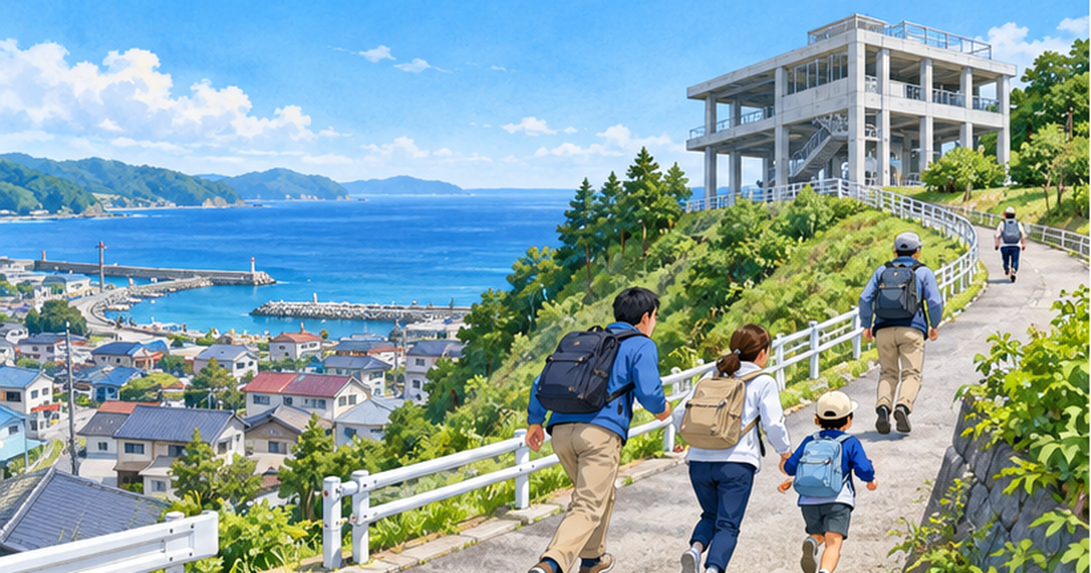
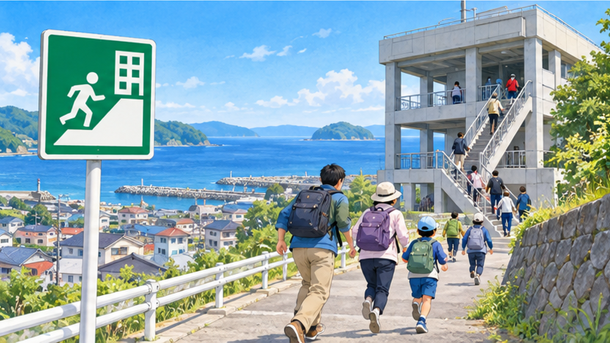
If you feel strong shaking, or long and slow shaking, near the sea, start evacuating without waiting for a tsunami warning. During the shaking, protect yourself first; when it subsides, move away from the coast, river mouths and riverbanks. The basic rule is "higher," not "farther." Aim for ground outside the expected inundation zone, or the upper floors of a tall building such as a tsunami evacuation building.
- Secure your safety and wait for the shaking to stop
- When the shaking stops, leave the coast and rivers immediately
- Check tsunami warning information on TV, radio or your smartphone
- Head to higher ground, outside the inundation zone or to a tsunami evacuation building
- Stay at your shelter until the warning or advisory is lifted
Don't assume "this place is safe"
In past disasters, the assumption that "the water won't come this far" led to delayed evacuation. Don't place too much trust in the assumptions shown on a hazard map; it is important to keep moving to higher ground as the situation requires. Evacuating on foot is the rule. Cars can become stuck in traffic jams or by road damage, so avoid them unless unavoidable.
What to do during sea leisure or while travelling
When you are near the sea fishing, surfing, swimming or playing on the rocks, you need to get out of the water and move away at once. When travelling, you lack local knowledge, so make it a habit to check evacuation routes and the nearest shelter as soon as you arrive at your lodging. Signs and flags along the coast and tsunami evacuation markers are also useful clues.
How to read hazard maps and check your own area
Reading inundation estimates and arrival times
A tsunami hazard map shows the area and depth of inundation expected from a tsunami, together with shelters and evacuation routes. Depth is shown by color, with deeper water in darker colors. If the arrival time of the tsunami is also shown, it is a guide to how much time you have to evacuate. In normal times, check where your home, workplace, school and favorite seaside spots lie on the map.
Understanding the assumptions behind estimates
A hazard map is an "assumption" calculated under certain premises. For a Nankai Trough megathrust earthquake, the Cabinet Office announced in 2012 a maximum tsunami height of 34 m. In the damage estimate published in March 2025, deaths are put at up to about 298,000, of which tsunami deaths are about 94,000 to 215,000. For great earthquakes on the Japan Trench and Kuril Trench too, the 2021–2022 estimates put deaths at up to about 199,000 for the Japan Trench and about 100,000 for the Kuril Trench. The figures vary with the assumptions, and it is important to understand that reality can exceed them.
| Scenario | Main figures | Source |
|---|---|---|
| Nankai Trough earthquake (2012) | Maximum tsunami height 34 m; about 230,000 tsunami deaths | Cabinet Office |
| Nankai Trough earthquake (2025) | Up to about 298,000 deaths (about 94,000–215,000 from the tsunami) | Cabinet Office |
| Japan Trench earthquake (2021–2022) | Up to about 199,000 deaths | Cabinet Office |
| Kuril Trench earthquake (same) | Up to about 100,000 deaths | Cabinet Office |
Evacuating can greatly reduce damage
In the Cabinet Office's estimate for the Japan Trench and Kuril Trench, if refuge such as tsunami evacuation facilities is secured and everyone in the inundation zone begins evacuating immediately after the quake, fatalities can be reduced by about 80%. In other words, the large numbers in damage estimates also mean that preparation and action can change them greatly.
"Tsunami tendenko" and the lessons of the Kamaishi incident
What "tsunami tendenko" means
"Tsunami tendenko" is a teaching handed down in the Sanriku region. "Tendenko" is a dialect word meaning "each on their own," and the saying has been told to mean that when a tsunami comes, you should not wait for your family but each flee separately. It may sound cold, but it rests on mutual trust: if each person protects their own life, everyone can be saved. It is also a warning against going back to look for family and becoming a victim.
How did the schoolchildren of Kamaishi escape?
During the Great East Japan Earthquake in Kamaishi, Iwate Prefecture, of about 2,900 elementary and junior high school students in the city, all but five who were absent from school escaped the tsunami, a survival rate of 99.8%. Out of consideration for children who died, the city now avoids calling it a "miracle" and refers to it as the "Kamaishi incident."
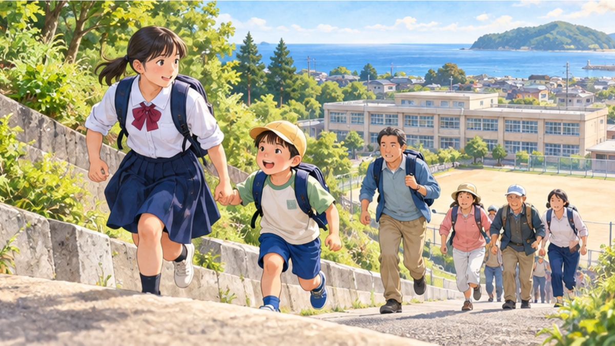
This result was no coincidence and is explained as the outcome of disaster education carried out since 2004. Toshitaka Katada, who led the education, taught the children three principles of evacuation: "Don't be bound by assumptions," "Do your best in the situation," and "Be the first to evacuate." Right after the quake, students at Kamaishi Higashi Junior High School ran off without waiting for teachers' instructions, taking the hands of pupils at neighboring Unosumai Elementary School as they evacuated. Local residents who saw them followed and also reached high ground.
Becoming a first evacuee
In a disaster, people tend to think "I'll be fine" or find it hard to move unless others do. In psychology these tendencies are called normalcy bias and herd (conformity) bias. If someone starts evacuating first, the behavior of those around them changes. When you feel the shaking, moving first yourself ends up protecting the lives around you too.
For how to hand down the lessons of the disaster, please also read How do we pass on the memory of the disaster? Lessons from ruins, storytellers, memorial museums and tsunami stones.
Drills and everyday preparedness: what families, schools and communities can do
Evacuation drills are practice for not hesitating
The purpose of an evacuation drill is not just to memorize the steps. It is to walk the actual route, notice slopes, stairs, nighttime darkness and signs that are hard to see, and learn it with your body rather than your head. As the Kamaishi case shows, drills repeated over time give you the ability to act without hesitation when the real event comes. Take part in drills in your community or school, and time how long evacuation actually takes.
- Walk the route from home, work and school to your shelter
- If there are several shelters, decide which to use depending on the strength of shaking and time of day
- Discuss in advance how to evacuate older adults, infants and family members with disabilities
- Share the locations of tsunami evacuation buildings and high ground with the whole family
- Check the settings of disaster apps and emergency alert mail
Emergency bags and family agreements
Because evacuation is a race against time, keep your emergency items near the entrance or bedroom so you can grab them and go. The basics are water, food, a portable radio, a flashlight, a mobile battery, regular medicine, cash and warm clothing. In northern Japan in winter, hypothermia at shelters is a known risk, and the Cabinet Office projects that up to about 42,000 people could die of hypothermia if a Japan Trench earthquake occurs in winter. Review your cold-weather gear for each season.
Three preparations you can start today
- Open the tsunami hazard map for your neighborhood and check inundation depth and shelters
- Agree as a family: "When it shakes, everyone flees on their own; we meet here"
- Check the contents and expiry dates of your emergency bag
Contact methods and rules for reuniting
Phone lines become hard to connect in a disaster. Decide on several ways to contact each other as a family, such as the Disaster Emergency Message Dial (171) and disaster message boards. Following the idea of "tsunami tendenko," if each person first flees to safe high ground and you agree to reunite later at a set place, you avoid the danger of going back to search for one another.
Protecting the sea also helps protect our lives from tsunamis
Disaster reduction with the help of nature
It is difficult to stop a tsunami completely, but nature can also soften damage. Coral reefs are known to act as natural breakwaters that weaken wave energy; see Coral reefs as natural breakwaters for details. Restoration of coastal forests, like Takata-Matsubara, which are expected to soften part of a tsunami's force, is also under way as part of reconstruction (Coastal forest restoration at Takata-Matsubara and the power of protective forests). However, natural protection has limits, and it should be combined with measures that assume evacuation.
Disaster prevention that supports fishing ports and sea-based work
Tsunami damage affects not only lives but also the foundations of work at sea, such as fishing ports, aquaculture facilities and fishing boats. The progress of fisheries recovery after the Great East Japan Earthquake is covered in 13 years of fisheries recovery after the Great East Japan Earthquake, and the fishing port that was uplifted in the 2024 Noto Peninsula Earthquake is covered in Fishing port uplifted by the Noto Peninsula Earthquake. Having a system in which people who work by the sea can evacuate at any time is also part of a community's disaster resilience.
Climate change and preparing for storm surges
Along with tsunamis, storm surges caused by typhoons are also a major coastal risk. Sea level rise may make the same size of tsunami or storm surge more likely to cause flooding. For adaptation to storm surges, see Introduction to adaptation to storm surges and coastal flooding. What tsunamis and storm surges have in common is that checking hazard maps and evacuating early are the basics.
Summary: the basics of tsunami preparedness are "know, prepare, evacuate at once"
A tsunami is a huge phenomenon created when an undersea earthquake moves the whole sea. In the Great East Japan Earthquake the run-up height exceeded 40 m, and about 90% of victims drowned. On the other hand, there are cases where many lives were saved by everyday education, drills and first-mover evacuation.
Summary of this article
- If you feel strong or long shaking, do not wait for a warning: leave the coast and move to high ground
- The "about 3 minutes" for tsunami warnings is a target for issuing them, not a grace period for evacuation
- Even a 20–30 cm tsunami can knock you off your feet. Stay away from the sea even during an advisory
- Tsunamis arrive repeatedly. Do not return until the warning or advisory is lifted
- Check hazard maps and evacuation routes in normal times, and decide on a meeting place and contact method as a family
- "Tsunami tendenko" and first-mover evacuation protect you and those around you
The sea gives us blessings but at times strikes with great force. Understanding the sea correctly and building preparedness into daily life is the first step toward living, working and playing safely by the sea.
References and sources
- Japan Meteorological Agency: Tsunami flag (Kagoshima Local Meteorological Observatory) – Visual communication of tsunami warnings
- Japan Meteorological Agency: Tsunami disaster prevention materials – Tsunami disaster prevention pamphlet
- Cabinet Office (Disaster Management): Nankai Trough earthquake measures – Damage estimates and countermeasures
- Cabinet Office (Disaster Management): Japan Trench and Kuril Trench earthquakes – Damage estimates and tsunami evacuation measures
- Cabinet Office Disaster Management website – White Paper on Disaster Management and records of the Great East Japan Earthquake
- MLIT Hazard Map Portal Site – Checking tsunami inundation estimates
- MLIT Water and Disaster Management Bureau: Coasts – Tsunami-resilient community building
- MEXT School Safety Web – Disaster education materials
※ Listed in descending order of reliability: government and academic institutions > peer-reviewed papers > specialized organizations > reliable media