⚡ In short
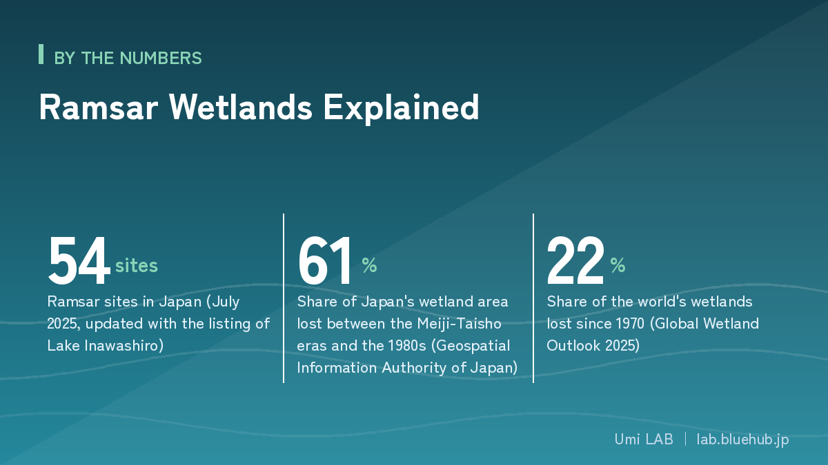
Adopted in 1971, the Ramsar Convention was the world's first environmental treaty devoted to a single ecosystem type. Japan's list reached 54 sites when Lake Inawashiro joined in July 2025. This guide covers the surprisingly broad definition of a wetland, how wetlands clean water and shelter wildlife, and the 61% of Japan's wetlands already lost.
Sucking mud, reeds up to your waist, the whine of insects. To be blunt, wetlands have long been treated as land that is simply hard to walk on. That is exactly why Japan lost 61% of its wetland area over roughly a century after the Meiji era, with half of it converted to farmland. That is a history of feeding a nation, but it is also the history of quietly whittling away an ecosystem that can only exist in the narrow zone between water and land.
What put an international brake on that trend was the Ramsar Convention. Adopted in 1971 in Ramsar, a resort town in northern Iran, it was the world's first international environmental treaty to target a specific ecosystem type. At a time when global environmental problems were barely known to the public, nations agreed that wetlands are an asset to be protected across borders — that in itself is remarkable.
Japan acceded in 1980, designating Kushiro Shitsugen as its first site. Forty-five years later, Lake Inawashiro in Fukushima Prefecture joined on 15 July 2025, bringing the total to 54 sites. This article walks through the basics of the Convention, the spread of Japan's listed wetlands, and the concrete services wetlands return to our lives — purifying water, nurturing life, storing carbon and softening floods — with figures drawn from primary sources.
What you will learn
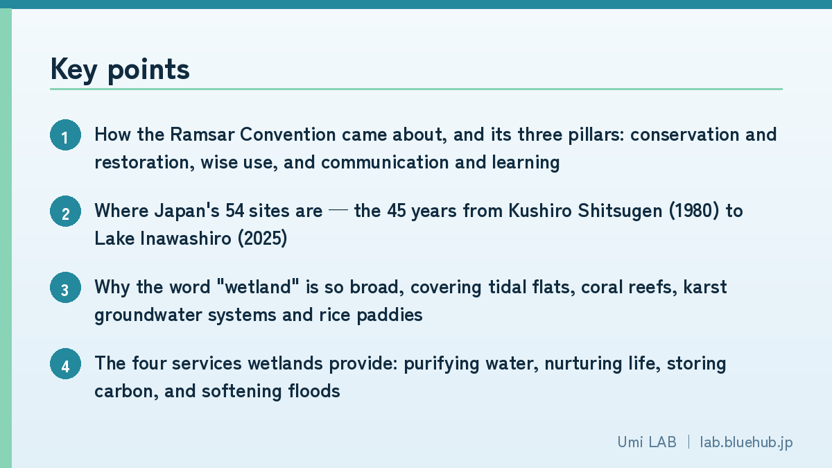
- How the Ramsar Convention came about, and its three pillars: conservation and restoration, wise use, and communication and learning
- Where Japan's 54 sites are — the 45 years from Kushiro Shitsugen (1980) to Lake Inawashiro (2025)
- Why the word "wetland" is so broad, covering tidal flats, coral reefs, karst groundwater systems and rice paddies
- The four services wetlands provide: purifying water, nurturing life, storing carbon, and softening floods
- How Japan lost its wetlands, and the story of the Fujimae Tidal Flat, saved from landfill by citizens
- The idea of "wise use" and what each of us can do starting today
What Is the Ramsar Convention? The World's First Environmental Treaty for Wetlands
The Ramsar Convention's formal name is the Convention on Wetlands of International Importance especially as Waterfowl Habitat. It was adopted on 2 February 1971 at an international conference in Ramsar, a town on the Caspian coast of northern Iran, and entered into force on 21 December 1975. It is one of the rare treaties known by the name of the town where it was signed.
What made it groundbreaking was its focus on a type of ecosystem rather than a single issue. Earlier international treaties mostly addressed individual problems such as protecting a particular animal species or preventing marine pollution. The Ramsar Convention wrote into treaty language, half a century ago, an idea that now seems obvious: to protect the creatures that live somewhere, you must protect the environment they depend on.
Why It Started with Waterbirds
There is a reason "waterfowl" appears in the treaty's name. Geese, ducks, sandpipers and plovers travel thousands of kilometres across national borders. If one country protects a breeding ground but a staging or wintering site is lost in another, that effort is wasted. In other words, protecting waterbirds can never be completed by one country alone. Migratory birds became the moving evidence that made the case for international cooperation on wetlands easiest to grasp.
Today, however, the Convention is not applied to waterbirds alone. Value as fish spawning grounds, rare plant communities, groundwater systems, endemic species dependent on wetlands, and local culture — the listing criteria have expanded to nine, and the many-sided value of wetlands is now assessed.
The Convention's Three Pillars
The Convention's work is organised around three pillars. Understanding this three-part structure makes it far clearer what actually happens when a site is listed.
| Pillar | Content | Examples |
|---|---|---|
| Conservation and restoration | Maintain the ecosystems of listed wetlands and restore degraded ones | Managing water levels in mires, removing invasive species, restoring reclaimed land |
| Wise use | Rather than banning use, allow sustainable use within limits that do not impair ecosystem function | Fisheries, rice farming, ecotourism, groundwater use |
| Communication and learning (CEPA) | Share the value of wetlands across society through outreach, education, awareness and participation | Visitor centres, observation events, school programmes |
The Ramsar Convention in numbers (as of 2025)
- Adopted: 2 February 1971 (Ramsar, Iran) / Entered into force: 21 December 1975
- Contracting Parties: more than 170 countries
- Listed wetlands: more than 2,500 sites worldwide, totalling roughly 250 million hectares
- Japan's accession: 1980 (Kushiro Shitsugen designated as its first site the same year)
- World Wetlands Day falls on 2 February each year, the anniversary of adoption
Japan's 54 Sites: From Northern Mires to Southern Coral Reefs
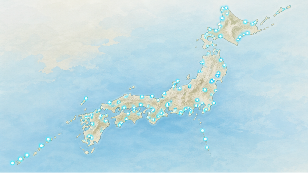
Japan has 54 listed wetlands as of July 2025. They run from the Sarobetsu Mire in Hokkaido in the north to Nagura Amparu and the Kerama Islands Coastal Zone in Okinawa in the south, spanning entirely different climate zones and landforms. It is precisely because the country stretches far north to south, with volcanoes, steep terrain and the Kuroshio and Oyashio currents overlapping, that such a diverse catalogue of wetlands exists.
Forty-Five Years That Began with Kushiro Shitsugen in 1980
Japan's first listing was Kushiro Shitsugen (Hokkaido) in 1980. It is Japan's largest mire and is known as habitat for the red-crowned crane, a Special Natural Monument. At the time, the very phrase "wetland conservation" was barely current in Japan, and the listing became the first instance of a pattern repeated many times since: using an international commitment to reinforce domestic protection.
Lake Kuccharo (Hokkaido) followed in 1989 and Izunuma-Uchinuma (Miyagi) in 1991, but Japan's numbers only began to grow in earnest in the 2000s.
Twenty Sites at Once at COP9 in 2005: The Turning Point That Showed Wetland Diversity
The great turning point came on 8 November 2005 at the 9th Conference of the Contracting Parties (COP9) in Kampala, Uganda. At that meeting Japan added 20 sites at once, taking its total from 13 to 33.
The line-up matters. It included not only Hokkaido mires such as the Sarobetsu Mire and Uryunuma Mire, but also lake systems such as Oze, Mikatagoko and Nakaumi-Lake Shinji, plus the Akiyoshidai Groundwater System (Yamaguchi) flowing beneath a karst plateau, coral reef seas such as the Kushimoto Coastal Area and the Kerama Islands Coastal Zone, and even Nagata-hama on Yakushima, a sea turtle nesting beach. Japan itself delivered the message, at an international conference, that a wetland is not simply a marsh.
And in 2025, Lake Inawashiro Became the 54th
The most recent listing is Lake Inawashiro in Fukushima Prefecture, designated on 15 July 2025. It covers 10,960 hectares and spans Aizuwakamatsu, Koriyama and Inawashiro Town. Japan's fourth-largest lake, it was recognised for its acidic water chemistry and high transparency, and for its value as a wintering ground for waterbirds including swans. With it, Japan's total reached 54.
| Year | Event | Total |
|---|---|---|
| 1980 | Japan accedes to the Convention; Kushiro Shitsugen (Hokkaido) becomes its first listed wetland | 1 site |
| 1989 | Lake Kuccharo (Hokkaido) listed | 2 sites |
| 1993 | Japan hosts the 5th Conference of the Contracting Parties (COP5) in Kushiro City | 9 sites |
| 2002 | Fujimae Tidal Flat, Miyajimanuma and others listed at COP8 | 13 sites |
| 2005 | Twenty sites added at once at COP9 | 33 sites |
| 2008 | Four sites including Onuma, Hyoko and Kejonuma added at COP10 in Changwon, Republic of Korea | 37 sites |
| 2025 | Lake Inawashiro (Fukushima) listed | 54 sites |
Thirteen Sites in Hokkaido: What the Skew Tells Us
By prefecture, Hokkaido stands out with 13 sites, followed by Okinawa with 5 and Miyagi with 4. This skew is not simply because Hokkaido has more wetlands. South of Honshu, most lowland wetlands have already been converted to rice fields, urban areas and industrial land, so few intact wetlands large enough to meet the listing requirements remain.
To be listed in Japan, a site must satisfy three requirements set out by the Ministry of the Environment.
- It must be a wetland of international importance, meeting at least one of the nine international criteria
- Its natural environment must be secured into the future under national law, such as the Natural Parks Act or the Wildlife Protection and Management Act
- Local residents and other stakeholders must support the listing
What the third requirement means
Local support is a requirement because the Ramsar Convention is not a mechanism for fencing off wetlands from local life. Listing does not blanket-ban development; it aims to maintain wetland ecosystems while existing farming, fishing and tourism continue. Conversely, a wetland that its community does not want to protect cannot be listed under the system at all.
A Wetland Is Not Just a Marsh: Tidal Flats, Coral Reefs, Groundwater and Rice Paddies
The Convention's definition of "wetland" is far broader than everyday usage. Article 1 defines wetlands as areas of marsh, fen, peatland or water, whether natural or artificial, permanent or temporary, with water that is static or flowing, fresh, brackish or salt, and adds that they include marine water the depth of which at low tide does not exceed six metres.
That means tidal flats, eelgrass beds, coral reefs, mangrove forests, and even artificial water environments such as reservoirs and rice paddies all qualify as wetlands if they meet the conditions. That breadth is one reason the Convention has remained useful for half a century.
The Variety of Wetland Types Among Japan's Listed Sites
| Wetland type | Japanese examples | Characteristics |
|---|---|---|
| Raised bogs and mires | Kushiro Shitsugen, Oze, Sarobetsu Mire, Uryunuma Mire | Peat accumulates; nutrient-poor conditions foster distinctive plant communities |
| Lakes and ponds | Lake Biwa, Lake Inawashiro, Lake Shinji and Nakaumi, Lake Kuccharo | Wintering grounds for waterbirds; brackish lakes hold unique biota |
| Tidal flats | Fujimae, Yatsu, Higashiyoka, Arao | Staging sites for migratory birds and key sites for water purification |
| Coral reefs and marine areas | Kerama Islands Coastal Zone, Kushimoto Coastal Area, Sekiseishoko | Listed as marine areas no deeper than 6 m at low tide |
| Mangroves and estuaries | Nagura Amparu, Manko, waters around the Kerama Islands | At the land-sea boundary, they serve as nurseries for juvenile fish |
| Karst groundwater systems | Akiyoshidai Groundwater System | A system of water flowing underground; Japan's only listing of this type |
| Rice paddies and agricultural wetlands | Kabukuri-numa and the surrounding rice paddies; lotus fields within the Watarase Retarding Basin | Human-made environments that have become wildlife habitat |
| Sandy beaches (sea turtle nesting) | Nagata-hama, Yakushima | One of the largest loggerhead turtle nesting sites in the North Pacific |
The Akiyoshidai Groundwater System: The Idea of an Invisible Wetland
Listed in 2005, the Akiyoshidai Groundwater System in Mine City, Yamaguchi Prefecture, is the most unusual entry on Japan's list. Beneath Akiyoshidai, one of Japan's largest karst plateaus, limestone dissolved over time has left a mesh of caverns and underground channels. Caves including Akiyoshido shelter bats and endemic aquatic species adapted to a world without light.
From the surface it does not look like a wetland. Yet it fits the Convention's definition perfectly: water is held, water flows, and living things are sustained. The listing became a symbol of wetland conservation extending its field of vision underground.
Kabukuri-numa and Surrounding Rice Paddies: Protecting a Wetland People Made
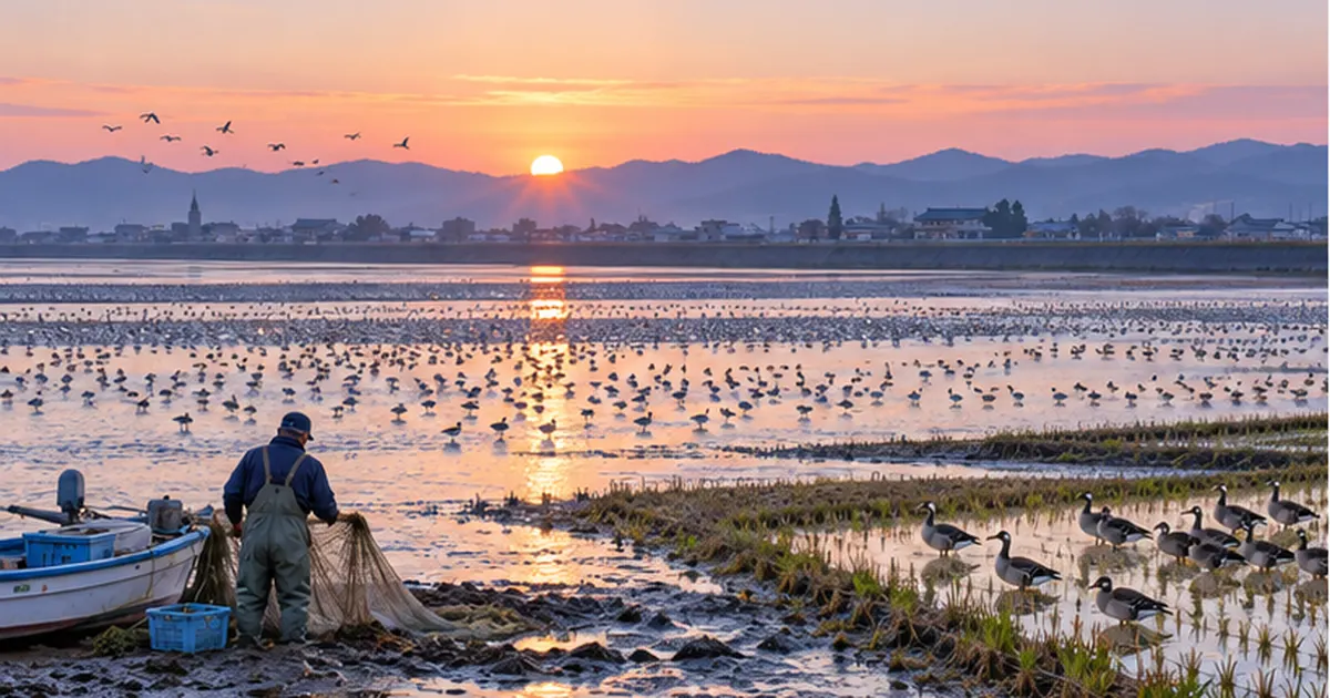
Spanning Osaki, Kurihara and Tome in Miyagi Prefecture, Kabukuri-numa and the surrounding rice paddies (423 hectares, listed on 8 November 2005) drew international attention because the surrounding paddies were included in the listing, not only the marsh itself. Alongside Izunuma-Uchinuma and Kejonuma, it is one of Japan's largest gathering sites for greater white-fronted geese, and in some seasons more than 100,000 birds arrive.
Locally, a practice called fuyu-mizu-tanbo — flooding rice paddies through the winter — has spread. It was partly intended to disperse goose roosts away from the crowded marsh and reduce disease risk, but it also increased roosting sites, drinking water and resting places for waterbirds, while enriching paddy life such as tubificid worms, midges and frogs and suppressing weeds as a side benefit. It is known as a Japanese-born example of farming and wetland conservation coexisting in the same place.
How Exactly Do Wetlands Clean Water?
Of all the services wetlands provide, water purification returns most directly to human life. Metaphors such as "nature's filter" or "the planet's kidneys" are common, but the reality is an intricate system in which physical, chemical and biological processes run at the same time.
1. Physical Action: Slowing the Flow, Settling and Trapping
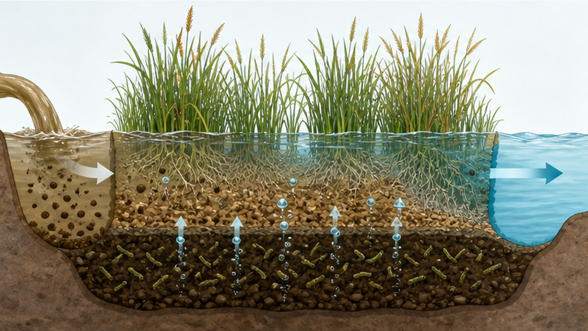
When water entering a wetland reaches stands of emergent plants such as reeds and wild rice, its velocity drops sharply. Slower water lets the sediment and organic particles it carries settle out. The dense structure of stems and roots also works as a filter, catching fine suspended matter. This stage alone removes a substantial share of turbidity-causing material and the nutrients and heavy metals adsorbed to it.
2. Chemical and Biological Action: Denitrification, or Returning Nitrogen to the Sky
The ability to handle nitrogen, the main driver of water pollution, is the wetland's most valuable capability. In wetland sediment, the very surface holds a little oxygen while just millimetres below it becomes anoxic. That thin juxtaposition of oxic and anoxic layers is decisive.
- In the oxic layer, nitrifying bacteria oxidise ammonium nitrogen to nitrite and nitrate (nitrification)
- The resulting nitrate diffuses down into the anoxic layer immediately below
- There, denitrifying bacteria use the nitrate for respiration and ultimately release it to the atmosphere as nitrogen gas (N₂) (denitrification)
- As a result, nitrogen is removed from the water system entirely
Step four is the crucial one. Purification by plant uptake alone returns nutrients to the water when the plants die. Denitrification, by contrast, returns nitrogen to the vast reservoir of the atmosphere, so it genuinely disappears from the water system. Wetlands do free of charge what sewage plants achieve through advanced treatment.
3. Filtration by Living Things: The Hard-Working Bivalves
On tidal flats, bivalves such as Manila clams and hard clams filter phytoplankton and suspended organic matter from the water. According to Fisheries Agency materials, a single oyster filters roughly 400 litres of seawater a day, which works out to filtering the whole of Hiroshima Bay in about five days. The organic matter taken in moves into the shellfish's tissue or into the sediment as faeces and pseudofaeces, where polychaetes, crabs and microbes break it down further.
For a closer look at the purification function of tidal flats, see Tidal Flat Conservation Explained: The Muddy Sea That Nurtures Life and Cleans Water.
How Much Purification, and Where the Limits Lie
So how large is that purification capacity in numbers? Ministry of the Environment materials estimate that tidal flats and shallows remove roughly 2 to 9 percent of the total nitrogen load flowing into coastal waters. Whether that reads as smaller than expected or as impressive for something provided free of charge is a matter of interpretation, but one thing is certain: a wetland's purification capacity has a ceiling.
"There is a wetland, so we can pollute" does not follow
- If pollution exceeding its capacity flows in, the wetland itself becomes eutrophic and its ecosystem breaks down
- Excess organic matter in the sediment causes oxygen depletion and hydrogen sulphide, killing shellfish en masse
- At Yatsu Tidal Flat (Chiba Prefecture), mass blooms of sea lettuce and their decay have been a long-running problem
- Purification is a supplementary mechanism that only works alongside efforts to reduce the incoming load
Nurturing Life: The Wetland as a Cradle
Wetlands occupy only a small fraction of the Earth's land surface, yet the density of life they gather is striking. Fresh water and salt water, organic matter and light, shallowness and shelter — the conditions organisms need all overlap in one place.
Wetlands as Refuelling Stops for Migratory Birds
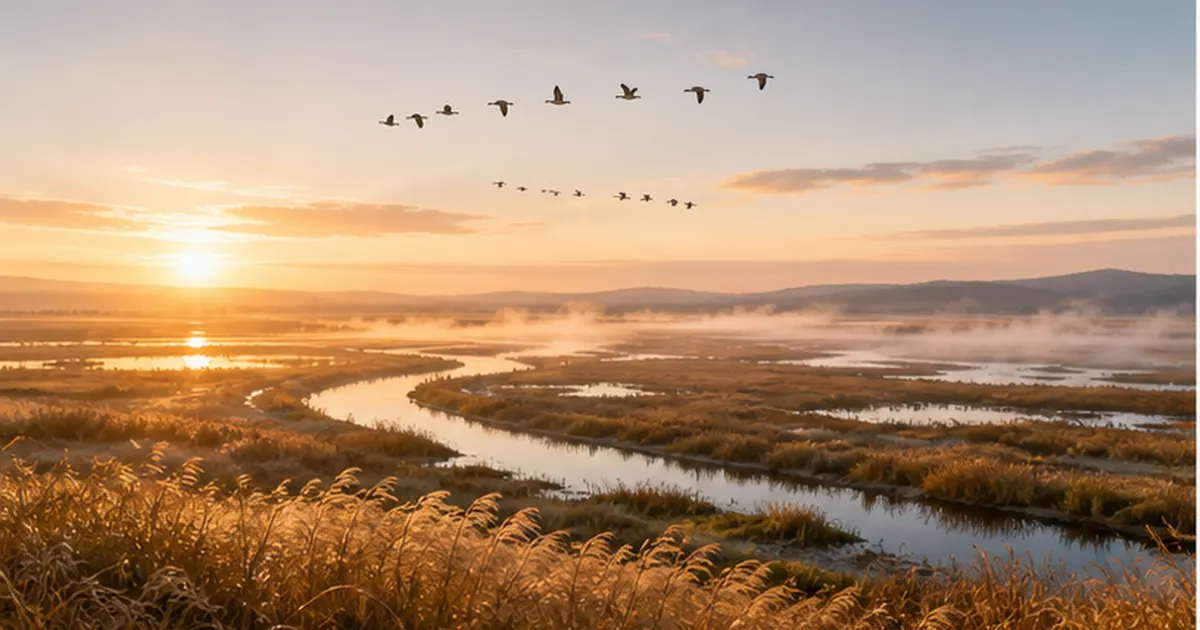
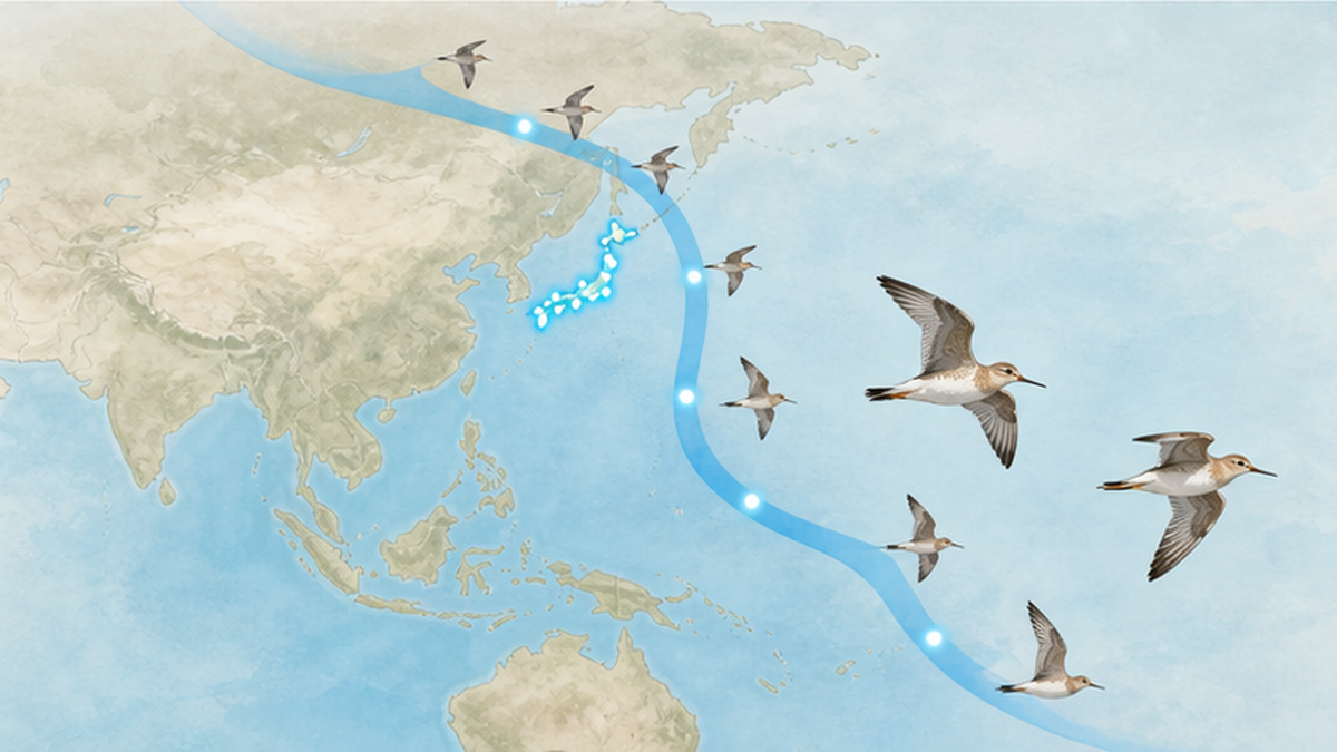
Nothing explains the international value of Japan's wetlands more clearly than migratory birds. The Japanese archipelago sits right in the middle of the East Asian-Australasian Flyway (EAAF), the migration route linking Siberia and Alaska to Australia and New Zealand. Of the world's nine flyways, this one is used by the greatest number of migratory bird species — and it also has the highest rate of coastal wetland loss.
Bar-tailed godwits and ruddy turnstones, for example, travel more than 10,000 kilometres between breeding and wintering grounds. Along the way they drop onto Japanese tidal flats and, in a few weeks, increase their body weight by nearly half before the next leg. Losing a single tidal flat is, for them, like a motorway service area suddenly vanishing. The relationship between migratory birds and tidal flats is covered in detail in Shorebirds and the Tidal Flat Crisis: The East Asian Flyway and Protecting Stopover Sites.
One Hundred Thousand Greater White-Fronted Geese: The Winter Held Up by Kabukuri-numa and Izunuma
Three listed wetlands in northern Miyagi Prefecture — Izunuma-Uchinuma, Kabukuri-numa and Kejonuma — form one of Japan's largest clusters of wintering grounds for greater white-fronted geese. Arriving from late September and staying until late February, the geese roost on the marshes at night and fly out at dawn to surrounding rice paddies to feed on fallen grain and second-growth shoots.
This "sleep on the marsh, feed in the paddies" pattern means that natural wetland and human farmland function as a set. The Convention listed Kabukuri-numa together with its surrounding paddies precisely because it recognised that unity institutionally. The fuyu-mizu-tanbo movement turned that principle into a concrete farming practice.
Brackish Water as a Nursery: The "Cradle of the Sea" Function
Estuaries and the brackish zones of tidal flats are where many fish and shellfish spend their early lives. Fluctuating salinity makes life difficult for large predators, while organic matter and microscopic food are abundant. Low predation pressure and plentiful food make ideal conditions for growing juveniles. Japanese sea bass, black sea bream, gobies, and commercially important species such as kuruma prawn and swimming crab all depend on tidal flats or estuaries at some point in their life history.
Losing wetlands therefore thins out fishery resources for the future. Corbicula clams in Lake Shinji, nori and fish in the Ariake Sea, Manila clams in Mikawa Bay — a considerable share of Japan's seafood rests on the health of wetlands.
Climate Change and Wetlands: Storing Carbon, Softening Floods
Wetlands have risen rapidly in standing lately because of climate change. They are one of the few ecosystems that work on both fronts at once: they store carbon and they soften the disasters climate change brings.
Peatlands: 3% of the Land, 30% of Soil Carbon
Among wetlands, the leading carbon store is the peatland. Where waterlogging starves the ground of oxygen, plant remains accumulate without fully decomposing, building thick peat layers over thousands of years. As a result, peatlands cover only about 3 percent of the Earth's land area yet hold roughly 30 percent of all soil carbon. That is around twice the carbon stored in all the world's forests.
The problem is that this carbon is protected by water. Drain a peatland and oxygen enters, decomposition accelerates, and the stored carbon is released as carbon dioxide. Emissions from dried and degraded peatlands are estimated at about 5 percent of global annual greenhouse gas emissions. Sarobetsu Mire and Kushiro Shitsugen in Hokkaido are peat mires too, and drainage for conversion to farmland has a history of drying them out.
Blue Carbon in Tidal Flats and Seagrass Beds
Carbon stored by coastal wetlands is called blue carbon. Mangrove forests, salt marshes and seagrass meadows are said to sequester carbon per unit area faster than tropical rainforests, and to lock it stably into sediment over long periods. In Japan, a system for valuing eelgrass and kelp bed restoration as blue carbon credits (J Blue Credit) has also begun to move. For details, see What Is Blue Carbon? How Mangroves and Seagrass Store Carbon in the Sea, and Japan's Efforts.
Green Infrastructure That Softens Floods
Wetlands are also natural retarding basins that temporarily hold water when rivers rise. Floodplain wetlands shave the peak off floods coming from upstream and reduce damage downstream. The Watarase Retarding Basin (spanning Tochigi, Gunma, Saitama and Ibaraki) was developed for exactly that purpose and was listed as a Ramsar site in 2012. It is a flood-control facility that also sustains a valuable reedbed ecosystem and raptors such as the northern goshawk and the eastern marsh harrier — a place with double value.
As climate change intensifies heavy rainfall, Japan is increasingly writing into policy the idea of not relying solely on grey infrastructure such as dams and levees, but harnessing natural functions of wetlands, forests and floodplains — green infrastructure and Eco-DRR (ecosystem-based disaster risk reduction). Conserving wetlands is an investment not only for wildlife but for our own safety.
Four services wetlands give back (summary)
- Water purification: settling, adsorption, denitrification and bivalve filtration remove nitrogen and phosphorus from the water system
- Nurturing life: staging sites for migratory birds, nurseries for juvenile fish, homes for endemic species
- Carbon storage: peatlands hold 30% of soil carbon on 3% of the land; coastal wetlands hold blue carbon
- Disaster mitigation: shaving flood peaks, damping storm surge and waves, recharging groundwater
The Wetlands Japan Has Lost: The Reality of a 61% Decline
We have looked at the value of wetlands, but there are hard numbers on the other side of the ledger. Japan's wetlands have largely disappeared over the past century or so.
From 211,000 Hectares in the Meiji-Taisho Eras to 82,000 by the 1980s
According to a Geospatial Information Authority of Japan study comparing Meiji- and Taisho-era topographic maps with modern ones, Japan's wetland area fell from roughly 211,000 hectares in the Meiji-Taisho eras to about 82,000 hectares by the 1980s, a decline of 61 percent. It also found that about 50.7 percent of the lost wetland became farmland. The rest became urban areas, industrial land and roads.
Reading those figures purely as a record of destruction would probably not be fair. In an era of food shortages, draining wetlands into rice fields was a national imperative. Developing Hokkaido's peatlands was part of postwar food production and settlement policy. Yet at the time, the water purification and flood control functions wetlands perform were barely known — in other words, we were making a trade without knowing the value of what we were giving up.
About 40% of Tidal Flats Are Gone
The decline of tidal flats, where land meets sea, was even steeper. According to the Ministry of the Environment's National Survey on the Natural Environment and related work, Japan's tidal flat area lost about 41 percent over the roughly 50 years from around 1945 to the 1990s. Tokyo Bay, Ise and Mikawa Bays, Osaka Bay, the Ariake Sea — land reclamation during the high-growth era targeted tidal flats precisely because they were shallow, easy to work on and had few rights holders.
For how tidal flats came to be filled in and what is happening now, see Why Were Japan's Tidal Flats Reclaimed? The History of 30,000 Lost Hectares and Tokyo Bay and the Ariake Sea Today.
Fujimae Tidal Flat: Citizens Who Stopped the Landfill
One place where that trend hit an exceptional brake is the Fujimae Tidal Flat in Nagoya. Spread across the mouths of the Shonai, Shin and Nikko Rivers at the head of Ise Bay, it had been slated since the 1980s to be filled in as a waste disposal site. For a city whose final disposal capacity was running out, landfill looked like a realistic solution.
But citizens, researchers and NGOs campaigned for more than a decade to show that Fujimae was a vital site for migratory birds, and after debate over the environmental impact assessment, in January 1999 the City of Nagoya announced it was abandoning the landfill plan.
What followed is rare even in Japan's environmental history. Having lost its disposal capacity, the city issued a "waste emergency declaration" in February and committed the whole city to thorough sorting and recycling. Waste volumes fell sharply, making real the causal chain of "we protected the tidal flat, and our garbage went down." Fujimae Tidal Flat was listed under the Ramsar Convention on 18 November 2002.
What Fujimae showed
- Nature conservation does not end at stopping development; it can trigger the building of an alternative social system
- Citizens accumulating scientific evidence, namely migratory bird count data, proved decisive
- Ramsar listing is the result of protection, and it only works where the community agrees
- More than 20 years on, the site now faces new problems such as drifting litter and microplastics
"Wise Use": Not Locking Wetlands Away, but Using Them Wisely
The most common misunderstanding about the Ramsar Convention is the belief that listing means nothing can be done there any more. The opposite is true: the treaty's core concept is wise use — people continuing to use a site while its ecological character as a wetland is maintained.
What Wise Use Means
The Convention defines wise use as maintaining the ecological character of wetlands, within the context of an ecosystem approach, so as to contribute to achieving sustainable development. Put plainly, it means you may use it, as long as the wetland remains a wetland.
- The corbicula clam fishery on Lake Shinji is wetland use itself, continued alongside resource management
- Fuyu-mizu-tanbo at Kabukuri-numa increased waterbird habitat within the industry of rice farming
- At Kushiro Shitsugen, canoe tours and viewing from observation decks have become regional tourism assets
- At Manko and Nagura Amparu in Okinawa, environmental education programmes built around mangrove forests are well established
CEPA: What Is Not Communicated Is Not Protected
The third pillar, CEPA (Communication, Capacity building, Education, Participation and Awareness), looks unglamorous but is the treaty's lifeline. The value of a wetland does not come across from simply looking at tidal flat mud or a thicket of reeds. Value is shared only when someone explains it.
Listed wetlands across Japan host visitor centres and waterbird and wetland centres running observation events and outreach classes. A child's memory of digging up crabs on a tidal flat may become, twenty years later, a vote to protect that flat — CEPA is an investment on that kind of timescale.
What Listing Brings to a Region
Ramsar listing does not impose new legal restrictions, since protection under existing laws such as the Natural Parks Act and the Wildlife Protection and Management Act is a prerequisite. Even so, listing has practical effects.
| Effect | Content |
|---|---|
| International endorsement | The title "wetland of international importance" becomes a source of local pride and outward visibility |
| Tourism and visitor numbers | Birdwatching, ecotours and visits to observation facilities increase |
| A hub for environmental education | The site is used as a field for school excursions and research |
| Branding | Brand value for farm and fishery products from around the listed wetland (for example, fuyu-mizu-tanbo rice) |
| Continuity of conservation | International reporting obligations make monitoring and management planning easier to sustain |
Wetland City Accreditation
In recent years the Convention has established a Wetland City Accreditation scheme recognising cities that work actively on wetland conservation and wise use. It targets municipalities adjacent to wetlands that tackle conservation as a whole community, and cities in Japan have received accreditation. It marks a shift away from setting nature against the city and towards placing wetlands within the city.
The Future of Wetlands: A Global Warning and What We Can Do
In July 2025, alongside the 15th Conference of the Contracting Parties (COP15) in Victoria Falls, Zimbabwe, the Convention secretariat published the Global Wetland Outlook 2025. Its contents are, to put it mildly, serious.
The Estimate That $39 Trillion Is at Stake
- Since 1970, an estimated 411 million hectares of wetlands have been lost worldwide, a 22% decline in wetland extent
- The economic value of wetlands lost over the past 50 years exceeds $5.1 trillion
- Without action, one fifth of the world's remaining wetlands could vanish by 2050
- In that case, up to $39 trillion in benefits supporting people, economies and nature would be lost, according to the estimate
The $39 trillion figure converts services wetlands have provided free of charge into market prices. It also means that if we tried to make up for what we have been receiving without paying by building artificial replacements — water treatment plants, levees, aquaculture facilities — that is what it would cost. Against this backdrop, COP15 adopted a new wetland action framework for 2025-2030.
30by30 and Wetlands: Japan's Next Challenge
The Kunming-Montreal Global Biodiversity Framework adopted in 2022 sets a target of conserving at least 30 percent of land and of sea by 2030 (30by30). In line with it, Japan has launched a scheme that certifies, in addition to protected areas such as national parks, places that are not protected areas but contribute to biodiversity conservation — corporate green space, shrine and temple forests, satoyama landscapes and agricultural wetlands — as Nationally Certified Sustainably Managed Natural Sites.
Wetlands fit that framework well. Land that supports wildlife while being farmed, as fuyu-mizu-tanbo paddies do, still lies dormant across Japan. The goal is not merely to raise the count above 54; the real challenge ahead is how to keep the small unlisted wetlands — irrigation ponds, fallow paddies, backswamps behind riparian woods, urban springs.
Five Things You Can Do Today
- Join an event around World Wetlands Day on 2 February — listed wetlands nationwide hold observation walks and lectures
- Visit a listed wetland near you — among the 54, more are within a day trip than you might expect, and many visitor centres are free
- Stay on designated paths on tidal flats and in mires — trampling directly damages vegetation and benthic life, so keep to boardwalks and observation trails
- Cut nitrogen and phosphorus in household wastewater — wipe grease off dishes before washing and use only as much detergent as needed; reducing the incoming load protects a wetland's purification capacity
- Choose products from around listed wetlands — buying fuyu-mizu-tanbo rice, or clams from well-managed fisheries, is direct support for wise use
Summary
- Adopted in 1971, the Ramsar Convention was the world's first environmental treaty targeting an ecosystem type, and it runs on three pillars: conservation and restoration, wise use, and communication and learning
- Japan's list reached 54 sites with Lake Inawashiro in July 2025; it began with Kushiro Shitsugen in 1980 and grew by 20 sites at once at COP9 in 2005
- The Convention's "wetland" covers not just marshes but tidal flats, coral reefs, karst groundwater systems, rice paddies and sandy beaches
- Wetlands purify water (denitrification, bivalve filtration), nurture life, store carbon (peatlands hold 30% of soil carbon on 3% of the land) and soften floods
- Japan's wetlands are down 61% since the Meiji-Taisho eras and its tidal flats down about 41%, though Fujimae shows citizen action can change the course
- The key is wise use: protecting while using, and making the effort to keep the small wetlands close to home
References
- Ministry of the Environment, Japan – The Ramsar Convention and Ramsar Sites: Ramsar Sites in Japan (list of 54 sites with designation dates and areas)
- Ministry of the Environment, Japan – What Is a Ramsar Site (the three domestic listing requirements and the international criteria)
- Convention on Wetlands (Ramsar Secretariat) – Global Wetland Outlook 2025 warns of $39 trillion loss without urgent action
- Geospatial Information Authority of Japan – Survey results on changes in wetland area across Japan (from the Meiji-Taisho eras to the 1980s)
- Biodiversity Center of Japan, Ministry of the Environment – National Survey on the Natural Environment: Tidal Flat Survey (national tidal flat area and its change)
- Fisheries Agency of Japan – Functions and current state of tidal flats (water purification, bivalve filtration, changes in tidal flat area)
- Ministry of the Environment, Japan – Ramsar site leaflet: Kabukuri-numa and the surrounding rice paddies (423 ha, fuyu-mizu-tanbo)
- City of Nagoya – The waste emergency declaration (abandoning the Fujimae landfill plan and cutting waste)
- Biodiversity Center of Japan, Ministry of the Environment – Fuyu-mizu-tanbo at Kabukuri-numa: a leading Japanese case of payments for ecosystem services (PES)
- East Asian-Australasian Flyway Partnership (EAAFP) – Official website of the East Asian-Australasian Flyway Partnership
* Ordered by reliability: government and academic institutions > peer-reviewed papers > specialist organisations > trusted media