⚡ In short
Citizen science using smartphone apps to record beach litter is spreading worldwide and in Japan. This article explains how apps like Pirika and the Marine Debris Tracker work, how the ICC data card enables globally standardized surveys, and how the resulting data influences policy and corporate action.
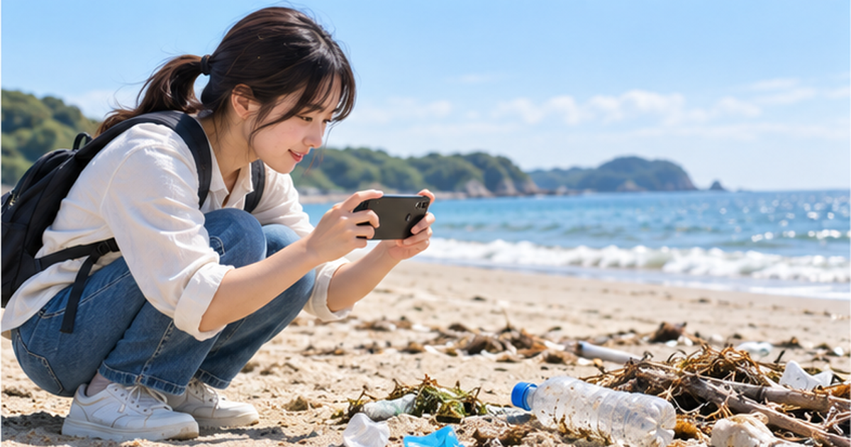
Walk along any beach and you'll spot plastic bottles and plastic bags. Instead of shrugging it off as "just more trash," a growing movement lets anyone turn that moment into useful data — simply by taking a photo with a smartphone and logging it. This is marine litter surveying through "citizen science."
A single observation may seem small, but when tens of thousands of people contribute, the data reveals where certain types of litter concentrate and even which companies' packaging is washing ashore.
This article focuses on Japan's homegrown app "Pirika" and the globally standardized "ICC data card" survey method, explaining — based on primary sources — how citizen-collected data actually feeds into policy and corporate responses.
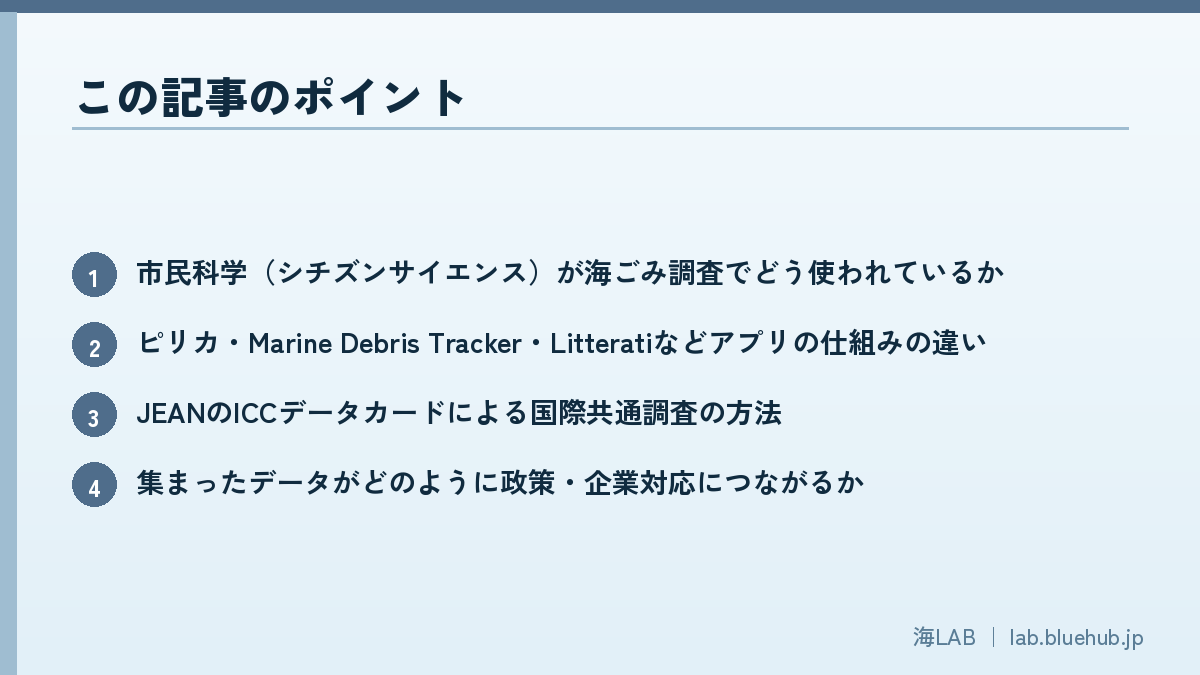
What you'll learn in this article
- How citizen science is used in marine litter surveys
- The differences between apps like Pirika, Marine Debris Tracker, and Litterati
- How JEAN's ICC data card enables internationally standardized surveys
- How the collected data connects to policy and corporate action
- The challenges and solutions for maintaining data quality
What Is Citizen Science? Its Role in Marine Litter Surveys
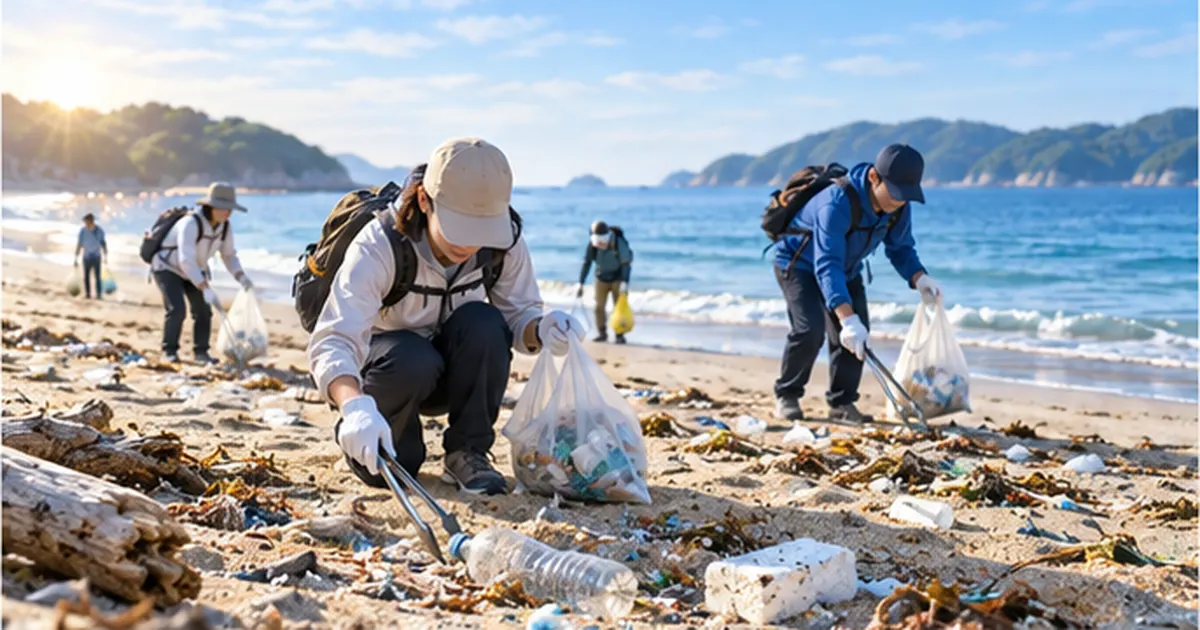
Citizen science refers to activities in which the general public, not only professional researchers, participates in data collection and observation to contribute to scientific investigation and research. In the marine litter field, coastlines are simply too vast for government agencies and research institutions to survey alone — citizen science fills that gap with the eyes and hands of many participants.
Why citizen science suits marine litter surveys
From wildlife surveys to litter surveys
Citizen science originally developed in fields such as bird and insect distribution surveys. As participants record what they observe, the accumulated entries produce broad, long-term data that experts alone could never gather. Marine litter surveys apply the same idea, turning individual "discoveries" into shared "records."
Benefits for government and research institutions
For government agencies and research institutions, the greatest benefit of citizen science is obtaining wide-ranging, high-frequency data without major cost. Sending professional surveyors to every coastline every week is unrealistic, but when local residents keep daily records, seasonal shifts and changes before and after typhoons — patterns that one-off surveys tend to miss — become visible.
- Japan's coastline alone stretches roughly 35,000 km, far more than professional surveyors can cover
- Smartphone GPS and cameras now let anyone log data with consistent precision
- Ongoing observation at fixed points is most efficiently sustained through the daily participation of local residents
- The act of picking up and recording litter itself tends to raise participants' environmental awareness
In February 2026, Japan's Ministry of the Environment published "Guidelines for Harmonizing Marine Litter Monitoring Methods Using Remote Sensing Technology, Version 2.1," signaling a direction that combines technologies such as drones and fixed cameras with citizen-participation surveys. For more on the origins of citizen science and its use in wildlife surveys, see What Is Citizen Science? Wildlife Surveys Anyone Can Join, and How the Data Is Used.
Three values citizen science provides
- Scientific value: wide-ranging, long-term data accumulates at a scale specialized institutions alone cannot achieve
- Educational value: the act of recording itself makes environmental issues personal for participants
- Social value: local residents' observations create a direct channel into government and corporate decision-making
How technology and citizen participation improve accuracy together
As the Ministry of the Environment's guidelines suggest, image analysis using drones and fixed cameras does not compete with on-the-ground citizen observation — the two complement each other. Remote sensing technology excels at surveying wide areas, while citizens standing on the beach excel at identifying details such as litter type and brand. Combining the two raises monitoring accuracy in both scale and detail.
A global trend in citizen science projects
Beyond marine litter, citizen-participation monitoring is spreading across many environmental fields — pollen dispersal, river water quality, even light pollution in the night sky. What they share is that the smartphone, a measuring and recording device nearly everyone carries, has made it possible for non-experts to leave reasonably accurate data. Marine litter citizen science is one strand within this larger trend.
Why the act of "recording" itself matters
A beach can be cleaned without anyone documenting it. The extra step of photographing litter and logging its location exists precisely so the effort doesn't end with one person's personal satisfaction — it leaves behind knowledge that can help someone else, somewhere else. Citizen science can be described as a mechanism that converts an individual action into a shared social asset.
How Japan's App "Pirika" Works and Has Spread
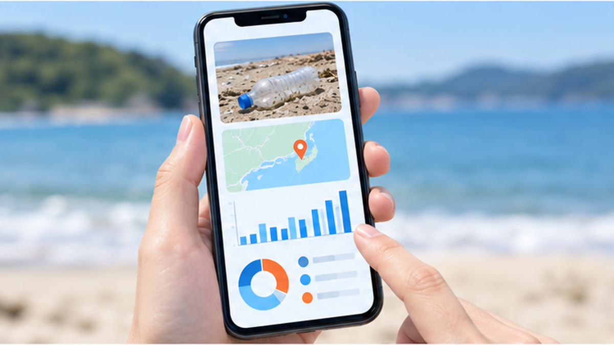
"Pirika" is an SNS-style app developed in 2011 by Pirika Inc. / the Pirika General Incorporated Association for recording and sharing litter-picking activity. Users photograph the litter before and after picking it up and post both images; combined with location data, this builds a database of where litter is occurring.
Over 450 million records logged
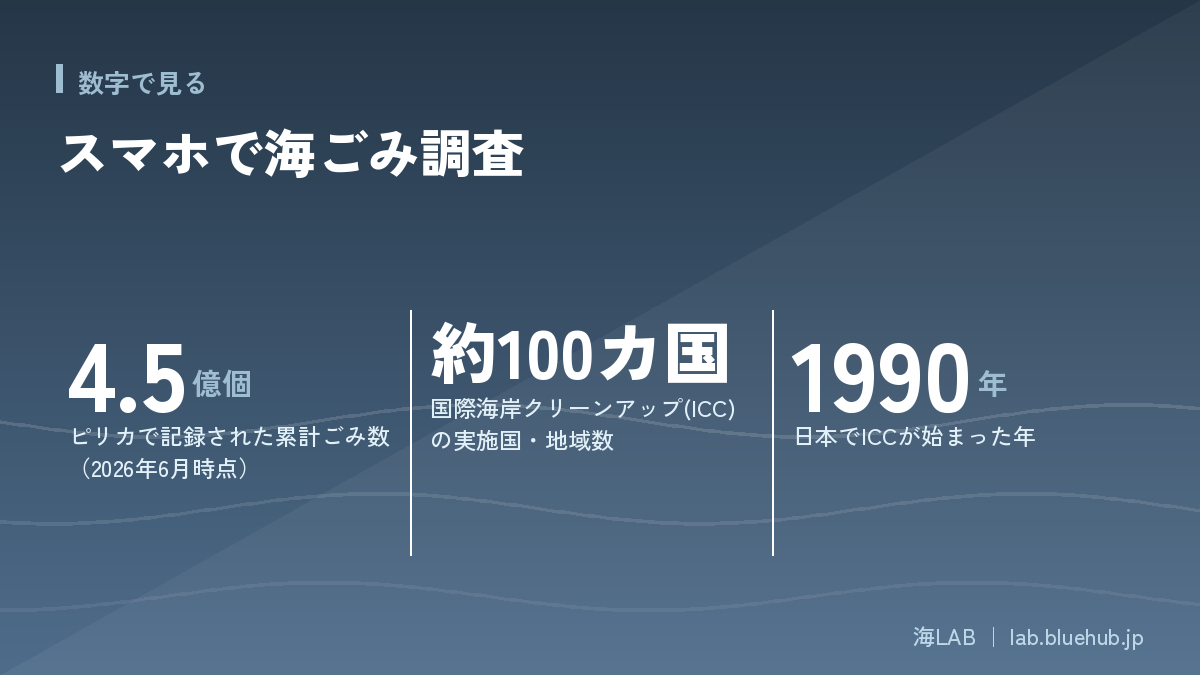
As of June 2026, Pirika is used in more than 135 countries and regions, with a cumulative total of over 450 million pieces of litter recorded. Beyond individual use, municipal and corporate editions are available; between April and June 2026, new municipal services launched in Osaka's Konohana Ward, Tokyo's Shibuya and Meguro wards, and Nagano Prefecture. For more on the sources of beach litter and its relationship to ocean currents, see The Truth About Beach Litter: 93% Is Plastic — Sources, Ocean Currents, and the Science of Beach Cleanups.
How it works: before-and-after photos become data
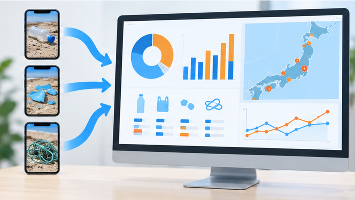
Using Pirika is straightforward. Users photograph litter before and after picking it up and post both images; the location and timestamp of the shot are recorded automatically. No personally identifying information is included, and submissions appear as pins on a map, so anyone can see at a glance where litter concentrates in their own town.
Development background and growth
Pirika was developed in 2011 by Pirika Inc. (Pirika General Incorporated Association). It began as a simple SNS for individuals to record and share litter-picking, but as the value of the accumulated data became clear, it expanded into "Pirika for Municipalities" and "Pirika for Businesses/Organizations," used to measure the effectiveness of policy and CSR activities. The cumulative record count passed 400 million in February 2025 and exceeded 450 million by June 2026.
Why companies and municipalities use Pirika
- Continuous recording of the same location lets people confirm numerically whether littering has increased or decreased
- Companies use it to measure the effectiveness of CSR activities and to understand how their own packaging washes ashore
- Municipalities use it to prioritize cleanup planning and litter collection points
Why municipal and corporate editions emerged
Once a sufficient volume of individual submissions accumulates, statistical patterns emerge — which areas, at what times, have which types of litter. Municipalities can use this trend data as a basis for allocating cleanup budgets and drafting ordinances, while companies can use it to design CSR initiatives with real substance, beyond simple brand-image benefits. Pirika's paid municipal and corporate editions can be seen as a business model built around visualizing this "value of collective data."
Making local change visible
Continuous recording of the same area makes it possible to confirm numerically whether cleanup efforts are working and whether littering is increasing or decreasing. Backing up what might otherwise be a vague impression — "it feels cleaner" — with an actual trend in record counts also helps sustain participants' motivation. For municipalities, it becomes one of the few quantitative indicators available for measuring the effectiveness of countermeasures.
Privacy and data handling
Because these are location-tagged records, privacy considerations are essential. Pirika and other major apps are designed to withhold personally identifying information such as the poster's name, disclosing only the aggregated information needed — litter type, location, and count. Having a system that allows people to participate with confidence is one of the factors sustaining continued use.
Future outlook
The number of municipalities adopting Pirika's municipal edition kept growing into 2026; new adoptions in Osaka's Konohana Ward, Shibuya, Meguro, and Nagano Prefecture show that citizen science data is shifting from being "an activity for a subset of environmentally conscious people" to becoming a standard policy tool for local government. As more municipalities and companies participate, this is expected to develop into a data infrastructure that captures litter conditions across Japan as a whole.
Global Citizen Science Apps: Marine Debris Tracker and Litterati
Similar frameworks exist overseas as well. "Marine Debris Tracker," supported by the U.S. National Oceanic and Atmospheric Administration (NOAA), lets users log and classify litter with location data, and the collected data is used in research under NOAA's Marine Debris Program.
Litterati: automatic classification by AI
"Litterati" is an app that uses AI to automatically classify litter from a single photo. Because it can identify brand names and product types, it is also used to analyze which companies' packaging appears most frequently as litter.
How the apps' strengths differ
All three apps share the feature that anyone can participate with just a smartphone, but their emphasis differs. Pirika is strong in local problem-solving through partnerships with municipalities and companies; Marine Debris Tracker emphasizes connections to academic research at universities and institutions; Litterati is suited to analyzing which companies' packaging appears most often, through AI-based classification and brand identification. Some regions use several of these tools together depending on the purpose.
| App | Developed/operated by | Features |
|---|---|---|
| Pirika | Pirika Inc. (Japan) | Photo-submission based; municipal and corporate editions; used in 135+ countries |
| Marine Debris Tracker | University of Georgia / NOAA (USA) | Academic use linked to NOAA's Marine Debris Program |
| Litterati | Litterati, Inc. (USA) | AI-based automatic litter classification and brand identification |
How the data is used for research
Data accumulated through Marine Debris Tracker is made available to researchers through NOAA's Marine Debris Program and has been cited in papers analyzing distribution trends by litter type and their relationship to specific ocean currents and seasons. A key difference from other apps is that it is designed with secondary academic use in mind from the outset.
Changes brought by AI-based classification
- Reduces the manual workload of classification, allowing more data to be processed in less time
- Automatic brand identification makes it possible to quantitatively show which companies' products appear most often
- Standardized classification criteria reduce variation caused by region or individual participant
App culture differences between Japan and abroad
While Japan's Pirika has developed as a "local problem-solving tool" centered on partnerships with municipalities and companies, apps in Europe and the U.S. tend to be led by universities and NGOs and function more as "research data collection infrastructure." This difference may reflect cultural background regarding who the main stakeholders in litter issues are in each country: in Japan, municipalities and companies often address it as a local issue, while in Europe and the U.S., research institutions and international NGOs more often lead the accumulation of scientific evidence.
Design choices that lower the barrier to participation
A feature common to all these apps is a design focus on "lowering the barrier to participation." Unlike identifying difficult wildlife species, litter classification is something most people can judge just by comparing photos, without specialized knowledge. Operability that completes a record in a few taps, and a sense of achievement as record counts build up, are gamification touches common across these apps to encourage continued use.
JEAN and the ICC: A Globally Shared "Data Card" Survey
Beyond apps, there is also an international citizen science framework built around a paper data card. The "International Coastal Cleanup (ICC)," which began in 1990, was launched at the call of the U.S. environmental NGO Ocean Conservancy and is now held annually in roughly 100 countries and regions worldwide.
JEAN created and promotes the Japanese version
In Japan, the nonprofit JEAN has overseen domestic implementation since 1990, using a globally standardized "ICC data card (Japanese version)" to record the type and quantity of collected litter under a unified classification system. It runs campaigns in spring (April–June) and autumn (September–October), and the results of the autumn survey are reported to the ICC, held simultaneously worldwide.
Why paper data cards are still used
Even now, when smartphone apps are widespread, there is a reason paper-based surveys like the ICC data card continue. Detailed classification across roughly 40 categories is often more accurate when a team divides the work and fills in a card together than when entering data into an app on the spot. Paper cards also have the advantage of working reliably on remote islands or fishing ports where cell signal is weak.
Main items recorded on the data card
- Type of litter (roughly 40 categories including plastic containers, plastic bags, fishing gear, and foamed polystyrene)
- Count and weight
- The coordinates of the location found and the survey distance
- Where possible, clues such as brand name or country of manufacture
Two annual campaigns: spring and autumn
JEAN calls for cleanup campaigns nationwide twice a year, in spring (April–June) and autumn (September–October). The autumn survey in particular is positioned as part of the International Coastal Cleanup held simultaneously around the world; data gathered across Japan is compiled and reported to the shared global database, allowing Japan's coastal litter trends to be compared side by side with those of other countries.
How data cards help pinpoint the source of litter
One feature of the ICC data card is that, wherever possible, it records not just the count of litter but clues such as brand name and country of manufacture. If the same type of plastic bottle cap shows up concentrated in a particular region, that becomes a clue for estimating which country or product it came from, helping narrow down the sources of cross-border litter. Each individual record may seem trivial, but together they build a map of where the litter originates.
Data as a foundation for international negotiations
Marine plastic pollution is an international issue that no single country can solve alone, and discussions on a plastics treaty are progressing at forums such as the UN Environment Assembly. Data gathered under a globally shared standard, like that of the ICC, enables international comparisons of what types of litter are found where and in what quantities, positioning it as one of the scientific foundations for such treaty negotiations.
How to participate: solo or as a team
ICC surveys, following the participation guidelines published by JEAN, are open to individuals, groups of family or friends, and teams from companies or schools alike. The basic flow is to register in advance, record litter using the data card at a designated or self-selected beach, and report the results to JEAN. Materials with sample entries and classification guidance are also available for first-time participants.
How the Collected Data Is Used in Policy
A mechanism is taking shape in which an individual's record does not end as a social media post but reaches actual policymaking. Japan's Ministry of the Environment continuously conducts a "marine litter status survey," and survey data collected by citizen groups is also positioned as reference information for grasping the overall situation.
A leading European example: Marine Litter Watch
"Marine Litter Watch," operated by the European Environment Agency (EEA), centrally manages beach litter data surveyed by citizens through the EEA's environmental data portal "Reportnet" and publishes it so that policymakers and researchers can use it for trend analysis by litter type and region.
Examples of use within Japan
In Japan, results from beach surveys conducted by citizen groups and NPOs are shared at forums such as regional councils promoting measures against coastal debris, helping prioritize cleanup activities and identify rivers and ports that are likely sources. They also play a significant role in filling in gaps national surveys alone cannot cover — small coves and beaches that few people visit.
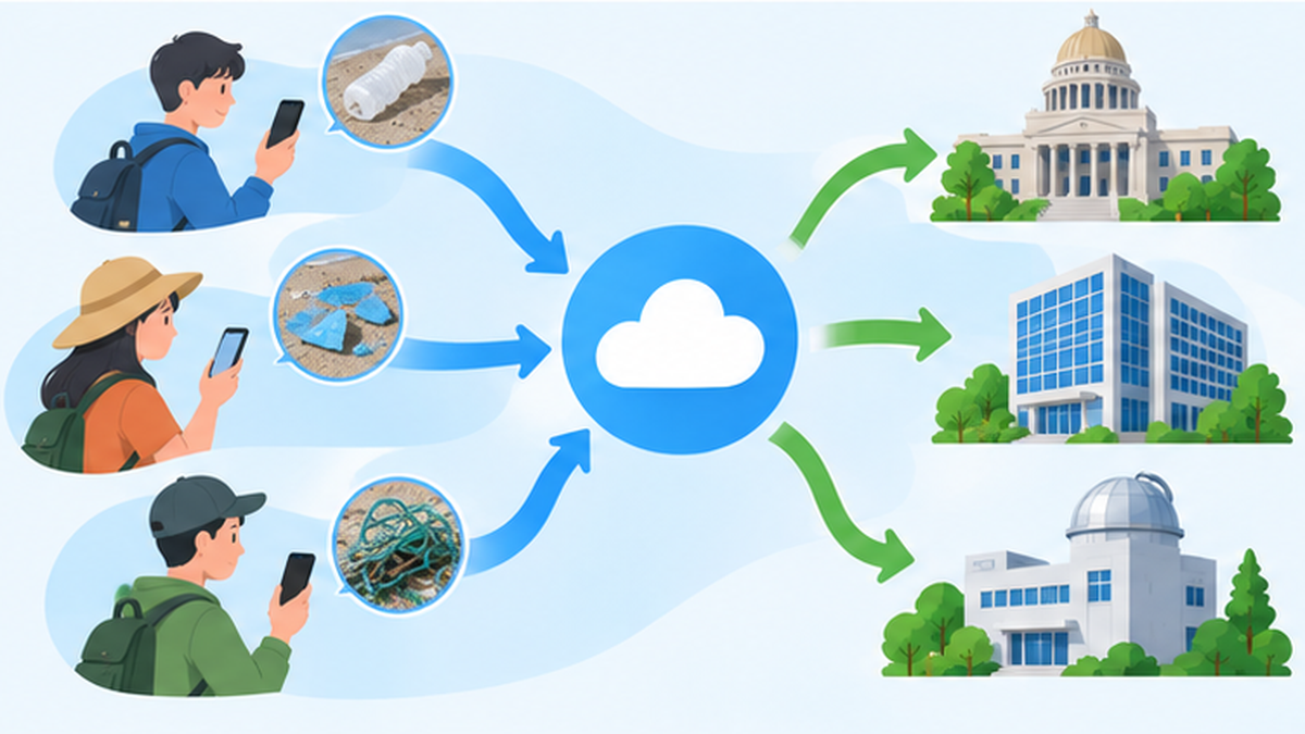
Concrete channels through which data feeds into policy include: (1) municipalities incorporating litter hotspots into cleanup plans, (2) companies learning how their own products wash ashore and improving their packaging accordingly, and (3) research institutions using the data for source analysis, such as distinguishing river-borne litter from litter dumped at sea. For more on how drifting litter crosses borders, see Marine Debris That Crosses Borders: Tracking Ocean Currents, Typhoons, and Tsunami-Origin Debris, and the Frontier of International Cooperation.
| Who uses it | How the data is used |
|---|---|
| National government (Ministry of the Environment, etc.) | Used as supplementary information for status surveys and nationwide trend analysis |
| Municipalities | Drafting cleanup plans, prioritizing collection points |
| Companies | Understanding how their own products/packaging wash ashore, considering packaging improvements |
| Research institutions | Source analysis (river-borne vs. dumped at sea, etc.), cross-referencing with ocean current models |
Making "unseen places" visible
Conventional government surveys often select easily accessible, representative beaches as fixed survey points, making it hard to grasp conditions at remote coves or islands that few people visit. Because citizen science generates records wherever people live or visit, it helps fill the "blank spots on the map" that government surveys alone cannot cover.
Data that has prompted companies to act
There are also emerging cases where citizen science data has led companies to change their behavior. If a company's own containers or packaging are repeatedly recorded as beach litter, that becomes a signal companies cannot ignore. Some point to such citizen-generated observation data as an indirect influence behind recent moves by beverage and household-goods makers to lighten their bottles and switch to more easily recyclable materials.
New analyses enabled by open data
The trend of publishing collected data as open data, as with Europe's Marine Litter Watch, is also important. Published data can be used far beyond its original collection purpose — by students for graduation research, by NPOs for independent analysis, and by media organizations for investigative reporting. A single record made by one citizen can become the starting point of someone else's new discovery.
Barriers before data reaches policy
- There is often a shortage of people who verify the data and bridge it to government use
- Data formats differ between apps, making cross-cutting analysis difficult in some cases
- While short-term event participation is high, the pool of people willing to sustain long-term fixed-point observation is limited
Data that reveals "hidden sources"
Much of the litter that washes up on beaches is pointed out to actually originate not at sea but inland, flowing down rivers. Citizen science records are made not only along coastlines but also along rivers, in parks, and on city streets; overlaying this data is helping research that visualizes the route litter takes to reach the sea — from land, to river, to ocean.
Maintaining Data Quality: The Challenges of Citizen Science
Citizen science has benefits, but also challenges. When classification standards vary among participants, or survey frequency and coverage are uneven across regions, the comparability of the resulting data declines.
Countermeasures: standardized formats and expert verification
- Using a globally shared classification standard, like the ICC data card, enables comparison across regions and years
- AI-based automatic classification (as with Litterati) is also being adopted to reduce variation in human judgment
- It is common practice for experts to verify and clean the data after collection, before publication
- Open-data publication aligned with the FAIR principles (an international guideline for making data findable and usable) is recommended
The difficulty of sustained participation
Beyond data quality, securing continued participation is also a challenge. Even when a one-time cleanup event draws a crowd, sustaining daily recording is much harder. Features like Pirika's gamified visualization of record counts and regional rankings are one solution to this challenge of sustaining engagement.
Citizen science is a valuable approach for tracking plastic pollution, but its effectiveness is often constrained by inconsistent methodologies, concerns about data quality, and a persistent gap between data collection and policy implementation.
— Academic review paper (MDPI Water, 2025)
The gap between data collection and policy implementation
As the academic review points out, the challenge facing citizen science is not only data quality but also the "implementation gap" — how far the collected data actually feeds into real policy. Even when large amounts of data accumulate, if there are no people (in government, research institutions, or NPOs) to interpret it and connect it to countermeasures, the records simply pile up without effect. Building mechanisms that connect citizens, data analysts, and policymakers is cited as a future challenge.
Helping beginners maintain accuracy
To allow participation even by beginners with no classification knowledge, many apps and data cards provide photo-based classification guides. When in doubt, it is accepted practice to select only a broad category (plastic, metal, glass, paper, fishing gear, etc.) without forcing a detailed classification. Many citizen science projects share the view that "continuous recording" holds more long-term data value than "perfect recording."
Handling duplicate and mistaken records
Duplicate entries, where multiple people separately record the same piece of litter, and misclassification are persistent issues with citizen science data. Many platforms have mechanisms to detect duplicate submissions based on the proximity of location and time, and to have experts review and exclude clearly unnatural entries. Fully automated quality control is still developing, but as AI-based image classification improves, this verification work is also becoming more efficient.
International discussions on data standardization
In recent years, international discussions have also progressed toward standardizing classification items and units so that data collected by different apps and organizations can be compared and integrated across sources. How to reconcile long-established frameworks like the ICC data card with the results of newer AI-classification apps is an important point for citizen science to have a greater policy impact going forward.
How to Get Involved Starting Today
No elaborate preparation is needed. Whether at the sea, along a river, or on a nearby street, simply photographing and logging litter you find with an app makes you part of citizen science.
Which app should you choose?
If you're unsure, it's worth first checking whether your local municipality partners with an app such as Pirika. Where such a partnership exists, your records are more directly reflected in local countermeasures. In areas without a partnership, using Pirika, Litterati, or Marine Debris Tracker still produces meaningful data as a personal record. There's no problem using more than one app.
Three steps to get started
- Install one of the apps — Pirika (SNS Pirika), Litterati, or Marine Debris Tracker — on your smartphone
- When you go for a walk or errand, photograph litter you find before and after picking it up, and post it
- Take part in a local cleanup event (such as JEAN's spring or autumn campaigns) and try a full-scale survey using the ICC data card
Tips for keeping it up
- Observing the same walking route repeatedly makes changes visible, which helps sustain motivation
- Recording with family or friends turns the amount collected into a game-like shared experience
- If a municipal edition exists in your area, participating there tends to connect more directly to local countermeasures
Use in school education
Citizen science is not only for adults. Overseas research has reported cases in which high school students used citizen science methods to record the distribution of plastic along beaches, contributing to surveys that fill data gaps in under-studied areas. In Japan too, a growing number of schools combine beach cleanups with data recording as part of integrated learning periods or club activities, drawing attention as a way to teach both environmental education and scientific thinking through the act of recording.
The long-term meaning of one person's record
A single record won't produce a major change on its own. Still, records sustained over several years become valuable material for describing litter trends in an area and the effectiveness of countermeasures. Because solving the marine litter problem takes time, the surest way to participate in citizen science is not to expect quick results, but to build the habit of "recording when you notice" within your own everyday surroundings.
References and Sources
- Ministry of the Environment, Japan, "Guidelines for Harmonizing Marine Litter Monitoring Methods Using Remote Sensing Technology, Version 2.1" (February 2026) – Marine litter monitoring methods using drones and fixed cameras
- Ministry of the Environment, Japan, "Marine Litter Status Survey" – Ongoing marine litter status survey by the Ministry of the Environment
- Pirika Inc. / Pirika General Incorporated Association, "SNS Pirika" – Official site of the litter-picking record app
- Pirika press release, "Supporting Litter Issue Solutions Through Citizen Collaboration and Data Use" (June 2026) – Expansion of the service to four municipalities
- JEAN, "ICC (International Coastal Cleanup)" – Explanation of International Coastal Cleanup activities in Japan
- JEAN official site – Overview of the NGO working on marine litter issues
- European Environment Agency, "Marine Litter Watch" – Europe's citizen-science-based marine litter monitoring initiative
- NOAA, "Citizen science and volunteer opportunities" – Introduction to citizen science efforts by the U.S. National Oceanic and Atmospheric Administration
- MDPI Water, "Citizen Science for Monitoring Plastic Pollution from Source to Sea" (2025) – Systematic review of plastic pollution monitoring through citizen science
* Listed in order of reliability: government/academic institutions > peer-reviewed papers > specialized organizations > reputable media